Articles similaires à River Systems Map of the World by A.K. Johnston – Educational Print 1852


Vous voulez plus d'images ou de vidéos ?
Demander au vendeur plus d'images ou de vidéos
1 sur 10
River Systems Map of the World by A.K. Johnston – Educational Print 1852
260 €par article|TVA incluse
Quantité
Expédition
Recherche du devis...La promesse 1stDibs :
Garantie d'authenticité,
Garantie de remboursement,
Annulation sous 24 heures
À propos de cet article
River Systems Map of the World by A.K. Johnston – Educational Print 1852
This striking 1852 map titled "The River Systems of the World" was created by the noted Scottish geographer Alexander Keith Johnston and published by William Blackwood & Sons in Edinburgh and London. It is Plate 4 from Johnston’s groundbreaking work *The Physical Atlas of Natural Phenomena*, a pioneering example of thematic cartography that visually communicates scientific data on a global scale.
This hand-colored copperplate engraving displays the world’s major river basins, categorized by color to represent the direction of river drainage toward different oceans and inland basins. Each continental landmass is divided by watershed, visually illustrating how rivers flow to the Atlantic, Pacific, Indian, Arctic Oceans, or into interior lakes and deserts. For instance, blue shows drainage toward the Arctic Ocean, brown for the Atlantic, green for the Indian Ocean, and so forth. The result is a vividly segmented and scientifically meaningful depiction of Earth's hydrological patterns.
A fascinating feature of the print is the comparative diagram running along the bottom, showing the relative lengths of the world’s principal rivers such as the Amazon, Nile, Mississippi, Yangtze, and Volga. This allows the viewer to grasp the scale and hierarchy of global river systems at a glance.
Johnston, who served as Geographer in Ordinary to Queen Victoria in Scotland, was renowned for his clarity, precision, and ability to synthesize scientific knowledge into accessible graphic forms. His *Physical Atlas* was one of the first atlases to present natural phenomena using maps rather than text alone, making it a cornerstone of modern data visualization.
This particular map is of special interest to collectors, educators, and designers for its combination of scientific accuracy and striking color composition. It appeals to those interested in geography, environmental science, and historical education, while also offering decorative appeal through its classic layout and 19th-century color palette.
Condition and framing tips:
Very good antique condition with some mild toning and occasional foxing in the margins. The printed area is clean and well-preserved. For framing, a walnut or black frame with a warm cream or ivory mat will bring out the map’s subtle hand-coloring. Pale blue or light earth-toned mats also work well to echo the map’s thematic hues. Ideal for display in a study, library, or educational setting.
- Dimensions:Hauteur : 27,4 cm (10,79 po)Largeur : 34,5 cm (13,59 po)Profondeur : 0,2 mm (0,01 po)
- Matériaux et techniques:
- Lieu d'origine:
- Période:
- Date de fabrication:1856
- État:Very good condition. Light overall toning near the margins. The paper remains strong and well-preserved. Folding line as issued.
- Adresse du vendeur:Langweer, NL
- Numéro de référence:Vendeur : BG-13207-41stDibs : LU3054345385942
À propos du vendeur
5,0
Vendeur reconnu
Ces vendeurs prestigieux sont des leaders du secteur. Ils représentent le summum en matière de qualité et de design.
Vendeur Platine
Vendeurs premium dont la note est supérieure à 4,7 et le délai de réponse de 24 heures maximum
Établi en 2009
Vendeur 1stDibs depuis 2017
2 492 ventes sur 1stDibs
Temps de réponse habituel : <1 heure
- ExpéditionRecherche du devis...Expédition depuis : Langweer, Pays-Bas
- Politique des retours
Certaines parties de cette page ont été traduites automatiquement. 1stDibs ne garantit pas l'exactitude des traductions. L'anglais est la langue par défaut de ce site web.
Garantie d'authenticité
Bien qu'il soit peu probable que la situation se présente, dans le cas où vous rencontreriez un problème d'authenticité d'un article, contactez-nous dans un délai d'un an pour obtenir un remboursement intégral. DétailsGarantie de remboursement
Si votre article n'est pas conforme à la description, est endommagé pendant le transport ou ne vous est pas livré, contactez-nous sous 7 jours pour obtenir un remboursement intégral. DétailsAnnulation sous 24 heures
Vous disposez d'un délai de 24 heures pour annuler votre achat sans motif.Des vendeurs professionnels agréés
Nos vendeurs de renommée mondiale doivent respecter des normes strictes en matière de service et de qualité, afin de préserver l'intégrité de nos fiches produit.Garantie d'alignement des prix
Si vous constatez qu'un autre vendeur a mis en vente le même article à un prix inférieur sur un autre site, nous nous alignerons sur ce prix.Livraison en toute confiance à l'international
Notre réseau de transporteurs de premier ordre propose des options d'expédition spécialisées dans le monde entier, y compris des livraisons personnalisées.Plus d'articles de ce vendeur
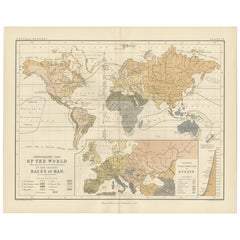
Tout afficherEthnographic Map of the World by A.K. Johnston – Races of Man Chart 1852
Ethnographic Map of the World by A.K. Johnston – Races of Man Chart 1852
This antique map titled "Ethnographic Map of the World Showing the Present Distribution of the Leading Races...
Catégorie
Antiquités, Milieu du XIXe siècle, Écossais, Estampes
Matériaux
Papier
Carte ancienne des systèmes fluviaux d'Europe et d'Asie de Johnston '1850'
Carte ancienne intitulée "The River Systems of Europe and Asia showing the boundaries and comparative extent of the river basins". Carte ancienne originale des réseaux fluviaux d'Eur...
Catégorie
Antiquités, Milieu du XIXe siècle, Cartes
Matériaux
Papier

160 € Prix de vente
20 % de remise
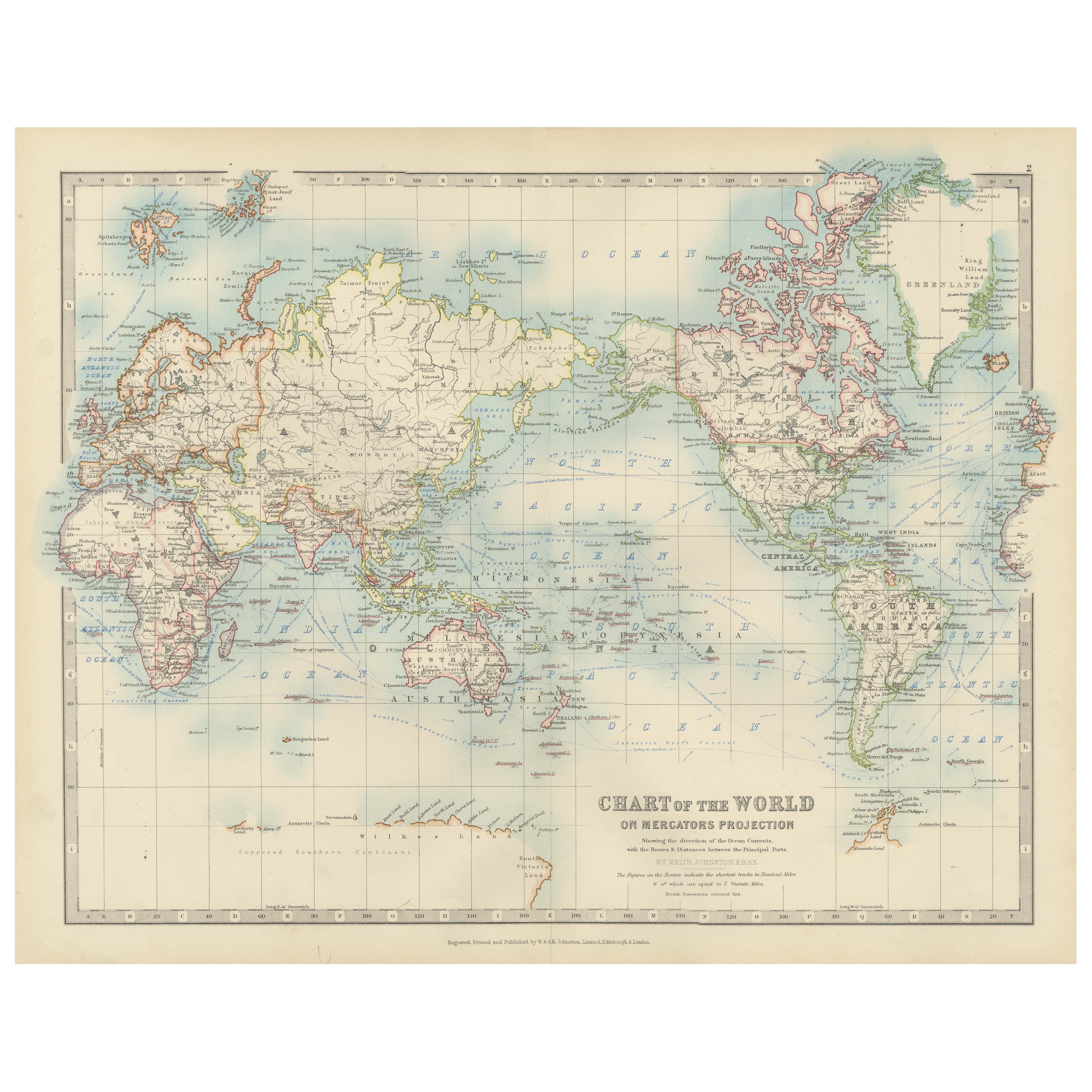
Ancienne carte du monde sur la projection de Mercator, courants océaniques et routes commerciales 1903
Titre : Carte du monde ancienne sur la projection de Mercator, 1903, montrant les courants océaniques et les routes commerciales
Description :
Cette carte ancienne, intitulée "Chart...
Catégorie
Début du 20ème siècle, Cartes
Matériaux
Papier

Carte ancienne montrant les religions du monde entier par Johnston '1854'
Carte ancienne intitulée "Moral & Statistical Chart showing the Geographical Distribution of Man According to Religious Belief". Rare carte thématique de grande taille sur la réparti...
Catégorie
Antiquités, Milieu du XIXe siècle, Cartes
Matériaux
Papier

780 € Prix de vente
35 % de remise
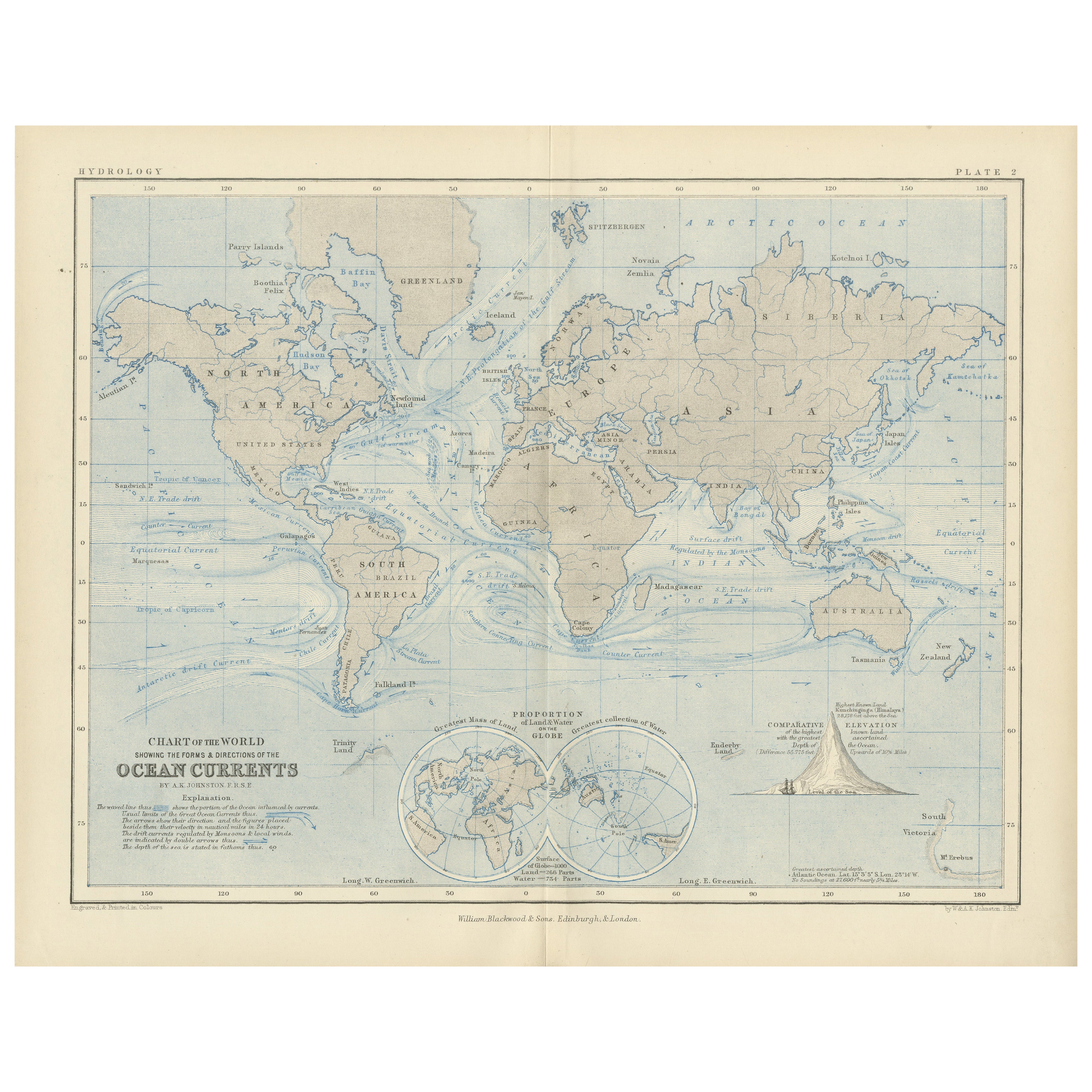
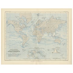
World Map of Ocean Currents by A.K. Johnston, Educational Print 1852
World Map of Ocean Currents by A.K. Johnston, Educational Print 1852
This detailed and scientifically rich chart titled 'Chart of the World Showing the Form & Direction of the Ocean...
Catégorie
Antiquités, Milieu du XIXe siècle, Écossais, Estampes
Matériaux
Papier
Carte ancienne du monde en hémisphères par W. G. Blackie, 1859
Carte ancienne intitulée "Le monde dans les hémisphères avec d'autres projections". Carte ancienne originale du monde. Cette carte provient de l'"Atlas impérial de géographie moderne...
Catégorie
Antiquités, Milieu du XIXe siècle, Cartes
Matériaux
Papier

245 € Prix de vente
30 % de remise
Suggestions
Carte du monde originale et ancienne par Dower, vers 1835
Belle carte du monde
Dessiné et gravé par J.Dower
Publié par Orr & Smith. C.1835
Non encadré.
Expédition gratuite
Catégorie
Antiquités, années 1830, Anglais, Cartes
Matériaux
Papier

Planisphere originale illustrée - Carte du monde - Géographie, 1864
Plongez dans l'épopée du passé avec le Planisphère historique illustré de 1864 par Charpentier ! 🗺️ Ce trésor cartographique vous transporte dans les méandres de l'histoire, avec de...
Catégorie
années 1860, Estampes et éditions
Matériaux
Lin, Lithographie, Papier

Grande carte ancienne originale du monde, Fullarton, vers 1870
Superbe carte du monde. Montrer les deux hémisphères
Extrait du célèbre Royal Illustrated Atlas
Lithographie. Couleur originale.
Publié par Fullarton, Edinburgh, C.1870.
Sans ca...
Catégorie
Antiquités, années 1870, Écossais, Cartes
Matériaux
Papier

Carte ancienne originale de l'hémisphère occidental par Dower, vers 1835
Belle carte de l'hémisphère occidental
Dessiné et gravé par J.Dower
Publié par Orr & Smith. C.1835
Non encadré.
Expédition gratuite
Catégorie
Antiquités, années 1830, Anglais, Cartes
Matériaux
Papier

Carte du monde - Gravure originale - 1820
Carte du monde est une gravure originale réalisée par un artiste inconnu du 19ème siècle en 1820.
Très bon état sur deux feuilles de papier blanc j...
Catégorie
années 1820, Moderne, Estampes - Figuratif
Matériaux
Eau-forte

Carte ancienne originale de l'hémisphère oriental par Dower, vers 1835
Belle carte de l'hémisphère oriental
Dessiné et gravé par J.Dower
Publié par Orr & Smith. C.1835
Non encadré.
Expédition gratuite
Catégorie
Antiquités, années 1830, Anglais, Cartes
Matériaux
Papier
