Articles similaires à Map of Corsica France with Ajaccio and Napoleon Portraits, 19th Century

Vous voulez plus d'images ou de vidéos ?
Demander au vendeur plus d'images ou de vidéos
1 sur 10
Map of Corsica France with Ajaccio and Napoleon Portraits, 19th Century
140 €TVA incluse
À propos de cet article
Map of Corsica France with Ajaccio and Napoleon Portraits, 19th Century
Description:
This finely engraved 19th-century map of Corsica, the Mediterranean island region of France, was created by Alexandre Vuillemin and published by Migeon in Paris for the *Nouvel Atlas Illustré*. Combining topographic clarity with historical reverence, this map presents Corsica in its full mountainous grandeur, surrounded by finely rendered vignettes that pay tribute to its most famous native—Napoleon Bonaparte.
The map displays the entire island with detailed roads, towns, and natural features, bordered in hand-applied pink watercolor. Ajaccio, the capital and birthplace of Napoleon, is prominently marked on the western coast. Other key towns such as Bastia, Corte, Sartène, and Bonifacio are shown with accuracy, as are the island’s rivers and rugged terrain.
At the top left, a panoramic engraving of Ajaccio is set against a mountainous backdrop, giving visual weight to Corsica’s dramatic landscapes and coastal towns. In the lower corners, two full-length portraits of Napoleon frame the map: one of him as a young military officer, and the other as emperor in coronation robes. These images honor Corsica’s most legendary figure and symbolize the island’s lasting influence on French and European history.
Corsica is known for its fierce regional identity, natural beauty, and distinct cultural heritage. While not a major wine-exporting island in the 19th century, Corsica has long produced wines from native grapes such as Nielluccio, Sciacarello, and Vermentino. Its wine culture has grown substantially over time, now celebrated for producing robust reds and aromatic whites with Mediterranean character. In the 1800s, Corsica was also known for olive oil, citrus, and chestnut production, much of it cultivated on terraced hillsides and in rural villages.
This map is a fitting tribute to the rugged independence and historical richness of Corsica. Its blend of political geography, maritime setting, and symbolic portraiture makes it a standout piece in any collection of antique French maps or Napoleonic memorabilia.
Condition summary:
Very good condition with light age-related toning and a few small foxing marks in the outer margins. Original hand coloring is clean and the engraving remains crisp and detailed.
Framing tips:
Best framed in a dark wood or empire-style frame to echo the Napoleonic theme. A soft ivory or light tan mat will complement the pink border and vignette engravings. Museum glass is recommended for long-term preservation and clarity.
- Dimensions:Hauteur : 32,5 cm (12,8 po)Largeur : 26,1 cm (10,28 po)Profondeur : 0,2 mm (0,01 po)
- Matériaux et techniques:Papier,Gravé
- Lieu d'origine:
- Période:
- Date de fabrication:circa 1850
- État:Very good condition with light age-related toning and a few small foxing marks in the outer margins. Original hand coloring is clean and the engraving remains crisp and detailed.
- Adresse du vendeur:Langweer, NL
- Numéro de référence:Vendeur : BG-13331-191stDibs : LU3054345363622
À propos du vendeur
5,0
Vendeur reconnu
Ces vendeurs prestigieux sont des leaders du secteur. Ils représentent le summum en matière de qualité et de design.
Vendeur Platine
Vendeurs premium dont la note est supérieure à 4,7 et le délai de réponse de 24 heures maximum
Établi en 2009
Vendeur 1stDibs depuis 2017
2 567 ventes sur 1stDibs
Temps de réponse habituel : <1 heure
- ExpéditionRecherche du devis...Expédition depuis : Langweer, Pays-Bas
- Politique des retours
Certaines parties de cette page ont été traduites automatiquement. 1stDibs ne garantit pas l'exactitude des traductions. L'anglais est la langue par défaut de ce site web.
Garantie d'authenticité
Bien qu'il soit peu probable que la situation se présente, dans le cas où vous rencontreriez un problème d'authenticité d'un article, contactez-nous dans un délai d'un an pour obtenir un remboursement intégral. DétailsGarantie de remboursement
Si votre article n'est pas conforme à la description, est endommagé pendant le transport ou ne vous est pas livré, contactez-nous sous 7 jours pour obtenir un remboursement intégral. DétailsAnnulation sous 24 heures
Vous disposez d'un délai de 24 heures pour annuler votre achat sans motif.Des vendeurs professionnels agréés
Nos vendeurs de renommée mondiale doivent respecter des normes strictes en matière de service et de qualité, afin de préserver l'intégrité de nos fiches produit.Garantie d'alignement des prix
Si vous constatez qu'un autre vendeur a mis en vente le même article à un prix inférieur sur un autre site, nous nous alignerons sur ce prix.Livraison en toute confiance à l'international
Notre réseau de transporteurs de premier ordre propose des options d'expédition spécialisées dans le monde entier, y compris des livraisons personnalisées.Plus d'articles de ce vendeur
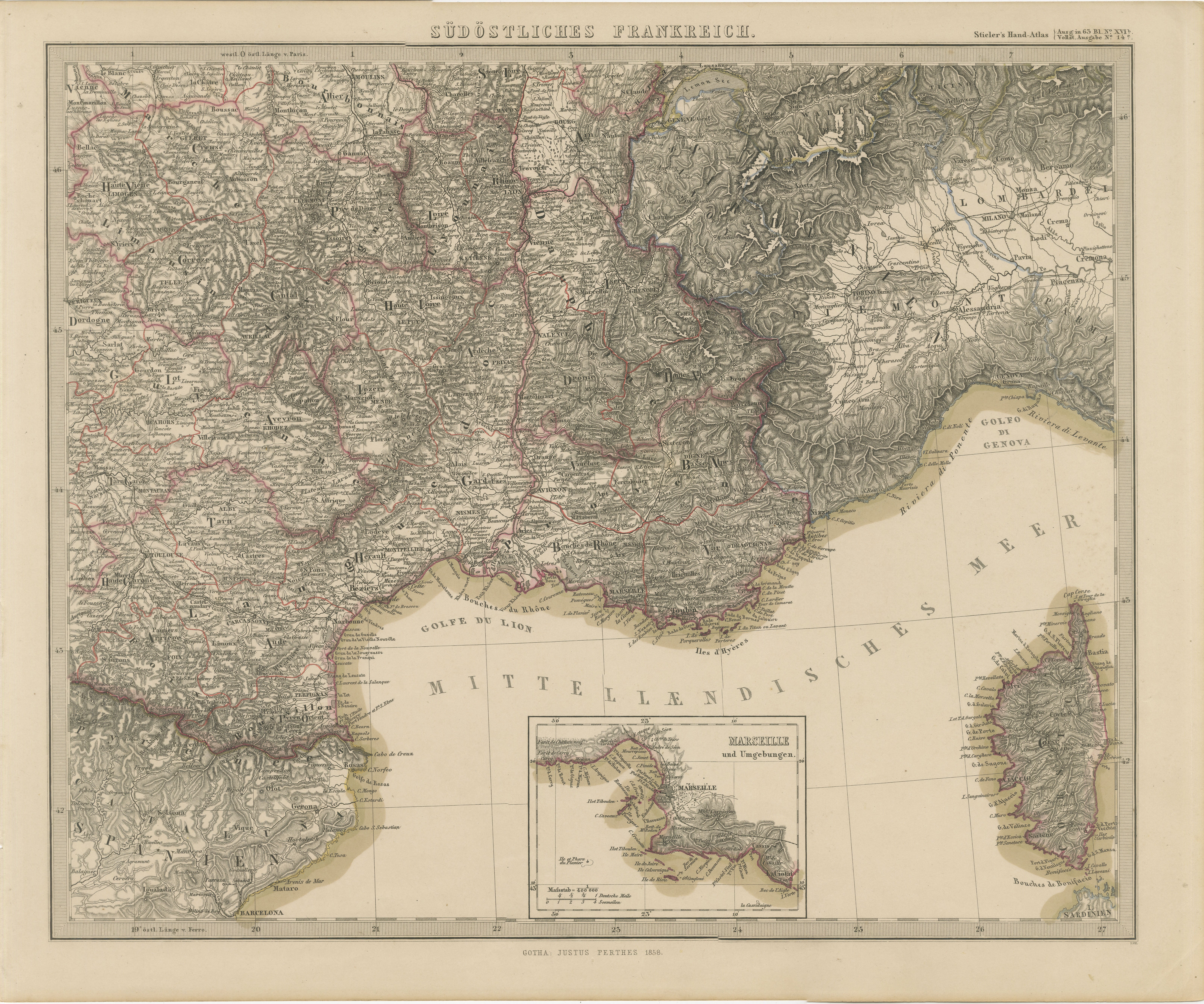
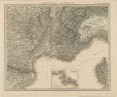
Tout afficher1858 Carte du Sud de la France avec la Corse - Marseille à la frontière italienne
Carte ancienne du sud-est de la France et de la Corse - Gravure de Stülpnagel, 1858
Carte très détaillée du XIXe siècle intitulée "Südöstliches Frankreich" (Sud-est de la France), g...
Catégorie
Antiquités, Milieu du XIXe siècle, Allemand, Cartes
Matériaux
Papier
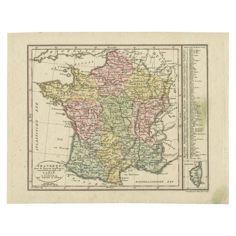
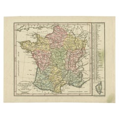
Carte ancienne de France avec une carte insérée de l'île de Corsica, vers 1820
Carte ancienne intitulée "Frankrijk naar de nieuwste bepalingen meerendeels gevolgd naar Lapie". Belle carte de France avec un encart sur l'île de Corse. Comprend un tableau de référ...
Catégorie
Antiquités, XIXe siècle, Néerlandais, Cartes
Matériaux
Papier
144 € Prix de vente
20 % de remise
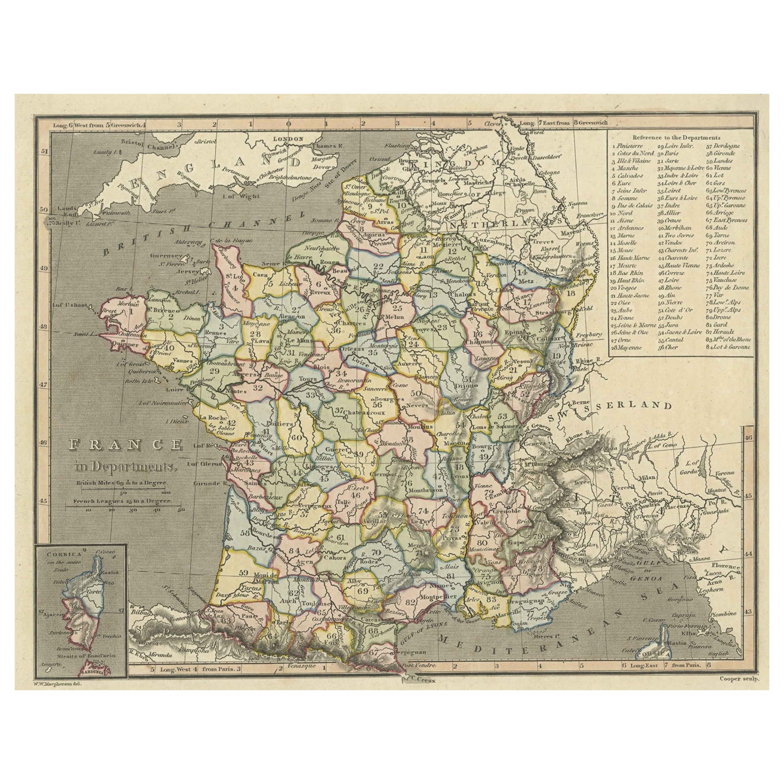
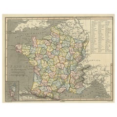
Carte ancienne de France avec carte insérée de l'île de Corsica, 1820
Carte ancienne intitulée "France in Departments". Ancienne carte de France, avec une petite carte insérée de l'île de Corse. Comprend un tableau de référence des départements.
Ar...
Catégorie
Antiquités, XIXe siècle, Cartes
Matériaux
Papier
208 € Prix de vente
20 % de remise
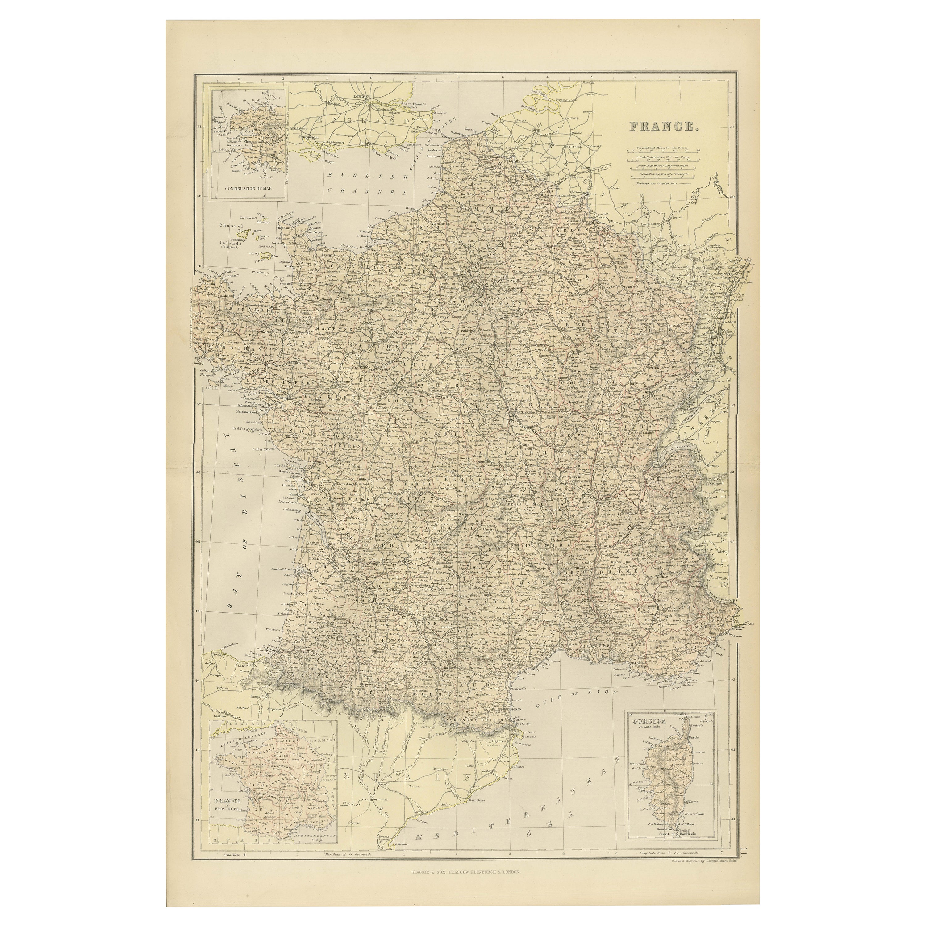
Carte de France mettant en valeur les frontières politiques, les villes et les inserts de Corsica, 1882
Cette carte de France de 1882, publiée par Blackie and Son dans le cadre du "Comprehensive Atlas and Geography of the World", offre une description détaillée du pays à la fin du XIXe...
Catégorie
Antiquités, années 1880, Cartes
Matériaux
Papier

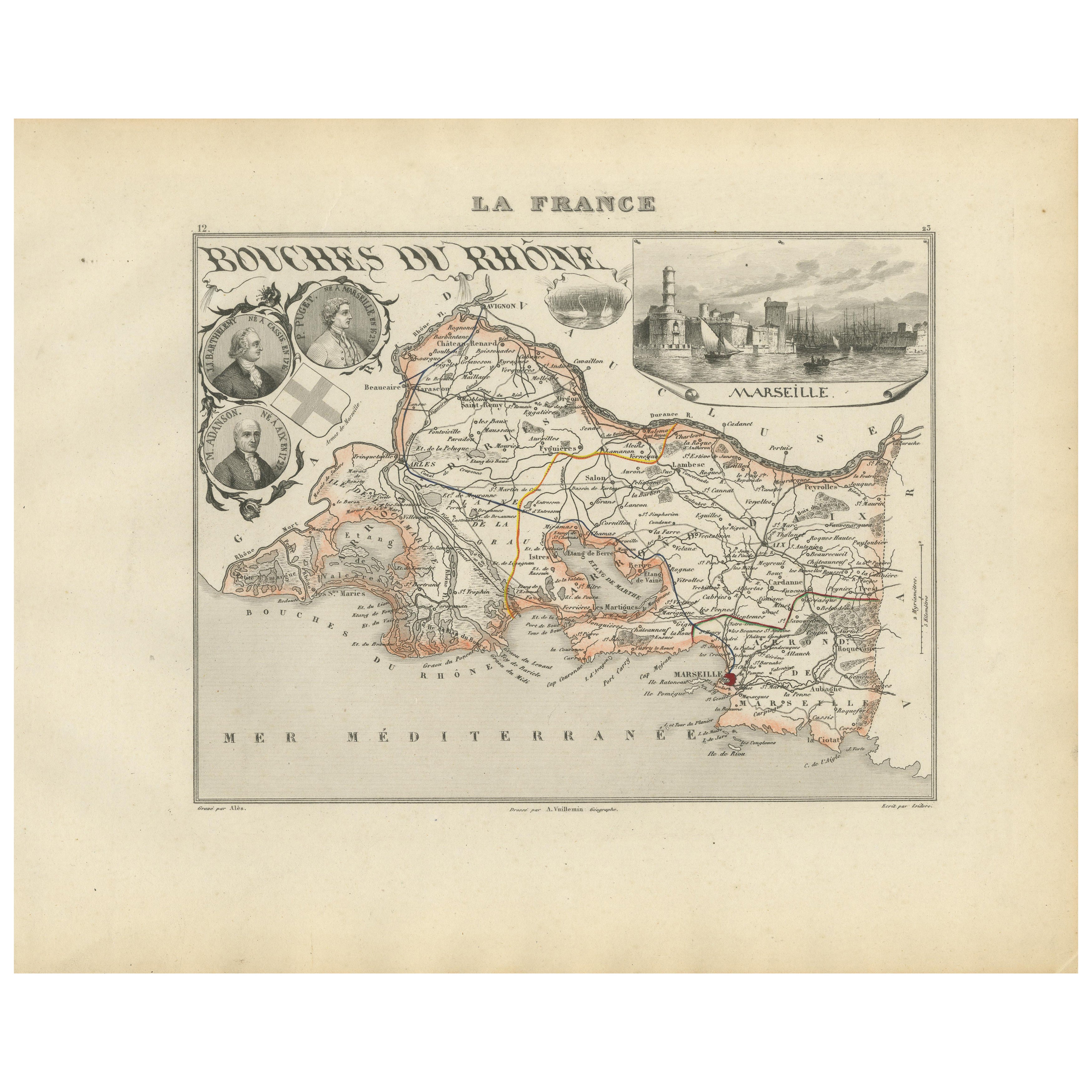
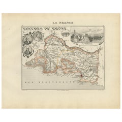
Map of Bouches-du-Rhône France with Marseille and Rhône Delta, 19th Century
Map of Bouches-du-Rhône France with Marseille and Rhône Delta, 19th Century
Description:
This finely engraved 19th-century map of the Bouches-du-Rhône department in southeastern Fra...
Catégorie
Antiquités, Milieu du XIXe siècle, Français, Cartes
Matériaux
Papier
Carte de France ancienne, 1903, avec insertion de Paris et de la Corse
Titre : Carte de France ancienne, 1903, avec insertion de Paris et de la Corse
Description :
Cette carte ancienne, intitulée "France", a été gravée et publiée en 1903 par la célèbre...
Catégorie
Début du 20ème siècle, Cartes
Matériaux
Papier

Suggestions
Magnifique carte à l'aquarelle française ancienne de 1856 en couleur, réalisée à la main, du département des La Corse
Nous sommes ravis d'offrir à la vente cette étonnante carte aquarelle de 1856 des Alpes autrichiennes intitulée Dept Des La Course, tirée de l'Atlas National Illustre de Victor Levas...
Catégorie
Antiquités, années 1850, Français, Début de l'époque victorienne, Cartes
Matériaux
Papier

Carte géographique ancienne de la Principalité de Monaco
Par Bruno Santini
ST/609 - Intéressante carte ancienne en couleur de la Principauté de Monaco : "Carte qui contient le Principauté de Piémont, le Monferrat et la comté de Nice avec la Rivière de Ponen...
Catégorie
Antiquités, Fin du XVIIIe siècle, italien, Autre, Cartes
Matériaux
Papier

Grande carte ancienne originale du sud de l'Italie I Johns, 1861
Grande carte du sud de l'Italie
Gravure lithographique de John Dower
Couleur originale
Publié, 1861
Non encadré
Bon état
Expédition gratuite
Catégorie
Antiquités, années 1860, Anglais, Victorien, Cartes
Matériaux
Papier

Carte ancienne de la Principalité de Monaco
Par Antonio Vallardi Editore
ST/619 - "Ancien atlas géographique de l'Italie - Carte topographique de l'ex-principauté de Monaco" -
ediz Vallardi - Milano -
Une édition un peu spéciale ---
Catégorie
Antiquités, Fin du XIXe siècle, italien, Autre, Estampes
Matériaux
Papier

Grande carte ancienne originale d'Italie. I Johns, 1861
Grande carte de l'Italie
Gravure lithographique de John Dower
Couleur originale
Publié, 1861
Non encadré
Bon état / réparation au coin supérieur droit visible sur la dernière im...
Catégorie
Antiquités, années 1860, Anglais, Victorien, Cartes
Matériaux
Papier

Italie, partie centrale et sud. Carte de l'Atlas du siècle
L'Atlas du siècle. Italie, partie centrale et sud".
Carte originale ancienne, 1903.
Cartes en médaillon de la Sicile et de Naples.
Pli central tel que publié. Le nom et le numéro d...
Catégorie
Début du 20ème siècle, Victorien, Plus d'Estampes
Matériaux
Lithographie
