Articles similaires à Map of Doubs France with Besançon and Swiss Border Landscape, 19th Century


Vous voulez plus d'images ou de vidéos ?
Demander au vendeur plus d'images ou de vidéos
1 sur 10
Map of Doubs France with Besançon and Swiss Border Landscape, 19th Century
120 €TVA incluse
Expédition
Recherche du devis...La promesse 1stDibs :
Garantie d'authenticité,
Garantie de remboursement,
Annulation sous 24 heures
À propos de cet article
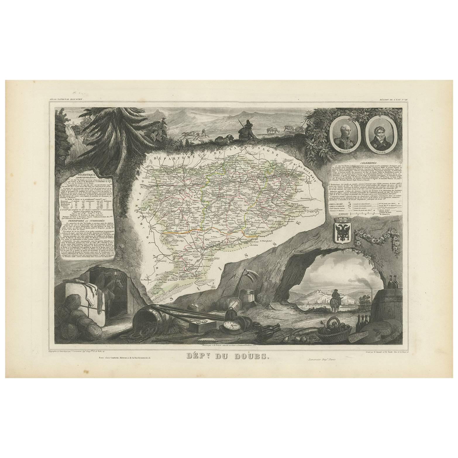
Map of Doubs France with Besançon and Swiss Border Landscape, 19th Century
Description:
This decorative 19th-century map of the department of Doubs in eastern France was drawn by Alexandre Vuillemin and published in Paris by Migeon as part of the *Nouvel Atlas Illustré*. Situated along the Swiss border, Doubs is a region defined by its mountainous terrain, rich natural beauty, and a long history of scientific and cultural achievement—all reflected in this finely engraved and hand-colored map.
The map shows the department in great detail, with towns, roads, rivers, and mountain ranges clearly engraved and bordered in soft violet watercolor. Besançon, the prefecture and historic heart of the region, is prominently displayed near the center. Other communes such as Montbéliard, Pontarlier, Morteau, and Baume-les-Dames are also clearly labeled.
In the lower left corner is a portrait of Georges Cuvier, the renowned naturalist and paleontologist born in Montbéliard. His scientific legacy is subtly honored in the floral and shell motifs surrounding his likeness. The vignette in the lower right captures the fortified city of Besançon along the Doubs River, nestled among hills and cliffs—an iconic scene that speaks to the city's strategic and cultural importance. The right edge also features the coat of arms of Doubs and a small image of the Saut du Doubs, a picturesque waterfall near the Swiss border.
Doubs is located within the Jura Mountains and forms part of the historic region of Franche-Comté. While not a major wine-producing department like nearby Burgundy, Doubs is known for its production of regional specialties including Comté cheese, smoked sausages, absinthe (especially around Pontarlier), and Jura wines from adjacent departments. Its mountainous terrain supports dairy farming, forestry, and small-scale viticulture along select valleys.
This map is not only a fine piece of decorative cartography, but also a celebration of Doubs’ blend of natural science, alpine beauty, and borderland heritage. It is ideal for collectors with interests in French geography, scientific history, or 19th-century engraving.
Condition summary:
Very good condition with some light foxing and toning in the margins. The engraved lines remain sharp and the original hand coloring is fresh and clean.
Framing tips:
This map suits a dark wood or black frame to emphasize the borderland topography. Pair with a light beige or soft lavender mat to enhance the violet border tones. Use UV-protective glass for long-term preservation.
- Dimensions:Hauteur : 26,1 cm (10,28 po)Largeur : 32,5 cm (12,8 po)Profondeur : 0,2 mm (0,01 po)
- Matériaux et techniques:Papier,Gravé
- Lieu d'origine:
- Période:
- Date de fabrication:circa 1850
- État:Very good condition with some light foxing and toning in the margins. The engraved lines remain sharp and the original hand coloring is fresh and clean.
- Adresse du vendeur:Langweer, NL
- Numéro de référence:Vendeur : BG-13331-241stDibs : LU3054345363862
À propos du vendeur
5,0
Vendeur reconnu
Ces vendeurs prestigieux sont des leaders du secteur. Ils représentent le summum en matière de qualité et de design.
Vendeur Platine
Vendeurs premium dont la note est supérieure à 4,7 et le délai de réponse de 24 heures maximum
Établi en 2009
Vendeur 1stDibs depuis 2017
2 493 ventes sur 1stDibs
Temps de réponse habituel : <1 heure
- ExpéditionRecherche du devis...Expédition depuis : Langweer, Pays-Bas
- Politique des retours
Certaines parties de cette page ont été traduites automatiquement. 1stDibs ne garantit pas l'exactitude des traductions. L'anglais est la langue par défaut de ce site web.
Garantie d'authenticité
Bien qu'il soit peu probable que la situation se présente, dans le cas où vous rencontreriez un problème d'authenticité d'un article, contactez-nous dans un délai d'un an pour obtenir un remboursement intégral. DétailsGarantie de remboursement
Si votre article n'est pas conforme à la description, est endommagé pendant le transport ou ne vous est pas livré, contactez-nous sous 7 jours pour obtenir un remboursement intégral. DétailsAnnulation sous 24 heures
Vous disposez d'un délai de 24 heures pour annuler votre achat sans motif.Des vendeurs professionnels agréés
Nos vendeurs de renommée mondiale doivent respecter des normes strictes en matière de service et de qualité, afin de préserver l'intégrité de nos fiches produit.Garantie d'alignement des prix
Si vous constatez qu'un autre vendeur a mis en vente le même article à un prix inférieur sur un autre site, nous nous alignerons sur ce prix.Livraison en toute confiance à l'international
Notre réseau de transporteurs de premier ordre propose des options d'expédition spécialisées dans le monde entier, y compris des livraisons personnalisées.Plus d'articles de ce vendeur
Tout afficherCarte ancienne du Doubs 'France' par V.I.I., 1854
Par Victor Levasseur
Carte ancienne intitulée "Dépt. du Doubs". Carte du département français du Doubs, France. L'ensemble est entouré de gravures décoratives élaborées destinées à illustrer à la fois la...
Catégorie
Antiquités, Milieu du XIXe siècle, Cartes
Matériaux
Papier
144 € Prix de vente
20 % de remise
Map of Aude France with Carcassonne and Languedoc Vineyards, 19th Century
Map of Aude France with Carcassonne and Languedoc Vineyards, 19th Century
Description:
This elegant 19th-century map of Aude, a department in southern France along the Mediterranean...
Catégorie
Antiquités, Milieu du XIXe siècle, Français, Cartes
Matériaux
Papier

Map of Aube France with Troyes and Champagne Wine Region, 19th Century
Map of Aube France with Troyes and Champagne Vineyards by Vuillemin, 19th c
Description:
This 19th-century map of the Aube department in the Grand Est region of northeastern France ...
Catégorie
Antiquités, Milieu du XIXe siècle, Français, Cartes
Matériaux
Papier

Map of Côtes-du-Nord France with Saint-Brieuc and Brittany Coastline, c.1850
Map of Côtes-du-Nord France with Saint-Brieuc and Brittany Coastline, 19th c
Description:
This elegant 19th-century map of Côtes-du-Nord, the historic name for what is now known as ...
Catégorie
Antiquités, Milieu du XIXe siècle, Français, Cartes
Matériaux
Papier

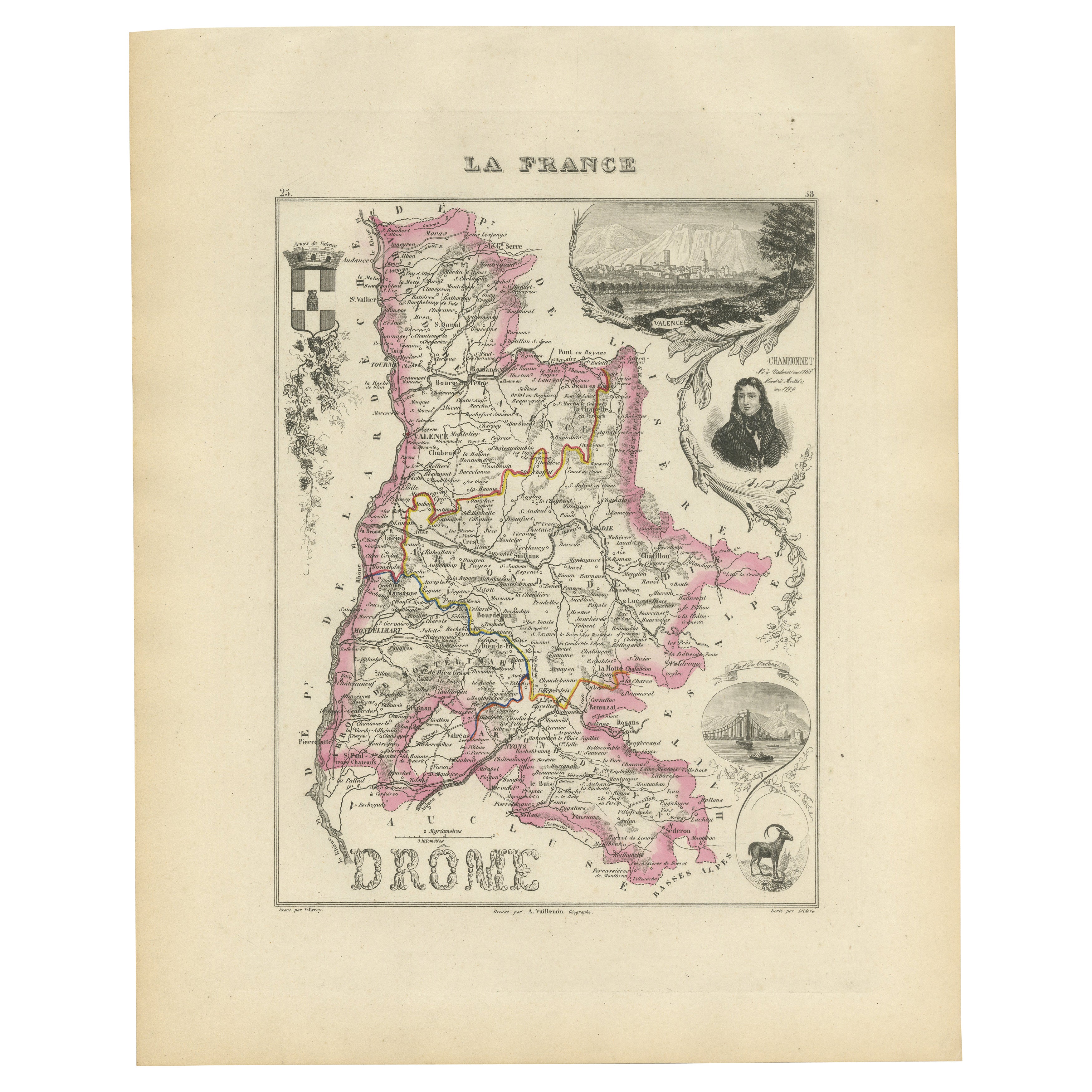
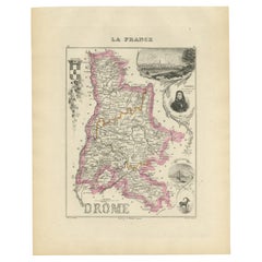
Map of Drôme France with Valence and Rhône Valley Wine Region, 19th Century
Map of Drôme France with Valence and Rhône Valley Wine Region, 19th Century
Description:
This beautifully engraved 19th-century map of the Drôme department in southeastern France wa...
Catégorie
Antiquités, Milieu du XIXe siècle, Français, Cartes
Matériaux
Papier
Map of Ariège France with Foix and Pyrenees Landscape by Vuillemin, 19th c
Map of Ariège France with Foix and Pyrenees Landscape by Vuillemin, 19th c
Description:
This beautifully detailed 19th-century map of the Ariège department in southwestern France wa...
Catégorie
Antiquités, Milieu du XIXe siècle, Français, Cartes
Matériaux
Papier

Suggestions
Aube, France. Carte ancienne d'un département français, 1856
Par Victor Levasseur
département de l'Aube, gravure sur acier avec contour original coloré à la main, 1856, de l'Atlas national illustré de Levasseur.
Cette région de France est connue pour sa producti...
Catégorie
XIXe siècle, Naturalisme, Estampes - Paysage
Matériaux
Gravure

Jura, France. Carte ancienne d'un département français, 1856
Par Victor Levasseur
département du Jura", gravure sur acier avec contour original coloré à la main, 1856, tirée de l'Atlas national illustré de Levasseur.
Les vins du Jura sont très distinctifs et inh...
Catégorie
XIXe siècle, Naturalisme, Estampes - Paysage
Matériaux
Gravure

Carte des deux Svres - gravure originale - 19ème siècle
Carte des Deux Sèvres est une gravure originale ancienne réalisée par un graveur anonyme du 19ème siècle.
Imprimé en série de "France Pittoresque" en haut au centre.
L'état de cons...
Catégorie
XIXe siècle, Moderne, Estampes - Figuratif
Matériaux
Eau-forte

Le Bas-Rhin, France Carte ancienne d'un département français, 1856
Par Victor Levasseur
Département du Bas-Rhin", gravure sur acier avec contour original colorié à la main, 1856, tirée de l'Atlas national illustré de Levasseur.
Fait partie de la région viticole d'Alsa...
Catégorie
XIXe siècle, Naturalisme, Estampes - Paysage
Matériaux
Gravure

Grande carte de France du 19ème siècle
Grande carte de France du 19e siècle.
Remarquable état de conservation, avec une patine d'usage agréable.
Récemment encadré.
France Circa 1874.
Catégorie
Antiquités, Fin du XIXe siècle, Français, Cartes
Matériaux
Lin, Papier

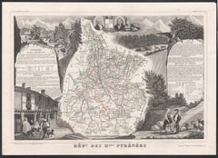
Les Hautes Pyrénées, France. Carte ancienne d'un département français, 1856
Par Victor Levasseur
département des Hautes-Pyrénées", gravure sur acier avec contour original coloré à la main, 1856, de l'Atlas national illustré de Levasseur.
Cette région abrite la région viticole ...
Catégorie
XIXe siècle, Naturalisme, Estampes - Paysage
Matériaux
Gravure