Articles similaires à Map of Haute-Garonne France with Toulouse and Garonne River by Vuillemin, c.1850


Vous voulez plus d'images ou de vidéos ?
Demander au vendeur plus d'images ou de vidéos
1 sur 10
Map of Haute-Garonne France with Toulouse and Garonne River by Vuillemin, c.1850
140 €TVA incluse
À propos de cet article
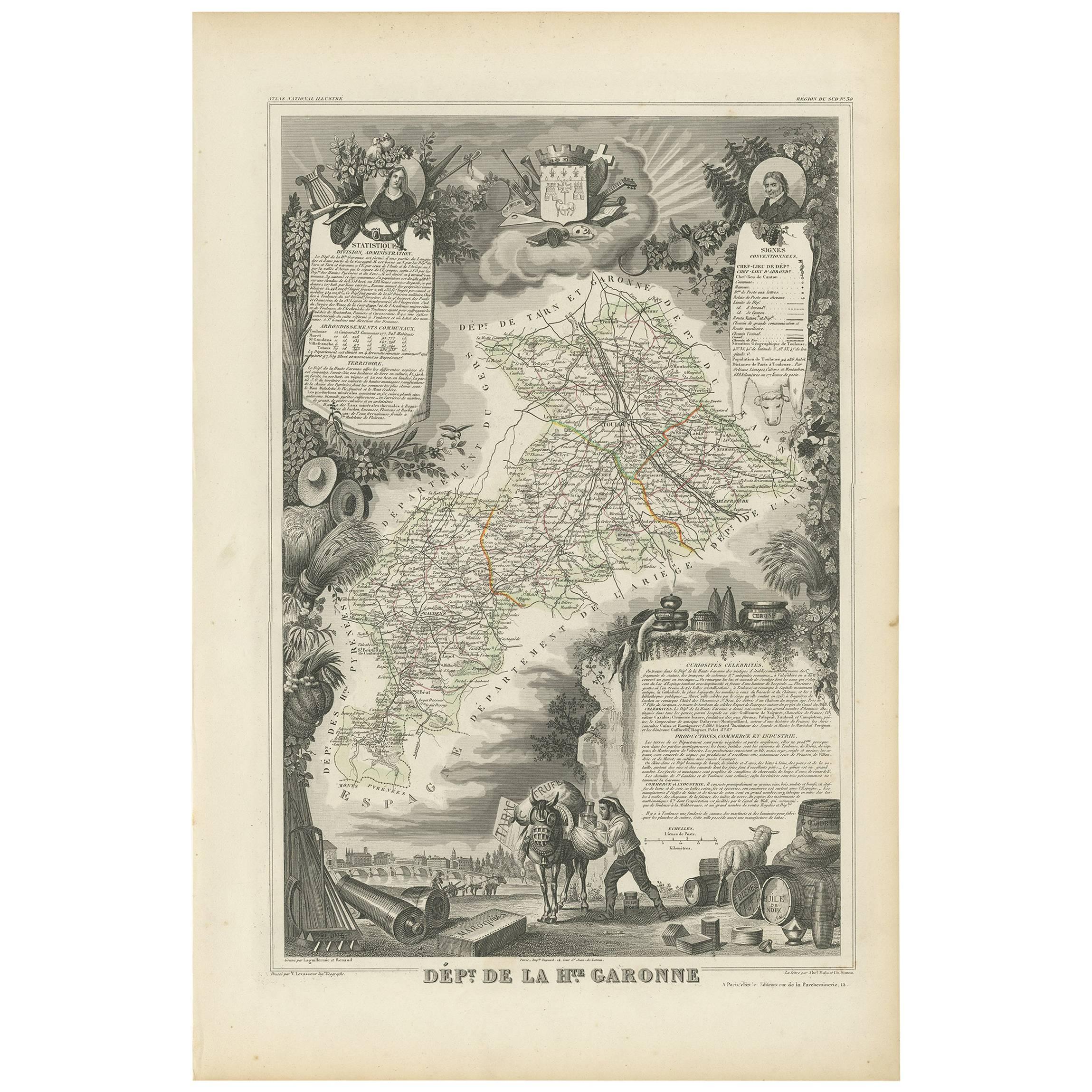
Map of Haute-Garonne France with Toulouse and Garonne River by Vuillemin, 19th c
Description:
This finely engraved 19th-century map of the department of Haute-Garonne, located in southwestern France, is part of Alexandre Vuillemin’s *Nouvel Atlas Illustré*, published in Paris by Migeon. The map presents a detailed view of the region’s topography and settlements, enriched by charming vignettes and portraits that highlight its cultural and historical importance.
Haute-Garonne is situated in the Occitanie region and is named after the Garonne River, which flows through the department’s capital, Toulouse. The map displays the area’s borders in soft hand-applied pink, and meticulously marks rivers, roads, and towns. Toulouse is prominently featured at the center, reflecting its status as the economic and cultural heart of the department.
The map is visually enriched with several artistic details. At the lower right, an attractive vignette shows the city of Toulouse with the Garonne River and a stone bridge—likely the Pont Neuf—connecting the historic parts of the city. At the top right, a portrait of the Abbé Sicard, a notable educator and pioneer in teaching the deaf, pays homage to one of the region’s historical figures. On the left side, a costumed couple with an ox—representing regional dress and agricultural heritage—adds a folkloric touch. The department's coat of arms is also included, further underscoring its civic identity.
Haute-Garonne is part of the greater Sud-Ouest wine region of France. Though better known today for its high-tech industry centered in Toulouse, the department still has a presence in viticulture. Local wines fall under the Comté Tolosan IGP label, and grape varieties such as Merlot, Cabernet Franc, and Tannat are grown in nearby areas. The region’s climate—characterized by warm summers and cool winters—supports a variety of wine styles, from red to white and rosé.
Alexandre Vuillemin was a noted 19th-century French cartographer who brought artistry and clarity to geographical publishing. His maps, engraved with great precision and often accompanied by cultural illustrations, were widely admired and collected. Publisher Migeon specialized in quality illustrated atlases that served both educational and decorative purposes.
Condition summary:
Very good condition with mild age toning and a few faint foxing spots near the edges. The engraved detail is crisp and the hand coloring remains clean and vivid.
Framing tips:
Best displayed in a natural wood or black frame to enhance the contrast of the engraving. A cream or soft rose-tinted mat will pair well with the pink border. Use UV-protective glass to preserve the fine detail and coloring.
- Dimensions:Hauteur : 26,1 cm (10,28 po)Largeur : 32,5 cm (12,8 po)Profondeur : 0,2 mm (0,01 po)
- Matériaux et techniques:Papier,Gravé
- Lieu d'origine:
- Période:
- Date de fabrication:circa 1850
- État:Very good condition with mild age toning and a few faint foxing spots near the edges. The engraved detail is crisp and the hand coloring remains clean and vivid.
- Adresse du vendeur:Langweer, NL
- Numéro de référence:Vendeur : BG-13331-301stDibs : LU3054345363932
À propos du vendeur
5,0
Vendeur reconnu
Ces vendeurs prestigieux sont des leaders du secteur. Ils représentent le summum en matière de qualité et de design.
Vendeur Platine
Vendeurs premium dont la note est supérieure à 4,7 et le délai de réponse de 24 heures maximum
Établi en 2009
Vendeur 1stDibs depuis 2017
2 567 ventes sur 1stDibs
Temps de réponse habituel : <1 heure
- ExpéditionRecherche du devis...Expédition depuis : Langweer, Pays-Bas
- Politique des retours
Certaines parties de cette page ont été traduites automatiquement. 1stDibs ne garantit pas l'exactitude des traductions. L'anglais est la langue par défaut de ce site web.
Garantie d'authenticité
Bien qu'il soit peu probable que la situation se présente, dans le cas où vous rencontreriez un problème d'authenticité d'un article, contactez-nous dans un délai d'un an pour obtenir un remboursement intégral. DétailsGarantie de remboursement
Si votre article n'est pas conforme à la description, est endommagé pendant le transport ou ne vous est pas livré, contactez-nous sous 7 jours pour obtenir un remboursement intégral. DétailsAnnulation sous 24 heures
Vous disposez d'un délai de 24 heures pour annuler votre achat sans motif.Des vendeurs professionnels agréés
Nos vendeurs de renommée mondiale doivent respecter des normes strictes en matière de service et de qualité, afin de préserver l'intégrité de nos fiches produit.Garantie d'alignement des prix
Si vous constatez qu'un autre vendeur a mis en vente le même article à un prix inférieur sur un autre site, nous nous alignerons sur ce prix.Livraison en toute confiance à l'international
Notre réseau de transporteurs de premier ordre propose des options d'expédition spécialisées dans le monde entier, y compris des livraisons personnalisées.Plus d'articles de ce vendeur
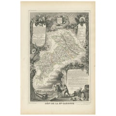
Tout afficherCarte ancienne de la Haute-Garonne "France" par V. Levasseur, 1854
Carte ancienne intitulée "Dépt. de la Hte. Garonne". Carte du département français de la Haute-Garonne, France. Cette région de France produit les délicieux mais moins connus vins de...
Catégorie
Antiquités, Milieu du XIXe siècle, Cartes
Matériaux
Papier
144 € Prix de vente
20 % de remise
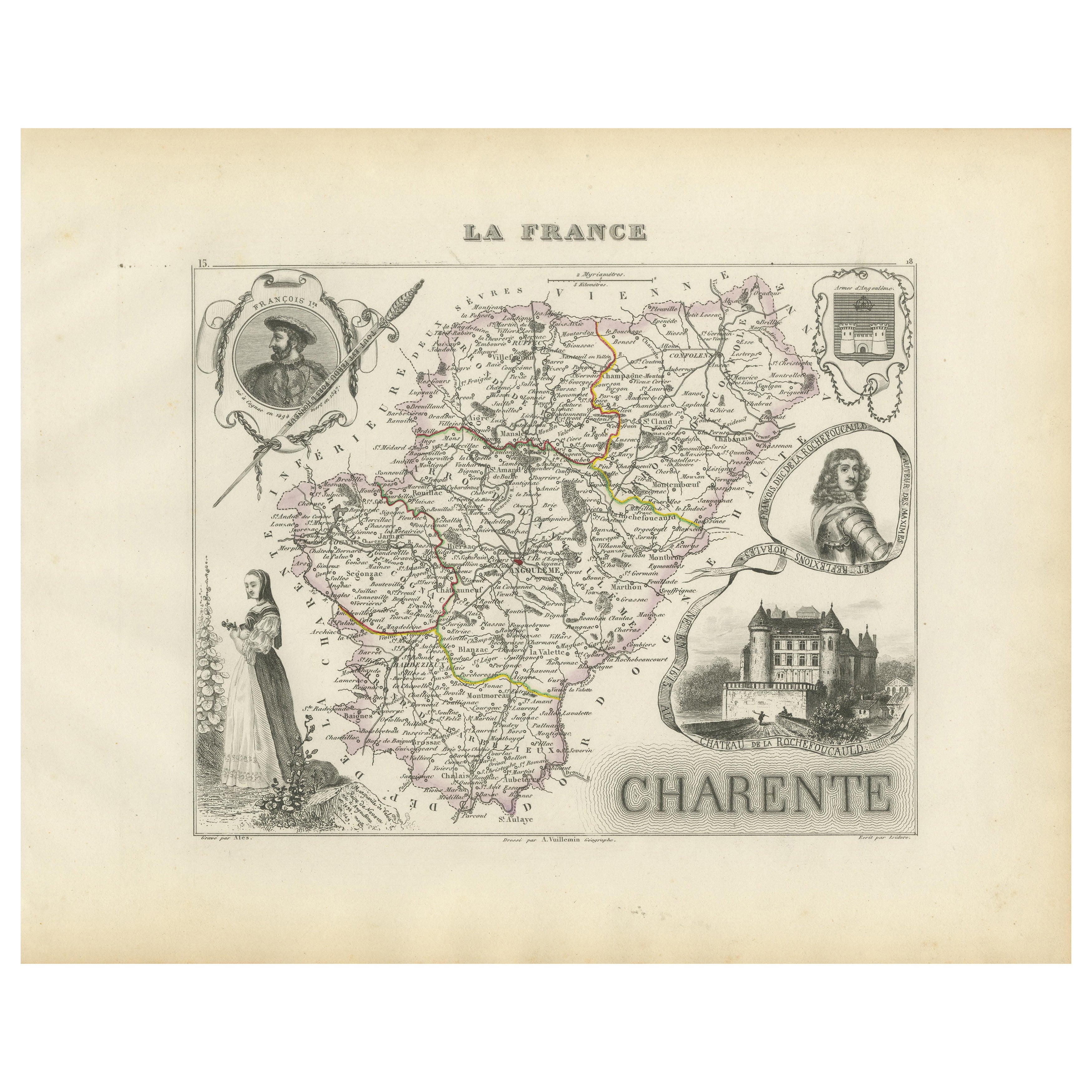
Map of Charente France with Cognac Region and Château de La Rochefoucauld, 1850
Map of Charente France with Cognac Region and Château de La Rochefoucauld, 19th c
Description:
This richly illustrated 19th-century map of the Charente department in southwestern Fr...
Catégorie
Antiquités, Milieu du XIXe siècle, Français, Cartes
Matériaux
Papier

Map of Ariège France with Foix and Pyrenees Landscape by Vuillemin, 19th c
Map of Ariège France with Foix and Pyrenees Landscape by Vuillemin, 19th c
Description:
This beautifully detailed 19th-century map of the Ariège department in southwestern France wa...
Catégorie
Antiquités, Milieu du XIXe siècle, Français, Cartes
Matériaux
Papier

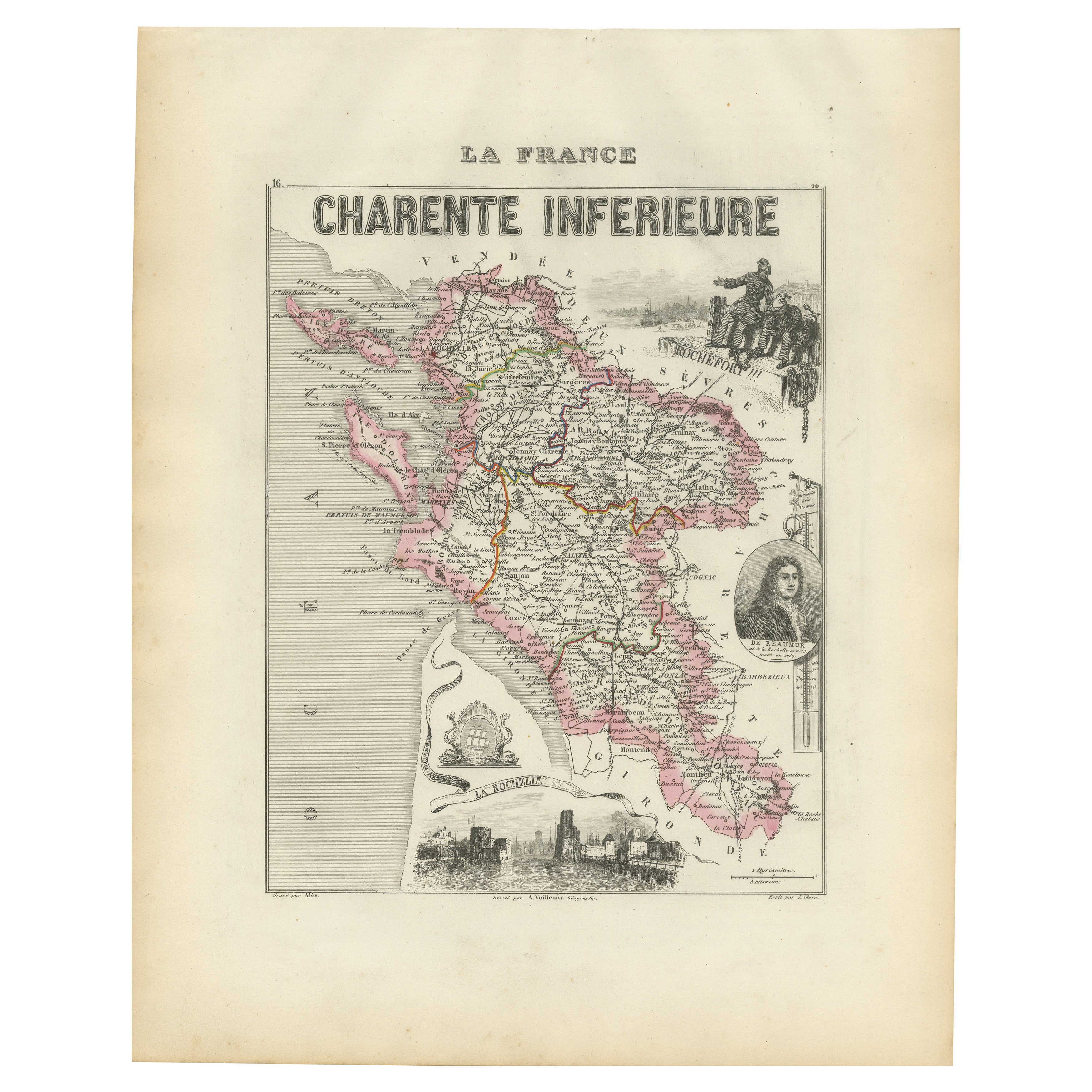
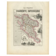
Map of Charente-Inférieure France with La Rochelle and Coastal Vineyards, c.1850
Map of Charente-Inférieure France with La Rochelle and Coastal Vineyards, 19th c
Description:
This decorative 19th-century map of the former department of Charente-Inférieure, now k...
Catégorie
Antiquités, Milieu du XIXe siècle, Français, Cartes
Matériaux
Papier
Map of Gard France with Pont du Gard and Wine Regions by Vuillemin, 19th c
Title: Map of Gard France with Pont du Gard and Wine Regions by Vuillemin, 19th c
Description:
This finely engraved 19th-century map of the department of Gard in southern France was...
Catégorie
Antiquités, Milieu du XIXe siècle, Français, Cartes
Matériaux
Papier

Map of Côtes-du-Nord France with Saint-Brieuc and Brittany Coastline, c.1850
Map of Côtes-du-Nord France with Saint-Brieuc and Brittany Coastline, 19th c
Description:
This elegant 19th-century map of Côtes-du-Nord, the historic name for what is now known as ...
Catégorie
Antiquités, Milieu du XIXe siècle, Français, Cartes
Matériaux
Papier

Suggestions
Saone et Loire, France. Carte ancienne d'un département français, 1856
Par Victor Levasseur
département de Saône et Loire", gravure sur acier avec contour original coloré à la main, 1856, de l'Atlas national illustré de Levasseur.
Le département français de la Saône et Lo...
Catégorie
XIXe siècle, Naturalisme, Estampes - Paysage
Matériaux
Gravure

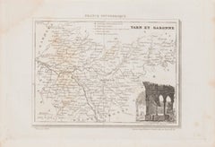
Carte de la région de Tarn et Garonne - Lithographie originale - 19ème siècle
Carte du Tarn et Garonne est une lithographie originale réalisée par un artiste anonyme du 19ème siècle.
Imprimé en série de "France Pittoresque" en haut au centre.
L'état de conse...
Catégorie
XIXe siècle, Moderne, Estampes - Figuratif
Matériaux
Papier, Lithographie
L'Herault, France. Carte ancienne d'un département français, 1856
Par Victor Levasseur
département de Saône et Loire", gravure sur acier avec contour original coloré à la main, 1856, de l'Atlas national illustré de Levasseur.
Cette région abrite une grande variété de...
Catégorie
XIXe siècle, Naturalisme, Estampes - Paysage
Matériaux
Gravure

L'Isere, France. Carte ancienne du département français de l'antiquité, 1856
Par Victor Levasseur
département de l'Isère, gravure sur acier avec contour original coloré à la main, 1856, de l'Atlas national illustré de Levasseur.
Cette région est connue pour sa production de Ble...
Catégorie
XIXe siècle, Naturalisme, Estampes - Paysage
Matériaux
Gravure

Aude, France. Carte ancienne d'un département français, 1856
Par Victor Levasseur
département de l'Aude, gravure sur acier avec contour original coloré à la main, 1856, de l'Atlas national illustré de Levasseur.
Cette région de France est célèbre pour sa grande ...
Catégorie
XIXe siècle, Naturalisme, Estampes - Paysage
Matériaux
Gravure

Aube, France. Carte ancienne d'un département français, 1856
Par Victor Levasseur
département de l'Aube, gravure sur acier avec contour original coloré à la main, 1856, de l'Atlas national illustré de Levasseur.
Cette région de France est connue pour sa producti...
Catégorie
XIXe siècle, Naturalisme, Estampes - Paysage
Matériaux
Gravure
