Articles similaires à Map of Hautes-Alpes France with Gap and Alpine Scenery by Vuillemin, c.1850

Vous voulez plus d'images ou de vidéos ?
Demander au vendeur plus d'images ou de vidéos
1 sur 10
Map of Hautes-Alpes France with Gap and Alpine Scenery by Vuillemin, c.1850
120 €TVA incluse
À propos de cet article
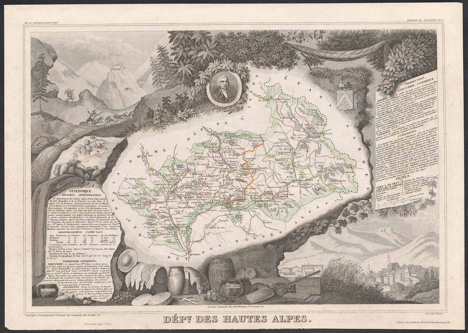
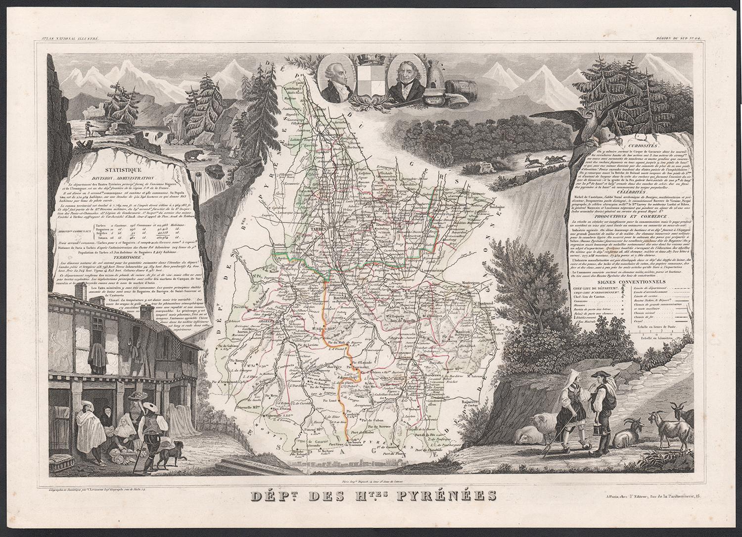
Map of Hautes-Alpes France with Gap and Alpine Scenery by Vuillemin
Description:
This elegant 19th-century map of the Hautes-Alpes department in southeastern France was created by Alexandre Vuillemin and published by Migeon in Paris as part of the richly illustrated Nouvel Atlas Illustré. The map presents a detailed view of this mountainous region, framed by artistic engravings that highlight its historical, topographical, and cultural significance.
Hautes-Alpes is one of the highest and most sparsely populated departments in France, located in the heart of the French Alps. The map is bordered with a soft hand-colored blue to indicate the departmental boundary. Towns, roads, and rivers are carefully engraved, and the mountainous terrain is subtly rendered with engraved shading. The map offers a close view of the towns of Gap, Embrun, Briançon, and the surrounding alpine passes that have long connected France and Italy.
At the upper left, a portrait of the Duc de Lesdiguières is featured. He was a key military leader in the Wars of Religion and the last Constable of France, born in the region and associated with its defense and development. In the upper right, a coat of arms appears with a fortified tower motif. The lower half of the sheet is dominated by an engraved vignette of Gap, the department’s prefecture, nestled in an idyllic alpine valley. Trees, livestock, and cottages contribute to the rural and peaceful atmosphere that characterizes this high-altitude area.
Though Hautes-Alpes is not a major wine-producing region due to its elevation and climate, it is known for small-scale, high-altitude viticulture in valleys such as those around Embrun and Tallard. More than its wine, however, the area is celebrated for winter sports, mountain tourism, and its stunning natural scenery. Hiking, skiing, and nature excursions are key to the region’s identity.
Alexandre Vuillemin was known for his skill in producing maps that were both accurate and decorative. His publisher, Migeon, brought these works to a wide audience through visually engaging atlases, combining educational and artistic appeal.
Condition summary:
Very good antique condition with only minor age-related foxing in the margins. Original hand-coloring is well preserved, and all engraved lines remain crisp and clear.
Framing tips:
This map would suit a natural wood frame or one with a distressed alpine finish. A cream or pale blue mat will complement the hand-colored border and evoke the cool tones of the mountain setting. Museum-quality glass is recommended for protection.
- Dimensions:Hauteur : 26,1 cm (10,28 po)Largeur : 32,5 cm (12,8 po)Profondeur : 0,2 mm (0,01 po)
- Matériaux et techniques:Papier,Gravé
- Lieu d'origine:
- Période:
- Date de fabrication:circa 1850
- État:Very good antique condition with only minor age-related foxing in the margins. Original hand-coloring is well preserved, and all engraved lines remain crisp and clear.
- Adresse du vendeur:Langweer, NL
- Numéro de référence:Vendeur : BG-13331-51stDibs : LU3054345359152
À propos du vendeur
5,0
Vendeur reconnu
Ces vendeurs prestigieux sont des leaders du secteur. Ils représentent le summum en matière de qualité et de design.
Vendeur Platine
Vendeurs premium dont la note est supérieure à 4,7 et le délai de réponse de 24 heures maximum
Établi en 2009
Vendeur 1stDibs depuis 2017
2 567 ventes sur 1stDibs
Temps de réponse habituel : <1 heure
- ExpéditionRecherche du devis...Expédition depuis : Langweer, Pays-Bas
- Politique des retours
Certaines parties de cette page ont été traduites automatiquement. 1stDibs ne garantit pas l'exactitude des traductions. L'anglais est la langue par défaut de ce site web.
Garantie d'authenticité
Bien qu'il soit peu probable que la situation se présente, dans le cas où vous rencontreriez un problème d'authenticité d'un article, contactez-nous dans un délai d'un an pour obtenir un remboursement intégral. DétailsGarantie de remboursement
Si votre article n'est pas conforme à la description, est endommagé pendant le transport ou ne vous est pas livré, contactez-nous sous 7 jours pour obtenir un remboursement intégral. DétailsAnnulation sous 24 heures
Vous disposez d'un délai de 24 heures pour annuler votre achat sans motif.Des vendeurs professionnels agréés
Nos vendeurs de renommée mondiale doivent respecter des normes strictes en matière de service et de qualité, afin de préserver l'intégrité de nos fiches produit.Garantie d'alignement des prix
Si vous constatez qu'un autre vendeur a mis en vente le même article à un prix inférieur sur un autre site, nous nous alignerons sur ce prix.Livraison en toute confiance à l'international
Notre réseau de transporteurs de premier ordre propose des options d'expédition spécialisées dans le monde entier, y compris des livraisons personnalisées.Plus d'articles de ce vendeur
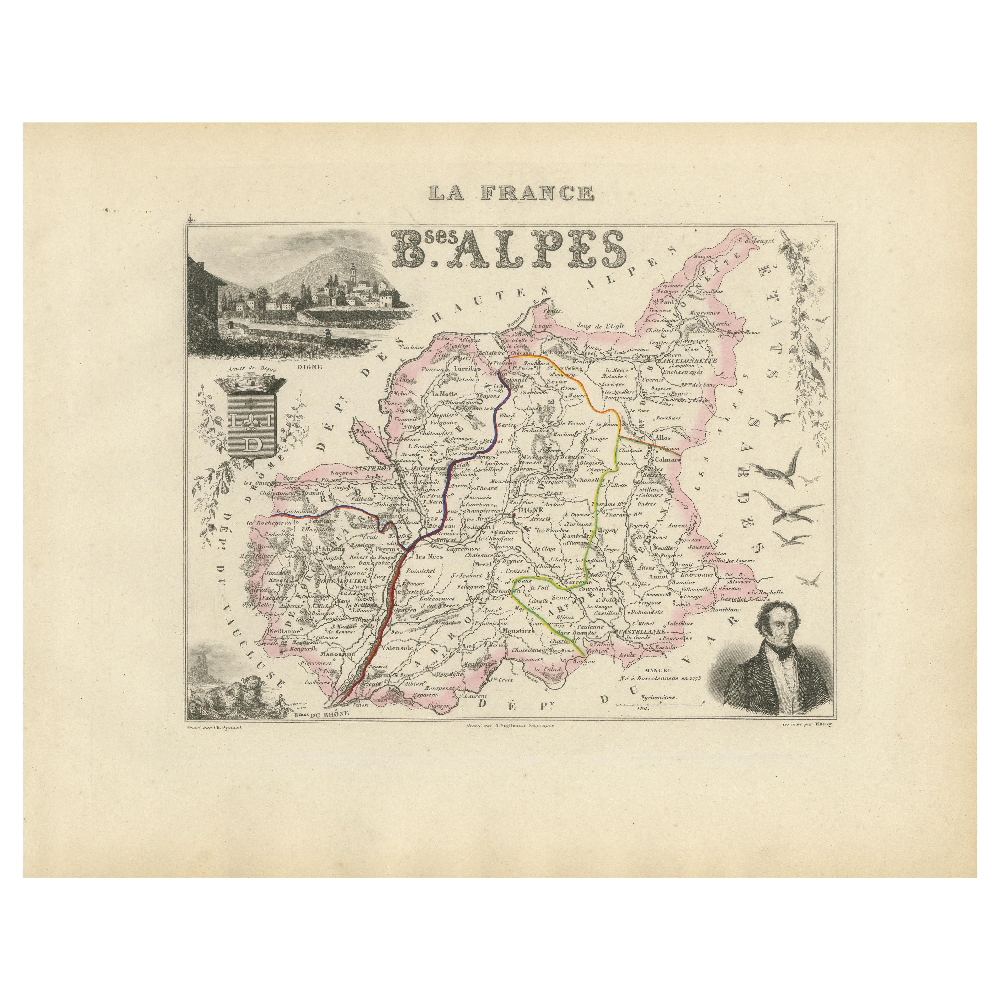
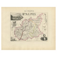
Tout afficherMap of Basses-Alpes France with Digne and Lavender Region by Vuillemin, c.1850
Map of Basses-Alpes France with Digne and Lavender Region by Vuillemin, 19th c
This finely engraved 19th-century map of the Basses-Alpes department of France (known today as Alpes-d...
Catégorie
Antiquités, Milieu du XIXe siècle, Français, Cartes
Matériaux
Papier
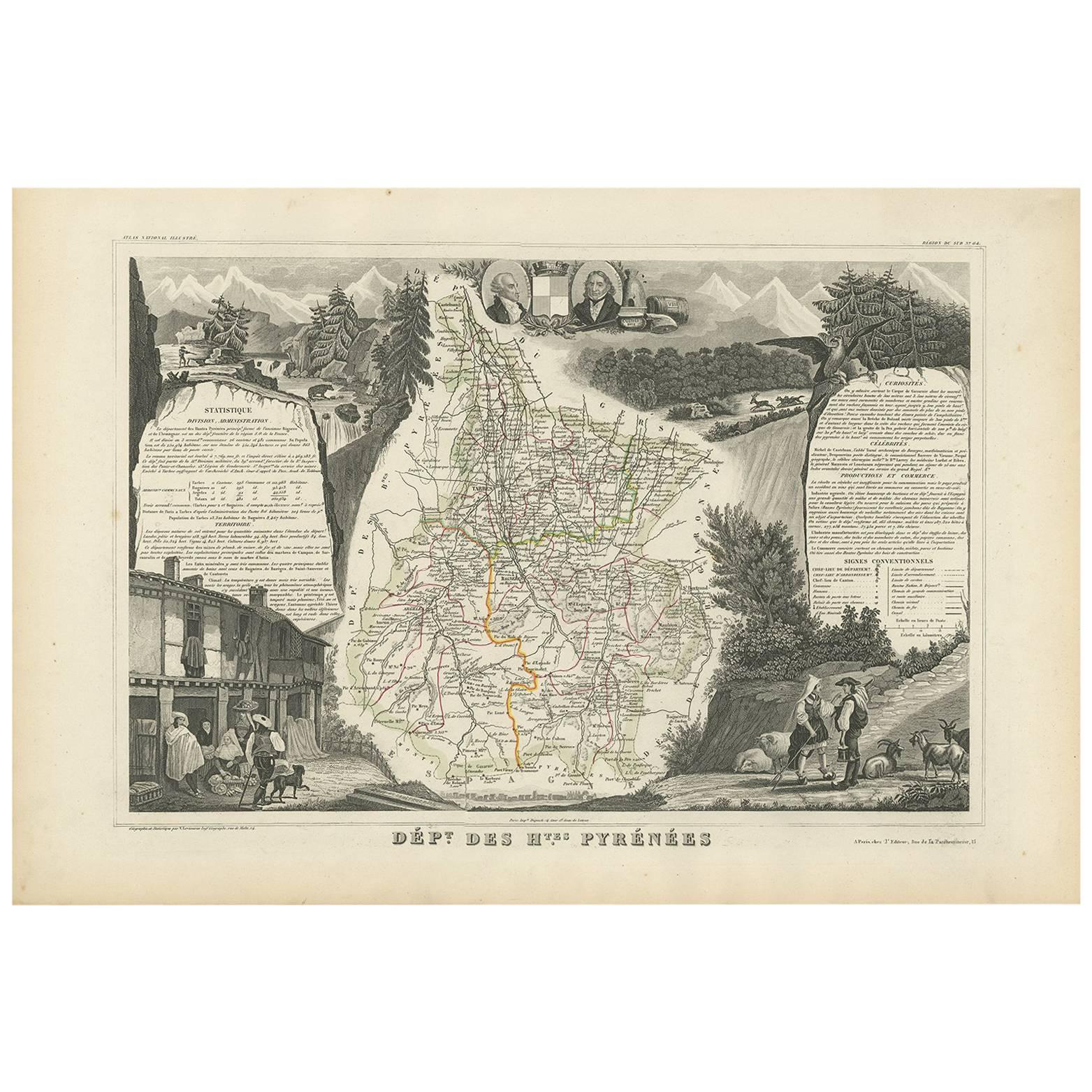
Map of Ariège France with Foix and Pyrenees Landscape by Vuillemin, 19th c
Map of Ariège France with Foix and Pyrenees Landscape by Vuillemin, 19th c
Description:
This beautifully detailed 19th-century map of the Ariège department in southwestern France wa...
Catégorie
Antiquités, Milieu du XIXe siècle, Français, Cartes
Matériaux
Papier

Carte ancienne des Hautes Pyrénées (France) par V. Levasseur, 1854
Par Victor Levasseur
Carte ancienne intitulée "Dépt. des Htes. Pyrénées". Carte du département français des Hautes-Pyrénées, France. Cette région abrite la région viticole de Madiran. Madrian est surtout...
Catégorie
Antiquités, Milieu du XIXe siècle, Cartes
Matériaux
Papier
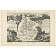
160 € Prix de vente
20 % de remise
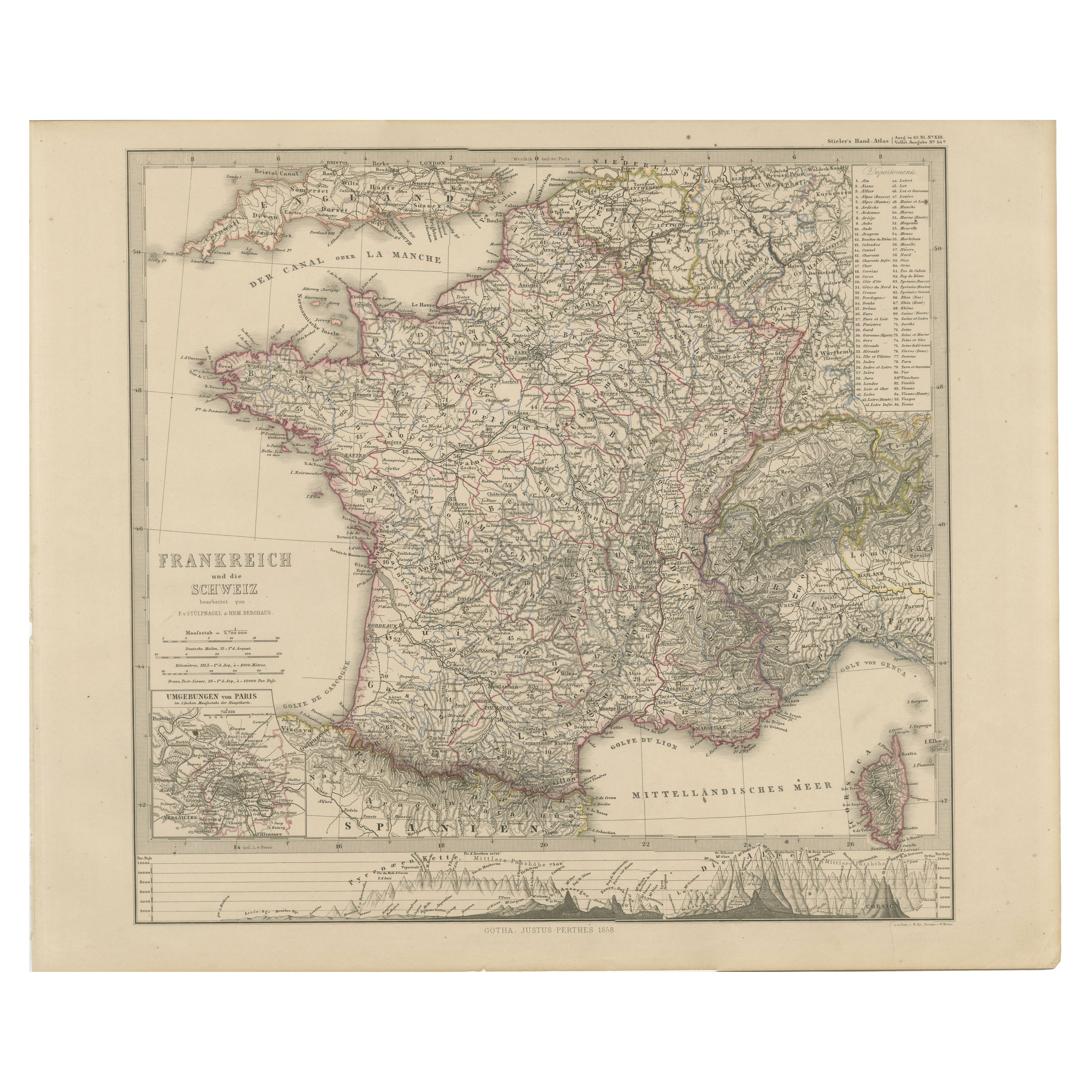
1856 Carte de France et de Suisse avec profils de montagne
1856 Carte de France et de Suisse avec encart sur Paris par Stülpnagel
Cette carte ancienne de la France et de la Suisse, finement détaillée, a été publiée en 1856 par le célèbre ca...
Catégorie
Antiquités, Milieu du XIXe siècle, Allemand, Cartes
Matériaux
Papier
Map of Allier France with Saint-Pourçain Wine Region by Vuillemin, 19th c
Map of Allier France with Saint-Pourçain Wine Region by Vuillemin, 19th c
This decorative 19th-century map of Allier, a central department of France, comes from the celebrated Nouve...
Catégorie
Antiquités, Milieu du XIXe siècle, Français, Cartes
Matériaux
Papier

Map of Côtes-du-Nord France with Saint-Brieuc and Brittany Coastline, c.1850
Map of Côtes-du-Nord France with Saint-Brieuc and Brittany Coastline, 19th c
Description:
This elegant 19th-century map of Côtes-du-Nord, the historic name for what is now known as ...
Catégorie
Antiquités, Milieu du XIXe siècle, Français, Cartes
Matériaux
Papier

Suggestions
Les Hautes Alpes, France. Carte ancienne d'un département français, 1856
Par Victor Levasseur
département des Hautes Alpes", gravure sur acier avec contour original coloré à la main, 1856, tirée de l'Atlas national illustré de Levasseur.
Cette...
Catégorie
XIXe siècle, Naturalisme, Estampes - Paysage
Matériaux
Gravure

Les Hautes Pyrénées, France. Carte ancienne d'un département français, 1856
Par Victor Levasseur
département des Hautes-Pyrénées", gravure sur acier avec contour original coloré à la main, 1856, de l'Atlas national illustré de Levasseur.
Cette région abrite la région viticole ...
Catégorie
XIXe siècle, Naturalisme, Estampes - Paysage
Matériaux
Gravure

Carte des Hautes-Pyrnes - Lithographie originale - 19ème siècle
La carte des Hautes-Pyrénées est une lithographie originale réalisée par un graveur anonyme du 19ème siècle.
Imprimé en série de "France Pittoresque" en haut au centre.
L'état de c...
Catégorie
XIXe siècle, Moderne, Estampes - Figuratif
Matériaux
Papier, Lithographie

Pyrenees Orientales, France. Carte ancienne d'un département français, 1856
Par Victor Levasseur
dept. des Pyrénées Orientales", gravure sur acier avec contour original coloré à la main, 1856, de l'Atlas National Illustre de Levasseur.
Cette région est une région viticole répu...
Catégorie
XIXe siècle, Naturalisme, Estampes - Paysage
Matériaux
Gravure

Fine carte ancienne à l'aquarelle du département des Hautes Alpes de 1856, réalisée à la main par Levasseur's
Nous sommes ravis d'offrir à la vente cette étonnante carte aquarelle de 1856 des Alpes autrichiennes intitulée Dept Des Hautes Alpes tirée de l'Atlas ...
Catégorie
Antiquités, années 1850, Français, Début de l'époque victorienne, Cartes
Matériaux
Papier

Lozere, France. Carte ancienne d'un département français, 1856
Par Victor Levasseur
département de la Lozère, gravure sur acier avec contour original coloré à la main, 1856, de l'Atlas national illustré de Levasseur.
Cette partie montagneuse isolée du Languedoc es...
Catégorie
XIXe siècle, Naturalisme, Estampes - Paysage
Matériaux
Gravure
