Articoli simili a Antique Map of Sweden & Norway, 1903, with Intricate Topographical Detail


Vuoi altre immagini o video?
Richiedi altre immagini o video al venditore
1 di 10
Antique Map of Sweden & Norway, 1903, with Intricate Topographical Detail
Informazioni sull’articolo
Title: Antique Map of Sweden & Norway, 1903, with Intricate Topographical Detail
Description:
This antique map, titled "Sweden & Norway (Scandinavia)," was engraved and published in 1903 by W. & A.K. Johnston in Edinburgh and London. It beautifully captures the geographical and political landscape of Scandinavia at the turn of the 20th century, highlighting the natural grandeur and strategic location of these northern European countries.
The map is delicately colored in pastel shades to mark provincial and administrative boundaries, while fine linework depicts the rugged mountains, deep fjords, and expansive forests that define the Scandinavian Peninsula. Cities such as Stockholm, Oslo (then Christiania), Gothenburg, and Bergen are marked with precision, alongside key rivers, lakes, and coastal features.
One of the most captivating aspects of this map is its depiction of the remote northern reaches above the Arctic Circle, including the northern coastlines and the rugged archipelagos of the Lofoten Islands. The carefully engraved typography and shading bring to life the varied topography of the region, emphasizing both its harsh beauty and its cultural significance.
For collectors, historians, and lovers of Scandinavian heritage, this map is more than just a visual artifact. It represents a time when these nations were known for their maritime traditions and natural resources, poised on the brink of the modern era. Its refined composition and careful coloring make it a statement piece for any setting.
Condition report:
This map is in very good antique condition, with only slight foxing and minor toning along the edges consistent with its age. The colors remain vibrant and the paper stable and well-preserved.
Framing tips:
A classic wooden frame in walnut or cherry will add warmth and depth to this antique map. Use a cream or light beige matting to accentuate the delicate coloring and fine engraving, creating a timeless and elegant display that will be a focal point in any home, library, or office.
- Dimensioni:Altezza: 36,8 cm (14,49 in)Larghezza: 47 cm (18,51 in)Profondità: 0,2 mm (0,01 in)
- Materiali e tecniche:
- Periodo:
- Data di produzione:1903
- Condizioni:The map is in very good antique condition, with minor foxing and gentle toning at the edges typical for its age. The colors remain vibrant and the paper well-preserved. Folding line as issued.
- Località del venditore:Langweer, NL
- Numero di riferimento:Venditore: BG-13577-211stDibs: LU3054345243032
Informazioni sul venditore
5,0
Venditore riconosciuto
Questi venditori prestigiosi sono leader del settore e rappresentano il massimo in termini di qualità e design.
Venditore Oro
Venditori Premium con valutazione 4,3+ e tempi di risposta entro 24 ore
Fondazione nel 2009
Venditore 1stDibs dal 2017
2.452 vendite su 1stDibs
Tempo di risposta standard: <1 ora
- SpedizioneRecupero del preventivo…Spedizione da: Langweer, Paesi Bassi
- Politica di reso
Alcune parti di questa pagina sono state tradotte automaticamente. 1stDibs non può garantire che le traduzioni siano corrette. L’inglese è la lingua predefinita del sito.
Garanzia di autenticità
Nell’improbabile caso in cui si verifichi un problema con l’autenticità di un articolo, contattaci entro un anno per ottenere un rimborso completo. DettagliGaranzia di rimborso
Se il tuo articolo non corrisponde alla descrizione, è danneggiato durante il trasporto o non arriva, contattaci entro 7 giorni per un rimborso completo. DettagliAnnullamento entro 24 ore
Hai un periodo di tolleranza di 24 ore per annullare il tuo acquisto, senza necessità di fornire spiegazioni.Venditori professionali selezionati
I nostri venditori di livello internazionale devono aderire a rigorosi standard di servizio e qualità, garantendo l’integrità delle inserzioni.Garanzia miglior prezzo
Se scopri che un venditore ha pubblicato altrove lo stesso articolo a un prezzo più basso, applicheremo lo stesso prezzo.Consegna globale affidabile
La nostra rete di vettori leader del settore offre opzioni di spedizione specializzate in tutto il mondo, inclusa la consegna personalizzata.Altro da questo venditore
Mostra tuttoAntique Map of Ireland, 1903, with Intricate County Boundaries & Coastal Details
Title: Antique Map of Ireland, 1903, with Intricate County Boundaries and Coastal Detail
Description:
This antique map of Ireland, engraved and published in 1903 by the esteemed W. ...
Categoria
Inizio XX secolo, Mappe
Materiali
Carta

Antique Map of Europe, 1903, with Intricate Political Boundaries and Rich Detail
Title: Antique Map of Europe, 1903, with Intricate Political Boundaries and Rich Detail
Description:
This antique map, titled "Europe," is a finely engraved and beautifully colored ...
Categoria
Inizio XX secolo, Mappe
Materiali
Carta

Antique Map of Northern Scotland, 1903, with Intricate Coastal Features
Title: Antique Map of Northern Scotland and Islands, 1903, with Intricate Coastal Features
Description:
This striking antique map, titled "Scotland (Northern Sheet I)," was engraved...
Categoria
Inizio XX secolo, Mappe
Materiali
Carta

Antique Map of Asia with Intricate Provincial Boundaries, Published in 1903
Title: Antique Map of Asia, 1903, with Intricate Provincial Boundaries and Coastal Features
Description:
This antique map, titled "Asia," was engraved and published in 1903 by the r...
Categoria
Inizio XX secolo, Mappe
Materiali
Carta

Antique Map of the German Empire, 1903, with Intricate Provincial Boundaries
Title: Antique Map of the German Empire, 1903, with Intricate Provincial Boundaries
Description:
This antique map, titled "Empire of Germany (Southern Portion)," was engraved and pu...
Categoria
Inizio XX secolo, Mappe
Materiali
Carta

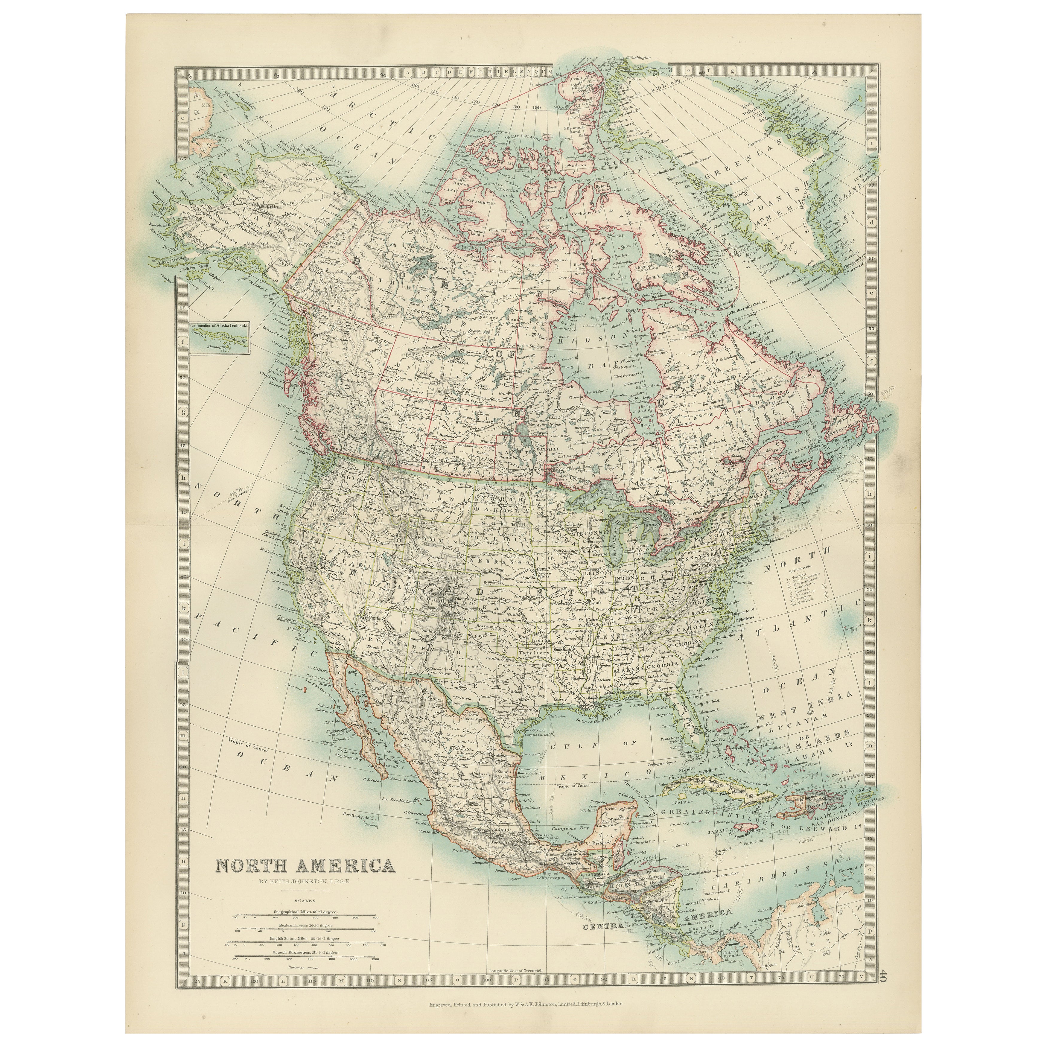
Explore North America in 1903 - Intricately Detailed Antique Map
North America, 1903 - A Colorful Historical Map with Detailed Borders
This attractive map of North America was engraved, printed, and published by W. & A.K. Johnston in 1903. A wond...
Categoria
Inizio XX secolo, Mappe
Materiali
Carta

Ti potrebbe interessare anche
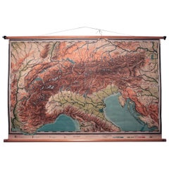
Carta scolastica topografica svedese d'epoca delle Alpi europee, Made in Sweden 1922
Carta topografica svedese d'epoca delle Alpi europee, Made in Sweden 1922
Questa mappa scolastica svedese d'epoca è davvero unica e rappresenta un ottimo esempio del perché questi...
Categoria
Vintage, Anni 1920, Svedese, Mappe
Materiali
Lino, Legno, Carta
Mappa antica originale dello Stato americano del Minnesota, 1903
Mappa antica del Minnesota
Pubblicato da A.I.C. Black. 1903
Colore originale
Buono stato
Senza cornice.
Spedizione gratuita
Categoria
Di antiquariato/d’epoca, Inizio Novecento, Inglese, Mappe
Materiali
Carta

Mappa antica originale dello Stato americano dell'Alabama, 1903
Antique map of Alabama
Published By A & C Black. 1903
Original colour
Good condition
Unframed.
Free shipping
Categoria
Di antiquariato/d’epoca, Inizio Novecento, Inglese, Mappe
Materiali
Carta

Mappa antica originale dello Stato americano dell'Alaska, 1903
Mappa antica dell'Alaska
Pubblicato da A.I.C. Black. 1903
Colore originale
Buono stato
Senza cornice.
Spedizione gratuita
Categoria
Di antiquariato/d’epoca, Inizio Novecento, Inglese, Mappe
Materiali
Carta

Mappa antica originale dello Stato americano del Nebraska, 1903
Mappa antica del Nebraska
Pubblicato da A.I.C. Black. 1903
Colore originale
Buono stato
Senza cornice.
Spedizione gratuita
Categoria
Di antiquariato/d’epoca, Inizio Novecento, Inglese, Mappe
Materiali
Carta

Mappa antica originale dello Stato americano di Washington, 1903
Mappa antica di Washington
Pubblicato da A.I.C. Black. 1903
Colore originale
Buono stato
Senza cornice.
Spedizione gratuita
Categoria
Di antiquariato/d’epoca, Inizio Novecento, Inglese, Mappe
Materiali
Carta
