Articoli simili a Antique Map of the German Empire, 1903, Northern Portion with Coastal and Inland


Vuoi altre immagini o video?
Richiedi altre immagini o video al venditore
1 di 10
Antique Map of the German Empire, 1903, Northern Portion with Coastal and Inland
Informazioni sull’articolo
Title: Antique Map of the German Empire, 1903, Northern Portion with Coastal and Inland Detail
Description:
This antique map, titled "Empire of Germany (Northern Portion)," was engraved and published in 1903 by the respected W. & A.K. Johnston in Edinburgh and London. It offers a richly detailed and colored portrayal of the northern part of the German Empire at the dawn of the 20th century, capturing the historical geography and political divisions of this powerful and complex nation.
Hand-colored in soft pastel shades of pink, green, yellow, and blue, this map elegantly delineates provincial and administrative boundaries. From the bustling port cities along the North Sea and Baltic Sea to the inland heartlands of Prussia and Saxony, the map reveals the extensive railways, rivers, and road networks that defined the region’s industrial might and cultural vibrancy.
The map also highlights Germany’s coastal regions, including the Frisian Islands, Pomerania, and East Prussia, emphasizing the maritime and economic importance of these areas. Johnston’s precise linework and careful typography make this map not just a historical document but a work of art that reflects the meticulous skill and dedication of the era’s finest cartographers.
For collectors, historians, and those with an interest in German history and geography, this map is a captivating window into a time of growth and ambition within the German Empire. It captures the dynamic landscape of a region that would soon see tremendous changes in the early 20th century.
Condition report:
This map is in very good antique condition, with slight foxing and toning around the edges consistent with its age. The colors remain vibrant and the paper is well-preserved.
Framing tips:
A classic dark wooden frame, such as walnut or mahogany, will complement the map’s warm pastel tones. Use a cream or light tan matting to highlight the delicate coloring and detailed engraving, creating an elegant and timeless display for any home, study, or office.
- Dimensioni:Altezza: 36,8 cm (14,49 in)Larghezza: 47 cm (18,51 in)Profondità: 0,2 mm (0,01 in)
- Materiali e tecniche:
- Periodo:
- Data di produzione:1903
- Condizioni:This map is in very good antique condition, showing only slight toning and minor foxing typical for its age. The colors remain vibrant and the paper stable and clear. Two folding lines as issued.
- Località del venditore:Langweer, NL
- Numero di riferimento:Venditore: BG-13577-171stDibs: LU3054345242572
Informazioni sul venditore
5,0
Venditore riconosciuto
Questi venditori prestigiosi sono leader del settore e rappresentano il massimo in termini di qualità e design.
Venditore Oro
Venditori Premium con valutazione 4,3+ e tempi di risposta entro 24 ore
Fondazione nel 2009
Venditore 1stDibs dal 2017
2.452 vendite su 1stDibs
Tempo di risposta standard: <1 ora
- SpedizioneRecupero del preventivo…Spedizione da: Langweer, Paesi Bassi
- Politica di reso
Alcune parti di questa pagina sono state tradotte automaticamente. 1stDibs non può garantire che le traduzioni siano corrette. L’inglese è la lingua predefinita del sito.
Garanzia di autenticità
Nell’improbabile caso in cui si verifichi un problema con l’autenticità di un articolo, contattaci entro un anno per ottenere un rimborso completo. DettagliGaranzia di rimborso
Se il tuo articolo non corrisponde alla descrizione, è danneggiato durante il trasporto o non arriva, contattaci entro 7 giorni per un rimborso completo. DettagliAnnullamento entro 24 ore
Hai un periodo di tolleranza di 24 ore per annullare il tuo acquisto, senza necessità di fornire spiegazioni.Venditori professionali selezionati
I nostri venditori di livello internazionale devono aderire a rigorosi standard di servizio e qualità, garantendo l’integrità delle inserzioni.Garanzia miglior prezzo
Se scopri che un venditore ha pubblicato altrove lo stesso articolo a un prezzo più basso, applicheremo lo stesso prezzo.Consegna globale affidabile
La nostra rete di vettori leader del settore offre opzioni di spedizione specializzate in tutto il mondo, inclusa la consegna personalizzata.Altro da questo venditore
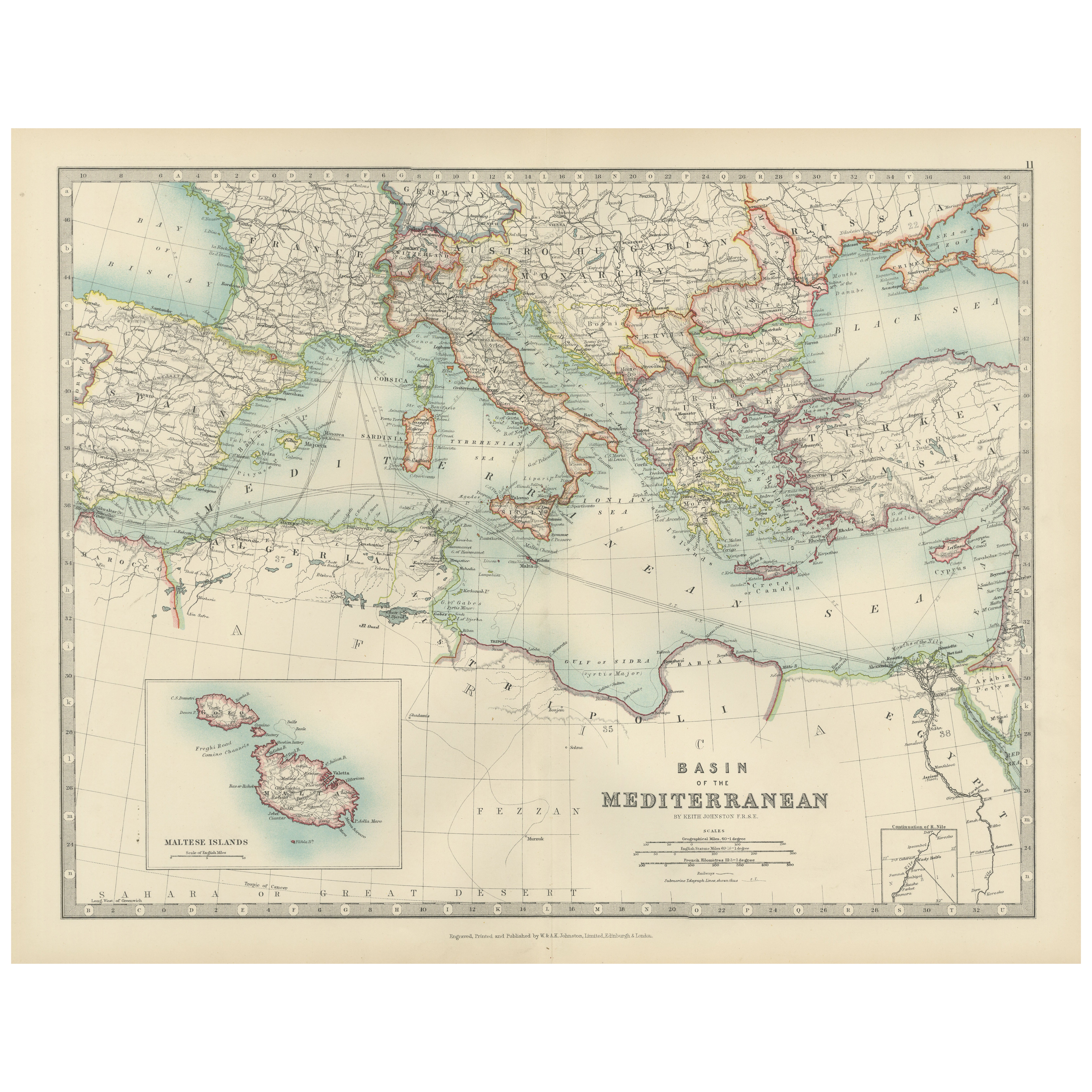
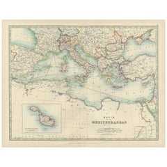
Mostra tuttoAntique Map of the Mediterranean Basin, 1903, with Detailed Coastal and Inland
Title: Antique Map of the Mediterranean Basin, 1903, with Detailed Coastal and Inland Geography
Description: This antique map, titled "Basin of the Mediterranean," was engraved and ...
Categoria
Inizio XX secolo, Mappe
Materiali
Carta
Antique Map of Southern Scotland, 1903, with Coastal and Inland Details
Title: Antique Map of Southern Scotland, 1903, with Coastal and Inland Details
Description:
This exquisite antique map, titled "Scotland (Southern Sheet I)," was engraved and publis...
Categoria
Inizio XX secolo, Mappe
Materiali
Carta

Antique Map of Northern Scotland, 1903, with Intricate Coastal Features
Title: Antique Map of Northern Scotland and Islands, 1903, with Intricate Coastal Features
Description:
This striking antique map, titled "Scotland (Northern Sheet I)," was engraved...
Categoria
Inizio XX secolo, Mappe
Materiali
Carta

Antique Map of the German Empire, 1903, with Intricate Provincial Boundaries
Title: Antique Map of the German Empire, 1903, with Intricate Provincial Boundaries
Description:
This antique map, titled "Empire of Germany (Southern Portion)," was engraved and pu...
Categoria
Inizio XX secolo, Mappe
Materiali
Carta

Mappa antica della parte settentrionale delle Filippine di J.N. Bellin, 1764
Mappa dettagliata della parte settentrionale delle Filippine, che si estende da Batanes e Babuyanes a Mindonoro e Masbate e che è centrata su Luzon. Una delle mappe più dettagliate d...
Categoria
Di antiquariato/d’epoca, Metà XVIII secolo, Mappe
Materiali
Carta

256 USD Prezzo promozionale
16% in meno
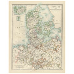
Antique Map of Denmark and German Empire Regions, 1903, Intricate and Colorful
Title: Antique Map of Denmark and German Empire Regions, 1903, Intricate and Colorful
Description:
This antique map, titled "Denmark with North West Portions of the German Empire," ...
Categoria
Inizio XX secolo, Mappe
Materiali
Carta
Ti potrebbe interessare anche
Mappa antica originale dello Stato americano dell'Illinois (parte settentrionale), 1903
Carta geografica antica dell'Illinois (parte settentrionale)
Pubblicato da A.I.C. Black. 1903
Colore originale
Buono stato
Senza cornice.
Spedizione gratuita
Categoria
Di antiquariato/d’epoca, Inizio Novecento, Inglese, Mappe
Materiali
Carta

49 USD
Spedizione gratuita
Mappa antica originale dello Stato americano del Michigan (parte settentrionale), 1903
Carta geografica antica del Michigan (parte settentrionale)
Pubblicato da A.I.C. Black. 1903
Colore originale
Buono stato
Senza cornice.
Spedizione gratuita
Categoria
Di antiquariato/d’epoca, Inizio Novecento, Inglese, Mappe
Materiali
Carta

49 USD
Spedizione gratuita
Mappa antica originale dello Stato americano dell'Ohio (parte settentrionale), 1903
Carta geografica antica dell'Ohio (parte settentrionale)
Pubblicato da A.I.C. Black. 1903
Colore originale
Buono stato
Senza cornice.
Spedizione gratuita
Categoria
Di antiquariato/d’epoca, Inizio Novecento, Inglese, Mappe
Materiali
Carta

49 USD
Spedizione gratuita
Mappa antica originale dello Stato americano della California (parte settentrionale), 1903
Carta geografica antica della California (parte settentrionale)
Pubblicato da A.I.C. Black. 1903
Colore originale
Buono stato
Senza cornice.
Spedizione gratuita
Categoria
Di antiquariato/d’epoca, Inizio Novecento, Inglese, Mappe
Materiali
Carta

49 USD
Spedizione gratuita
Mappa antica originale dello Stato americano del Missouri (parte settentrionale), 1903
Mappa antica del Missouri (Parte settentrionale)
Pubblicato da A.I.C. Black. 1903
Colore originale
Buono stato
Senza cornice.
Spedizione gratuita
Categoria
Di antiquariato/d’epoca, Inizio Novecento, Inglese, Mappe
Materiali
Carta

49 USD
Spedizione gratuita
Mappa antica originale dello Stato americano di New York (Parte settentrionale) 1903
Antique map of New York ( Northern Part )
Published By A & C Black. 1903
Original colour
Good condition
Unframed.
Free shipping
Categoria
Di antiquariato/d’epoca, Inizio Novecento, Inglese, Mappe
Materiali
Carta

49 USD
Spedizione gratuita