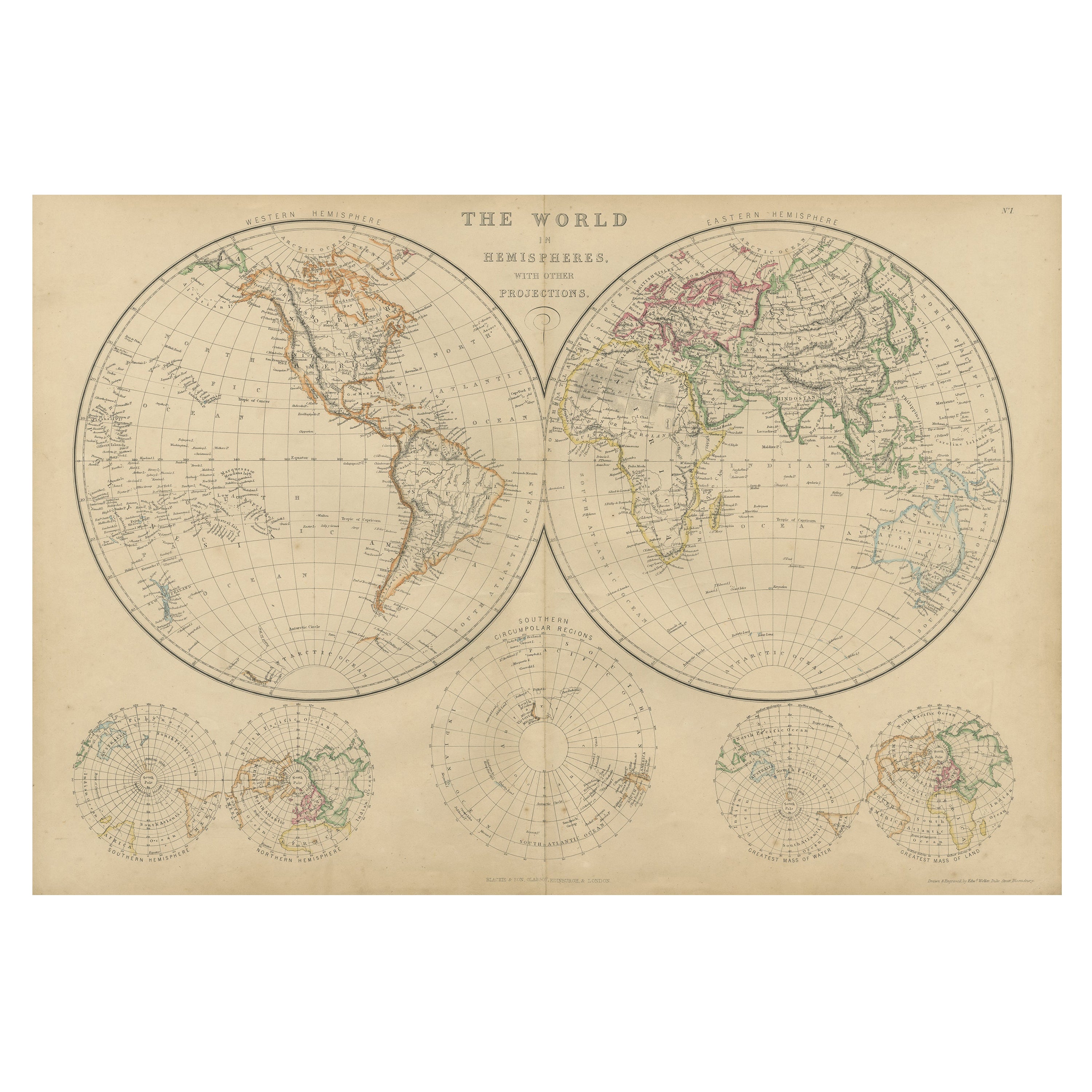
Articoli simili a Antique World Map in Hemispheres with Delicate Pastel Coloring, 1903

Vuoi altre immagini o video?
Richiedi altre immagini o video al venditore
1 di 10
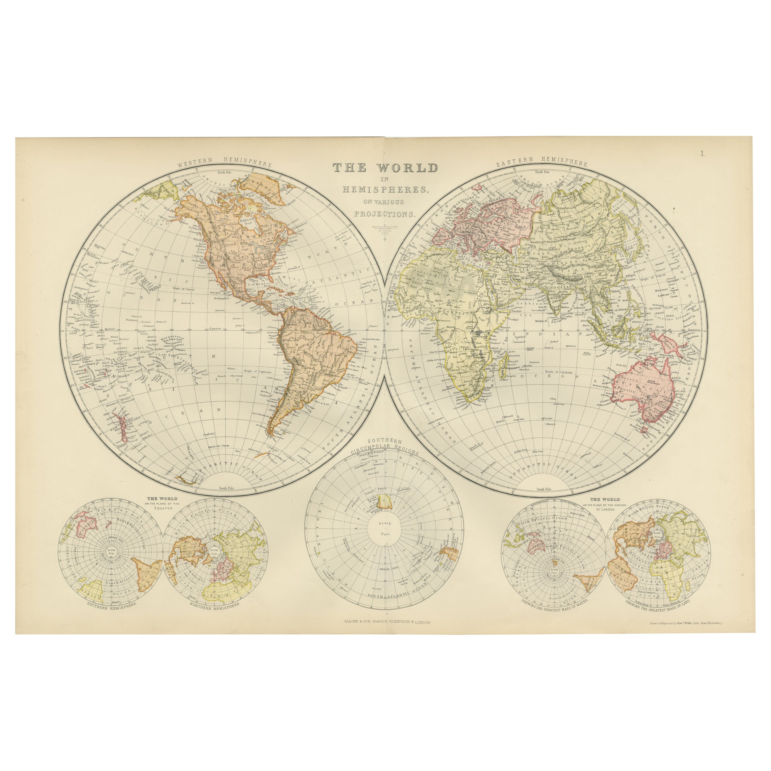
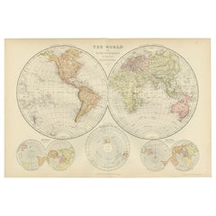
Antique World Map in Hemispheres with Delicate Pastel Coloring, 1903
Informazioni sull’articolo
Title: Antique World Map in Hemispheres with Delicate Pastel Coloring, 1903
Description:
This stunning antique map, titled "The World in Hemispheres," dates back to 1903 and offers a beautiful depiction of the Earth’s Western and Eastern hemispheres. Engraved and published by the esteemed firm of W. & A.K. Johnston in Edinburgh and London, this map is part of their highly regarded cartographic works from the early 20th century.
The map divides the world into two elegant circular projections—one for each hemisphere—highlighting the continents, countries, and major cities as they were understood at the dawn of the 20th century. With its delicate pastel coloring and intricate detailing, it showcases the geographical knowledge of the time in an aesthetically refined manner.
What makes this map particularly fascinating is how it captures a period of intense global change and discovery. The early 1900s marked the height of European imperialism, rapid industrialization, and the beginnings of modern global connectivity. The carefully drawn political boundaries reflect a world in flux, with colonial empires reaching their zenith and countries like Australia and Canada still relatively new on the global stage. For collectors, historians, and lovers of antique cartography, this piece serves as both an educational tool and a historical artifact.
The pastel color palette, featuring soft shades of blue, green, and rose, makes this map not only a source of information but also a beautiful decorative object that exudes a sense of refinement and tranquility. Its classical cartographic style, with fine linework and elegant typography, makes it a perfect focal point in any interior space, whether a study, library, or living room.
Condition report:
This map is in good antique condition, with only minor foxing and gentle toning around the edges typical of its age. The colors remain vibrant and the paper is in stable condition. Folding line as issued. Please study the scans carefully.
Framing tips:
A traditional wooden frame in walnut or maple will enhance the warm tones of the map. Use a cream or light beige matting to bring out the pastel shades and highlight the intricate detail, creating a sophisticated display for any room.
- Dimensioni:Altezza: 36,8 cm (14,49 in)Larghezza: 48 cm (18,9 in)Profondità: 0,2 mm (0,01 in)
- Materiali e tecniche:
- Periodo:
- Data di produzione:1903
- Condizioni:This map is in good antique condition, with only minor foxing and gentle toning around the edges typical of its age. The colors remain vibrant and the paper is in stable condition. Folding line as issued. Please study the scans carefully.
- Località del venditore:Langweer, NL
- Numero di riferimento:Venditore: BG-13577-11stDibs: LU3054345240672
Informazioni sul venditore
5,0
Venditore riconosciuto
Questi venditori prestigiosi sono leader del settore e rappresentano il massimo in termini di qualità e design.
Venditore Oro
Venditori Premium con valutazione 4,3+ e tempi di risposta entro 24 ore
Fondazione nel 2009
Venditore 1stDibs dal 2017
2.462 vendite su 1stDibs
Tempo di risposta standard: <1 ora
- SpedizioneRecupero del preventivo…Spedizione da: Langweer, Paesi Bassi
- Politica di reso
Alcune parti di questa pagina sono state tradotte automaticamente. 1stDibs non può garantire che le traduzioni siano corrette. L’inglese è la lingua predefinita del sito.
Garanzia di autenticità
Nell’improbabile caso in cui si verifichi un problema con l’autenticità di un articolo, contattaci entro un anno per ottenere un rimborso completo. DettagliGaranzia di rimborso
Se il tuo articolo non corrisponde alla descrizione, è danneggiato durante il trasporto o non arriva, contattaci entro 7 giorni per un rimborso completo. DettagliAnnullamento entro 24 ore
Hai un periodo di tolleranza di 24 ore per annullare il tuo acquisto, senza necessità di fornire spiegazioni.Venditori professionali selezionati
I nostri venditori di livello internazionale devono aderire a rigorosi standard di servizio e qualità, garantendo l’integrità delle inserzioni.Garanzia miglior prezzo
Se scopri che un venditore ha pubblicato altrove lo stesso articolo a un prezzo più basso, applicheremo lo stesso prezzo.Consegna globale affidabile
La nostra rete di vettori leader del settore offre opzioni di spedizione specializzate in tutto il mondo, inclusa la consegna personalizzata.Altro da questo venditore
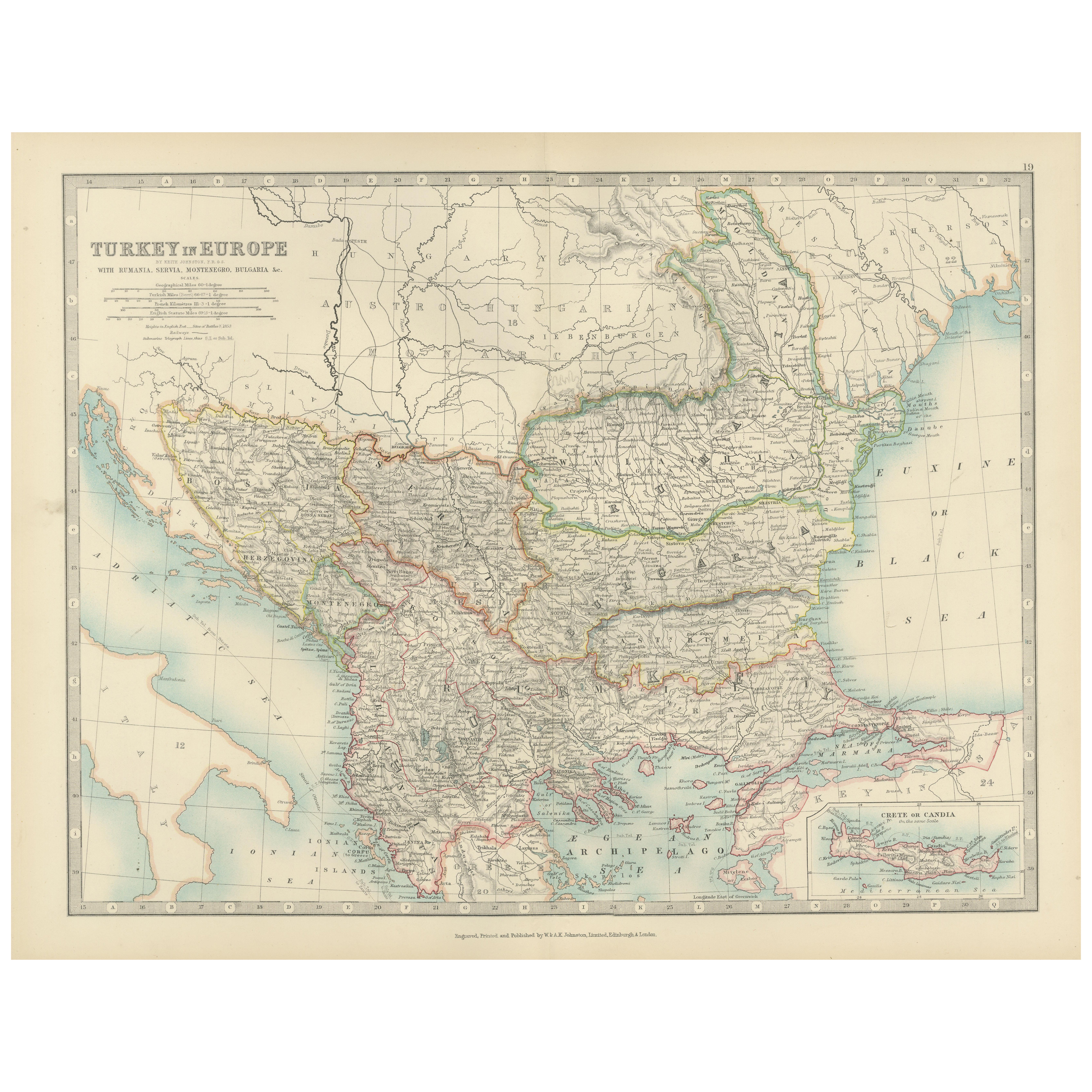
Mostra tuttoAntique Map of Turkey in Europe, 1903, with Delicate Pastel Coloration
Title: Antique Map of Turkey in Europe, 1903, with Delicate Pastel Coloration
Description:
This antique map, titled "Turkey in Europe," was engraved and published in 1903 by the dis...
Categoria
Inizio XX secolo, Mappe
Materiali
Carta

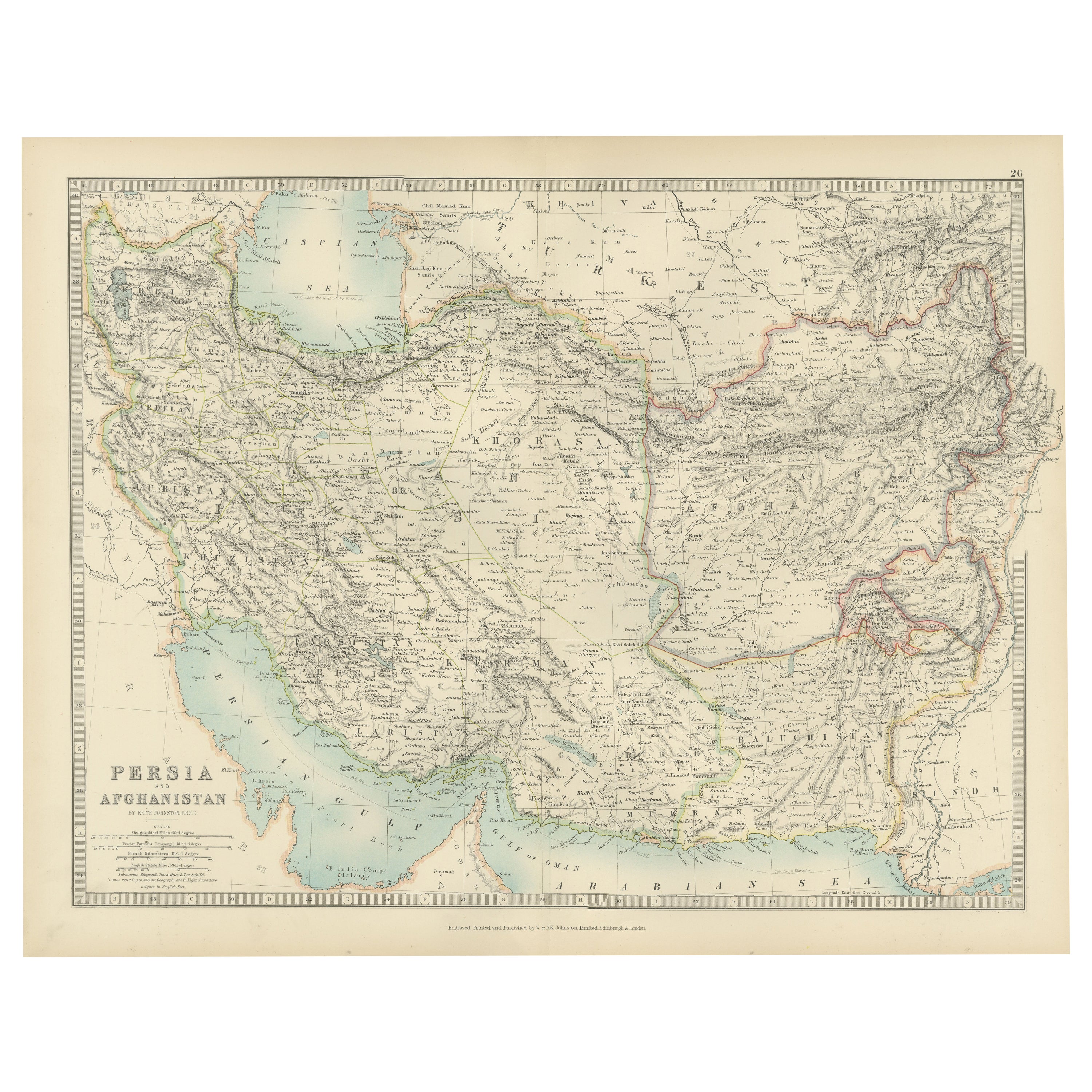
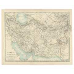
Antique Map of Persia and Afghanistan, 1903, with Delicate Pastel Borders
Title: Antique Map of Persia and Afghanistan, 1903, with Delicate Pastel Borders and Detailed Topography
Description:
This antique map, titled "Persia and Afghanistan," was engraved...
Categoria
Inizio XX secolo, Mappe
Materiali
Carta
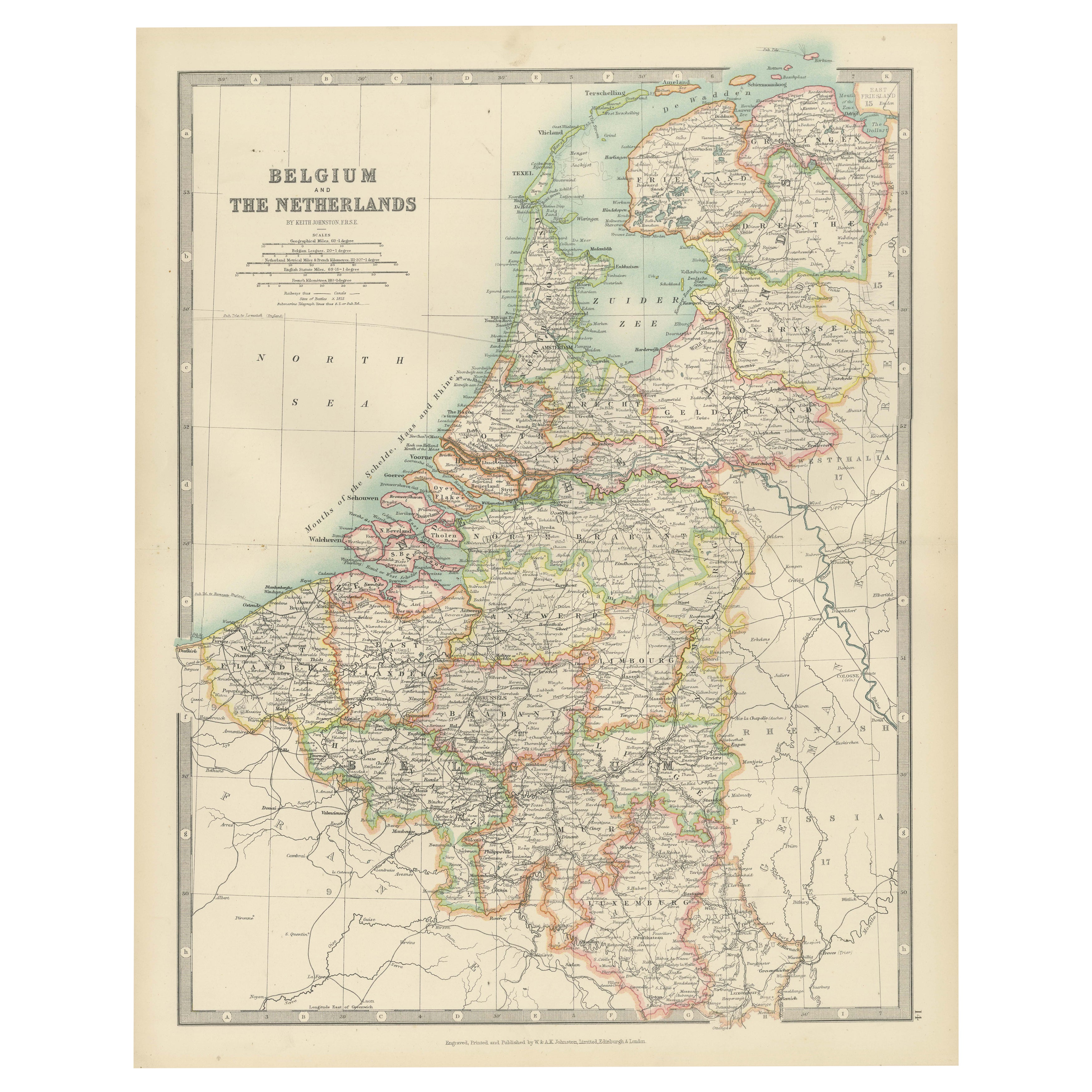
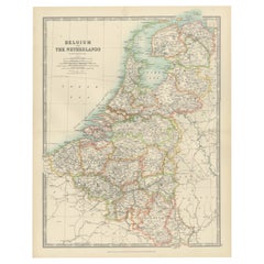
Antique Map of Belgium and The Netherlands with Delicate Pastel Coloration, 1903
Antique Map of Belgium and The Netherlands, 1903, with Delicate Pastel Coloration
This antique map, titled "Belgium and The Netherlands," was engraved and published in 1903 by the d...
Categoria
Inizio XX secolo, Mappe
Materiali
Carta
Carta geografica antica del mondo in emisferi di Johnson, 1872
Carta geografica antica intitolata "Il mondo globulare di Johnson". Mappa del mondo originale che raffigura l'emisfero orientale e l'emisfero occidentale. Questa mappa proviene da "J...
Categoria
Di antiquariato/d’epoca, Fine XIX secolo, Mappe
Materiali
Carta

407 USD Prezzo promozionale
30% in meno
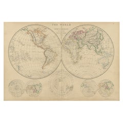
Mappa antica del mondo in emisferi di W. G. Blackie, 1859
Carta geografica antica intitolata "Il mondo in emisferi con altre proiezioni". Mappa antica originale del mondo. Questa mappa proviene da "The Imperial Atlas of Modern Geography". P...
Categoria
Di antiquariato/d’epoca, Metà XIX secolo, Mappe
Materiali
Carta
284 USD Prezzo promozionale
30% in meno
Mappa antica del mondo in emisferi su varie proiezioni, 1882
Questa splendida "Mappa antica del mondo in emisferi" del 1882 mostra una squisita miscela di precisione cartografica ed eleganza artistica. Realizzato sotto l'occhio vigile di W.G. ...
Categoria
Di antiquariato/d’epoca, Anni 1880, Mappe
Materiali
Carta
260 USD Prezzo promozionale
20% in meno
Ti potrebbe interessare anche
Mappa ricamata in seta dell'emisfero occidentale orientale Nuovo Vecchio Mondo Asia America Afri
Un raro sampler ricamato in seta della fine del XVIII secolo, a doppio emisfero, con mappa del mondo, lavorato in nero, che mostra le tracce dei tre viaggi del capitano Cook
- Ill...
Categoria
Di antiquariato/d’epoca, XVIII secolo, Britannico, Georgiano, Mappe
Materiali
Seta
Mappa colorata del Nuovo Mondo dell'Emisfero Occidentale di Vincenzo Coronelli, con cornice 47".
Di Vincenzo Coronelli
Riproduzione incorniciata della mappa del Nuovo Mondo di Coronelli, attribuita alla Trevor James Company. La mappa mostra l'emisfero occidentale, comprese le scoperte fatte da Abel T...
Categoria
XX secolo, Mappe
Materiali
Carta

1.080 USD Prezzo promozionale
20% in meno
Mappa dei rilievi del mondo
Mappa in rilievo del mondo di grandi dimensioni.
Misure: Larghezza 232 cm.
Altezza 158 cm.
Categoria
Metà XX secolo, Tedesco, Mid-Century moderno, Mappe
Materiali
Acrilico

2.093 USD
Antique Map of Eastern Hemisphere from the collection of Thierry Despont
Designed by Enrico Bonetti (E. Bonatti) and published by Francesco Vallardi Editore. Based on an earlier map by Evangelista Azzi (Ev. Azzi). Labeled as such at bottom edge of map.
T...
Categoria
Di antiquariato/d’epoca, Fine XIX secolo, Italiano, Mappe
Materiali
Tela, Legno
Mappa antica originale dello Stato americano del Minnesota, 1903
Mappa antica del Minnesota
Pubblicato da A.I.C. Black. 1903
Colore originale
Buono stato
Senza cornice.
Spedizione gratuita
Categoria
Di antiquariato/d’epoca, Inizio Novecento, Inglese, Mappe
Materiali
Carta

Mappa antica originale dello Stato americano dell'Alabama, 1903
Antique map of Alabama
Published By A & C Black. 1903
Original colour
Good condition
Unframed.
Free shipping
Categoria
Di antiquariato/d’epoca, Inizio Novecento, Inglese, Mappe
Materiali
Carta
