Articoli simili a Canada Map 1903 - East Central Dominion - Ontario, Quebec & More
Vuoi altre immagini o video?
Richiedi altre immagini o video al venditore
1 di 10
Canada Map 1903 - East Central Dominion - Ontario, Quebec & More
Informazioni sull’articolo
Canada Map 1903 - East Central Dominion - Ontario, Quebec & More
This captivating antique map, titled "Dominion of Canada (East Central Sheet)" and published in 1903 by Keith Johnston, offers a detailed depiction of the heart of Canada’s eastern territories. The map encompasses parts of Ontario and Quebec, extending to the northern Great Lakes and incorporating significant areas of the Atlantic coastline. It's a magnificent example of early 20th-century cartography and showcases the precision and artistry of the Johnston publishing firm.
The map details the complex geography of the region, including rivers, mountain ranges, roads, and railways, revealing the infrastructure and growth of Canada during this period. The meticulously engraved lines and delicate coloring of provincial borders bring an elegance to the presentation, while the naming of towns and cities speaks to the historical importance of the time.
This map not only captures geographical features but also hints at the political and economic development of Canada in the early 1900s, illustrating a period of growth and connection between regions. The inset of major urban areas and the care taken in denoting smaller settlements reflect a keen understanding of the land’s evolving identity.
Condition:
This original map is in excellent condition with slight toning along the edges, typical for its age. The color borders remain bright, and there are no significant tears or repairs.
Framing Tips:
To preserve and display this historical piece, consider framing it in a solid wood frame in a warm mahogany or walnut finish. A cream or off-white mat will enhance the subtle coloring of the map, while museum glass will help protect it from light and dust, ensuring its beauty endures.
- Dimensioni:Altezza: 36,8 cm (14,49 in)Larghezza: 47 cm (18,51 in)Profondità: 0,2 mm (0,01 in)
- Materiali e tecniche:
- Periodo:
- Data di produzione:1903
- Condizioni:This original map is in excellent condition with slight toning along the edges, typical for its age. The color borders remain bright, and there are no significant tears or repairs.
- Località del venditore:Langweer, NL
- Numero di riferimento:Venditore: BG-13577-421stDibs: LU3054345291472
Informazioni sul venditore
5,0
Venditore riconosciuto
Questi venditori prestigiosi sono leader del settore e rappresentano il massimo in termini di qualità e design.
Venditore Oro
Venditori Premium con valutazione 4,3+ e tempi di risposta entro 24 ore
Fondazione nel 2009
Venditore 1stDibs dal 2017
2.462 vendite su 1stDibs
Tempo di risposta standard: <1 ora
- SpedizioneRecupero del preventivo…Spedizione da: Langweer, Paesi Bassi
- Politica di reso
Alcune parti di questa pagina sono state tradotte automaticamente. 1stDibs non può garantire che le traduzioni siano corrette. L’inglese è la lingua predefinita del sito.
Garanzia di autenticità
Nell’improbabile caso in cui si verifichi un problema con l’autenticità di un articolo, contattaci entro un anno per ottenere un rimborso completo. DettagliGaranzia di rimborso
Se il tuo articolo non corrisponde alla descrizione, è danneggiato durante il trasporto o non arriva, contattaci entro 7 giorni per un rimborso completo. DettagliAnnullamento entro 24 ore
Hai un periodo di tolleranza di 24 ore per annullare il tuo acquisto, senza necessità di fornire spiegazioni.Venditori professionali selezionati
I nostri venditori di livello internazionale devono aderire a rigorosi standard di servizio e qualità, garantendo l’integrità delle inserzioni.Garanzia miglior prezzo
Se scopri che un venditore ha pubblicato altrove lo stesso articolo a un prezzo più basso, applicheremo lo stesso prezzo.Consegna globale affidabile
La nostra rete di vettori leader del settore offre opzioni di spedizione specializzate in tutto il mondo, inclusa la consegna personalizzata.Altro da questo venditore
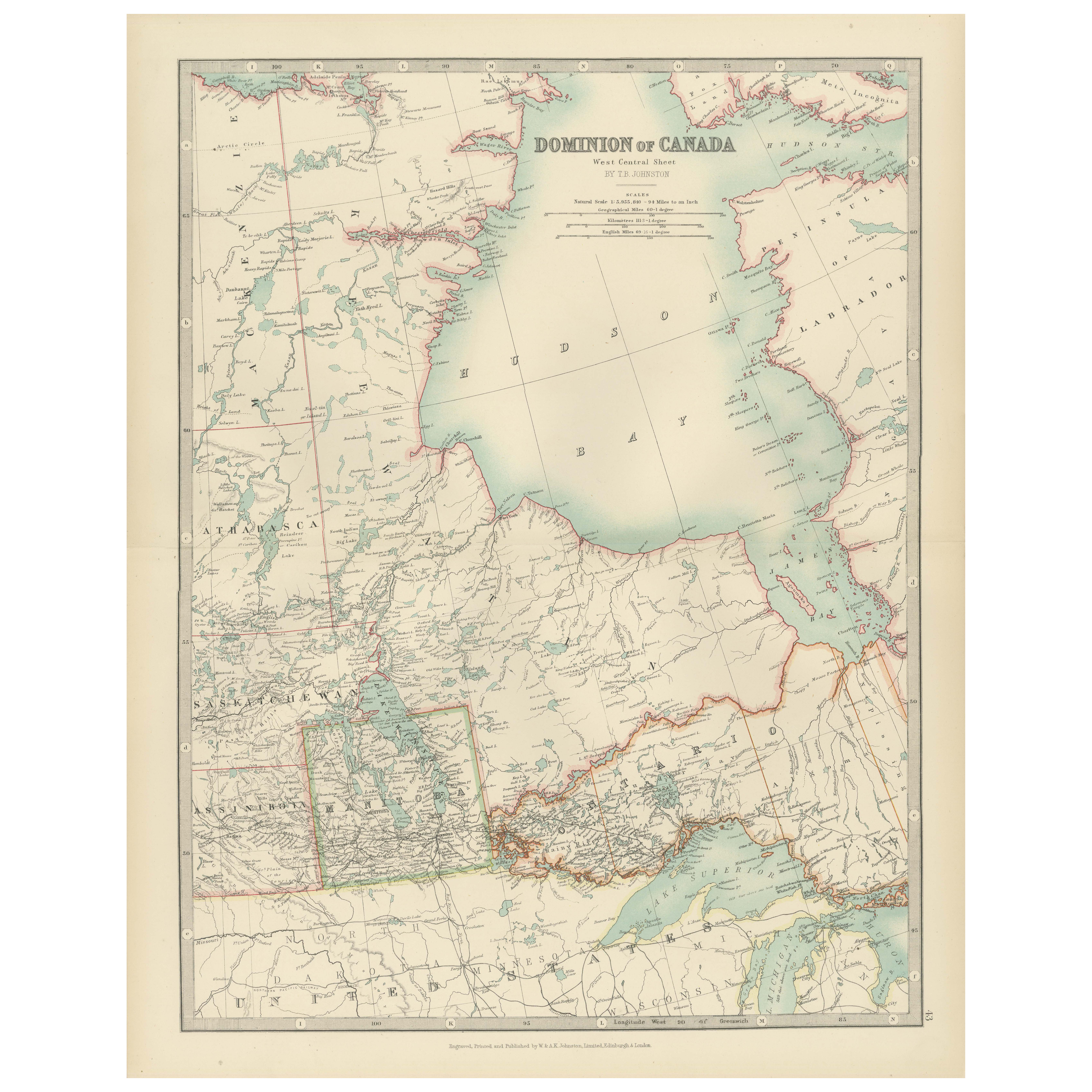
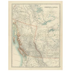
Mostra tuttoCanada Map 1903 - Dominion of Canada, West Central Sheet
Title: Canada Map 1903 - Dominion of Canada, West Central Sheet
Description:
This fascinating 1903 map of the Dominion of Canada’s West Central regions by T.R. Johnston offers a viv...
Categoria
Inizio XX secolo, Mappe
Materiali
Carta
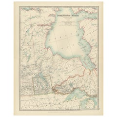
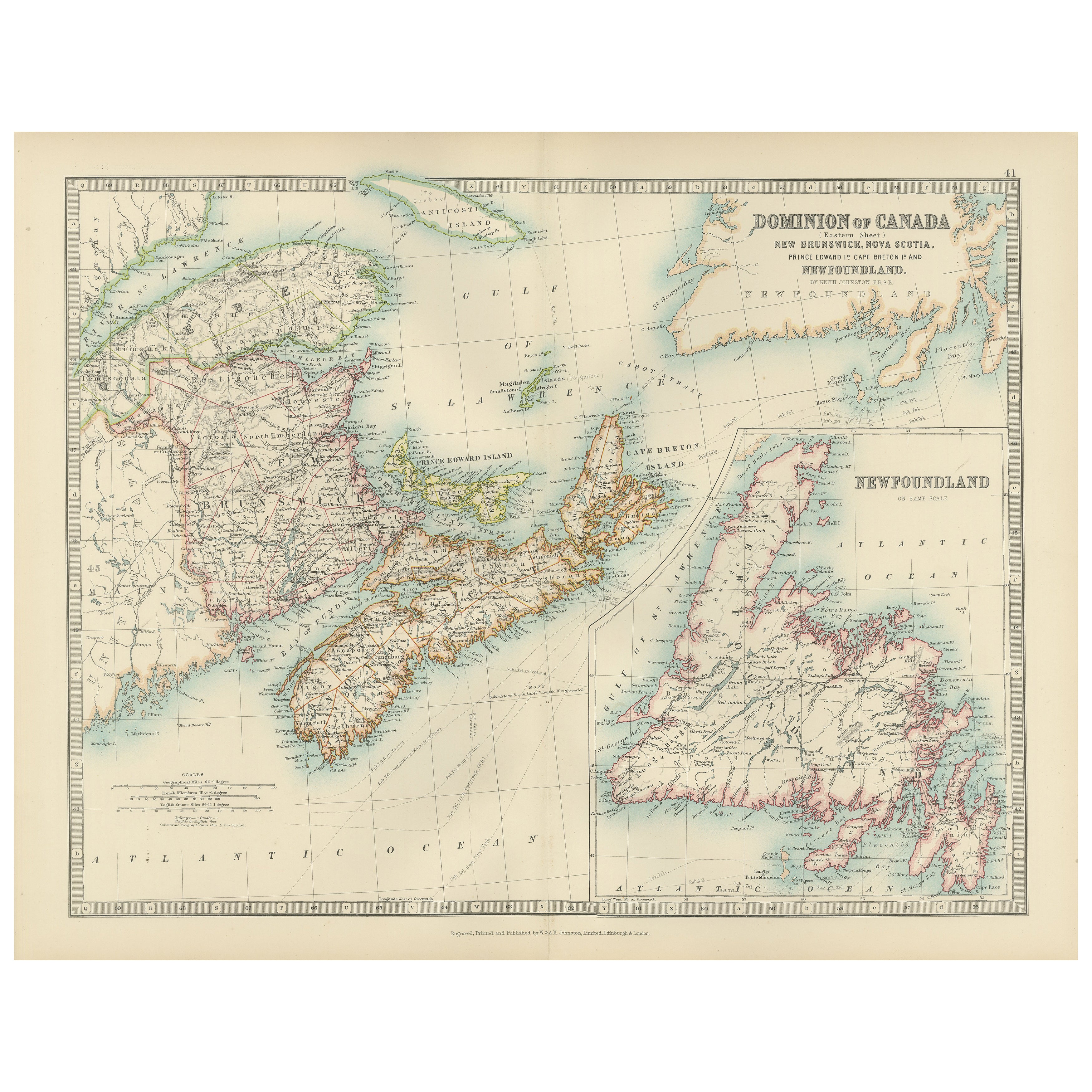
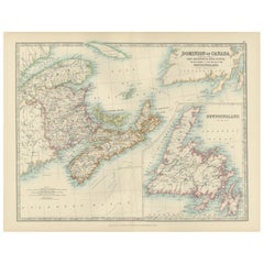
Canada Dominion Map 1903 - A Detailed View of Eastern Canada and Newfoundland
North America, 1903 - A Colorful Historical Map with Detailed Borders
This attractive map of North America was engraved, printed, and published by W. & A.K. Johnston in 1903. A wond...
Categoria
Inizio XX secolo, Mappe
Materiali
Carta
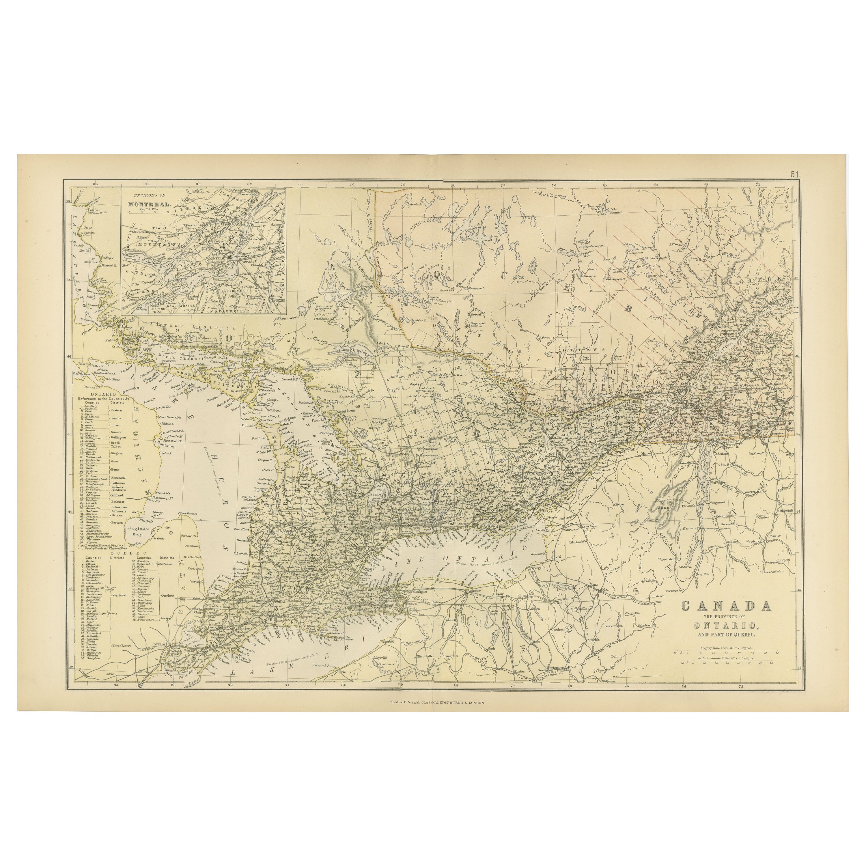
Carta geografica antica del Canada, Provincia dell'Ontario e parte del Quebec, 1882
Questa è una mappa storica tratta dall'Atlante Blackie del 1882, questa volta con i dettagli di "The Province of Ontario, and Part of Quebec" in Canada. La mappa presenta un'illustra...
Categoria
Di antiquariato/d’epoca, Anni 1880, Mappe
Materiali
Carta

232 USD Prezzo promozionale
20% in meno
Spedizione gratuita
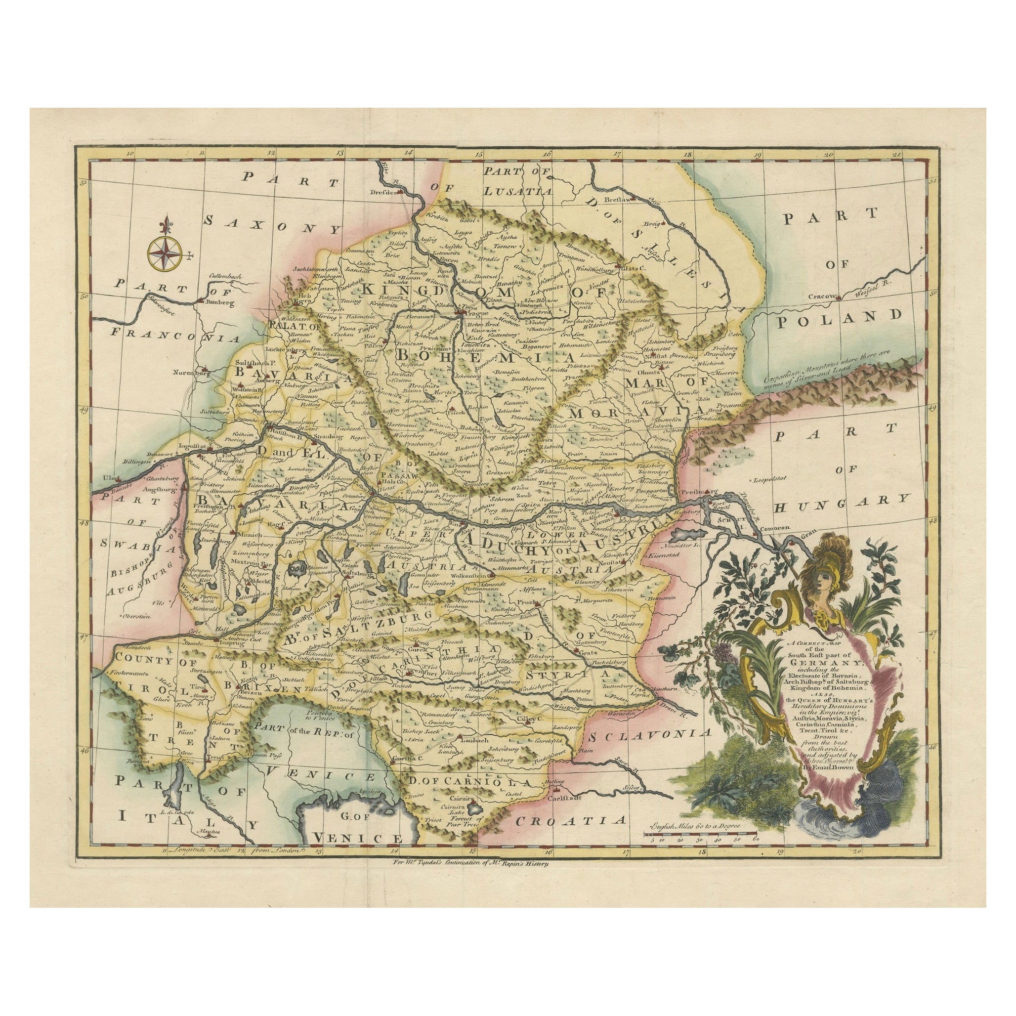
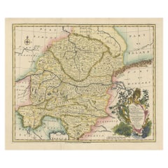
Una splendida mappa di Bowen del 1744: Germania sudorientale e domini della Regina d'Ungheria
Titolo: Una nuova e corretta carta della Germania sudorientale, 1744
Questa mappa di Emanuel Bowen, risalente al 1744 circa, ritrae magnificamente la parte sud-orientale della Germa...
Categoria
Di antiquariato/d’epoca, Anni 1740, Mappe
Materiali
Carta
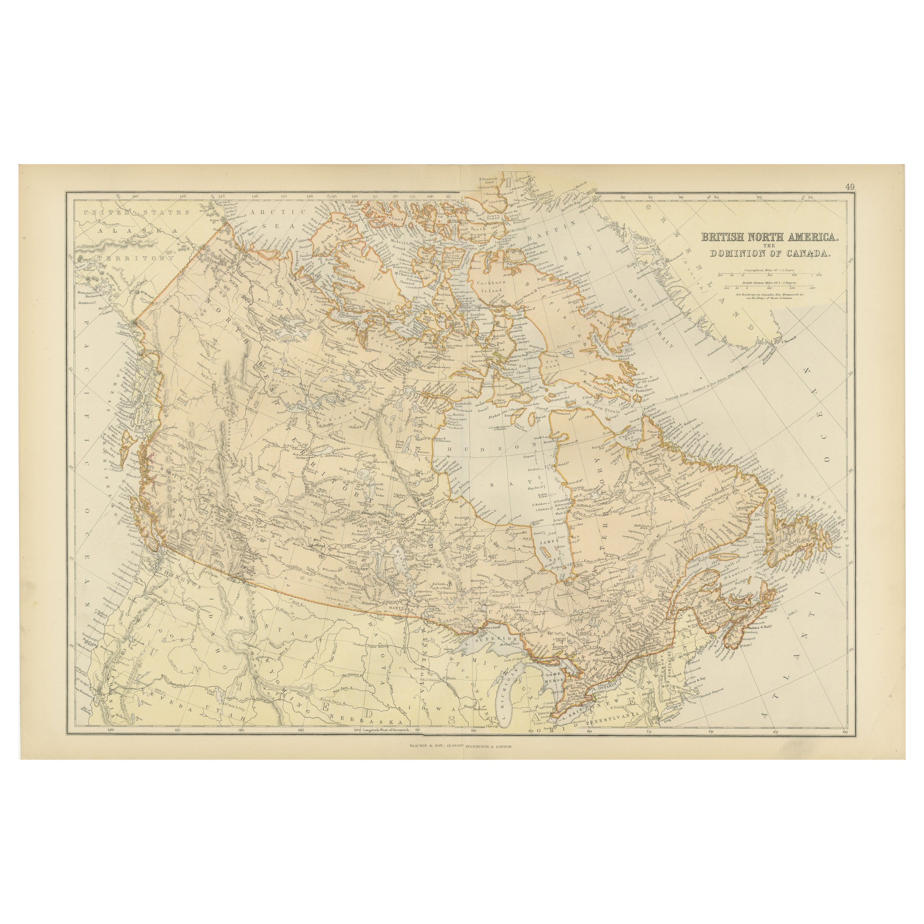
Mappa antica del Nord America Britannico, Il Dominio del Canada, 1882
Questa mappa è intitolata "Nord America Britannico, Dominio del Canada", tratta dall'Atlante Blackie del 1882. Presenta l'area geografica che comprende l'odierno Canada, con le carat...
Categoria
Di antiquariato/d’epoca, Anni 1880, Mappe
Materiali
Carta

232 USD Prezzo promozionale
20% in meno
Spedizione gratuita
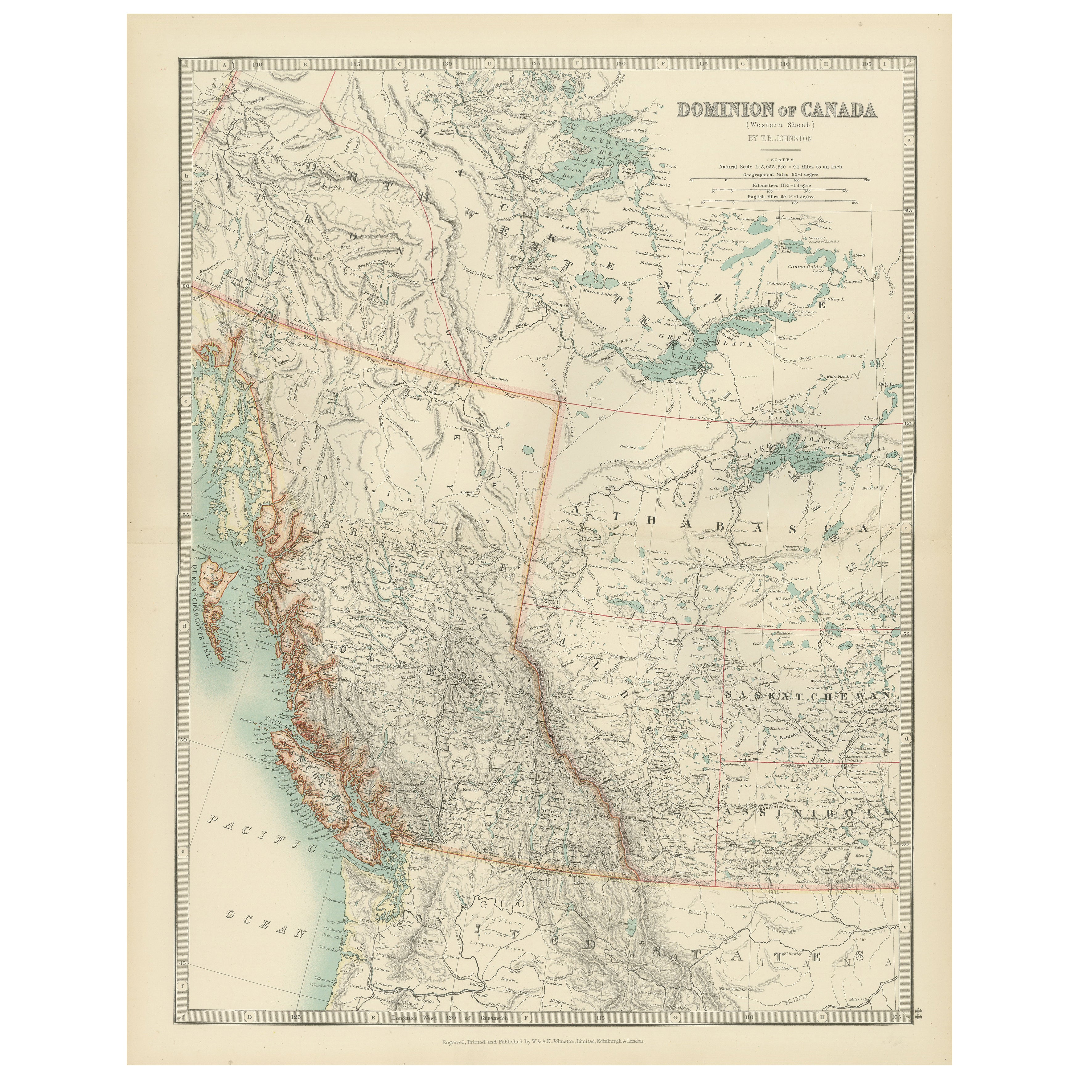
Canada’s West – 1903 Engraved Map by Johnston – Unique and Historic
This beautiful and detailed map, titled "Dominion of Canada (Western Sheet)," was created by Keith Johnston and published in 1903.
It presents a fascinating depiction of Canada's w...
Categoria
Inizio XX secolo, Mappe
Materiali
Carta
Ti potrebbe interessare anche
Mappa della Germania Est
Di VEB Hermann Haack
Una mappa brillantemente colorata dell'area di Lipsia, Karl Marx Stadt e Dresda, nell'ex Repubblica Democratica Tedesca, realizzata da VEB Hermann Haack di Gotha.
Categoria
Vintage, Anni 1970, Tedesco, Mappe

295 USD Prezzo promozionale
25% in meno
Mappa antica originale dello Stato americano del Minnesota, 1903
Mappa antica del Minnesota
Pubblicato da A.I.C. Black. 1903
Colore originale
Buono stato
Senza cornice.
Spedizione gratuita
Categoria
Di antiquariato/d’epoca, Inizio Novecento, Inglese, Mappe
Materiali
Carta

Mappa antica originale dello Stato americano dell'Alabama, 1903
Antique map of Alabama
Published By A & C Black. 1903
Original colour
Good condition
Unframed.
Free shipping
Categoria
Di antiquariato/d’epoca, Inizio Novecento, Inglese, Mappe
Materiali
Carta

Mappa antica originale dello Stato americano dell'Alaska, 1903
Mappa antica dell'Alaska
Pubblicato da A.I.C. Black. 1903
Colore originale
Buono stato
Senza cornice.
Spedizione gratuita
Categoria
Di antiquariato/d’epoca, Inizio Novecento, Inglese, Mappe
Materiali
Carta

Mappa antica originale dello Stato americano del Nebraska, 1903
Mappa antica del Nebraska
Pubblicato da A.I.C. Black. 1903
Colore originale
Buono stato
Senza cornice.
Spedizione gratuita
Categoria
Di antiquariato/d’epoca, Inizio Novecento, Inglese, Mappe
Materiali
Carta

Mappa antica originale dello Stato americano di Washington, 1903
Mappa antica di Washington
Pubblicato da A.I.C. Black. 1903
Colore originale
Buono stato
Senza cornice.
Spedizione gratuita
Categoria
Di antiquariato/d’epoca, Inizio Novecento, Inglese, Mappe
Materiali
Carta
