Articoli simili a Map of Ardèche France with Annonay and Vineyards by Vuillemin, 19th c


Vuoi altre immagini o video?
Richiedi altre immagini o video al venditore
1 di 11
Map of Ardèche France with Annonay and Vineyards by Vuillemin, 19th c
120 €IVA inclusa
Informazioni sull’articolo
Map of Ardèche France with Annonay and Vineyards by Vuillemin, 19th c
This beautifully engraved 19th-century map of Ardèche, a department in southeastern France, comes from Alexandre Vuillemin’s *Nouvel Atlas Illustré*, published in Paris by Migeon. The map offers a detailed and artistic representation of the region, enhanced by vignettes, coats of arms, and historical references that highlight Ardèche’s cultural and natural richness.
The map presents the department’s full geographical scope with towns, rivers, and road networks, bordered by hand-applied yellow watercolor. Key locations such as Annonay, Privas, and Aubenas are clearly marked. The engraving also depicts the rugged terrain for which the Ardèche is well known, including the mountainous Massif Central and deep river gorges. In the upper left is a vignette of the town of Annonay, famous as the birthplace of the Montgolfier brothers, pioneers of balloon flight. Below that is a depiction of the natural stone arch of the Pont d’Arc, one of the most iconic landmarks in the region.
In the lower right corner, a striking scene depicts Joseph Marie Jacquard presenting his invention of the Jacquard loom, symbolizing Ardèche’s historical contributions to the textile industry. Jacquard’s automated loom was a key innovation in the development of modern weaving.
Ardèche is also a celebrated wine-producing region, especially in the southern part of the department near the Rhône Valley. The area is known for its rustic, characterful wines, including red blends made from Grenache, Syrah, and Merlot, as well as fresh white wines from Viognier and Chardonnay grapes. These wines are often labeled under the Côtes du Vivarais and Coteaux de l’Ardèche designations. The region’s climate and diverse terroirs make it an increasingly respected area within the Rhône wine landscape.
Alexandre Vuillemin, a skilled 19th-century French cartographer, was renowned for blending geography with artistic and cultural elements in his maps. His works were both decorative and informative, aimed at a growing educated public. The publisher, Migeon, was known for high-quality atlases that brought historical and geographic knowledge to a broad audience.
Condition summary:
Excellent impression with mild toning to the edges and a few small, scattered foxing marks. The hand-coloring remains vivid and the engraving is sharp and detailed.
Framing tips:
A classic dark wood or olive-toned frame will highlight the natural character of the Ardèche region. A warm off-white or light tan mat works well to emphasize the yellow hand-coloring. Use UV-protective glass for preservation.
- Dimensioni:Altezza: 26,1 cm (10,28 in)Larghezza: 32,5 cm (12,8 in)Profondità: 0,2 mm (0,01 in)
- Materiali e tecniche:Carta,Inciso
- Luogo di origine:
- Periodo:
- Data di produzione:circa 1850
- Condizioni:Excellent impression with mild toning to the edges and a few small, scattered foxing marks. The hand-coloring remains vivid and the engraving is sharp and detailed.
- Località del venditore:Langweer, NL
- Numero di riferimento:Venditore: BG-13331-61stDibs: LU3054345359162
Informazioni sul venditore
5,0
Venditore riconosciuto
Questi venditori prestigiosi sono leader del settore e rappresentano il massimo in termini di qualità e design.
Venditore Platino
Venditori Premium con valutazione 4.7+ e tempi di risposta entro 24 ore
Fondazione nel 2009
Venditore 1stDibs dal 2017
2667 vendite su 1stDibs
Tempo di risposta standard: <1 ora
- SpedizioneRecupero del preventivo…Spedizione da: Langweer, Paesi Bassi
- Politica di reso
Alcune parti di questa pagina sono state tradotte automaticamente. 1stDibs non può garantire che le traduzioni siano corrette. L’inglese è la lingua predefinita del sito.
Garanzia di autenticità
Nell’improbabile caso in cui si verifichi un problema con l’autenticità di un articolo, contattaci entro un anno per ottenere un rimborso completo. DettagliGaranzia di rimborso
Se il tuo articolo non corrisponde alla descrizione, è danneggiato durante il trasporto o non arriva, contattaci entro 7 giorni per un rimborso completo. DettagliAnnullamento entro 24 ore
Hai un periodo di tolleranza di 24 ore per annullare il tuo acquisto, senza necessità di fornire spiegazioni.Venditori professionali selezionati
I nostri venditori di livello internazionale devono aderire a rigorosi standard di servizio e qualità, garantendo l’integrità delle inserzioni.Garanzia miglior prezzo
Se scopri che un venditore ha pubblicato altrove lo stesso articolo a un prezzo più basso, applicheremo lo stesso prezzo.Consegna globale affidabile
La nostra rete di vettori leader del settore offre opzioni di spedizione specializzate in tutto il mondo, inclusa la consegna personalizzata.Altro da questo venditore
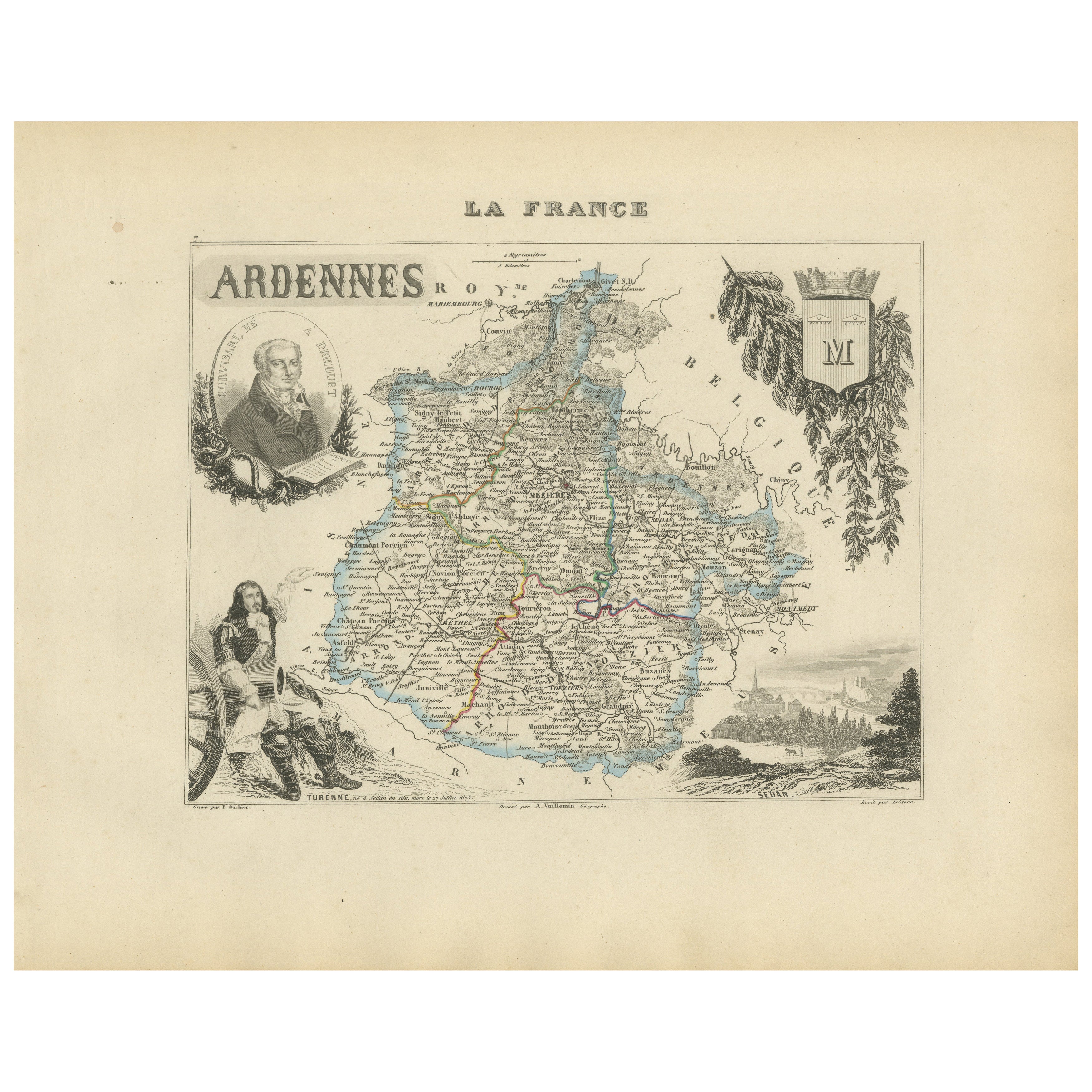
Mostra tuttoMap of Ardennes France with Sedan and Military History by Vuillemin, c.1850
Map of Ardennes France with Sedan and Military History by Vuillemin, 19th c
Description:
This detailed and decorative 19th-century map of the Ardennes department in northeastern Fra...
Categoria
Di antiquariato/d’epoca, Metà XIX secolo, Francese, Mappe
Materiali
Carta
Map of Aisne France with Soissons and Champagne Vineyards by Vuillemin, 19th c
Map of Aisne France with Soissons and Champagne Vineyards by Vuillemin, 19th c
Description:
This richly detailed 19th-century engraved and hand-colored map of the department of Aisn...
Categoria
Di antiquariato/d’epoca, Metà XIX secolo, Francese, Mappe
Materiali
Carta

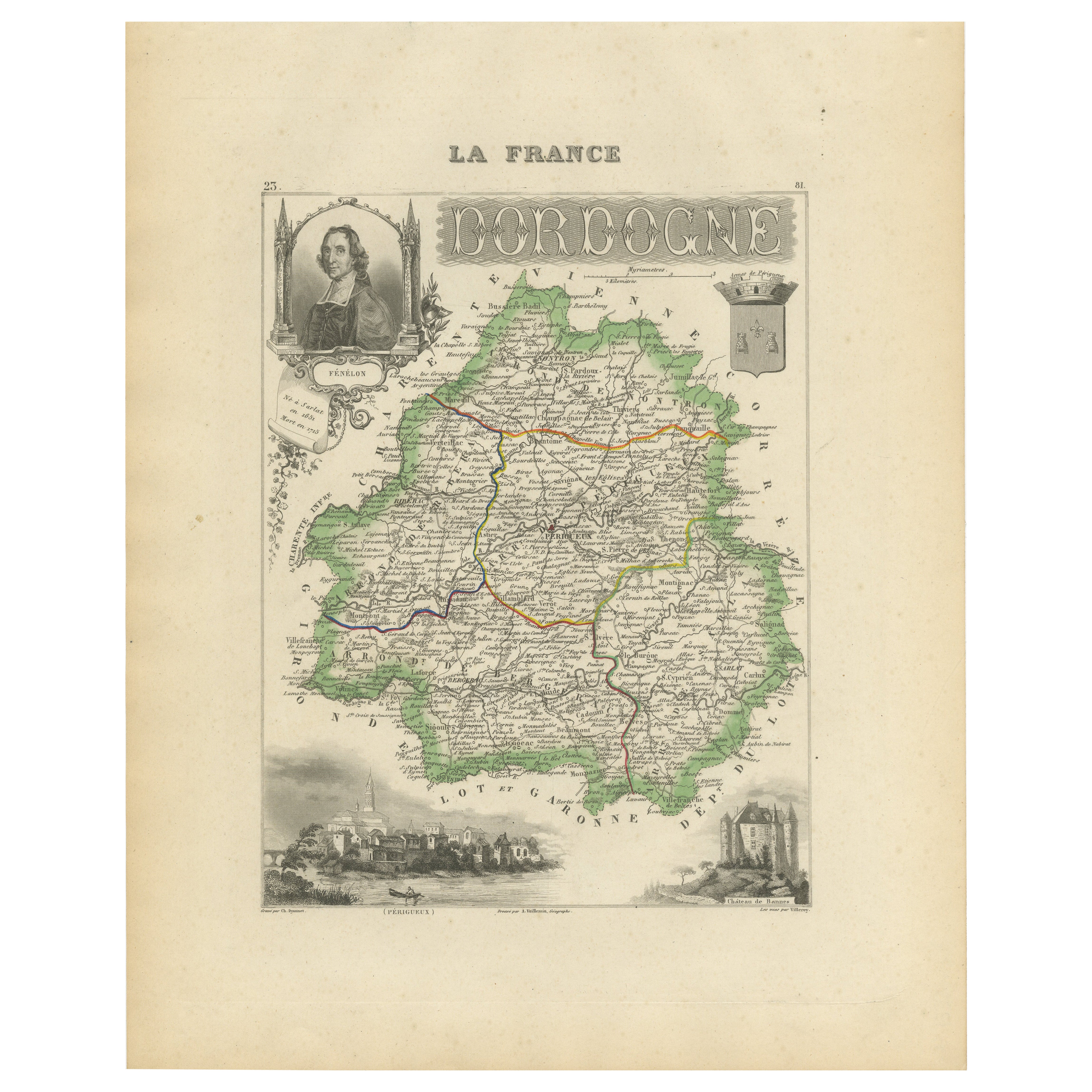
Map of Dordogne France with Périgueux and Château de Jumilhac, 19th Century
Map of Dordogne France with Périgueux and Château de Jumilhac, 19th Century
Description:
This richly detailed 19th-century map of the Dordogne department in southwestern France was ...
Categoria
Di antiquariato/d’epoca, Metà XIX secolo, Francese, Mappe
Materiali
Carta
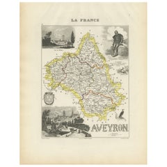
Map of Aveyron France with Rodez, Millau and Wine Routes, 19th Century
Map of Aveyron France with Rodez, Millau and Wine Routes, 19th Century
Description:
This detailed and decorative 19th-century map of Aveyron, a department in southern France, was dr...
Categoria
Di antiquariato/d’epoca, Metà XIX secolo, Francese, Mappe
Materiali
Carta
Map of Allier France with Saint-Pourçain Wine Region by Vuillemin, 19th c
Map of Allier France with Saint-Pourçain Wine Region by Vuillemin, 19th c
This decorative 19th-century map of Allier, a central department of France, comes from the celebrated Nouve...
Categoria
Di antiquariato/d’epoca, Metà XIX secolo, Francese, Mappe
Materiali
Carta

Mappa di Gers Francia con Auch e la regione vinicola dell'Armagnac di Vuillemin, XIX sec.
Mappa di Gers Francia con Auch e la regione vinicola dell'Armagnac di Vuillemin, XIX sec.
Questa mappa incisa e colorata a mano del XIX secolo del dipartimento di Gers, nel sud-oves...
Categoria
Di antiquariato/d’epoca, Metà XIX secolo, Francese, Mappe
Materiali
Carta

Ti potrebbe interessare anche
Aude, Francia. Mappa antica di un dipartimento francese, 1856
Di Victor Levasseur
'Dept. de L' Aude', incisione in acciaio con colorazione a mano dei contorni originali, 1856, da 'Atlas National Illustre' di Levasseur.
Questa zona della Francia è famosa per l'am...
Categoria
XIX secolo, Naturalismo, Stampe (paesaggio)
Materiali
Incisione

Var, Francia. Mappa antica di un dipartimento francese, 1856
Di Victor Levasseur
Dept. du Var", incisione in acciaio con colorazione a mano dei contorni originali, 1856, dall'Atlas National Illustre di Levasseur.
Il Var copre il cuore della Costa Azzurra e comp...
Categoria
XIX secolo, Naturalismo, Stampe (paesaggio)
Materiali
Incisione

Lozere, Francia. Mappa antica di un dipartimento francese, 1856
Di Victor Levasseur
'Dept. de La Lozere', incisione in acciaio con colorazione a mano dei contorni originali, 1856, da 'Atlas National Illustre' di Levasseur.
Questa remota zona montuosa della Linguad...
Categoria
XIX secolo, Naturalismo, Stampe (paesaggio)
Materiali
Incisione

L'Isere, Francia. Mappa antica del dipartimento francese, 1856
Di Victor Levasseur
'Dept. de L'Isere', incisione in acciaio con colorazione a mano dei contorni originali, 1856, da 'Atlas National Illustre' di Levasseur.
Questa zona è nota per la produzione del Bl...
Categoria
XIX secolo, Naturalismo, Stampe (paesaggio)
Materiali
Incisione

Aube, Francia. Mappa antica di un dipartimento francese, 1856
Di Victor Levasseur
'Dept. de L'Aube', incisione in acciaio con colorazione a mano dei contorni originali, 1856, da 'Atlas National Illustre' di Levasseur.
Questa zona della Francia è nota per la prod...
Categoria
XIX secolo, Naturalismo, Stampe (paesaggio)
Materiali
Incisione

L'Herault, Francia. Mappa antica di un dipartimento francese, 1856
Di Victor Levasseur
'Dept. de Saone et Loire', incisione in acciaio con colorazione a mano dei contorni originali, 1856, dall'Atlas National Illustre di Levasseur.
Quest'area ospita un'ampia varietà d...
Categoria
XIX secolo, Naturalismo, Stampe (paesaggio)
Materiali
Incisione
