Articoli simili a Map of Western United States 1903 – Railroads, State Borders, and Terrain


Vuoi altre immagini o video?
Richiedi altre immagini o video al venditore
1 di 11
Map of Western United States 1903 – Railroads, State Borders, and Terrain
Informazioni sull’articolo
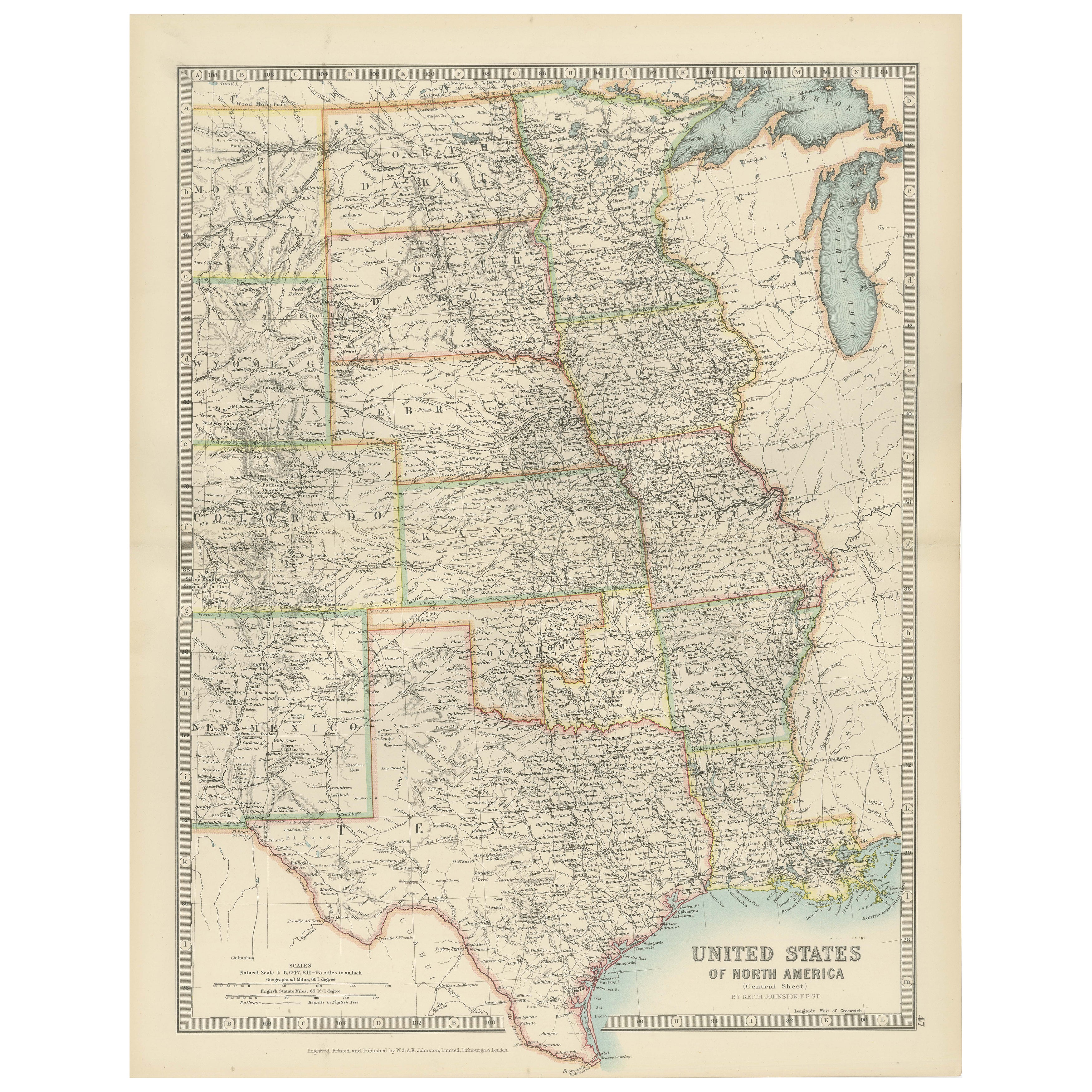
Map of Western United States 1903 – Railroads, State Borders, and Terrain
This beautifully engraved map titled "United States of North America (Western Sheet)" was created by Keith Johnston and published by W. & A.K. Johnston, Ltd. in London and Edinburgh, around 1903. It captures the western portion of the United States during a transformative period, showcasing states such as California, Oregon, Washington, Nevada, Idaho, Utah, Arizona, New Mexico, and parts of Montana, Wyoming, and Colorado.
This map is rich with historical detail, including an intricate network of railroads, key to the development of the western frontier in the early 20th century. State and county boundaries are carefully colored, while major rivers, mountain ranges, and settlements are precisely engraved, offering a glimpse into the growth of infrastructure and commerce. The typography is clean and refined, with town names, mountain peaks, and railway lines meticulously labeled.
Particularly interesting is the depiction of topography through delicate hachuring and shading, which brings the rugged beauty of the western landscape to life. The map also hints at the political and economic aspirations of the era, reflecting the westward expansion that defined the American experience.
The condition of this map is excellent for its age, with light toning around the edges and crisp, vibrant color that highlights the states and regions. It retains its charm and historical significance, making it a remarkable addition to any collection of antique maps or Americana.
For framing, a classic wooden frame in dark or natural tones would complement the historical aesthetic, while a neutral cream or soft tan mat would allow the detailed engravings to stand out. This map would make a wonderful centerpiece in an office, library, or living space, celebrating the rich heritage of the American West.
- Dimensioni:Altezza: 47 cm (18,51 in)Larghezza: 36,8 cm (14,49 in)Profondità: 0,2 mm (0,01 in)
- Materiali e tecniche:
- Periodo:
- Data di produzione:1903
- Condizioni:The condition is excellent for its age, with light toning around the edges and crisp, vibrant color that highlights the states and regions. It retains its charm and historical significance, making it a remarkable addition to any collection.
- Località del venditore:Langweer, NL
- Numero di riferimento:Venditore: BG-13577-481stDibs: LU3054345291982
Informazioni sul venditore
5,0
Venditore riconosciuto
Questi venditori prestigiosi sono leader del settore e rappresentano il massimo in termini di qualità e design.
Venditore Oro
Venditori Premium con valutazione 4,3+ e tempi di risposta entro 24 ore
Fondazione nel 2009
Venditore 1stDibs dal 2017
2.462 vendite su 1stDibs
Tempo di risposta standard: <1 ora
- SpedizioneRecupero del preventivo…Spedizione da: Langweer, Paesi Bassi
- Politica di reso
Alcune parti di questa pagina sono state tradotte automaticamente. 1stDibs non può garantire che le traduzioni siano corrette. L’inglese è la lingua predefinita del sito.
Garanzia di autenticità
Nell’improbabile caso in cui si verifichi un problema con l’autenticità di un articolo, contattaci entro un anno per ottenere un rimborso completo. DettagliGaranzia di rimborso
Se il tuo articolo non corrisponde alla descrizione, è danneggiato durante il trasporto o non arriva, contattaci entro 7 giorni per un rimborso completo. DettagliAnnullamento entro 24 ore
Hai un periodo di tolleranza di 24 ore per annullare il tuo acquisto, senza necessità di fornire spiegazioni.Venditori professionali selezionati
I nostri venditori di livello internazionale devono aderire a rigorosi standard di servizio e qualità, garantendo l’integrità delle inserzioni.Garanzia miglior prezzo
Se scopri che un venditore ha pubblicato altrove lo stesso articolo a un prezzo più basso, applicheremo lo stesso prezzo.Consegna globale affidabile
La nostra rete di vettori leader del settore offre opzioni di spedizione specializzate in tutto il mondo, inclusa la consegna personalizzata.Altro da questo venditore
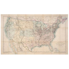
Mostra tuttoMap of United States Central Sheet 1903 – Railroads, States, and Topography
Map of United States Central Sheet 1903 – Railroads, States, and Topography
This is a finely engraved and beautifully colored map titled "United States of North America (Central She...
Categoria
Inizio XX secolo, Mappe
Materiali
Carta
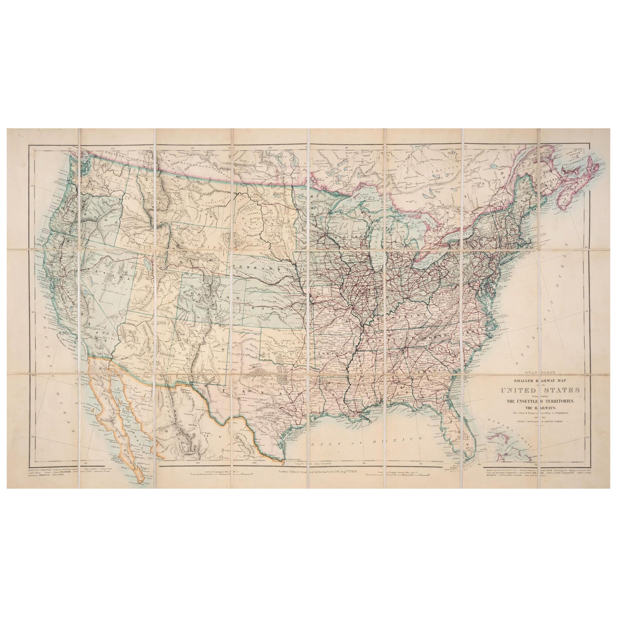
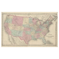
Mappa degli Stati Uniti del 1876: Con i dettagli delle ferrovie e dei territori non colonizzati
Mappa ferroviaria ridotta degli Stati Uniti di Stanford, 1876
Questa mappa originale del 1876, intitolata "Stanford's Smaller Railway Map of the United States Distinguishing the Uns...
Categoria
Di antiquariato/d’epoca, Anni 1870, Mappe
Materiali
Carta
Carta ferroviaria antica degli Stati Uniti di Rand, McNally & Co., 1900
Carta geografica antica intitolata "Rand, McNally & Co. New Official Railroad map of the United States with portions of The Dominion of Canada, The Republic of Mexico and the West In...
Categoria
XX secolo, Mappe
Materiali
Lino, Carta

2.180 USD Prezzo promozionale
25% in meno
Spedizione gratuita
Piccola mappa degli Stati Uniti
Carta geografica antica intitolata 'Amérique septe. Fisico". Piccola mappa degli Stati Uniti. litografata dai fratelli C. Callewaert a Bruxelles nel 1870 circa.
Categoria
Di antiquariato/d’epoca, Metà XIX secolo, Mappe
Materiali
Carta

69 USD Prezzo promozionale
20% in meno
Mappa antica degli Stati Uniti d'America di Colton
Carta geografica antica intitolata "Gli Stati Uniti d'America di Colton". Mostra le ferrovie, i canali, le capitali degli stati, le principali città e cittadine, le postazioni milita...
Categoria
Di antiquariato/d’epoca, Metà XIX secolo, Mappe
Materiali
Carta
827 USD Prezzo promozionale
20% in meno
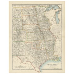
Carta geografica antica degli Stati Uniti d'America del Nord, Stati del Pacifico, 1882
La mappa è tratta dallo stesso Atlante Blackie del 1882 e si concentra sugli Stati del Pacifico degli Stati Uniti d'America in quel periodo. Ecco alcuni dettagli e il contesto storic...
Categoria
Di antiquariato/d’epoca, Anni 1880, Mappe
Materiali
Carta

232 USD Prezzo promozionale
20% in meno
Spedizione gratuita
Ti potrebbe interessare anche
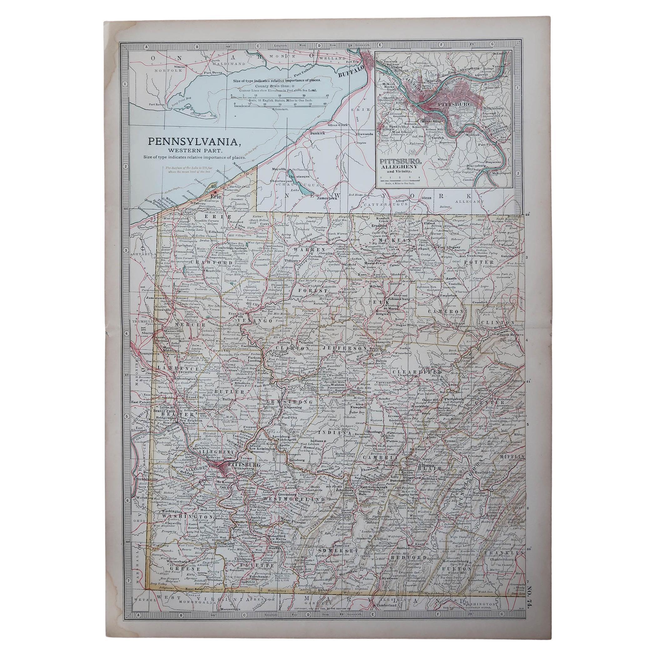
Mappa antica originale dello Stato americano della Pennsylvania (parte occidentale), 1903
Antique map of Pennsylvania ( Western part )
Published By A & C Black. 1903
Original colour
Good condition
Unframed.
Free shipping
Categoria
Di antiquariato/d’epoca, Inizio Novecento, Inglese, Mappe
Materiali
Carta

49 USD
Spedizione gratuita
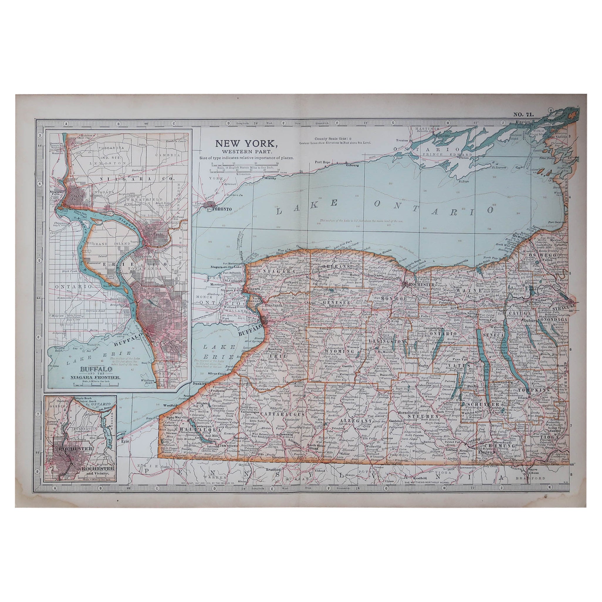
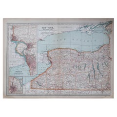
Mappa antica originale dello Stato americano di New York (parte occidentale) 1903
Antique map of New York ( Western Part )
Published By A & C Black. 1903
Original colour
Good condition
Unframed.
Free shipping
Categoria
Di antiquariato/d’epoca, Inizio Novecento, Inglese, Mappe
Materiali
Carta
49 USD
Spedizione gratuita
Mappa degli Stati Uniti con cornice vintage
Mappa degli Stati Uniti in carta invecchiata d'epoca montata su pannello di particelle e incorniciata in una semplice cornice di legno.
Categoria
XX secolo, Americano, Mid-Century moderno, Mappe
Materiali
Legno, Carta

Mappa del Messico e degli Stati Uniti del 1830 con cornice
Mappa del Nord America pubblicata nel 1830 circa. La mappa mostra gli Stati Uniti e il Canada. Messico che si estende nel territorio dell'alta California. Il Texas compare nel nome m...
Categoria
Di antiquariato/d’epoca, Anni 1830, Americano, Classico americano, Mappe
Materiali
Vetro, Legno, Carta

Mappa antica originale degli Stati Uniti, Grattan and Gilbert, 1843
Grande mappa degli Stati Uniti
Disegnato e inciso da Archer
Pubblicato da Grattan e Gilbert. 1843
Colore originale
Senza cornice.
Categoria
Di antiquariato/d’epoca, Anni 1840, Inglese, Mappe
Materiali
Carta

Mappa antica originale dello Stato americano del Minnesota, 1903
Mappa antica del Minnesota
Pubblicato da A.I.C. Black. 1903
Colore originale
Buono stato
Senza cornice.
Spedizione gratuita
Categoria
Di antiquariato/d’epoca, Inizio Novecento, Inglese, Mappe
Materiali
Carta
