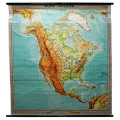
Articoli simili a Geological Map of North America by A.K. Johnston – Mountains and Valleys 1852

Vuoi altre immagini o video?
Richiedi altre immagini o video al venditore
1 di 12
Geological Map of North America by A.K. Johnston – Mountains and Valleys 1852
Informazioni sull’articolo
Geological Map of North America by A.K. Johnston – Mountains and Valleys 1852
This finely detailed and beautifully shaded antique map titled "The Mountains, Table Lands, Plains & Valleys of North America" was created by the noted Scottish geographer Alexander Keith Johnston and published in 1852 by William Blackwood & Sons in Edinburgh and London. It was issued as Plate 8 in Johnston’s groundbreaking *Physical Atlas of Natural Phenomena*, one of the earliest and most influential works of thematic cartography in the 19th century.
The map presents the topographic structure of the North American continent, emphasizing physical geography over political borders. Using a delicate yet effective palette of hand-applied color, it distinguishes between mountainous regions, plateaus, plains, and river valleys. Green areas denote lowlands and river basins, while tan and brown areas indicate elevated terrain, such as mountain ranges and high plateaus.
Key geographical features are precisely labeled, including the Rocky Mountains, Appalachian Mountains, Sierra Nevada, Great Basin, Canadian Shield, and Mississippi River Valley. The map covers all of North America, including Canada, the United States, Mexico, Central America, the Caribbean, and Greenland, as well as the Arctic archipelagos. Major tablelands such as those of Mexico and the Colorado Plateau are also clearly outlined, demonstrating the complexity of North America's geological structure.
What sets this map apart is its educational clarity and scientific intent. Johnston’s work was intended to inform and enlighten readers about the structure of the natural world, making this a valuable piece not just for collectors of antique maps but also for educators, environmental historians, and interior designers seeking historically meaningful artwork.
Alexander Keith Johnston (1804–1871) was a pioneering figure in British cartography. As Geographer in Ordinary to Queen Victoria for Scotland, he advanced the visual communication of scientific data through maps. His *Physical Atlas* remains a landmark publication in the history of science and cartography.
Condition and framing tips:
Very good condition with light age toning, original centerfold, and faint foxing at edges. Printed area clean and well-preserved. Frame in dark wood or black with a soft ivory or sage green mat to enhance the earthy palette and highlight the map's elegant detailing. Perfect for libraries, offices, or natural history-themed interiors.
- Dimensioni:Altezza: 34,5 cm (13,59 in)Larghezza: 27,4 cm (10,79 in)Profondità: 0,2 mm (0,01 in)
- Materiali e tecniche:
- Luogo di origine:
- Periodo:
- Data di produzione:1852
- Condizioni:Very good condition. Light overall toning near the margins. The paper remains strong and well-preserved. Folding line as issued.
- Località del venditore:Langweer, NL
- Numero di riferimento:Venditore: BG-13207-81stDibs: LU3054345386722
Informazioni sul venditore
5,0
Venditore riconosciuto
Questi venditori prestigiosi sono leader del settore e rappresentano il massimo in termini di qualità e design.
Venditore Oro
Venditori Premium con valutazione 4,3+ e tempi di risposta entro 24 ore
Fondazione nel 2009
Venditore 1stDibs dal 2017
2.469 vendite su 1stDibs
Tempo di risposta standard: <1 ora
- SpedizioneRecupero del preventivo…Spedizione da: Langweer, Paesi Bassi
- Politica di reso
Alcune parti di questa pagina sono state tradotte automaticamente. 1stDibs non può garantire che le traduzioni siano corrette. L’inglese è la lingua predefinita del sito.
Garanzia di autenticità
Nell’improbabile caso in cui si verifichi un problema con l’autenticità di un articolo, contattaci entro un anno per ottenere un rimborso completo. DettagliGaranzia di rimborso
Se il tuo articolo non corrisponde alla descrizione, è danneggiato durante il trasporto o non arriva, contattaci entro 7 giorni per un rimborso completo. DettagliAnnullamento entro 24 ore
Hai un periodo di tolleranza di 24 ore per annullare il tuo acquisto, senza necessità di fornire spiegazioni.Venditori professionali selezionati
I nostri venditori di livello internazionale devono aderire a rigorosi standard di servizio e qualità, garantendo l’integrità delle inserzioni.Garanzia miglior prezzo
Se scopri che un venditore ha pubblicato altrove lo stesso articolo a un prezzo più basso, applicheremo lo stesso prezzo.Consegna globale affidabile
La nostra rete di vettori leader del settore offre opzioni di spedizione specializzate in tutto il mondo, inclusa la consegna personalizzata.Altro da questo venditore
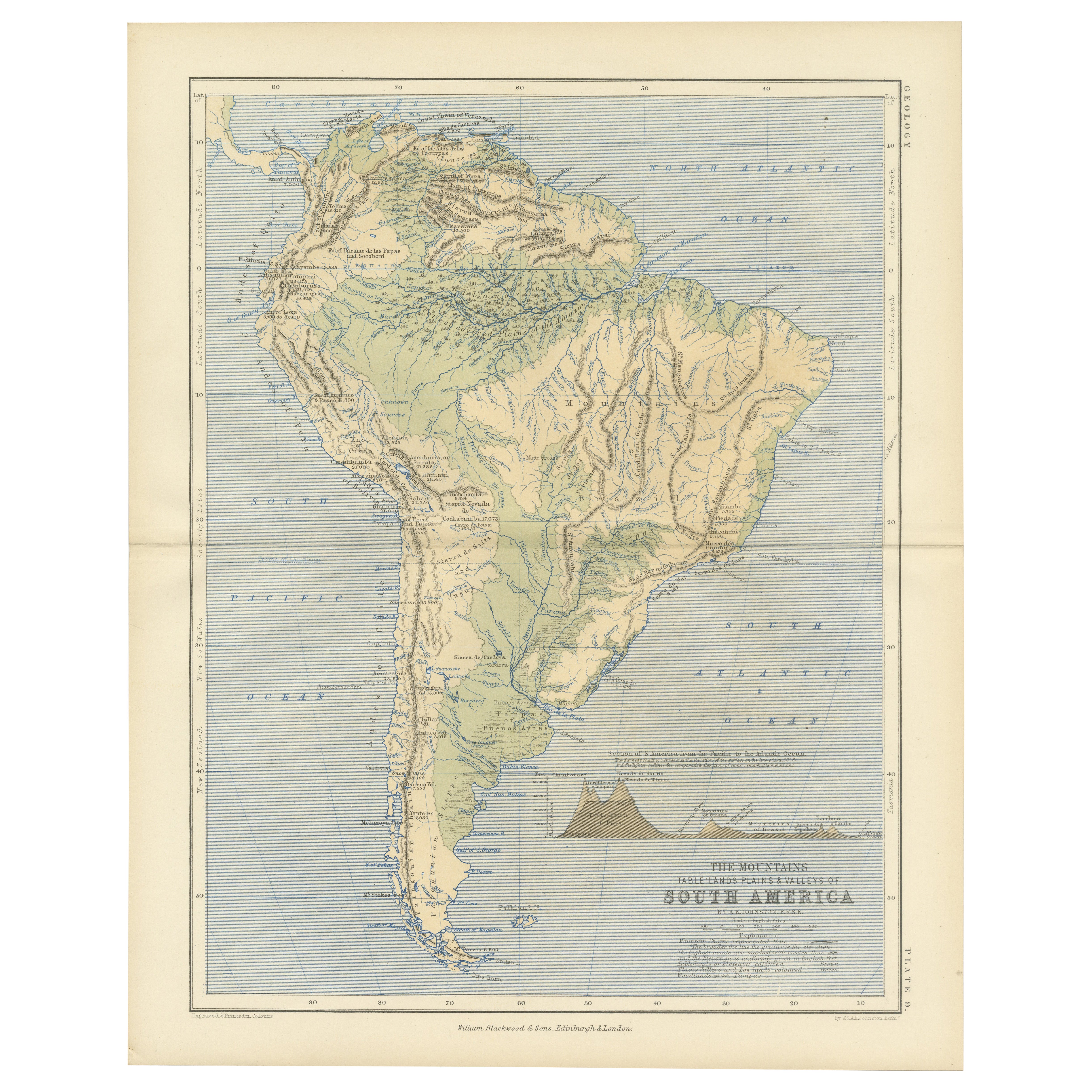
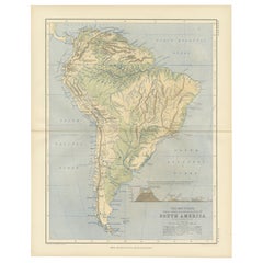
Mostra tuttoGeological Map of South America by A.K. Johnston – Mountains and Valleys 1852
Geological Map of South America by A.K. Johnston – Mountains and Valleys 1852
This antique map titled "The Mountains, Table Lands, Plains & Valleys of South America" was produced by...
Categoria
Di antiquariato/d’epoca, Metà XIX secolo, Scozzese, Stampe
Materiali
Carta
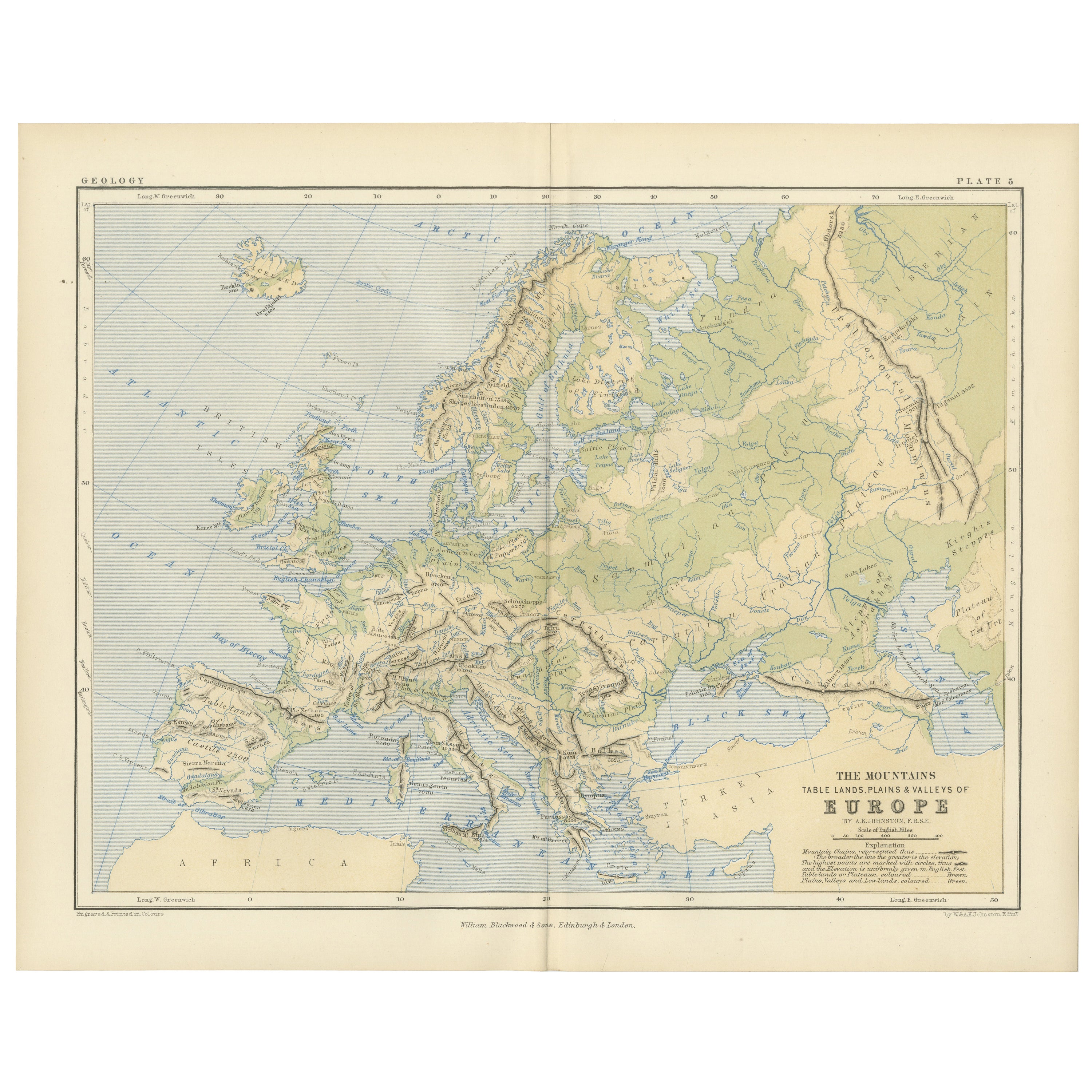
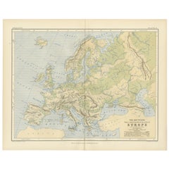
Geological Map of Europe by A.K. Johnston – Mountains and Valleys 1852
Geological Map of Europe by A.K. Johnston – Mountains and Valleys 1852
This elegant 1852 map titled "The Mountains, Table Lands, Plains & Valleys of Europe" was designed by the accl...
Categoria
Di antiquariato/d’epoca, Metà XIX secolo, Scozzese, Stampe
Materiali
Carta
306 USD / articolo
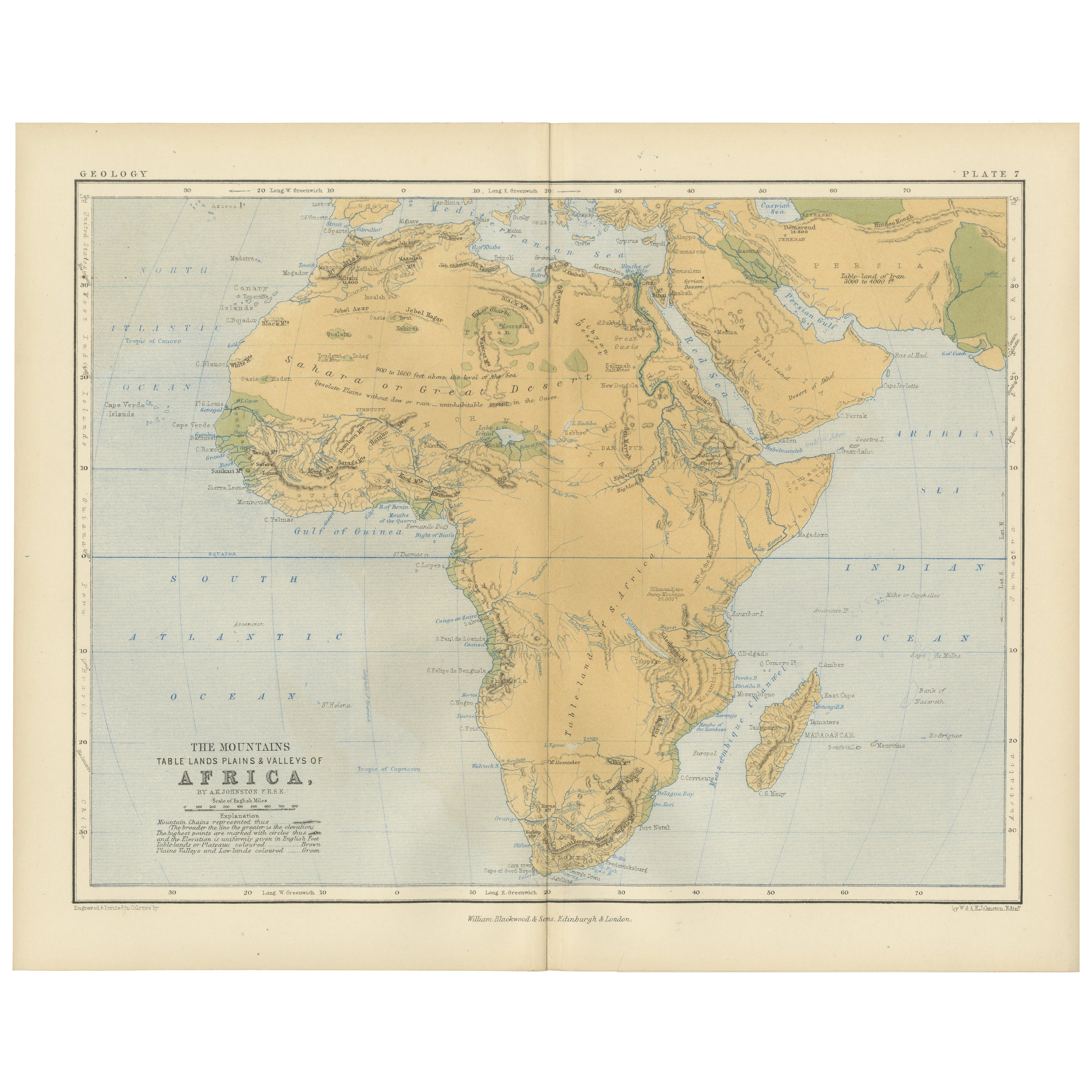
Geological Map of Africa by A.K. Johnston – Mountains and Valleys 1852
Geological Map of Africa by A.K. Johnston – Mountains and Valleys 1852
This antique map titled "The Mountains, Table Lands, Plains & Valleys of Africa" was produced by the distingui...
Categoria
Di antiquariato/d’epoca, Metà XIX secolo, Scozzese, Stampe
Materiali
Carta

306 USD / articolo
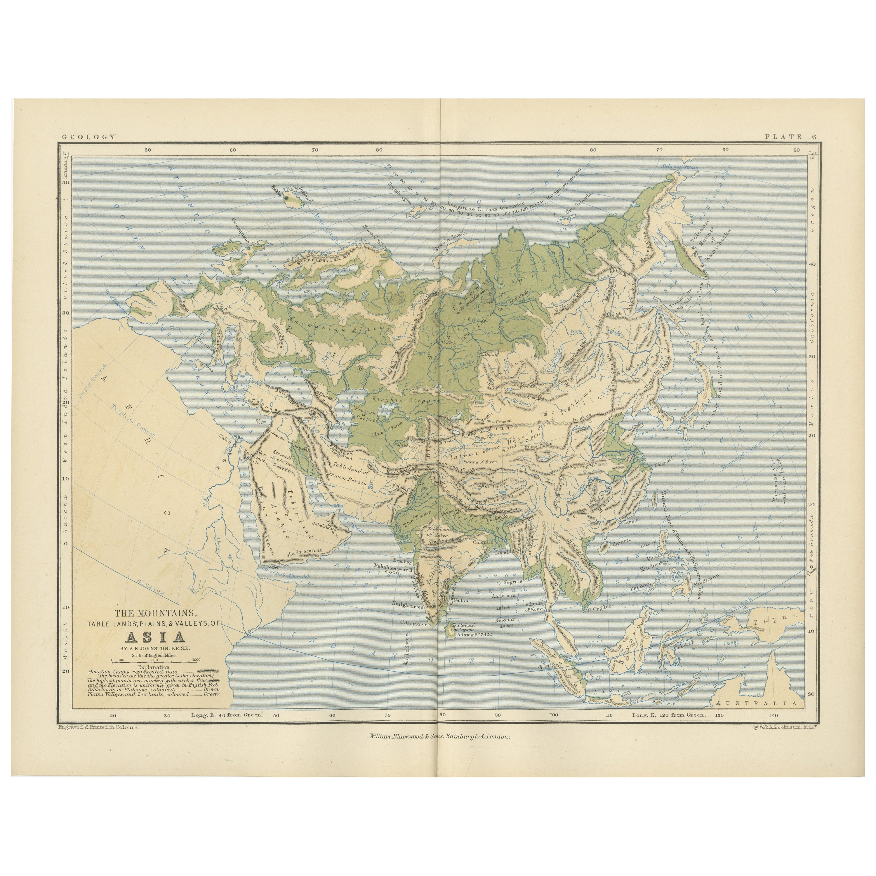
Geological Map of Asia by A.K. Johnston – Mountains and Valleys 1852
Geological Map of Asia by A.K. Johnston – Mountains and Valleys 1852
This finely engraved and hand-colored map titled "The Mountains, Table Lands, Plains & Valleys of Asia" was crea...
Categoria
Di antiquariato/d’epoca, Metà XIX secolo, Scozzese, Stampe
Materiali
Carta

306 USD / articolo
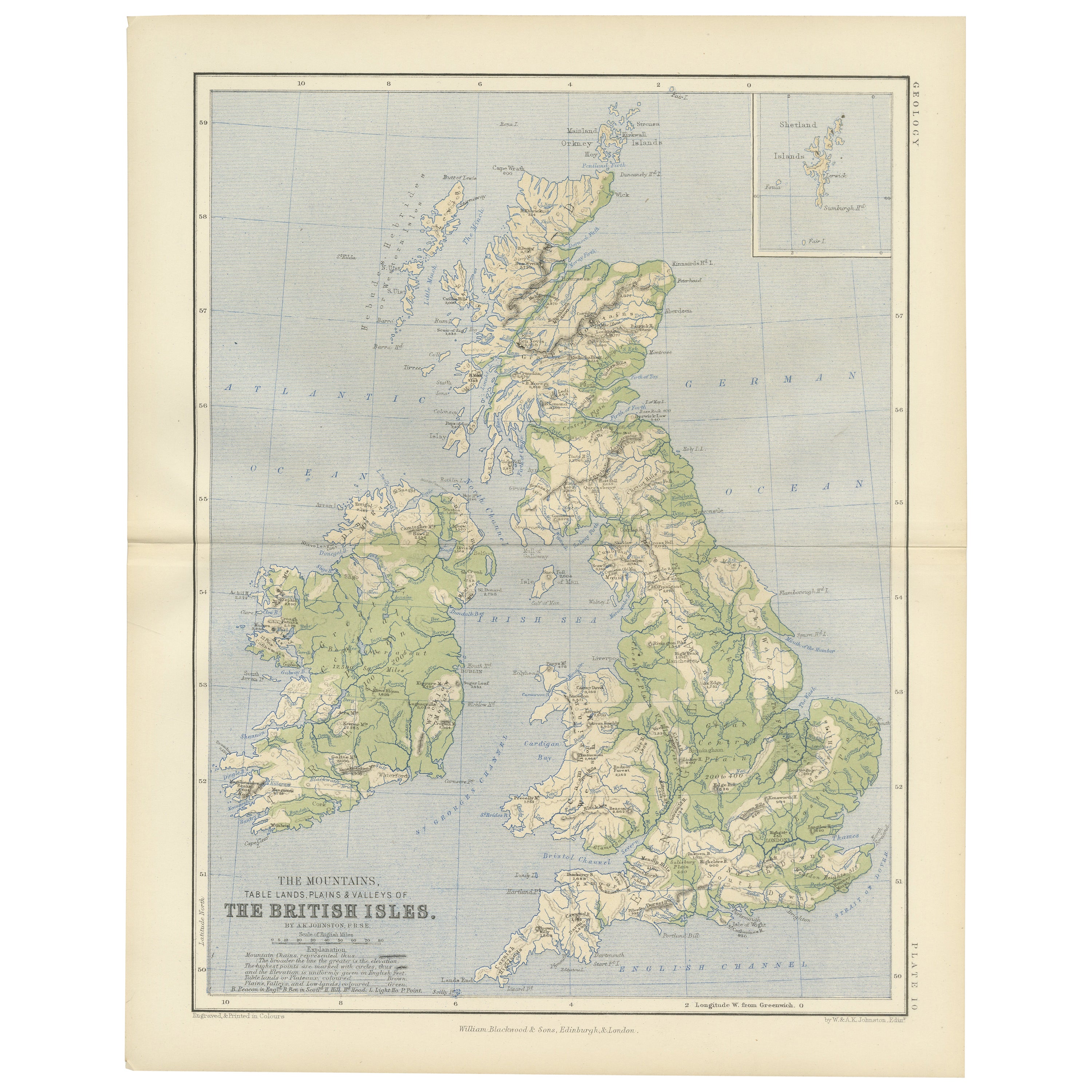
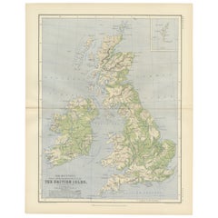
Geological Map of the British Isles by A.K. Johnston – Highlands & Valleys 1852
Geological Map of the British Isles by A.K. Johnston – Highlands & Valleys 1852
This antique topographic map titled "The Mountains, Table Lands, Plains & Valleys of the British Isle...
Categoria
Di antiquariato/d’epoca, Metà XIX secolo, Scozzese, Stampe
Materiali
Carta
Carta geografica antica del Sud America 'Nord' di A.K. Johnston, 1865
Carta geografica antica intitolata "Sud America, foglio settentrionale". Raffigura la Guiana, l'Ecuador, il Brasile, la Bolivia, le Amazzoni e molto altro ancora. Questa mappa provie...
Categoria
Di antiquariato/d’epoca, Metà XIX secolo, Mappe
Materiali
Carta

259 USD Prezzo promozionale
20% in meno
Ti potrebbe interessare anche
Nuova mappa del Nord America dalle ultime scoperte, 1763
Una bella mappa antica del XVIII secolo della costa nordamericana.
Intitolato "Una nuova mappa del Nord America dalle ultime scoperte del 1763".
Dal cartografo/incisore - John ...
Categoria
Di antiquariato/d’epoca, Metà XVIII secolo, Inglese, Georgiano, Mappe
Materiali
Carta

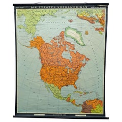
Mappa vintage da parete Paesi del Nord America Poster murale arrotolabile
La mappa scolastica vintage a scomparsa illustra i paesi/stati del Nord America. Pubblicato da Haack-Painke Justus Perthes Darmstadt. Stampa colorata su carta rinforzata con tela.
Mi...
Categoria
Fine XX secolo, Tedesco, Country, Stampe
Materiali
Tela, Legno, Carta
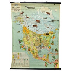
Uso del suolo e allevamento del Nord America Immagine Mappa Murale Grafico Poster Murale
La mappa vintage arrotolabile dell'America settentrionale e centrale mostra l'uso del suolo e del bestiame. Pubblicato da JRO. Stampa colorata su carta rinforzata con tela.
Misure:
L...
Categoria
Fine XX secolo, Tedesco, Country, Stampe
Materiali
Tela, Legno, Carta
America del Nord e del Sud: Una mappa colorata a mano del XVII secolo di Jansson & Goos
Di Johannes Janssonius
Mappa del Nord e del Sud America colorata a mano del XVII secolo intitolata "Americae Descriptio" del cartografo Johannes Jansson, pubblicata nell'Atlante Minore di Jansson ad Amster...
Categoria
Di antiquariato/d’epoca, Anni 1620, Olandese, Mappe
Materiali
Carta

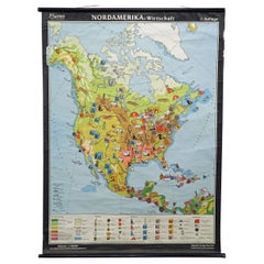
Mappa dell'America del Nord Economia Grafico murale Poster arrotolabile Murale d'epoca
Una mappa d'epoca che mostra l'economia del Nord America, pubblicata da Harms. Stampa colorata su carta rinforzata con tela.
Misure:
Larghezza 101 cm (39,76 pollici)
Altezza 169 cm (...
Categoria
Fine XX secolo, Tedesco, Country, Stampe
Materiali
Tela, Legno, Carta
Mappa d'epoca dell'America del Nord Carta da parete Poster Countrycore Stampa
Una tradizionale mappa scolastica d'epoca che illustra il Nord America, pubblicata da Westermann. Stampa colorata su carta rinforzata con tela.
Misure:
Larghezza 156 cm (61,42 polli...
Categoria
Fine XX secolo, Tedesco, Country, Stampe
Materiali
Tela, Legno, Carta