Articoli simili a River Systems Map of the World by A.K. Johnston – Educational Print 1852


Vuoi altre immagini o video?
Richiedi altre immagini o video al venditore
1 di 10
River Systems Map of the World by A.K. Johnston – Educational Print 1852
260 €per articolo|IVA inclusa
Quantità
Informazioni sull’articolo
River Systems Map of the World by A.K. Johnston – Educational Print 1852
This striking 1852 map titled "The River Systems of the World" was created by the noted Scottish geographer Alexander Keith Johnston and published by William Blackwood & Sons in Edinburgh and London. It is Plate 4 from Johnston’s groundbreaking work *The Physical Atlas of Natural Phenomena*, a pioneering example of thematic cartography that visually communicates scientific data on a global scale.
This hand-colored copperplate engraving displays the world’s major river basins, categorized by color to represent the direction of river drainage toward different oceans and inland basins. Each continental landmass is divided by watershed, visually illustrating how rivers flow to the Atlantic, Pacific, Indian, Arctic Oceans, or into interior lakes and deserts. For instance, blue shows drainage toward the Arctic Ocean, brown for the Atlantic, green for the Indian Ocean, and so forth. The result is a vividly segmented and scientifically meaningful depiction of Earth's hydrological patterns.
A fascinating feature of the print is the comparative diagram running along the bottom, showing the relative lengths of the world’s principal rivers such as the Amazon, Nile, Mississippi, Yangtze, and Volga. This allows the viewer to grasp the scale and hierarchy of global river systems at a glance.
Johnston, who served as Geographer in Ordinary to Queen Victoria in Scotland, was renowned for his clarity, precision, and ability to synthesize scientific knowledge into accessible graphic forms. His *Physical Atlas* was one of the first atlases to present natural phenomena using maps rather than text alone, making it a cornerstone of modern data visualization.
This particular map is of special interest to collectors, educators, and designers for its combination of scientific accuracy and striking color composition. It appeals to those interested in geography, environmental science, and historical education, while also offering decorative appeal through its classic layout and 19th-century color palette.
Condition and framing tips:
Very good antique condition with some mild toning and occasional foxing in the margins. The printed area is clean and well-preserved. For framing, a walnut or black frame with a warm cream or ivory mat will bring out the map’s subtle hand-coloring. Pale blue or light earth-toned mats also work well to echo the map’s thematic hues. Ideal for display in a study, library, or educational setting.
- Dimensioni:Altezza: 27,4 cm (10,79 in)Larghezza: 34,5 cm (13,59 in)Profondità: 0,2 mm (0,01 in)
- Materiali e tecniche:
- Luogo di origine:
- Periodo:
- Data di produzione:1856
- Condizioni:Very good condition. Light overall toning near the margins. The paper remains strong and well-preserved. Folding line as issued.
- Località del venditore:Langweer, NL
- Numero di riferimento:Venditore: BG-13207-41stDibs: LU3054345385942
Informazioni sul venditore
5,0
Venditore riconosciuto
Questi venditori prestigiosi sono leader del settore e rappresentano il massimo in termini di qualità e design.
Venditore Platino
Venditori Premium con valutazione 4.7+ e tempi di risposta entro 24 ore
Fondazione nel 2009
Venditore 1stDibs dal 2017
2641 vendite su 1stDibs
Tempo di risposta standard: <1 ora
- SpedizioneRecupero del preventivo…Spedizione da: Langweer, Paesi Bassi
- Politica di reso
Alcune parti di questa pagina sono state tradotte automaticamente. 1stDibs non può garantire che le traduzioni siano corrette. L’inglese è la lingua predefinita del sito.
Garanzia di autenticità
Nell’improbabile caso in cui si verifichi un problema con l’autenticità di un articolo, contattaci entro un anno per ottenere un rimborso completo. DettagliGaranzia di rimborso
Se il tuo articolo non corrisponde alla descrizione, è danneggiato durante il trasporto o non arriva, contattaci entro 7 giorni per un rimborso completo. DettagliAnnullamento entro 24 ore
Hai un periodo di tolleranza di 24 ore per annullare il tuo acquisto, senza necessità di fornire spiegazioni.Venditori professionali selezionati
I nostri venditori di livello internazionale devono aderire a rigorosi standard di servizio e qualità, garantendo l’integrità delle inserzioni.Garanzia miglior prezzo
Se scopri che un venditore ha pubblicato altrove lo stesso articolo a un prezzo più basso, applicheremo lo stesso prezzo.Consegna globale affidabile
La nostra rete di vettori leader del settore offre opzioni di spedizione specializzate in tutto il mondo, inclusa la consegna personalizzata.Altro da questo venditore
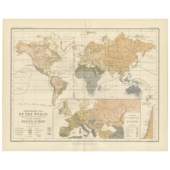
Mostra tuttoEthnographic Map of the World by A.K. Johnston – Races of Man Chart 1852
Ethnographic Map of the World by A.K. Johnston – Races of Man Chart 1852
This antique map titled "Ethnographic Map of the World Showing the Present Distribution of the Leading Races...
Categoria
Di antiquariato/d’epoca, Metà XIX secolo, Scozzese, Stampe
Materiali
Carta
Carta antica dei sistemi fluviali dell'Europa e dell'Asia di Johnston del 1850
Carta geografica antica intitolata "I sistemi fluviali dell'Europa e dell'Asia che mostrano i confini e l'estensione comparativa dei bacini fluviali". Mappa antica originale dei sist...
Categoria
Di antiquariato/d’epoca, Metà XIX secolo, Mappe
Materiali
Carta

160 € Prezzo promozionale
20% in meno
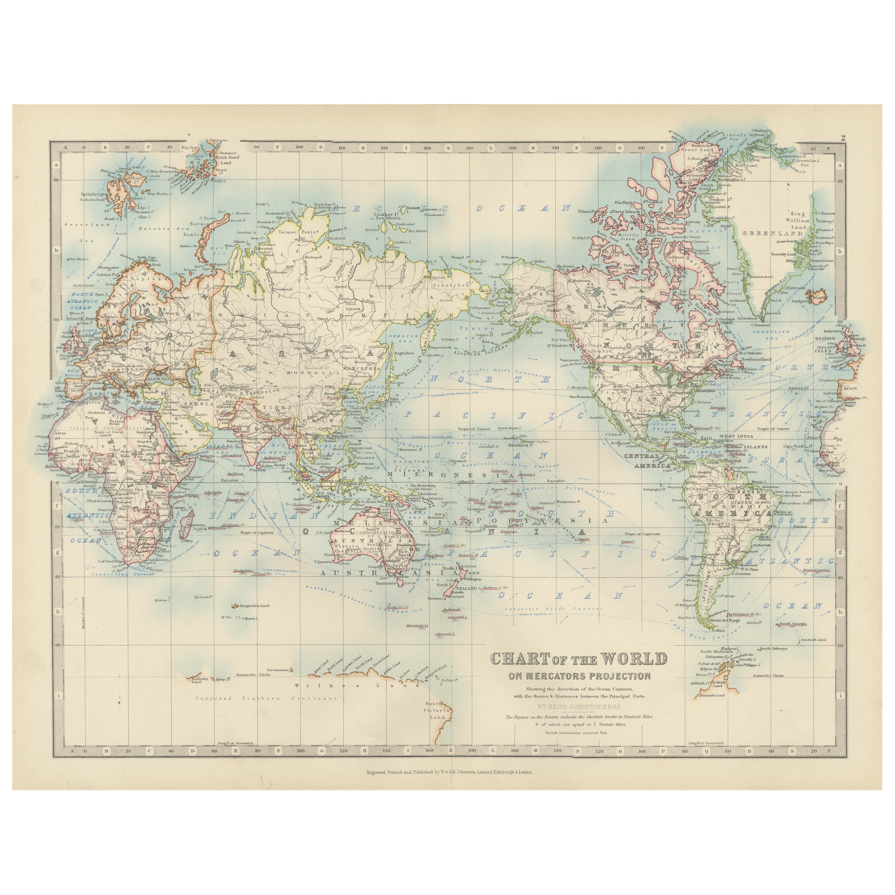
Carta del mondo antica su proiezione di Mercatore, correnti oceaniche e rotte commerciali 1903
Titolo: Carta del mondo antica su proiezione di Mercatore, 1903, che mostra le correnti oceaniche e le rotte commerciali
Descrizione:
Questa carta geografica antica, intitolata "Car...
Categoria
Inizio XX secolo, Mappe
Materiali
Carta

Mappa antica delle religioni nel mondo di Johnston del 1854
Carta geografica antica intitolata "Grafico morale e statistico che mostra la distribuzione geografica dell'uomo secondo le credenze religiose". Rara mappa tematica di grandi dimensi...
Categoria
Di antiquariato/d’epoca, Metà XIX secolo, Mappe
Materiali
Carta

780 € Prezzo promozionale
35% in meno
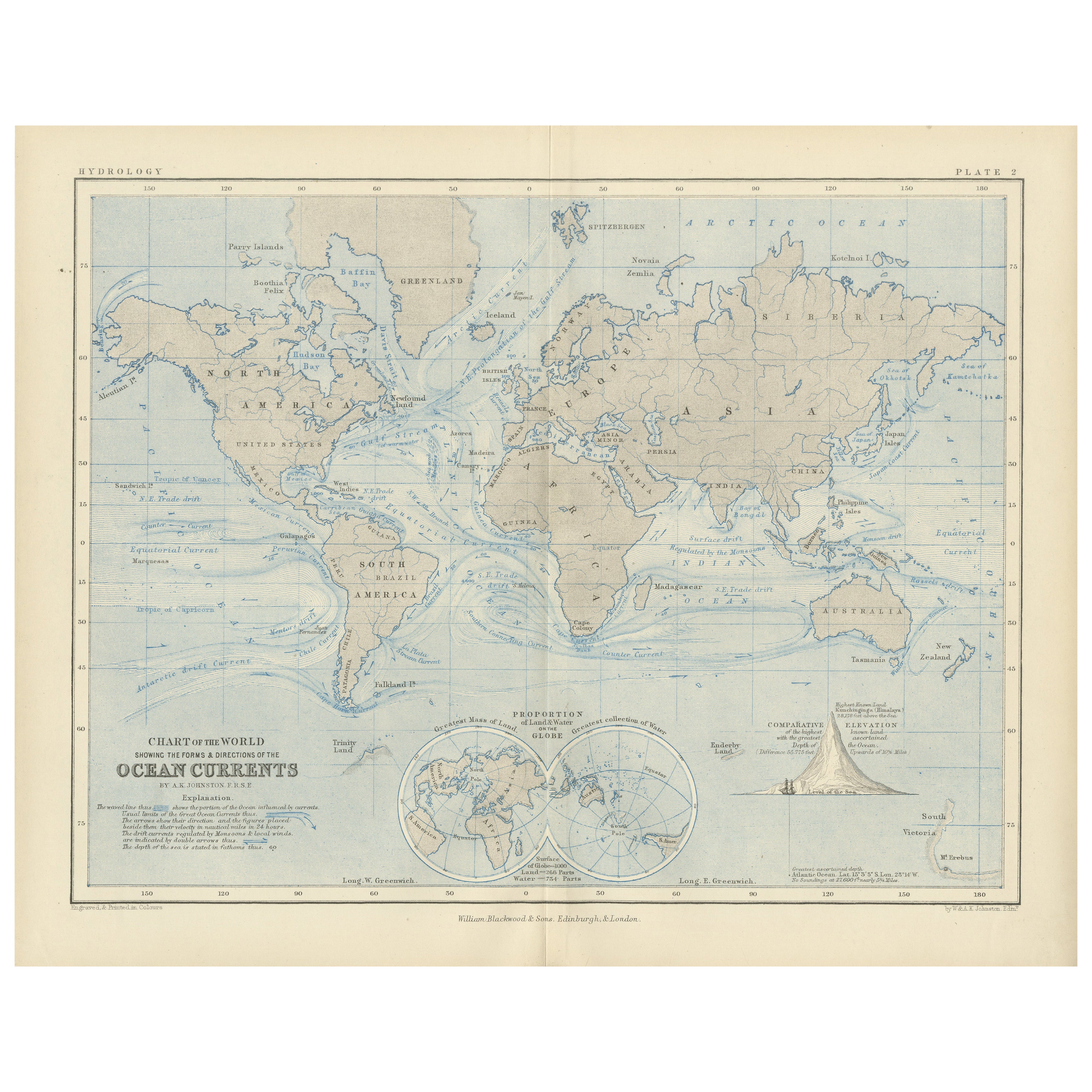
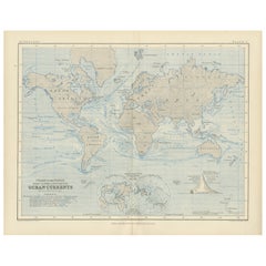
World Map of Ocean Currents by A.K. Johnston, Educational Print 1852
World Map of Ocean Currents by A.K. Johnston, Educational Print 1852
This detailed and scientifically rich chart titled 'Chart of the World Showing the Form & Direction of the Ocean...
Categoria
Di antiquariato/d’epoca, Metà XIX secolo, Scozzese, Stampe
Materiali
Carta
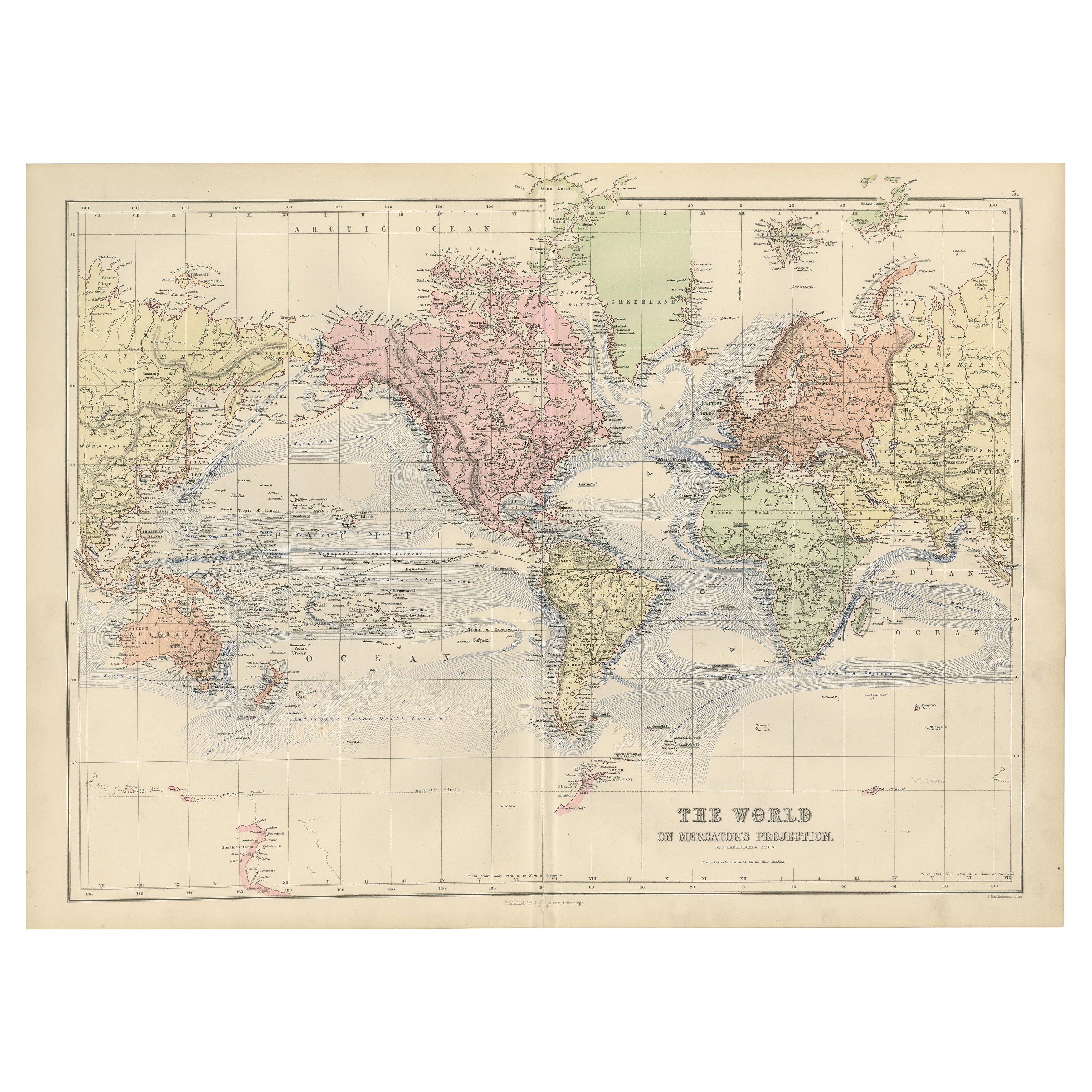
Mappa del mondo decorativa del 1884 - Proiezione di Mercatore, stampa dell'epoca vittoriana
Carta del mondo antica con proiezione di Mercatore - Atlante di Black, 1884
Questa mappa finemente incisa e colorata, intitolata The World on Mercator's Projection, è stata pubblica...
Categoria
Di antiquariato/d’epoca, Anni 1880, Scozzese, Mappe
Materiali
Carta

Ti potrebbe interessare anche
Mappa antica originale del mondo di Dower, 1835 circa
Bella mappa del mondo
Disegnato e inciso da J.Dower
Pubblicato da Orr & Smith. C.1835
Senza cornice.
Spedizione gratuita
Categoria
Di antiquariato/d’epoca, Anni 1830, Inglese, Mappe
Materiali
Carta

1864 Planisfero originale illustrato - Mappa del mondo - Geografia
Immergiti nell'epico viaggio del passato con il Planisfero Storico Illustrato del 1864 di Charpentier! 🗺️ Questo tesoro cartografico ti trasporta attraverso le complessità della sto...
Categoria
Anni 1860, Stampe e riproduzioni
Materiali
Lino, Litografia, Carta

Grande mappa antica originale del mondo, Fullarton, 1870 ca.
Grande mappa del mondo. Mostra entrambi gli emisferi
Dal celebre Atlante Reale Illustrato
Litografia. Colore originale.
Pubblicato da Fullarton, Edimburgo, 1870 ca.
Senza cornic...
Categoria
Di antiquariato/d’epoca, Anni 1870, Scozzese, Mappe
Materiali
Carta

Mappa antica originale dell'emisfero occidentale di Dower, 1835 circa
Bella mappa dell'emisfero occidentale
Disegnato e inciso da J.Dower
Pubblicato da Orr & Smith. C.1835
Senza cornice.
Spedizione gratuita
Categoria
Di antiquariato/d’epoca, Anni 1830, Inglese, Mappe
Materiali
Carta

Mappa del mondo - Acquaforte originale - 1820
La Mappa del Mondo è un'acquaforte originale realizzata da un artista sconosciuto del XIX secolo nel 1820.
Ottimo stato su due fogli di carta bianca uniti al centro.
La mappa è un'...
Categoria
Anni 1820, Moderno, Stampe figurative
Materiali
Acquaforte

Mappa antica originale dell'emisfero orientale di Dower, 1835 circa
Bella mappa dell'emisfero orientale
Disegnato e inciso da J.Dower
Pubblicato da Orr & Smith. C.1835
Senza cornice.
Spedizione gratuita
Categoria
Di antiquariato/d’epoca, Anni 1830, Inglese, Mappe
Materiali
Carta
