Articoli simili a World Map of Ocean Currents by A.K. Johnston, Educational Print 1852


Vuoi altre immagini o video?
Richiedi altre immagini o video al venditore
1 di 10
World Map of Ocean Currents by A.K. Johnston, Educational Print 1852
240 €per articolo|IVA inclusa
Quantità
Informazioni sull’articolo
World Map of Ocean Currents by A.K. Johnston, Educational Print 1852
This detailed and scientifically rich chart titled 'Chart of the World Showing the Form & Direction of the Ocean Currents' was created by the Scottish cartographer Alexander Keith Johnston and published in 1852 by William Blackwood & Sons of Edinburgh and London. Issued as Plate 2 in a series on hydrology, it appeared in Johnston’s influential educational work *The Physical Atlas*.
The map illustrates the world’s ocean currents with remarkable clarity, using finely engraved directional arrows and shading to indicate both warm and cold currents across the globe’s seas. The Equatorial Current, Gulf Stream, Brazil Current, Kuroshio, and Antarctic Circumpolar Current are all clearly labeled and presented in relation to the major continents and climatic zones. The precise depiction of ocean flow patterns reveals the 19th-century understanding of global oceanography and its connection to trade, navigation, and climatology.
This map is not just a geographic representation, but a visual explanation of hydrological science. Two insets enhance the plate’s instructional value: one shows the “Proportion of Land & Water on the Globe,” and the other compares the relative elevation of mountain chains and ocean depths, including the Mariana Trench and Mount Everest. These contextual diagrams reflect the Enlightenment ideal of synthesizing visual data with scientific observation for public education.
Johnston (1804–1871) was known for merging scientific accuracy with elegant presentation. As “Geographer in Ordinary to Her Majesty for Scotland,” his maps were widely used in schools and universities. His Physical Atlas is considered one of the first thematic atlases, combining cartography with natural sciences.
This print is a compelling artifact of early scientific cartography, ideal for collectors of antique maps, maritime history, or 19th-century educational materials.
Condition and framing tips:
Excellent condition with minor age toning and clean margins. Frame in dark wood or matte black with a pale blue or neutral-toned mat to complement the soft blue engraving and highlight the fine scientific detailing.
- Dimensioni:Altezza: 27,4 cm (10,79 in)Larghezza: 34,5 cm (13,59 in)Profondità: 0,2 mm (0,01 in)
- Materiali e tecniche:
- Luogo di origine:
- Periodo:
- Data di produzione:1852
- Condizioni:Very good antique condition. Clean impression with light age-toning and minimal foxing. Edges show only minor wear. Fold in middle as issued. Suitable for immediate display or archival framing.
- Località del venditore:Langweer, NL
- Numero di riferimento:Venditore: BG-13207-21stDibs: LU3054345385652
Informazioni sul venditore
5,0
Venditore riconosciuto
Questi venditori prestigiosi sono leader del settore e rappresentano il massimo in termini di qualità e design.
Venditore Platino
Venditori Premium con valutazione 4.7+ e tempi di risposta entro 24 ore
Fondazione nel 2009
Venditore 1stDibs dal 2017
2641 vendite su 1stDibs
Tempo di risposta standard: <1 ora
- SpedizioneRecupero del preventivo…Spedizione da: Langweer, Paesi Bassi
- Politica di reso
Alcune parti di questa pagina sono state tradotte automaticamente. 1stDibs non può garantire che le traduzioni siano corrette. L’inglese è la lingua predefinita del sito.
Garanzia di autenticità
Nell’improbabile caso in cui si verifichi un problema con l’autenticità di un articolo, contattaci entro un anno per ottenere un rimborso completo. DettagliGaranzia di rimborso
Se il tuo articolo non corrisponde alla descrizione, è danneggiato durante il trasporto o non arriva, contattaci entro 7 giorni per un rimborso completo. DettagliAnnullamento entro 24 ore
Hai un periodo di tolleranza di 24 ore per annullare il tuo acquisto, senza necessità di fornire spiegazioni.Venditori professionali selezionati
I nostri venditori di livello internazionale devono aderire a rigorosi standard di servizio e qualità, garantendo l’integrità delle inserzioni.Garanzia miglior prezzo
Se scopri che un venditore ha pubblicato altrove lo stesso articolo a un prezzo più basso, applicheremo lo stesso prezzo.Consegna globale affidabile
La nostra rete di vettori leader del settore offre opzioni di spedizione specializzate in tutto il mondo, inclusa la consegna personalizzata.Altro da questo venditore
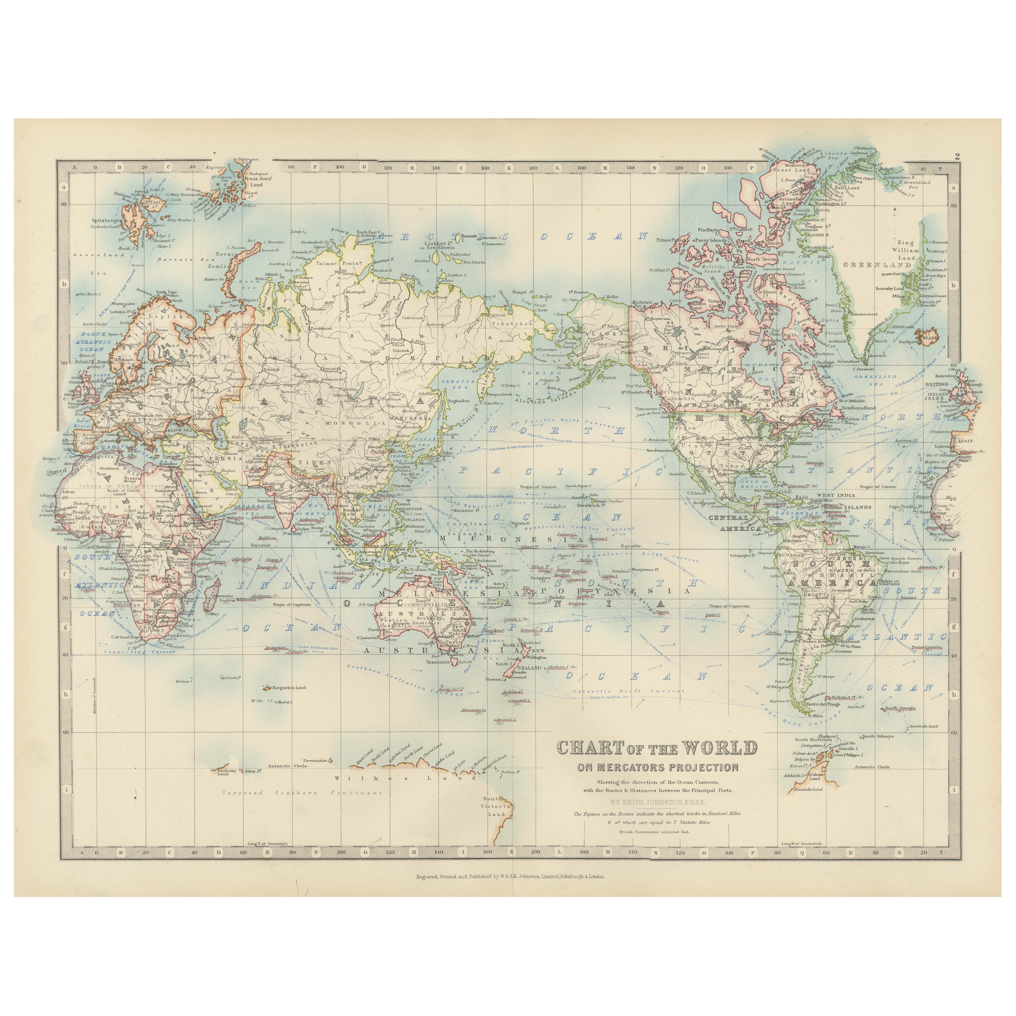
Mostra tuttoCarta del mondo antica su proiezione di Mercatore, correnti oceaniche e rotte commerciali 1903
Titolo: Carta del mondo antica su proiezione di Mercatore, 1903, che mostra le correnti oceaniche e le rotte commerciali
Descrizione:
Questa carta geografica antica, intitolata "Car...
Categoria
Inizio XX secolo, Mappe
Materiali
Carta

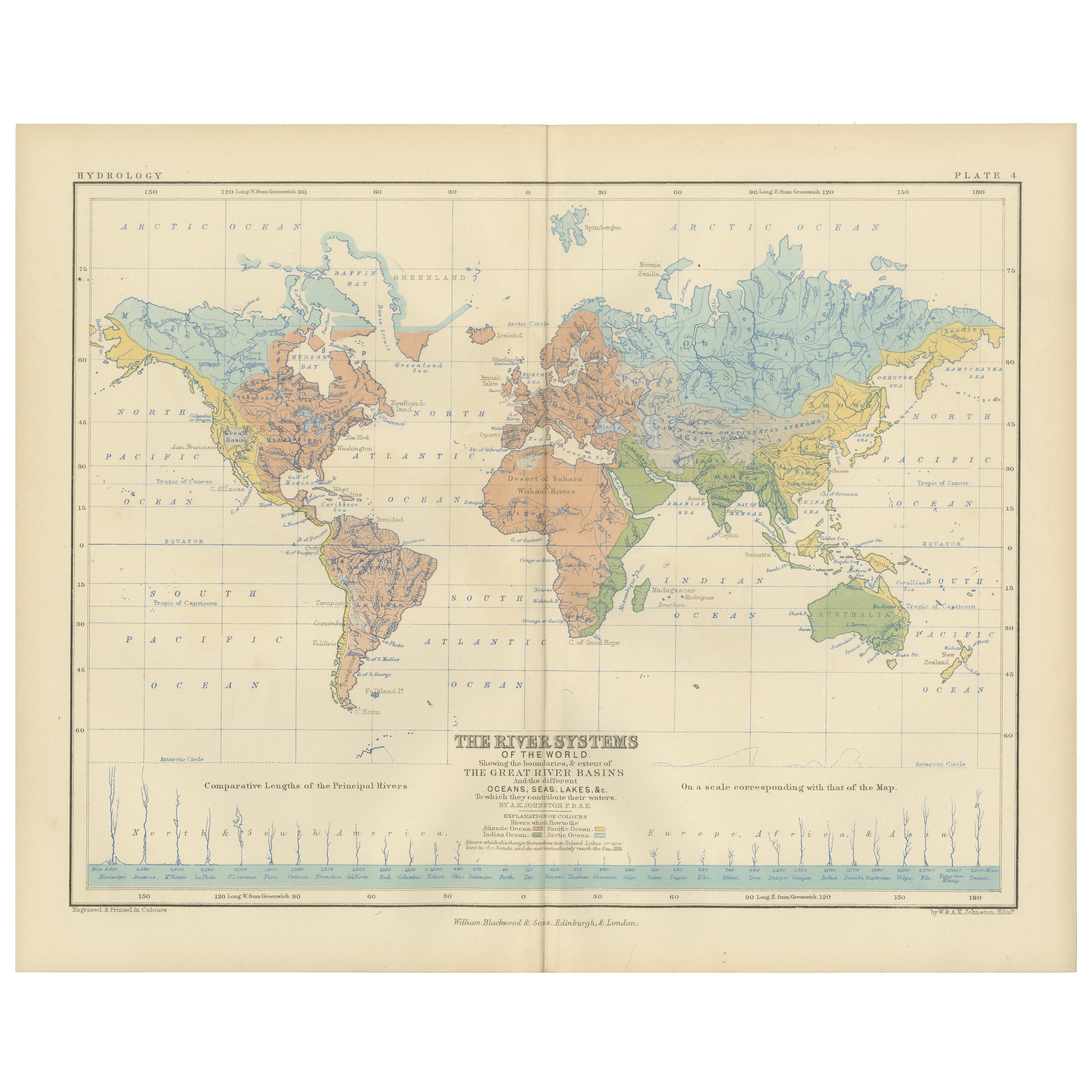
River Systems Map of the World by A.K. Johnston – Educational Print 1852
River Systems Map of the World by A.K. Johnston – Educational Print 1852
This striking 1852 map titled "The River Systems of the World" was created by the noted Scottish geographer ...
Categoria
Di antiquariato/d’epoca, Metà XIX secolo, Scozzese, Stampe
Materiali
Carta

Mappa antica che mostra le correnti oceaniche e la temperatura dell'aria, '1872'.
Due mappe su un unico foglio intitolate "Johnson's Oceans Currents (..)" e "Johnson's World showing the Distribution of the Temperature of the Air". Mappa del mondo originale che mos...
Categoria
Di antiquariato/d’epoca, Fine XIX secolo, Mappe
Materiali
Carta

280 € Prezzo promozionale
20% in meno
Wind and Hurricane Map by A.K. Johnston – Meteorological Chart 1852
Wind and Hurricane Map by A.K. Johnston – Meteorological Chart 1852
This scientifically significant 1852 map titled "The Distribution of the Constant, Periodical & Variable Winds Ov...
Categoria
Di antiquariato/d’epoca, Metà XIX secolo, Scozzese, Stampe
Materiali
Carta

Mappa antica che mostra la distribuzione delle correnti d'aria di Johnston del 1850
Mappa antica intitolata "Distribuzione geografica delle correnti d'aria". Mappa antica originale che mostra la distribuzione delle correnti d'aria. Questa mappa proviene da 'The Phys...
Categoria
Di antiquariato/d’epoca, Metà XIX secolo, Mappe
Materiali
Carta

160 € Prezzo promozionale
20% in meno
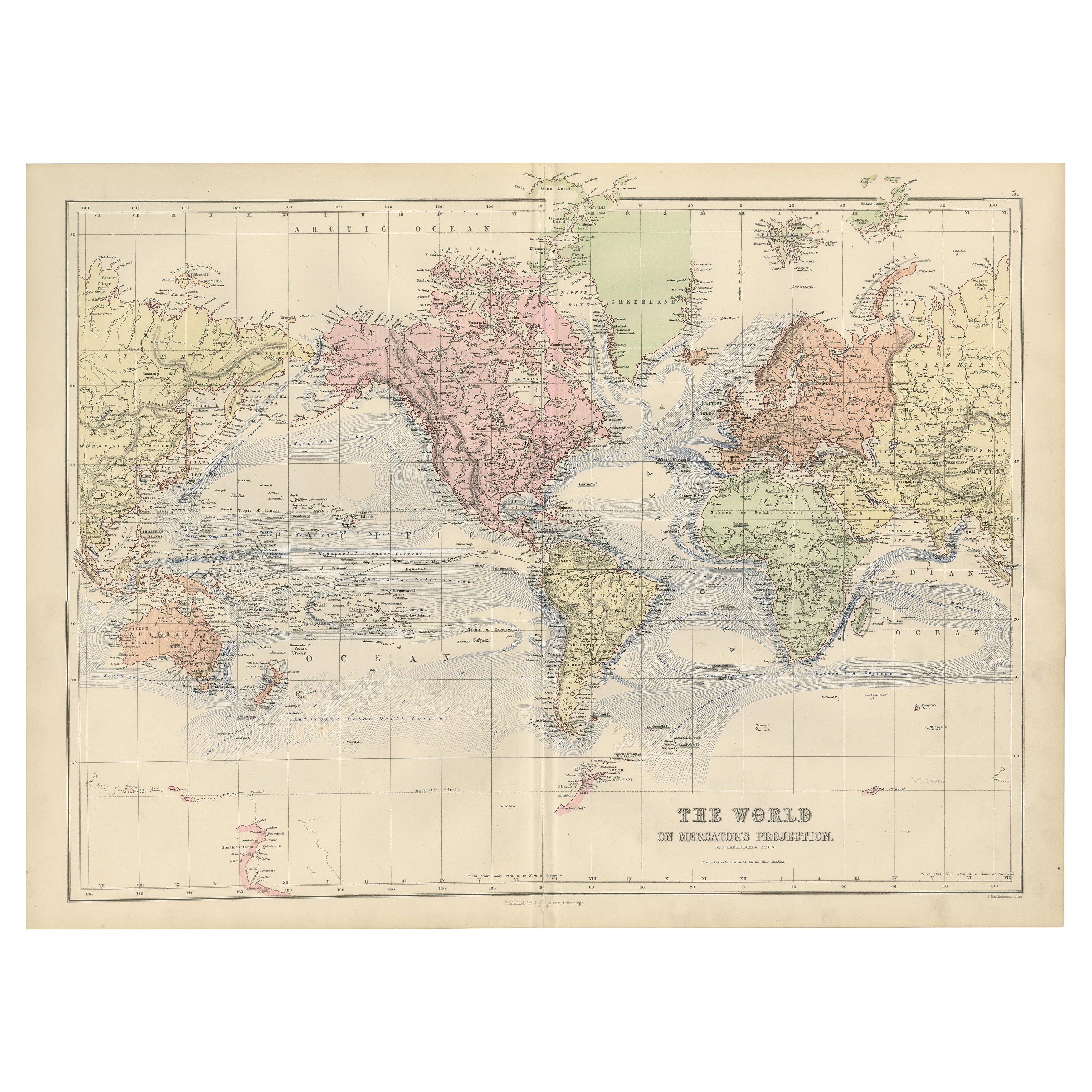
Mappa del mondo decorativa del 1884 - Proiezione di Mercatore, stampa dell'epoca vittoriana
Carta del mondo antica con proiezione di Mercatore - Atlante di Black, 1884
Questa mappa finemente incisa e colorata, intitolata The World on Mercator's Projection, è stata pubblica...
Categoria
Di antiquariato/d’epoca, Anni 1880, Scozzese, Mappe
Materiali
Carta

Ti potrebbe interessare anche
Grande mappa antica originale dell'Oceano Pacifico, Fullarton, 1870 ca.
Grande mappa dell'Oceano Pacifico
Dal celebre Atlante Reale Illustrato
Litografia di Swanston. Colore originale.
Pubblicato da Fullarton, Edimburgo. C.1870
Riparazione d...
Categoria
Di antiquariato/d’epoca, Anni 1870, Scozzese, Mappe
Materiali
Carta

Mappa antica originale del mondo di Dower, 1835 circa
Bella mappa del mondo
Disegnato e inciso da J.Dower
Pubblicato da Orr & Smith. C.1835
Senza cornice.
Spedizione gratuita
Categoria
Di antiquariato/d’epoca, Anni 1830, Inglese, Mappe
Materiali
Carta

1864 Planisfero originale illustrato - Mappa del mondo - Geografia
Immergiti nell'epico viaggio del passato con il Planisfero Storico Illustrato del 1864 di Charpentier! 🗺️ Questo tesoro cartografico ti trasporta attraverso le complessità della sto...
Categoria
Anni 1860, Stampe e riproduzioni
Materiali
Lino, Litografia, Carta

Mappa antica originale dell'emisfero occidentale di Dower, 1835 circa
Bella mappa dell'emisfero occidentale
Disegnato e inciso da J.Dower
Pubblicato da Orr & Smith. C.1835
Senza cornice.
Spedizione gratuita
Categoria
Di antiquariato/d’epoca, Anni 1830, Inglese, Mappe
Materiali
Carta

Antica mappa dell'Oceania - Incisione originale - XIX secolo
Questa mappa dell'Oceania è un'incisione realizzata nel XIX secolo.
Lo stato di conservazione delle opere d'arte è buono. Nella parte superiore del foglio, l'iscrizione "Longitudine...
Categoria
XIX secolo, Altre stampe
Materiali
Acquaforte

Mappa del mondo - Acquaforte originale - 1820
La Mappa del Mondo è un'acquaforte originale realizzata da un artista sconosciuto del XIX secolo nel 1820.
Ottimo stato su due fogli di carta bianca uniti al centro.
La mappa è un'...
Categoria
Anni 1820, Moderno, Stampe figurative
Materiali
Acquaforte
