City Maps With Color
3
to
24
611
77
428
293
158
88
79
51
43
36
29
26
22
20
16
14
14
13
9
9
8
7
7
7
7
6
6
6
5
5
5
4
4
4
3
3
3
2
2
2
2
2
2
1
1
1
104
33
31
25
21
Sort By
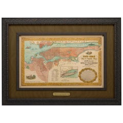
1855 "New-York City & County Map" by Charles Magnus
By Charles Magnus
Located in Colorado Springs, CO
This is a beautiful hand-colored map titled “New York City & County Map with Vicinity entire
Category
Antique 1850s American Maps
Materials
Paper
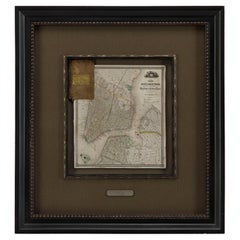
1840 "New Map of the City of New York With Part of Brooklyn & Williamsburg"
Located in Colorado Springs, CO
Presented is a hand-colored, engraved folding map titled "New Map of the City of New York With Part
Category
Antique 1840s American Maps
Materials
Paper
H 30 in W 27.5 in D 3 in
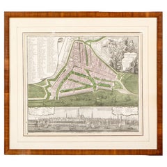
Framed 1731 Color Engraving, Map of Rotterdam by Matthaus Seutter, "Roterodami"
Located in Bridgeport, CT
"Roterodami". Seutter (1678-1757) was an important German 18th century map maker. Bird's eye view
Category
Antique 18th Century European Renaissance Maps
Materials
Glass, Wood, Paper
H 29.75 in W 32.75 in D 1 in
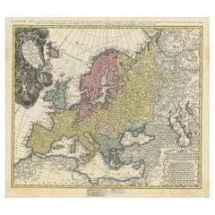
Antique Map of Europe with Elaborate Title Cartouche, c.1750
Located in Langweer, NL
Antique map of Europe titled 'Europa Secundum legitimas Projectionis Stereographicae regulas et
Category
Antique 18th Century Maps
Materials
Paper
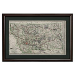
"Clason's Guide Map of Montana" by The Clason Map Company, Circa 1920s
Located in Colorado Springs, CO
transitioned to railroad and city maps of the local area. In the 1920’s, as cars became more commonplace, the
Category
Vintage 1920s American Art Deco Maps
Materials
Paper
H 23.13 in W 33.88 in D 1.5 in
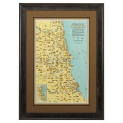
Pictorial Map of Chicago, circa 1926
Located in Colorado Springs, CO
This is a colorful folding pocket map of the city of Chicago, published by The Clason Map Co
Category
Vintage 1920s American Maps
Materials
Paper
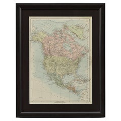
1875 "North America" Map by J. Bartholomew
Located in Colorado Springs, CO
rivers, mountain ranges, and cities are labeled on the map, and country borders are emphasized in red
Category
Antique 1870s Scottish Maps
Materials
Paper
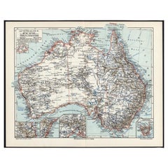
German Antique Map of Australia, Meyers, 1885
Located in Langweer, NL
Australien.' (Map of Australia. With inset maps of the large cities and Tasmania.) This attractive
Category
Antique 19th Century Maps
Materials
Paper
1814 Map of "Russian Empire" Ric.r032
Located in Norton, MA
.
Publication History
Thomson maps are known for their stunning color, awe inspiring size, and magnificent
Category
Antique 19th Century Unknown Maps
Materials
Paper
Historical Map Depicting the Continent of Asia, 1882
Located in Langweer, NL
time. The map is color-coded to differentiate between the various countries, regions, and their
Category
Antique 1880s Maps
Materials
Paper
1858 Colton's Map of New York, Ric.B011
Located in Norton, MA
An 1858 Colton's map of New York
Ric.b011
Colton’s New York, 1858 - A large original color
Category
Antique 19th Century Unknown Maps
Materials
Paper
Antique Lithography Map, Environs of Southampton, English, Framed, Victorian
Located in Hele, Devon, GB
a desirable antique lithography map of Southampton, with fine cartographic interest of the city
Category
Antique Late 19th Century British Victorian Maps
Materials
Wood
H 13.98 in W 11.42 in D 0.6 in
Decorative Antique Map of Eastern Canada, Published in 1882
Located in Langweer, NL
detailed intricately.
On the map, the provinces of Nova Scotia and New Brunswick are color differentiated
Category
Antique 1880s Maps
Materials
Paper
Free Shipping
H 14.97 in W 22.45 in D 0 in
Original 1882 Map of Arabia, Red Sea & Persian Gulf
Located in Langweer, NL
This print is a historically significant map titled "Arabia, the Red Sea, and the Persian Gulf
Category
Antique 1880s Maps
Materials
Paper
Antique Map Depicting Burma, Siam, Annam (Vietnam) and Japan, 1882
Located in Langweer, NL
The image shows two maps side by side from the 1882 atlas by Blackie & Son. On the left, the map is
Category
Antique 1880s Maps
Materials
Paper
Free Shipping
H 14.97 in W 22.45 in D 0 in
Vintage Reproduction 17th Century Map of Europe, American, Cartography, Blaeuw
Located in Hele, Devon, GB
in colour
Annotated with countries, key cities and examples of national dress
Dressed to the eye
Category
Late 20th Century Central American Mid-Century Modern Maps
Materials
Glass, Wood, Paper
H 30.32 in W 38.39 in D 1.38 in
Original Antique Map of the British Isles Surrounded by Text
Located in Langweer, NL
is color coded and thoroughly labeled with provinces and many major and minor cities. Since northern
Category
Antique Late 18th Century Maps
Materials
Paper
Historical Large Map of Kyoto, Japan (1905) - Published by Kobayashi
Located in Langweer, NL
the top, translates to "Map of Kyoto City".
### Interesting Aspects
1. **Historical Context
Category
Early 20th Century Maps
Materials
Paper
No Reserve
H 21.26 in W 30.91 in D 0.02 in
Very Large Vintage Map of Canada, German, Education, Institution, Cartography
Located in Hele, Devon, GB
This is a very large vintage map of Canada. A German, quality printed educational or institution
Category
Mid-20th Century German Maps
Materials
Paper
H 77.56 in W 85.04 in D 1.19 in
Map of Soria Province, 1901: Detailed Cartography of Northeastern Spain
Located in Langweer, NL
The map is a historical map of the province of Soria from 1901.
A decorative coat of arms
Category
Antique Early 1900s Maps
Materials
Paper
Free Shipping
H 14.77 in W 20.08 in D 0 in
Black Sea in Antiquity: Pontus Euxinus Map, Published in 1880
Located in Langweer, NL
This map, titled "PONTUS EUXINUS," depicts the Black Sea region, historically known as the Pontus
Category
Antique 1880s Maps
Materials
Paper
Free Shipping
H 15.56 in W 18.51 in D 0 in
Antique Map of Sweden, Norway and Denmark by Johnson, 1872
Located in Langweer, NL
The image is an antique map, a two-page spread from "Johnson's New Illustrated Family Atlas of the
Category
Antique Late 19th Century Maps
Materials
Paper
Antique Map of the Area centered on the Rhine River, Germany
Located in Langweer, NL
Antique map titled 'Uterque Rheni Circulus Superior (..)'. Fine old color map of the area centered
Category
Antique Early 18th Century Maps
Materials
Paper
Old Map of Vaucluse, France: A Cartographic Celebration of Viticulture, 1852
Located in Langweer, NL
region's geography, economy, and notable figures. The use of color along the boundaries makes the map not
Category
Antique 1850s Maps
Materials
Paper
H 14.18 in W 20.99 in D 0 in
A Decorative Map of Nova Scotia and Newfoundland by John Tallis, 1851
Located in Langweer, NL
activity of the region.
The map's detailed geographic features are color-coded, depicting the intricate
Category
Antique 1850s Maps
Materials
Paper
1899 Poole Brothers Antique Railroad Map of the Illinois Central Railroad
Located in Colorado Springs, CO
:
Map is in good condition, with original color. Minor stains along the bottom margin. Loss along top
Category
Antique 1890s American Maps
Materials
Paper
Territories of Antiquity: The Northern Division of Syria, A Detailed 1882 Map
Located in Langweer, NL
features such as mountain ranges and valleys depicted using hachures. The map meticulously charts cities
Category
Antique 1880s Maps
Materials
Paper
H 14.97 in W 11.03 in D 0 in
Antique Map Depicting Sydney and Surrounding Areas, Known as Port Jackson, c1889
Located in Langweer, NL
," published in Paris.
The map is a color-printed engraving, a common technique of the time, which allowed for
Category
Antique 1880s Maps
Materials
Paper
Free Shipping
H 10.16 in W 13.39 in D 0 in
1852 Map of Haut-Rhin: An Illustrated Gateway to Alsace's Viticultural Splendors
Located in Langweer, NL
region's geography, economy, and notable figures. The use of color along the boundaries makes the map not
Category
Antique 1850s Maps
Materials
Paper
H 14.18 in W 20.75 in D 0 in
1859 "Colton's New Map of the State of Texas..." by Johnson & Browning
Located in Colorado Springs, CO
Presented is "Colton's New Map of the State of Texas Compiled from De Cordova's Large Map
Category
Antique 1850s American Maps
Materials
Paper
H 27.75 in W 38.5 in D 1.38 in
Imperium Romanum: A Detailed Map of the Roman Empire in its Zenith, 1880
Located in Langweer, NL
This original antique map, titled "IMPERIVM ROMANVM", is a detailed depiction of the Roman Empire
Category
Antique 1880s Maps
Materials
Paper
Free Shipping
H 15.56 in W 18.51 in D 0 in
Cartographic Elegance of the Mughal Dominion in a Hand-Colored Antique Map, 1705
Located in Langweer, NL
This original antique map titled “'T Ryk van den Grooten Mogol” by Nicolas Sanson from 1705 is an
Category
Antique Early 1700s Maps
Materials
Paper
Free Shipping
H 8.67 in W 11.89 in D 0 in
1847 Antique Map of Mexico, Texas and California by Samuel Augustus Mitchell
By Samuel Augustus Mitchell 1
Located in Colorado Springs, CO
"Map of the Principal Roads from Vera Cruz and Alvarado to the City of Mexico," the corresponding
Category
Antique 1840s American Maps
Materials
Paper
H 32 in W 23.63 in D 0.5 in
Paris Street View #9 – Michael Wolf, Google Maps, Color Photography, Pixel
By Michael Wolf
Located in Zurich, CH
of Michael Wolf’s work is life in mega-cities. His projects document both the architecture and the
Category
Early 2000s Contemporary Color Photography
Materials
C Print
Free Shipping
H 70.01 in W 90.01 in
Attractive Original Hand-Colored Map of the Swabia Region of Germany, 1799
Located in Langweer, NL
detailed with color coding according to region. Shows forests, cities, palaces, forts, roads and rivers
Category
Antique 1790s Maps
Materials
Paper
H 19.97 in W 23.23 in D 0 in
Map of Rhône: Culture and Commerce in Lyon's Silk and Wine Legacy, 1852
Located in Langweer, NL
region's geography, economy, and notable figures. The use of color along the boundaries makes the map not
Category
Antique 1850s Maps
Materials
Paper
Map Road Strip Britannia Sheet 2 John Ogilby London Aberistwith Islip Bramyard
By John Ogilby
Located in BUNGAY, SUFFOLK
of England and Wales.
Strip map Islip to Bramyard, on a scale of approximately one inch to the mile
Category
Antique 17th Century English Baroque Maps
Materials
Paper
H 14.38 in W 19.3 in D 0.79 in
The Illustrated Map of the Var Department from the Atlas National Illustré, 1856
Located in Langweer, NL
This original hand-colored map is from the "Atlas National Illustré," a work by Victor Levasseur, a
Category
Antique 1850s Maps
Materials
Paper
H 14.18 in W 20.87 in D 0 in
Antique Map of the French Province Maine, Showing Le Mans, Alencon Etc., Ca1640
Located in Langweer, NL
Antique map titled 'Le Maine'.
Old map of the province of Maine, France. It shows the cities of
Category
Antique 1640s Maps
Materials
Paper
H 19.49 in W 23.04 in D 0 in
17th Century Hand-Colored Map of a Region in West Germany by Janssonius
By Johannes Janssonius
Located in Alamo, CA
spotting in the margins of the sheet, but not affecting the map. There is minimal color offset in the upper
Category
Antique Mid-17th Century Dutch Maps
Materials
Paper
Original Old Composite of Several Maps of the Ancient World on One Sheet, 1880
Located in Langweer, NL
of color is strategic, demarcating different regions for easy visual distinction.
The map is a rich
Category
Antique 1880s Maps
Materials
Paper
Free Shipping
H 15.56 in W 18.51 in D 0 in
Prussia, Poland, N. Germany, Etc: A Hand-colored 17th Century Map by Janssonius
By Johannes Janssonius
Located in Alamo, CA
This is an attractive hand-colored copperplate engraved 17th century map of Prussia entitled
Category
Antique Mid-17th Century Dutch Maps
Materials
Paper
H 21.25 in W 24.63 in D 0.07 in
Map Room, Caprarola, Italy by David Burdeny
By David Burdeny
Located in New York City, NY
the world’s most iconic cities while his vast aerial photographs serve to build bridges of empathy to
Category
2010s Contemporary Color Photography
Materials
Archival Pigment
Large Format Polaroid Photograph Still Life Color Photo Dye Print Betty Hahn Art
Located in Surfside, FL
Lifes"
New York: Paradox Editions, Ltd., 1980. 5 original Polaroid color prints. Each hand signed
Category
1980s Contemporary Color Photography
Materials
Color, Polaroid
Large Format Polaroid Photograph Still Life Color Photo Dye Print Betty Hahn Art
By Betty Hahn
Located in Surfside, FL
., 1980. 5 original Polaroid color prints. Each hand signed, titled, dated and numbered 37/40 in ink in
Category
1980s Contemporary Color Photography
Materials
Color, Polaroid
Ancient Gaul: A Cartographic Overview of Gallic Tribes and Roman Provinces, 1880
Located in Langweer, NL
. **Regional Divisions**: The map is color-coded to delineate the various tribes or administrative divisions
Category
Antique 1880s Maps
Materials
Paper
Free Shipping
H 15.56 in W 18.51 in D 0 in
Original Antique Engrving of Chinese Tartary in the 18th Century, 1737
Located in Langweer, NL
compass roses. Some maps bound out of sequence, some folded and some outline hand color. Descriptive text
Category
Antique 1730s Maps
Materials
Paper
Mediterranean Encounters: From the Punic Wars to the Hannibalic War, 1880
Located in Langweer, NL
The map, with the title "MARE INTERNUM cum populis adiacentibus a bello Hannibalico usque ad
Category
Antique 1880s Maps
Materials
Paper
Free Shipping
H 15.56 in W 18.51 in D 0 in
Cartographic Elegance: The British Raj's India, 1882 Atlas by Blackie and Son
Located in Langweer, NL
for the time.
The northern map includes the Himalayan frontier, with color-coded regions denoting
Category
Antique 1880s Maps
Materials
Paper
H 14.97 in W 22.45 in D 0 in
Roman Balkans: Pannonia, Illyricum, Dacia, Moesia, Thracia, Macedonia and Thyris
Located in Langweer, NL
and color codes used throughout the map.
This map would serve as a detailed educational resource for
Category
Antique 1880s Maps
Materials
Paper
Free Shipping
H 15.56 in W 18.51 in D 0 in
Zaragoza: Crossroads of Heritage - The 1901 Cartographic Chronicle
Located in Langweer, NL
. The provincial capital, Zaragoza city, is prominently marked. Symbols used on the map include those
Category
Antique Early 1900s Maps
Materials
Paper
Free Shipping
H 14.77 in W 20.08 in D 0 in
Roman Frontiers Engraved: Germania, Raetia, and Noricum, Published in 1880
Located in Langweer, NL
The map, titled "GERMANIA, RAETIA, NORICUM," depicts the regions of Germania, Raetia, and Noricum
Category
Antique 1880s Maps
Materials
Paper
Free Shipping
H 15.56 in W 18.51 in D 0 in
Ancient Italy: Regions and Rome in the Roman Empire, Published in 1880
Located in Langweer, NL
. **Inset Map of Rome (ROMA)**: There is an inset map of ancient Rome, with color-coding to highlight
Category
Antique 1880s Maps
Materials
Paper
Free Shipping
H 15.56 in W 18.51 in D 0 in
Zamora: A Mosaic of Romanesque Heritage and Natural Wonders in Spain, 1901
Located in Langweer, NL
color gradations to indicate elevation, highlighting the topographical diversity of the region. The city
Category
Antique Early 1900s Maps
Materials
Paper
Free Shipping
H 14.77 in W 20.08 in D 0 in
Levasseur's 1852 Cartographic Portrait of Gironde: Celebrating the Bordeaux Wine
Located in Langweer, NL
region's geography, economy, and notable figures. The use of color along the boundaries makes the map not
Category
Antique 1850s Maps
Materials
Paper
H 20.67 in W 14.06 in D 0 in
Vintage Cartographic Collection Set of India Explored - W. G. Blackie's 1859
Located in Langweer, NL
, major rivers like the Ganges, and key cities of the time. The map is adorned with ornate borders and
Category
Antique Mid-19th Century Maps
Materials
Paper
H 14.57 in W 21.26 in D 0.02 in
Duchy of Brunswick-Lüneburg, 1595: A Renaissance Cartographic Masterpiece
Located in Langweer, NL
Renaissance.
Stretching northward to the Elbe River and encompassing the notable city of Hamburg, the map is
Category
Antique 16th Century Maps
Materials
Paper
H 16.93 in W 11.03 in D 0 in
Antique Rand McNally & Company Schoolmap. Ancient Oriental Empires. Historical
By Rand McNally & Co.
Located in ROTTERDAM, ZH
Road Map of New York City & Vicinity, in 1904. In 1910,[citation needed] the company acquired the line
Category
Vintage 1920s American American Classical Maps
Materials
Fabric, Paper
H 43.31 in W 64.18 in D 1.19 in
Burgundy's Viticultural Landscape: A 1640 Cartographic Engraving by Willem Blaeu
Located in Langweer, NL
, including the rivers, cities, and topographical features that were known to Europeans. The use of color to
Category
Antique 1640s Maps
Materials
Paper
Free Shipping
H 18.51 in W 23.43 in D 0 in
Edinburgh, Scotland Coast: A 17th Century Hand-Colored Sea Chart by Collins
By Captain Greenvile Collins
Located in Alamo, CA
in 1693. It depicts the city of Edinburgh, Scotland with its castle and abbey and adjacent waterways
Category
Antique Late 17th Century English Maps
Materials
Paper
H 23 in W 27.75 in D 0.5 in
- 1
- ...
Get Updated with New Arrivals
Save "City Maps With Color", and we’ll notify you when there are new listings in this category.
City Maps With Color For Sale on 1stDibs
You are likely to find exactly the city maps with color you’re looking for on 1stDibs, as there is a broad range for sale. Find abstract versions now, or shop for abstract creations for a more modern example of these cherished works. If you’re looking for a city maps with color from a specific time period, our collection is diverse and broad-ranging, and you’ll find at least one that dates back to the 18th Century while another version may have been produced as recently as the 21st Century. Adding a city maps with color to a room that is mostly decorated in warm neutral tones can yield a welcome change — find a piece on 1stDibs that incorporates elements of gray, brown, beige, black and more. Creating a city maps with color has been a part of the legacy of many artists, but those crafted by Chase Langford, William Gropper, David Fredrik Moussallem, Elise Wagner and Timothy Hogan are consistently popular. Artworks like these of any era or style can make for thoughtful decor in any space, but a selection from our variety of those made in paint, oil paint and fabric can add an especially memorable touch.
How Much is a City Maps With Color?
The average selling price for a city maps with color we offer is $2,556, while they’re typically $0 on the low end and $166,026 for the highest priced.
More Ways To Browse
Cs Lewis
Mid19th Century Oil Portraits
Paintings 18 And19 Th Century
Pirate Flag
Richard Gorman
Robert Madden
21c Penguin
Backwards B And R
Jan Dyer
Mid20th Century Abstract
Sellers Vancouver Canada
Used Library Card Catalog
18 Th Century Bird Prints
Antique Montana Map
Canadian Railway Map
German Kugel
Nathan Youngblood
Yacht Cannon
