Items Similar to John Speede Map The Countye Palatine of Chester with that most ancient citie

Want more images or videos?
Request additional images or videos from the seller
1 of 5
John SpeedJohn Speede Map The Countye Palatine of Chester with that most ancient citie 1676
1676
About the Item
To see our other views and maps of England - including London, Oxford and Cambridge, scroll down to "More from this Seller" and below it click on "See all from this Seller" - or send us a message if you cannot find the view you want.
John Speed/Speede (1551/2-1629)
The Countye Palatine of Chester with that most ancient citie described
Performed by John Speede assisted by William Smyth. And are to be sold by Thomas Bassett in Fleetstreet, and Richard Chiswell in St Paul's Churchyard.
Probably the most famous early English mapmaker, John Speed's early life is somewhat of an enigma. He is believed to have trained as a rolling-press printer, but he was at heart an historian granted a sinecure in the Customs House by Queen Elizabeth to indulge his passion, later becoming a Fellow of the Society of Antiquaries. His first maps were historical, of the Holy Land 'Canaan as it was Possessed both in Abraham and Israels Dayes' and of England and Ireland recording 'all their Civill Warres since the Conquest'.
In 1611 he published his 'Hostory of Great Britaine' which he regarded as his magnum opus, but it was the companion atlas 'Theatre of the Empire of Great Britaine' that - as the first printed atlas of Great Britain - sealed his reputation. William Rogers engraved the first map, 'the County Palatine of Chester' in about 1600, but following his untimely death the task of engraving was passed to Jodocus Hondius of Amsterdam.
By 1612 the atlas was complete, the maps famed for their decorative elements. Many have town plans - Brtiain's first series of such plans - and descriptive text was printed to the reverse until the 1676 edition. Later printings (up until 1770) were issued without this text. By 1627 it has become a part of a world atlas 'Prospect of the Most Famous Parts of the World'. During the 17th century the plates passed through the hands of a series of publishers, the 1676 edition (as here) of Thomas Bassett and Richard Chiswell being regarded as its high point with the inclusion for the first time of a series of important maps.
- Creator:John Speed (1552 - 1629)
- Creation Year:1676
- Dimensions:Height: 15.36 in (39 cm)Width: 20.08 in (51 cm)
- Medium:
- Movement & Style:
- Period:
- Condition:Trimmed and other small losses outside platemark. Some toning and spotting to paper as usual. Later but well undertaken hand-colouring. Old tape mark to top outside platemark. Generally good condition.
- Gallery Location:London, GB
- Reference Number:1stDibs: LU79535859742
About the Seller
4.8
Platinum Seller
These expertly vetted sellers are 1stDibs' most experienced sellers and are rated highest by our customers.
Established in 2014
1stDibs seller since 2017
282 sales on 1stDibs
Typical response time: <1 hour
- ShippingRetrieving quote...Ships From: London, United Kingdom
- Return PolicyA return for this item may be initiated within 14 days of delivery.
More From This SellerView All
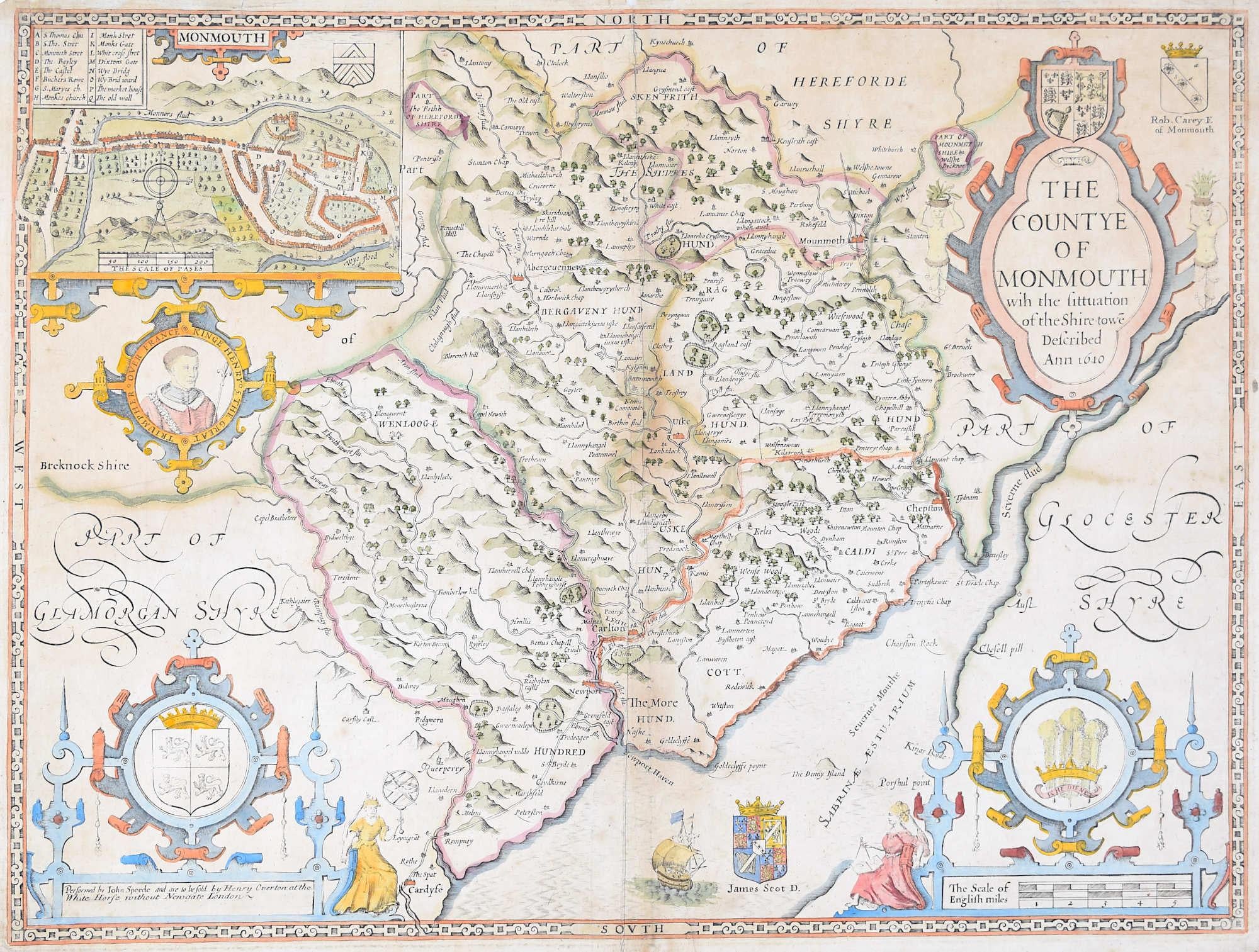
- John Speede Map The Countye of MonmouthBy John SpeedLocated in London, GBTo see our other views and maps of England - including London, Oxford and Cambridge, scroll down to "More from this Seller" and below it click on "See all from this Seller" - or send...Category
17th Century Realist Landscape Prints
MaterialsEngraving
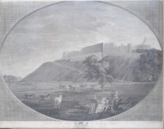
- 1782 View of Windsor Castle by James Fittler RA George Robertson John BoydellBy James FittlerLocated in London, GBTo see our other Architectural Prints and Drawings including other views of Windsor, scroll down to "More from this Seller" and below it click on "See all from this Seller." James Fittler (1758-1835) after George Robertson...Category
Mid-18th Century Realist Landscape Prints
MaterialsEngraving
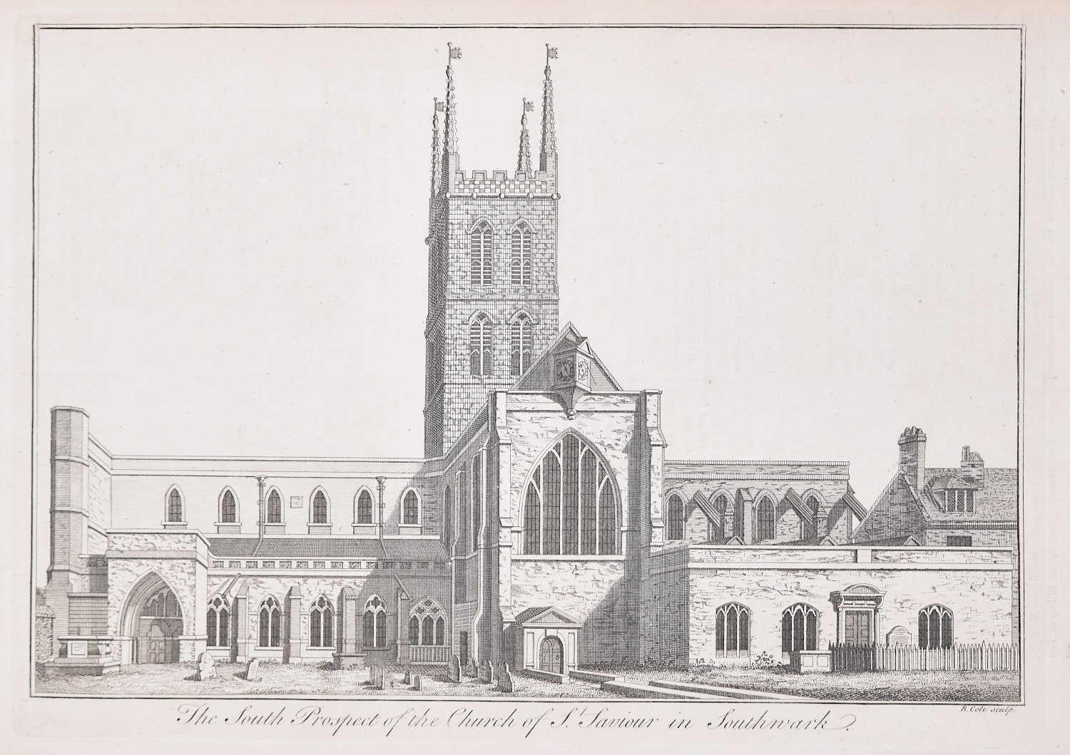
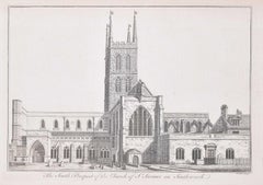
- Southwark Cathedral engraving c. 1753 for Stow's Survey of LondonLocated in London, GBTo see our other views and maps of England - including London, Oxford and Cambridge, scroll down to "More from this Seller" and below it click on "See all from this Seller" - or send...Category
1750s Realist Landscape Prints
MaterialsEngraving
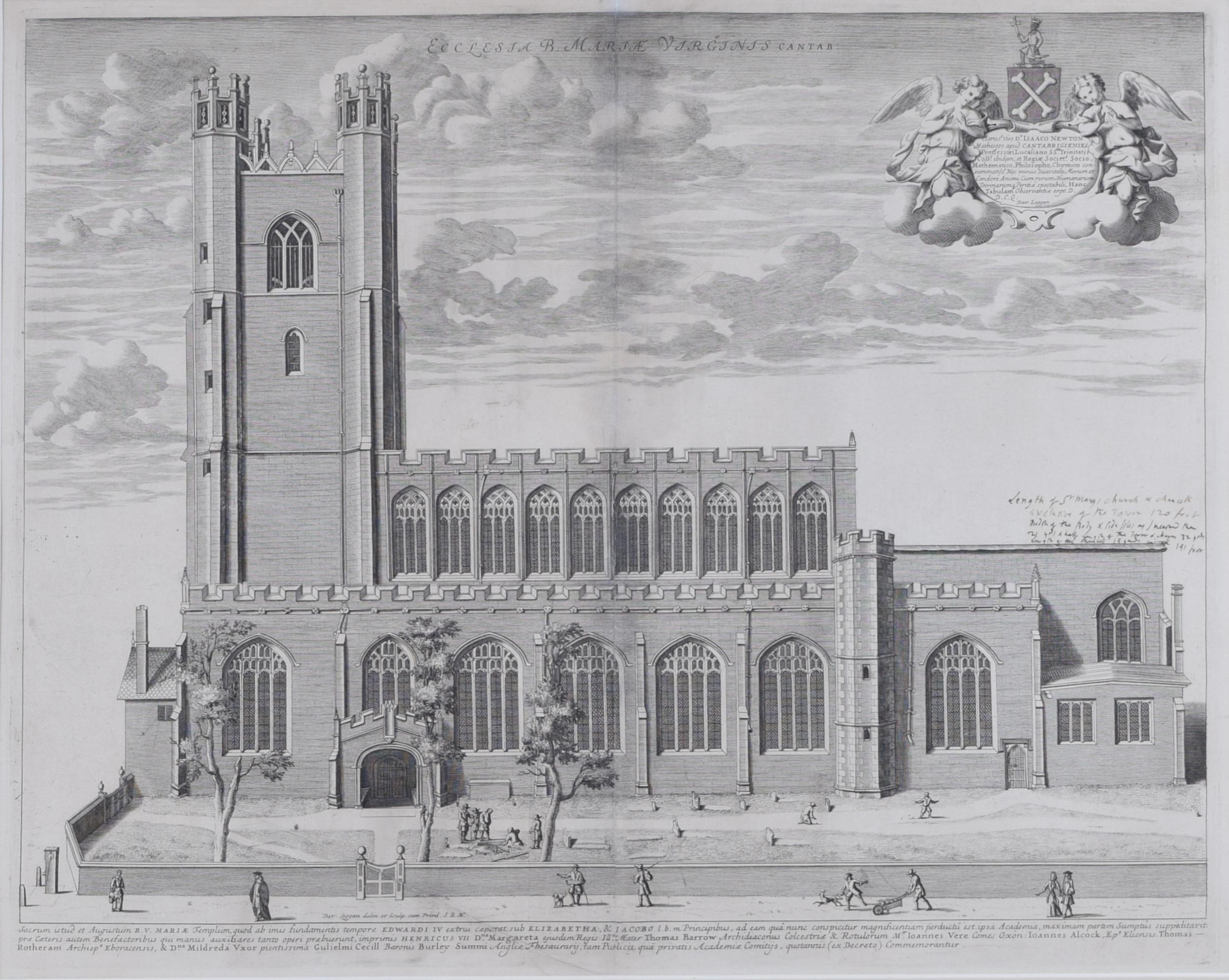
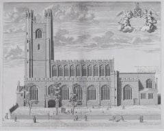
- David Loggan: Great St Mary's Church Cambridge University engraving 1690By David LogganLocated in London, GBTo see our other views of Oxford and Cambridge, scroll down to "More from this Seller" and below it click on "See all from this Seller" - or send us a message if you cannot find the ...Category
1690s Realist Prints and Multiples
MaterialsEngraving
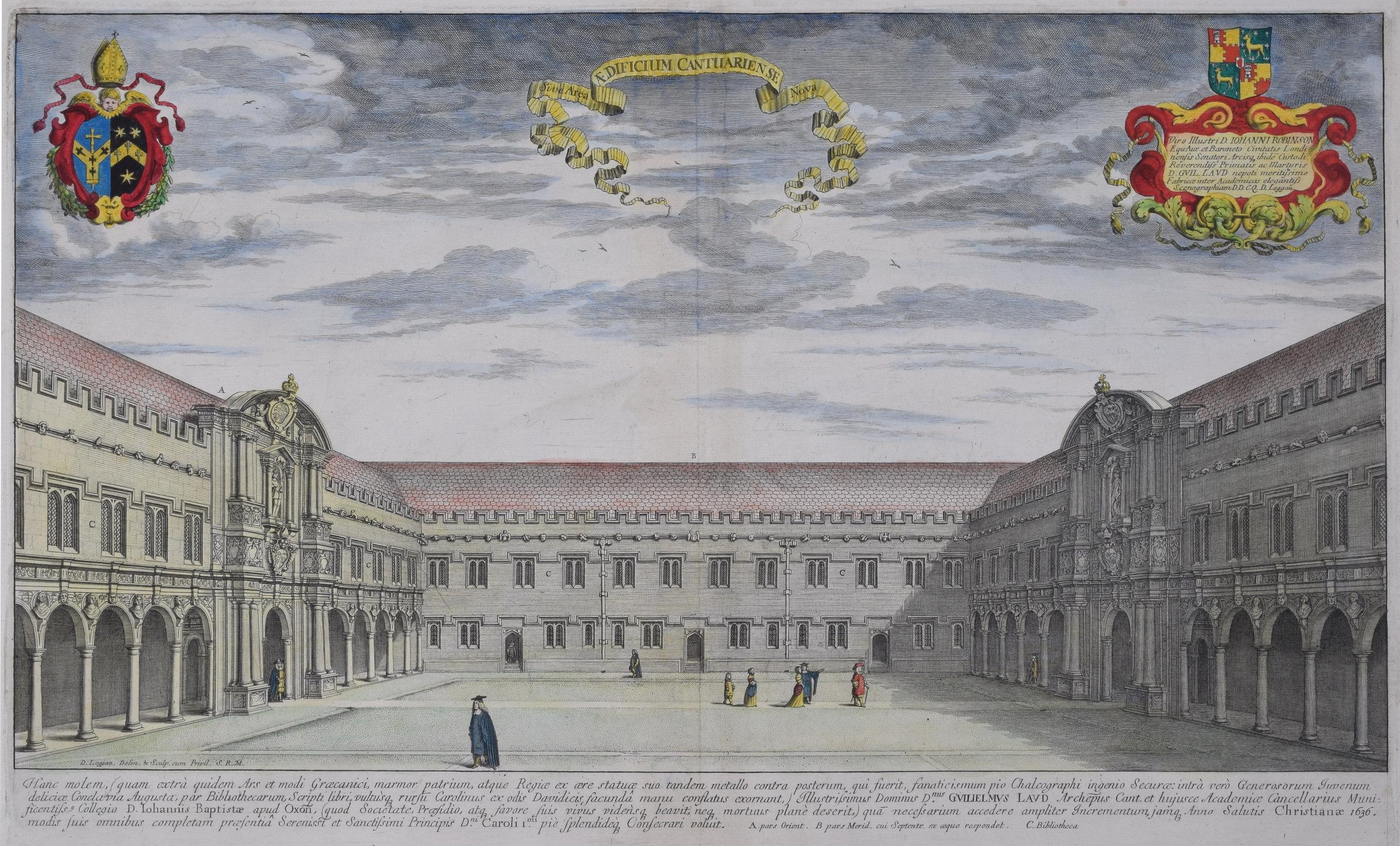
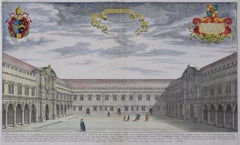
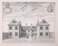
- David Loggan St John's College Oxford Canterbury Quad engraving 1675By David LogganLocated in London, GBDavid Loggan (1634-1692) St John's College Oxford - Canterbury Quad Engraving 1675 31x50cm Baptised in Danzig in 1634 Loggan's parents were English and Scottish. Studying engraving in Danzig with Willem Hondius (1598-1652 or 1658) he moved to London in the late 1650s producing the engraved title-page for the folio 1662 Book of Common Prayer. Marrying in 1663 he moved to Nuffield, Oxfordshire in 1665 to avoid the Plague and was in 1668/9 appointed Public Sculptor to the nearby University of Oxford having been commissioned to produce bird’s-eye views of all the Oxford Colleges. He lived in Holywell Street as he did this. Oxonia illustrata was published in 1675, with the help of Robert White (1645-1704). Following its completion he commenced work on his equivalent work for Cambridge, Cantabrigia Illustrata which was finally published in 1690 when he was made engraver to Cambridge University. Oxonia illustrata also includes an engraving of Winchester College (sharing its founder – William of Wykeham – with New College) whilst Cantabrigia illustrata includes one of Eton College (which shares its founder – Henry VIII – with King’s College). Bird’s-eye views required a particular talent as an architectural perspectivist of that era as it was not until 1783 that the first living thing (a sheep, named Montauciel ‘climb to the sky’) was sent aloft by the Mongolfier brothers in a balloon. Loggan thus had to rely on his imagination in conceiving the views. Loggan’s views constitute the first accurate depictions of the two Universities, in many ways unchanged today. Whilst the Oxford engravings were produced in reasonable numbers and ran to a second edition (on thicker paper and with a plate number in the bottom right-hand corner), those of Cambridge were printed in smaller numbers and no second edition was produced. The Dutchman Pieter van der Aa published some miniature versions of the engravings for James Beverell’s guidebook to the UK Les Delices de la Grande Bretagne c. 1708. Edmund Hort New (1871-1931) produced a series of pen-and-ink drawings of views of Oxford that paid homage to Loggan showing the development of the city in the following two hundred years. They were turned into photoengravings by Emery Walker...Category
1670s Realist Prints and Multiples
MaterialsEngraving
- David Loggan Trinity College Cambridge Bishop's Hostel engraving 1690By David LogganLocated in London, GBTo see our other views of Oxford and Cambridge, scroll down to "More from this Seller" and below it click on "See all from this Seller" - or send us a message if you cannot find the view you want. David Loggan (1634-1692) The Bishop's Hostal, Trinity College Cambridge...Category
1690s Realist Prints and Multiples
MaterialsEngraving

You May Also Like
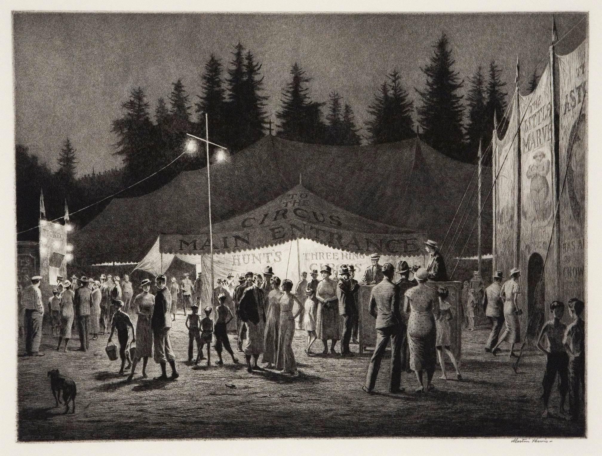
- Circus Night.By Martin LewisLocated in New York, NYSigned in pencil by the artist. Drypoint and sandground, 1933. Edition 100, recorded impressions 43. Of the forty-three recorded impressions printed, a group of those were unsigne...Category
1930s Realist Landscape Prints
MaterialsDrypoint
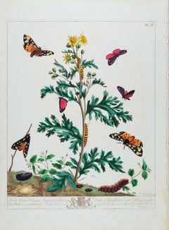
- The Natural History of Moths: An Antique Hand-colored Engraving by Moses HarrisBy Moses HarrisLocated in Alamo, CAThis is a hand-colored engraving depicting the natural history of Pinkunderwing Moths, Cream Spotted Tyger Moths, which is plate 4 from Moses Harris' publication "The Aurelian: or Na...Category
Mid-19th Century Realist Landscape Prints
MaterialsEngraving
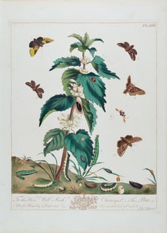
- Natural History of Moths and a Beetle: A Hand-colored Engraving by Moses HarrisBy Moses HarrisLocated in Alamo, CAThis is a hand-colored engraving depicting the natural history of moths and a beetle, which is plate 22 from Moses Harris' publication "The Aurelian: or Natural History of English In...Category
Mid-19th Century Realist Landscape Prints
MaterialsEngraving
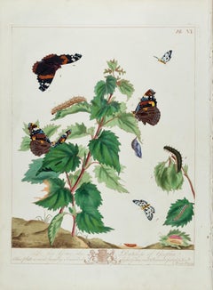
- Admirable Butterflies, Magpie Moths: A Hand-colored Engraving by Moses HarrisBy Moses HarrisLocated in Alamo, CAThis is a hand-colored antique engraving depicting the natural history of the Admirable Butterfly and the Small Magpie Moth, which is plate 6 from Moses Harris' publication "The Aure...Category
Mid-19th Century Realist Landscape Prints
MaterialsEngraving
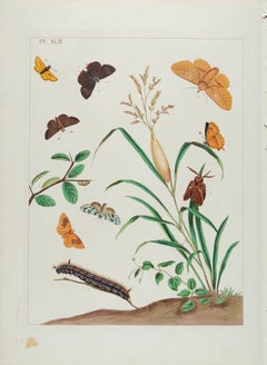
- Butterflies & Moths: An Antique Hand-colored Engraving by Moses HarrisBy Moses HarrisLocated in Alamo, CAThis is a hand-colored antique engraving depicting the natural history of the Drinker Moth, the Brown Hairstreak Butterfly, the Larke Skipper Butterfly, the Small Skipper Butterfly, ...Category
Mid-19th Century Realist Landscape Prints
MaterialsEngraving
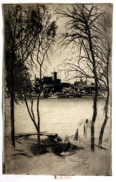
- Laburnums and BatterseaBy Theodore Casimir RousselLocated in New York, NYTheodore Roussel, Laburnums and Battersea, etching and drypoint, 1889/1890 and 1898; signed in the plate lower right, and signed in pencil on the tab, with the inscription IMP. Hausb...Category
Late 19th Century Realist Landscape Prints
MaterialsEtching, Drypoint