Items Similar to 16th c. woodcut map - Tabula Asiae Vlll

Want more images or videos?
Request additional images or videos from the seller
Sebastian Münster16th c. woodcut map - Tabula Asiae Vlll1545
1545
About the Item
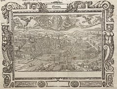
SEBASTIAN MUNSTER (1488-1652)
ASIAE TABVLA Vlll 1540 (45)
Woodcut from Munster's edition of Geographia Universalis, Basel, Henri Petri. 1545 edition of Ptolemy. Shows ancient Scythia Extra, India Gangen, Tartary: present day central Asia, Northern India, Pakistan and Southwest China. With the usual centerfold, some minor soiling and minor foxing at upper sheet edges. 10 3/8 x 13 1/2 inches, sheet 11 5/8 x 14 7/8 inches.
The map is enhanced by Wonderful decorative monsters from medieval legends. One of the classic monster maps.
- Creator:Sebastian Münster (1488 - 1552, German)
- Creation Year:1545
- Dimensions:Height: 9.75 in (24.77 cm)Width: 13.5 in (34.29 cm)
- Medium:
- Movement & Style:
- Period:
- Condition:see description.
- Gallery Location:Santa Monica, CA
- Reference Number:1stDibs: LU41132274871
About the Seller
5.0
Recognized Seller
These prestigious sellers are industry leaders and represent the highest echelon for item quality and design.
Platinum Seller
These expertly vetted sellers are 1stDibs' most experienced sellers and are rated highest by our customers.
Established in 1977
1stDibs seller since 2016
264 sales on 1stDibs
Typical response time: <1 hour
Associations
International Fine Print Dealers Association
- ShippingRetrieving quote...Ships From: Santa Monica, CA
- Return PolicyA return for this item may be initiated within 7 days of delivery.
More From This SellerView All
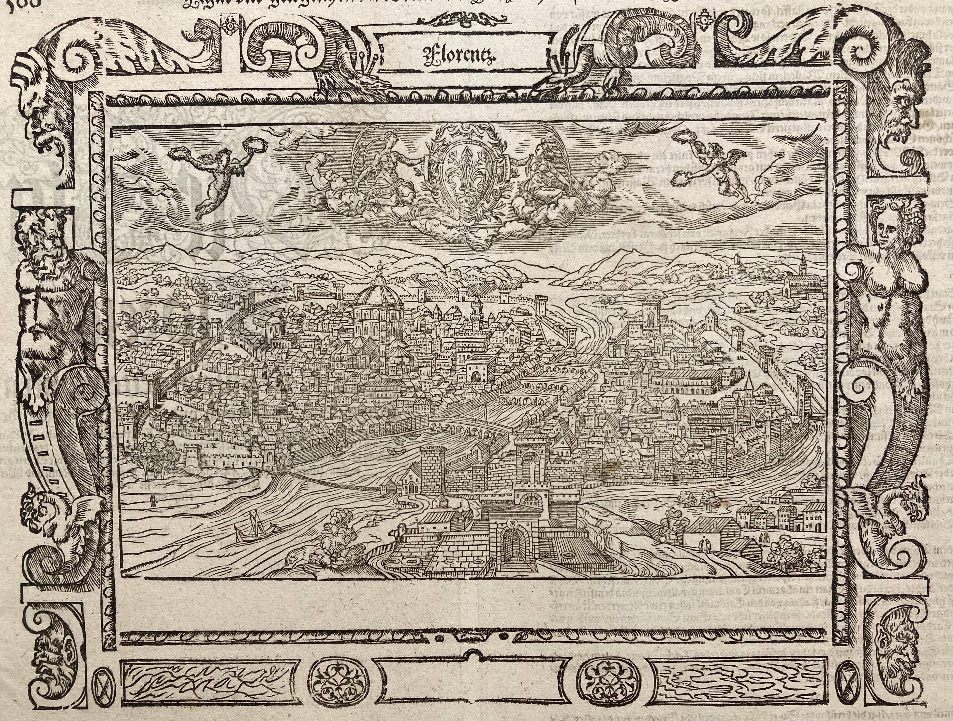
- !6th c. VIEW OF FLORENCEBy Sebastian MünsterLocated in Santa Monica, CASEBASTIAN MUNSTER (1488-1552) FLORENCZ - -- FIGUR UND GELEGENHEIT DER EDLEN UND HOCH BERHÜMPTEN STATT FLORENTZ. . c 1550 (Fauser, #3925.) Woodcut f...Category
16th Century Old Masters Landscape Prints
MaterialsWoodcut
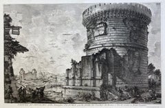
- VEDUTA del SEPOLCRO della Famiglia PLAUZIA per la strada che Conduce da Roma....By Giovanni Battista PiranesiLocated in Santa Monica, CAGIOVANNI BATTISTA PIRANESI (Italian 1720-1778) VEDUTA del SEPOLCRO della Famiglia PLAUZIA per la strada che Conduce da Roma a Tivoli vicino a Ponte Lugan...Category
1750s Old Masters Landscape Prints
MaterialsEtching
- PERUBy Johannes JanssonLocated in Santa Monica, CAJOHANNES JANSSON (1588 - 1664) PERU, engraving with early coloring. Platemark 15 1/8 x 19 3/8 inches, sheet 17 x 20 1/2 A nice example of one of the earliest maps of Peru. From the ...Category
1630s Old Masters Landscape Prints
MaterialsEngraving
- AMERICAE - Sive Novi Orbis, Nova DescriptioBy Abraham OrteliusLocated in Santa Monica, CAABRAHAM ORTELIUS (1527 - 1598) AMERICAE SIVE NOVI ORBIS, NOVA DESCRIPTIO, 1587 (1603) (Van Den Broecke 11, Burden 64; Schwartz & Ehrenberg 69) Engraving. A very good, well printed...Category
16th Century Old Masters Landscape Prints
MaterialsEngraving
- New Map of the Terraqueous Globe - WORLD MAP - CALIFORNIA AS AN ISLANDBy Edward WellsLocated in Santa Monica, CAEDWARD WELLS (British 1667- 1727) A NEW MAP of the TERRAQUEOUS GLOBE - according to the latest Discoveries and most general Divisions of it into CONTINENTS and OCEANS, 1700-01 (Shirley 609) Engraved by Michael Burghers, Oxford. Hand-colored, Platemark 14 1/4 x 20 1/8 inches. Central cartouche flanked by figures representing the continents with dedication to William, Duke of Gloucester...Category
Early 1700s Old Masters Landscape Prints
MaterialsEngraving
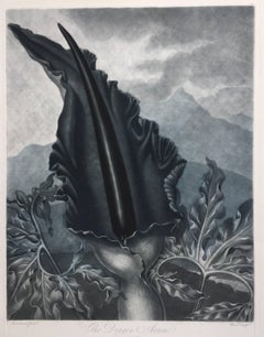
- THE DRAGON ARUMBy Dr. Robert John ThorntonLocated in Santa Monica, CADR. ROBERT JOHN THORNTON (circa 1768- 1837) THE DRAGON ARUM, 1801 (Dunthorne plate 161, pg. 250 i/iii; Nissen 1 955) Mezzotint printed in Payne's grey...Category
Early 1800s Old Masters Landscape Prints
MaterialsMezzotint


You May Also Like
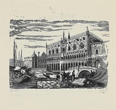
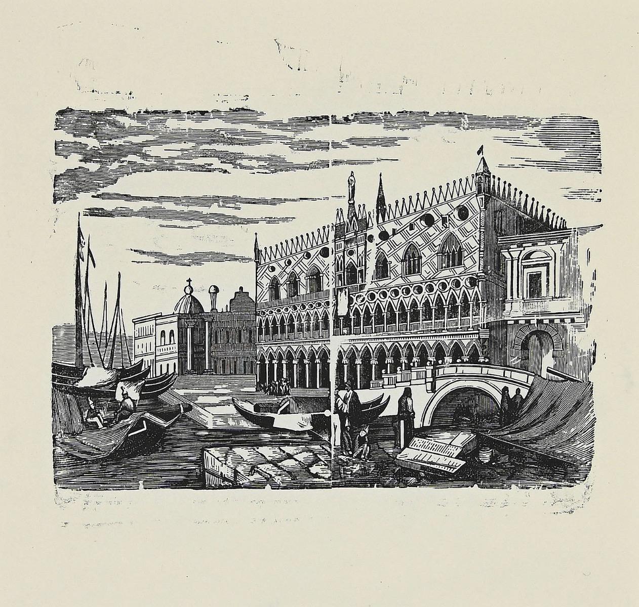
- Venice - Original Woodcut - 1950sLocated in Roma, ITVenice is an original artwork realized in 1950s. Original woodcut on ivory paper; reissue of a hand-printed woodcut, 1950s. Good conditions. Image Dimensions: 18 x 19 cm.Category
Mid-20th Century Old Masters Landscape Prints
MaterialsWoodcut
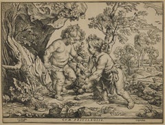
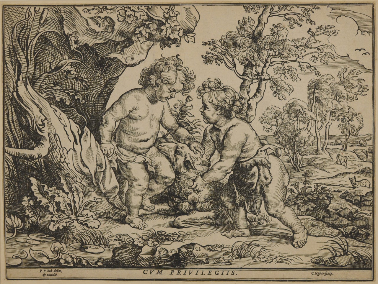
- The Infant Christ and St. John Playing with the Lamb, after Peter Paul RubensBy Christoffel JegherLocated in Fairlawn, OHThe Infant Christ and St. John Playing with the Lamb, after Peter Paul Rubens (1577-1640) Woodcut, trimmed and tipped to support Initialed in the block bottom ...Category
1630s Old Masters Prints and Multiples
MaterialsWoodcut
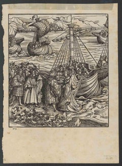
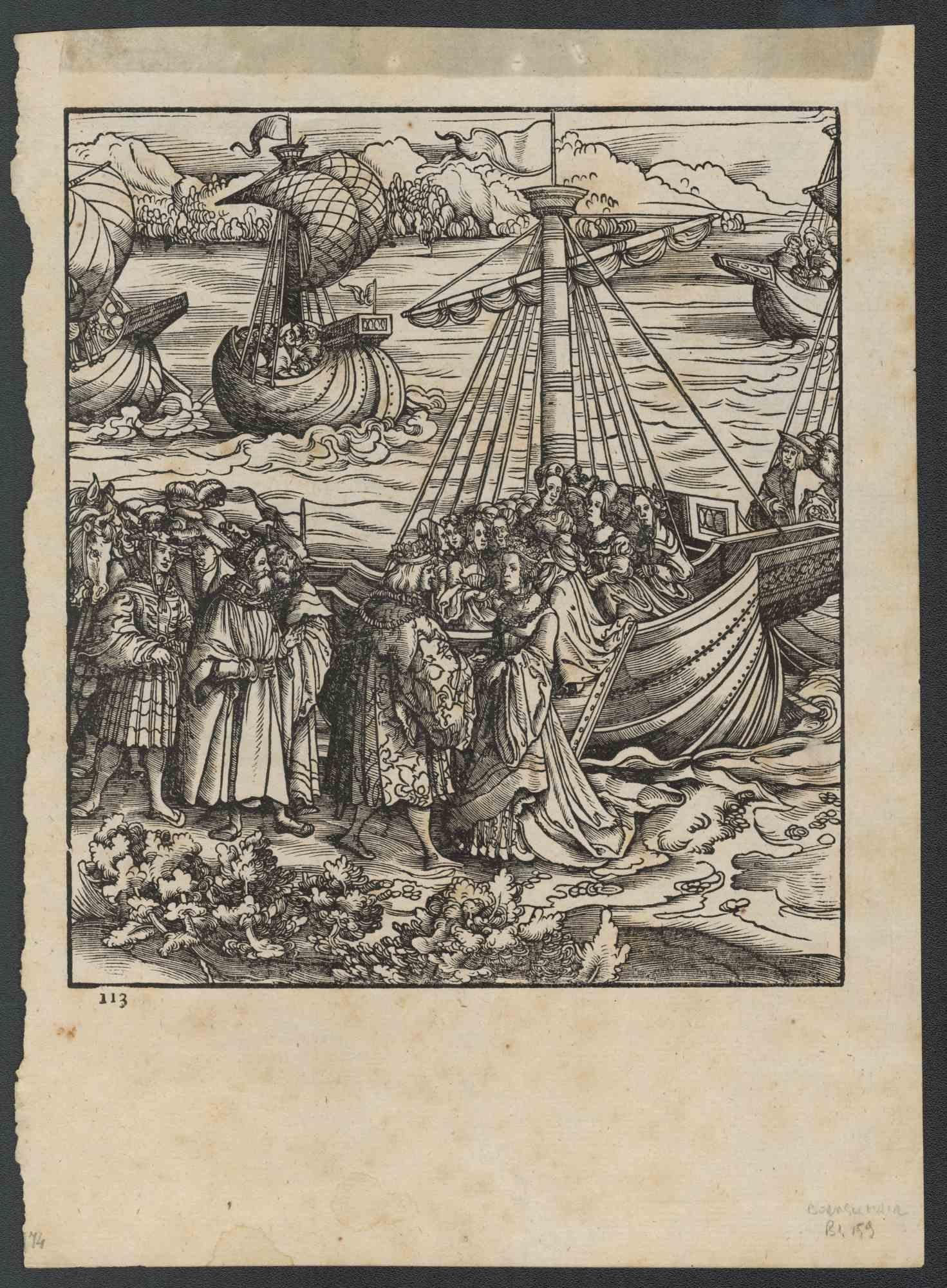
- Der Weisskunig - Woodcut Prints by Various artists - 1775Located in Roma, ITDer Weisskunig is an ancient set of Woodcuts realized in 1775, There are 14 plates from the Weisskunig series, the fictitious biography of Emperor Maximilian I...Category
18th Century Old Masters Figurative Prints
MaterialsWoodcut
- Cartusia Bruxellensis Monastery in Brussels: A 17th C. Hand-colored EngravingBy Lucas Vorsterman the YoungerLocated in Alamo, CAThis is a 17th century hand-colored copperplate engraving entitled "Cartusia Bruxellensis" by Lucas Vorsterman, the Younger, after a drawing by Jacob van Werden or Jacques van Weerden, published in 1659 in Antonius Sanderus' book 'Chorographia sacra Brabantiae sive celebrium aliquot in ea provincia ecclesiarum et coenobiorum descriptio . . . Brussel' (A sacred chorography of Brabant, or a description of several famous churches and convents in that province). It also appeared in other publications by Sanderus. In the 17th century, Brussels was within the Duchy of Brabant. This engraving depicts a bird's-eye view of the Scheut Carthusian Monastery in Brussels. Scheut is a district of Anderlecht, a municipality of Brussels, Belgium. The monastery housed monks, who took a vow of silence, in 20 rooms. There is a central courtyard with trees and shrubs. Monks are depicted strolling along its pathways. The cells for the friars are in the middle the cloister. There are people along the streets in the foreground and to the right of the large, imposing monastery. Some are on horseback, others are walking. In the lower right, what appears to be a dog pulls a small cart containing barrels, possibly of beer or wine. Districts and neighborhoods are labelled in the background, including Scheut, Anderlecht and Ransfort. A very ornate cartouche in the lower left contains Latin and the artist's attribution. Another decorative cartouche in the upper central area contains the title. This beautifully hand-colored and detailed engraving is printed on laid, chain-linked paper with wide, full margins. The sheet measures 17.25" high and 21.25" wide. It has Latin text on the verso. It has a central vertical fold, as issued, which is reinforced on the verso. Two small spots in the lower margin may actually represent drops of watercolor paint used to color the engraving. It is otherwise in very good condition. Antonius Sanderus (1586-1664) was a Flemish Catholic cleric and historian. He was born "Antoon Sanders", but Latinized his name like many writers and scholars of his time. He was the author of several books, including 'Chorographia Sacra Brabantiae', which was illustrated with this engraving. Lucas Vorsterman the Younger (1624-between 1666 & 1676) was a Flemish Baroque engraver and draughtsman. He produced engravings after the work of contemporary painters and for books by Antwerp publishers. Jacob van Werden or Jacques van Weerden (active 1643-1669), was a Flemish draughtsman, cartographer, military engineer and archer who was active in the Habsburg Netherlands. His drawings were used as designs for prints executed by various printmakers. He worked on maps, topographical views, historical scenes, portraits and book illustrations. He had a career as a military engineer and a member of the guard of the Spanish King. He advised on various military engineering projects and was an engineer of the Spanish army...Category
Mid-17th Century Old Masters Landscape Prints
MaterialsEngraving
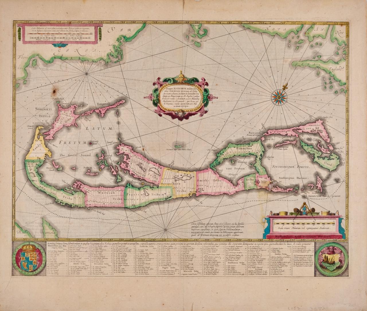
- Bermuda: An Early 17th Century Hand-colored Map by Henricus HondiusBy Henricus HondiusLocated in Alamo, CAThis attractive and interesting map of Bermuda by Henricus Hondius in 1633 is entitled "Mappa Aestivarum Insularum, Alias Barmudas". It is based on a ...Category
Early 17th Century Old Masters Landscape Prints
MaterialsEngraving
- L'Isle de France: A Hand-colored 17th Century Map by De WitBy Frederick de WitLocated in Alamo, CAThis colorful and detailed 17th century hand-colored copperplate map by Frederick De Wit was published in Amsterdam between 1666 and 1760. The map depicts the Île-de-France, which is one of the ancient provinces of France. Paris is located in the center of the map, with Versailles to the southwest The map extends from Rouen in the west to Reims in the east. The area around Paris, the Véxin Français, was the original domain of the king of France. Other areas were ruled by French feudal lords. For example, the Véxin Normand area was the domain of the Duke of Normandy...Category
Early 18th Century Old Masters More Prints
MaterialsEngraving