Antique Map Of Massachusetts
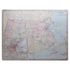
Large Original Antique Map of Massachusetts, USA, circa 1900
Located in St Annes, Lancashire
Fabulous map of Massachusetts
In 2 sheets. They can be joined but I have not done it
Original
Category
1890s American Antique Map Of Massachusetts
Materials
Paper
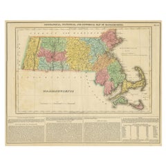
Antique Geographical, Historical and Statistical Map of Massachusetts, 1822
Located in Langweer, NL
This attractive map of Massachusetts presents a finely detailed overview of the state in the first
Category
1820s Antique Map Of Massachusetts
Materials
Paper
H 17.13 in W 21.46 in D 0 in
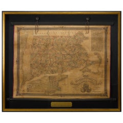
1854 Map of Massachusetts, Connecticut and Rhode Island, Antique Wall Map
Located in Colorado Springs, CO
This striking wall map was published in 1854 by Ensign, Bridgman & Fanning and has both full
Category
19th Century American Antique Map Of Massachusetts
Materials
Paper
H 38.13 in W 45 in D 3.5 in
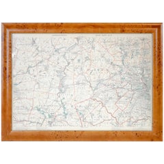
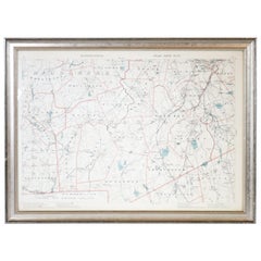
Original 1891 Walker Map
Located in Norwell, MA
Original 1891 map of Massachusetts by Walker. Towns include Cambridge, Boston, Dedham, Ashland
Category
19th Century Antique Map Of Massachusetts
1891 Map of Norfolk County Massachusetts
Located in Norwell, MA
1891 map of Norfolk county Massachusetts including the towns of Wrentham, Franklin, Medfield
Category
19th Century Antique Map Of Massachusetts
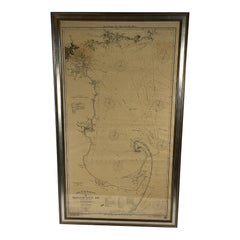
1918 George Eldridge Chart of Massachusetts Bay
Located in Norwell, MA
Rare early twentieth century chart of Cape Cod bay by George Eldridge showing Massachusetts Bay
Category
1910s North American Antique Map Of Massachusetts
Materials
Paper
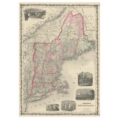
Large Antique Map of New England with decorative Vignettes
Located in Langweer, NL
Antique map titled 'Johnson's New England'. Large map of New England, comprising the states
Category
Mid-19th Century Antique Map Of Massachusetts
Materials
Paper
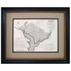
Plan for the City of Washington by Andrew Ellicott, Antique Print, 19th Century
Located in Colorado Springs, CO
original plan including the alignment of Massachusetts Avenue, reworked some short radial avenues, and
Category
Late 19th Century American Antique Map Of Massachusetts
Materials
Paper
H 36 in W 43.75 in D 3 in
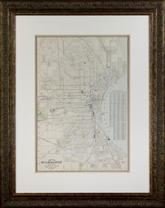
'Map of Milwaukee' color lithograph published by George F. Cram of Chicago
Located in Milwaukee, WI
This is an original color lithograph map of the City of Milwaukee, published in 1895 by the Chicago
Category
1890s Other Art Style Antique Map Of Massachusetts
Materials
Lithograph
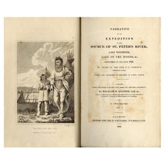
Keating, William. Narrative of an Expedition to the Source of St. Peter's River
Located in Middletown, NY
opposite plates.
Vol. 1 includes 3 copper engravings etched by R Fenner, a large folded map 12 3/8 x 21 in
Category
Early 19th Century English Antique Map Of Massachusetts
Materials
Leather, Paper
H 8.75 in W 5.5 in D 3 in
Interior of a Japanese House
By Harry Humphrey Moore
Located in New York, NY
topographical artist and explorer who mapped the Japanese coast in 1855; and the Boston landscapist
Category
Late 19th Century Antique Map Of Massachusetts
Materials
Oil, Wood Panel
Portrait Painting Oil on Canvas by Joseph Badger
Located in Rome, IT
Joseph Badger (c. 1707–1765) was a portrait artist in Boston, Massachusetts, in the 18th century
Category
18th Century Academic Antique Map Of Massachusetts
Materials
Oil
Portrait Painting Oil on Canvas by Joseph Badger
Located in Rome, IT
Joseph Badger (c. 1707–1765) was a portrait artist in Boston, Massachusetts, in the 18th century
Category
18th Century Academic Antique Map Of Massachusetts
Materials
Oil
"Stag Beetle & Longicorn Beetle, " Original Color Lithograph by Louis Prang
By Louis Prang
Located in Milwaukee, WI
specialized in prints of buildings and towns in Massachusetts. In 1860, he bought the share of his partner
Category
1880s Academic Antique Map Of Massachusetts
Materials
Lithograph
Map of Palestine or Judea, Illustrating the History of the New Testament
By Rev. Nathan B. Rogers
Located in New York, NY
. E. D. Daniels, Palmer, Mass.
Provenance:
Rev. Eugene Davidson Daniels, Palmer, Massachusetts, 1871
Category
19th Century Antique Map Of Massachusetts
Materials
Canvas, Paper, Ink, Pen
People Also Browsed
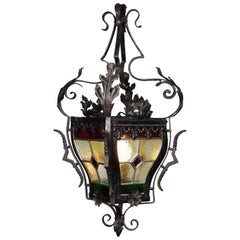
French Baroque Style Wrought-Iron Stained Glass Hall Lantern, 19th-20th Century
Located in Los Angeles, CA
A French 19th-20th century Baroque Revival style wrought iron and four-color vitreaux stained glass single-light hall lantern, the rounded four stained glass panels with red, green, ...
Category
Early 1900s French Baroque Revival Antique Map Of Massachusetts
Materials
Wrought Iron
H 27.5 in W 17.25 in D 17.25 in
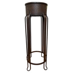
Top Quality and Pure Art Deco Wrought Iron / Brass Top Pedestal or Flower Stand
Located in Lisse, NL
Unique and timeless pedestal flower, plant, vase, or sculpture stand.
When it comes to Art Deco pedestals this particular piece is among the most handsome and stylish we ever had th...
Category
Early 20th Century French Art Deco Antique Map Of Massachusetts
Materials
Wrought Iron, Brass
Free Shipping
H 29.5 in Dm 9.5 in
Large Cape Buffalo Taxidermy Shoulder Mount
Located in Ongar, GB
A large vintage taxidermy Cape Buffalo shoulder mount. Very well modelled and is a very impressive piece. Wear in places from age and use.
Please contact us for an accurate shipping ...
Category
Early 20th Century Unknown Antique Map Of Massachusetts
Materials
Animal Skin
Antique 5 Arm Wood Wall Mount Drying Rack Towel Bar Rod Laundry Holder 25"
Located in Dayton, OH
Antique wall mounted drying rack featuring black metal hardware and five wooden arms that extend out in a fan shape or can be folded neatly against the wall via spring action mechani...
Category
Early 20th Century Country Antique Map Of Massachusetts
Materials
Metal
Anne Andersson Sisal Fiber Snow Leopard 2006
Located in Palm Springs, CA
A wonderful wall sculpture by the noted artist Anne Andersson. It is signed and dated 2006 #4 on the back. These sculptures are made of Sisal Fiber from an Agave and meticulously han...
Category
Early 2000s American Antique Map Of Massachusetts
Materials
Clay, Natural Fiber, Blown Glass
Antique Map of The United States of North America, 1882
Located in Langweer, NL
This is a historical map titled "The United States of North America, Central Part" from the 1882 Blackie Atlas. It depicts the continental United States with a high level of detail, ...
Category
1880s Antique Map Of Massachusetts
Materials
Paper
Raimundo de Madrazo Y Garreta Palatial Oil on Canvas
By Raimundo de Madrazo y Garreta
Located in Los Angeles, CA
Raimundo De Madrazo Y Garreta (Spanish School, 1841-1920) an exceptional and palatial oil on canvas "Portrait of Isabelle McCreery” depicting an elegant woman gracefully exiting a li...
Category
1880s Spanish Rococo Antique Map Of Massachusetts
Materials
Canvas, Giltwood
Large Original Antique Map of New Mexico, Usa, C.1900
Located in St Annes, Lancashire
Fabulous map of New Mexico.
Original color.
Engraved and printed by the George F. Cram Company, Indianapolis.
Published, C.1900.
Unframed.
Free shipping.
Category
1890s American Antique Map Of Massachusetts
Materials
Paper
Mid-19th Century Chinese Telescopic Fan of Gilt Decorated Black Lacquer Stays
Located in Kenilworth, IL
Chinese telescopic fan of gilt decorated black lacquer stays with paper painted in gauche in the Mandarin palette. Archival mount in a shadow box frame.
China, made for the Western ...
Category
Mid-19th Century Chinese Antique Map Of Massachusetts
Materials
Enamel
H 19 in W 25 in D 2.75 in
Mid 19th Century Chinese Telescopic Canton Fan with Carved Bone Stays
Located in Kenilworth, IL
Chinese telescopic Canton fan of carved bone stays supporting a scenic decorated paper in gouache in the Mandarin palette. Archival mount in a shadow box frame.
China, made for th...
Category
Mid-19th Century Chinese Antique Map Of Massachusetts
Materials
Bone, Paper
Mid-Century Modern Sculpture in Brass, Steel & Aluminum, Manner of Silas Seandle
By Silas Seandel
Located in New York, NY
This sophisticated Mid-Century Modern sculpture- realized in the manner of Silas Seandle- was realized in the United States, circa 1970. It consists of a lattice work of rectangular ...
Category
1970s American Mid-Century Modern Antique Map Of Massachusetts
Materials
Aluminum, Brass, Steel
H 46 in W 21 in D 7 in
French 19th-20th Century Louis XV Style Wrought Iron & Bronze Crystal Chandelier
Located in Los Angeles, CA
A French 19th-20th century Louis XV style wrought iron and bronze seven-light color crystal (cut-glass) chandelier. The black painted iron frame with six candle arms and a center lig...
Category
Early 1900s French Louis XV Antique Map Of Massachusetts
Materials
Bronze, Wrought Iron
Art Deco Geometric Reverse Painted Tray
Located in Devon, England
For your consideration is this large and original 1930's French Art Deco tray featuring a lovely reverse painted design on glass. Ideal size for modern use, quite large in size and v...
Category
Mid-20th Century French Art Deco Antique Map Of Massachusetts
Materials
Glass, Beech, Paint
Nelson's Guide to the City of New York and its Neighbourhood, 1858
Located in Langweer, NL
"Nelson's Guide to the City of New York and its Neighbourhood," published in 1858 by T. Nelson in London and New York, serves as an invaluable resource for exploring the historical a...
Category
1850s Antique Map Of Massachusetts
Materials
Paper
Samuel Yellin Wrought Iron Gate, Signed
By Samuel Yellin
Located in Sharon, CT
Classic Yellin small gate. Hand-forged wrought iron with a brass rail across the top. Weight: about 80lbs.
Category
Early 20th Century American Arts and Crafts Antique Map Of Massachusetts
Materials
Iron
1856 U.S. Coast Survey Map of Chesapeake Bay and Delaware Bay
Located in Colorado Springs, CO
Presented is U.S. Coast Survey nautical chart or maritime map of Chesapeake Bay and Delaware Bay from 1856. The map depicts the region from Susquehanna, Maryland to the northern Oute...
Category
1850s American Antique Map Of Massachusetts
Materials
Paper
Recent Sales
1818 Map of the Battle of Bunker Hill
Located in New York, NY
under the command of Major General Howe, and a Large Body of American Rebels."
Description
1818 map of
Category
1810s Realist Antique Map Of Massachusetts
Materials
Engraving
6, 19th Century hand-colored maps printed by Anthony Finley of Philadelphia 1824
Located in San Antonio, TX
nascent American cartographic world.
Maps in series: Maryland, Vermont, Maine, Massachusetts, Ohio and
Category
Early 19th Century Academic Antique Map Of Massachusetts
Materials
Lithograph, Pastel
H 13 in W 10.38 in D 0.07 in
SCHOOL GIRL HAND DRAWN MAP OF MASSACHUSETTS, circa 1815
Located in Essex, MA
Pen and ink school girl hand drawn map of Massachusetts, rendered in great detail with topography
Category
19th Century American Antique Map Of Massachusetts
Materials
Paper, Ink, Pen
Giant Framed Map of Massachusetts, circa 1903
By Scarborough Company
Located in Essex, MA
A giant framed map of the Commonwealth of Massachusetts, measuring 62" wide x 44" high and
Category
Early 20th Century American Antique Map Of Massachusetts
Materials
Paper, Plexiglass, Wood
1850 Map of Massachusetts, Connecticut, and Rhode Island, Antique, Hand-Colored
Located in Colorado Springs, CO
This attractive pocket map depicts the New England states of Massachusetts, Connecticut, and Rhode
Category
1850s American Antique Map Of Massachusetts
Materials
Paper
H 29.75 in W 34 in D 2.25 in
1824 Massachusetts, Connecticut and Rhode Island Antique Wall Map by E. Ruggles
Located in Colorado Springs, CO
This rare and detailed 1824 wall map by Edward Ruggles depicts eastern New York to Cape Cod
Category
1820s American Antique Map Of Massachusetts
Materials
Paper
H 47 in W 52 in L 47 in
1842 Map of Boston
Located in Essex, MA
An 1842 Map of Boston, Massachusetts and surrounding communities, published by the Society for the
Category
19th Century English Antique Map Of Massachusetts
Map of Nantucket by Tony Sarg, 1926
By Tony Sarg
Located in Nantucket, MA
Colored pictorial map of Nantucket in the State of Massachusetts, with central image of the Island
Category
Early 20th Century North American Folk Art Antique Map Of Massachusetts
Materials
Paper
Rare Decorative Map of Nantucket Designed Jack Atherton, circa 1937
Located in Nantucket, MA
Jack (Bonney) Atherton.
A decorative map of Nantucket Island, Massachusetts.
LeBaron-Bonney Co
Category
Early 20th Century American Folk Art Antique Map Of Massachusetts
"At the Service of Mankind" Vintage Wwi Red Cross Poster by Lawrence Wilbur
Located in Colorado Springs, CO
, above a map of the United States. The map is emblazoned with a large red cross and scenes of a doctor
Category
1910s Antique Map Of Massachusetts
Materials
Paper
H 31.5 in W 21.25 in D 1.5 in
Large Original Antique Map of Massachusetts, USA, 1894
By Rand McNally & Co.
Located in St Annes, Lancashire
Fabulous map of Massachusetts.
Original color.
By Rand, McNally & Co.
Published, 1894
Category
1890s American Antique Map Of Massachusetts
Materials
Paper
Antique Map of Massachusetts, Connecticut and Rhode Island by Johnson, 1872
Located in Langweer, NL
Antique map titled 'Johnson's Massachusetts, Connecticut and Rhode Island'. Original map of
Category
Late 19th Century Antique Map Of Massachusetts
Materials
Paper
H 17.92 in W 26.58 in D 0.02 in
Original Antique Map of The American State of Massachusetts, 1889
Located in St Annes, Lancashire
Great map of Massachusetts
Drawn and Engraved by W. & A.K. Johnston
Published By A & C Black
Category
1880s Scottish Victorian Antique Map Of Massachusetts
Materials
Paper
Original Antique Map of the American State of Massachusetts, 1889
Located in St Annes, Lancashire
Great map of Massachusetts
Drawn and Engraved by W. & A.K. Johnston
Published By A & C Black
Category
1880s Scottish Victorian Antique Map Of Massachusetts
Materials
Paper
1 bid
No Reserve
H 8 in W 11 in D 0.07 in
Antique Map of the Northern States of America by Russell, '1794'
Located in Langweer, NL
, New Hampshire, District of Main, Massachusetts, Rhode Island, and Connecticut'. Map of New England and
Category
Late 18th Century Antique Map Of Massachusetts
Materials
Paper
Hand-Drawn School Girl Map of the United States, circa 1831
By Lydia Mudge
Located in Essex, MA
A wonderfully naive, yet accomplished hand-drawn school girl map of the United States, circa 1831
Category
1830s American Antique Map Of Massachusetts
Antique Map of the East Indies and Southeast Asia by Bradford, 1835
Located in Langweer, NL
Antique map titled 'Farther India or Chin India (..)'. Old map of the East Indies and Southeast
Category
19th Century Antique Map Of Massachusetts
Materials
Paper
Cape Cod Map Showing New York City
Located in Colorado Springs, CO
map was issued by George H. Walker to promote the Joy Line. The Joy Line was a regular steamship ferry
Category
Early 1900s American Antique Map Of Massachusetts
Old French Map with Details of New England, Lake Erie, Virginia, Maryland, 1780
Located in Langweer, NL
Description: Antique map titled 'Carte De La Partie Nord, Des Etats Unis, de l' Amerique
Category
1780s Antique Map Of Massachusetts
Materials
Paper
H 10.24 in W 14.97 in D 0 in
Massachusetts. USA Century Atlas state antique vintage map
Located in Melbourne, Victoria
'The Century Atlas. Massachusetts'
Inset map of 'Boston and Vicinity'.
Original antique map, 1903
Category
Early 20th Century Victorian Antique Map Of Massachusetts
Materials
Lithograph
The Battle of Little Big Horn River (Custer Massacre, June 25 1876)
By William De La Montagne Cary
Located in Missouri, MO
issue has a map of the battlefield. There are very few, if any holdings of this extremely scarce 19th
Category
19th Century Antique Map Of Massachusetts
Materials
Lithograph
American Commonwealths, Kentucky
Located in valatie, NY
, separation from Virginia, The War of 1812, The Civil War, and more. It has a fold out map and the state seal
Category
Late 19th Century American Antique Map Of Massachusetts
The Dutch and Quaker Colonies in America, 1899, in Two Volumes, 1st Edition
Located in valatie, NY
Darwin and became a writer of histories near the end of his life. He died at Gloucester, Massachusetts
Category
1890s American Antique Map Of Massachusetts
Materials
Paper
H 8 in W 5.25 in D 1.25 in
American Commonwealths, Michigan
Located in valatie, NY
elements and more. It has a fold out map and the state seal. The book was published by The Riverside Press
Category
Late 19th Century American Antique Map Of Massachusetts
Materials
Leather, Paper
American Commonwealths, California
Located in valatie, NY
Conquest in 1846, the second Vigilance Committee in San Franciso, and more. It has a fold out map and the
Category
Late 19th Century American Antique Map Of Massachusetts
Materials
Paper, Leather
American Commonwealths, Oregon
Located in valatie, NY
Trail, 200 wagons heading for Oregon, The Whitman Massacre, and more. It has a fold out map and the
Category
Late 19th Century American Antique Map Of Massachusetts
Materials
Paper, Leather
American Commonwealths, Missouri
Located in valatie, NY
1865, and more. It has a fold out map and the state seal. The book was published by The Riverside Press
Category
Late 19th Century American Antique Map Of Massachusetts
Materials
Paper, Leather
American Commonwealths, New York in Two Volumes
Located in valatie, NY
state, The French War, The Revolution, and more. It has a fold out map and the state seal. The book was
Category
Late 19th Century American Antique Map Of Massachusetts
Materials
Leather, Paper
"Cicadae, Lantern Fly, Etc., " original color lithograph by Louis Prang
By Louis Prang
Located in Milwaukee, WI
specialized in prints of buildings and towns in Massachusetts. In 1860, he bought the share of his partner
Category
1880s Academic Antique Map Of Massachusetts
Materials
Lithograph
"Hermit-Crabs, " Original Color Lithograph Seafloor Print by Louis Prang
By Louis Prang
Located in Milwaukee, WI
specialized in prints of buildings and towns in Massachusetts. In 1860, he bought the share of his partner
Category
1880s Academic Antique Map Of Massachusetts
Materials
Lithograph
"Holothurians and Sea Star, " Original Color Lithograph by Louis Prang
By Louis Prang
Located in Milwaukee, WI
specialized in prints of buildings and towns in Massachusetts. In 1860, he bought the share of his partner
Category
1880s Academic Antique Map Of Massachusetts
Materials
Lithograph
Map of Massachusetts Sea Coast circa1856
Located in Bridgehampton, NY
US coastal survey map of the Massachusetts coast line, hand colored lithograph in amazing condition
Category
19th Century American Antique Map Of Massachusetts
Hammett's Planisphere Celestial Map
Located in Dallas, TX
This wonderful astrological map was made for the J. L. Hammett Co. of Boston, Massachusetts and
Category
Early 20th Century Antique Map Of Massachusetts
Get Updated with New Arrivals
Save "Antique Map Of Massachusetts", and we’ll notify you when there are new listings in this category.
Antique Map Of Massachusetts For Sale on 1stDibs
There is a range of antique map of massachusetts for sale on 1stDibs. Frequently made of paper, all antique map of massachusetts available were constructed with great care. There are all kinds of antique map of massachusetts available, from those produced as long ago as the 18th Century to those made as recently as the 19th Century. There are many kinds of antique map of massachusetts to choose from, but at 1stDibs, Victorian antique map of massachusetts are of considerable interest. There have been many well-made antique map of massachusetts over the years, but those made by Harry Humphrey Moore, Louis Prang and Rev. Nathan B. Rogers are often thought to be among the most beautiful.
How Much are Antique Map Of Massachusetts?
The average selling price for at 1stDibs is $1,460, while they’re typically $30 on the low end and $75,000 highest priced.
More Ways To Browse
Modern Vintage Cape Cod
Used Office Furniture Rhode Island
Nantucket Antiques
George Washington Glass
Hamilton Engravings
Horace Brown
Print Boston 18 Century
Maryland Map
Map Of Maryland
Antique Carved Roses Frame
Vintage Cape Cod
Thomas Edison
Antique Glass Floats
Antique Glass Float
Antique Float Glass
Thomas Worth
Map Of Washington D C
New York City Vintage Map
