Antique South Carolina Maps
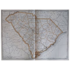
Large Original Antique Map of South Carolina, USA, 1894
By Rand McNally & Co.
Located in St Annes, Lancashire
Fabulous map of South Carolina
Original color
By Rand, McNally & Co.
Published, 1894
Category
1890s American Antique South Carolina Maps
Materials
Paper
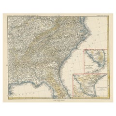
Antique Map of the Region of Georgia with Inset Maps of Florida and Texas
Located in Langweer, NL
Antique map of part of the United States showing Alabama, Georgia, North Carolina, South Carolina
Category
Late 19th Century Antique South Carolina Maps
Materials
Paper
H 15.04 in W 18.63 in D 0.02 in
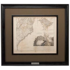
1812 United States Map, by Pierre Tardieu, Antique French Map Depicting the U.S.
By Pierre François Tardieu
Located in Colorado Springs, CO
South Carolina. Additionally, Ellicott’s plan for the City of Washington D.C. is included at the top
Category
1810s French Antique South Carolina Maps
Materials
Paper
H 43.5 in W 48 in D 2.25 in
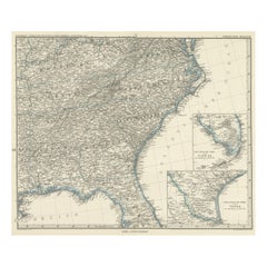
Antique Map of Tennessee, Kentucky, Virginia, Alabama, Georgia and Surroundings
Located in Langweer, NL
Antique map of part of the United States showing Alabama, Georgia, North Carolina, South Carolina
Category
Mid-19th Century Antique South Carolina Maps
Materials
Paper
Free Shipping
H 15.16 in W 18.71 in D 0.02 in
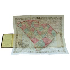
Antique Engraved Hand Colored Colton & Co. Pocket Book Map of South Carolina
By G.W. & C.B. Colton
Located in Charleston, SC
paper of South Carolina, 1874
Published at 172 William Street, New York
Below date of "1874" says
Category
Late 19th Century American Antique South Carolina Maps
Materials
Paper
H 13.75 in W 16.5 in D 0.25 in
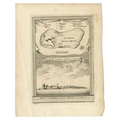
Antique Print of Bunce Island an Island in the Sierra Leone River, 1748
By Jakob van der Schley
Located in Langweer, NL
Island was the departure point for thousands of slaves for the North American colonies of South Carolina
Category
18th Century Antique South Carolina Maps
Materials
Paper
Satyr and Pan, Life Magazine Cover
By B. Cory Kilvert
Located in Fort Washington, PA
several mural-sized pictorial maps, including one for the Pinehurst Country Club in North Carolina
Category
1920s Other Art Style Antique South Carolina Maps
Materials
Board, Oil
Kellogg's Corn Flakes Advertisement
By B. Cory Kilvert
Located in Fort Washington, PA
maps, including one for the Pinehurst Country Club in North Carolina.
Kilvert complemented his
Category
1910s Other Art Style Antique South Carolina Maps
Materials
Gouache, Board, Watercolor
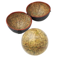
A truly delightful miniature terrestrial pocket globe
By Nathaniel Mills
Located in ZWIJNDRECHT, NL
South America. It is partly worn in other places and has some slight spotting. It is lacking the axis
Category
Mid-18th Century British Dutch Colonial Antique South Carolina Maps
Materials
Other
English Pocket Globe, London, Circa 1775-1798
By Herman Moll
Located in Milano, IT
region in his 1727 map. (Encyclopaedia Britannica, ed. 1902, under "States of Central Africa"); Tartary
Category
Late 18th Century English George III Antique South Carolina Maps
Materials
Shagreen, Paper
Portrait Painting Oil on Canvas by Joseph Badger
Located in Rome, IT
Charleston, South Carolina, shortly after their father’s death in 1765, the brothers announced that they had
Category
18th Century Academic Antique South Carolina Maps
Materials
Oil
Ecce Homo Plate X
By Werner Drewes
Located in Fairlawn, OH
portraits. While in San Francisco he set up a shop from which he sold prints he had made in Spain and South
Category
1920s Bauhaus Antique South Carolina Maps
Materials
Woodcut
Ecce Homo VII
By Werner Drewes
Located in Fairlawn, OH
portraits. While in San Francisco he set up a shop from which he sold prints he had made in Spain and South
Category
1920s Expressionist Antique South Carolina Maps
Materials
Woodcut
Portrait Painting Oil on Canvas by Joseph Badger
Located in Rome, IT
Charleston, South Carolina, shortly after their father’s death in 1765, the brothers announced that they had
Category
18th Century Academic Antique South Carolina Maps
Materials
Oil
People Also Browsed
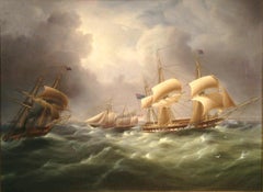
American Steam Schooner Meets British Frigates Crossing the English Channel
By James Edward Buttersworth
Located in Costa Mesa, CA
Three ships - an American Three-Masted Steam Schooner, a British Sailing Royal Navy Frigate and a British Sidewheel Steam Naval Frigate - are all challenged by a tempestuous sea in t...
Category
1830s Antique South Carolina Maps
Materials
Canvas, Oil
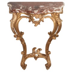
Early 20th Century Louis XV Style Marble Top Console
Located in Winter Park, FL
An early 20th century French Louis XV style giltwood console with carved foliate details and warm gold painted patina. Original Rouge Royale marble top. Minor chips and some paint lo...
Category
Early 20th Century French Louis XV Antique South Carolina Maps
Materials
Marble
Original Antique World War One Humoros Wap Map Of The World WWI Japan Caricature
Located in London, GB
Original antique World War One satirical map of Europe and Asia portraying the outbreak of WWI featuring colourful caricatures and illustrations of the countries including Germany as...
Category
1910s Japanese Antique South Carolina Maps
Materials
Paper
H 18.51 in W 24.81 in D 0.04 in
Ed Sketching at Red Rocks, Vintage 1940s Original Mountain Landscape, Colorado
By Vance Kirkland
Located in Denver, CO
Original vintage 1940s Modernist Landscape painting of Red Rocks Park, Colorado by Vance Kirkland (1904-1981). Titled, "Ed (Hicks) Sketching at Red Rocks". This regionalist mountai...
Category
1940s American Modern Antique South Carolina Maps
Materials
Watercolor
H 34.75 in W 42.75 in D 1.25 in
Large Original Antique Map of Arizona, Usa, C.1900
Located in St Annes, Lancashire
Fabulous map of Arizona
Original color.
Engraved and printed by the George F. Cram Company, Indianapolis.
Published, C.1900.
Unframed.
Free shipping.
Category
1890s American Antique South Carolina Maps
Materials
Paper
34-Star Civil War American Flag, Antique Great Star Pattern, circa 1861
Located in Colorado Springs, CO
The stars of this extremely rare, Civil War-era flag are arranged in what is sometimes called the "Great Flower" pattern, a large star made out of smaller stars -- named as such beca...
Category
1860s American Antique South Carolina Maps
Materials
Linen
Rare Japanese antique pottery jar/13th century/Kamakura period/Excavated pottery
Located in Sammu-shi, Chiba
We would like to introduce you to some fascinating pots excavated in Japan.
This is a pot fired in an ancient Japanese kiln called Tokoname ware.
Tokoname is a kiln located in Aichi...
Category
15th Century and Earlier Japanese Other Antique South Carolina Maps
Materials
Pottery
H 15.08 in Dm 14.81 in
19th Century Embroidered Silk Panel Map Of The World
Located in Forney, TX
A rare and visually striking framed antique European embroidered silk panel.
Exquisitely hand-crafted in Continental Europe in the 19th century, depicting map of the world, double ...
Category
19th Century European Victorian Antique South Carolina Maps
Materials
Silk, Thread
The Picnic
Located in San Francisco, CA
This artwork titled "The Picnic" c.1990, is an oil painting on canvas board by Irish artist Val McGann, 1928-2016. It is signed at the lower left corner by the artist. The artwork (...
Category
Late 20th Century Realist Antique South Carolina Maps
Materials
Oil
Large Original Antique Map of North Carolina, USA, 1894
By Rand McNally & Co.
Located in St Annes, Lancashire
Fabulous map of North Carolina
Original color
By Rand, McNally & Co.
Published, 1894
Unframed
Free shipping.
Category
1890s American Antique South Carolina Maps
Materials
Paper
Civil War Union Solider in Full Dress, Sword & Cannon, Union Gutta Percha Case
Located in West Palm Beach, FL
Civil War portrait, union solider in landscape in 'Union' Gutta Percha case
Rare and unusual, the Ambrotype of a Union solider, in full uniform, with sword, standing next to a canno...
Category
19th Century North American High Victorian Antique South Carolina Maps
Materials
Glass
H 3.75 in W 3.25 in D 1 in
French Empire Style Late 19th c Wardrobe in the Manner of Maison Krieger
By Maison Krieger
Located in Hudson, NY
This impressive and commanding wardrobe made in France at the end of the 19th century is almost certainly by Masion Krieger; While not stamped certain details are directly relatable ...
Category
Late 19th Century French Empire Revival Antique South Carolina Maps
Materials
Ormolu
H 86.25 in W 61 in D 23.5 in
Large Civil War recruitment Broadside for the 53rd New York Volunteer Infantry
Located in York County, PA
LARGE CIVIL WAR RECRUITMENT BROADSIDE FOR THE 53RD NEW YORK VOLUNTEER INFANTRY, 5th REGIMENT, "EAGLE BRIGADE," WITH AN ATTRACTIVE AND COMPELLING IMAGE OF ITS COMMANDER, LT. COL. GEOR...
Category
1860s American Antique South Carolina Maps
Materials
Paper
H 48.5 in W 34.5 in D 2.5 in
Early 19th Century American Primitve Texas Farmhouse Painted Pine Work Table
Located in Forney, TX
A scarce Texas farm house painted pine work table with dark rich nicely aged distressed patina.
Hand-crafted by a skilled but formally untrained farmer in the early 19th century, ...
Category
Early 19th Century American Country Antique South Carolina Maps
Materials
Pine, Paint
H 29.75 in W 31.25 in D 30.5 in
Antique Bible World Map by R. & J. Wetstein, 1743
Located in Langweer, NL
Antique world map titled 'De Werelt Caart'.
A scarce and richly detailed double hemisphere world map that was probably based on an earlier work by Cornelis Dankerts. This map has t...
Category
Mid-18th Century Antique South Carolina Maps
Materials
Paper
18th Century Antique Map of the Virgin Islands and Caribbean Inset Maps
Located in Langweer, NL
A fascinating piece of cartographic history! The map, titled "Carte du supplément pour les Isles Antilles," featuring inset maps of various islands in the Caribbean, is from the "Atl...
Category
Late 18th Century Antique South Carolina Maps
Materials
Paper
Free Shipping
H 12.68 in W 18 in D 0.02 in
Recent Sales
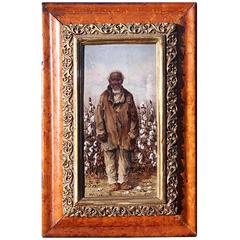
Painting of a Cotton Picker by William Aiken Walker
By William Aiken Walker
Located in Alexandria, VA
of several monographs.
William Aiken Walker was born in Charleston, South Carolina, on March 11
Category
1870s American Antique South Carolina Maps
Materials
Composition
Rare Charleston, South Carolina Engraved Map "Town & Harbor, " Circa 1700
Located in Hollywood, SC
French engraved map of Charleston, South Carolina town and harbor depicting the Ashley & Cooper
Category
Early 1700s French Louis XIV Antique South Carolina Maps
Map of Appomattox Court House, Antique Map from Surveys, 1867
Located in Colorado Springs, CO
. This extensively surveyed and informative map extends south to Evergreen Station and north to the Bent
Category
1860s American Antique South Carolina Maps
Materials
Paper
Florida and Virginia: A 17th Century Hand-colored Map by Hondius after Mercator
By Gerard Mercator
Located in Alamo, CA
from the Chesapeake Bay south to St. Augustine, including present day North and South Carolina and
Category
Early 17th Century Dutch Antique South Carolina Maps
Materials
Paper
H 6.75 in W 8.63 in D 0.13 in
1833 Map of Eastern North & South Carolina, Printed in 1844
Located in Chapel Hill, NC
1833 Map of Eastern North & South Carolina, printed in 1844 by Baldwin & Cradock, London. This
Category
Mid-19th Century English Georgian Antique South Carolina Maps
Materials
Paper
An Early Map of Florida and the Carolinas by Seligmann
Located in Downingtown, PA
An Early Map after Mark Catesby by Johann Michael Seligmann of South Eastern North America
Category
18th Century and Earlier German Antique South Carolina Maps
"Southern Gentleman" Unusal White Subject. Known for his African American
By William Aiken Walker
Located in San Antonio, TX
Charleston, South Carolina in 1838.
Walker completed his first painting at twelve and painted until his
Category
1870s Realist Antique South Carolina Maps
Materials
Oil
"Battle of Gettysburg, Repulse of Longstreet's Assault" John B. Bachelder, 1876
Located in Colorado Springs, CO
of remarkable maps and prints.
In the late 1860s Bachelder commissioned painter James Walker to
Category
1870s American Antique South Carolina Maps
H 20 in W 40 in D 2.5 in
Antique Map of North Carolina and South Carolina by Johnson, 1872
Located in Langweer, NL
Antique map titled 'Johnson's North Carolina and South Carolina'. Original map of North Carolina
Category
Late 19th Century Antique South Carolina Maps
Materials
Paper
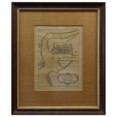
Rare Charleston, South Carolina Engraved Map "Town and Harbor, " Circa 1747
By Bowen
Located in Hollywood, SC
Charleston, South Carolina engraved map of "The Town and Harbor of Charles town" in wood frame by
Category
1740s American American Colonial Antique South Carolina Maps
Original Antique Map of The American State of South Carolina, 1889
Located in St Annes, Lancashire
Great map of South Carolina
Drawn and Engraved by W. & A.K. Johnston
Published By A & C Black
Category
1880s Scottish Victorian Antique South Carolina Maps
Materials
Paper
No Reserve
H 8 in W 11 in D 0.07 in
Large Original Antique Map of South Carolina by Rand McNally, circa 1900
By Rand McNally & Co.
Located in St Annes, Lancashire
Fabulous monochrome map with red outline color
Original color
By Rand, McNally & Co
Category
Early 1900s American Edwardian Antique South Carolina Maps
Materials
Paper
No Reserve
H 20.5 in W 27.5 in D 0.07 in
A Rare French Engraved Map of The Southeastern United States. R.Bonne Circa 1780
By Rigobert Bonne
Located in Hollywood, SC
, North Carolina, South Carolina, and Georgia. Rigobert Bonne, Paris Circa 1780. Plate measures 8.75
Category
1780s French Louis XVI Antique South Carolina Maps
Materials
Paper, Wood
H 16.5 in W 21 in D 1 in
Antique Map of the United States of North America ‘East’ by A.K. Johnston, 1865
Located in Langweer, NL
, Alabama, Florida, Virginia, North Carolina, South Carolina, Tennessee, Kentucky, Ohio and more. This map
Category
Mid-19th Century Antique South Carolina Maps
Materials
Paper
H 24.41 in W 19.1 in D 0.02 in
South Carolina. USA. Century Atlas state antique vintage map
Located in Melbourne, Victoria
'The Century Atlas. South Carolina'
Original antique map, 1903.
Central fold as issued. Map name
Category
Early 20th Century Victorian Antique South Carolina Maps
Materials
Lithograph
Florida and Virginia: A 17th Century Hand-colored Map by Hondius after Mercator
By Gerard Mercator
Located in Alamo, CA
from the Chesapeake Bay south to St. Augustine, including present day North and South Carolina and
Category
Early 17th Century Antique South Carolina Maps
Materials
Engraving
The Atlantic Ocean, Americas, Africa and Europe: Hand-colored 18th C. Bowen Map
Located in Alamo, CA
referring to English claim on the Carolinas: "The south boundary of Carolina according to King Charles II'ds
Category
Mid-18th Century Old Masters Antique South Carolina Maps
Materials
Engraving
A Cotton Picker - Realist Figurative Oil Painting by William Aiken Walker
By William Aiken Walker
Located in Marlow, Buckinghamshire
work depicts an African American South Carolina lady smoking a pipe while she picks cotton in a field
Category
Early 20th Century American Realist Antique South Carolina Maps
Materials
Board, Oil
A Cotton Picker - Realist Figurative Oil Painting by William Aiken Walker
By William Aiken Walker
Located in Marlow, Buckinghamshire
work depicts an African American South Carolina gentleman smoking a pipe while she picks cotton in a
Category
Early 20th Century American Realist Antique South Carolina Maps
Materials
Board, Oil
Pensacola - Original Etching 1769
By Dominic Serres
Located in Roma, IT
Pensacola in the late XVIII century, described the Floridian city in his "Travels Through North and South
Category
1790s Old Masters Antique South Carolina Maps
Materials
Etching
Lewis' the State of South Carolina, 1795 Map
Located in Atlanta, GA
Lewis' the State of South Carolina, 1795 map.
Category
1790s Antique South Carolina Maps
Engraved Map of South Carolina from John Payne's Book, circa 1799
By John Payne
Located in Atlanta, GA
Engraved map of the state of South Carolina from John Payne's "New & Complete Universal Geography
Category
1790s American Antique South Carolina Maps
Materials
Paper
1778 Map of Plans of Cities and Harbours. including Havana, Cuba."
By Thomas Conder
Located in New York, NY
the River Delaware from Chester to Philadelphia", "Plan of the Harbour of Charles Town, South Carolina
Category
1770s Realist Antique South Carolina Maps
Materials
Engraving
Get Updated with New Arrivals
Save "Antique South Carolina Maps", and we’ll notify you when there are new listings in this category.
Antique South Carolina Maps For Sale on 1stDibs
There is a range of antique south carolina maps for sale on 1stDibs. Each of these unique antique south carolina maps was constructed with extraordinary care, often using paper, animal skin and shagreen. There are all kinds of antique south carolina maps available, from those produced as long ago as the 18th Century to those made as recently as the 19th Century. Antique south carolina maps made by Georgian designers — are very popular at 1stDibs. Many antique south carolina maps are appealing in their simplicity, but G.W. & C.B. Colton, Herman Moll and Pierre François Tardieu produced popular antique south carolina maps that are worth a look.
How Much are Antique South Carolina Maps?
The average selling price for at 1stDibs is $2,774, while they’re typically $80 on the low end and $9,721 highest priced.
More Ways To Browse
Antique Railroad Watches
Antique Railroad Watch
George Gordon Silver
Cuba Map
Cuban Map
Arden B
Antique Map North Carolina
Antique Maps Of New Mexico
Antique Maps North Carolina
Map Antarctica
Antique Postcard Collection
Charles Morin Fine Art
Life Cereal
Antique Pocket Calendar
Antique Maps Of North Carolina
Old Antique Suitcases
Miniature Piano
Mountain Place Cards
