Copper Map
92
to
67
428
159
294
177
161
122
92
76
73
59
51
50
44
35
35
26
26
25
22
21
21
16
16
15
13
12
11
9
8
8
7
7
7
6
6
6
6
5
5
5
5
5
4
4
4
3
3
3
3
3
2
2
2
2
2
2
2
2
1
1
1
1
24
14
13
8
7
Sort By
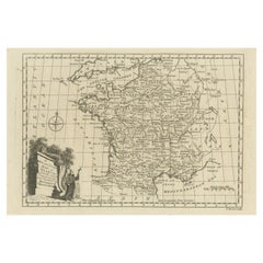
Original Copper Engraved Map of France
Located in Langweer, NL
Antique map titled 'New and Accurate Map of France from the latest improvements'. Original copper
Category
Antique Late 18th Century Maps
Materials
Paper
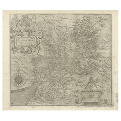
Antique Copper Engraved Map of Gloucestershire in England, 1637
Located in Langweer, NL
Antique map titled 'Glocestriae comitatus olim sedes Dobunorum'. Map of Gloucestershire, England
Category
Antique 17th Century Maps
Materials
Paper
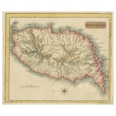
Copper Engraved Grenada Map by John Thompson Published in 1810
Located in Langweer, NL
John Thomson's original antique map of Grenada, dating back to 1810 and hailing from Edinburgh
Category
Antique Early 19th Century Maps
Materials
Paper
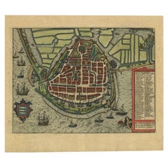
Detailed Copper Engraved City Map of Enkuizen, the Netherlands, c.1620
By L. Guicciardini
Located in Langweer, NL
Antique map titled 'Die stadt Enchuijsen.' Detailed copper engraved city map of Enkuizen, the
Category
Antique 17th Century Maps
Materials
Paper
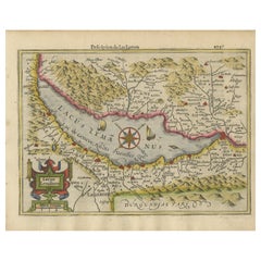
Beautiful Original Copper Engraved Map of Lake Geneva in Switzerland, 1613
Located in Langweer, NL
Description: Antique map titled 'Lacus Lemanus'.
Old map of Lake Geneva with good detail of
Category
Antique 1610s Maps
Materials
Paper
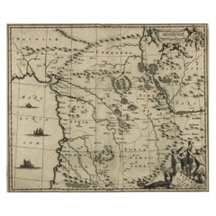
Original Copper Engraving of a Map of Syria and Lebanon, 1698
Located in Langweer, NL
Antique map titled 'Syriae, sive Soriae, Nova et Accurata Descriptio.'
Map of Syria and Lebanon
Category
Antique 1690s Maps
Materials
Paper
Free Shipping
H 12.41 in W 14.45 in D 0 in
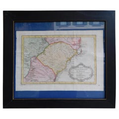
French Framed Copper Engraved Hand Colored Map of Carolina & Georgia, Circa 1757
Located in Hollywood, SC
French copper engraved hand colored map of Carolina & Georgia matted under glass with a painted
Category
Antique 1750s French Louis XV Maps
Materials
Paper, Paint, Wood, Glass
H 14.5 in W 16.75 in D 1 in
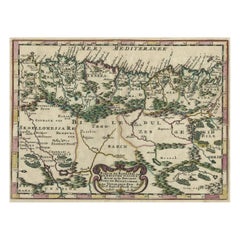
Copper-Engraved Map Showing the Algerian Coast of North Africa, Published 1683
Located in Langweer, NL
Antique map titled 'Partie de Barbarie, ou est le Royaume d'Alger (..)'.
Copper-engraved map
Category
Antique 1680s Maps
Materials
Paper
H 8.51 in W 11.78 in D 0 in
Original Copper Engraved Map of the Bering Strait by Captain Cook, 1803
Located in Langweer, NL
Antique map titled 'Kaart van den Mond van Norton, en van de Engte van Bhering, toonende de meest
Category
Antique Early 1800s Maps
Materials
Paper
Copper Engraved Map of Tierra del Fuego and the Strait of Magellan, c1780
Located in Langweer, NL
Antique map titled 'Extremite Meridionale de l'Amerique.'
Copper engraved map of Tierra del
Category
Antique 1780s Maps
Materials
Paper
H 12.21 in W 18.51 in D 0 in
Antique Copper Engraved Map of Germany in the Early 18th Century, c.1740
Located in Langweer, NL
Antique map Germany titled 'Allemagne'.
Rare miniature map of Germany and surroundings. Also
Category
Antique 18th Century Maps
Materials
Paper
Large Copper Engraved Map of the Coastline of Friesland and Terschelling, c.1670
Located in Langweer, NL
Antique print, titled: 'Dominii Frisiae Tabula, inter Flevum et Lavicum (…)'
This large copper
Category
Antique 1670s Maps
Materials
Paper
H 20.28 in W 23.9 in D 0 in
Original Old Copper Engraved Map of the Region of Albi, Southern France, 1663
Located in Langweer, NL
Antique map titled 'Carte du Diocese d'Alby'.
Original antique map of the region of Albi in
Category
Antique 1660s Maps
Materials
Paper
H 12.6 in W 15.16 in D 0 in
Rare Antique Copper Engraving of a Map of Pegu and Arakan, Burma (Myanmar), 1714
Located in Langweer, NL
Antique map Myanmar (Birma) titled 'Les Royaumes de Pegu et d'Aracan'.
Rare map of Pegu and
Category
Antique 1710s Maps
Materials
Paper
H 7.29 in W 9.06 in D 0 in
Antique Map of New Jersey
Located in Langweer, NL
Antique map titled 'Colton's New Jersey'. This rare hand colored map of New Jersey is a copper
Category
Antique Mid-19th Century Maps
Materials
Paper
1812 United States Map, by Pierre Tardieu, Antique French Map Depicting the U.S.
By Pierre François Tardieu
Located in Colorado Springs, CO
Map by Tardieu
This attractive map, published in Paris in 1812, is one of the most rare large
Category
Antique 1810s French Maps
Materials
Paper
H 43.5 in W 48 in D 2.25 in
Colored wall map of the WORLD
By Chambon
Located in ZWIJNDRECHT, NL
.. - 1781)
Paris, Longchamps et Janvier, 1754
Size H. 115 x W. 145 cm.
Gobert-Denis Chambon made copper
Category
Antique Mid-18th Century French French Provincial Maps
Materials
Wood, Paper
Greece 1660 Jan Jansson Watercolour Map Peloponesus Sive Morea I Laurenbergio
Located in GB
We are delighted to offer for sale this Jan Jansson Date: 1660 (published) Amsterdam map of Greece
Category
Antique 1660s Danish Dutch Colonial Maps
Materials
Copper
H 20.08 in W 23.43 in D 0.79 in
Original Antique Map of Asia. C.1780
Located in St Annes, Lancashire
Great map of Asia
Copper-plate engraving
Published C.1780
Two small worm holes to right side of
Category
Antique Early 1800s English Georgian Maps
Materials
Paper
Original Antique Map of India. C.1780
Located in St Annes, Lancashire
Great map of India
Copper-plate engraving
Published C.1780
Three small worm holes to right
Category
Antique Early 1800s English Georgian Maps
Materials
Paper
Original Antique Map of Italy. C.1780
Located in St Annes, Lancashire
Great map of Italy
Copper-plate engraving
Published C.1780
Unframed.
Category
Antique Early 1800s English Georgian Maps
Materials
Paper
Original Antique Map of Hungary, Arrowsmith, 1820
Located in St Annes, Lancashire
Great map of Hungary
Drawn under the direction of Arrowsmith.
Copper-plate engraving.
Published
Category
Antique 1820s English Maps
Materials
Paper
Original Antique Map of France, Arrowsmith, 1820
Located in St Annes, Lancashire
Great map of France
Drawn under the direction of Arrowsmith.
Copper-plate engraving
Category
Antique 1820s English Maps
Materials
Paper
Original Antique Map of Europe, Arrowsmith, 1820
Located in St Annes, Lancashire
Great map of Europe
Drawn under the direction of Arrowsmith.
Copper-plate engraving
Category
Antique 1820s English Maps
Materials
Paper
Original Antique Map of Italy. Arrowsmith. 1820
Located in St Annes, Lancashire
Great map of Italy
Drawn under the direction of Arrowsmith
Copper-plate engraving
Published by
Category
Antique 1820s English Maps
Materials
Paper
Original Antique Map of Canada, Arrowsmith, 1820
Located in St Annes, Lancashire
Great map of Canada.
Drawn under the direction of Arrowsmith.
Copper-plate engraving
Category
Antique 1820s English Maps
Materials
Paper
Original Antique Map of China, Arrowsmith, 1820
Located in St Annes, Lancashire
Great map of China
Drawn under the direction of Arrowsmith
Copper-plate engraving
Category
Antique 1820s English Maps
Materials
Paper
Antique County Map of Derbyshire, England, 1804
Located in Langweer, NL
in London from circa 1800. His maps were finely engraved on copper and featured beautiful hand
Category
Antique Early 1800s Maps
Materials
Paper
1875 "North America" Map by J. Bartholomew
Located in Colorado Springs, CO
Presented is an original 1875 map of “North America.” The map was issued in Volume 1 of the Ninth
Category
Antique 1870s Scottish Maps
Materials
Paper
Antique County Map of Leicestershire, England, 1804
Located in Langweer, NL
working in London from circa 1800. His maps were finely engraved on copper and featured beautiful hand
Category
Antique Early 1800s Maps
Materials
Paper
German Antique Map of Southeastern Australia, 1904
Located in Langweer, NL
chromolithography, rather than copper plate engraving, but reproducing the maps from zinc plates that were etched in
Category
20th Century Maps
Materials
Paper
Original Antique Map of South America. C.1780
Located in St Annes, Lancashire
Great map of South America
Copper-plate engraving
Published C.1780
Two small worm holes to left
Category
Antique Early 1800s English Georgian Maps
Materials
Paper
Antique Map of Northern Jutland by Kaerius, 1628
Located in Langweer, NL
Antique map titled 'Iutia Septentrionalis'. Copper engraved map of Northern Jutland (Denmark) by P
Category
Antique Mid-17th Century Maps
Materials
Paper
Original Antique Map of Russia By Arrowsmith. 1820
Located in St Annes, Lancashire
Great map of Russia
Drawn under the direction of Arrowsmith
Copper-plate engraving
Published by
Category
Antique 1820s English Maps
Materials
Paper
Original Antique Map of South Africa, Arrowsmith, 1820
Located in St Annes, Lancashire
Great map of South Africa.
Drawn under the direction of Arrowsmith.
Copper-plate engraving
Category
Antique 1820s English Maps
Materials
Paper
Antique Map of Vänersborg by Merian 'circa 1680'
Located in Langweer, NL
Antique map titled 'Grundtriss und Situation von der Statt und Vöstung Wennersburg'. Copper
Category
Antique Late 17th Century Maps
Materials
Paper
Original Antique Map of South America, circa 1830
Located in St Annes, Lancashire
Great map of South America
Copper plate engraving
Published by Butterworth, Livesey & Co
Category
Antique Early 1800s English Other Maps
Materials
Paper
Antique County Map of Monmouthshire, England, circa 1804
Located in Langweer, NL
in London from circa 1800. His maps were finely engraved on copper and featured beautiful hand
Category
Antique Early 1800s Maps
Materials
Paper
Antique Map of Oberlausitz by Homann Erben, '1746'
Located in Langweer, NL
Budissin (..)'. Copper engraved map of Oberlausitz, a historical region of Saxony & Germany that covers
Category
Antique Mid-18th Century Maps
Materials
Paper
Antique Map of the Netherlands by Guicciardini, 1582
Located in Langweer, NL
Antique map titled 'Hollandiae Cattorum Regionis Typus'. Early copper engraving of the Netherlands
Category
Antique 16th Century Maps
Materials
Paper
Antique Map of France with Decorative Border, 1766
Located in Langweer, NL
Antique map titled 'La France, divisée en ses quarante Gouvernemens Généraux.' Attractive map of
Category
Antique 18th Century Maps
Materials
Paper
Antique Map of Central Asia and India, 1904
Located in Langweer, NL
Antique map titled 'Zentralasien und Vorderindien'. Map of Central Asia and India. This large
Category
20th Century Maps
Materials
Paper
Antique Map of New Zealand and Tasmania, 1904
Located in Langweer, NL
chromolithography, rather than copper plate engraving, but reproducing the maps from zinc plates that were etched in
Category
20th Century Maps
Materials
Paper
Antique Decorative County Map of Huntingdonshire, England, 1804
Located in Langweer, NL
circa 1800. His maps were finely engraved on copper and featured beautiful hand colouring. The county
Category
Antique Early 1800s Maps
Materials
Paper
No Reserve
H 25.2 in W 21.26 in D 0 in
Antique Decorative County Map of Lincolnshire, England, 1804
Located in Langweer, NL
. His maps were finely engraved on copper and featured beautiful hand colouring. The county maps were
Category
Antique Early 1800s Maps
Materials
Paper
Antique Map of Southern India by Andree, 1904
Located in Langweer, NL
"Antique map titled 'Vorderindien, sudlicher Teil'. Map of India, southern part. This map
Category
20th Century Maps
Materials
Paper
Original Antique Map of Sweden, Engraved by Barlow, 1806
Located in St Annes, Lancashire
Great map of Sweden
Copper-plate engraving by Barlow
Published by Brightly & Kinnersly
Category
Antique Early 1800s English Maps
Materials
Paper
Original Antique Map of Central America / Florida, Arrowsmith, 1820
Located in St Annes, Lancashire
Great map of Central America.
Drawn under the direction of Arrowsmith.
Copper-plate engraving
Category
Antique 1820s English Maps
Materials
Paper
No Reserve
H 10.5 in W 16 in D 0.07 in
Original Antique Map of South East Asia, Arrowsmith, 1820
Located in St Annes, Lancashire
Great map of South East Asia
Drawn under the direction of Arrowsmith
Copper-plate engraving
Category
Antique 1820s English Maps
Materials
Paper
Original Antique Map of Spain and Portugal, circa 1790
Located in St Annes, Lancashire
Super map of Spain and Portugal
Copper plate engraving by A. Bell
Published, circa 1790
Category
Antique 1790s English Other Maps
Materials
Paper
Antique Hand-Colored County Map of Rutland, England, 1804
Located in Langweer, NL
1800. His maps were finely engraved on copper and featured beautiful hand colouring. The county maps
Category
Antique Early 1800s Maps
Materials
Paper
Original Antique Map of China by Thomas Clerk, 1817
Located in St Annes, Lancashire
Great map of China
Copper-plate engraving
Drawn and engraved by Thomas Clerk, Edinburgh
Category
Antique 1810s English Maps
Materials
Paper
Antique Map of Scandinavia by T. Jefferys, circa 1750
Located in Langweer, NL
Antique map titled 'Sweden, Denmark, Norway & Finland'. An original mid-18th century copper
Category
Antique Mid-18th Century Maps
Materials
Paper
Original Antique Map of Ancient Greece- Boeotia, Thebes, 1787
Located in St Annes, Lancashire
Great map of Ancient Greece. Showing the region of Boeotia, including Thebes
Drawn by J.D
Category
Antique 1780s French Other Maps
Materials
Paper
Original Antique Map of Ancient Greece, Achaia, Corinth, 1786
Located in St Annes, Lancashire
Great map of Ancient Greece. Showing the region of Thessaly, including Mount Olympus
Drawn by
Category
Antique 1780s French Other Maps
Materials
Paper
Antique Map of the Low Countries by Brué, 1822
Located in Langweer, NL
Antique map titled 'Carte du Royaume des Pays-Bas'. Large format map of the Low Countries. This map
Category
Antique 19th Century Maps
Materials
Paper
Antique Map of Celebes 'Sulawesi', Island in Indonesia, 1754
By Jacques-Nicolas Bellin
Located in Langweer, NL
Antique map titled 'Carte De L'Isle Celebes ou Macassar'. Detailed copper engraved map of Celebes
Category
Antique 18th Century Maps
Materials
Paper
1590 Mercator Map Entitled "France Picardie Champaigne, Ric.0001
Located in Norton, MA
Picardie and Champagne.) Copper engraved map of the french provinces of Picardie and Champagne, showing the
Category
Antique 16th Century Dutch Maps
Materials
Paper
Original Antique Map of France, Sherwood, Neely & Jones, Dated 1809
Located in St Annes, Lancashire
Great map of France
Copper-plate engraving by Cooper
Published by Sherwood, Neely & Jones
Category
Antique Early 1800s English Maps
Materials
Paper
No Reserve
H 10.25 in W 8.25 in D 0.07 in
Road Map, John Ogilby, No 54, London, Yarmouth, Britannia
By John Ogilby
Located in BUNGAY, SUFFOLK
-sixth year, as a publisher of maps and geographical accounts.
Ogilby was born outside Dundee, in
Category
Antique 1670s English Baroque Maps
Materials
Paper
- 1
Get Updated with New Arrivals
Save "Copper Map", and we’ll notify you when there are new listings in this category.
Copper Map For Sale on 1stDibs
With a vast inventory of beautiful furniture at 1stDibs, we’ve got just the copper map you’re looking for. A copper map — often made from paper, copper and metal — can elevate any home. You’ve searched high and low for the perfect copper map — we have versions that date back to the 18th Century alongside those produced as recently as the 19th Century are available. A copper map is a generally popular piece of furniture, but those created in Louis XV styles are sought with frequency. Many designers have produced at least one well-made copper map over the years, but those crafted by J.B. Elwe and L. Guicciardini are often thought to be among the most beautiful.
How Much is a Copper Map?
Prices for a copper map can differ depending upon size, time period and other attributes — at 1stDibs, they begin at $152 and can go as high as $2,800, while the average can fetch as much as $506.
More Ways To Browse
Antique Map Scandinavia
Serbia Antique Map
William Acton
Albania Antique Map
Antique Barbie Furniture
Antique Puerto Rico Map
Antique Maps Scandinavia
Antique Map Of Puerto Rico
Sierra Leone Antique Map
Antique Maps Of Puerto Rico
Antique Boat Compass
Magellan Map
G Plan 62
Irish Canterbury
Irish Canterbury Furniture
Congo Antique Map
Antique Map Louisiana
Rush Seats With Final
