Map Of Arkansas
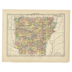
Antique Map of Arkansas
Located in Langweer, NL
Antique map titled 'Arkansas'. Original antique map of Arkansas, United States. This print
Category
Antique Late 19th Century Maps
Materials
Paper
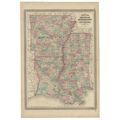
Antique Map of Arkansas, Mississippi and Louisiana by Johnson, 1872
Located in Langweer, NL
Antique map titled 'Johnson's Arkansas (..)'. Original map of Arkansas, Mississippi and Louisiana
Category
Antique Late 19th Century Maps
Materials
Paper
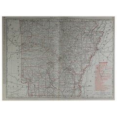
Large Original Antique Map of Arkansas by Rand McNally, circa 1900
By Rand McNally & Co.
Located in St Annes, Lancashire
Fabulous monochrome map with red outline color
Original color
By Rand, McNally & Co
Category
Antique Early 1900s American Edwardian Maps
Materials
Paper
1 bid
No Reserve
H 20.5 in W 27.5 in D 0.07 in
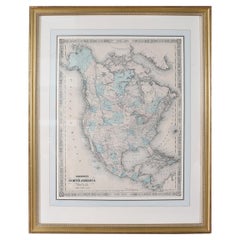
Antique Map of North America, 1821
Located in Langweer, NL
Antique map of America titled 'Carte de l'Amerique septentrionale'. Scarce map of North America
Category
Antique 19th Century Maps
Materials
Paper
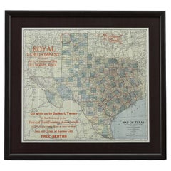
1908 "Map of Texas" by The Kenyon Company
Located in Colorado Springs, CO
prominently on this fantastic map. Although uncolored, the bordering states of New Mexico, Oklahoma, Arkansas
Category
Antique Early 1900s American Maps
Materials
Paper
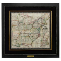
1866 Ensign & Bridgman's Rail Road Map of the United States
Located in Colorado Springs, CO
borders of Minnesota, Iowa, Missouri, Arkansas, and Louisiana. As alluded to in its title, the map
Category
Antique 1860s American Late Victorian Maps
Materials
Paper
1859 "Map of the United States of America..." by J. H. Colton
By J.H. Colton
Located in Colorado Springs, CO
Presented is an 1859 “Map of the United States of America, the British Provinces, Mexico, the West
Category
Antique 1850s American Maps
Materials
Paper
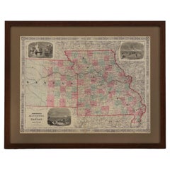
1865 "Johnson's Missouri and Kansas" Map by Johnson and Ward
Located in Colorado Springs, CO
Iowa, Illinois, and Arkansas. The map is beautifully detailed, with railroads, roads, rivers and creeks
Category
Antique Mid-19th Century Maps
Materials
Paper
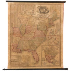
1842 Wall Map of the United States by J. H. Young, Published by S. A. Mitchell
Located in Colorado Springs, CO
Presented is an 1842 hanging “Map of the United States,” engraved by J. H. Young and published by
Category
Antique 1840s American Maps
Materials
Paper
H 45 in W 38 in D 1 in
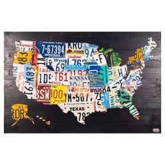
Contemporary Assemblage License Plate Art Map of the USA by Design Turnpike
Located in Keego Harbor, MI
Another recently finished unique and impressive map on Very Black wood planks that will be the
Category
21st Century and Contemporary Contemporary Art
Materials
Metal
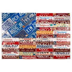
Contemporary Assemblage Map License Plate Art American Flag by Design Turnpike
Located in Keego Harbor, MI
and maps under the name Design Turnpike. As a boy, he loved keeping track of license plates. Road
Category
21st Century and Contemporary Contemporary Art
Materials
Metal
H 32.5 in W 48 in D 1 in
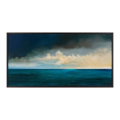
Framed Oil on Canvas "Gulf Stream" by Michael Francis Reagan
Located in Savannah, GA
Michael Francis Reagan was born in the piney woods of south Arkansas but grew up in Army bases
Category
21st Century and Contemporary American Paintings
Materials
Canvas
Framed Oil on Board "Salt Marsh" by Michael Francis Reagan
Located in Savannah, GA
Michael Francis Reagan was born in the piney woods of south Arkansas but grew up in Army bases
Category
21st Century and Contemporary American Paintings
Materials
Canvas
Framed Oil on Canvas "Marsh Islands" by Michael Francis Reagan
Located in Savannah, GA
Michael Francis Reagan was born in the piney woods of south Arkansas but grew up in Army bases
Category
21st Century and Contemporary American Paintings
Materials
Canvas
Framed Oil on Board "November Morning" by Michael Francis Reagan
Located in Savannah, GA
Michael Francis Reagan was born in the piney woods of south Arkansas but grew up in Army bases
Category
21st Century and Contemporary American Paintings
Materials
Canvas
Framed Oil on Canvas "North Star" by Michael Francis Reagan
Located in Savannah, GA
Michael Francis Reagan was born in the piney woods of south Arkansas but grew up in Army bases
Category
21st Century and Contemporary American Paintings
Materials
Canvas
Framed Oil on Canvas "Arrowheads" by Michael Francis Reagan
Located in Savannah, GA
Michael Francis Reagan was born in the piney woods of south Arkansas but grew up in Army bases
Category
21st Century and Contemporary American Paintings
Materials
Canvas
Framed Oil on Canvas "The Stopping Tree" by Michael Francis Reagan
Located in Savannah, GA
Michael Francis Reagan was born in the piney woods of south Arkansas but grew up in Army bases
Category
21st Century and Contemporary American Paintings
Materials
Canvas
Contemporary Assemblage John F Kennedy License Plate Art by Design Turnpike
Located in Keego Harbor, MI
Fitzgerald Kennedy's suit lapel.
David Bowman creates handmade license plate art and maps under the name
Category
21st Century and Contemporary Contemporary Art
Materials
Metal
Christo and Jeanne-Claude and Christo Signed in Christo in Crayon Lithograph
By Christo and Jeanne-Claude
Located in Chicago, IL
above the Arkansas River along a 42-mile stretch of the river between Salida and Cañon City in south
Category
1990s North American Organic Modern Contemporary Art
Materials
Paper
H 42.5 in W 34 in D 1.25 in
People Also Browsed
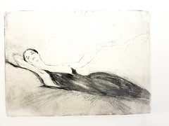
Jean Gabriel Domergue - Lying Woman - Original Etching
By Jean-Gabriel Domergue
Located in Collonge Bellerive, Geneve, CH
Original Etching by Jean-Gabriel Domergue
Dimensions: 33 x 25 cm
1924
Edition of 100
This artwork is part of the famous portfolio The Afternoon of a Faun.
Jean-Gabriel Domergue
Jea...
Category
1920s Impressionist Nude Prints
Materials
Lithograph
H 15.75 in W 12.21 in D 0.04 in
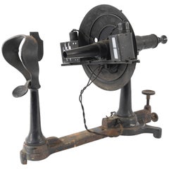
Antique Ophthalmometer Eye Machine by General Optical Company
Located in Norwalk, CT
This Antique Universal Ophthalmometer Eye Exam Machine by General Optical Company is stamped “Pat Oct 24th 1911”. This is an optical optometrist device to measure the curvature of th...
Category
Early 20th Century Scientific Instruments
Antique Kodak No. 2 Premo Folding Camera c.1916 (FREE SHIPPING)
By Eastman Kodak
Located in San Francisco, CA
ABOUT
An original Eastman Kodak No. 2 folding camera. The body of camera is all leather with that folds smoothly closed to 1.5 inches. This camera has retained its original finish...
Category
Early 20th Century Industrial Photography
Materials
Chrome
Japanese Antique Pottery Jar 15th-16th Century/ Wabi-Sabi Jar/Tokoname Vase
Located in Sammu-shi, Chiba
It is a very old jar in Japan.
This is a pottery called Tokoname ware.
Tokoname is a kiln located in Aichi prefecture, Japan.
It is said to have originated around the 12th century.
A...
Category
Antique 16th Century Japanese Other Vases
Materials
Pottery
Antique Rosewood Folding Stereoscope Viewer - Philadelphia Gallery of Fine Arts
Located in Centennial, CO
This stunning and highly unusual folding stereoscope viewer was crafted out of rosewood and brass in the Victorian style of the late 1800s. The plaque attached to the eyepiece is ins...
Category
Antique Late 19th Century American Victorian Picture Frames
Materials
Brass
H 5.5 in W 24 in D 12 in
Japanese antique pottery Wabisabi vase/15th century/Bizen ware/Muromachi period
Located in Sammu-shi, Chiba
I would like to introduce an attractive pot that gives you a sense of wabi-sabi.
It is "Shigaraki ware".
Shigaraki is a historical kiln located in Shiga Prefecture, Japan. (Shigaraki...
Category
Antique 15th Century and Earlier Japanese Other Vases
Materials
Pottery
H 12.6 in Dm 12.41 in
Antique Map of The United States of North America, 1882
Located in Langweer, NL
This is a historical map titled "The United States of North America, Central Part" from the 1882 Blackie Atlas. It depicts the continental United States with a high level of detail, ...
Category
Antique 1880s Maps
Materials
Paper
Large Kodak No. 2 Folding Camera with Leather Case c.1903 (FREE SHIPPING)
By Eastman Kodak
Located in San Francisco, CA
ABOUT
A large leather wrapped Eastman Kodak Anastigmat No.2 folding camera with chrome and brass accents. Original leather case with brass lock. Folds smoothly closed to 2.25 inch...
Category
Early 20th Century Industrial Photography
Materials
Chrome, Brass
Rare Japanese antique pottery jar/13th century/Kamakura period/Excavated pottery
Located in Sammu-shi, Chiba
We would like to introduce you to some fascinating pots excavated in Japan.
This is a pot fired in an ancient Japanese kiln called Tokoname ware.
Tokoname is a kiln located in Aichi...
Category
Antique 15th Century and Earlier Japanese Other Jars
Materials
Pottery
H 15.08 in Dm 14.81 in
Large Original Antique Map of Ohio, Usa, C.1900
Located in St Annes, Lancashire
Fabulous map of Ohio
Original color.
Engraved and printed by the George F. Cram Company, Indianapolis.
Published, C.1900.
Unframed.
Free shipping.
Category
Antique 1890s American Maps
Materials
Paper
Large Kodak No. 2C Folding Pocket Camera/Leather Case c.1914 (FREE SHIPPING)
By Eastman Kodak
Located in San Francisco, CA
ABOUT
An original large Eastman Kodak No. 2C folding pocket camera with red bellows. The body is wrapped in leather with chrome and brass accents. The camera folds to 2.25 inches. O...
Category
Early 20th Century Industrial Photography
Materials
Brass, Chrome
H 9.5 in W 4 in D 7.5 in
Plan of Paris, France, by A. Vuillemin, Antique Map, 1845
Located in Colorado Springs, CO
This large and detailed plan of Paris was published by Alexandre Vuillemin in 1845. The map conveys a wonderful amount of information and is decorated throughout with pictorial vigne...
Category
Antique 1840s American Maps
Materials
Paper
Original Lithograph - Henri Matisse - Apollinaire
By Henri Matisse
Located in Collonge Bellerive, Geneve, CH
Original Lithograph - Henri Matisse - Apollinaire
Artist : Henri MATISSE
13 x 10 inches
Edition: 151/330
References : Duthuit-Matisse Catalogue raisonné 31
MATISSE'S BIOGRAPHY
YO...
Category
1930s Modern Portrait Prints
Materials
Linocut
Japanese antique pottery vase/14th-15th century/Tokoname ware/Wabi-Sabi
Located in Sammu-shi, Chiba
It is a very old jar in Japan.
This is a pottery called Tokoname ware.
Tokoname is a kiln located in Aichi prefecture, Japan.(Tokoname Kiln is marked with a red circle on the map.)
I...
Category
Antique 15th Century and Earlier Japanese Other Vases
Materials
Pottery
A truly delightful miniature terrestrial pocket globe
By Nathaniel Mills
Located in ZWIJNDRECHT, NL
A truly delightful miniature terrestrial pocket globe in a celestial case, 3 inches / 6.8 cm. The globe consists of 12 wonderful varnished, engraved hand-coloured gores that stretch ...
Category
Antique Mid-18th Century British Dutch Colonial Globes
Materials
Other
Antique Coaching Road Map, Devon, English, Regional Cartography, Georgian, 1720
Located in Hele, Devon, GB
This is an antique coaching road map of Devon. An English, framed lithograph engraving of regional interest, dating to the early 18th century and later.
Fascinating 18th century hig...
Category
Antique Early 18th Century British Georgian Maps
Materials
Wood
H 12.21 in W 9.65 in D 0.6 in
Recent Sales
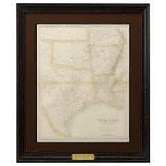
Giltwood Framed and Matted Map
Located in Tarry Town, NY
Giltwood framed and matted library / study room map of Arkansas, Mississippi, Louisiana. Each map
Category
Early 20th Century Posters
Materials
Giltwood, Paper
1860 Map of South Central United States by Swanston, Antique Hand-Colored Map
Located in Colorado Springs, CO
, Arkansas, Western Territory, and Part of Missouri" this map was published in The Royal Illustrated Atlas of
Category
Antique 1860s British Maps
Materials
Paper
H 28.5 in W 24 in D 1 in
1844 Map of the World on Mercator's Projection by Atwood and Ensign, Antique Map
Located in Colorado Springs, CO
This 1844 large format world map is surrounded by several decorative elements including 91 flags of
Category
Antique 1840s American Maps
Materials
Paper
H 47.5 in W 60.5 in D 4 in
1856 Map of the State of Texas by J. H. Colton
Located in Colorado Springs, CO
Mexico, Arkansas and the Indian Territory (Oklahoma). At lower left, Colton included three inset maps
Category
Antique 1850s American Maps
Materials
Paper
1828 "Map of the United States" by T. Ensign
Located in Colorado Springs, CO
Presented is Timothy Ensign’s “Map of the United States,” published in 1828. The map is one of the
Category
Antique 1820s American Maps
Materials
Paper
Grant's Siege of Vicksburg, Civil War Era Military Map, circa 1863
Located in Colorado Springs, CO
states of Arkansas, Louisiana, and Texas from the rest of the Confederacy.
This map is incredibly
Category
Antique 1860s American Maps
Materials
Paper
Texas Civil War Map, circa 1863
Located in Colorado Springs, CO
of adjacent New Mexico, Arkansas, and the Indian Territory (Oklahoma). The map shows the Elevated
Category
Antique 1860s American Maps
1865 "Johnson's Kentucky and Tennessee" Map by Johnson and Ward
Located in Colorado Springs, CO
Arkansas, Illinois, Alabama, Georgia, North Carolina, Virginia, Ohio, and Indiana. The map is beautifully
Category
Antique Mid-19th Century Maps
Materials
Paper
Contemporary Assemblage Untitled #2 Open Road License Plate Art Design Turnpike
Located in Keego Harbor, MI
David Bowman creates handmade license plate art and maps under the name Design Turnpike. As a boy
Category
21st Century and Contemporary Contemporary Art
Materials
Metal
H 48.5 in W 24.5 in D 1 in
Framed Oil on Canvas "Downeast Sunrise" by Michael Francis Reagan
Located in Savannah, GA
Michael Francis Reagan was born in the piney woods of south Arkansas but grew up in Army bases
Category
21st Century and Contemporary American Paintings
Materials
Canvas
Contemporary Assemblage Aretha Franklin License Plate Art by Design Turnpike
Located in Keego Harbor, MI
maps under the name Design Turnpike. As a boy, he loved keeping track of license plates. Road trips
Category
21st Century and Contemporary Contemporary Art
Materials
Metal
Original Antique Map of Arkansas, circa 1890
Located in St Annes, Lancashire
Great map of Arkansas
Original color.
Published, circa 1890
Repairs to minor edge tears
Category
Antique 1890s English Other Maps
Materials
Paper
Large Original Antique Map of Texas, United States &c. Fullarton, C.1870
Located in St Annes, Lancashire
Great map of Texas. Also showing Indian Territory, Arkansas, Louisiana etc
From the celebrated
Category
Antique 1870s Scottish Maps
Materials
Paper
Free Shipping
H 18.5 in W 22.5 in D 0.07 in
Antique Map of the United States of North America ‘West’ by A.K. Johnston, 1865
Located in Langweer, NL
, Arkansas, Colorado, Nevada, Idaho, Dakota and more. This map originates from the ‘Royal Atlas of Modern
Category
Antique Mid-19th Century Maps
H 19.1 in W 24.41 in D 0.02 in
Framed 19th Century Colton Map of Mexico, Texas, California and US Territories
By J.H. Colton
Located in Alamo, CA
This framed 19th century map of the southern portions of North America by J. H. Colton, published
Category
Antique Mid-19th Century American Other Maps
Materials
Paper
H 20 in W 22.63 in D 0.88 in
Antique Map of the Southern United States with Inset Map of New Orleans
Located in Langweer, NL
Antique map titled 'Die Staaten von Arkansas Mississippi, Louisiana & Alabama'. Detailed map of the
Category
Antique Mid-19th Century Maps
Materials
Paper
H 9.06 in W 12.21 in D 0.02 in
Monumental Pair of Cary's Library Globes
Located in New York, NY
, ending in spade feet on brass casters.
The terrestrial globe is mapped with detailed
Category
Antique 19th Century English Globes
Materials
Mahogany
Get Updated with New Arrivals
Save "Map Of Arkansas", and we’ll notify you when there are new listings in this category.
Map Of Arkansas For Sale on 1stDibs
Find a variety of map of arkansas available on 1stDibs. Each of these unique map of arkansas was constructed with extraordinary care, often using paper, metal and wood. Map of arkansas have long been popular, with older editions for sale from the 19th Century and newer versions made as recently as the 21st Century. Many map of arkansas are appealing in their simplicity, but Christo and Jeanne-Claude, J.H. Colton and Rand McNally & Co. produced popular map of arkansas that are worth a look.
How Much are Map Of Arkansas?
Prices for map of arkansas start at $50 and top out at $15,500 with the average selling for $1,400.
More Ways To Browse
Southern Pacific Railroad
World Map Metal Wall Art
Antique Paper Roller
Lithograph 1800s
California Island Map
Gigantic Table
Used Western Spurs
Talon Table
Drake Design
Georgian Diamond Cross
Snake Linen
Used Wooden Pallet
Used Wooden Pallets
Antique Glass Santa
Western Metal Belt
Antique Captains Table
18th C Pair Brackets
Used Office Furniture South Florida
