Military Maps
9
to
40
198
180
159
126
71
70
69
45
41
36
24
24
24
23
23
18
15
15
14
13
10
10
9
9
9
7
6
5
5
5
5
5
5
4
4
4
3
3
3
2
2
2
2
2
1
1
1
1
1
1
1
1
8
7
5
5
3
Sort By
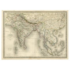
Superb, Large Map of British India, Chinese Empire, Indochina, Malaysia, 1860
Located in Langweer, NL
'Graveur du Depot de la Marine' and in this position engraved numerous French naval and military maps
Category
Antique 1860s Maps
Materials
Paper
H 22.8 in W 31.07 in D 0 in
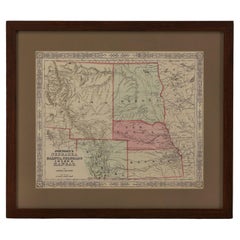
1865 "Johnson's Nebraska, Dakota, Colorado, Idaho & Kansas" Map, Johnson & Ward
Located in Colorado Springs, CO
Virginia” and the “New Military Map of the United States.”
Category
Antique Mid-19th Century Maps
Materials
Paper
H 18.5 in W 21.38 in D 0.75 in
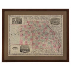
1865 "Johnson's Missouri and Kansas" Map by Johnson and Ward
Located in Colorado Springs, CO
Military Map of the United States.”
Condition: Fine condition overall. Hand Colored. Page 59 and 60 from
Category
Antique Mid-19th Century Maps
Materials
Paper
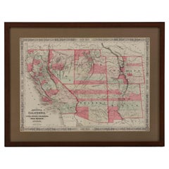
1865 "Johnson's California, Utah, Nevada, Colorado, New Mexico, Arizona" Map
Located in Colorado Springs, CO
Virginia” and the “New Military Map of the United States.”
Condition: Fine condition overall. Hand Colored
Category
Antique Mid-19th Century Maps
Materials
Paper
H 22.5 in W 30.5 in D 0.75 in
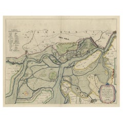
Original Map of the Military Situation After the Dutch Blockade of Antwerp, 1648
Located in Langweer, NL
Antique map titled 'Tabula Castelli ad Sandflitam (..)'.
This map depicts the complex military
Category
Antique 1640s Maps
Materials
Paper
H 19.69 in W 22.05 in D 0 in
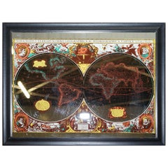
Vintage World Map Mirror Based on the Original by Johnson 1882 Military Campaign
Located in GB
We are delighted to offer for sale this lovely Antique style pictorial plan map of the globe based
Category
20th Century English Campaign Maps
Materials
Mirror
H 18.9 in W 24.02 in D 0.79 in
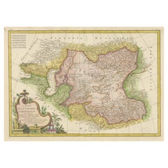
Decorative Antique Map of Central Asia
Located in Langweer, NL
Antique map titled 'Carte de la Tartarie Indépendante (..)'. Decorative map of Central Asia
Category
Antique Late 18th Century Maps
Materials
Paper
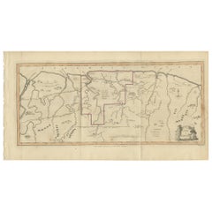
Antique Map of Surinam by Stedman '1813'
Located in Langweer, NL
, military posts, rebel Maroon camps and native villages. This map originates from 'Narrative of a five years
Category
Antique Early 19th Century Maps
Materials
Paper
Antique Map Colton's United States of America
Located in Langweer, NL
Antique map titled 'Colton's United States of America'. Show railroads, canals, state capitals
Category
Antique Mid-19th Century Maps
Materials
Paper
Antique Map of Stavoren by Priorato, 1673
Located in Langweer, NL
Antique map titled 'Staveren'. Original antique map of the city of Stavoren, Friesland, the
Category
Antique 17th Century Maps
Materials
Paper
Antique Map of Stavoren by Priorato, 1673
Located in Langweer, NL
Antique map titled 'Staveren'. Original antique map of the city of Stavoren, Friesland, the
Category
Antique 17th Century Maps
Materials
Paper
Antique Map of Northern Asia by Mallet, 1719
Located in Langweer, NL
Antique map titled 'Das Mitternächtige Theil des Alten Asien'. This sheet of five miniature maps
Category
Antique 18th Century Maps
Materials
Paper
Antique Decorative Coloured Map Marocco, Algeria and Tunis, 1882
Located in Langweer, NL
military expeditions.
3. **Cultural Significance**: Maps like this one represent the knowledge and
Category
Antique 1880s Maps
Materials
Paper
Free Shipping
H 14.97 in W 22.45 in D 0 in
Antique Map of Fortification of Bellingwolderschans, The Netherlands, 1673
Located in Langweer, NL
Antique map titled 'Bellingwolderschans'. Original map of the fortification of Bellingwolderschans
Category
Antique 17th Century Maps
Materials
Paper
H 13.39 in W 9.45 in D 0 in
Antique Map of Japan by A.M. Mallet, 1683
Located in Langweer, NL
A charming late 17th century French map with a very decorative title cartouche showing trumpet
Category
Antique Late 17th Century Maps
Materials
Paper
Antique Map of the Eastern Mediterranean and the Balkans
Located in Langweer, NL
Antique map titled 'La Turquie d'Europe et celle d'Asie'. Attractive double page map of the Eastern
Category
Antique Late 18th Century Maps
Materials
Paper
Antique Map of Switzerland by N. Visscher, circa 1690
Located in Langweer, NL
Italy. This map features two decorative cartouches: the larger is flanked by two putti, one in military
Category
Antique Late 17th Century Maps
Materials
Paper
Original Antique Map of West Central France in Frame, 1748
Located in Langweer, NL
portable, universal, and military collection composed of the best maps available for the King. It is both
Category
Antique 1740s Maps
Materials
Paper
Ancient Iberia: Hispania Map from Spruner-Menke Atlas Antiquus, 1880
Located in Langweer, NL
This map is titled "HISPANIA," indicating it is a historical map of ancient Spain.
It is an
Category
Antique 1880s Maps
Materials
Paper
No Reserve
H 15.56 in W 18.51 in D 0 in
Antique Map of Southern Brazil by Bonne, c.1780
Located in Langweer, NL
"Antique map titled 'Carte de la Partie Méridionale du Bresil (..)'. This antique map of Brazil
Category
Antique 18th Century Maps
Materials
Paper
Antique Map of Southeastern Australia by F. von Stülpnagel, 1850
Located in Langweer, NL
Antique map titled 'Süd-Östlichen Australien'. Map of southeastern Australia with inset maps of
Category
Antique Mid-19th Century Maps
Materials
Paper
Antique Map of Greece from Ortelius's Theatrum Orbis Terrarum, 1595
Located in Langweer, NL
Original antique map titled "Graecia Sophiani." This is a very detailed and decorative engraved map
Category
Antique 16th Century Maps
Materials
Paper
Free Shipping
H 17.92 in W 21.86 in D 0 in
Map of Polynesia Highlighting Cultural Landscapes and Maritime Activities, 1851
Located in Langweer, NL
John Tallis & Company was a London-based map publisher that flourished during the 19th century
Category
Antique 1850s Maps
Materials
Paper
H 10.71 in W 14.26 in D 0 in
Antique Map of Ambon Island by Van den Bosch, '1818'
Located in Langweer, NL
Antique map titled 'Kaart van het Eiland Amboina'. Rare and attractive map of Ambon Island. One of
Category
Antique Early 19th Century Maps
Materials
Paper
Antique Map of Java and Batavia of nowadays Indonesia, '1818'
Located in Langweer, NL
Antique map titled 'Kaart van het Eiland Java'. A rare and attractive early 19th century Dutch map
Category
Antique Early 19th Century Maps
Materials
Paper
Copper Engraved Grenada Map by John Thompson Published in 1810
Located in Langweer, NL
John Thomson's original antique map of Grenada, dating back to 1810 and hailing from Edinburgh
Category
Antique Early 19th Century Maps
Materials
Paper
Antique Map of the Region of Lyonnais by Nolin, 1697
Located in Langweer, NL
Rhone rivers. This map is a single sheet and part of a two sheet map titled 'The General and Military
Category
Antique 17th Century Maps
Materials
Paper
Antique Map of the Siege of Gent by Dumont, 1729
By Dumont
Located in Langweer, NL
Antique map titled 'Plan of the Siege and Attacks of the City and Citadel of Ghent'. Large map
Category
Antique 18th Century Maps
Materials
Paper
Antique Hand-Coloured Miniature Map of Ancient Europe, c.1685
Located in Langweer, NL
Antique map of Europe titled 'Europe Ancienne, Das alte Europa'. Hand-coloured miniature map with
Category
Antique 17th Century Maps
Materials
Paper
Detailed Antique Miniature Map of France by Mallet, c.1683
Located in Langweer, NL
Antique map titled 'France en General'. BG-11796-55. Originates from Mallet's 'Description de
Category
Antique 17th Century Maps
Materials
Paper
Antique Map of the City of Leeuwarden by Priorato, 1673
Located in Langweer, NL
Antique map titled 'Leverden'. This map depicts the city of Leeuwarden (Friesland, The Netherlands
Category
Antique 17th Century Maps
Materials
Paper
The World After the Battle of Corupedium: Hellenistic Kingdoms Map, 1880
Located in Langweer, NL
The map is titled "ORBIS TERRARUM post proelium Corupedinse," which translates to "The World after
Category
Antique 1880s Maps
Materials
Paper
Free Shipping
H 15.56 in W 18.51 in D 0 in
Cortesi's Masterpiece: A Comprehensive and Authoritative Map of Uruguay, 1903
Located in Langweer, NL
progressive geographical sources, both military and civilian, to devise an authoritative national map of the
Category
Early 20th Century Maps
Materials
Paper
Free Shipping
H 72.84 in W 50.79 in D 0.02 in
Antique Map of the Burgundy Region by Mallet, c.1683
Located in Langweer, NL
Antique map titled 'Royaume de Bourgogne sous la seconde Race des Roys de France'. Detailed
Category
Antique 17th Century Maps
Materials
Paper
Antique Map of the City of Alkmaar by Priorato, 1673
Located in Langweer, NL
Antique map titled 'Alcmaer'. Original map of the city of Alkmaar, the Netherlands. This map
Category
Antique 17th Century Maps
Materials
Paper
Antique Map of the Burgundy Region by Mallet, c.1683
Located in Langweer, NL
Antique map titled 'Cercle de Bourgogne'. Detailed miniature map of the Burgundy region, France
Category
Antique 17th Century Maps
Materials
Paper
Antique Map of the Burgundy Region by Mallet, c.1683
Located in Langweer, NL
Antique map titled 'Royaume de Bourgogne sous la Race des Roys Bourguignons (..)'. Detailed
Category
Antique 17th Century Maps
Materials
Paper
Antique Map of the Ternate Islands by Van den Bosch '1818'
Located in Langweer, NL
Antique map titled 'Kaart der Ternataansche Eilanden'. Rare and attractive map of the Ternate
Category
Antique Early 19th Century Maps
Materials
Paper
Antique Map of the Banda Islands by Van den Bosch '1818'
Located in Langweer, NL
Antique map titled 'Kaart der Bandasche Eilanden'. Rare and attractive map of the Banda Islands
Category
Antique Early 19th Century Maps
Materials
Paper
Oriental Realms: A Detailed Map of Persia, Afghanistan, and Beloochistan, 1882
Located in Langweer, NL
military history.
This map would have been a crucial resource for explorers, traders, and imperial
Category
Antique 1880s Maps
Materials
Paper
No Reserve
H 14.97 in W 22.45 in D 0 in
Antique Map of Madura and Surabaya by Van den Bosch, '1818'
Located in Langweer, NL
Two maps on one sheet titled 'Kaart van het Eiland Madura en de Oost hoek van het Eiland Java' and
Category
Antique Early 19th Century Maps
Materials
Paper
Antique Map of the Maluku Islands by Le Rouge, c.1750
By George Louis Le Rouge
Located in Langweer, NL
Antique map Moluccas/Spice Islands titled 'Isles Moluques'. Detailed map of the famous Spice
Category
Antique 18th Century Maps
Materials
Paper
Antique Map of the Empire of the Assyriens by Mallet, 1683
By Alain Manesson Mallet
Located in Langweer, NL
Antique map titled 'Empire des Assyriens' and 'Assyrie Chaldee et Mesopotamie selon les Anciens
Category
Antique 17th Century Maps
Materials
Paper
Antique Map of The Kingdom of Alexander the Great, Published in 1880
Located in Langweer, NL
in Alexander's military campaigns.
4. **Geographical Features**: The map shows important
Category
Antique 1880s Maps
Materials
Paper
Free Shipping
H 15.56 in W 18.51 in D 0 in
Old Map of British Mediterranean Territories with Images of Historic Sites, 1851
Located in Langweer, NL
, essential to Gibraltar's military history.
These insets not only add artistic value to the map but also
Category
Antique 1850s Maps
Materials
Paper
H 14.26 in W 10.71 in D 0 in
Antique Map of Hungary, Transylvania and Dalmatia by W. G. Blackie, 1859
Located in Langweer, NL
(Romania), Dalmatia (Croatia) and the Military Frontiers (Croatia, Slavonia & Banat) with inset map of
Category
Antique Mid-19th Century Maps
Materials
Paper
H 14.57 in W 21.26 in D 0.02 in
Antique Miniature Map of the Western Hemisphere, with California as an Island
Located in Langweer, NL
Antique miniature map titled 'Nouveau Continent avec plusieurs Isles et Mers'. Decorative map of
Category
Antique Late 17th Century Maps
Materials
Paper
H 8.27 in W 5.6 in D 0.02 in
Antique Railroad Map of the United States by Rand, McNally & Co, 1900
Located in Langweer, NL
Antique map titled 'Rand, McNally & Co's New Official Railroad map of the United States with
Category
20th Century Maps
Materials
Linen, Paper
No Reserve
H 30.91 in W 43.9 in D 0.02 in
Antique Map of Bantam, Jakarta and Cirebon by Van den Bosch '1818'
Located in Langweer, NL
Antique map titled 'Kaart van het Ryk van Bantam, Jacatra, Cheribon op het Eiland Java'. Rare and
Category
Antique Early 19th Century Maps
Materials
Paper
Antique Map of Central and East Java by Van den Bosch, 1818
Located in Langweer, NL
Antique map titled 'Kaart van de Keizers en Sultans Landen benevens de Strand Regentschappen op het
Category
Antique Early 19th Century Maps
Materials
Paper
Imperial Splendor: Antique Map of the Ottoman Empire by Blaeu, circa 1640
Located in Langweer, NL
The antique map titled 'Turcicum Imperium' is an original old map of the Ottoman Empire
Category
Antique Mid-17th Century Maps
Materials
Paper
No Reserve
H 17.33 in W 21.54 in D 0.02 in
Antique Map of the Dutch East Indies by Van den Bosch '1818'
Located in Langweer, NL
Antique map titled 'Kaart der Nederlandsche Bezittingen in Oost-Indiën'.
Rare and attractive map
Category
Antique Early 19th Century Maps
Materials
Paper
Asia Minor and Provinces: A Roman Empire Map from Spruner-Menke Atlas, 1880
Located in Langweer, NL
trade, military campaigns, and cultural exchange within the empire.
4. **Inset Maps**: The presence of
Category
Antique 1880s Maps
Materials
Paper
Free Shipping
H 15.56 in W 18.51 in D 0 in
Map of The Italian Peninsula with the islands of Sicily, Sardinia, Corsica, 1880
Located in Langweer, NL
military campaigns, which were instrumental in Rome's expansion.
This map would be particularly useful for
Category
Antique 1880s Maps
Materials
Paper
Free Shipping
H 15.56 in W 18.51 in D 0 in
Extremely Large Hand-Drawn Manuscript Map of Surinam, 1830, History of Slavery
Located in Amsterdam, NL
A unique large hand-drawn map of Surinam by Albrecht Helmut Hiemcke (German, 1760-1839
Category
Antique Mid-19th Century Surinamer Maps
Materials
Paper
Free Shipping
H 34.85 in W 97.05 in D 0.08 in
Imperium Romanum: A Detailed Map of the Roman Empire in its Zenith, 1880
Located in Langweer, NL
This original antique map, titled "IMPERIVM ROMANVM", is a detailed depiction of the Roman Empire
Category
Antique 1880s Maps
Materials
Paper
Free Shipping
H 15.56 in W 18.51 in D 0 in
Antique Map of Northern India and the Bengal Gulf by Mallet, 1686
Located in Langweer, NL
Antique map titled "Partie Orientale de la Terre Ferme de l'Inde Moderne". Original antique map of
Category
Antique 17th Century Maps
Materials
Paper
Antique Map of Brazil of Southern Brazil, Uruguay, and Northern Argentina, c1780
Located in Langweer, NL
Antique map titled 'Carte de la Partie Méridionale du Bresil (..)'. This antique map of Brazil
Category
Antique 1780s Maps
Materials
Paper
H 9.85 in W 15.16 in D 0 in
Imperial Frontiers: A 19th Century Map of Southern Russia and the Caucasus, 1882
Located in Langweer, NL
This map, sourced from the comprehensive 1882 atlas by Blackie & Son, delineates the southern part
Category
Antique 1880s Maps
Materials
Paper
No Reserve
H 14.97 in W 22.45 in D 0 in
The Illustrated Map of the Var Department from the Atlas National Illustré, 1856
Located in Langweer, NL
This original hand-colored map is from the "Atlas National Illustré," a work by Victor Levasseur, a
Category
Antique 1850s Maps
Materials
Paper
H 14.18 in W 20.87 in D 0 in
- 1
Get Updated with New Arrivals
Save "Military Maps", and we’ll notify you when there are new listings in this category.
Military Maps For Sale on 1stDibs
At 1stDibs, there are several options of military maps available for sale. Frequently made of wood, hardwood and brass, all military maps available were constructed with great care. Military maps have been made for many years, and versions that date back to the 18th Century alongside those produced as recently as the 20th Century. There are many kinds of military maps to choose from, but at 1stDibs, Georgian military maps are of considerable interest. Military maps have been a part of the life’s work for many furniture makers, but those produced by Maison Jansen are consistently popular.
How Much are Military Maps?
Prices for military maps start at $378 and top out at $4,849 with the average selling for $1,511.
More Ways To Browse
Pair Campaign Side Tables
Vintage Wooden Tools
Book Trolley
Campaign Pair Of Side Tables
Mid Century Printed Modern Sofa
Antique Desk Ireland
Eglomise Furniture Vintage
Antique Desks Ireland
Celine 1989
Antique German Trunk
Military Campaign Desk
Large Drum Shade
Timber Side Table Pair
Mid Century G Line
Big Tree Antique
Primitive Mirror
Richard J Smith
Marine Life Glasses
