Urban Map
9
to
20
255
142
305
147
52
34
22
21
21
18
13
12
11
10
8
7
6
5
5
5
4
4
3
2
2
2
2
1
1
1
1
1
1
1
1
1
1
1
1
1
54
34
32
17
17
Sort By
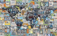
Geobond - Colorful Authentic Urban Map Currency Painting
By Fabio Coruzzi
Located in Los Angeles, CA
a new outlook on an otherwise ordinary urban scene. His artworks represent an authenticity unlike
Category
21st Century and Contemporary Pop Art Figurative Paintings
Materials
Canvas, Oil Pastel, Mixed Media, Acrylic, Ink, Graphite
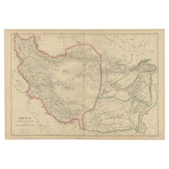
Antique Map of Persia, Afghanistan and Balochistan, 1859
Located in Langweer, NL
The antique map titled "Persia, Afghanistan and Beloochistan" is a remarkable historical document
Category
Antique Mid-19th Century Maps
Materials
Paper
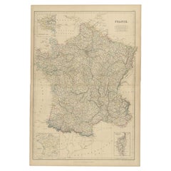
1859 Classic Map of France: Blackie's Imperial Geographic Masterpiece
Located in Langweer, NL
. The map provides a detailed view of France's urban landscape and rural settlements, highlighting key
Category
Antique Mid-19th Century Maps
Materials
Paper
H 21.26 in W 14.57 in D 0.02 in
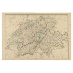
1859 Antique Swiss Panorama: Blackie's Detailed Map of Switzerland
Located in Langweer, NL
The "Antique Map of Switzerland" is a distinguished piece from 'The Imperial Atlas of Modern
Category
Antique Mid-19th Century Maps
Materials
Paper
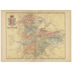
Anrtique Map of the Province of Valladolid, Central Spain, 1902
Located in Langweer, NL
A historical or archival map of the province of Valladolid, Spain, from the year 1902. Valladolid
Category
Antique Early 1900s Maps
Materials
Paper
Free Shipping
H 14.77 in W 20.08 in D 0 in
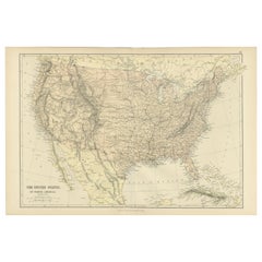
Antique Map of The United States of North America, 1882
Located in Langweer, NL
This is a historical map titled "The United States of North America, Central Part" from the 1882
Category
Antique 1880s Maps
Materials
Paper
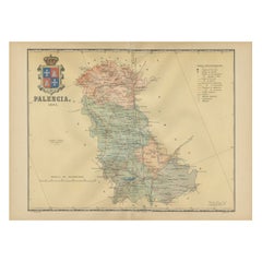
Original Antique Map of Palencia Province, in Northern Spain, 1901
Located in Langweer, NL
This historical map is of Palencia, a province in the northern part of Spain.
Palencia is
Category
Antique Early 1900s Maps
Materials
Paper
Free Shipping
H 14.77 in W 20.08 in D 0 in
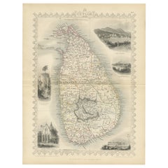
19th Century Illustrated Map of Ceylon (Sri Lanka) with Notable Landmarks
Located in Langweer, NL
John Tallis & Company is known for producing maps and atlases that were highly regarded for their
Category
Antique 1850s Maps
Materials
Paper
H 14.26 in W 10.71 in D 0 in
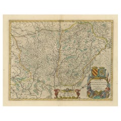
1644 Janssonius Original Wine Regions Map: The Ducal and Comital Burgundy
Located in Langweer, NL
This authentic handcolored map is a detailed 17th-century depiction of the Burgundy region
Category
Antique 1640s Maps
Materials
Paper
Free Shipping
H 19.1 in W 22.84 in D 0 in
Oriental Realms: A Detailed Map of Persia, Afghanistan, and Beloochistan, 1882
Located in Langweer, NL
This historical map from the 1882 atlas published by Blackie & Son is a comprehensive depiction of
Category
Antique 1880s Maps
Materials
Paper
No Reserve
H 14.97 in W 22.45 in D 0 in
1859 Vintage Map of Holland and Belgium: Blackie's Imperial Geographic Insight
Located in Langweer, NL
, Brussels, and Antwerp are prominently marked. The map provides insights into the urban landscape
Category
Antique Mid-19th Century Maps
Materials
Paper
H 21.26 in W 14.57 in D 0.02 in
1859 Vintage Maps of England and Wales: Blackie's Imperial Geographic Detail
Located in Langweer, NL
marked. The map provides a view of the urban distribution and key population centers, highlighting the
Category
Antique Mid-19th Century Maps
Materials
Paper
H 14.57 in W 21.26 in D 0.02 in
Antique Map of Italy, North Part, by W. G. Blackie, 1859
Located in Langweer, NL
, Florence, and Bologna are prominently marked. The map provides a snapshot of urban development and the
Category
Antique Mid-19th Century Maps
Materials
Paper
Antique Map of the City of Leuven, Belgium, with Original Coloring, 1609
Located in Langweer, NL
An original antique map titled "Lovanium Brabantiarum," which depicts the city of Leuven in Belgium
Category
Antique Early 17th Century Maps
Materials
Paper
H 11.74 in W 13.94 in D 0.02 in
An Old Illustrated Tallis Map of Central America with Volcanic Vignettes, 1851
Located in Langweer, NL
This map of Central America, part of John Tallis & Company's series from "The British Colonies" by
Category
Antique 1850s Maps
Materials
Paper
H 10.71 in W 14.26 in D 0 in
1859 Detailed Map of North West Germany with Bavaria Inset - Blackie's Atlas
Located in Langweer, NL
with other smaller towns and communities. The map provides a snapshot of urban development and
Category
Antique Mid-19th Century Maps
Materials
Paper
H 21.26 in W 14.57 in D 0.02 in
Antique Map of The United States of North America, Pacific States, 1882
Located in Langweer, NL
The map is from the same 1882 Blackie Atlas and focuses on the Pacific States of the United States
Category
Antique 1880s Maps
Materials
Paper
No Reserve
H 14.97 in W 11.03 in D 0 in
1859 Denmark and Schleswig-Holstein Map: A Historical View from Blackie's Atlas
Located in Langweer, NL
The "Antique Map of Denmark with Schleswig & Holstein" from 'The Imperial Atlas of Modern Geography
Category
Antique Mid-19th Century Maps
Materials
Paper
H 14.57 in W 10.63 in D 0.02 in
Antique Map of Canada, The Province of Ontario and Part of Quebec, 1882
Located in Langweer, NL
This is a historical map from the 1882 Blackie Atlas, this time detailing "The Province of Ontario
Category
Antique 1880s Maps
Materials
Paper
Free Shipping
H 14.97 in W 22.45 in D 0 in
Map of The Italian Peninsula with the islands of Sicily, Sardinia, Corsica, 1880
Located in Langweer, NL
This map, titled "ITALIA, Sicilia, Sardinia, Corsica," represents the Italian Peninsula along with
Category
Antique 1880s Maps
Materials
Paper
Free Shipping
H 15.56 in W 18.51 in D 0 in
Navarra in Cartographic Detail: A 1902 Map of the Crossroads of Northern Spain
Located in Langweer, NL
The original antique map for sale shows the Spanish province of Navarra as it was in 1902. Here's a
Category
Antique Early 1900s Maps
Materials
Paper
Free Shipping
H 14.77 in W 20.08 in D 0 in
Antique Map of Cities in the Hubei and Hunan Provinces of China, 1755
By Jacques-Nicolas Bellin
Located in Langweer, NL
-Fou), capital of Hubei Province; and Huangzhou (Hoang-Tcheou-Fou), now an urban district of the Hubei
Category
Antique 18th Century Maps
Materials
Paper
Old Map of Turkey in Asia with Mosul Environs and Assyrian Ruins Inset , 1859
Located in Langweer, NL
original antique map from W. G. Blackie's esteemed 1859 publication, 'The Imperial Atlas of Modern
Category
Antique Mid-19th Century Maps
Materials
Paper
H 14.57 in W 21.26 in D 0.02 in
Antique Map of Three Cities of China's Hubei and Hunan Provinces by Bellin
By Jacques-Nicolas Bellin
Located in Langweer, NL
-Fou), capital of Hubei Province; and Huangzhou (Hoang-Tcheou-Fou), now an urban district of the Hubei
Category
Antique Mid-18th Century Maps
Materials
Paper
H 10.04 in W 15.36 in D 0.02 in
Antique Map of Dokkum a City in the North of Friesland, the Netherlands, 1868
Located in Langweer, NL
Antique map titled 'Provincie Friesland - Gemeente Dokkum'. Map of the township of Dokkum
Category
Antique 19th Century Maps
Materials
Paper
H 7.49 in W 9.85 in D 0 in
Ancient Italy: Regions and Rome in the Roman Empire, Published in 1880
Located in Langweer, NL
This print is an original detailed map titled "ITALIAE REGIONES I VII VIII IX XI," representing the
Category
Antique 1880s Maps
Materials
Paper
No Reserve
H 15.56 in W 18.51 in D 0 in
Málaga 1901: A Cartographic Detailing of Andalusia's Coastal Jewel
Located in Langweer, NL
The map depicts the province of Málaga, located in the autonomous community of Andalusia in
Category
Antique Early 1900s Maps
Materials
Paper
Free Shipping
H 14.77 in W 20.08 in D 0 in
Álava in Northern Spain: The Geography of Basque Heritage and Terrain, 1902
Located in Langweer, NL
This original antique map is a historical depiction of the province of Álava (in Basque: Araba
Category
Antique Early 1900s Maps
Materials
Paper
Free Shipping
H 14.77 in W 20.08 in D 0 in
Detailed Antique Cartography of Asian Russia, 1882
Located in Langweer, NL
This exquisite map, hailing from the year 1882, is a remarkable historical cartographic artifact
Category
Antique 1880s Maps
Materials
Paper
Toledo 1902: A Historical Cartographic Study of this Spanish Province
Located in Langweer, NL
The print is a historical map of the province of Toledo from 1902. It's a detailed, colored map
Category
Antique Early 1900s Maps
Materials
Paper
Free Shipping
H 14.77 in W 20.08 in D 0 in
Levasseur's 1852 Cartographic Portrait of Gironde: Celebrating the Bordeaux Wine
Located in Langweer, NL
This original hand-colored map is from the "Atlas National Illustré," a work by Victor Levasseur, a
Category
Antique 1850s Maps
Materials
Paper
H 20.67 in W 14.06 in D 0 in
León 1903: A Cartographic Detailing of Castilla y León's Mountainous Province
Located in Langweer, NL
The map depicts the province of León, which is located in the northwest of Spain and forms part of
Category
Antique Early 1900s Maps
Materials
Paper
Free Shipping
H 14.77 in W 20.08 in D 0 in
Lleida 1902: A Cartographic Perspective of Catalonia's Gateway to the Pyrenees
Located in Langweer, NL
The map for sale shows the province of Lleida, located in the western part of Catalonia, Spain, as
Category
Antique Early 1900s Maps
Materials
Paper
Free Shipping
H 20.08 in W 14.77 in D 0 in
1902 Murcia: A Cartographic Snapshot of Spain's Southeastern Province
Located in Langweer, NL
The map represents the province of Murcia, Spain, as it was in 1902. Here's an overview of its
Category
Antique Early 1900s Maps
Materials
Paper
Free Shipping
H 20.08 in W 14.77 in D 0 in
La Rioja 1901: A Cartographic Journey Through Spain's Renowned Wine Country
Located in Langweer, NL
The map for sale illustrates the province of La Rioja, with its capital Logroño, as of the year
Category
Antique Early 1900s Maps
Materials
Paper
Free Shipping
H 14.77 in W 20.08 in D 0 in
Vintage Geographic Splendor: 1859 Spain and Portugal
Located in Langweer, NL
urban landscape of 19th-century Spain and Portugal.
4. **Transportation and Trade Routes**: The map may
Category
Antique Mid-19th Century Maps
Materials
Paper
Lugo 1901: A Cartographic Chronicle of Galicia's Ancient Roman Walled City
Located in Langweer, NL
The map presents the province of Lugo, located in the autonomous community of Galicia in
Category
Antique Early 1900s Maps
Materials
Paper
Free Shipping
H 20.08 in W 14.77 in D 0 in
The Divided Realms of Syria - North and South as Seen in 1859 by W. G. Blackie
Located in Langweer, NL
The "Antique Map of Syria, North and South Division" by W. G. Blackie, dated 1859, is a significant
Category
Antique Mid-19th Century Maps
Materials
Paper
H 14.57 in W 21.26 in D 0.02 in
Albacete, Spain - 1902: A Cartographic Depiction of Landscape and Infrastructure
Located in Langweer, NL
historical map of the province of Albacete, dated 1902, from the "Atlas Geográfico Ibero-Americano España" by
Category
Antique Early 1900s Maps
Materials
Paper
Free Shipping
H 14.77 in W 20.08 in D 0 in
Space Invader Map Ravenna Invasion 2017 Print Street Art Urban Art Contemporary
By Invader
Located in Draper, UT
Invader - MAP OF RAVENNA - Invasion Map # 24
Size : 12 X 21 cm / 60 x 42 cm
Limited Print Edition
Category
2010s Street Art More Art
Materials
Lithograph
INVADER Invasion Map of Djerba Island (Djerba Map Folded)
By Invader
Located in Englishtown, NJ
Super cool Invader map designed to look like a pirate treasure map.
Limited edition.
Has the
Category
21st Century and Contemporary Street Art Prints and Multiples
Materials
Offset
Topo Map 5
By Cal Lane
Located in Montreal, Quebec
. The cuttings depict power struggles between coupling mythological beings, urban street scenes and
Category
21st Century and Contemporary Contemporary Sculptures
Materials
Metal
Travelers Mind Map
Located in New Orleans, LA
Africa for his next series Transit Urban, which included twelve paintings using local traditional fabrics
Category
2010s Contemporary Paintings
Materials
Fabric, Oil, Acrylic
Geometric Map of Florence with Black Lacquered Frame Old Map Reproduction
Located in Scandicci, Florence
GEOMETRIC PLAN OF THE CITY OF FLORENCE WHICH IS TRUE AS 1:4.500, showing expansions and urban
Category
21st Century and Contemporary Italian Prints
Materials
Wood, Paper
H 47.64 in W 43.71 in D 1.58 in
CT: Aerial Map, Zones / Ramps
By Kim Frohsin
Located in Burlingame, CA
Morgan Flagg Collection” the following year. KEYWORDS: Urban, City, San Francisco, NYC, Orange, Abstract
Category
21st Century and Contemporary Abstract Expressionist Abstract Paintings
Materials
Acrylic, Gouache, Mixed Media, Pigment
Oil Tank map of the world
By Cal Lane
Located in Montreal, Quebec
. The cuttings depict power struggles between coupling mythological beings, urban street scenes and
Category
21st Century and Contemporary Sculptures
Materials
Metal
Griffin's 1955 Northern Ireland original map - Tourism - Geography
Located in PARIS, FR
bustling urban centers, the map offers a snapshot of Northern Ireland's rich heritage. The inclusion of
Category
1950s Prints and Multiples
Materials
Linen, Lithograph, Paper
Oil Drum Map of the World #1
By Cal Lane
Located in Montreal, Quebec
. The cuttings depict power struggles between coupling mythological beings, urban street scenes and
Category
21st Century and Contemporary Contemporary Sculptures
Materials
Metal
1861 Original vintage map of Paris - Historical cartography
Located in PARIS, FR
witness to the urban evolution of the French capital in the 19th century. Drawn up by Alexandre Vuillemin
Category
1860s Prints and Multiples
Materials
Paper, Lithograph
H 33.86 in W 42.92 in
Urban Anatomy - contemporary abstract street art graffiti painting blue grey
By David Fredrik Moussallem
Located in New York, NY
” and respond to urban landscape.
Extensive travels all around the world have triggered a fascination
Category
2010s Street Art Abstract Paintings
Materials
Mixed Media, Acrylic, Wood Panel, Magazine Paper
INVADER BXL 2012 Derives Brussels Map (Signed Print Version)
By Invader
Located in Englishtown, NJ
, Map Art, Urban Art, Graffiti.
Category
21st Century and Contemporary Street Art Prints and Multiples
Materials
Color
16 Oil Can Map of the World #2
By Cal Lane
Located in Montreal, Quebec
. The cuttings depict power struggles between coupling mythological beings, urban street scenes and
Category
21st Century and Contemporary Contemporary Sculptures
Materials
Metal
Broke - Mixed Media Credit Card Map Original Artwork
By Fabio Coruzzi
Located in Los Angeles, CA
a new outlook on an otherwise ordinary urban scene. His artworks represent an authenticity unlike
Category
21st Century and Contemporary Pop Art Mixed Media
Materials
Mixed Media, Spray Paint, Panel
Soil Map N°4 Table by Estudio Rafael Freyre
Located in Geneve, CH
Soil map N°4 table by Estudio Rafael Freyre.
Dimensions: D 120 x H 80 cm.
Materials: diverse
Category
2010s Peruvian Modern Dining Room Tables
Materials
Stone
Soil Map N°5 Table by Estudio Rafael Freyre
Located in Geneve, CH
Soil Map N°5 table by Estudio Rafael Freyre
Dimensions: D 150 x H 75 cm
Materials: diverse
Category
2010s Peruvian Modern Dining Room Tables
Materials
Stone
Soil Map N°3 Table by Estudio Rafael Freyre
Located in Geneve, CH
Soil Map N°3 table by Estudio Rafael Freyre
Dimensions: D 65 x H 100 cm
Materials: Diverse
Category
2010s Peruvian Modern Side Tables
Materials
Stone
Soil Map N°1 Table by Estudio Rafael Freyre
Located in Geneve, CH
Soil Map N°1 table by Estudio Rafael Freyre
Dimensions: W 130 x D 80 x H 75 cm
Materials
Category
2010s Peruvian Modern Dining Room Sets
Materials
Stone
Original map of Corsica by Carriat-Rolant - Travel poster - Tourism
Located in PARIS, FR
dynamism. Drawn by Gabriel Carriat-Roland, the map presents the urban agglomerations in the form of small
Category
Mid-20th Century Prints and Multiples
Materials
Paper, Lithograph
Broke 2 - Mixed Media Credit Card Map Original Artwork
By Fabio Coruzzi
Located in Los Angeles, CA
a new outlook on an otherwise ordinary urban scene. His artworks represent an authenticity unlike
Category
21st Century and Contemporary Pop Art Mixed Media
Materials
Mixed Media, Spray Paint, Panel
Map of Canonor - Etching by G. Braun/F. Hogenberg - 1575
Located in Roma, IT
by Franz Hogenberg, eventually contained 546 prospects, bird-eye views and map views of cities from
Category
16th Century Modern Figurative Prints
Materials
Etching
H 5.52 in W 6.3 in D 0.04 in
- 1
Get Updated with New Arrivals
Save "Urban Map", and we’ll notify you when there are new listings in this category.
Urban Map For Sale on 1stDibs
You are likely to find exactly the urban map you’re looking for on 1stDibs, as there is a broad range for sale. Find abstract versions now, or shop for abstract creations for a more modern example of these cherished works. Making the right choice when shopping for an urban map may mean carefully reviewing examples of this item dating from different eras — you can find an early iteration of this piece from the 18th Century and a newer version made as recently as the 21st Century. If you’re looking to add an urban map to create new energy in an otherwise neutral space in your home, you can find a work on 1stDibs that features elements of gray, brown, black, blue and more. An urban map from David Fredrik Moussallem, Luke O'Sullivan, Alyssa Warren, Tessa Grundon and Cal Lane — each of whom created distinctive versions of this kind of work — is worth considering. Artworks like these of any era or style can make for thoughtful decor in any space, but a selection from our variety of those made in paint, paper and acrylic paint can add an especially memorable touch.
How Much is a Urban Map?
An urban map can differ in price owing to various characteristics — the average selling price for items in our inventory is $2,979, while the lowest priced sells for $90 and the highest can go for as much as $150,000.
