Vintage School Map
to
7
84
56
141
76
58
37
14
11
10
8
3
2
38
3
3
2
2
Sort By
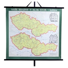
Vintage School Map of Czechoslovakia, 1960s
Located in Zohor, SK
This is a great vintage school map produced in Czechoslovakia by Skolske pomucky n.p., which was a
Category
1960s Slovak Mid-Century Modern Vintage School Map
Materials
Paper
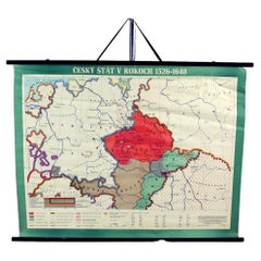
Vintage School Map Of Czech State, Czechoslovakia 1960s
Located in Zohor, SK
This is a great vintage school map of "Czech State1526-1648". The map was produced by a National
Category
1960s Czech Mid-Century Modern Vintage School Map
Materials
Wood, Paper
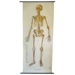
Vintage Anatomical Schoolmap, Skeleton School Chart, Vintage German School Map
Located in ROTTERDAM, ZH
What an eyecatcher. This beautiful linen anatomical map is a must have for everybody who loves
Category
1950s German Bohemian Vintage School Map
Materials
Linen
H 78.75 in W 36.62 in D 0.4 in
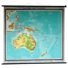
Map Mural Rollable Poster Vintage Wall Chart Australia New Zealand Polynesia
Located in Berghuelen, DE
Map Mural Rollable Poster Vintage Wall Chart Australia New Zealand Polynesia
A beautiful vintage
Category
1970s German Country Vintage School Map
Materials
Canvas, Wood, Paper
H 70.87 in W 64.57 in D 0.79 in
Antique Vintage Australia Wall Map By W & A K Johnston
By W. & A.K. Johnston
Located in Stockbridge, GB
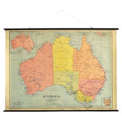
Vintage Australia Wall Map By W & A K Johnston
A vintage school pull down wall map of Australia
Category
Mid-20th Century British Schoolhouse Vintage School Map
Materials
Canvas, Wood
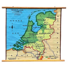
School Chart or Pull Down Map of Geography of the Netherlands, 1950s
Located in Hemiksem, VAN
A beautiful old school map of the Netherlands, painted on linen. The map shows the 3 different
Category
1950s Belgian Mid-Century Modern Vintage School Map
Materials
Linen, Paint
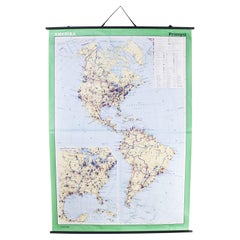
Late 20th Century Educational Geographic Map - Continent Of Americas Industry
Located in Hook, Hampshire
Educational Geographic Map – Continent Of Americas Industry. Good quality roll up school educational
Category
Late 20th Century Czech Vintage School Map
Materials
Cotton
H 73.23 in W 51.58 in D 0.4 in
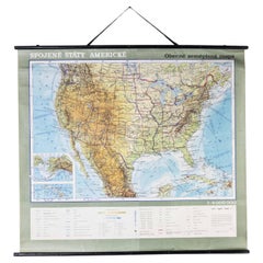
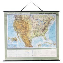
Late 20th Century Educational Geographic Map - USA Topography
Located in Hook, Hampshire
Geographic Map – USA Topography. Good quality roll up school educational geographic map from the Czech
Category
Late 20th Century Czech Vintage School Map
Materials
Cotton
Late 20th Century Educational Geographic Map - South Asia Topography
Located in Hook, Hampshire
Geographic Map – South Asia Topography. Good quality roll up school educational geographic map from the Czech
Category
Late 20th Century Czech Vintage School Map
Materials
Cotton
Late 20th Century Educational Geographic Map - Australia Topography And Economy
Located in Hook, Hampshire
Educational Geographic Map – Australia Topography And Economy. Good quality roll up school educational
Category
Late 20th Century Czech Vintage School Map
Materials
Cotton
H 66.15 in W 57.88 in D 0.4 in
Late 20th Century Educational Geographic Map - African Climate
Located in Hook, Hampshire
Geographic Map – African Climate. Good quality roll up school educational geographic map from the Czech
Category
Late 20th Century Czech Vintage School Map
Materials
Cotton
Late 20th Century Educational Geographic Map - South African Topography (1728.4)
Located in Hook, Hampshire
Educational Geographic Map – South African Topography. Good quality roll up school educational geographic map
Category
Late 20th Century Czech Vintage School Map
Materials
Cotton
H 70.48 in W 45.28 in D 0.4 in
Late 20th Century Educational Geographic Map - South African Topography (1728.5)
Located in Hook, Hampshire
Educational Geographic Map – South African Topography. Good quality roll up school educational geographic map
Category
Late 20th Century Czech Vintage School Map
Materials
Cotton
H 64.18 in W 45.28 in D 0.4 in
Late 20th Century Educational Geographic Map - Australasia
Located in Hook, Hampshire
Map – Australasia. Good quality roll up school educational geographic map from the Czech republic. The
Category
Late 20th Century Czech Vintage School Map
Materials
Cotton
Late 20th Century Educational Geographic Map - Hemispheres
Located in Hook, Hampshire
Map – Hemispheres. Good quality roll up school educational geographic map from the Czech republic. The
Category
Late 20th Century Czech Vintage School Map
Materials
Cotton
Late 20th Century Educational Geographic Map - African Industry (1728.2)
Located in Hook, Hampshire
Educational Geographic Map – African Industry. Good quality roll up school educational geographic map from the
Category
Late 20th Century Czech Vintage School Map
Materials
Cotton
H 63.78 in W 46.07 in D 0.4 in
Late 20th Century Educational Geographic Map - Worlds Resources
Located in Hook, Hampshire
Geographic Map – Worlds Resources. Good quality roll up school educational geographic map from the Czech
Category
Late 20th Century Czech Vintage School Map
Materials
Cotton
Late 20th Century Educational Geographic Map - Worlds Oceans
Located in Hook, Hampshire
Geographic Map – Worlds Oceans. Good quality roll up school educational geographic map from the Czech
Category
Late 20th Century Czech Vintage School Map
Materials
Cotton
Late 20th Century Educational Geographic Map - World Atlas
Located in Hook, Hampshire
Map – World Atlas . Good quality roll up school educational geographic map from the Czech republic
Category
Late 20th Century Czech Vintage School Map
Materials
Cotton
Late 20th Century Educational Geographic Map - Scandinavian Topography
Located in Hook, Hampshire
Educational Geographic Map – Scandinavian Topography. Good quality roll up school educational geographic map
Category
Late 20th Century Czech Vintage School Map
Materials
Cotton
H 73.23 in W 59.85 in D 0.4 in
Late 20th Century Educational Geographic Map - European Countries (1728.14)
Located in Hook, Hampshire
Educational Geographic Map – European Countries (1728.14). Good quality roll up school educational geographic
Category
Late 20th Century Czech Vintage School Map
Materials
Cotton
H 68.51 in W 63 in D 0.4 in
Late 20th Century Educational Geographic Map - Japan - Korea
Located in Hook, Hampshire
Geographic Map – Japan – Korea. Good quality roll up school educational geographic map from the Czech
Category
Late 20th Century Czech Vintage School Map
Materials
Cotton
Late 20th Century Educational Geographic Map - European Countries
Located in Hook, Hampshire
Geographic Map – European Countries. Good quality roll up school educational geographic map from the Czech
Category
Late 20th Century Czech Vintage School Map
Materials
Cotton
Late 20th Century Educational Geographic Map - Earths Lithosphere
Located in Hook, Hampshire
Geographic Map – Earths Lithosphere. Good quality roll up school educational geographic map from the Czech
Category
Late 20th Century Czech Vintage School Map
Materials
Cotton
Late 20th Century Educational Geographic Map - Atlantic Currents
Located in Hook, Hampshire
Geographic Map – Atlantic Currents. Good quality roll up school educational geographic map from the Czech
Category
Late 20th Century Czech Vintage School Map
Materials
Cotton
Late 20th Century Educational Geographic Map - African Industry (1728.1)
Located in Hook, Hampshire
Educational Geographic Map – African Industry. Good quality roll up school educational geographic map from the
Category
Late 20th Century Czech Vintage School Map
Materials
Cotton
H 64.18 in W 46.07 in D 0.4 in
Antique New York Wall Map by Westermann
By Westermann
Located in Stockbridge, GB
Antique New York Map By Westermann
A rare early school pull down wall map of New York. The map
Category
Mid-20th Century British Schoolhouse Vintage School Map
Materials
Canvas, Wood
Mushrooms of Middle Europe Print Cardboard Wall Chart, Germany 1930s
Located in Nuernberg, DE
This rare vintage wall chart shows different types of mushrooms, which are native to middle europe
Category
1930s German Mid-Century Modern Vintage School Map
Materials
Paper
Mushrooms of Middle Europe Print Cardboard Wall Chart, Germany 1930s
Located in Nuernberg, DE
This rare vintage wall chart shows different types of mushrooms, which are native to middle europe
Category
1930s German Mid-Century Modern Vintage School Map
Materials
Paper
Mushrooms of Middle Europe Print Cardboard Wall Chart, Germany 1930s
Located in Nuernberg, DE
This rare vintage wall chart shows different types of mushrooms, which are native to middle europe
Category
1930s German Mid-Century Modern Vintage School Map
Materials
Paper
Mushrooms of Middle Europe Print Cardboard Wall Chart, Germany 1930s
Located in Nuernberg, DE
This rare vintage wall chart shows different types of mushrooms, which are native to middle europe
Category
1930s German Mid-Century Modern Vintage School Map
Materials
Paper
Mushrooms of Middle Europe Print Cardboard Wall Chart, Germany 1930s
Located in Nuernberg, DE
This rare vintage wall chart shows different types of mushrooms, which are native to middle europe
Category
1930s German Mid-Century Modern Vintage School Map
Materials
Paper
Vintage Wall Chart 'Crusades of the Early Middle Ages'
Located in Hemiksem, VAN
A beautiful, original vintage map of the crusades ('Les Croisades') in the early Middle Ages in
Category
1960s French Mid-Century Modern Vintage School Map
Materials
Wood, Paper
Set of Two Mushrooms Scientific Models Europe , Germany 1960s
Located in Nuernberg, DE
wealthy private schools to rural elementary schools. The oldest mentioned series of wall maps appeared
Category
1960s German Folk Art Vintage School Map
Materials
Paper, Wood
Original Vintage Travel Poster Rhodesia Pictorial Map Southern Africa Zimbabwe
Located in London, GB
Original vintage travel poster - A Pictorial Map of Rhodesia (Southern & Northern) - featuring a
Category
1930s British Vintage School Map
Materials
Paper
H 39.38 in W 24.41 in D 0.04 in
Great Britain Scandinavia Northern France Netherland Germany Mural Map
Located in Berghuelen, DE
The vintage pull-down cottagecore mural map illustrates the North Sea countries with Great Britain
Category
1970s German Country Vintage School Map
Materials
Canvas, Wood, Paper
H 81.89 in W 88.19 in D 0.79 in
Countrycore Mural Vintage Map Wall Chart Rollable Poster Central South Africa
Located in Berghuelen, DE
The cottagecore pull-down mural map depicts Middle and South Africa. Published by Westermann
Category
1970s German Country Vintage School Map
Materials
Canvas, Wood, Paper
H 68.51 in W 83.86 in D 0.79 in
Denmark Greenland Faroe Islands the North Atlantic Vintage Mural Map Wall Chart
Located in Berghuelen, DE
The vintage pull-down mural map illustrates Denmark with Greenland, the Faroe Islands and the North
Category
1970s German Country Vintage School Map
Materials
Canvas, Wood, Paper
H 75.6 in W 81.5 in D 0.79 in
Vintage Mural Map Rollable Wall Chart Poster Australia New Zealand Indonesia
Located in Berghuelen, DE
Vintage Mural Map Rollable Wall Chart Poster Australia New Zealand Indonesia
The vintage pull-down
Category
1970s German Country Vintage School Map
Materials
Canvas, Wood, Paper
H 39.38 in W 48.04 in D 0.79 in
Australia and Oceania Vintage Art Map Poster Rollable Wall Chart Mural
Located in Berghuelen, DE
Australia and Oceania Vintage Art Map Poster Rollable Wall Chart Mural
The classical geographical
Category
1970s German Country Vintage School Map
Materials
Canvas, Wood, Paper
H 82.29 in W 66.93 in D 0.79 in
1960s Canvas Wall School Chart with Sheep by Jung-Koch-Quentell
By Jung Koch Quentell 1
Located in Antwerp, BE
Vintage school wall chart, pull down chart with beautiful illustrated lithograph of Sheep. It shows
Category
Mid-20th Century German Mid-Century Modern Vintage School Map
Materials
Wood, Canvas, Paper
Europe Map Vintage Rollable Mural Countrystyle Wall Chart Decoration
Located in Berghuelen, DE
The vintage pull-down map shows the European continent / Europe. Published by Haack-Painke, Justus
Category
1970s German Country Vintage School Map
Materials
Canvas, Wood, Paper
Australia Original Vintage Propaganda Poster post WW2 MacDonald Max Gill
By "Leslie MacDonald ""Max"" Gill"
Located in London, GB
Gill’s first map was made for a school map-drawing project following which he entered maps into
Category
1940s Modern Vintage School Map
Materials
Lithograph
Southern Hemisphere of the Earth Rollable Map Vintage Wall Chart
Located in Berghuelen, DE
A great pull-down map or vintage wall chart illustrating the southern hemisphere of the earth
Category
Mid-20th Century German Country Vintage School Map
Materials
Canvas, Wood, Paper
Vintage Map Wall Chart Countries of North America Rollable Mural Poster
Located in Berghuelen, DE
The vintage pull-down school map illustrates the countries / states of North America. Published by
Category
Late 20th Century German Country Vintage School Map
Materials
Canvas, Wood, Paper
H 51.19 in W 39.38 in D 0.79 in
Land Use and Livestock North America Picture Map Wall Chart Poster Mural
Located in Berghuelen, DE
The vintage rollable picture map of North- and Middle America shows land use and livestock
Category
Late 20th Century German Country Vintage School Map
Materials
Canvas, Wood, Paper
H 47.25 in W 35.44 in D 0.79 in
North America Map Economy Wall Chart Rollable Poster Vintage Mural
Located in Berghuelen, DE
A vintage pull-down map showing the economy of North America, published by Harms. Colorful print on
Category
Late 20th Century German Country Vintage School Map
Materials
Canvas, Wood, Paper
North America Vintage Map Pull-Down Wall Chart Poster Countrycore Print
Located in Berghuelen, DE
A traditional vintage pull-down school map illustrating North America, published by Westermann
Category
Late 20th Century German Country Vintage School Map
Materials
Wood, Paper, Canvas
H 66.54 in W 61.42 in D 0.79 in
Cottagecore Wall Chart Spain Landscape Culture Souvenir Rollable Map Poster
Located in Berghuelen, DE
A countrycore vintage pull-down wall chart depicting Spain with a map and coloful pictures of
Category
1960s German Country Vintage School Map
Materials
Canvas, Wood, Paper
H 25.2 in W 39.38 in D 0.79 in
Vintage Picture Poster Wall Chart Rollable Large Map Peoples Republic of China
Located in Berghuelen, DE
A vintage wall chart illustrating a map of people's republic of china. Used as teaching material in
Category
Late 20th Century German Country Vintage School Map
Materials
Canvas, Wood, Paper
H 63 in W 84.26 in D 0.79 in
Vintage German Map Rhineland Rollable Wall Chart Poster Print
Located in Berghuelen, DE
A country core vintage pull-down map illustrating the popular German region of the Rhineland
Category
1960s German Country Vintage School Map
Materials
Canvas, Wood, Paper
Northern Hemisphere of the Earth Rollable Map Vintage Wall Chart World Mural
Located in Berghuelen, DE
A great pull-down map or vintage wall chart illustrating the northern hemisphere of the earth
Category
Mid-20th Century German Country Vintage School Map
Materials
Canvas, Wood, Paper
H 70.48 in W 66.93 in D 0.79 in
Vintage Pull-Down Map Germany BRD / DDR History Wall Chart
Located in Berghuelen, DE
A classical rollable vintage wall chart illustrating a map of Germany (Federal Republic of Germany
Category
Mid-20th Century German Country Vintage School Map
Materials
Canvas, Wood, Paper
Aboriginal Painting by Kathleen Petyarre
Located in Miami, FL
grew up.
In 1969 she was successful in applying for a job at Utopia school where she stayed for 20
Category
20th Century Vintage School Map
Materials
Linen, Acrylic
Mountain Devil Lizard
Located in Miami, FL
grew up.
In 1969 she was successful in applying for a job at Utopia school where she stayed for 20
Category
20th Century Contemporary Vintage School Map
Materials
Acrylic, Linen
Bush Seeds
Located in Miami, FL
grew up.
In 1969 she was successful in applying for a job at Utopia school where she stayed for 20
Category
20th Century Contemporary Vintage School Map
Materials
Acrylic, Linen
Aboriginal Painting by Kathleen Petyarre
Located in Miami, FL
grew up.
In 1969 she was successful in applying for a job at Utopia school where she stayed for 20
Category
20th Century Vintage School Map
Materials
Linen, Acrylic
Mountain Devil Lizard
Located in Miami, FL
grew up.
In 1969 she was successful in applying for a job at Utopia school where she stayed for 20
Category
20th Century Contemporary Vintage School Map
Materials
Acrylic, Linen
Lyrical Abstraction Abstract Expressionist painting for Sonoma CA (signed heart)
By Robert Natkin
Located in New York, NY
from Bob", accompanied by a heart doodle. Also signed "Natkin" on the front
Original vintage frame
Category
1990s Abstract Geometric Vintage School Map
Materials
Paper, Mixed Media, Acrylic, Pencil
HMS Newcastle. In Sydney Harbor. December 1956 Melbourne Olympics. Royal Navy.
By Eric Erskine Campbell Tufnell
Located in Sutton Poyntz, Dorset
anti-reflective glass with UV Protection greater than 70% (Artglass AR 70™).
This vintage watercolor is
Category
Mid-20th Century Realist Vintage School Map
Materials
Paper
H 20.28 in W 24.22 in D 0.99 in
- 1
Get Updated with New Arrivals
Save "Vintage School Map", and we’ll notify you when there are new listings in this category.
Vintage School Map For Sale on 1stDibs
At 1stDibs, there are many versions of the ideal vintage school map for your home. Frequently made of paper, fabric and wood, every vintage school map was constructed with great care. Your living room may not be complete without a vintage school map — find older editions for sale from the 20th Century and newer versions made as recently as the 20th Century. Each vintage school map bearing Mid-Century Modern hallmarks is very popular. You’ll likely find more than one vintage school map that is appealing in its simplicity, but Dr. Friedrich Quentell, Gottlieb von Koch and Lehrmittelverlag Hagemann produced versions that are worth a look.
How Much is a Vintage School Map?
The average selling price for a vintage school map at 1stDibs is $321, while they’re typically $186 on the low end and $2,400 for the highest priced.
More Ways To Browse
Low Board Vintage
Vintage Chair Illustration
Used Hospital Chairs
Vintage French Zinc
Mid Century Banquet
Set Of 18 Louis Dining Chairs
Big Rare Chair
Tie Up Heels Black
214 Modern Vintage
Retro Modern Record Player
1920s Chinese Lamp
Chinese Figuring Lamps
Vintage 40s Womens Clothing
French Open Back Dining Chairs
Jewel Chair
Naval Battle Art
Fireplace In The 1920s
Set Of 12 Office Chairs
