Thomas Kitchin Furniture
2
to
1
17
1
9
9
9
1
1
1
1
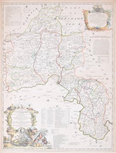
Map of Oxfordshire coloured 18th century engraving by Thomas Kitchin
By Thomas Kitchin
Located in London, GB
To see our other original maps, scroll down to "More from this Seller" and below it click on "See all from this Seller" - or send us a message if you cannot find the poster you want....
Category
1760s Thomas Kitchin Furniture
Materials
Engraving
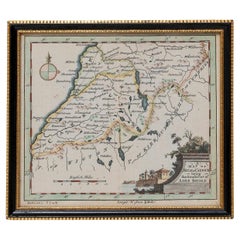
Map Kyle Carrick Aireshire Thomas Kitchen 1749
By Thomas Kitchin
Located in BUNGAY, SUFFOLK
A Map of Kyle & Carrick Aireshire Thomas Kitchen 1749
In original black and gold frame
Just purchased more information to follow
MAKER Thomas Kitchin (1718-1784) English engrave...
Category
18th Century English Georgian Antique Thomas Kitchin Furniture
Materials
Paper
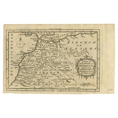
Antique Map of the Empire of Morocco by Kitchin, c.1760
By Thomas Kitchin
Located in Langweer, NL
Antique map titled 'A Map of the Empire of Morocco Comprehending the Kingdoms of Fez, Morocco'. Original antique map of the kingdoms of Fez, Algiers, Segelmese, Tafilet and Morocco. ...
Category
18th Century Antique Thomas Kitchin Furniture
Materials
Paper
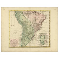
Antique Map of South America by Tirion, c.1765
By Thomas Kitchin
Located in Langweer, NL
Antique map titled 'Kaart van het Onderkoningschap van Peru zig uitstrekkende: over Chile, Paraguay en andere Spaansche Landen als ook van Brazil en verdere Bezittingen van Portugal ...
Category
18th Century Antique Thomas Kitchin Furniture
Materials
Paper
Antique Map of South America by Scherer, c.1700
By Thomas Kitchin
Located in Langweer, NL
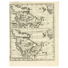
Antique map of part of South America. Two maps on a single sheet, each depicting nearly the same area. On close examination there are slight differences in the rivers, lakes and moun...
Category
18th Century Antique Thomas Kitchin Furniture
Materials
Paper
Antique Map of Southeast Asia and China by Kiepert, c.1870
By Thomas Kitchin
Located in Langweer, NL
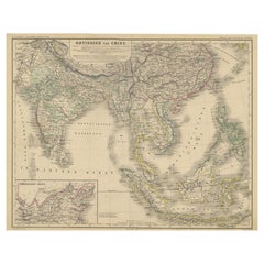
Antique map titled 'Ostindien und China'. Old map of Southeast Asia and China. This map originates from 'H. Kiepert's Kleiner Atlas der Neueren Geographie für Schule und Haus'. Artis...
Category
19th Century Antique Thomas Kitchin Furniture
Materials
Paper
Antique Map of South East Australia by Stieler, c.1848
By Thomas Kitchin
Located in Langweer, NL
Antique map Australia titled 'Süd-Ost Australien'. Detailed map of South East Australia. Orginates from 'Stieler's Hand Atlas', published in Germ...
Category
19th Century Antique Thomas Kitchin Furniture
Materials
Paper
Antique Map of South Australia by Johnston, 1882
By Thomas Kitchin
Located in Langweer, NL
Antique map titled 'South Australia, New South Wales, Victoria & Queensland'. Old map of Southern Australia, with an inset map of Cape York Peninsula. This map originates from 'The R...
Category
19th Century Antique Thomas Kitchin Furniture
Materials
Paper
Antique Map of South America by Walker, 1816
By Thomas Kitchin
Located in Langweer, NL
Antique map titled 'South America'. Old map of South America. This map originates from 'Walker's Universal Atlas'. Artists and Engravers: Printed by Barnard and Farley.
Artist: Pr...
Category
19th Century Antique Thomas Kitchin Furniture
Materials
Paper
Antique Map of South America by Reichard, 1820
By Thomas Kitchin
Located in Langweer, NL
Antique map titled 'Süd America'. Decorative antique map of South America with an inset map of Ecuador. Artists and Engravers: Published b...
Category
19th Century Antique Thomas Kitchin Furniture
Materials
Paper
Antique Map of Southeast Asia and the Indian Ocean by Valentijn, 1726
By Thomas Kitchin
Located in Langweer, NL
Antique map titled 'Tabula Indiae Orientalis'. Beautiful detailed map of Australia, Southeast Asia and the Indian Ocean. The map features a fine depiction of the outlines of the western two-thirds of Australia, based on the discoveries of explorers working for the Dutch East India Company (the VOC). These include Willem Jansz's discoveries in the Gulf of Carpentaria in 1606; the encounters of Dirk Hartog...
Category
18th Century Antique Thomas Kitchin Furniture
Materials
Paper
Antique Map of South Australia by Tallis, 1851
By Thomas Kitchin
Located in Langweer, NL
Antique map Australia titled 'Part of South Australia'. Decorative map of part of South Australia, surrounded by illustrations of Adelaide, natives on a catamaran, an Australian dog and a nymphicus bird illustrated. Originates from 'The Illustrated Atlas, And Modern History Of The World Geographical, Political, Commercial & Statistical, Edited By R. Montgomery Martin'. Published; John Tallis London, New York, Edinburgh & Dublin. 1851. Drawn and Engraved by J. Rapkin. Artists and Engravers: John Tallis (1817-1876) was a British map...
Category
19th Century Antique Thomas Kitchin Furniture
Materials
Paper
Antique Map of South America by Petri, 1852
By Thomas Kitchin
Located in Langweer, NL
Antique map titled 'Zuid-Amerika'. Map of South America. This map originates from 'School-Atlas van alle deelen der Aarde' by Otto Petri. Artists and Engrav...
Category
19th Century Antique Thomas Kitchin Furniture
Materials
Paper
Antique Map of the Coast of Southwest Asia by Kitchin, c.1770
By Thomas Kitchin
Located in Langweer, NL
Antique map titled 'Chart of the Coast of Persia, Malabar & c'. Antique map of the coast of Southwest Asia. It shows the Maldives and part of Persia and India. Published for the 'Lon...
Category
18th Century Antique Thomas Kitchin Furniture
Materials
Paper
Antique Map of South America by Tyrer, 1821
By Thomas Kitchin
Located in Langweer, NL
Antique map titled 'South America'. Beautiful antique map of South America engraved by Tyrer. Artists and Engravers: Published by J. Soute...
Category
19th Century Antique Thomas Kitchin Furniture
Materials
Paper
Antique Map of South America by Petri, c.1873
By Thomas Kitchin
Located in Langweer, NL
Antique map titled 'Zuid-Amerika'. Old map depicting South America, with an inset map of the highland of Quito. This map originates from 'School-Atlas van alle Deelen der Aarde'. Art...
Category
19th Century Antique Thomas Kitchin Furniture
Materials
Paper
Antique Map of Eastern Tartary as Surveyed by the Jesuits, 1746
By Thomas Kitchin
Located in Langweer, NL
Antique map titled 'A Map of Eastern Tartary as Surveyed by the Jesuits in 1709, 10 & 11'. The map covers much of the course of the Amur River or Heilong Jiang, the world's tenth lon...
Category
18th Century Antique Thomas Kitchin Furniture
Materials
Paper
Two-Part Large Hand-Colored Map of Europe from 1798
By Thomas Kitchin
Located in New York, NY
Map of Europe printed on two separate sheets from A New Universal Atlas by Thomas Kitchin. Published in London by Laurie & Whittle, 1798. Original engravings hand-colored at publicat...
Category
1790s Thomas Kitchin Furniture
Materials
Paper
Related Items
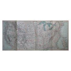
Original Antique Map of The United States of America, circa 1890
Located in St Annes, Lancashire
Great map of the USA
By The Stanford's Geographical Establishment
Original colour
Unframed.
Category
1890s English Victorian Antique Thomas Kitchin Furniture
Materials
Paper
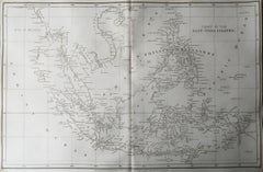
Original Antique Map of South East Asia, Arrowsmith, 1820
Located in St Annes, Lancashire
Great map of South East Asia
Drawn under the direction of Arrowsmith
Copper-plate engraving
Published by Longman, Hurst, Rees, Orme and Brown, 1820
Unframed.
Category
1820s English Antique Thomas Kitchin Furniture
Materials
Paper
Original Antique Map of Asia. C.1780
Located in St Annes, Lancashire
Great map of Asia
Copper-plate engraving
Published C.1780
Two small worm holes to right side of map
Unframed.
Category
Early 1800s English Georgian Antique Thomas Kitchin Furniture
Materials
Paper
Large Original Antique Map of South Carolina, USA, 1894
By Rand McNally & Co.
Located in St Annes, Lancashire
Fabulous map of South Carolina
Original color
By Rand, McNally & Co.
Published, 1894
Unframed
Free shipping.
Category
1890s American Antique Thomas Kitchin Furniture
Materials
Paper
St. Michael's Mount, Cornwall: A Framed 19th C. Engraving After Myles Foster
By Myles Birket Foster
Located in Alamo, CA
This beautiful 19th century framed hand-colored engraving is entitled "St. Michael's Mount, Cornwall" by J. Saddler after an original painting by the British artist Myles Birket Fost...
Category
Mid-19th Century Romantic Thomas Kitchin Furniture
Materials
Engraving
H 14.38 in W 17.88 in D 1.5 in
Mountebank - XXI Century, Contemporary Figurative DryPoint Etching Print
By Czeslaw Tumielewicz
Located in Warsaw, PL
Polish painter and graphic designer, Czeslaw Tumielewicz was born in 1942.
In 1968, he studied at the Architecture faculty of Gdank, before continuing his course at the Technical Un...
Category
2010s Contemporary Thomas Kitchin Furniture
Materials
Paper, Etching, Drypoint
The Fighting Temeraire: A Framed 19th C. Engraving After J. M. W. Turner
By J.M.W. Turner
Located in Alamo, CA
This beautiful 19th century framed engraving "The Fighting Temeraire" by James Tibbetts Willmore is based on an original painting by the renowned British artist J.M.W. Turner. It was published by James S. Virtue & Co. in London between 1859-1875. It depicts the once mighty British warship the HMS Temeraire being towed away down the river Thames by a much smaller steamboat to a ship-breaking yard to be broken up for scrap. The Temeraire was first launched in 1798 and represented the pinnacle of British ship-building. 180-feet long, constructed of English oak and armed with 98 guns, she was one of the largest warships of the period. The Temeraire became a symbol of British pride and military power that endured throughout the 19th century. The man-of-war served during the French Revolutionary and Napoleonic Wars and was among the last serving ships to have been at the Battle of Trafalgar in 1805. It became one of the many older ships put out of service in the 1830s and 1840s. The once mighty and feared ship symbolizes a once magnificent, but now obsolete, technology. Turner seems to lament her inglorious final journey, being towed by a less magnificent, but modern steam powered tugboat.
The Turner painting was created in 1838 and is now held in the National Gallery in London. Willmore's engraving, created in 1859, captures the dramatic scene with great detail and skill. The image has become an iconic representation of the decline of Britain's naval power and the transition from sail to steam in the 19th century. The sunset in the background is symbolic of the sun going down on British naval power and tradition. The painting conveys profound and diverse themes that are central to the human experience: those of mortality and change, technology and progress, heroism and brutality. The painting demonstrates Turner’s skill as an artist. His ability to produce scenes of great beauty that are dramatic, but are also symbolic, stimulating both thoughtful analysis, as well as emotion. Turner's painting was voted by the British public in a 2005 BBC radio sponsored survey to be the British people's favorite painting of all time. In 2020 it was included on a new British banknote...
Category
Mid-19th Century Romantic Thomas Kitchin Furniture
Materials
Engraving
H 18 in W 20.5 in D 1 in
Ireland: A Framed 17th Century Hand-colored Map by Jan Jannson
By Johannes Janssonius
Located in Alamo, CA
This is a 17th century hand-colored map entitled "Hibernia Regnum Vulgo Ireland" by Johannes Janssonius's (Jan Jansson), published in Amsterdam in 1640. This highly detailed map depicts the Emerald Isle with an extensive display of towns, roads, mountains, rivers, lakes and county borders, etc. It includes two decorative cartouches on the left. The title cartouche includes the Irish harp and the second, in the upper left, includes a lion wearing a crown on the left, a unicorn on the right and a coat-of-arms in the middle, which includes another Irish harp. A distance scale is seen in the lower right, augmented with two putti. The map is embellished with three sailing ships and a sea monster. Western portions of Scotland and England...
Category
Mid-17th Century Old Masters Thomas Kitchin Furniture
Materials
Engraving
H 17.88 in W 22 in D 0.75 in
Into the Night (a lone male emerges from a subway stop by the Flatiron Building)
By Frederick Mershimer
Located in New Orleans, LA
A lone figure emerges out of bright lights streaming from a subway entrance at the corner of 23rd and Broadway near the Flatiron Building and Madison Square Park. He has just exited the uptown...
Category
Early 2000s American Modern Thomas Kitchin Furniture
Materials
Mezzotint
A View of Scarborough, England: A Framed 19th C. Engraving After J. M. W. Turner
By J.M.W. Turner
Located in Alamo, CA
This beautiful 19th century framed engraving "Scarborough" by W. Chapman is based on an original painting by the renowned British artist J.M.W. Turner. It was published in London by ...
Category
Mid-19th Century Romantic Thomas Kitchin Furniture
Materials
Engraving
H 18.25 in W 20.88 in D 1 in
Antique 18th Century Map of the Province of Pensilvania 'Pennsylvania State'
Located in Philadelphia, PA
A fine antique of the colony of Pennsylvania.
Noted at the top of the sheet as a 'Map of the province of Pensilvania'.
This undated and anonymous map is thought to be from the Gentleman's Magazine, London, circa 1775, although the general appearance could date it to the 1760's.
The southern boundary reflects the Mason-Dixon survey (1768), the western boundary is placed just west of Pittsburgh, and the northern boundary is not marked.
The map has a number of reference points that likely refer to companion text and appear to be connected to boundaries. The western and southern boundaries are marked Q, R, S, for example. A diagonal line runs from the Susquehanna R to the Lake Erie P. A broken line marked by many letters A, B, N, O, etc., appears in the east.
There are no latitude or longitude markings, blank verso.
Framed in a shaped contemporary gilt wooden frame and matted under a cream colored matte.
Bearing an old Graham Arader Gallery...
Category
18th Century British American Colonial Antique Thomas Kitchin Furniture
Materials
Paper
H 10.25 in W 13.25 in D 0.5 in
View of Emden, Germany: A 16th Century Hand-colored Map by Braun & Hogenberg
By Franz Hogenberg
Located in Alamo, CA
This is a 16th century original hand-colored copperplate engraved map of a bird's-eye View of Embden, Germany entitled " Emuda, vulgo Embden vrbs Frisia orientalis primaria" by Georg Braun & Franz Hogenberg, in volume II of their famous city atlas "Civitates Orbis Terrarum", published in Cologne, Germany in 1575.
This is a beautifully colored and detailed map of Emden, a seaport in northwestern Germany, along the Ems River and perhaps portions of over Dollart Bay, near the border with the Netherland. The map depicts a bird's-eye view of the city from the southwest, as well as a view of the harbor and an extensive system of canals. Numerous ships of various sizes, as well as two rowboats containing numerous occupants are seen in the main waterway in the foreground and additional boats line two canals in the center of the city. Two men and two women are shown on a hill in the foreground on the right, dressed in the 16th century style of nobility. Two ornate crests are included in each corner. A title strap-work cartouche is in the upper center with the title in Latin. The crest on the right including Engelke up de Muer (The Little Angel on the Wall) was granted by Emperor Maximilian I in 1495.
This is an English translation of an excerpt of Braun's description of Embden: "In Emden, the capital of East Frisia, rich merchants live in very fine houses. The city has a broad and well-situated harbour, which in my opinion is unique in Holland. Frisia and the whole of the Netherlands, for the ships can anchor here right under the city walls. They have also extended the harbour as far as the New Town, so that up to 400 ships can now find shelter here when the sea is rough."
The emphasis on the harbor and waterways within the city highlights the importance of Emden's place as a seaport at this time. Embden developed from a Dutch/Flemish trading settlement in the 7th-8th centuries into a city as late as late 14th century. In 1494 it was granted staple rights, and in 1536 the harbour was extended. In the mid-16th century Emden's port was thought to have the most ships in Europe. Its population then was about 5,000, rising to 15,000 by the end of the 16th century. The Ems River flowed directly under the city walls, but its course was changed in the 17th century by the construction of a canal. Emden has canals within its city limits, a typical feature of Dutch towns, which also enabled the extension of the harbor. In 1744 Emden was annexed by Prussia and is now part of Germany. It was captured by French forces in 1757 during the Seven Years' War, but recaptured by Anglo-German forces in 1758. During the Napoleonic French era, Emden and the surrounding lands of East Frisia were part of the short-lived Kingdom of Holland.
References:Van der Krogt 4, 1230, State 2; Taschen, Braun and Hogenberg...
Category
16th Century Old Masters Thomas Kitchin Furniture
Materials
Engraving
Thomas Kitchin furniture for sale on 1stDibs.
Thomas Kitchin furniture are available for sale on 1stDibs. These distinctive items are frequently made of paper and are designed with extraordinary care. There are many options to choose from in our collection of Thomas Kitchin furniture, although beige editions of this piece are particularly popular. Many of the original furniture by Thomas Kitchin were created in the Georgian style in united kingdom during the 19th century. If you’re looking for additional options, many customers also consider furniture by Schreiber, Isaak Tirion, and Johann Baptist Homann. Prices for Thomas Kitchin furniture can differ depending upon size, time period and other attributes — on 1stDibs, these items begin at $49 and can go as high as $6,281, while a piece like these, on average, fetch $137.
