United States Coastal Survey Furniture
1
to
1
1
1
1
1
1
1
1
1
5,317
4,007
2,454
2,235
Creator: United States Coastal Survey
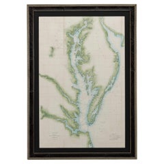
1856 U.S. Coast Survey Map of Chesapeake Bay and Delaware Bay
Located in Colorado Springs, CO
Presented is U.S. Coast Survey nautical chart or maritime map of Chesapeake Bay and Delaware Bay from 1856. The map depicts the region from Susquehanna, Maryland to the northern Outer Banks in North Carolina. It also shows from Richmond and Petersburg, Virginia to the Atlantic Ocean. The map is highly detailed with many cities and towns labeled throughout. Rivers, inlets, and bays are also labeled. Various charts illustrating more specific parts of the region are marked on the map using dotted lines. The lines form boxes, and the corresponding chart number and publication date are given. Extensive triangulation surveys were conducted the length of Chesapeake Bay and are illustrated here. Hampton Roads, Virginia is labeled, along with the James, York, and Rappahannock Rivers, which were all extensively surveyed.
The chart was published under the supervision of A. D. Bache, one of the most influential and prolific figures in the early history of the U.S. Coast Survey, for the 1856 Report of the Superintendent of the U.S. Coast Survey. Alexander Dallas Bache (1806-1867) was an American physicist, scientist, and surveyor. Bache served as the Superintendent of the U.S. Coast Survey from 1843 to 1865. Born in Philadelphia, Bache toured Europe and composed an important treatise on European Education. He also served as president of Philadelphia's Central High School and was a professor of natural history and chemistry at the University of Pennsylvania. Upon the death of Ferdinand Rudolph Hassler, Bache was appointed Superintendent of the United States Coast Survey.
The Office of the Coast Survey, founded in 1807 by President Thomas Jefferson and Secretary of Commerce Albert Gallatin...
Category
1850s American Antique United States Coastal Survey Furniture
Materials
Paper
Related Items
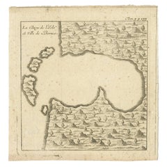
Antique Map of a Bay of Borneo, Indonesia, c.1760
Located in Langweer, NL
Antique map titled 'La Baye de l'isle et Ville de Borneo'. Small map depicting a Bay of Borneo.
Artists and Engravers: Anonymous.
Condition: Good, general age-related toning. ...
Category
18th Century Antique United States Coastal Survey Furniture
Materials
Paper
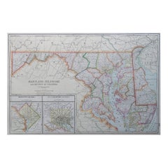
Large Original Antique Map of Maryland, Delaware & DC, USA, C.1900
Located in St Annes, Lancashire
Fabulous map of Maryland, Delaware And District of Columbia
Original color
Engraved and printed by the George F. Cram Company, Indianapolis.
Pu...
Category
1890s American Antique United States Coastal Survey Furniture
Materials
Paper
No Reserve
H 15 in W 22 in D 0.07 in
Original Old Map of the Coast of Syria and Phoenicia, 1773
Located in Langweer, NL
Antique map titled 'Kaart van de Zee Kust van Syrië (..)'.
Old map of the coast of Syria and Phoenicia. Originates from the first Dutch editon of an interesting travel account of...
Category
1770s Antique United States Coastal Survey Furniture
Materials
Paper
1864 U.S. Coast Survey of the Potomac River, from Indian Head to Georgetown
Located in Bridgeport, CT
An antique nautical map with hand-painted color accents entitled "Potomac River (in four sheets): Sheet no. 4, from Indian Head to Georgetown". Created b...
Category
19th Century American Classical Antique United States Coastal Survey Furniture
Materials
Paper
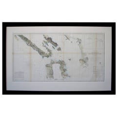
Scarce U.S. Coast Survey Map Depicting Entrance to San Francisco Bay Dated 1856
Located in San Francisco, CA
A fine example of the 1856 U.S. Coast lithographic survey nautical chart of the entrance to San Francisco bay and the city. Published in 1856 by the Office of the Coast Survey the of...
Category
Mid-19th Century American Antique United States Coastal Survey Furniture
Materials
Paper
H 28 in W 46 in D 1.5 in
Antique Map of New Jersey, Delaware and Maryland by Johnson, 1872
Located in Langweer, NL
Antique map titled 'Johnson's New Jersey (..). Two maps on one sheet showing New Jersey, Delaware and Maryland. With inset map of the district of Columbia...
Category
Late 19th Century Antique United States Coastal Survey Furniture
Materials
Paper
Antique Map of Western Tartary, with Information from Kyrkov's Surveys
Located in Langweer, NL
Antique map titled 'Carte de la Tartarie Occidentale'. This map covers western Tartary with a focus on the region of present-day Mongolia. This map includes information from Kyrkov's...
Category
Mid-18th Century Antique United States Coastal Survey Furniture
Materials
Paper
H 9.18 in W 12.72 in D 0.02 in
Large Custom Framed 1857 U.S. Coast Survey of the Chesapeake Bay
Located in Bridgeport, CT
An antique 1850's nautical map with hand-painted color accents entitled “Chesapeake Bay; Sheet no. 2: Head of the Bay to the Mouth of the Potomac River”....
Category
1850s American American Classical Antique United States Coastal Survey Furniture
Materials
Paper
Antique Map of the Coast of Roussillon, France
Located in Langweer, NL
Antique map titled 'Coste de Roussillon depuis Port Vendres, jusqu'au golphe de Rozes'. Original map of the coast of Roussillon, France. This map originates from 'Le Petit Atlas Mari...
Category
Mid-18th Century Antique United States Coastal Survey Furniture
Materials
Paper
Antique Map of a Bay on the Coast of Chile by Anson, 1749
Located in Langweer, NL
Antique map titled 'Plan van een Baai en Haven aan de Kust van Chili (..) - Plan d'une Baye de la Côte du Chili (..)'. Original antique map of a bay on the coast of Chile discovered ...
Category
18th Century Antique United States Coastal Survey Furniture
Materials
Paper
Antique Map of Cordes Bay and Surroundings
Located in Langweer, NL
Antique map titled 'Baye et Havre de Cordes (..)'. Four maps on the one sheet of; Cordes Bay, Port Famine, Woods Pay, Port Gallant, Fortescue Bay, Chile based on the voyage of John B...
Category
Late 18th Century Antique United States Coastal Survey Furniture
Materials
Paper
Maritime and Terrestrial Survey of Spanish Santander in 1901, An Original Map
Located in Langweer, NL
This antique map is a historical map of the province of Santander (currently known as Cantabria) from the year 1901. Santander is located along the northern coast of Spain, bordering...
Category
Early 1900s Antique United States Coastal Survey Furniture
Materials
Paper
Free Shipping
H 14.77 in W 20.08 in D 0 in
Previously Available Items
Rare United States Coastal Survey Office Map
Located in San Francisco, CA
A rare United States coastal survey office map of the entrance to San Francisco Bay, California, dated 1856; lithograph on tissue; the large-scaled map charting...
Category
19th Century American Antique United States Coastal Survey Furniture
United States Coastal Survey furniture for sale on 1stDibs.
United States Coastal Survey furniture are available for sale on 1stDibs.


