Items Similar to Old Optical View of French Boarding for the Cayenne Isle Port of Rochefort
Want more images or videos?
Request additional images or videos from the seller
1 of 8
Old Optical View of French Boarding for the Cayenne Isle Port of Rochefort
About the Item
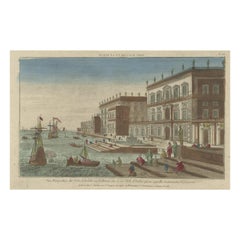
Antique print titled 'Enbarquement des Francois pour l'Isle de Cayenne au Port de Rochefort'. Hand coloured optical view of French boarding for the Cayenne Isle Port of Rochefort, as seen from the quay. In the front of the picture the bourgeoisie waits for their ship. In the distance ships sail to open water. This is an optical print, also called 'vue optique' or 'vue d'optique', which were made to be viewed through a Zograscope, or other devices of convex lens and mirrors, all of which produced an optical illusion of depth. Published circa 1780.
- Dimensions:Height: 13 in (33 cm)Width: 19.69 in (50 cm)Depth: 0.02 in (0.5 mm)
- Materials and Techniques:
- Period:
- Date of Manufacture:circa 1780
- Condition:Wear consistent with age and use. General age-related toning, minor wear. Blank verso. Please study images carefully.
- Seller Location:Langweer, NL
- Reference Number:
About the Seller
5.0
Platinum Seller
These expertly vetted sellers are 1stDibs' most experienced sellers and are rated highest by our customers.
Established in 2009
1stDibs seller since 2017
1,947 sales on 1stDibs
Typical response time: <1 hour
- ShippingRetrieving quote...Ships From: Langweer, Netherlands
- Return PolicyA return for this item may be initiated within 14 days of delivery.
More From This SellerView All
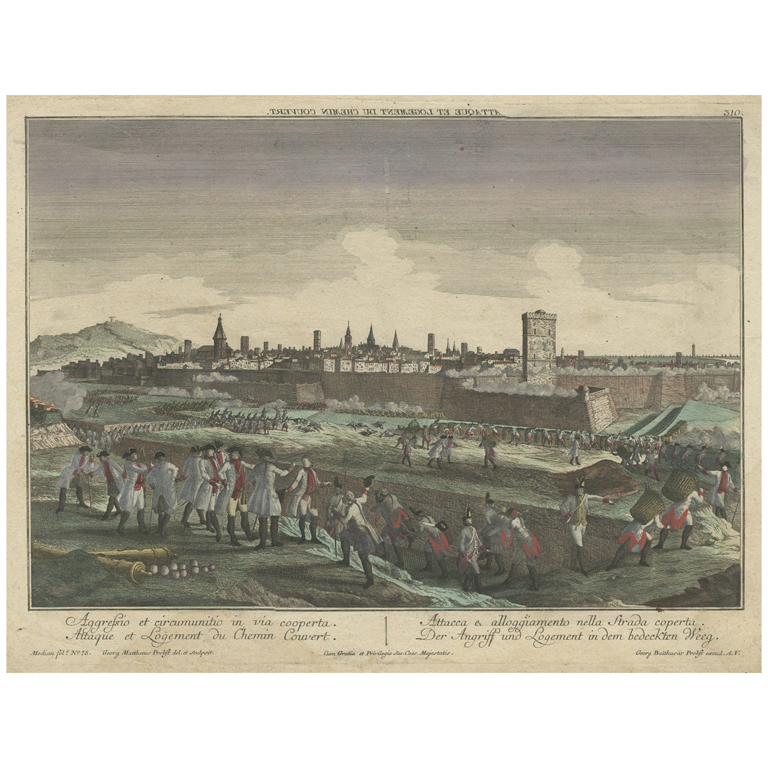
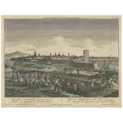
- Optical View Depicting the Siege of Barcelona, Spain, ca.1765Located in Langweer, NLAntique print Barcelona titled 'Aggressio et Circumunitio in via cooperta'. Optical view depicting the siege of Barcelona (Spain) which took place between 25 July 1713 and 11 September 1714. With Latin, French, Italian and German caption. Artists and Engravers: Georg Balthasar Probst (1732 - 1801) was a German artist, engraver and publisher in Augsburg. The Siege of Barcelona (Catalan: Setge de Barcelona) was a battle at the end of the War of Spanish Succession, which pitted Archduke Charles of Austria (backed by Great Britain and the Netherlands, i.e. the Grand Alliance) against Philip V of Spain, backed by France in a contest for the Spanish crown. The surrender of the pro-Archduke forces to the Franco-Spanish army in 1714 was not only the end of the war, but also a phase in the centralization of various monarchies on the European continent which had been going on for two centuries. With the War of the Spanish Succession completed, Spain evolved from a personal union of different states to a centralized kingdom. The defenders of the city were buried in a cemetery, now a plaça (Catalan: square) called Fossar de les Moreres, where Catalans gather every 11 September, known as the National Day of Catalonia or la Diada. The former market hall Mercat del Born covers archaeological ruins which were part of the La Ribera district of Barcelona that was demolished after the defeat of Catalonia in 1714. The alleged abandonment of the Catalans defenders of Barcelona was one of the criticisms made by his opponents during the British Parliament...Category
Antique 1760s Prints
MaterialsPaper
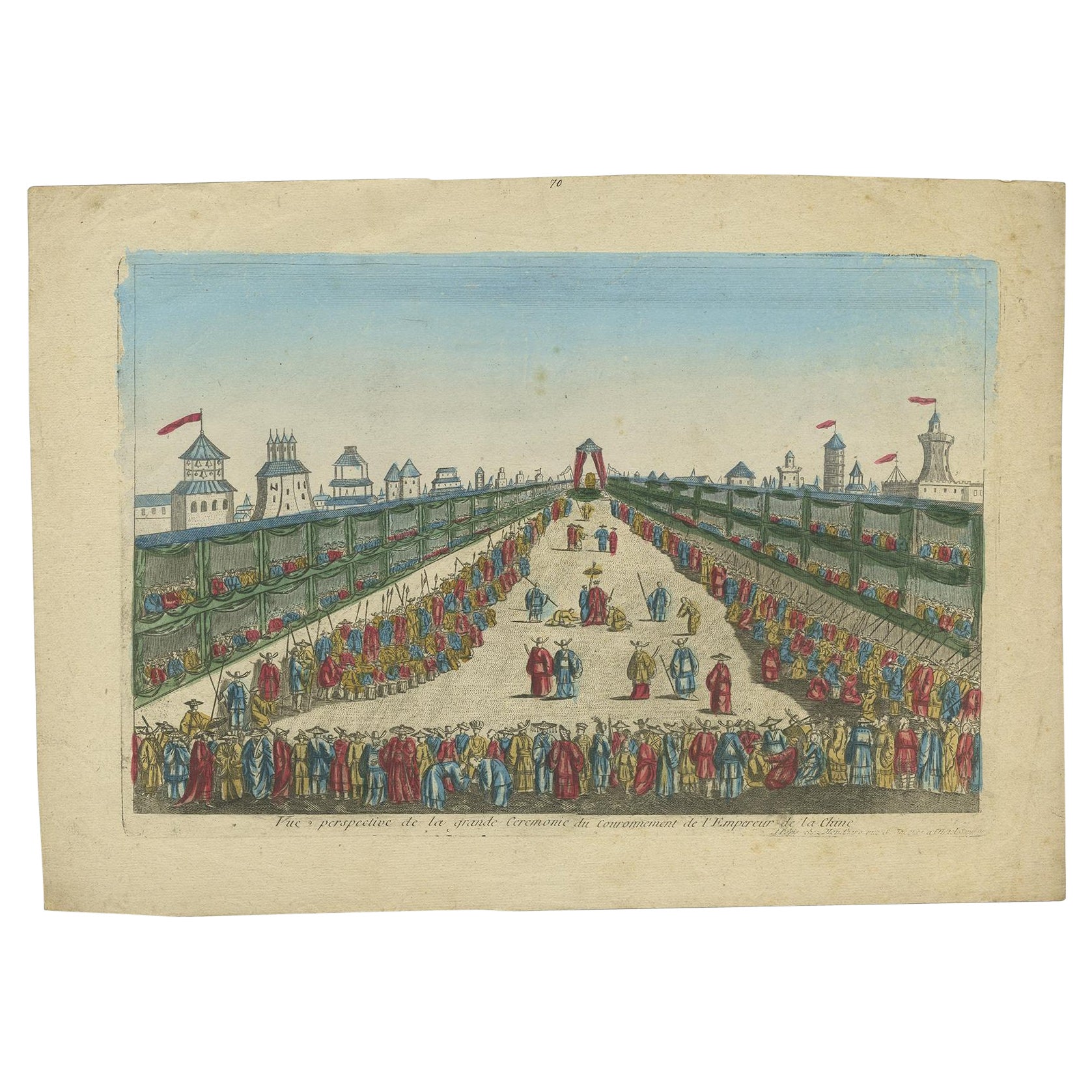
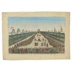
- Antique Optical View of The Coronation Ceremony of The Emperor of China, ca.1770Located in Langweer, NLAntique print China titled 'Vue perspective de la grande Ceremonie du couronnement de l'Empereur de la Chine'. Optical view of the coronation c...Category
Antique 1770s Prints
MaterialsPaper
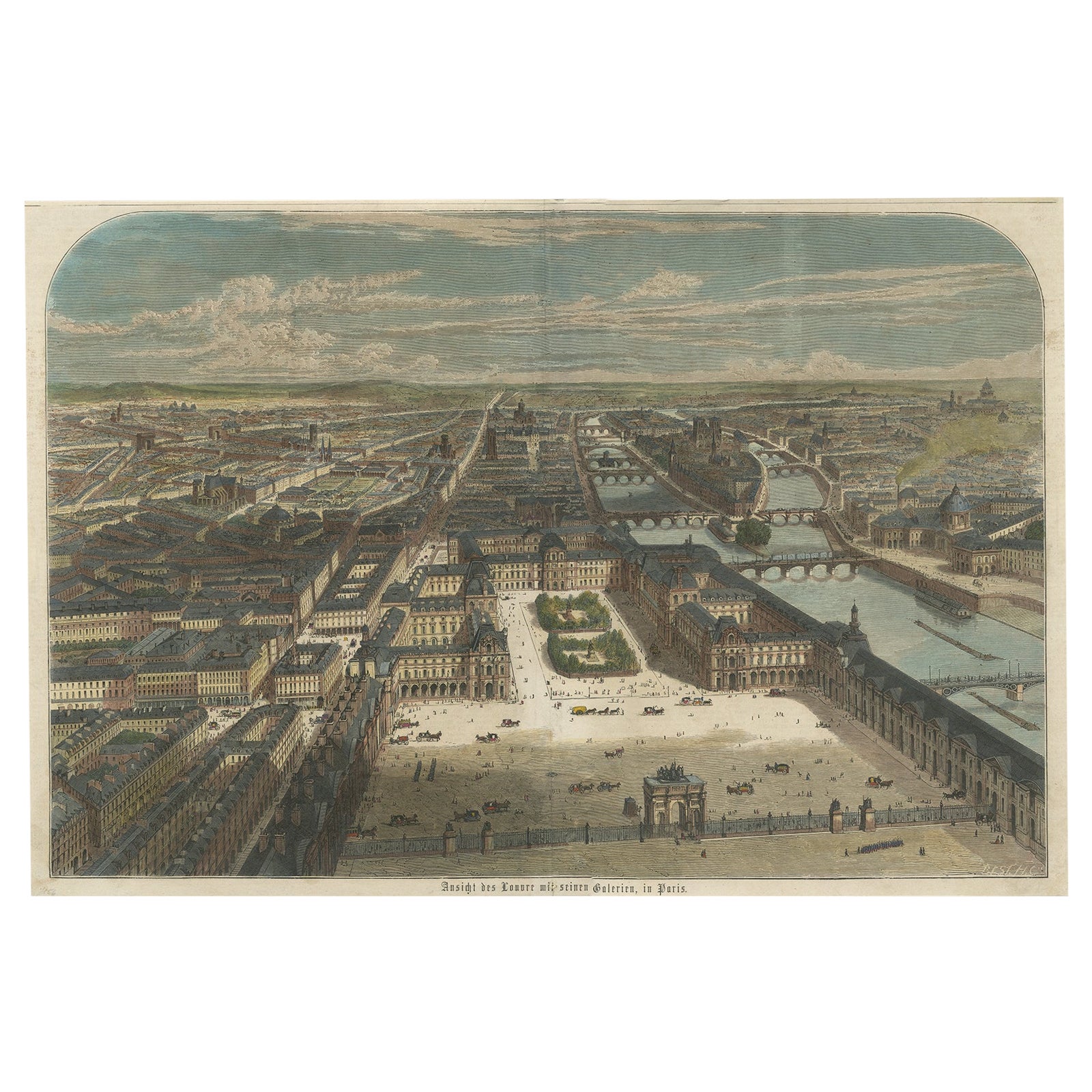
- Old Hand-Colored Print With a View of the Louvre, France, ca.1885Located in Langweer, NLAntique print titled 'Anischt des Louvre mit seinen Galerien, in Paris'. Old print with a view of the Louvre, France. This print originates from a German illustrated newsletter, pu...Category
Antique 1880s Maps
MaterialsPaper
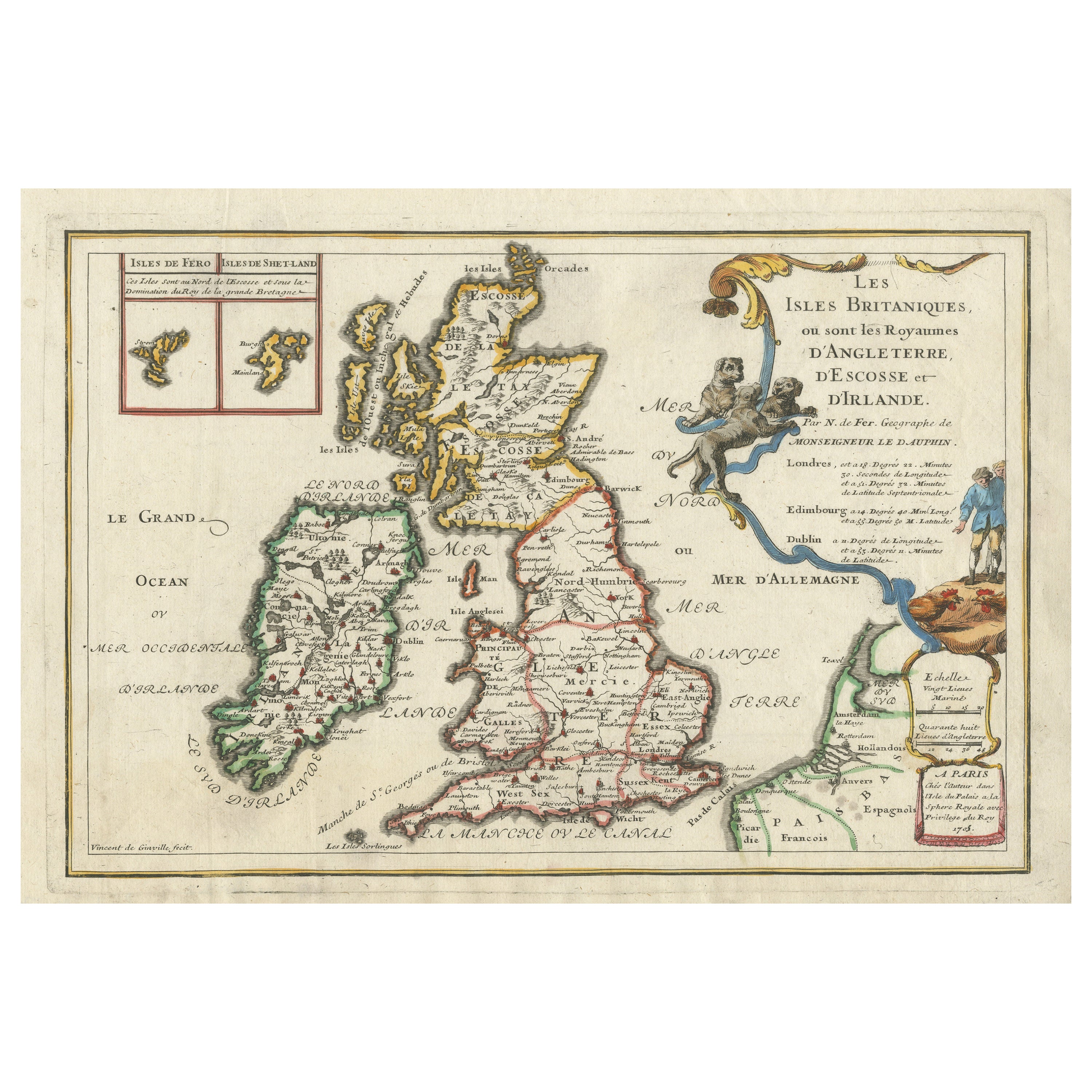
- Old Map of the British Isles with the Faroes and Shetlands, Showing Cock FightsLocated in Langweer, NLAntique map titled 'Les Isles Britaniques ou sont les Royaumes d'Angleterre (..)'. Original old map of the British Isles with inset maps of the Faroes and Shetlands. The title cartouche depicts dog...Category
Antique Early 18th Century Maps
MaterialsPaper
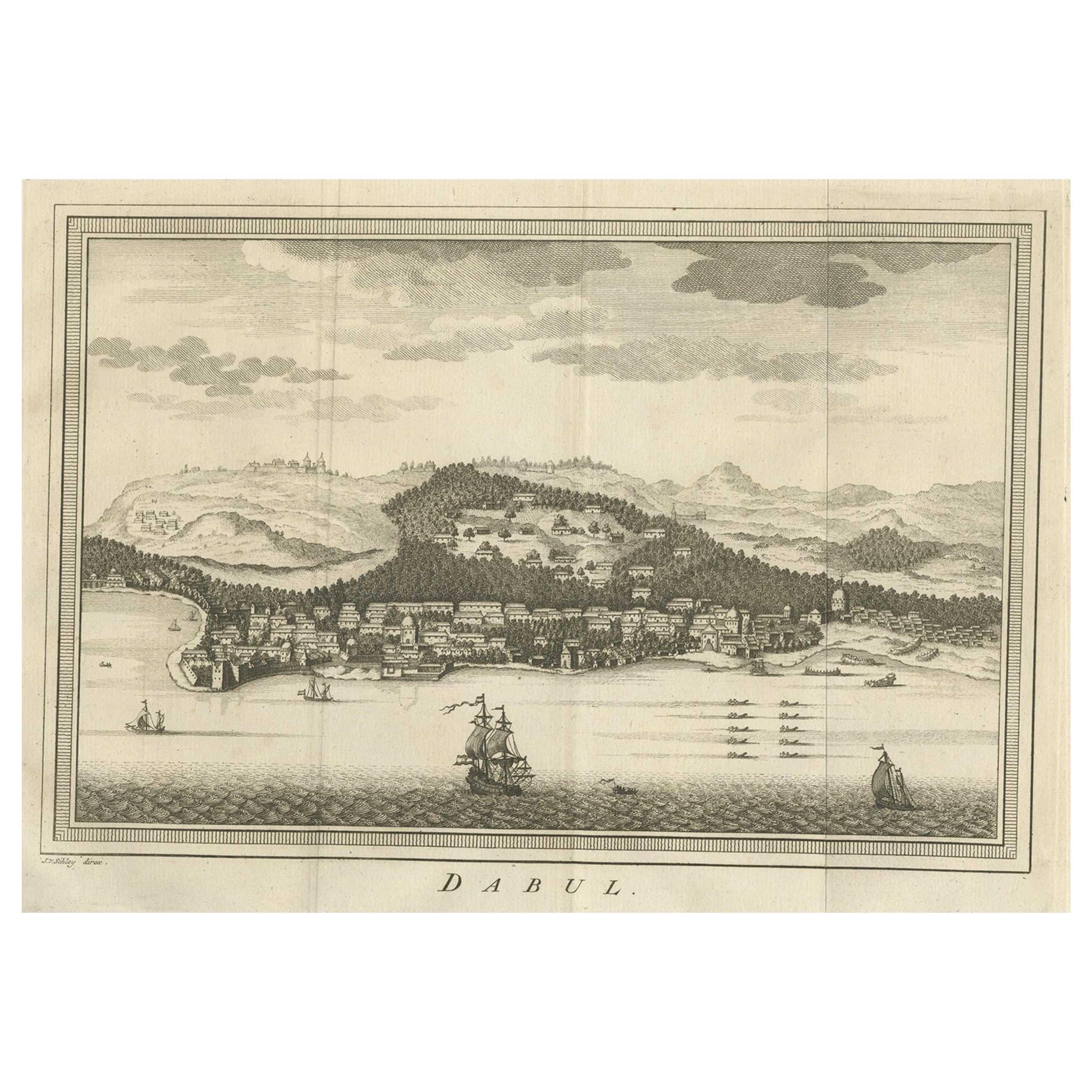
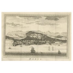
- Old Copper Engraving of the Port City Dabhol in India, 1757Located in Langweer, NLAntique print titled 'Dabul'. Old print of the port city Dabhol in India. In the 15th and 16th centuries, Dabul was an opulent Muslim trade center. Around 1660 it was annexed to th...Category
Antique 1750s Maps
MaterialsPaper
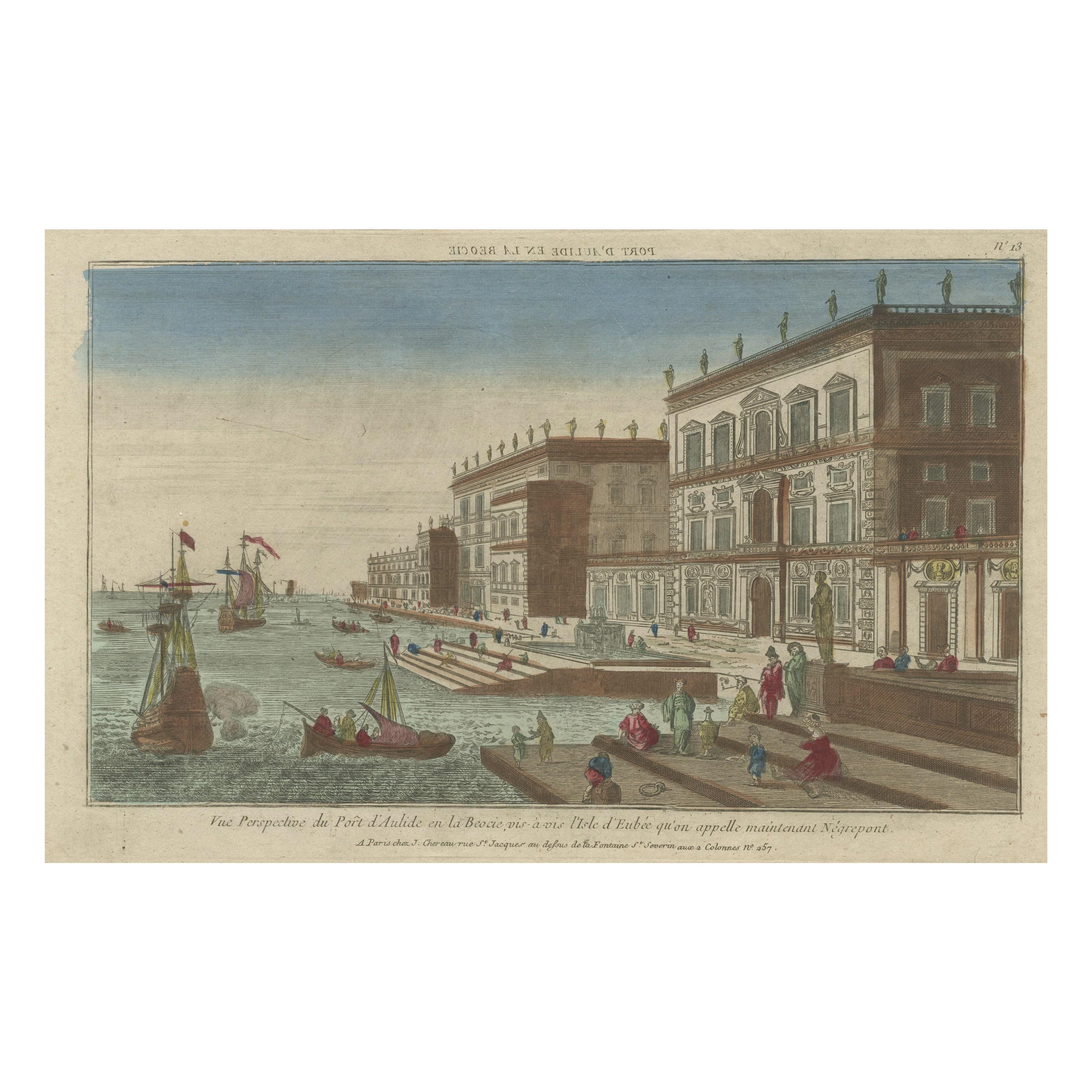
- Optical View of the Port of Boeotia Near the Island of Evvia, GreeceLocated in Langweer, NLAntique print titled 'Vue Perspective du Port d'Aulide en la Beocie vis-a-vis l'Isle d'Eubee qu'on appelle maintenant Negrepont'. View of the port of Boeotia near the island of Evvia...Category
Antique Late 18th Century Prints
MaterialsPaper


You May Also Like
- Old Nautical Print Depicting the Bombardment of Cadiz by the French Navy 1823Located in Milan, ITPrint by engraving on copper plate of the first half of the 19th century, depicting the bombardment of Cadiz by the French Navy, 23 September 1823. The print is signed peint par Crep...Category
Antique 1830s French Nautical Objects
MaterialsPaper
- Vintage "View of the Center of Paris Taken from the Air" Lithograph MapLocated in San Diego, CAA very stylish "View of the Center of Paris Taken from the Air" lithograph map published by the Paris Ministry of Tourism, circa early 1950s. The piece measures 27" x 43" and shows...Category
20th Century French Mid-Century Modern Prints
MaterialsPaper
- Large 17th Century Hand Colored Map of England and the British Isles by de WitBy Frederick de WitLocated in Alamo, CAA large hand colored 17th century map of England and the British Isles by Frederick de Wit entitled "Accuratissima Angliæ Regni et Walliæ Principatus", published in Amsterdam in 1680. It is a highly detailed map of England, Scotland, the Scottish Isles...Category
Antique Late 17th Century Dutch Maps
MaterialsPaper
- N.E. View of the United States Capitol, Washington, DC Antique Proof Print 1858Located in Colorado Springs, COThis engraved print shows a view of the United States Capitol Building, in Washington, D.C. The print depicts the neoclassical building from the northeast orientation, with a bustling street scene in front. The steel engraving is a proof printing, drawn and engraved by Henry Sartain and published in 1858. Plans began in May 1854 to build a new cast-iron dome for the United States Capitol. The then-architect of the Capitol Thomas Walter and his team were sold on the aesthetics of a new dome, as well as the utility of a fire-proof one. A year later, on March 3, 1855, President Franklin Pierce...Category
Antique 1850s American Prints
MaterialsPaper
- Old Nautical Map of CorsicaLocated in Alessandria, PiemonteST/556/1 - Old map of Corsica isle, surveyed by Captain Hell, of the French Royal Navy in 1824, engraved and published on 1874, with additions and corre...Category
Antique Early 19th Century English Other Prints
MaterialsPaper
- Old Horizontal Map of EnglandBy TassoLocated in Alessandria, PiemonteST/520 - Old rare Italian map of England, dated 1826-1827 - by Girolamo Tasso, editor in Venise, for the atlas of M.r Le-Sage.Category
Antique Early 19th Century Italian Other Prints
MaterialsPaper


