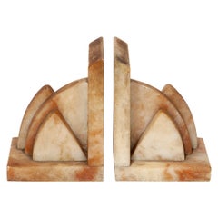
Items Similar to Bookend Pair Royal Air Force Badge Pilot Squadron 341 FreeFrenchFlight Spitfire


Want more images or videos?
Request additional images or videos from the seller
1 of 6
Bookend Pair Royal Air Force Badge Pilot Squadron 341 FreeFrenchFlight Spitfire
About the Item
One oak bookend with a polychrome Badge of the Royal Air Force and bearing the motto : Per Ardua ad Astra" (Latin) - Through Adversity to the Stars
The other bookend with a polychrome badge or shield of three crowns of Alsace the badge of no 341 Squadron, formed in 1943 out of the Free French Flight, who had been operating in the Western Desert. Its French name was Groupe de Chasse III/2 “Alsace”.
provenance : collector of war memorabilia
height 15cm., 6 1/2" length and depth 13cm., 5", depth
No.341 SQUADRON
Badge on a hand three crowns of Alsace. Motto Friendship. Formed 15 January 1943 Disbanded 27 November 1945. No 341 Squadron was a spitfire fighter squadron formed in January 1943 out of the Free French Flight, who had been operating in the Western Desert. Its French name was Groupe de Chasse III/2 “Alsace”.
In March the Squadron moved to RAF Biggin Hill and began flying first Channel patrols and then sweeps over France. It was a busy summer for No 341 Squadron and in October it moved to RAF Perranporth in Cornwall, adding convoy patrols and anti-shipping sorties over the Cornish coastline to its duties. In April the Squadron moved to RAF Merston, joining No 145 Wing, Second Tactical Air Force to prepare for the invasion. Its task now was to provide bombing escort for the tremendous volume of day-bombing raids, which were softening up northern France in readiness for the landings. On 6 June 1944 (D-Day) No 341 Squadron switched to low-level beachhead patrols and escorting Stirlings which were towing gliders to land behind enemy positions. In August the Squadron moved to France from where they carried out armed reconnaissance patrols, and gradually advanced into Belgium and Holland. At the start of 1945 they returned to Scotland to re-equip and then for the last few months of fighting carried out low-level strafing of communications targets. On 27 November 1945 the Squadron was disbanded and control passed to the Armée de l’Air.
AIRCRAFT - Spitfire VB/IXB/XVI 1943 - 1945
- Dimensions:Height: 6.7 in (17 cm)Width: 5.91 in (15 cm)Depth: 5.91 in (15 cm)
- Sold As:Set of 2
- Style:Mid-Century Modern (Of the Period)
- Materials and Techniques:
- Place of Origin:
- Period:
- Date of Manufacture:c1945
- Condition:Wear consistent with age and use.
- Seller Location:BUNGAY, GB
- Reference Number:1stDibs: LU3867332101502
About the Seller
5.0
Vetted Seller
These experienced sellers undergo a comprehensive evaluation by our team of in-house experts.
Established in 1985
1stDibs seller since 2018
84 sales on 1stDibs
Typical response time: 9 hours
- ShippingRetrieving quote...Ships From: BUNGAY, United Kingdom
- Return PolicyA return for this item may be initiated within 7 days of delivery.
More From This SellerView All
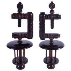
- Lignum Vitae Treen Vices Pair of Minature Tree of LifeLocated in BUNGAY, SUFFOLK- Collector's specimens - Lignum vitae is sought after for the beauty of its grain, coloring, patina, density and toughness Translated from Latin, vignum vitae means “wood of lif...Category
Antique 1750s English George II Models and Miniatures
MaterialsWood
- Bookends Pair Marble Art Deco Architectural OchreLocated in BUNGAY, SUFFOLK- Very fine quality evoking classic Art Deco architectural designs - Beautiful form with the layered segmented curves creating soft yet bold fo...Category
Vintage 1930s Italian Art Deco Bookends
MaterialsSiena Marble
- Table Low Sofa Vintage 1950s Map Isle of Man John Speed 1610 Thomas Durham 1595Located in BUNGAY, SUFFOLK- The juxtaposition of modern design and this ancient map create a unique small table and conversation piece - This is the first map featuring the Isle of Man on its own. - It is also the first map of the Island based on an actual survey, undertaken by Thomas Durham 1595 and was first published by Speed in 1605-1611 and reprinted many times over the next century. This is the second state or print from 1610. The map is inset within a fruitwood box frame with a glass top. Supported by tapering stick legs. The map is based on a survey (and presumably a MS map) by Thomas Durham, of whom nothing is known other that he was paid by Sir Thomas Gerrard to make a survey of the Island. This survey, almost certainly for military purposes, arose from the disputed possession of the Island during which time Elizabeth had assumed control in order to prevent the Scots or the Spanish from using the Island as a base. Speed had used the Durham Map in his slightly earlier 4-sheet wall map showing invasions and battles of c1603/4 [ref: Shirley #261] - there are some differences from this 1605/10 map - Port Eran (rather than Earn on 1605);Knockalo point (= Contrary Hd) not on 1605;Spalbrecke shown west of Calf rather than E as on 1605/10. Thus it is possible that the Durham Map had even more detail than Speed used in his derived version. In sea are four mythical beasts with riders: to NW of Island Unicorn with Scottish flag...Category
Antique 1610s English Mid-Century Modern Sofa Tables
MaterialsPaper
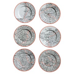
- Plates Commemorating Le Tour De France 1959 Luneville FaienceLocated in BUNGAY, SUFFOLK- Fabulous rare set of Tour de France commemorative plates for the cycling enthusiast - In original condition, no damage - Luneville 1959 1. June 25 depart Mullhouse, 26 June, 17 July, 18 July 2. June 29 Rennes June 30 Blain July 1 Nantes 3. July 2 Rochelle July 3 Bordeaux, July 4 Bayonne, July 5 Bagneres de Bigorre 4. July 6 St Gaudens...Category
Vintage 1950s French Mid-Century Modern Sports Equipment and Memorabilia
MaterialsPottery
- Map North Wales Robert Marsden AngleseyLocated in BUNGAY, SUFFOLKMap of North Wales by Robert Marsden Including Anglesey Charming topography and detail and colouring just purchased more information to follow.Category
Antique 18th Century English Georgian Maps
MaterialsPaper
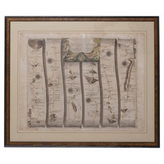
- Road Map Britannia No 32 the Road from London to Barnstable John Ogilby FramedBy John OgilbyLocated in BUNGAY, SUFFOLKA road map from Britannia, by John Ogilby Esq., Cosmographer and Geographick Printer to Charles II. Containing 293 miles. No 32. From Standard in Cornhill London to Andover thence to Amesbury, to Shruton, to Warminster, to Maiden-Bradley, to Bruton, to Weston, to Ascot and to Bridgewater Hand coloured, some foxing and creasing, commensurate with age. Floated in a cream mount with a gilded linear border within a burr walnut, ebonised and gilded frame. Provenance : purchased as pair from a collector with no 15 London to St Davids. Framed as a pair. Measures: Black Linear Border around Map Length 44cm., 17 1/8" Height 36cm., 14". Full Sheet Length 51cm., 20" Height 39cm., 15 1/4" Frame Length 62cm., 24 1/2 " Height 52cm., 20 1/2" Literature: In a remarkable life John Ogilby pursued, several careers, each ending in misfortune, and yet he always emerged undeterred, to carry on. His modern reputation is based on his final career, started in his sixty-sixth year, as a publisher of maps and geographical accounts. Ogilby was born outside Dundee, in 1600, the son of a Scottish gentleman. While he was still a child, the family moved to London. When the elder Ogilby was imprisoned for debt, the young John invested his savings in a lottery, won a minor prize, and settled his father's debts. Unfortunately, not enough money was left to secure John a good apprenticeship; instead, he was apprenticed to a dance master. Ogilby was soon dancing in masques at court but, one day, while executing a particularly ambitious leap, he landed badly. The accident left him with a permanent limp, and ended his dancing career. However, he had come to the attention of Thomas Wentworth, later Earl of Strafford, Charles I's most senior minister. Ever one to exploit his contacts, Ogilby became a dance instructor in Strafford's household. When Strafford was sent to Ireland, Ogilby accompanied him as Deputy-Master of the Kings Revels, and then Master of Revels. In Dublin, he built the New Theatre, in St. Werburgh Street, which prospered at first, but the Irish Rebellion, in 1641, cost Ogilby his fortune, which he estimated at £2,000, and almost his life. After brief service as a soldier, he returned to England, survived shipwreck on the way, and arrived back penniless. On his return, Ogilby turned his attention to the Latin classics, as a translator and publisher. His first faltering attempt, in 1649, was a translation of the works of Virgil, but after his marriage to a wealthy widow the same year, his publishing activities received a considerable boost. One means by which Ogilby financed these volumes was by subscription, securing advance payments from his patrons, in return for including their name and coats-of-arms on the plates of illustrations. Another approach was to secure a patron, preferably in the court circle. Ogilby's first patron was Strafford, who found out too late that all leading ministers are dispensable when Charles I assented to his execution in 1641. As he re-established himself, Ogilby sought a new patron, the King himself. In 1661, Ogilby was approached to write poetry for Charles II's coronation procession; he later published 'The Relation of His Majesties Entertainment Passing Through the City of London', and a much enlarged edition the following year, which included a Fine set of plates depicting the procession. Royal favour was bestowed in 1674 when John Ogilby received the title of 'His Majesty's Cosmographer and Geographick Printer' with a salary of £13.6s.8d per annum. In 1665, Ogilby left London to avoid the Plague then ravaging the capital. The following year, in the Great Fire of London, Ogilby claimed that he lost his entire stock of books valued at some £3,000, as well as his shop and house, leaving him worth just £5. As he sought to restore his fortunes, Ogilby was already looking in new directions. The initial opportunity he seized on was the reconstruction of London's burnt-out centre. He secured appointment as a 'sworn viewer', whose duty was to establish the property boundaries as they existed before the Fire. Ogilby was assisted in the project by his step-grandson, William Morgan...Category
Antique Late 17th Century English Charles II Maps
MaterialsPaper

You May Also Like
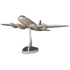
- Royal Air Force Hastings Model Airplane, circa 1940sLocated in London, GBA splendid enamel painted cast aluminum model of a Handley Page Hastings on newly made polished aluminum stand. This model was originally made for the Air Ministry at the end of the 1940s when the Hastings was first introduced. Dimensions: 52 cm/20½ inches (length) x 571.75 cm/28? inches (wing span) x 31.25 cm/12? inches (maximum height on stand). Designed and manufactured by aviation company Handley Page for the Royal Air Force...Category
Vintage 1940s British Aviation Objects
MaterialsAluminum
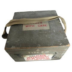
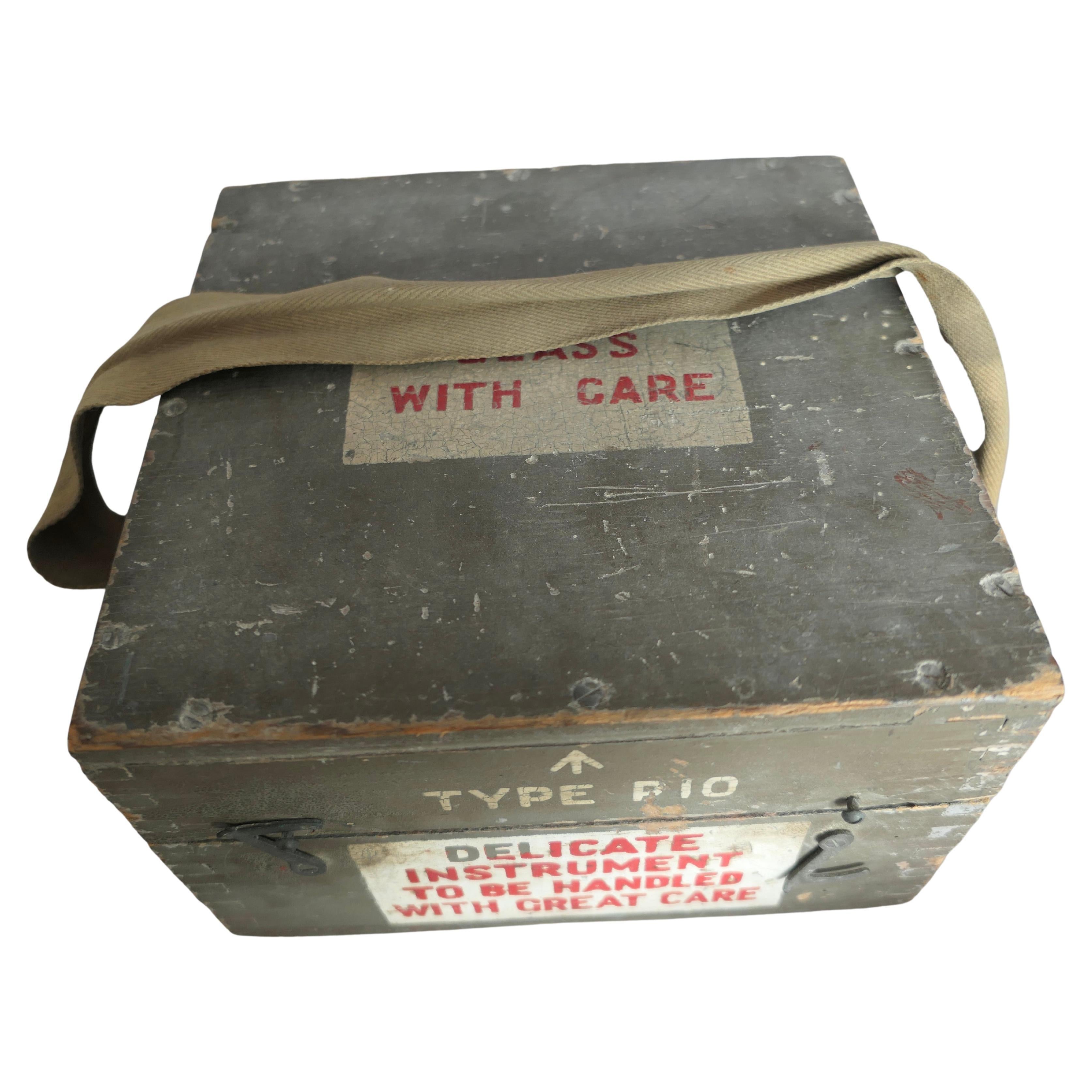
- A Royal Air Force P10 Aircraft Compass No. 23145 T MLocated in Chillerton, Isle of WightA Royal Air Force P10 Aircraft Compass No. 23145 T M The compass has a brass body finished in black, it comes in its battleship grey painted wooden ...Category
Vintage 1930s Industrial Aviation Objects
MaterialsBrass
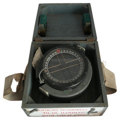
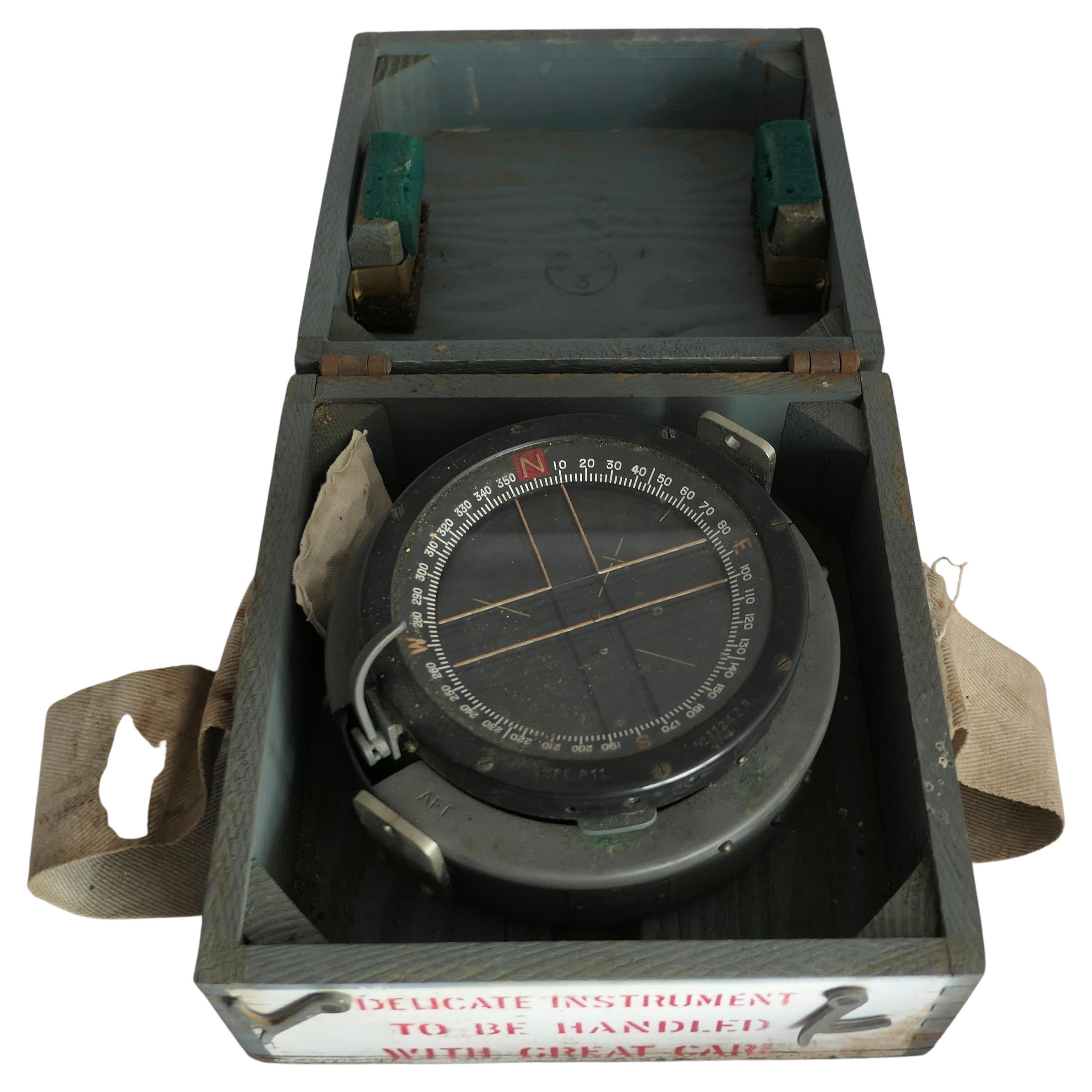
- A Royal Air Force P11 Aircraft Compass No. 11242 DLocated in Chillerton, Isle of WightA Royal Air Force P11 Aircraft Compass No. 11242 D The compass has a brass body finished in black, it comes in its battleship grey painted wooden...Category
Vintage 1930s Art Deco Aviation Objects
MaterialsBrass
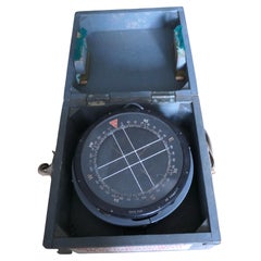
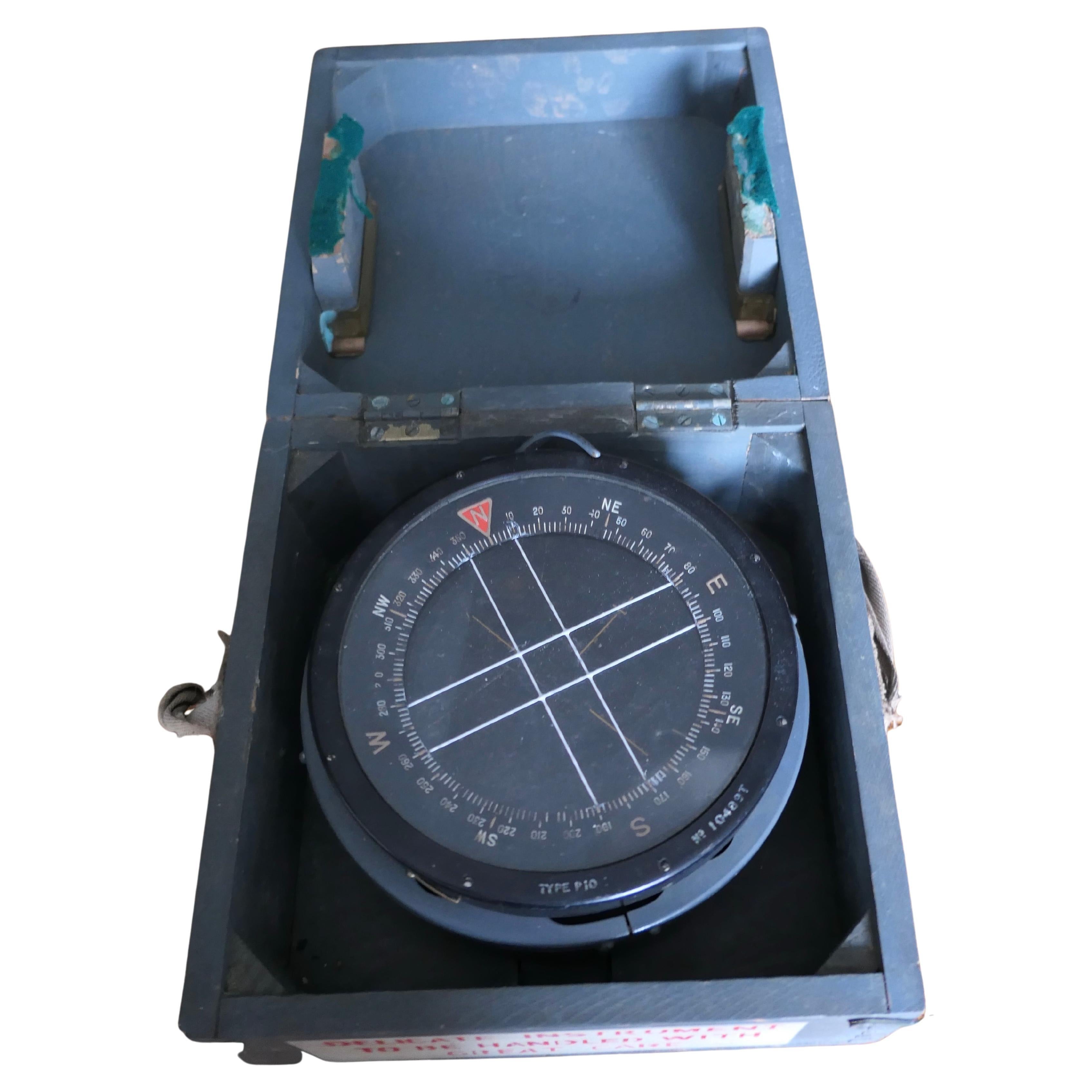
- Royal Air Force P10 Aircraft Compass No. 10489 TLocated in Chillerton, Isle of WightA Royal Air Force P10 aircraft compass No. 10489 T The compass has a brass body finished in black, it comes in its battleship grey painted wooden ...Category
Vintage 1930s British Colonial Aviation Objects
MaterialsBrass
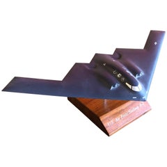
- Air Force B-2 Bomber Desk ModelLocated in San Diego, CAAir Force B-2 Bomber desk model, circa 1989. A very cool piece made of high quality plastic measuring 11" wide on a walnut base. The bomber is marked "Northr...Category
Late 20th Century American Aviation Objects
MaterialsPlastic, Walnut
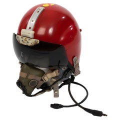
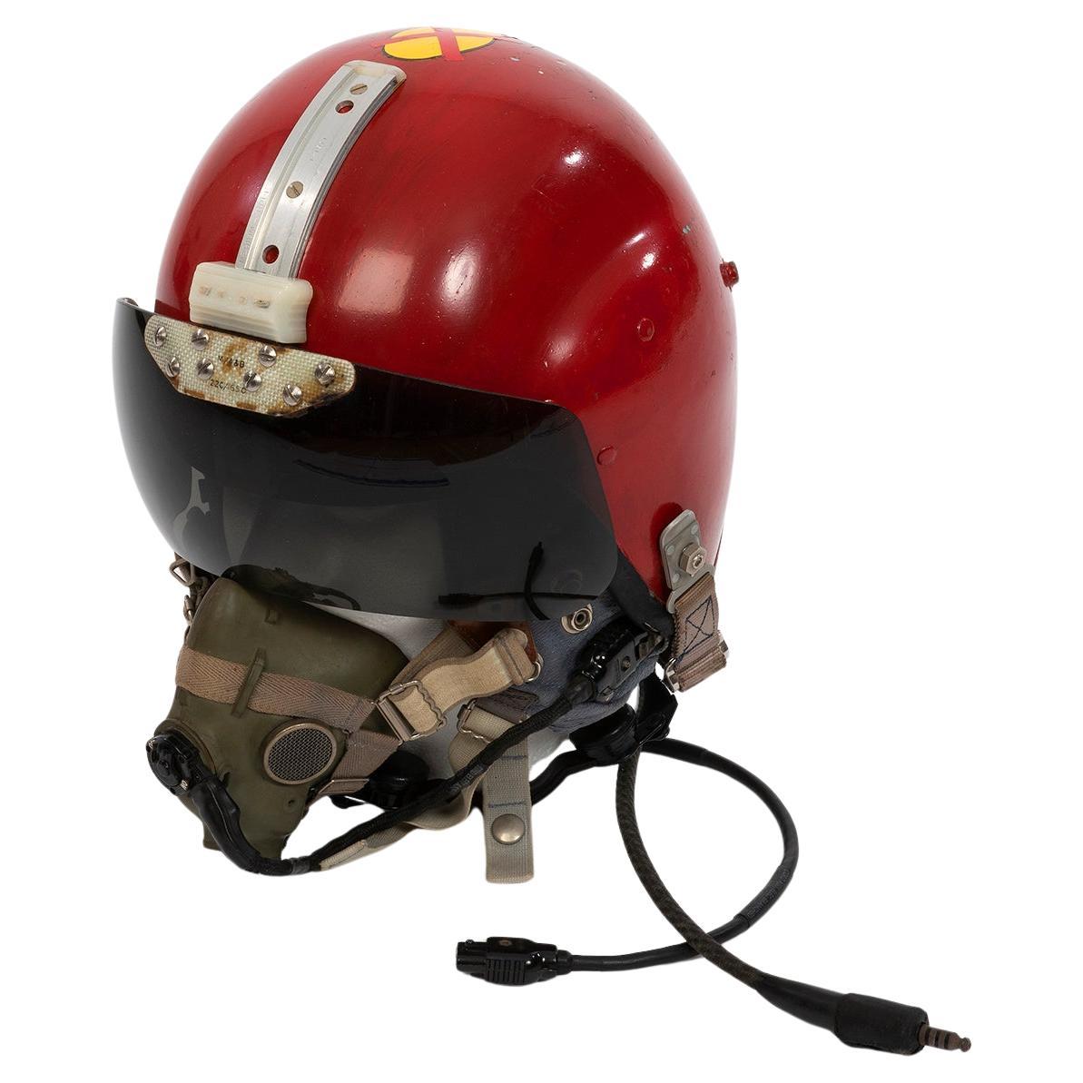
- Mk1A Pilots Helmet Raf 'Bone Dome" 1971 Squadron Leader, Issued 1950's.Located in Canterbury, GBOriginally Issued to RAF Squadron Leader Dick Woodhead, who was a highly successful pilot, later to become head of aptitude testing for future pilots at RAF Cranwell, and featured on...Category
Vintage 1950s Other Aviation Objects
MaterialsSteel