Items Similar to 'Chicago, the Old and the New' by Fred B. Hitchings 'circa 1920'


Want more images or videos?
Request additional images or videos from the seller
1 of 11
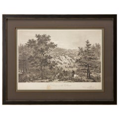
'Chicago, the Old and the New' by Fred B. Hitchings 'circa 1920'
About the Item
'Chicago, the Old and the New' by Fred B. Hitchings. Vintage booklet with pictures reproduced from authentic drawings of scenes before the great fire of October 9 1871, and pictures from recent photographs made especially for this work. In original binding, published circa 1920.
- Dimensions:Height: 5.91 in (15 cm)Width: 8.78 in (22.3 cm)Depth: 0.2 in (5 mm)
- Materials and Techniques:
- Period:
- Date of Manufacture:circa 1920
- Condition:Few pages partly loose. Original cover, shows some wear and sl. sunned. Please study images carefully.
- Seller Location:Langweer, NL
- Reference Number:
About the Seller
5.0
Platinum Seller
These expertly vetted sellers are 1stDibs' most experienced sellers and are rated highest by our customers.
Established in 2009
1stDibs seller since 2017
1,933 sales on 1stDibs
Typical response time: <1 hour
- ShippingRetrieving quote...Ships From: Langweer, Netherlands
- Return PolicyA return for this item may be initiated within 14 days of delivery.
More From This SellerView All
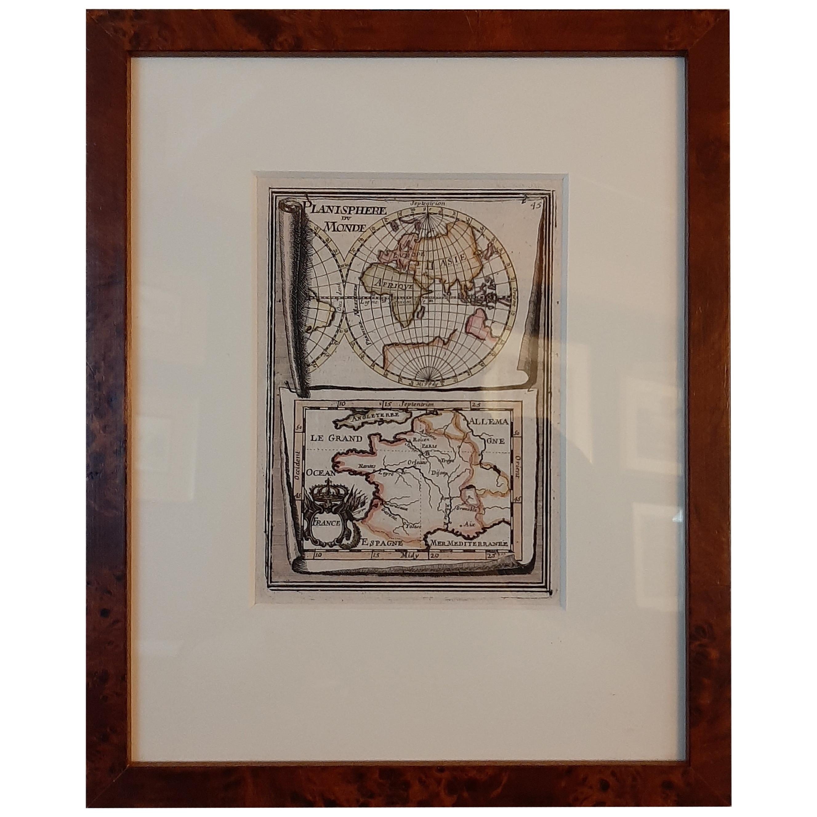
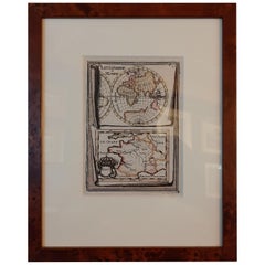
- Antique Miniature Map of the Old World and France by Mallet, circa 1683Located in Langweer, NLAntique map titled 'Planisphere du Monde - France'. Two miniature maps on one sheet. The upper map shows a hemisphere of the Old World. The lower map shows France. This map originate...Category
Antique Late 17th Century Maps
MaterialsPaper
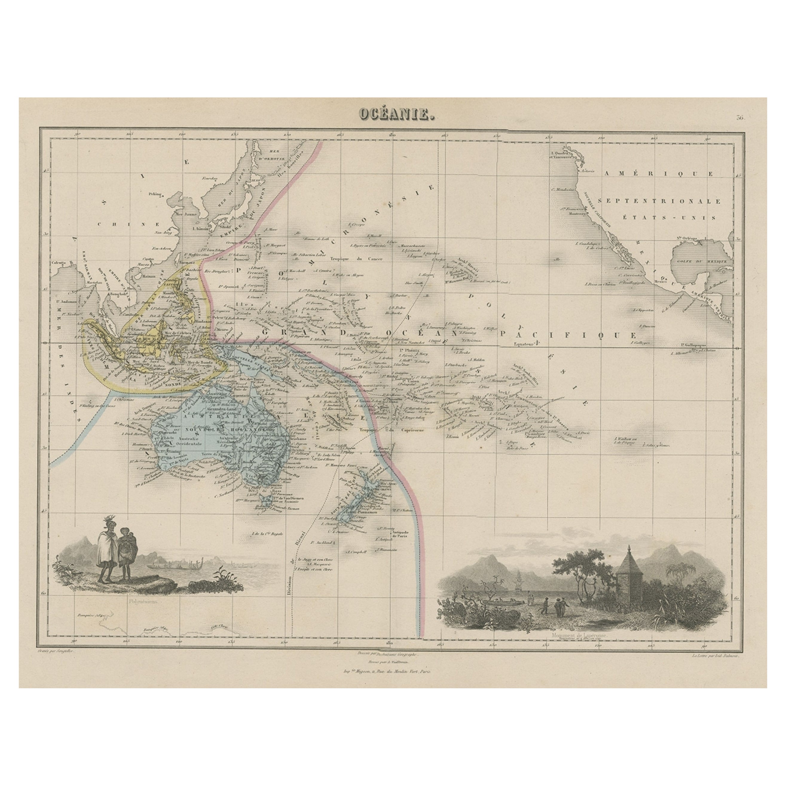
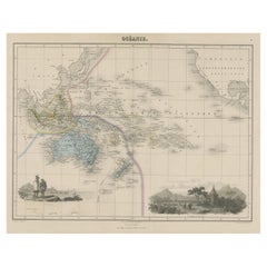
- Old Map of the Oceans Around Australia, Indonesia and New Zealand, 1880Located in Langweer, NLAntique map titled 'Océanie'. Old map of the oceans around Australia, Indonesia and New Zealand. With vignettes of people from Polynesia and the old monument Laparouse. This map ...Category
Antique 1880s Maps
MaterialsPaper
- Antique Map of New Guinea and New Britain by P. Carteret, circa 1773Located in Langweer, NLAntique map titled 'A chart of captn Carteret's Discoveries at New Britain'. Philip Carterets map of New Guinea and the islands of New Britain and New Ireland with the tracks of William Dampier...Category
Antique Late 18th Century Maps
MaterialsPaper
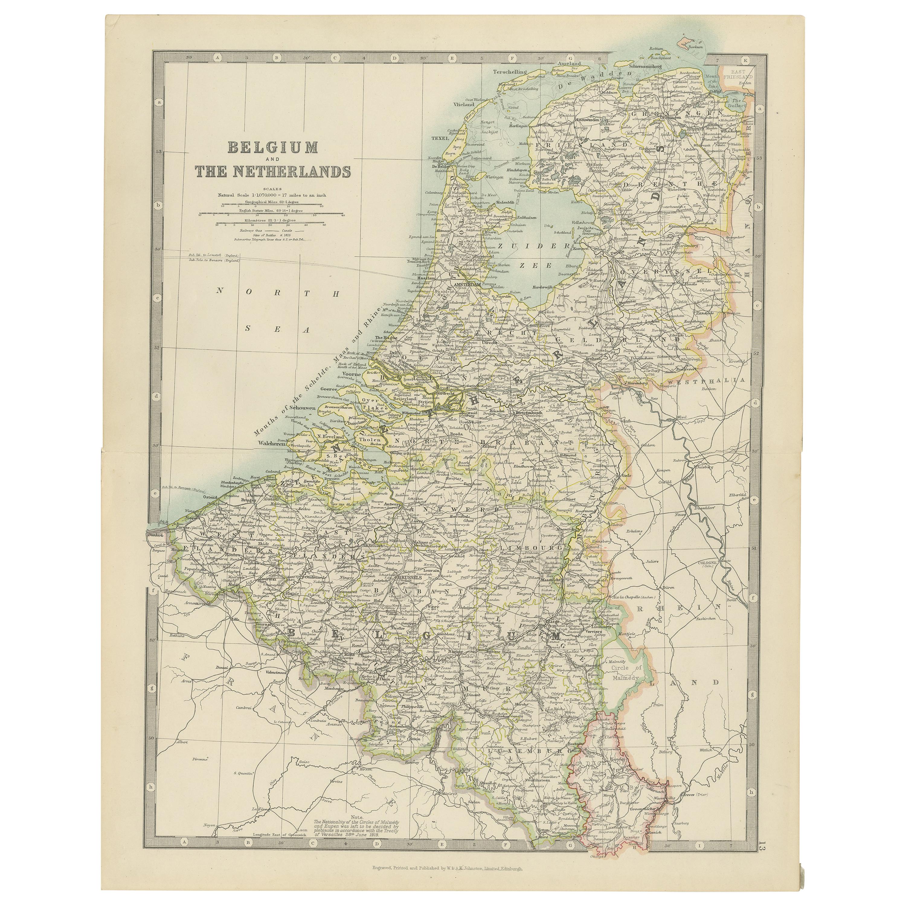
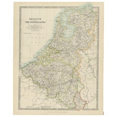
- Antique Map of Belgium and the Netherlands by Johnston 'c.1920'Located in Langweer, NLAntique map titled 'Belgium and the Netherlands'. Original antique map of Belgium and the Netherlands. Published by W. & A.K. Johnston, circa 1920.Category
20th Century Maps
MaterialsPaper
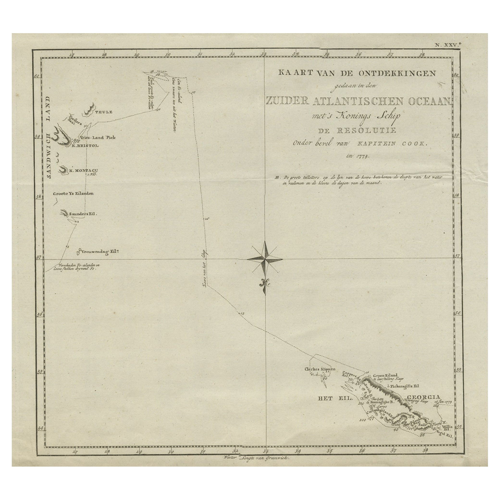
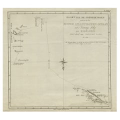
- Old Antique of the Southern Georgia and the Sandwich Islands by Capt Cook, 1803Located in Langweer, NLAntique map Atlantic titled 'Kaart van de Ontdekkingen gedaan in den Zuider Atlantischen Oceaan (..)'. Antique chart depicting Southern Georgia and the Sandwich Islands. Originat...Category
Antique Early 1800s Maps
MaterialsPaper
- Old Decorative Pictorial Map of the United States, circa 1953Located in Langweer, NLAntique map titled 'A Pictorial Map of the United States of America Showing Principal Regional Resources, Products, and Natural Features'. This information-packed map was create by the General Drafting Company for the New Jersey Bell Telephone Company. The main map features over 700 drawings in full color including points of interest, natural resources, and agricultural products. At bottom are inset maps showing railroad lines, air routes, telephone lines, as well as a pictorial map of New Jersey...Category
20th Century Maps
MaterialsPaper


You May Also Like
- Old Nautical Print Depicting the Bombardment of Cadiz by the French Navy 1823Located in Milan, ITPrint by engraving on copper plate of the first half of the 19th century, depicting the bombardment of Cadiz by the French Navy, 23 September 1823. The print is signed peint par Crep...Category
Antique 1830s French Nautical Objects
MaterialsPaper
- "Army of the Potomac" by John Bachelder, Civil War Era Lithograph, circa 1863Located in Colorado Springs, COFully-entitled: Army of the Potomac. The Wagon Trains of the Army of the Potomac en Route from Chickahominy to James River VA. During the Seven...Category
Antique 19th Century American Prints
MaterialsPaper
- H.M. Tomlinson "The Sea and The Jungle" 1st Edition Woodcuts by Clare LeightonBy TomlinsonLocated in San Francisco, CAH.M. Tomlinson "The Sea and The Jungle" First Edition with woodcuts by Clare Leighton, circa 1930 Rare First Edition. Very good condition. Fantastic woodcuts by noted artist Clare...Category
Early 20th Century American American Classical Books
MaterialsOther
- New Map of North America from the Latest Discoveries, 1763Located in Philadelphia, PAA fine antique 18th century map of the North American seaboard. Entitled "A New Map of North America from the Latest Discoveries 1763". By the Cartographer/Engraver - John Spil...Category
Antique Mid-18th Century English Georgian Maps
MaterialsPaper
- Civil War Panorama of the Seat of War by John Bachmann, Antique Print circa 1864Located in Colorado Springs, COPanorama of the seat of war. Bird's-eye View of Virginia, Maryland, Delaware and the District of Columbia. This third state of this fascinating bird's eye view of the northernmost p...Category
Antique 1860s American Maps
MaterialsPaper
- Old Nautical Map of CorsicaLocated in Alessandria, PiemonteST/556/1 - Old map of Corsica isle, surveyed by Captain Hell, of the French Royal Navy in 1824, engraved and published on 1874, with additions and corre...Category
Antique Early 19th Century English Other Prints
MaterialsPaper


Recently Viewed
View AllMore Ways To Browse
Used Furniture In Chicago
Chicago Vintage Furniture
Vintage Furniture In Chicago
Vintage Fire Collectibles
Fred B
Vintage Hitch
Sample Book
French Royal Books
Antique Readers
Sothebys Home
Books Jewels
Star Dust Furniture
Trent Antiques Jewelry
Book Tower
England Vintage Map
Ian Fleming Vintage
England Map Vintage
Copy Machine