Items Similar to De Indische Archipel by C.W. Mieling, 1865-1876


Want more images or videos?
Request additional images or videos from the seller
1 of 6
De Indische Archipel by C.W. Mieling, 1865-1876
About the Item
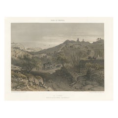
'De Indische Archipel: Tafereelen uit de natuur en het volksleven in Indië' by C.W. Mieling. This is a very rare first edition (only 1 copy in Nederlandse Centrale Catalogus – NCC and only 1 copy in JAP, sold in 1974) of a sumptuous work originally published in 12 instalments (started in 1865 by C.W. Mieling and completed in 1876 by J.M. van ‘t Haaff, both in The Hague). It was in January 1862 that a Prospectus was issued by C. W. Mieling, The Hague, announcing the publication of what is the most spectacular of the plate works of Indonesia, De Indische Archipel, which commenced publication in The Hague in 1865. The work contains 24 large chromolithograph plates which are among the largest published on Indonesia. From both a topographical and artistic point of view the plates are of considerable interest as they present a comprehensive series of views in the archipelago, ranging through Java. Borneo, Sumatra and Minahasa, after drawings by virtually all the prominent mid-19th century artists of Indonesia:
Raden Saleh
A. Salm
E. Hardouin
C. Deeleman
J. S G. Gramberg
F C. Wilsen
Jhr. L. H. W. M. de Stuers
F. Lebret
Th. J. D. van Herwerden
This unique folio was part of the “Between Worlds” Exhibition on Raden Saleh and Juan Luna at the National Gallery of Singapore ~ 16 Nov 2017 ~ 11 Mar 2018. Between Worlds features the works of Indonesian artist Raden Saleh (c.1811–1880) and Filipino artist Juan Luna (1857–1899), two leading painters from Southeast Asia who achieved wide acclaim in Europe. This will be the first major survey to bring their works together, drawing from important collections around the world.
- Dimensions:Height: 28.94 in (73.5 cm)Width: 22.45 in (57 cm)Depth: 1.19 in (3 cm)
- Materials and Techniques:
- Period:
- Date of Manufacture:1865
- Condition:With lithogr. title and 24 chromo-lithogr. views & plates (each accompanied by letterpress text-leaf). Large folio, contemp. green h.morocco, gilt panelled upper cover with central gilt brass coat-of-arms (dep. 2 Dutch lions). Minor toning and foxing.
- Seller Location:Langweer, NL
- Reference Number:1stDibs: LU3054321952972
About the Seller
5.0
Platinum Seller
These expertly vetted sellers are 1stDibs' most experienced sellers and are rated highest by our customers.
Established in 2009
1stDibs seller since 2017
1,957 sales on 1stDibs
Typical response time: <1 hour
- ShippingRetrieving quote...Ships From: Langweer, Netherlands
- Return PolicyA return for this item may be initiated within 14 days of delivery.
More From This SellerView All
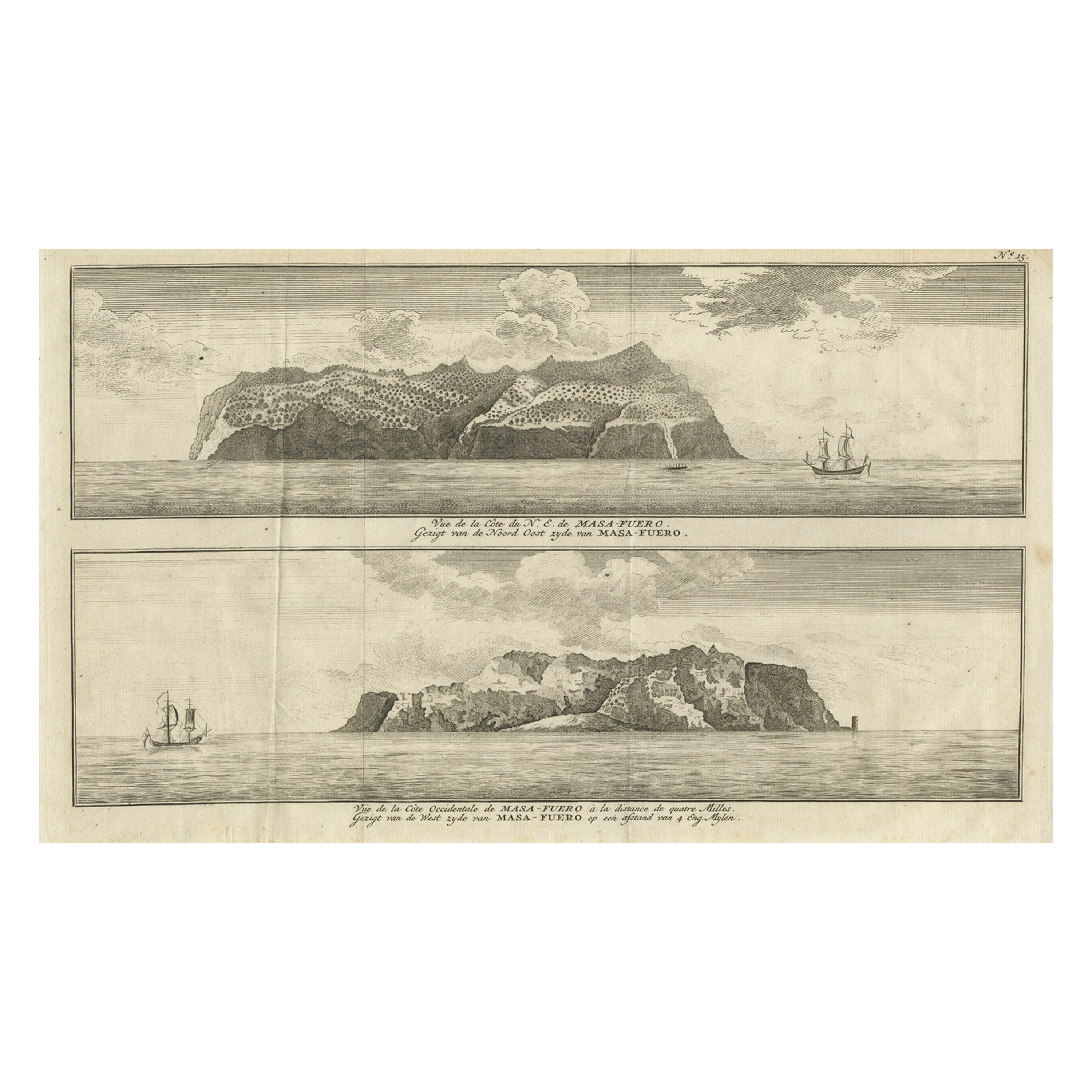
- Engraving of Alejandro Selkirk Island, Juan Fernández-archipel, Chile, 1749Located in Langweer, NLAntique print titled 'Vue de la cote du N. E. de Masa-Fuero' - 'Vue de la cote occidentale de Masa-Fuero a la distance de quatre milles.' Views of Alejandro Selkirk Island...Category
Antique 18th Century Prints
MaterialsPaper
- Antique Map of Denmark by A.K. Johnston, 1865Located in Langweer, NLAntique map titled 'Denmark and the Duchies Schleswig, Holstein & Lauenburg; Hanover, Brunswick, Mecklenburg, Oldenburg, Anhalt and Lippe'. With an inset map of Iceland, Copenhagen a...Category
Antique Mid-19th Century Maps
MaterialsPaper
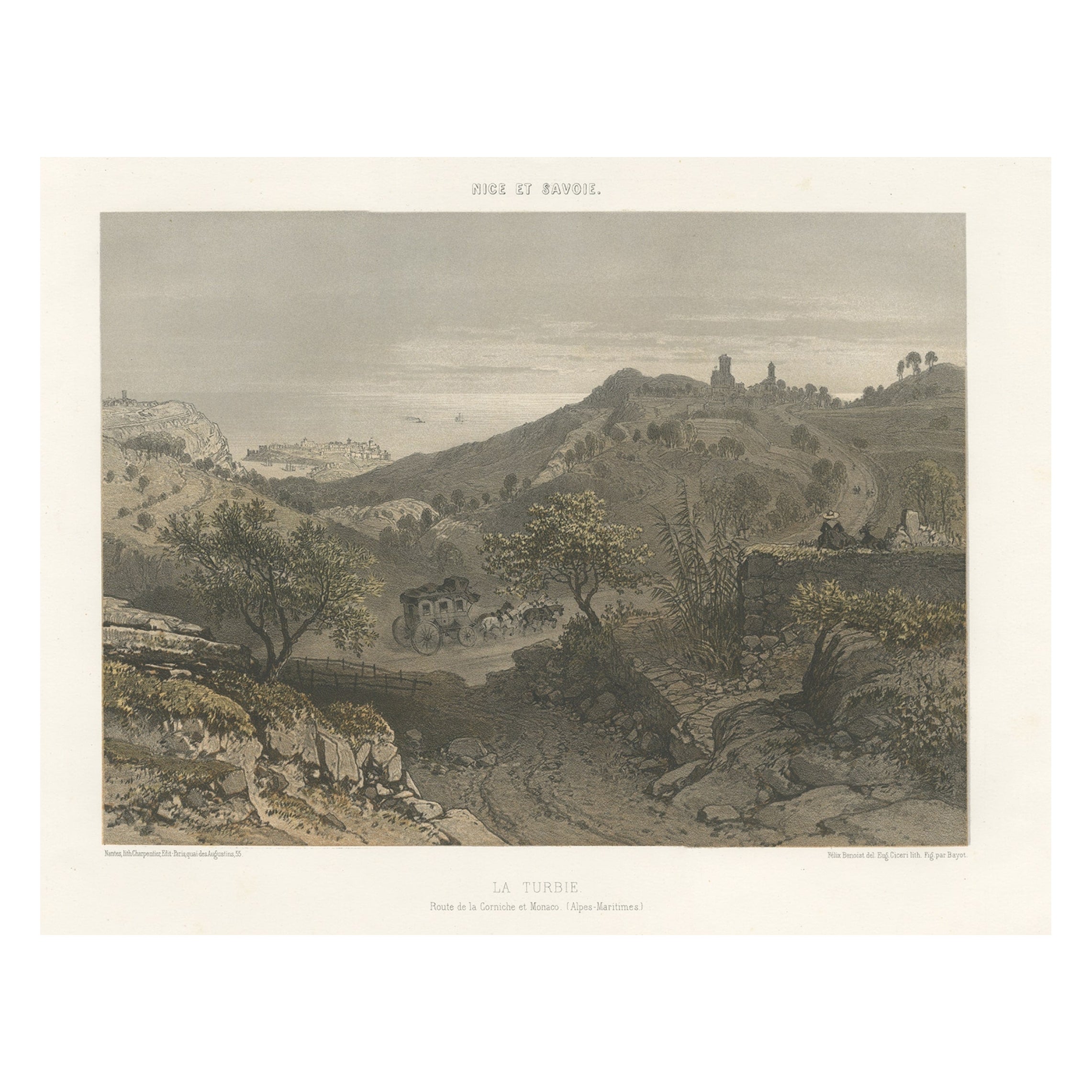
- Antique Print of La Turbie or Route de la Corniche et Monaco, c.1865Located in Langweer, NLAntique print titled 'La Turbie, Route de la Corniche et Monaco'. View of the commune of La Turbie, France. This print originates from 'Nice Et Savoie, Sites Pittoreques, Monuments, ...Category
Antique 19th Century Prints
MaterialsPaper
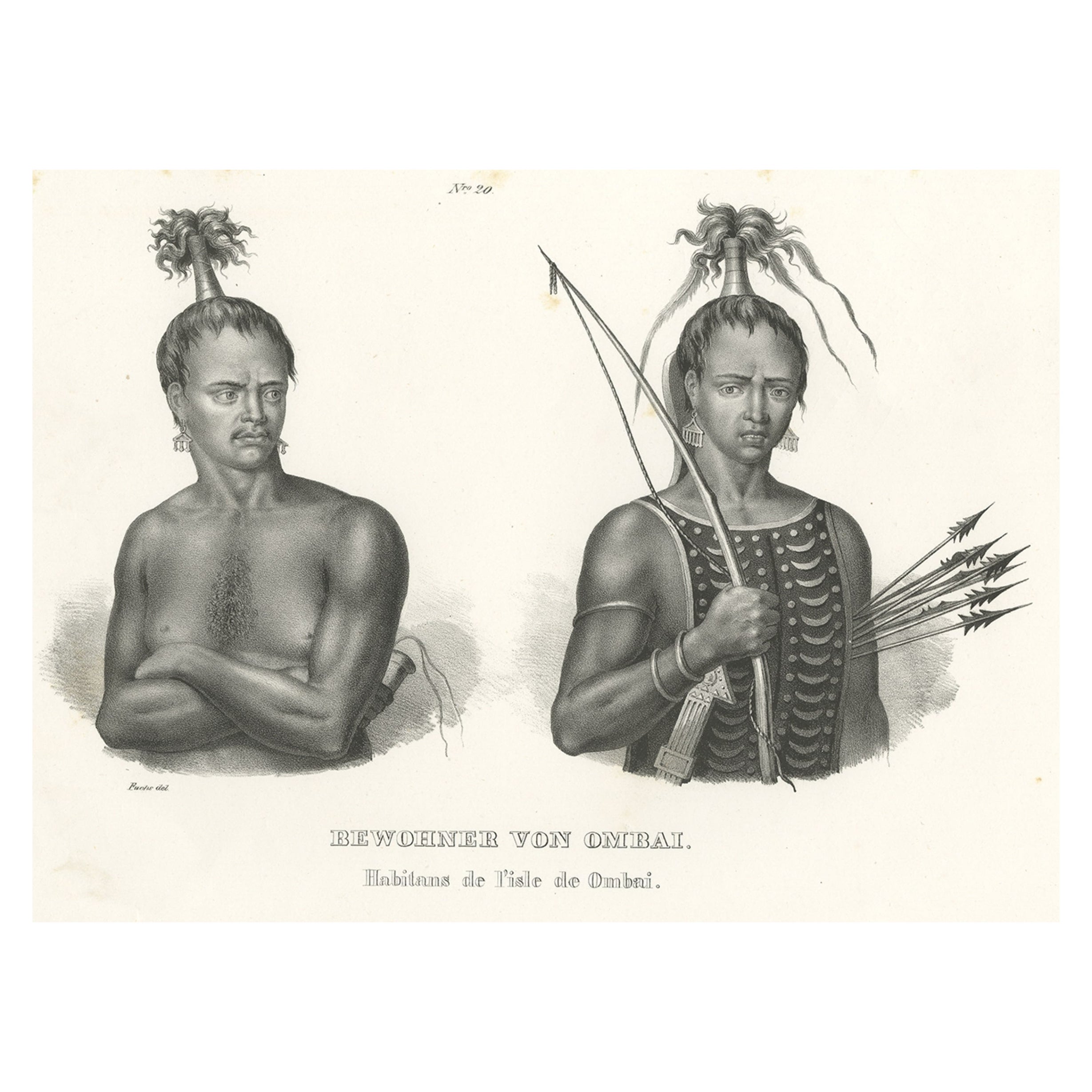
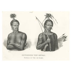
- Antique Print of Warriors from Ombai Island, Alor, Archipel, Indonesia, ca.1845Located in Langweer, NLAntique print titled 'Bewohner von Ombai, Habitans de l'isle de Ombai'. This print depicts natives from Ombai, Indonesia. Originates from 'Naturgeschichte und Abbildungen des Men...Category
Antique 1840s Prints
MaterialsPaper
- Antique Map of Sweden & Norway by A.K. Johnston '1865'Located in Langweer, NLAntique map titled 'Sweden & Norway (Scandinavia)'. With an inset map of Stockholm and environments. This map originates from the ‘Royal Atlas of Modern Geography’ by Alexander Keith...Category
Antique Mid-19th Century Maps
MaterialsPaper
- Antique Map of South Australia by A.K. Johnston, 1865Located in Langweer, NLAntique map titled 'South Australia, New South Wales, Victoria & Queensland'. This map originates from the ‘Royal Atlas of Modern Geography’ by Alexander Keith Johnston. Published by...Category
Antique Mid-19th Century Maps
MaterialsPaper


You May Also Like
- "Lady Washington's Reception, " Engraved by A. H. Ritchie, Antique Print, 1865Located in Colorado Springs, COThis 1865, hand-colored engraving by A. H. Ritchie is entitled Lady Washington's Reception and is based on Daniel F. Huntington's original painting "Th...Category
Antique 1860s American Prints
MaterialsPaper
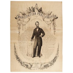
- 1865 Emancipation Proclamation, Antique Lithograph by P.S. Duval and SonLocated in Colorado Springs, COPresented is a lithographic broadside of the text of the Emancipation Proclamation issued on January 1, 1863. This broadside was published in...Category
Antique 1860s American Historical Memorabilia
MaterialsPaper
- 1876 "Gettysburg, The Repulse of Longstreet's Assault." EngravingLocated in Colorado Springs, COPresented here is an 1876 engraving of John B. Bachelder and James Walker’s Gettysburg. The Repulse of Longstreet’s Assault. The engraved scene depicts the decisive battle on the final day of the Battle of Gettysburg. Researched by the photographer and topographer John B. Bachelder and painted by James Walker, the original painting was created in 1870. This detailed engraving was done by H. B. Hall Jr. and published by James Drummond Ball. Otherwise called Pickett’s Charge, the battle occurred on July 3, 1863. Pickett’s corp commander, Lieutenant General James Longstreet was placed in charge of the attack despite his hesitations. Longstreet’s central role led to the title of the work, Repulse of Longstreet’s Assault. In an attempt to gain control of an important supply route, nine Confederate brigades charged across three-quarters of a mile of open ground against cannon fire to take Cemetery Ridge from the defending Union Army. Despite their overwhelming numbers, the Confederate forces were repelled with considerable casualties marking not only a decisive victory for the Union, but also the beginning of the slow defeat of Lee’s Army. The furthest the charging forces advanced before being repulsed would forever be known as the “High Water Mark of the Confederacy.” The Confederate army never recovered from the losses at Gettysburg and it effectively ended Lee’s campaign into Pennsylvania. The engraving gives the perspective from the Union rear, one that encompasses most of the battlefield, from Big Round Top on the left to the northern reaches of Cemetery Ridge on the right. The Confederate lines at Seminary Ridge are in the far distance, partially obscured by bursting shells. The image centers on the main Confederate assault, in the vicinity of what today are known as "The Copse" and "The Bloody Angle." The composition has elemen...Category
Antique 1870s American Prints
MaterialsPaper
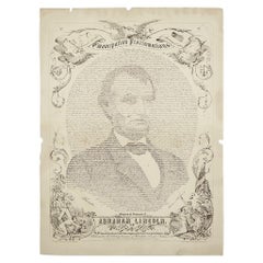
- 1865 Emancipation Proclamation with Abraham Lincoln Portrait, Antique EngravingLocated in Colorado Springs, COPresented is an elaborate engraved broadside presentation of both the preliminary and final Emancipation Proclamations, dated September 22, 1...Category
Antique 1860s American Historical Memorabilia
MaterialsPaper
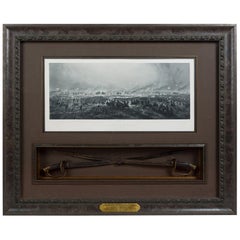
- 1876 "Gettysburg. Repulse of Longstreet's Assault" with Union Officer SwordsLocated in Colorado Springs, COPresented here is an 1876 engraving of John B. Bachelder and James Walker’s Gettysburg. Repulse of Longstreet’s Assault together with two ornately decorated Union Officer swords...Category
Antique 1870s American Prints
MaterialsMetal
- Map of the Holy Land "Carte de la Syrie et de l'Egypte" by Pierre M. LapieBy Pierre M. LapieLocated in Alamo, CAAn early 19th century map of ancient Syria and Egypt entitled "Carte de la Syrie et de l'Egypte anciennes/dressée par M. Lapie, Colonel d'Etat Major, et...Category
Antique Early 19th Century French Maps
MaterialsPaper


Recently Viewed
View AllMore Ways To Browse
Very Rare Books
Philippines Antique
Antique Philippines
Filipino Antique
Antique Filipino Furniture
1876 Plates
Plate 1865
Filipino Drawing
Antique In Philippines
Antique In The Philippines
Antique Furniture In Philippines
Mar M
19th Century Philippines
Filipino Painter
Antique Furniture In The Philippines
Borneo Antique
F J Gallery
Singapore Antique