Items Similar to 17th Century John Speed Map of Denbighshire, c.1610


Want more images or videos?
Request additional images or videos from the seller
1 of 21
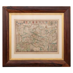
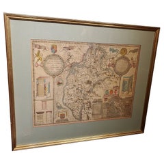
17th Century John Speed Map of Denbighshire, c.1610
About the Item
Antique early 17th century British very rare and original John Speed, hand coloured map of Denbighshire, dated 1610, by John Sunbury and George Humble. John Speed (1550s – 1629) was the most famous English cartographer and the key name in the history of English map making of the early modern period.
Condition
In good condition - Wear as expected with age and comes newly framed.
Size
Height: 37cm
Width: 49cm,
- Creator:John Speed (Maker)
- Dimensions:Height: 14.57 in (37 cm)Width: 19.3 in (49 cm)Depth: 0.79 in (2 cm)
- Materials and Techniques:
- Place of Origin:
- Period:
- Date of Manufacture:circa 1610
- Condition:Wear consistent with age and use. Minor fading. In Good Condition - Wear as expected with age and comes newly framed.
- Seller Location:Royal Tunbridge Wells, GB
- Reference Number:
About the Seller
5.0
Platinum Seller
These expertly vetted sellers are 1stDibs' most experienced sellers and are rated highest by our customers.
Established in 2014
1stDibs seller since 2015
371 sales on 1stDibs
Typical response time: <1 hour
- ShippingRetrieving quote...Ships From: Royal Tunbridge Wells, United Kingdom
- Return PolicyA return for this item may be initiated within 14 days of delivery.
More From This SellerView All
- 17th Century John Speed Map of the Barkshire Described, c.1616By John SpeedLocated in Royal Tunbridge Wells, KentAntique 17th century British very rare and original John Speed (1551-1629) map of the Barkshire Described, J. Sud and Georg Humble, publication (1616 or lat...Category
Antique 17th Century British Maps
MaterialsPaper
- 17th Century John Speed Map of Kent with Her Cities & Earles Described, C.1676By John SpeedLocated in Royal Tunbridge Wells, KentAntique 17th century British very rare and original John Speed (1551-1629) map of Kent with her Cities and Earles described and observed, Thomas Bassett & ...Category
Antique 17th Century British Maps
MaterialsPaper
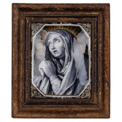
- Antique 17th Century Limoge Signed Plaque Of A Madonna PrayingLocated in Royal Tunbridge Wells, KentAntique 17th Century French painted porcelain wall hanging plaque portraying the Madonna in prayer against a radiant sunburst backdrop. Intricately painted with foliate patterns ador...Category
Antique 17th Century French Other Religious Items
MaterialsPorcelain
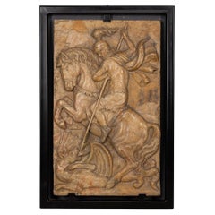
- 19th Century Italian Marble Plaque of George Slaying the Dragon, C.1870Located in Royal Tunbridge Wells, KentAntique 19th Century Italian Grand Tour marble relief depicting St George slaying the Dragon. England has always been one of the leading countries in terms of travelling and explori...Category
Antique 19th Century Italian Grand Tour Historical Memorabilia
MaterialsMarble
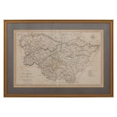
- 19th Century John Cary Map of North Part of West Riding of Yorkshire, C.1805By John CaryLocated in Royal Tunbridge Wells, KentAntique 19th century British original John Cary sr (1755-1835) map of North part of the West Riding of Yorkshire, From the beft Authorities. Engraved J Car...Category
Antique 19th Century British Maps
MaterialsPaper
- 19th Century John Cary Map of South Part of West Riding of Yorkshire, circa 1805By John CaryLocated in Royal Tunbridge Wells, KentAntique 19th century British original John Cary sr (1755-1835) map of South part of the West Riding of Yorkshire, From the beft Authorities. Engraved J Car...Category
Antique 19th Century British Maps
MaterialsPaper


You May Also Like
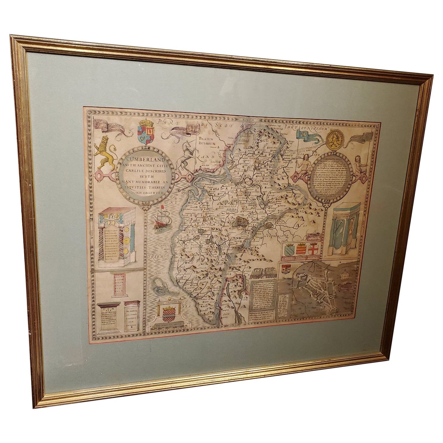
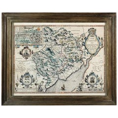
- 17th Century Map of Cumberland County in Northwest England Printed by John SpeedBy John SpeedLocated in Middleburg, VARare extremely early map of the county of Cumberland in the Northwest of England. Printed by John Speed, hand colored. Excellent condition. English. Dated...Category
Antique Early 17th Century English Maps
MaterialsPaper
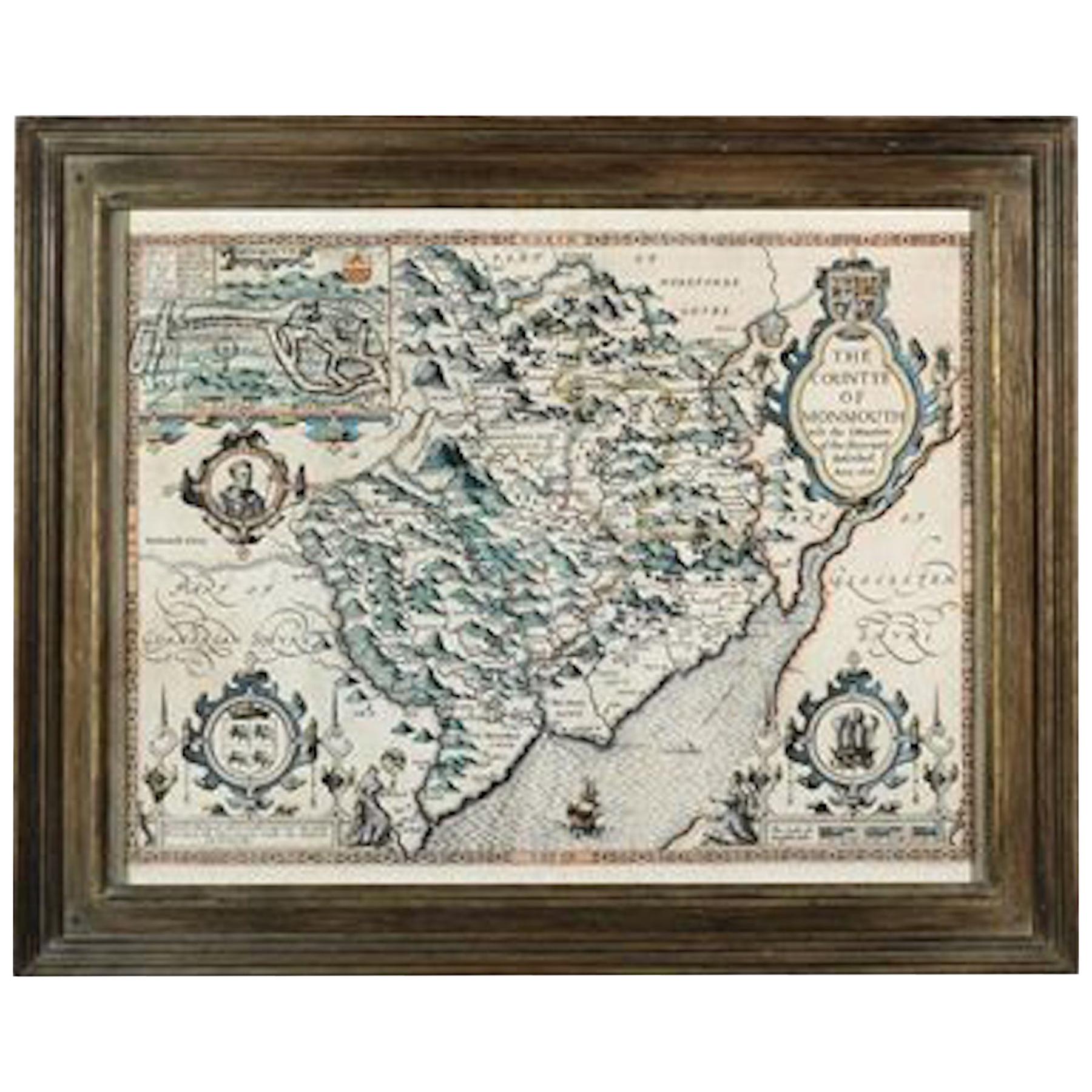
- Countye of Monmouth, Dated 1610By John SpeedLocated in BUNGAY, SUFFOLKThe countye of Monmouth with the situation of the townshire described Anno, 1610 The reverse with Monmouthshire, Chapter VI and an alphabetical list of towns. In a beautiful Flemish oak polished and gilded frame Cartographer: John Speed...Category
Antique 1610s English Baroque Decorative Art
MaterialsPaper
- 17th Century Nicolas Visscher Map of Southeastern EuropeLocated in Hamilton, OntarioA beautiful, highly detailed map of southeastern Europe by Nicolas Visscher. Includes regions of Northern Italy (showing the cities Bologna, Padua, and Venice), Bohemia, Austria (sho...Category
Antique 17th Century Dutch Maps
MaterialsPaper
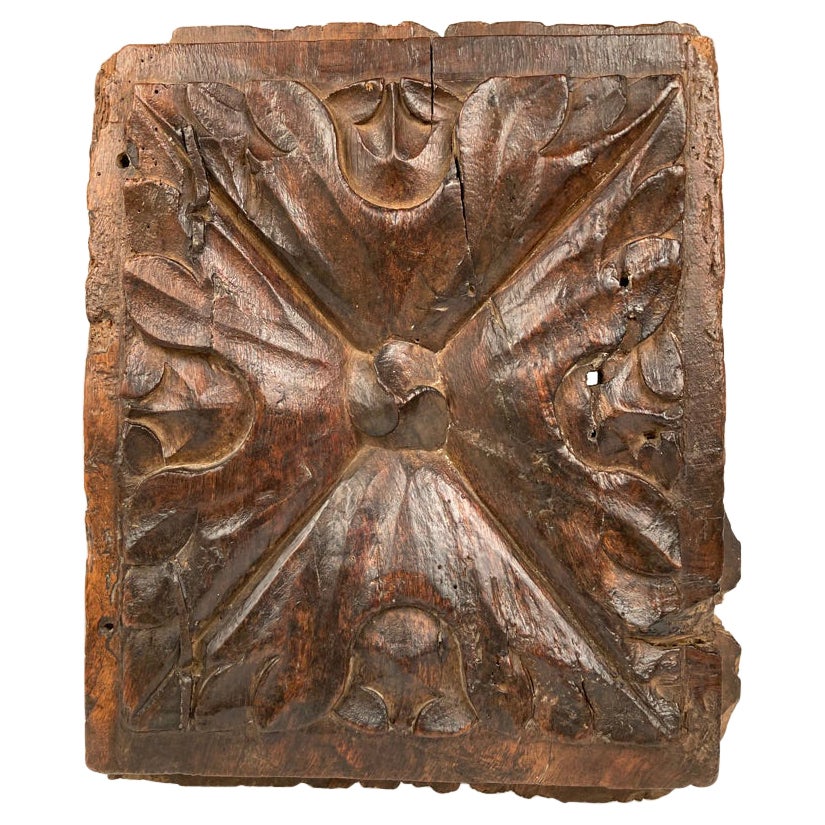
- 17th Century Spanish Carved Walnut Door PanelLocated in Stamford, CTA really gutsy and interesting early 17th century carved wood panel. If this kind of thing appeals to you, it does to me, than this is a compelling example of early carving and the p...Category
Antique Early 17th Century Spanish Baroque Decorative Art
MaterialsWalnut
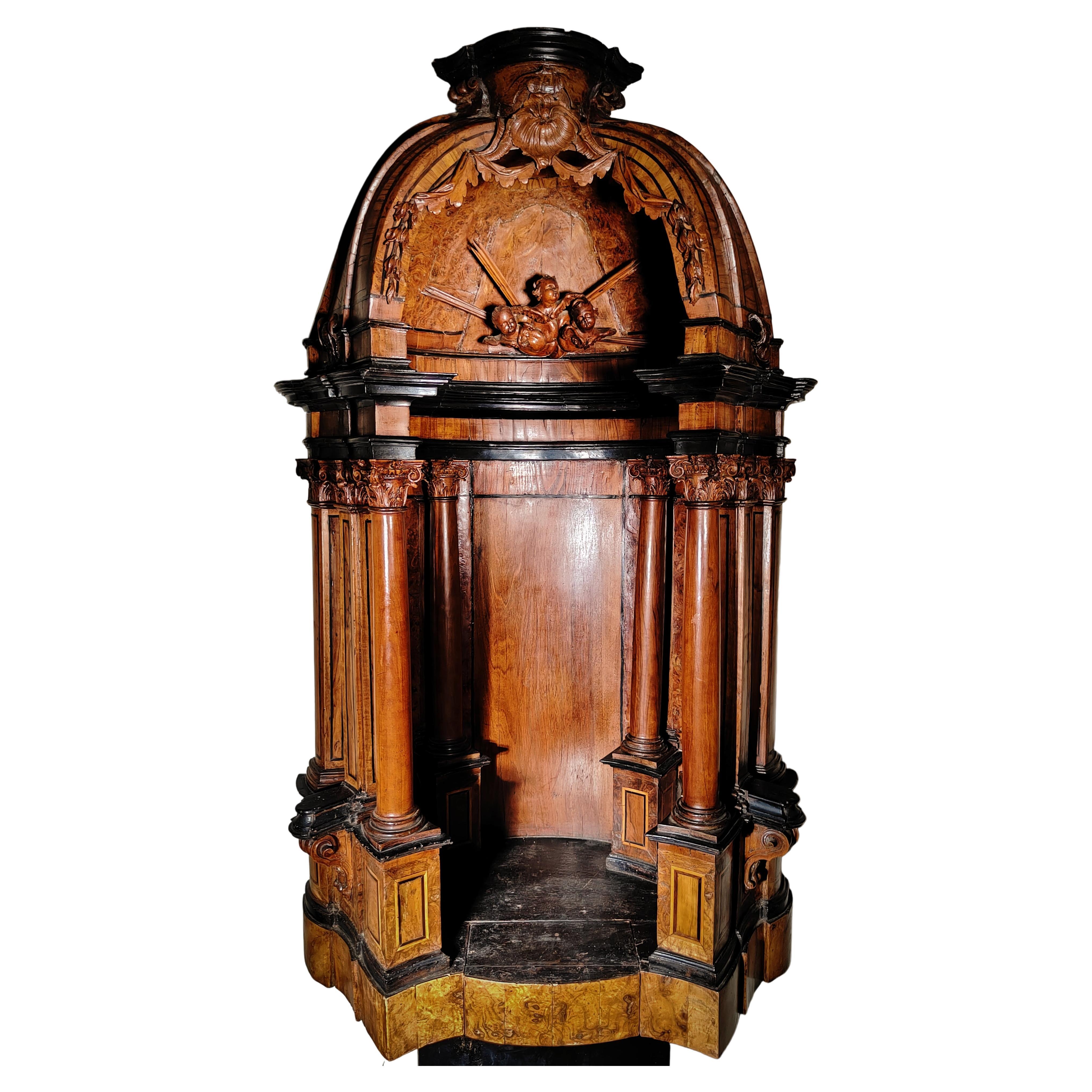
- Important German Tabernacle Museum Piece 16th-17th CenturyLocated in Madrid, ESImportant German Tabernacle Museum Piece 16th-17th century IMPORTANT GERMAN TABERNACLE IN MUSEUM 16TH-17TH CENTURY EXCEPTIONAL SOUTHERN GERMAN TABERNACLE...Category
Antique 16th Century Religious Items
MaterialsFruitwood
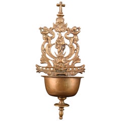
- Bronze Bassin for Holy Water, Spain, 17th CenturyLocated in Madrid, ESHoly wall font. Bronze. Spain, 17th Century. Small font for holy water designed to be placed on a wall, which has a container decorated with moldings and architectural elements and...Category
Antique 17th Century Spanish Baroque Religious Items
MaterialsBronze, Other


Recently Viewed
View AllMore Ways To Browse
John Antique Furniture
Dated 17th Century Furniture
English Early 17th Century Furniture
Antique English 17th Century
17th Century Keys
17th C English
John Speed
Speed Map
John Speed Map
John Speed Antique Maps
John Speed Maps
Speed Antique Map
Nautical Chart Nautical Chart
Turkish Map
Antique World Chart
Map Of Portugal
Hemispheres Map
Portugal Map