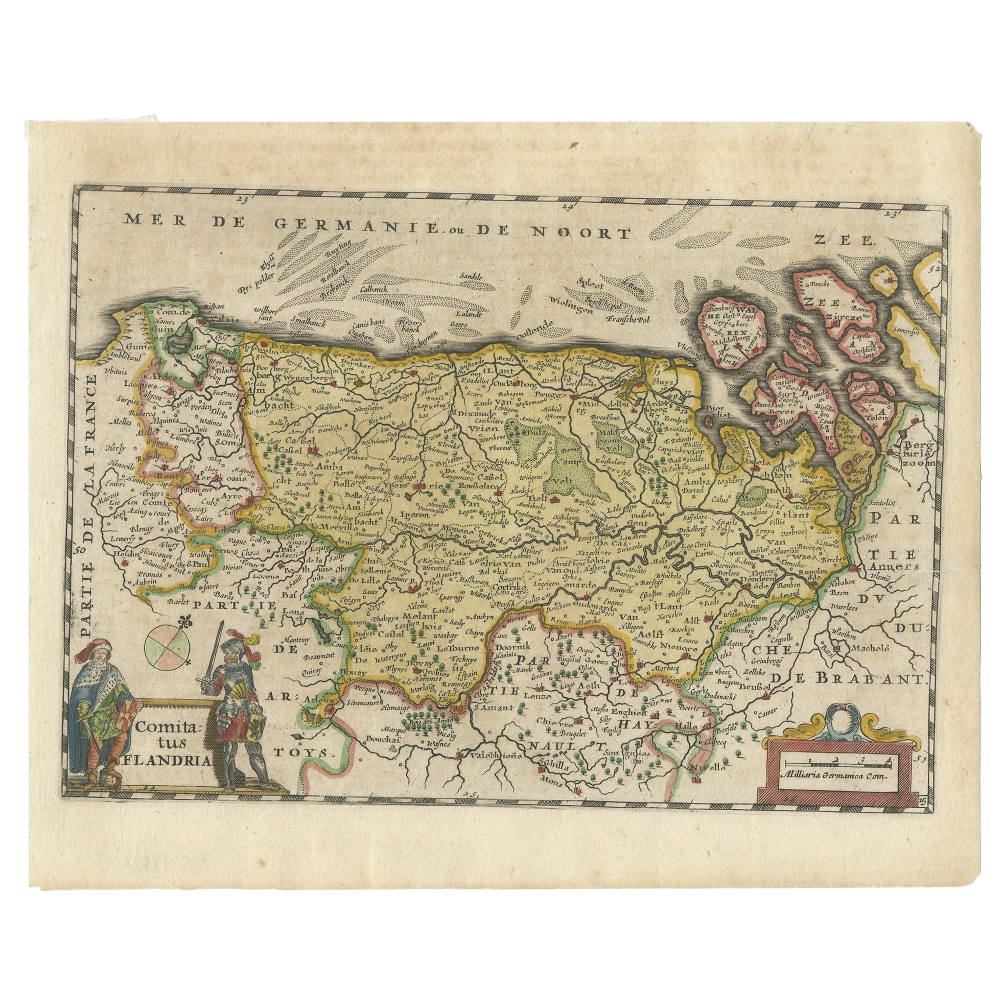
Items Similar to Antique 1630 Colored Belgium Map Flandria Gallica Flanders Henricus Hondius


Want more images or videos?
Request additional images or videos from the seller
1 of 13
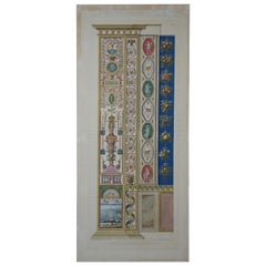
Antique 1630 Colored Belgium Map Flandria Gallica Flanders Henricus Hondius
About the Item
"Antique hand colored map of Flanders, Belgium, circa 1630, engraved by Henricus Hondius. “Henricus Hondius II (1597 – 16 August 1651) was a Dutch engraver, cartographer, and publisher. He was born in Amsterdam, the son of the famous cartographer Jodocus Hondius who had started a map-making business in the city. Henricus obtained the original plates of the Mercator 1569 world map, and published a 1606 version of it. After his father died in 1612 Henricus co-ran the business with his brother-in-law.[1] In 1621 opened his own company in his hometown. The first time his name was mentioned in an atlas was in 1623 when he published the fifth edition of the Mercator-Hondius atlas. After 1628 Henricus partnered with the cartographer Jan Janssonius and together they continued the business. He died in Amsterdam. Measure: 23".
He came from a different family from Hendrik Hondius I; there were two families engaged in very similar activities at the same time. “"
Sans frame - 21.25” x 18”.
- Dimensions:Height: 20 in (50.8 cm)Width: 0.625 in (1.59 cm)Depth: 23.375 in (59.38 cm)
- Style:Renaissance (Of the Period)
- Materials and Techniques:
- Period:Early 17th Century
- Date of Manufacture:1630
- Condition:Wear consistent with age and use. Good Overall - Crease down center; some holes/discoloration; dark stain (from tape?); see pictures.
- Seller Location:Dayton, OH
- Reference Number:

About the Seller
4.9
Platinum Seller
These expertly vetted sellers are 1stDibs' most experienced sellers and are rated highest by our customers.
Established in 2010
1stDibs seller since 2020
1,126 sales on 1stDibs
Typical response time: <1 hour
- ShippingRetrieving quote...Ships From: Dayton, OH
- Return PolicyA return for this item may be initiated within 2 days of delivery.
More From This SellerView All
- Antique 1901 National Publishing Company's Road Map of New Jersey GeologicalLocated in Dayton, OHThe National Publishing Company's road map of New Jersey, showing all county and township divisions, cities villages and post-offices, railroads, ste...Category
Antique Early 1900s Victorian Prints
MaterialsPaper
- 138 Vintage & Antique Post Cards Holiday Greeting Valentine Trade Comic AdLocated in Dayton, OHLot of 138 vintage and antique postcards for a variety of holiday greetings and travel locations, plus a handful of Lion Coffee print advertisements.Category
20th Century Prints
MaterialsPaper
- Meddlesome & Mettlesome Exhibition Catalog Press Sheet Lot Contemporary ArtworkLocated in Dayton, OHLot of unbound press sheet pages and portfolio covers for the 1993 exhibition catalog of “Mettlesome & Meddlesome: Selections from the Collection of Ro...Category
1990s Modern Prints
MaterialsPaper
- Giovanni Ottaviani Le Logge Di Raffaello Hand Colored EngravingBy Giovanni OttavianiLocated in Dayton, OHGiovanni Ottaviani (1735-1808) Le Logge di Raffaello Hand Colored Engraving "2 joined copper plate engravings with later hand colouring ""Loggie di Raffaelo nel Vaticano"" by Giov...Category
Antique 18th Century Renaissance Prints
MaterialsPaper
- 2 Antique Hand Colored Botanical Lithographs Evergreen Perennial & Hybrid LillyLocated in Dayton, OHAeschynanthus longiflorus & Lilium testaceum, circa 1849 by Samuel Holden. Each lithograph is hand colored and set in a green mat beneath glass. The frame is made from wood with bl...Category
Antique Mid-19th Century Victorian Prints
MaterialsPaper
- Antique Chicago Illinois National Map Commercial Rollup Classroom Census Map 47"Located in Dayton, OHAntique early to mid 20th century double sided hanging map titled the New Commercial and Census Map of Illinois, Edition 1073. Verso shows the National Map of Chicago and Suburbs - O...Category
Early 20th Century North American Maps
MaterialsPaper


You May Also Like
- Antique Map of Flanders, Belgium, 1630Located in Langweer, NLAntique map titled 'Comitatus Flandria'. Original antique map of Flanders, Belgium. This map originates from 'Vyerige Colom verthonende de 17 Nederlandsche Provintien' published 1630...Category
Antique 17th Century Maps
MaterialsPaper
- Antique Map of the Region of Lyon by Hondius, circa 1630Located in Langweer, NLAntique map titled 'Lionnois, Forest et Beauiolois'. Old map of the former region of Lyon, Vienne, Bresse, Rohan and the Rhône River. This map originates f...Category
Antique Mid-17th Century Maps
MaterialsPaper
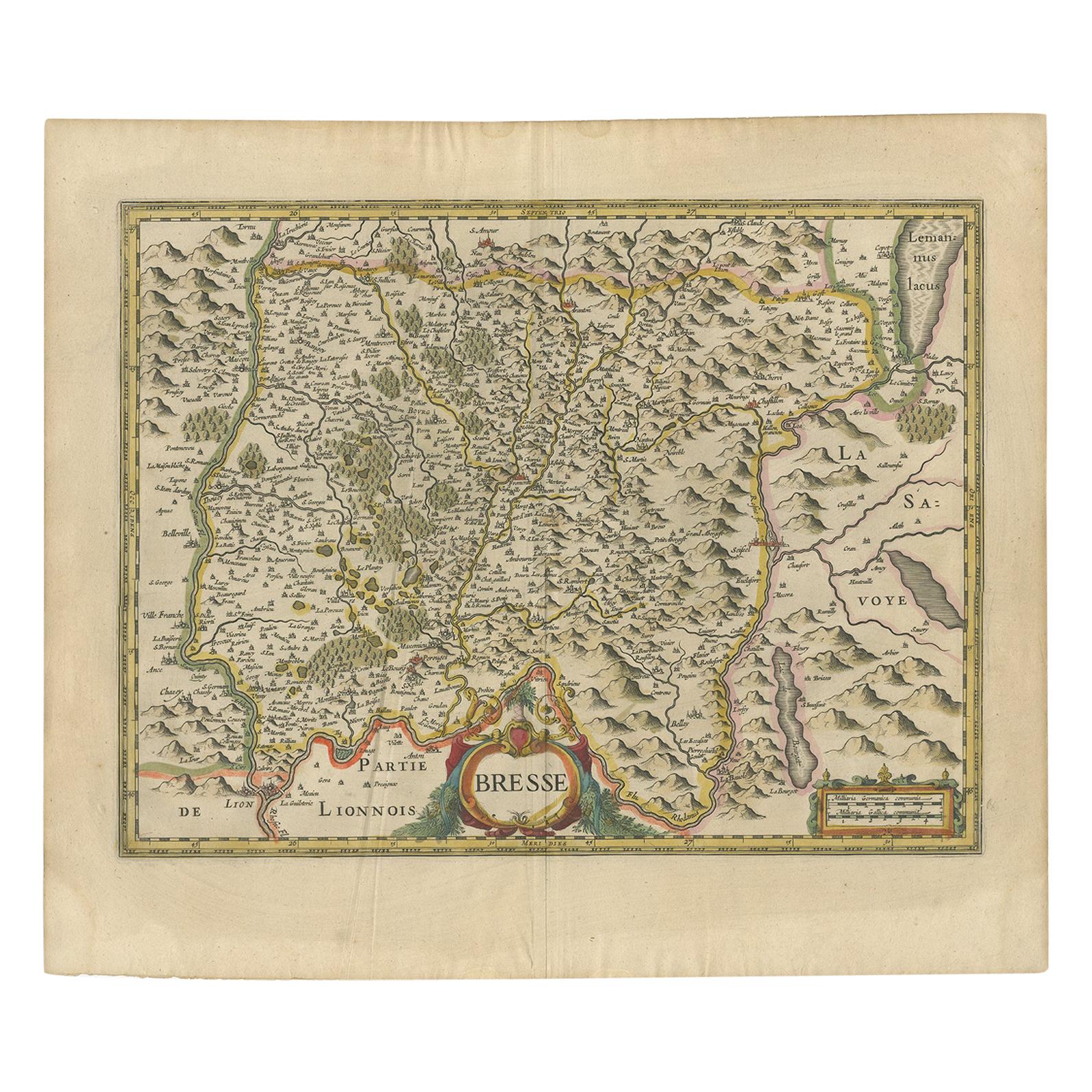
- Antique Map of the Region of Bresse by Hondius, circa 1630Located in Langweer, NLAntique map titled 'Bresse'. Old map of the former region of Bresse, France. It is located in the regions of Auvergne-Rhône-Alpes and Bourgogne-Franche-Comté of eastern France. This ...Category
Antique Mid-17th Century Maps
MaterialsPaper
- Antique Map of the Region of Beauvais by Hondius, circa 1630Located in Langweer, NLAntique map titled 'Beauvaisis - Comitatus Belovacium'. Old map of the region of Beauvais, France. This map originates from a composite atlas and is signed by J. Hondius.Category
Antique Mid-17th Century Maps
MaterialsPaper
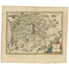
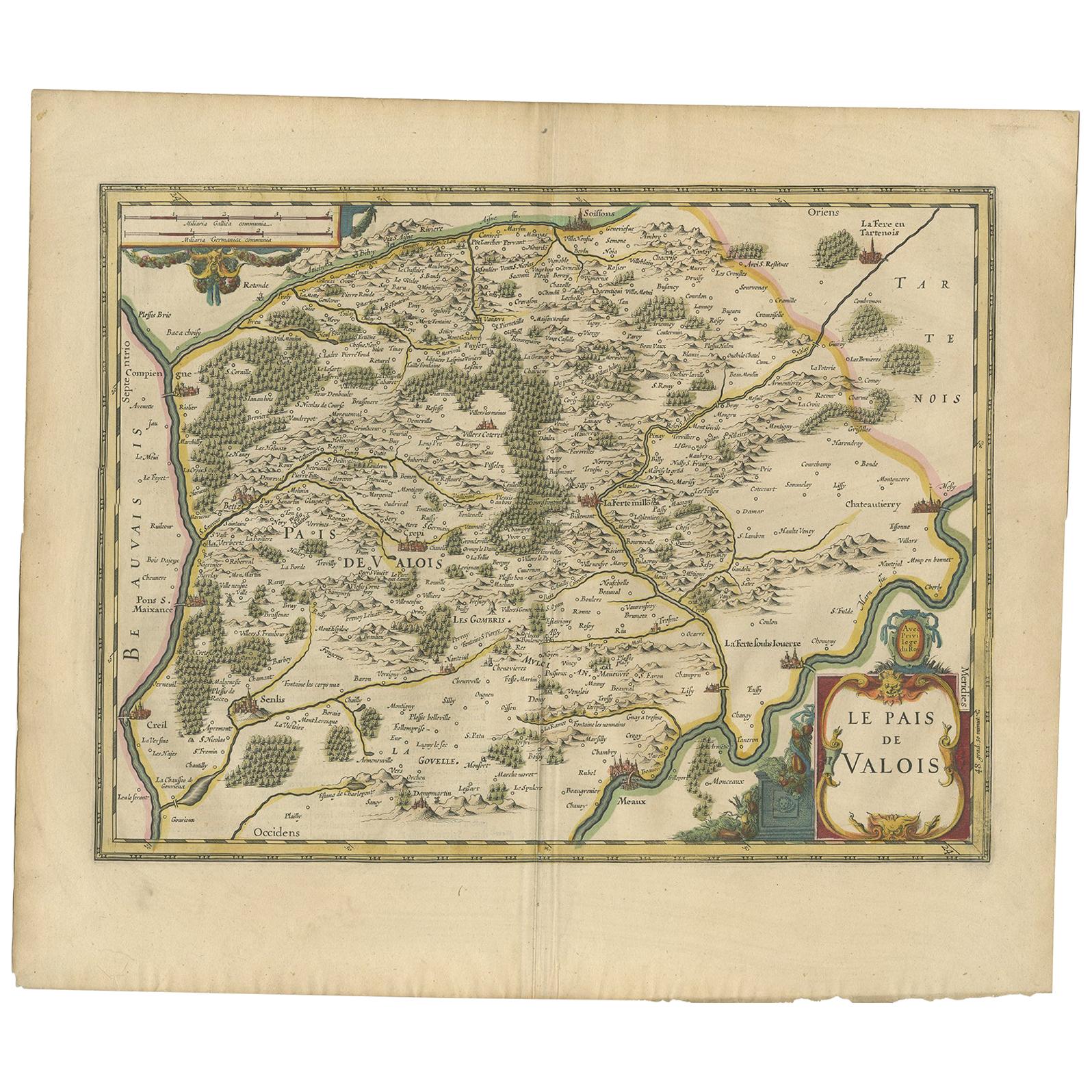
- Antique Map of the Region of Valois by Hondius, circa 1630Located in Langweer, NLAntique map titled 'Le Pais de Valois'. Old map of the historic region of Valois, France. It corresponds to the southeastern quarter of the modern département of Oise, with an adjace...Category
Antique Mid-17th Century Maps
MaterialsPaper
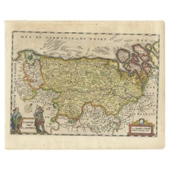
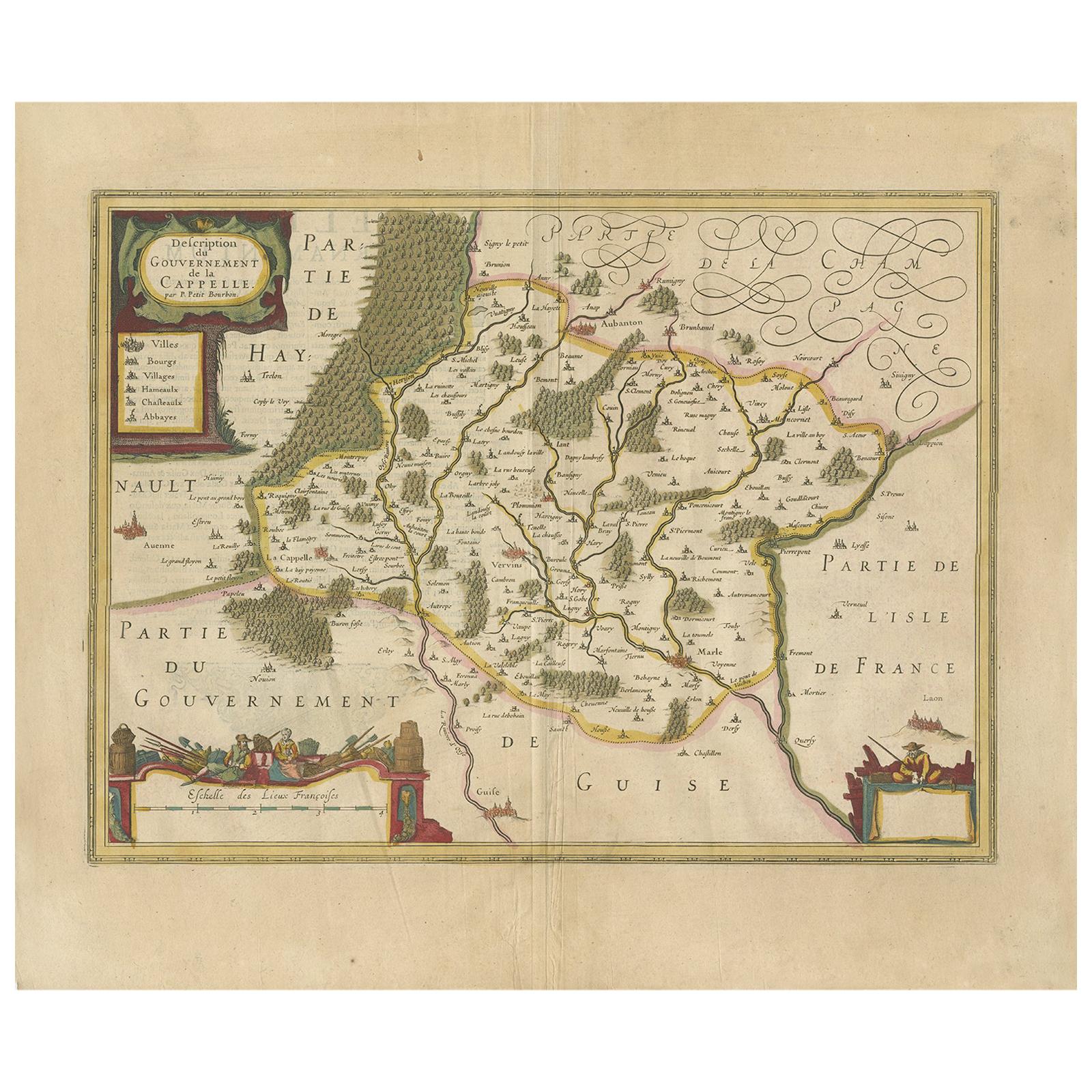
- Antique Map of the Region of Hauts-de-France by Hondius, circa 1630Located in Langweer, NLAntique map titled 'Description du Gouvernement de la Cappelle'. Old map of the region of Hauts-de-France including the cities of Vervins, Marle, Cappelle and others. This map origin...Category
Antique Mid-17th Century Maps
MaterialsPaper