Items Similar to Antique Decorative Map of the Low Countries, '17 Provinces, Netherlands', c.1680
Want more images or videos?
Request additional images or videos from the seller
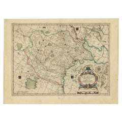
Antique Decorative Map of the Low Countries, '17 Provinces, Netherlands', c.1680
About the Item
Description: Antique map titled 'Germaniae Inferioris XVII Provinciarum Accuratissima Tabula.'
Map of the low countries (17 provinces, Netherlands). The map is dedicated to Theodoro Munter. Embellished with a large and decorative title-cartouche and a cartouche with scales and a coat-of-arms. Source unknown, to be determined.
Artists and Engravers: Made by 'Nicolaes Visscher'. For nearly a century the members of the Visscher family were important art dealers and map publishers in Amsterdam. The founder of the business, C. J. Visscher, had premises near to those of Pieter van den Keere and Jodocus Hondius whose pupil he may have been. From about 1620 he designed a number of individual maps, including one of the British Isles, but his first atlas consisted of maps printed from plates bought from van den Keere and issued as they stood with some additions of his own, including historical scenes of battles and sieges for which he had a high reputation. Some maps bear the latinized form of the family name: Piscator. After Visscher's death his son and grandson, both of the same name, issued a considerable number of atlases, constantly revised and brought up to date but most of them lacking an index and with varying contents. The widow of Nicholaes Visscher II carried on the business until it finally passed into the hands of Pieter Schenk.
Condition: Good, given age. Paper separation top and bottom middle fold; backed. Edges with a few tiny tears. Some small spots in the margins. Several creases. Original middle fold as issued. General age-related toning and/or occasional minor defects from handling. Please studyimage carefully.
- Dimensions:Height: 21.26 in (54 cm)Width: 24.89 in (63.2 cm)Depth: 0 in (0.02 mm)
- Materials and Techniques:
- Period:1680-1689
- Date of Manufacture:circa 1680
- Condition:
- Seller Location:Langweer, NL
- Reference Number:
About the Seller
5.0
Platinum Seller
These expertly vetted sellers are 1stDibs' most experienced sellers and are rated highest by our customers.
Established in 2009
1stDibs seller since 2017
1,949 sales on 1stDibs
Typical response time: <1 hour
- ShippingRetrieving quote...Ships From: Langweer, Netherlands
- Return PolicyA return for this item may be initiated within 14 days of delivery.
More From This SellerView All
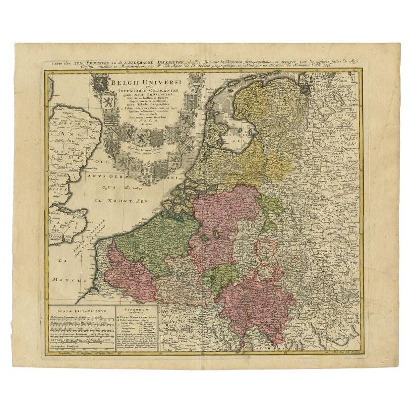
- Antique Map of the Seventeen Provinces of Netherlands, Belgium, Luxembourg, 1748By Homann HeirsLocated in Langweer, NLAntique map titled 'Belgii Universi seu Inferioris Germaniae quam XVII Provinciae (..)'. Map of the Seventeen Provinces after Tobias Meier, published by Homann's Heirs in 1748. The...Category
Antique 18th Century Maps
MaterialsPaper
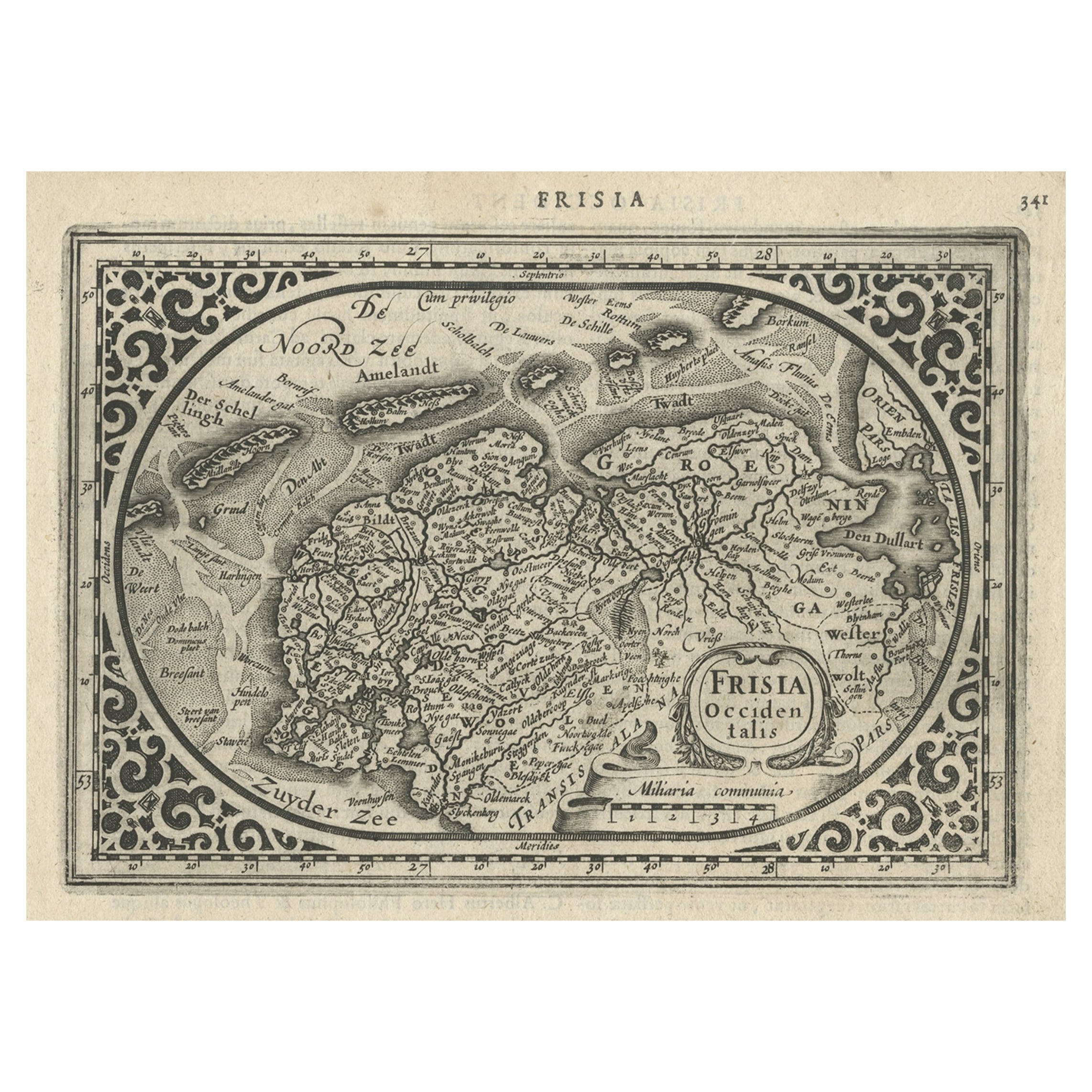
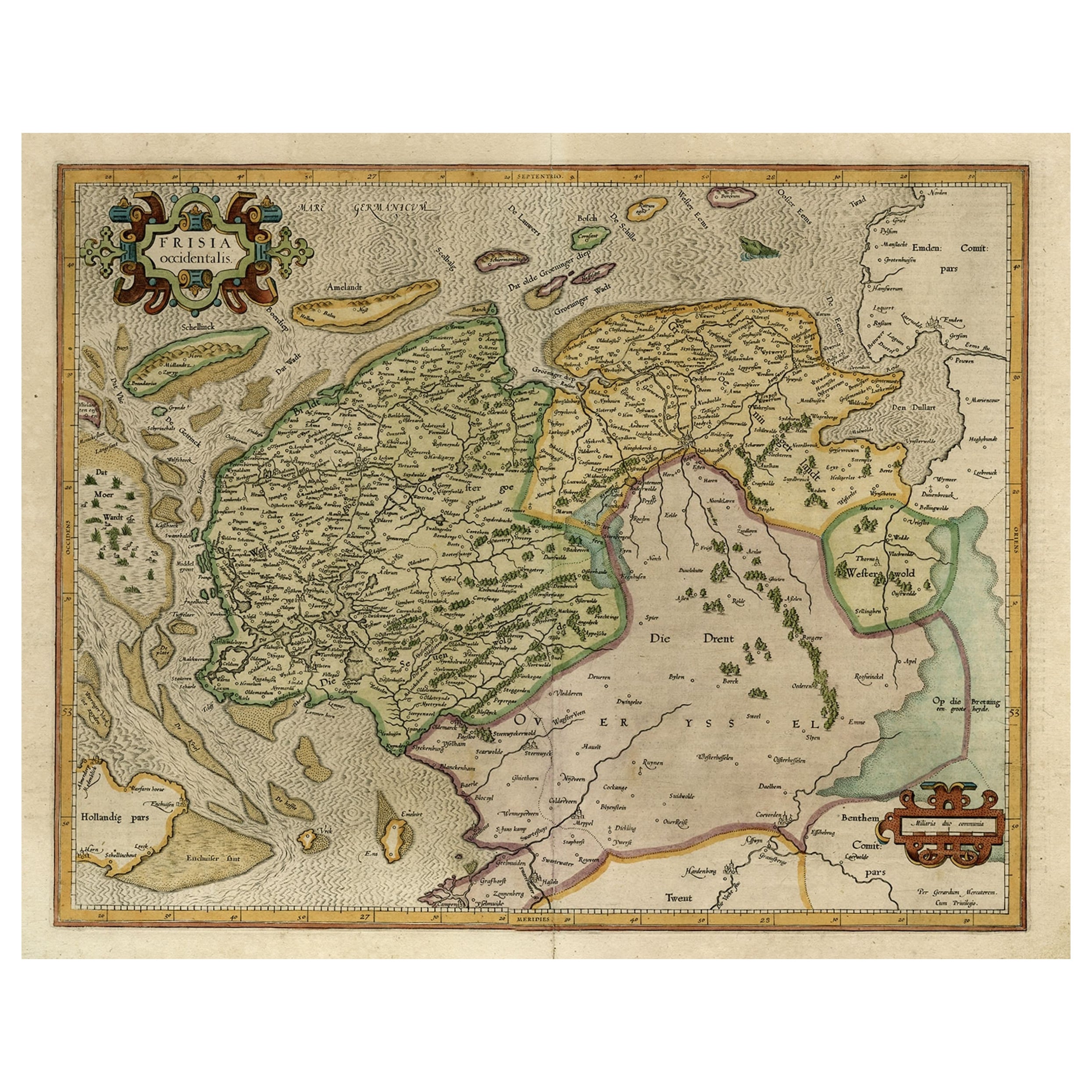
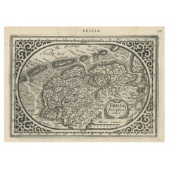
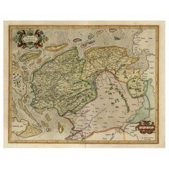
- Antique Map of Friesland and Groningen, Provinces of the Netherlands, 1628Located in Langweer, NLAntique map Friesland titled 'Frisia Occidentalis'. Small, decorative map of the province of Friesland, the Netherlands. Second state, out of three, originating from 'Atlas Minor' by...Category
Antique 17th Century Maps
MaterialsPaper
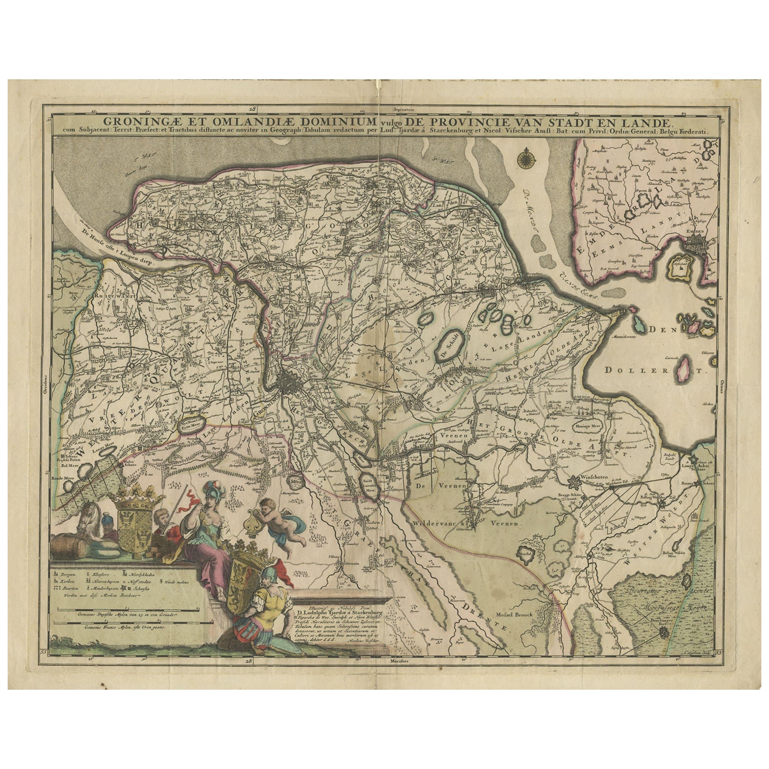
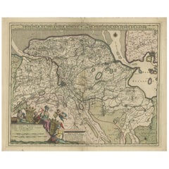
- Antique Map of the Province Groningen in The Netherlands, c.1680Located in Langweer, NLAntique map titled 'Groningae et Omlandiae Dominium vulgo de Provincie van Stadt en Lande'. Old map of the province of Groningen, the Netherlands. This map originates from 'Germani...Category
Antique 17th Century Maps
MaterialsPaper
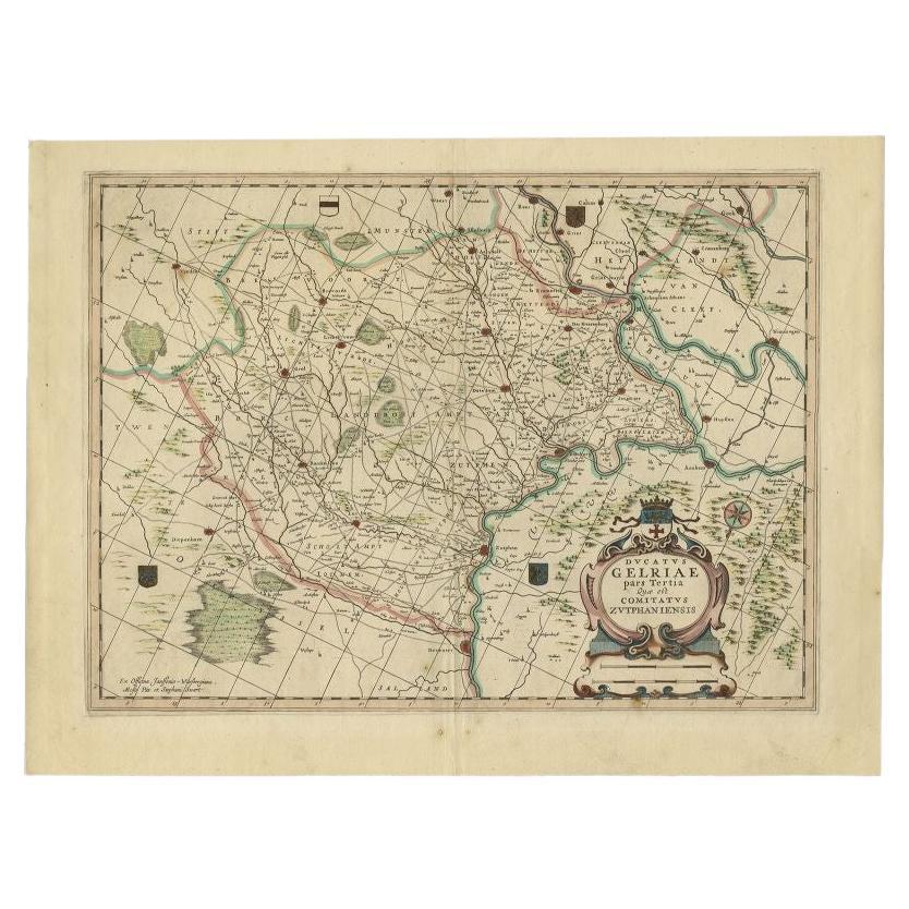
- Antique Map of the Region of Zutphen, Netherlands by Janssonius, c.1680By Johannes JanssoniusLocated in Langweer, NLAntique map titled 'Ducatus Gelriae pars tertia Quae est Comitatus Zutphaniensis.' Map of region around Zutphen in the historic Duchy Gelre in the Netherlands. Cities included in...Category
Antique 17th Century Maps
MaterialsPaper
- Old Map of the Dutch Provinces of Friesland and Groningen, The Netherlands, 1604Located in Langweer, NLAntique print, titled: 'Frisiae Occidentalis.' Handsome map of the Dutch Provinces of Friesland and Groningen. Embellished with strapwork title-car...Category
Antique Early 1600s Maps
MaterialsPaper
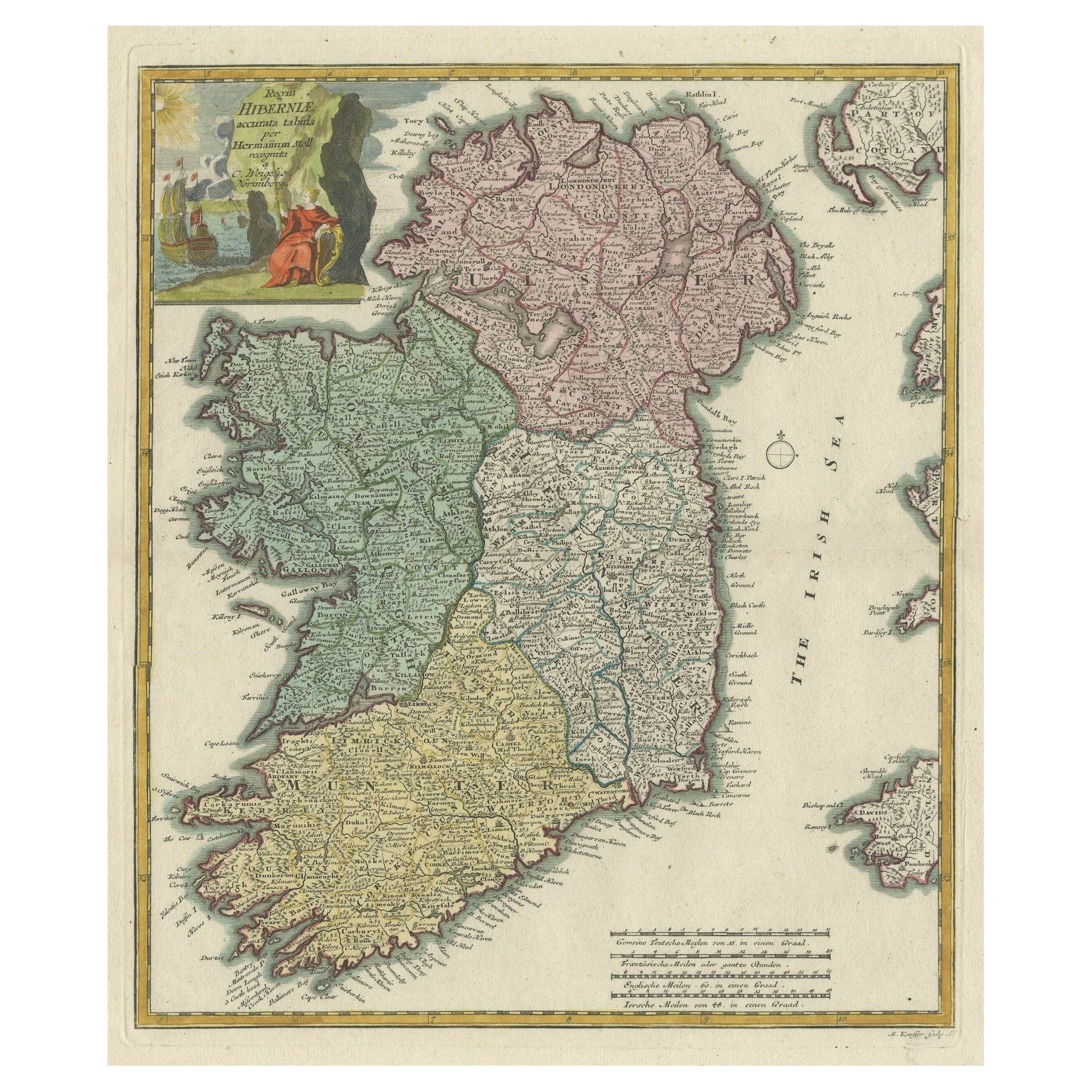
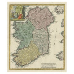
- Decorative Hand-Coloured Antique Map of the Four Irish Provinces, Ireland, c1718Located in Langweer, NLTitle: Regni Hiberniae Accurata Tabula per Hermanum Moll Decorative map of the four Irish provinces, Ireland, 1718, by Christoph Weigel (with credit to Herman Moll), engraved by Mi...Category
Antique 1710s Maps
MaterialsPaper

You May Also Like
- Original Antique Map of The Netherlands, Sherwood, Neely & Jones, Dated 1809Located in St Annes, LancashireGreat map of The Netherlands Copper-plate engraving by Cooper Published by Sherwood, Neely & Jones. Dated 1809 Unframed.Category
Antique Early 1800s English Maps
MaterialsPaper
- Original Antique Map of The Netherlands, Engraved by Barlow, Dated 1807Located in St Annes, LancashireGreat map of Netherlands Copper-plate engraving by Barlow Published by Brightly & Kinnersly, Bungay, Suffolk. Dated 1807 Unframed.Category
Antique Early 1800s English Maps
MaterialsPaper
- Map of the Republic of GenoaLocated in New York, NYFramed antique hand-coloured map of the Republic of Genoa including the duchies of Mantua, Modena, and Parma. Europe, late 18th century. Dimension: 25...Category
Antique Late 18th Century European Maps
- Antique Map of Principality of MonacoBy Antonio Vallardi EditoreLocated in Alessandria, PiemonteST/619 - "Old Geographical Atlas of Italy - Topographic map of ex-Principality of Monaco" - ediz Vallardi - Milano - A somewhat special edition ---Category
Antique Late 19th Century Italian Other Prints
MaterialsPaper
- Original Antique Map of The World by Thomas Clerk, 1817Located in St Annes, LancashireGreat map of The Eastern and Western Hemispheres On 2 sheets Copper-plate engraving Drawn and engraved by Thomas Clerk, Edinburgh. Published by Mackenzie And Dent, 1817 ...Category
Antique 1810s English Maps
MaterialsPaper
- The Holy Land at the Time of Jesus: A 17th Century Dutch Map by VisscherBy Nicolaes Visscher IILocated in Alamo, CAThis detailed Dutch map entitled "Het Beloofe de Landt Canaan door wandelt van onsen Salichmaecker Iesu Christo, nessens syne Apostelen" by Nicolaes Visscher was published in Amsterd...Category
Antique Mid-17th Century Dutch Maps
MaterialsPaper


Recently Viewed
View AllMore Ways To Browse
Circa 17
17 Antiques
Low Country Furniture
Scale Map
Large Scale Map
Antique British Maps
Circa 1620
Siege Antique
Antique Scale Art Collectibles
Antique Scales Art Collectibles
Antique Map Britain
Antique Britain Map
Vans Coat Of Arms
Large Bear Prints
Amsterdam Coat Of Arms
Large Map Of The Netherlands
Battle Maps
Antique Battle Maps