Items Similar to Antique Engraved Map of Saxonia in Northern Germany, ca.1721-1750


Want more images or videos?
Request additional images or videos from the seller
1 of 5
Antique Engraved Map of Saxonia in Northern Germany, ca.1721-1750
About the Item
Duitsland, Sassonia; Johannes Baptist Homann - Circulus Saxoniae Inferioris in omnes suos Status et Principatus accurate divisus ex conatibus -
A large map of Lower Saxony, extending from Hamburg with the Elbe River to the Baltic Sea with the island of Rügen to the east.
Decorated cartouche with two scales at lower right, inset engraving of Hamburg at lower left, inside. The map shows northern Germany, and its regions.
Condition: Good. Brown spot in bottom , just outside image in the lower middle fold. Central fold as issued.
- Dimensions:Height: 21.07 in (53.5 cm)Width: 23.63 in (60 cm)Depth: 0 in (0.02 mm)
- Materials and Techniques:
- Period:
- Date of Manufacture:circa 1721-1750
- Condition:
- Seller Location:Langweer, NL
- Reference Number:
About the Seller
5.0
Platinum Seller
These expertly vetted sellers are 1stDibs' most experienced sellers and are rated highest by our customers.
Established in 2009
1stDibs seller since 2017
1,940 sales on 1stDibs
Typical response time: <1 hour
- ShippingRetrieving quote...Ships From: Langweer, Netherlands
- Return PolicyA return for this item may be initiated within 14 days of delivery.
More From This SellerView All
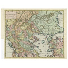
- Antique Engraved Map of the Northern Part of Greece and the Aegean Sea, Ca.1730Located in Langweer, NLTitle: "GRÆCIÆ PARS Septentrionalis". Hand Coloured Engraved map by G. Delisle of the northern part of the Aegean. In the top left corner a distance scale included. Condition...Category
Antique 1730s Maps
MaterialsPaper
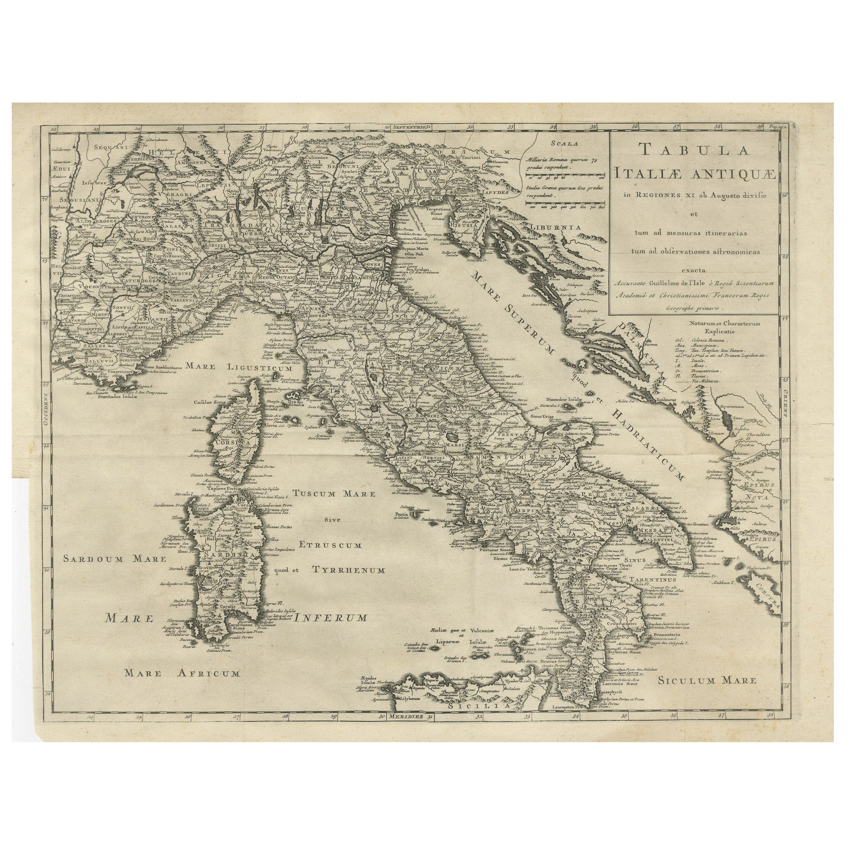
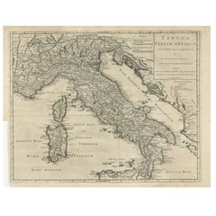
- Antique Engraved Map of Italy in Roman Times, ca.1730Located in Langweer, NLPlain engr. map of Italy according to the division of Emperor Augustus by G. Delisle. Title: "Tabula Italiae Antiquae In Regiones XI Ab Augusto Divisae Et Tum Ad Mensuras Itinerari...Category
Antique 1730s Maps
MaterialsPaper
- Antique Map of Northern Europe and European Russia, ca.1780Located in Langweer, NLAntique map titled 'Le Nord de L'Europe, Contenant Le Danemark, La Norwege; La Suede et La Laponie avec la Majeure Partie de al Russie Europeenne.' Map of Northern Europe and Eur...Category
Antique 1780s Maps
MaterialsPaper
- Antique Map of Northern Germany by M. Seutter, circa 1730By Matthew SeutterLocated in Langweer, NLAntique map titled 'Saxoniae Inferioris Circulus'. Old map of the northern part of Germany by M. Seutter. Covering the area of Lower Saxony, Mecklenburg-Vorpommern and Schleswig-Hols...Category
Antique Mid-18th Century Maps
MaterialsPaper
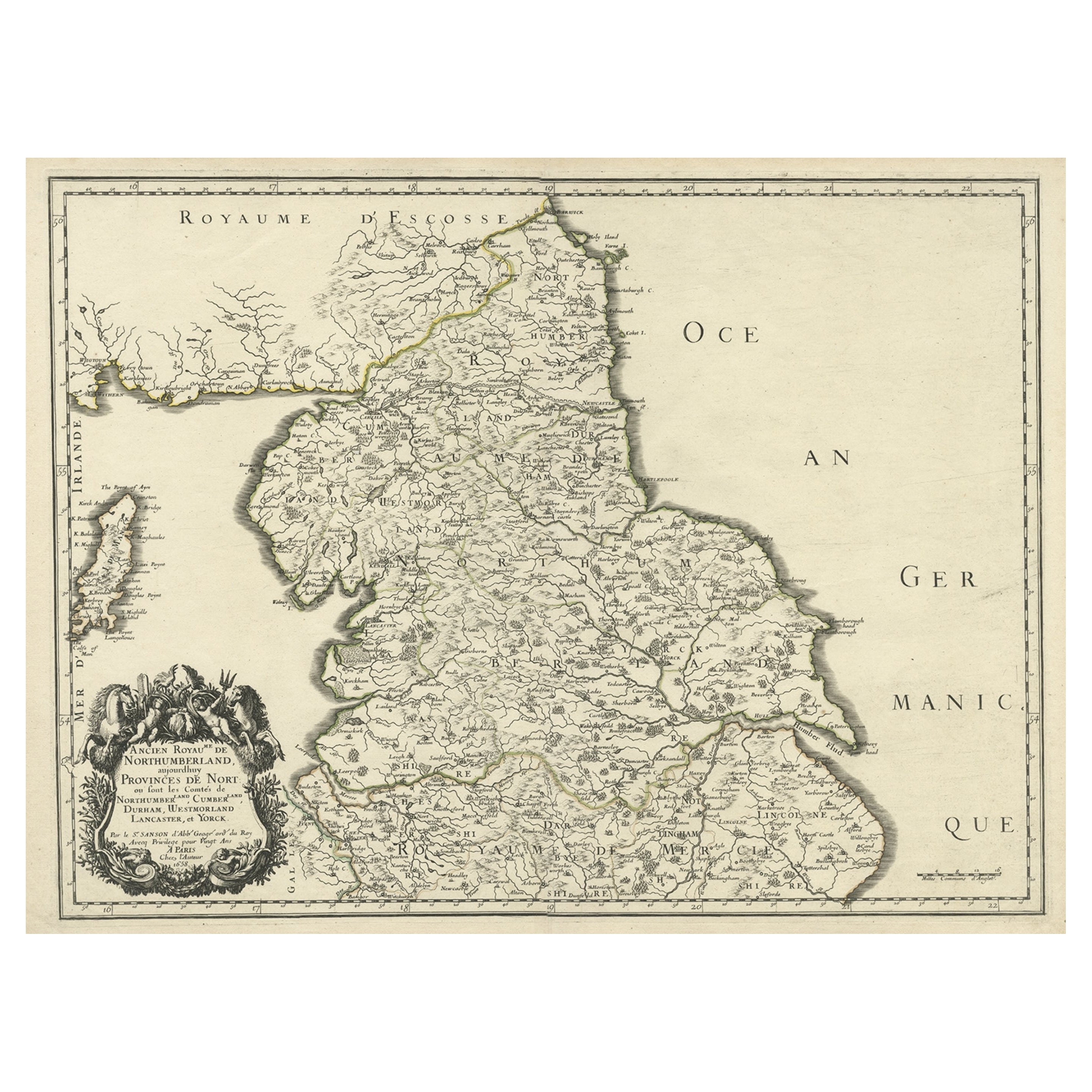
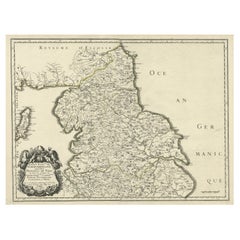
- Engraved Map of Northern England, Focusing on Northumberland, 1658Located in Langweer, NLAntique map titled 'Ancien Royaume de Northumberland, aujourdhuy Provinces de Nort (..)'. Engraved map of northern England, focusing on Northumber...Category
Antique 1650s Maps
MaterialsPaper
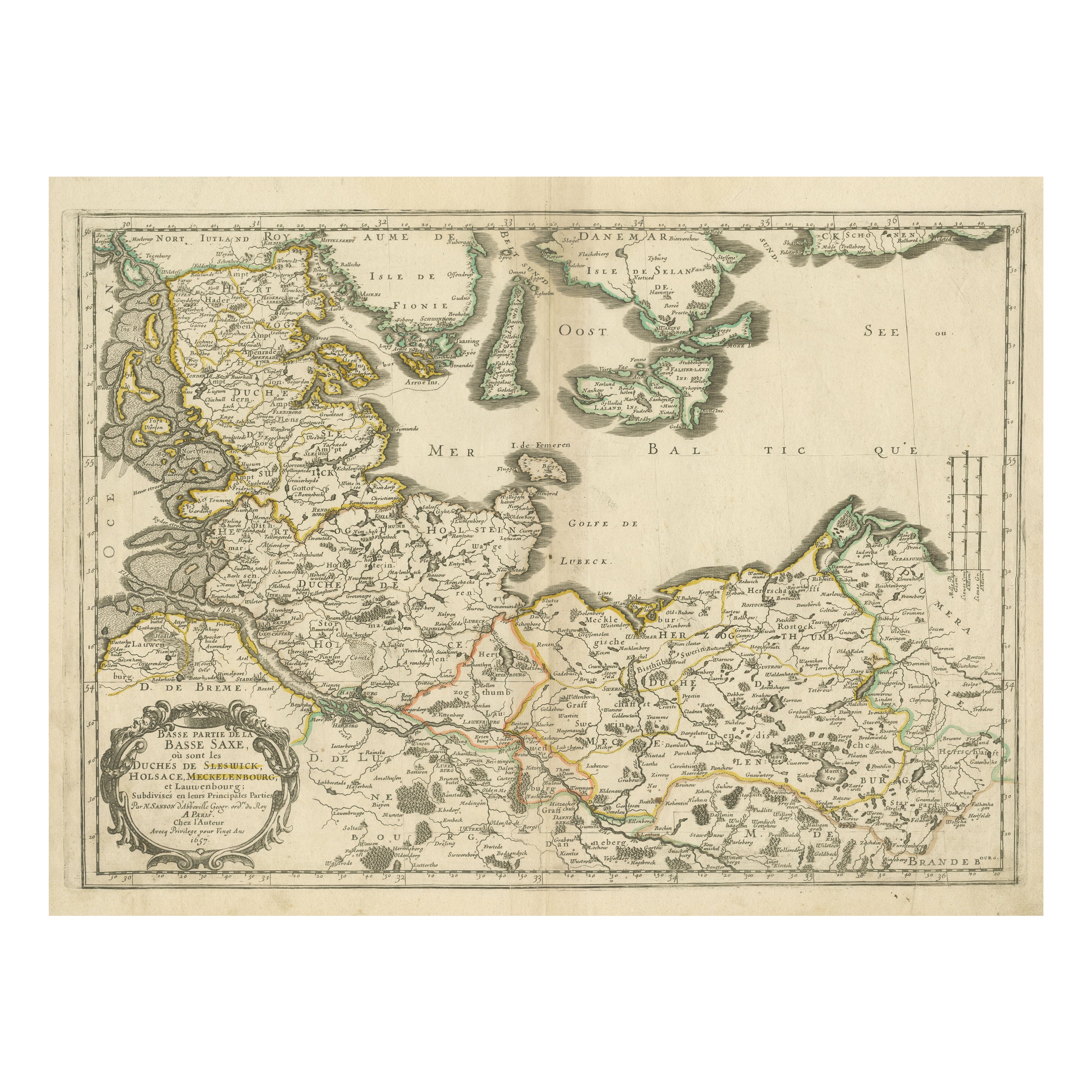
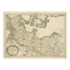
- Antique Map of Northern Germany, Including Schleswig-Holstein and HamburgLocated in Langweer, NLAntique map titled 'Basse Partie de la Basse Saxe ou sont les Duchés de Sleswick, Holsace, Meckelenbourg et Lauvenbourg (..)'. Original old map of northern Germany, including Schlesw...Category
Antique Mid-17th Century Maps
MaterialsPaper


You May Also Like
- Original Antique Map of Sweden, Engraved by Barlow, 1806Located in St Annes, LancashireGreat map of Sweden Copper-plate engraving by Barlow Published by Brightly & Kinnersly, Bungay, Suffolk. 1806 Unframed.Category
Antique Early 1800s English Maps
MaterialsPaper
- Original Antique Map of Switzerland, Engraved By Barlow, Dated 1807Located in St Annes, LancashireGreat map of Switzerland Copper-plate engraving by Barlow Published by Brightly & Kinnersly, Bungay, Suffolk. Dated 1807 Unframed.Category
Antique Early 1800s English Maps
MaterialsPaper
- Original Antique Map of Spain and Portugal, Engraved By Barlow, 1806Located in St Annes, LancashireGreat map of Spain And Portugal Copper-plate engraving by Barlow Published by Brightly & Kinnersly, Bungay, Suffolk. 1806 Unframed.Category
Antique Early 1800s English Maps
MaterialsPaper
- Original Antique Map of The Netherlands, Engraved by Barlow, Dated 1807Located in St Annes, LancashireGreat map of Netherlands Copper-plate engraving by Barlow Published by Brightly & Kinnersly, Bungay, Suffolk. Dated 1807 Unframed.Category
Antique Early 1800s English Maps
MaterialsPaper
- Antique Map of Principality of MonacoBy Antonio Vallardi EditoreLocated in Alessandria, PiemonteST/619 - "Old Geographical Atlas of Italy - Topographic map of ex-Principality of Monaco" - ediz Vallardi - Milano - A somewhat special edition ---Category
Antique Late 19th Century Italian Other Prints
MaterialsPaper
- Original Antique Map of Italy. C.1780Located in St Annes, LancashireGreat map of Italy Copper-plate engraving Published C.1780 Unframed.Category
Antique Early 1800s English Georgian Maps
MaterialsPaper


