Items Similar to Antique Folding Map of Kyoto, Japan, 1920


Want more images or videos?
Request additional images or videos from the seller
1 of 5
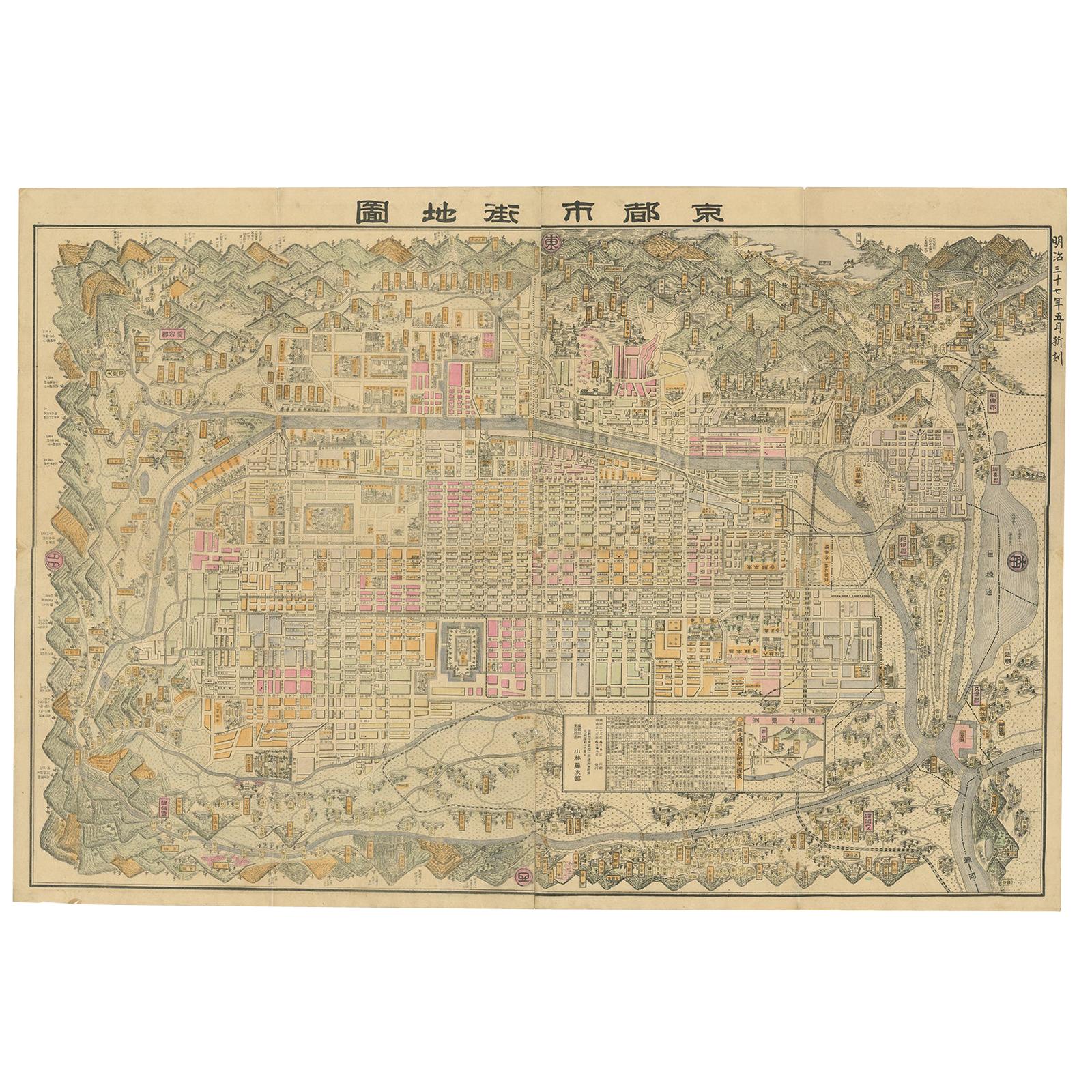
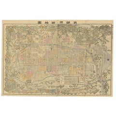
Antique Folding Map of Kyoto, Japan, 1920
About the Item
Antique folding map of Kyoto, Japan. On the verso of this map photos of buildings, other structures and informative text can be found.
- Dimensions:Height: 21.07 in (53.5 cm)Width: 30.71 in (78 cm)Depth: 0.02 in (0.5 mm)
- Materials and Techniques:
- Period:
- Date of Manufacture:1920
- Condition:General age-related toning, minor staining and some wear. Damaged folding lines are stenghtened with bookbinder tape.
- Seller Location:Langweer, NL
- Reference Number:
About the Seller
5.0
Platinum Seller
These expertly vetted sellers are 1stDibs' most experienced sellers and are rated highest by our customers.
Established in 2009
1stDibs seller since 2017
1,947 sales on 1stDibs
Typical response time: <1 hour
- ShippingRetrieving quote...Ships From: Langweer, Netherlands
- Return PolicyA return for this item may be initiated within 14 days of delivery.
More From This SellerView All
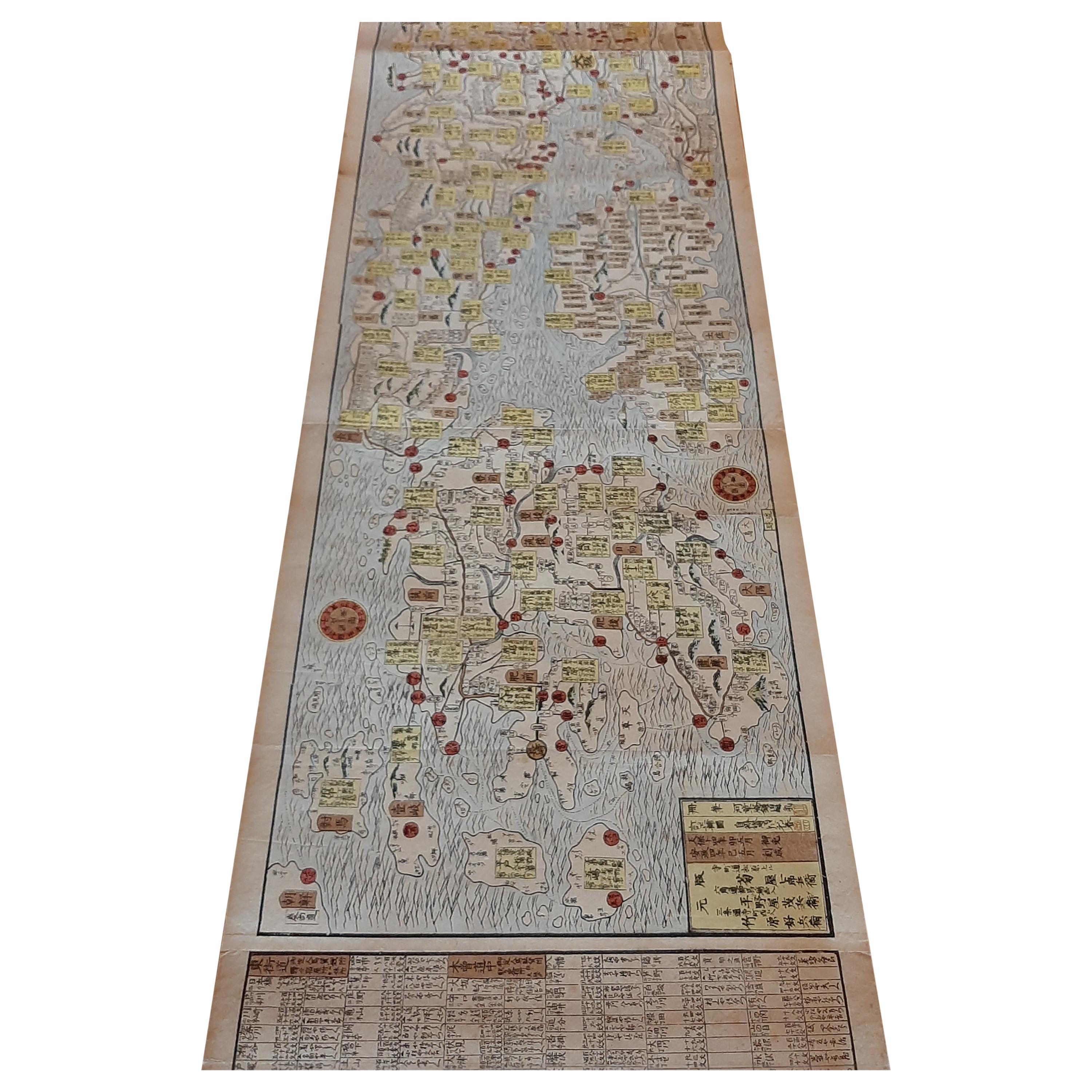
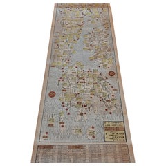
- Large Antique Map of Kyoto in Japan by Kobayashi, '1905'Located in Langweer, NLOld map of Kyoto, Japan. Published by Kobayashi, 1905.Category
Early 20th Century Maps
MaterialsPaper
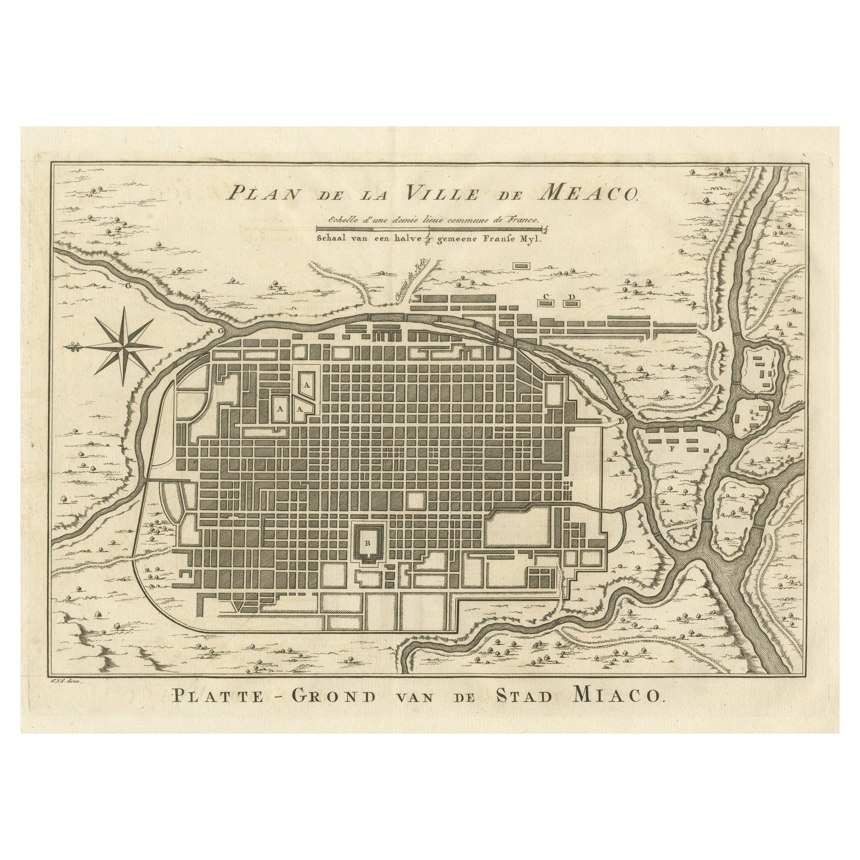
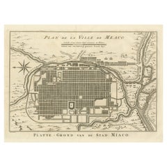
- Antique Plan of Meaco, Kyoto, JapanLocated in Langweer, NLAntique map titled 'Plan de la Ville de Meaco - Platte-Grond van de Stad Miaco'. Detailed and unusual antique copper engraved plan of Kyoto, ancient named Meaco, when it was the capi...Category
Antique Mid-18th Century Maps
MaterialsPaper
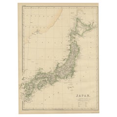
- Antique Map of Japan by W. G. Blackie, 1859Located in Langweer, NLAntique map titled 'Japan'. Original antique map of Japan. This map originates from ‘The Imperial Atlas of Modern Geography’. Published by W. G. B...Category
Antique Mid-19th Century Maps
MaterialsPaper
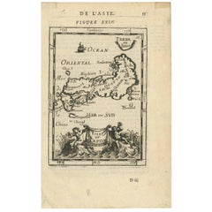
- Antique Map of Japan by J.N. Bellin, 1752Located in Langweer, NLBellin's wonderfully detailed map of Japan from the atlas of Prevost d'Exiles' influential collection of travel narratives, Histoire Generale des Voyages. Considered the best general...Category
Antique Mid-18th Century Maps
MaterialsPaper
- Antique Woodblock Print Map of Japan 'circa 1860'Located in Langweer, NLOriginal Japanese woodblock print map of Japan. Very large and fascinating map, rebacking with Japanese paper. Published circa 1860.Category
Antique Late 19th Century Maps
MaterialsPaper
- Antique Map of Japan by A.M. Mallet, 1683Located in Langweer, NLA charming late 17th century French map with a very decorative title cartouche showing trumpet-blowing cherubs, by Allain Manneson Mallet (1630-1706), a well traveled military engine...Category
Antique Late 17th Century Maps
MaterialsPaper

You May Also Like
- Antique Map of Principality of MonacoBy Antonio Vallardi EditoreLocated in Alessandria, PiemonteST/619 - "Old Geographical Atlas of Italy - Topographic map of ex-Principality of Monaco" - ediz Vallardi - Milano - A somewhat special edition ---Category
Antique Late 19th Century Italian Other Prints
MaterialsPaper
- Original Antique Map of Italy. C.1780Located in St Annes, LancashireGreat map of Italy Copper-plate engraving Published C.1780 Unframed.Category
Antique Early 1800s English Georgian Maps
MaterialsPaper

- Original Antique Map of Asia. C.1780Located in St Annes, LancashireGreat map of Asia Copper-plate engraving Published C.1780 Two small worm holes to right side of map Unframed.Category
Antique Early 1800s English Georgian Maps
MaterialsPaper

- Original Antique Map of India. C.1780Located in St Annes, LancashireGreat map of India Copper-plate engraving Published C.1780 Three small worm holes to right side of map and one bottom left corner Unframed.Category
Antique Early 1800s English Georgian Maps
MaterialsPaper

- Large Antique 1859 Map of North AmericaLocated in Sag Harbor, NYThis Map was made by Augustus Mitchell in 1859 It is in amazing condition for being 163 years old. This price is for the rolled up easy to ship version of this piece. I will be Frami...Category
Antique Mid-19th Century American Maps
MaterialsCanvas, Paper

- Original Antique Map of Italy. Arrowsmith. 1820Located in St Annes, LancashireGreat map of Italy Drawn under the direction of Arrowsmith Copper-plate engraving Published by Longman, Hurst, Rees, Orme and Brown, 1820 Unframed.Category
Antique 1820s English Maps
MaterialsPaper


Recently Viewed
View AllMore Ways To Browse
1920 Vintage Furniture
The Vintage Map
Folding Photo
Japanese Vintage Collectibles
Vintage Japanese Japanese Collectables
Folding Maps
Japan Antiques Collectables
Map Japan
Japan Maps
Map Of Japan
Vintage Folded Map
Antique Map Japan
Vintage Japanese Map
Prints Of Antique Maps
Antique Over A Hundred Years Old
Antique Furniture Plans
Antique Rare Maps
Rare Antique Maps