Items Similar to Antique Hand Colored Framed Map of Europe


Want more images or videos?
Request additional images or videos from the seller
1 of 6
Antique Hand Colored Framed Map of Europe
About the Item
Antique reproduction copied from an edition dated 1595 by Ortelius.
- Dimensions:Height: 22.5 in (57.15 cm)Width: 27 in (68.58 cm)Depth: 1 in (2.54 cm)
- Period:
- Date of Manufacture:Late 19th Century
- Condition:
- Seller Location:West Palm Beach, FL
- Reference Number:
About the Seller
5.0
Platinum Seller
These expertly vetted sellers are 1stDibs' most experienced sellers and are rated highest by our customers.
1stDibs seller since 2004
925 sales on 1stDibs
Typical response time: 1 hour
- ShippingRetrieving quote...Ships From: West Palm Beach, FL
- Return PolicyA return for this item may be initiated within 3 days of delivery.
More From This SellerView All
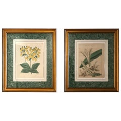
- Pair of Original Antique Hand Colored Botanical EngravingsLocated in West Palm Beach, FLPair of hand colored botanical engravings of flowers.Category
Antique 19th Century English Prints
MaterialsPaper
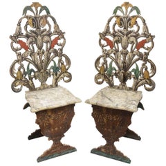
- Exceptional Pair of Antique Venetian Side ChairsLocated in West Palm Beach, FLUnique pair of carved and pierced wood side chairs. Beautifully painted by an artisan featuring faux marble seat supported by a garden urn.Category
Antique 19th Century Italian Chairs
MaterialsWood
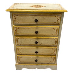
- Miniature Painted Italian Chest of DrawersLocated in West Palm Beach, FLMiniature hand painted five drawer chest.Category
20th Century Italian Models and Miniatures
MaterialsWood, Paint
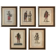
- Set of Five French Hand Colored Engravings of Historic Turkish FiguresLocated in West Palm Beach, FLFive beautifully framed hand colored engravings of Turkish figures in historic costumes.Category
Antique Late 19th Century French Prints
MaterialsPaper
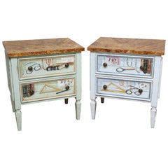
- Pair of Trompe L'oeil Miniature ChestsLocated in West Palm Beach, FLVery sweet pair of small trompe l'oeil chests with art work on all four sides.Category
20th Century Commodes and Chests of Drawers
MaterialsWood
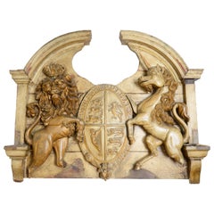
- Large English 19th Century Armorial Coat of ArmsLocated in West Palm Beach, FLExceptional large carved wood crest representing the British Royal family. Beautiful patina, original painted finish.Category
Antique 19th Century English Wall-mounted Sculptures
You May Also Like
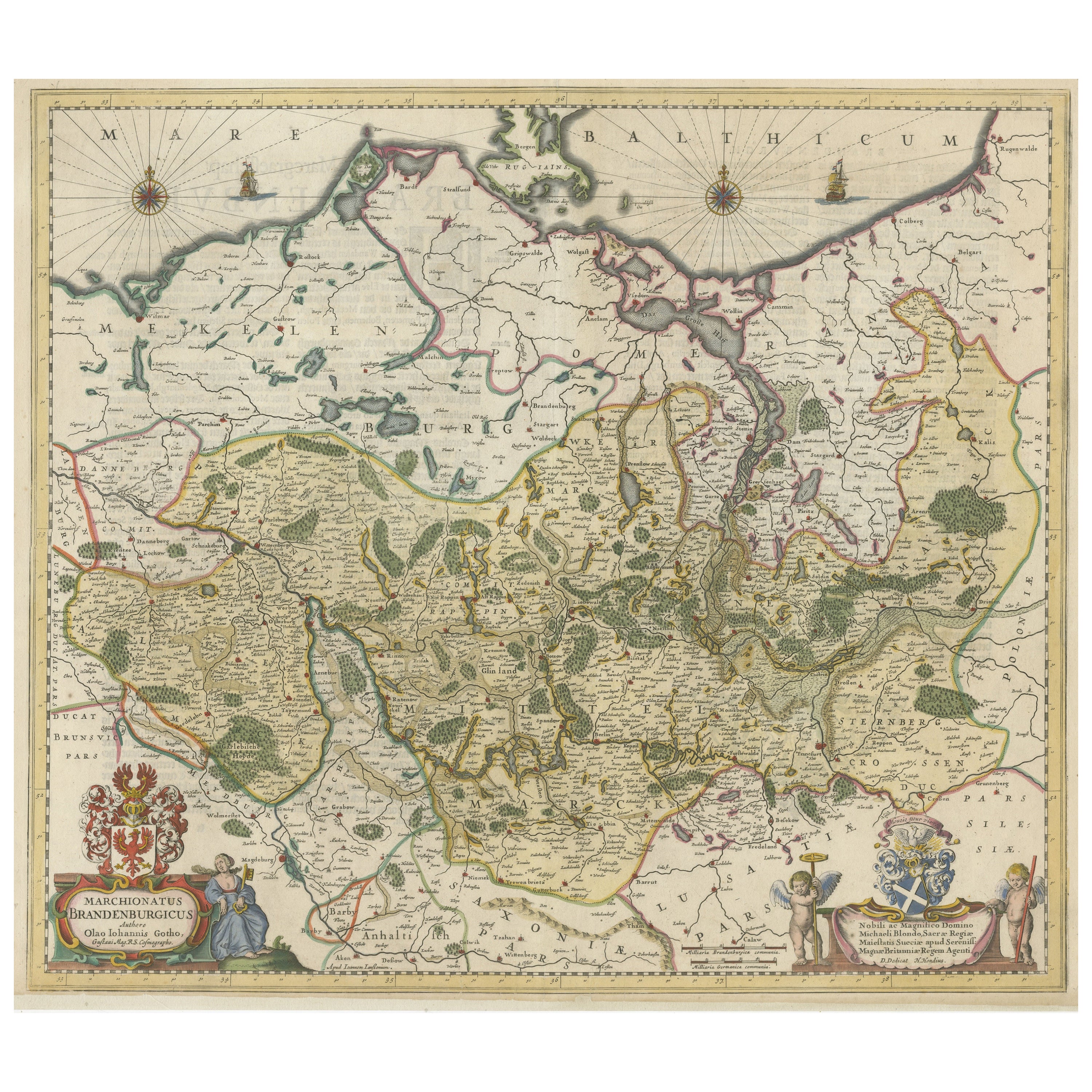
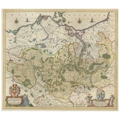
- Antique Hand-colored Map of Brandenburg, GermanyLocated in Langweer, NLAntique map titled 'Marchionatus Brandenburgicus'. Original antique map of Brandenburg, with Königsberg and Stettin, Germany. Published by J. Janssonius, circ 1650. Jan Janssonius ...Category
Antique Mid-17th Century Maps
MaterialsPaper
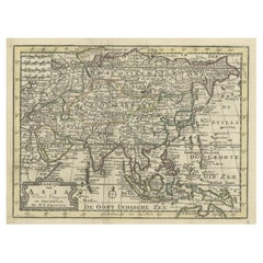
- Rare Hand-Colored Antique Map of Asia, 1788Located in Langweer, NLAntique map titled 'Kaartje van Asia'. Original antique map of Asia. This map originates from 'Nieuwe Natuur- Geschied- en Handelkundige Zak- en Reisatlas' by N.T. Gravius, 1788....Category
Antique 1780s Maps
MaterialsPaper
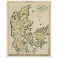
- Antique Hand-Colored Engraved Map of Denmark, 1790Located in Langweer, NLPublished by Russell (J. C.). Denmark. Divided into Dioceses and Prefectures compiled from the best Authorities, 1790, hand-coloured engraved map on handmade paper with watermark. 41...Category
Antique 1790s Maps
MaterialsPaper
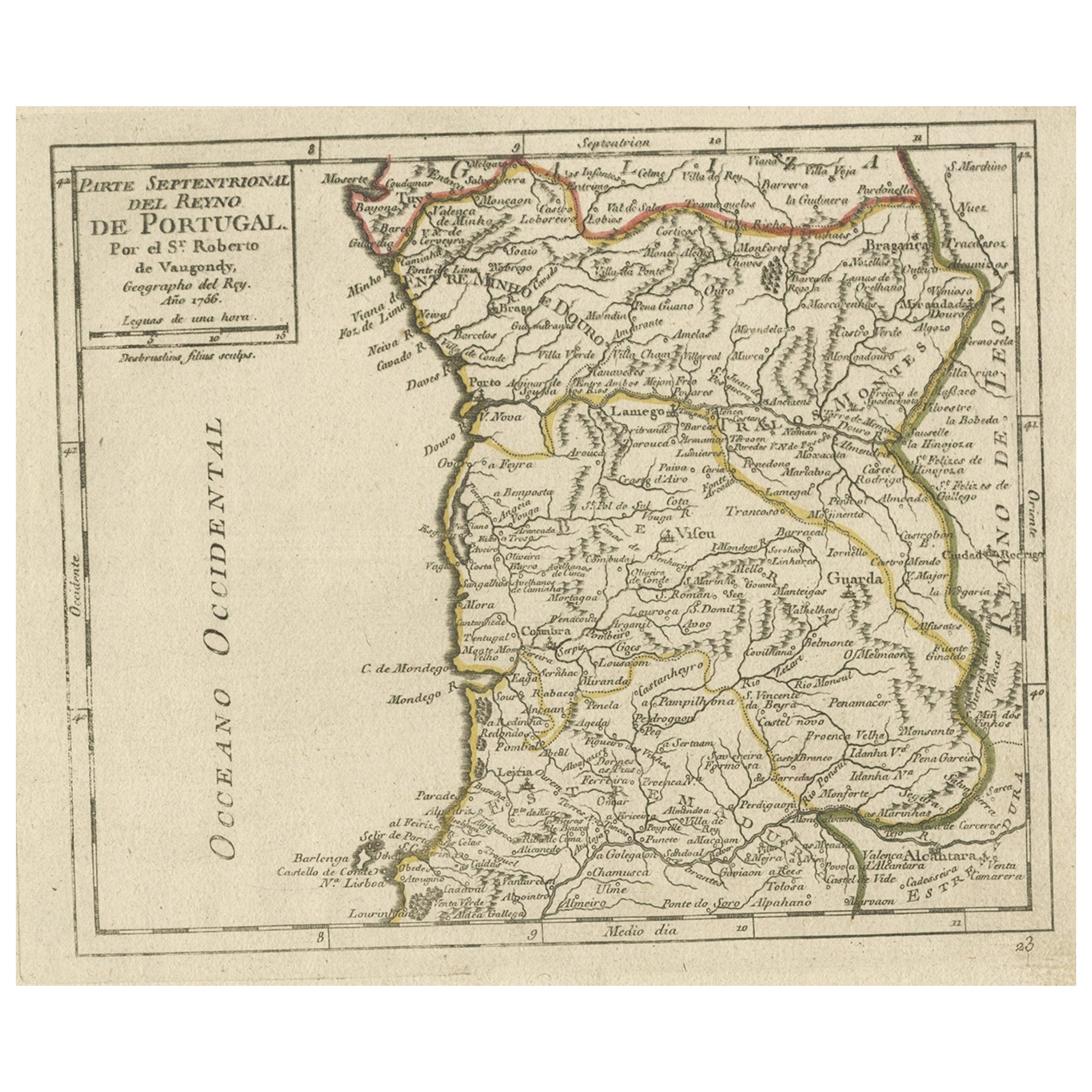
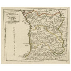
- Antique Hand-Colored Map of Northern Portugal, 1756Located in Langweer, NLAntique map Portugal titled 'Parte Sepentrional del Reyno de Portugal'. Antique map of Northern Portugal. This map originates from 'Atlas Port...Category
Antique 1750s Maps
MaterialsPaper
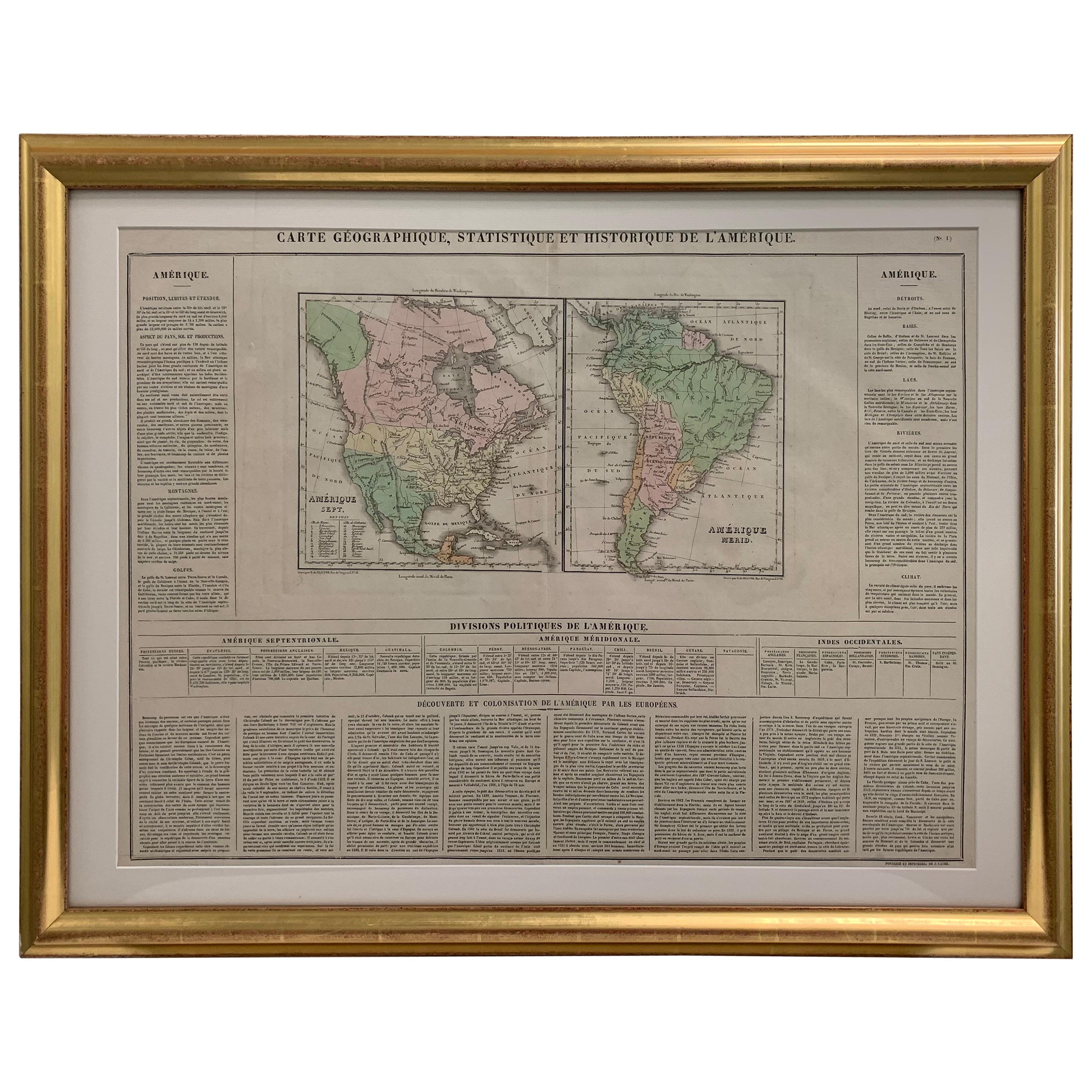
- Framed 1820s Hand Colored Map of the United StatesLocated in Stamford, CTFramed 1820s hand colored map photos of North America and South America. As found framed in giltwood frame.Category
Antique 1820s American Spanish Colonial Maps
MaterialsGiltwood, Paper, Glass
- Framed 1839 Hand Colored Map of the United StatesLocated in Stamford, CTFramed hand colored map of the United States of America from 1839. Newly framed in a giltwood frame.Category
Antique 1830s American American Classical Maps
MaterialsGiltwood, Paper, Glass


Recently Viewed
View AllMore Ways To Browse
Colored Antique Furniture
Antique Maps Ortelius
Antique Map Ortelius
Antique Fireplaces And Ranges
Antique Florida Collectibles
Antique Victoria Australia
Map Berlin
Antique Sailing Maps
Berlin Maps
Antique Sailing Map
West Coat Of Arms
Bay Area Antique Furniture
World Map Copper
Greek Asia Minor
Antique Map Of Portugal
Antique Map Portugal
Antique Map Egypt
Hemisphere World Map