Items Similar to Antique Map of Aero by Blaeu, 'circa 1670'


Want more images or videos?
Request additional images or videos from the seller
1 of 5
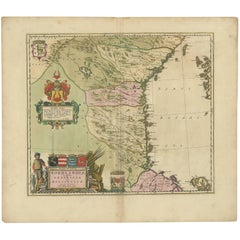
Antique Map of Aero by Blaeu, 'circa 1670'
About the Item
Antique map titled 'Aroe Insulae delineatio geometrica'. Old map of Aero, a small Danish island in the Baltic Sea. This map originates from a Spanish edition of 'Atlas Maior' by J. Blaeu.
- Dimensions:Height: 21.26 in (54 cm)Width: 13.19 in (33.5 cm)Depth: 0.02 in (0.5 mm)
- Materials and Techniques:
- Period:Mid-17th Century
- Date of Manufacture:circa 1670
- Condition:General age-related toning. Minor wear, Spanish text on verso. Please study images carefully.
- Seller Location:Langweer, NL
- Reference Number:
About the Seller
5.0
Platinum Seller
These expertly vetted sellers are 1stDibs' most experienced sellers and are rated highest by our customers.
Established in 2009
1stDibs seller since 2017
1,967 sales on 1stDibs
Typical response time: <1 hour
- ShippingRetrieving quote...Ships From: Langweer, Netherlands
- Return PolicyA return for this item may be initiated within 14 days of delivery.
More From This SellerView All
- Antique Map of Catalonia by Blaeu, circa 1650Located in Langweer, NLAntique map titled 'Catalonia'. Antique map of Catalonia, extending from C. De Romani on the Northern Coast to Alfachs and Panicola in Valencia on the southern end of the coast and s...Category
Antique Mid-17th Century Maps
MaterialsPaper
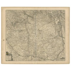
- Antique Map of Prussia by Blaeu, circa 1635By Willem BlaeuLocated in Langweer, NLAntique map titled 'Prussiae Nova Tabula'. Rare early edition of Blaeu's map of Prussia, embellished with a gorgeous large format cartouche, compass ros...Category
Antique Mid-17th Century Maps
MaterialsPaper
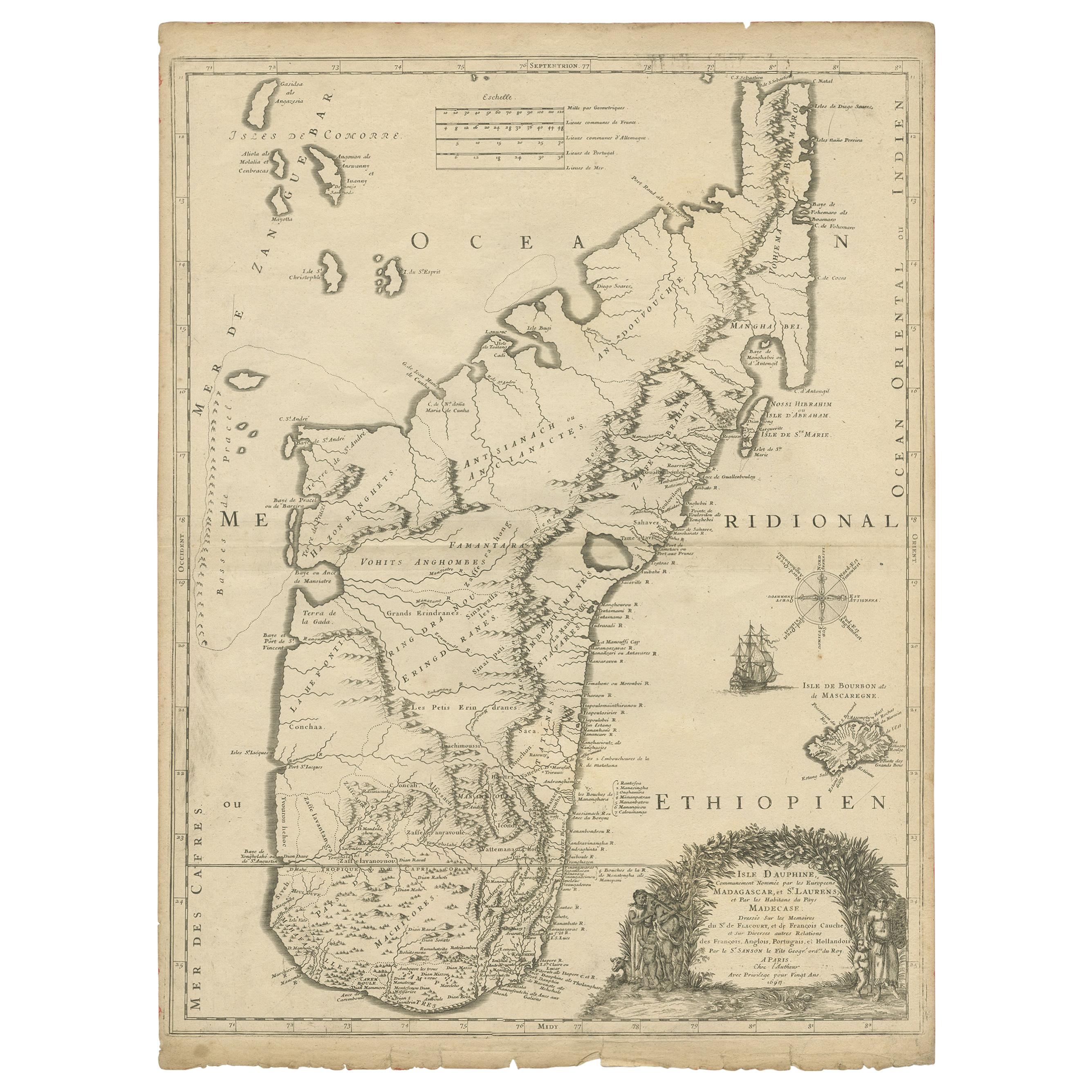
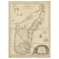
- Antique Map of Madagascar by Mariette 'c.1670'Located in Langweer, NLAntique map titled 'Isle Dauphine communement nommée par les Europeens Madagascar, et St. Laurens (..)'. Original large-scale antique map of Madagascar...Category
Antique Mid-17th Century Maps
MaterialsPaper
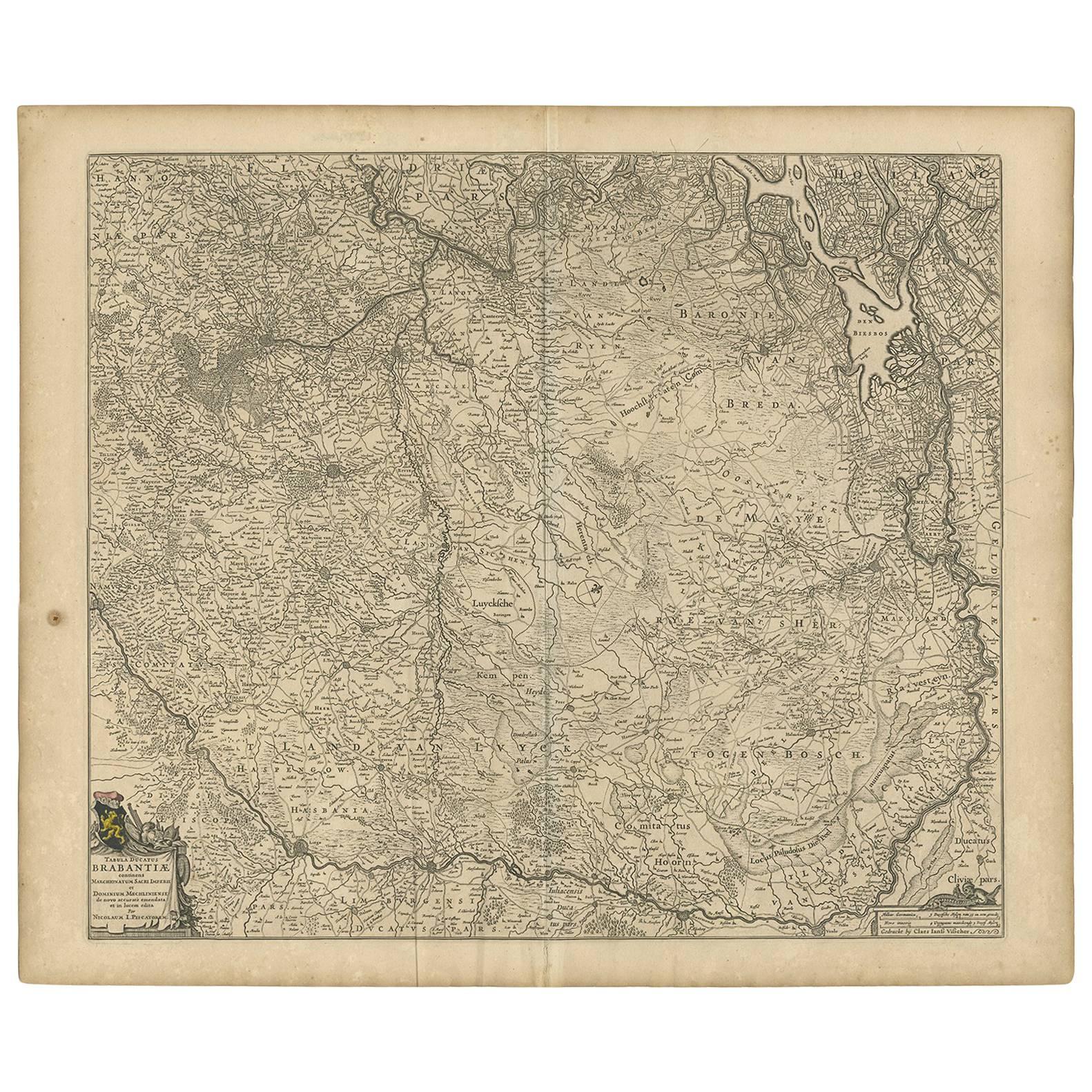
- Antique Map of Brabant 'The Netherlands' by N. Visscher, circa 1670Located in Langweer, NLDetailed map of the southern part of The Netherlands and the northern part of Belgium with Antwerp and Brussels. In the corner top left in Holland with Rotterdam partly on the map. S...Category
Antique Mid-17th Century Maps
MaterialsPaper
- Antique Map of Friesland ‘The Netherlands’ by N. Visscher, circa 1670By Nicolaes Visscher IILocated in Langweer, NLThis large copper engraved map details the coastline of Friesland and Terschelling. At east is a part of Groningen. The main cities are colored in red. The very decorative cartouches...Category
Antique Late 17th Century Maps
MaterialsPaper
- Antique Map of Central Sweden by J. Blaeu, 1662Located in Langweer, NLA striking, rare map with a cartouche dedicated to Gabriel Bengtsson Oxenstierna. Published by J. Bleau, Amsterdam, 1662. Contemporary coloring.Category
Antique Mid-17th Century Maps
MaterialsPaper


You May Also Like
- Original Antique Map of Belgium by Tallis, Circa 1850Located in St Annes, LancashireGreat map of Belgium Steel engraving Many lovely vignettes Published by London Printing & Publishing Co. ( Formerly Tallis ), C.1850 Origin...Category
Antique 1850s English Maps
MaterialsPaper
- Original Antique Map of South America, circa 1830Located in St Annes, LancashireGreat map of South America Copper plate engraving Published by Butterworth, Livesey & Co., circa 1830 Unframed.Category
Antique Early 1800s English Other Maps
MaterialsPaper
- Original Antique Map of South East Asia by Becker, circa 1840Located in St Annes, LancashireGreat map of South East Asia Steel engraving with original color outline Engraved by Becker Published by Virtue, circa 1840. Unframed.Category
Antique 1840s English Other Maps
MaterialsPaper
- Original Antique Map / City Plan of Brussels by Tallis, circa 1850Located in St Annes, LancashireGreat map of Brussels. Steel engraving. Published by London Printing & Publishing Co. (Formerly Tallis), C.1850 Free shipping.Category
Antique 1850s English Maps
MaterialsPaper
- Original Antique Map of Spain and Portugal, circa 1790Located in St Annes, LancashireSuper map of Spain and Portugal Copper plate engraving by A. Bell Published, circa 1790. Unframed.Category
Antique 1790s English Other Maps
MaterialsPaper
- Antique Map of Italy by Andriveau-Goujon, 1843By Andriveau-GoujonLocated in New York, NYAntique Map of Italy by Andriveau-Goujon, 1843. Map of Italy in two parts by Andriveau-Goujon for the Library of Prince Carini at Palazzo Carini i...Category
Antique 1840s French Maps
MaterialsLinen, Paper


