Items Similar to Antique Map of Algeria, 1880


Want more images or videos?
Request additional images or videos from the seller
1 of 5
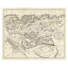
Antique Map of Algeria, 1880
About the Item
Antique map titled 'Algérie. Old map of Algeria. This map originates from 'Géographie Universelle Atlas-Migeon' by J. Migeon.
Artists and Engravers: Published by J. Migeon. Reviewed by A. Vuillemin. Alexandre Vuillemin (1812-1880) was a cartographer and an book editor based in Paris, France.
Condition: Good, age-related toning. Please study image carefully.
Date: 1880
Overall size: 47.5 x 34.5 cm.
Image size: 37.5 x 28 cm.
- Dimensions:Height: 13.59 in (34.5 cm)Width: 18.71 in (47.5 cm)Depth: 0 in (0.01 mm)
- Materials and Techniques:
- Period:
- Date of Manufacture:1880
- Condition:
- Seller Location:Langweer, NL
- Reference Number:
About the Seller
5.0
Platinum Seller
These expertly vetted sellers are 1stDibs' most experienced sellers and are rated highest by our customers.
Established in 2009
1stDibs seller since 2017
1,940 sales on 1stDibs
Typical response time: <1 hour
- ShippingRetrieving quote...Ships From: Langweer, Netherlands
- Return PolicyA return for this item may be initiated within 14 days of delivery.
More From This SellerView All
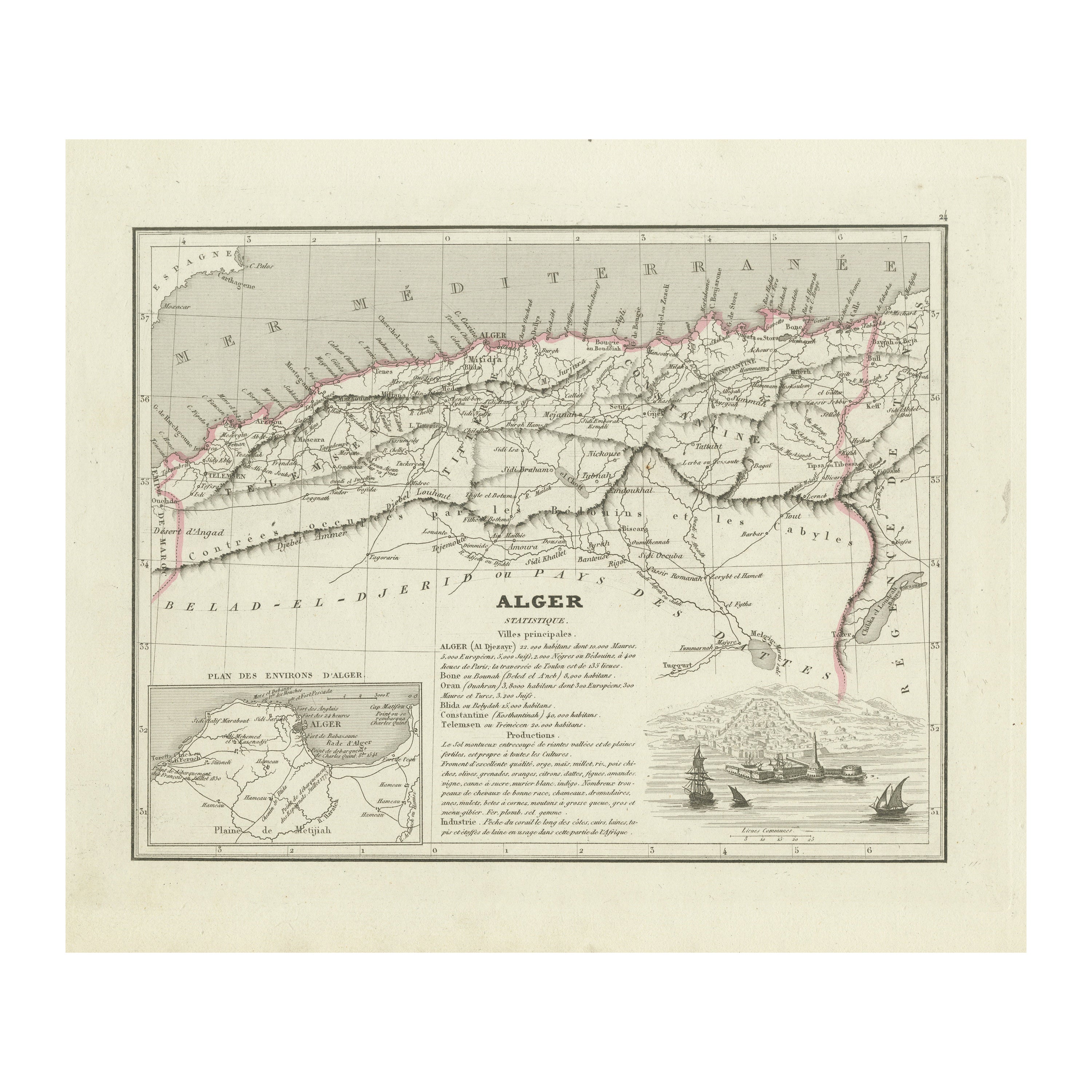
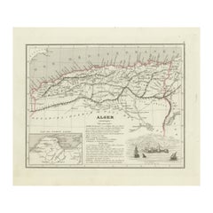
- Antique Map of the Region of Algiers, AlgeriaLocated in Langweer, NLAntique map titled 'Alger'. This map shows the region of Algiers, Algeria. With a small inset map of the region of Algiers and a decorative vignette with a harbor view. Originates fr...Category
Antique Mid-19th Century Maps
MaterialsPaper
- Antique Map of Algeria and the French Colonies, 1875Located in Langweer, NLAntique map titled 'Algérie et Colonies Francaises'. Large map of Algeria and the French Colonies. This map originates from 'Atlas de Géographie Moderne Physique et Politique' by A. ...Category
Antique Late 19th Century Maps
MaterialsPaper
- Antique Map of the French Colony of Algeria by V. Levasseur, 1854By Victor LevasseurLocated in Langweer, NLAntique map titled 'Algérie, Colonie Francaise'. Shows the region divided into the administrative provinces of Oban, Alger, and Constantine. The map proper is surrounded by elaborate...Category
Antique Mid-19th Century Maps
MaterialsPaper
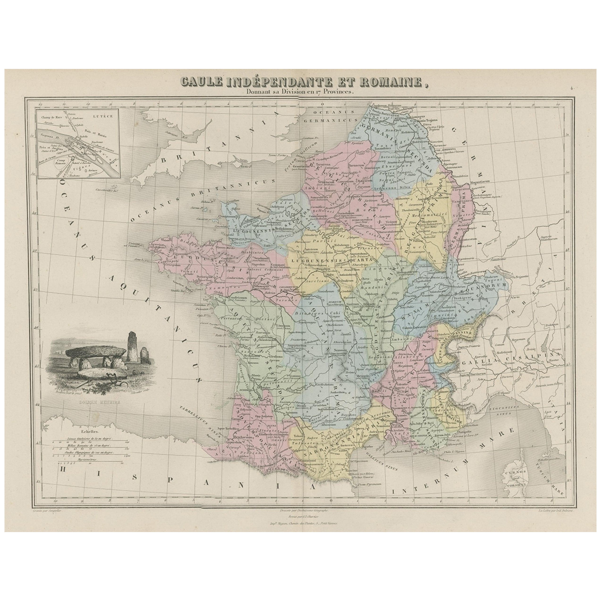
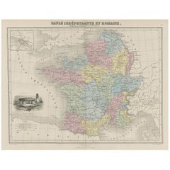
- Antique Map of France in Ancient Roman Times, 1880Located in Langweer, NLAntique map titled 'Gaule indépendante et Romaine'. Old map of Gaul or France in ancient Roman times. The map covers from the southern part of England (Britannia) to the north of S...Category
Antique 19th Century Maps
MaterialsPaper
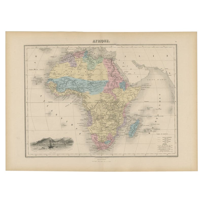
- Antique Map of Africa with Decorative Vignette of Saint Helena, 1880Located in Langweer, NLAntique map titled 'Afrique'. Old map of Africa, covering the African continent. With decorative vignette of Saint Helena. This map originates from 'Géogr...Category
Antique 19th Century Maps
MaterialsPaper
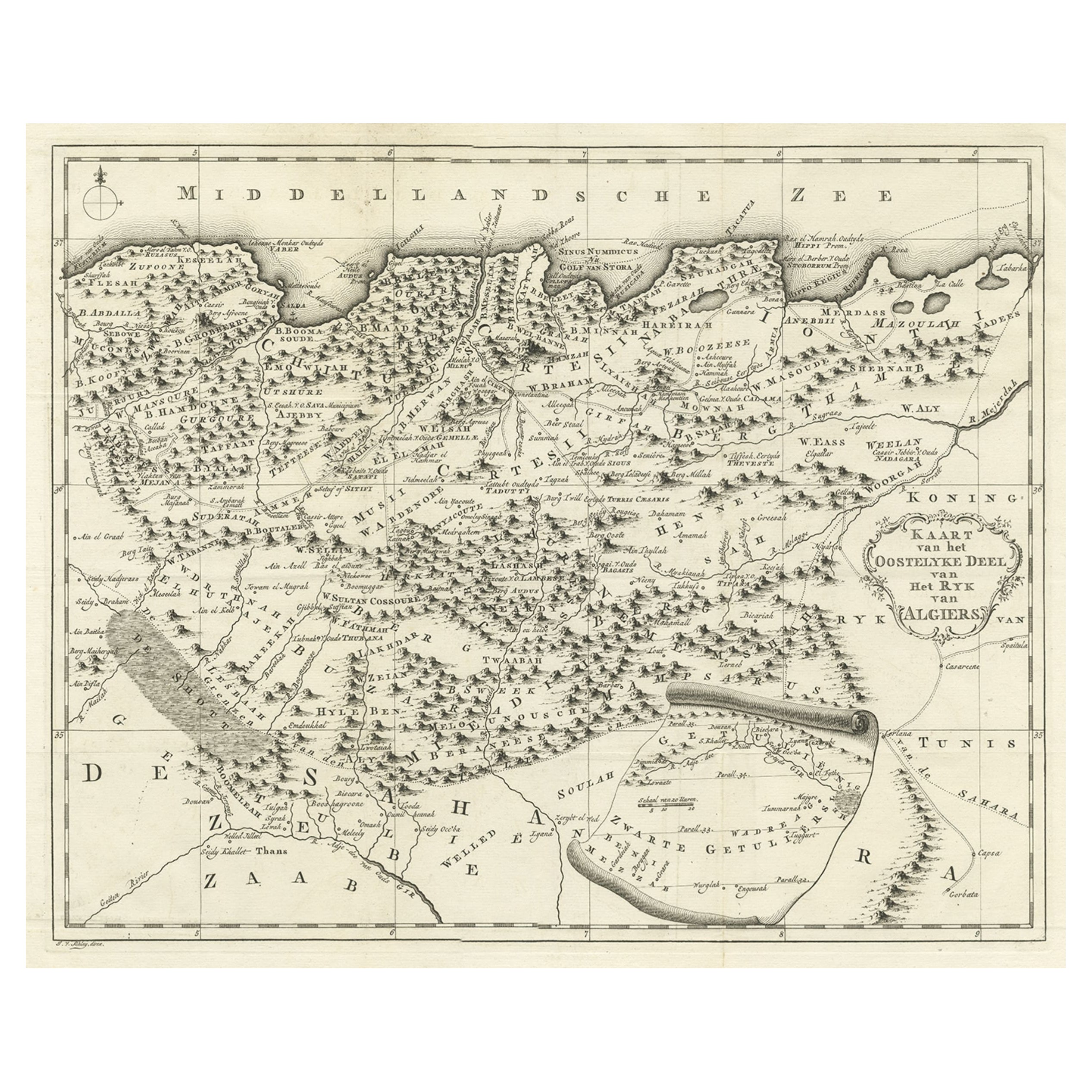
- Old Map of the Eastern Region of the Kingdom of Algiers, Algeria, 1773Located in Langweer, NLAntique map titled 'Kaart van het Oostelyke Deel van het Ryk van Algiers'. Old map of the eastern region of the Kingdom of Algiers, Algeria. Originates from the first Dutch edito...Category
Antique 1770s Maps
MaterialsPaper


You May Also Like
- Antique Map of Principality of MonacoBy Antonio Vallardi EditoreLocated in Alessandria, PiemonteST/619 - "Old Geographical Atlas of Italy - Topographic map of ex-Principality of Monaco" - ediz Vallardi - Milano - A somewhat special edition ---Category
Antique Late 19th Century Italian Other Prints
MaterialsPaper
- Original Antique Map of Italy. C.1780Located in St Annes, LancashireGreat map of Italy Copper-plate engraving Published C.1780 Unframed.Category
Antique Early 1800s English Georgian Maps
MaterialsPaper

- Original Antique Map of Asia. C.1780Located in St Annes, LancashireGreat map of Asia Copper-plate engraving Published C.1780 Two small worm holes to right side of map Unframed.Category
Antique Early 1800s English Georgian Maps
MaterialsPaper

- Original Antique Map of India. C.1780Located in St Annes, LancashireGreat map of India Copper-plate engraving Published C.1780 Three small worm holes to right side of map and one bottom left corner Unframed.Category
Antique Early 1800s English Georgian Maps
MaterialsPaper

- Original Antique Map of South America. C.1780Located in St Annes, LancashireGreat map of South America Copper-plate engraving Published C.1780 Two small worm holes to left side of map Unframed.Category
Antique Early 1800s English Georgian Maps
MaterialsPaper
- Original Antique Map of Ireland- Kerry. C.1840Located in St Annes, LancashireGreat map of Kerry Steel engraving Drawn under the direction of A.Adlard Published by How and Parsons, C.1840 Unframed.Category
Antique 1840s English Maps
MaterialsPaper


Recently Viewed
View AllMore Ways To Browse
Antique Paris Map
Paris Antique Maps
Antique Paris Maps
Antique Maps Paris
Antique Map Paris
Paris Map Antique
Antique Map Of Paris
Antique Maps Of Paris
Antique Maps Book
Antique Map Book
Antique Maps Of Paris France
Antique Map Of Paris France
Alexandre Antiques
Book Of Antique Maps
Old Map Of Paris
Old Map Paris
Atlas Book
Migeon And Migeon