Items Similar to Antique Map of Asia Minor, Route of the Retreat of Ten Thousand Greeks, c.1720


Want more images or videos?
Request additional images or videos from the seller
1 of 6
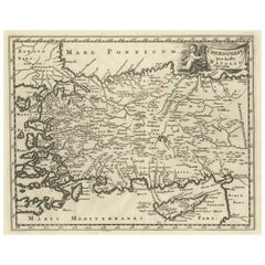
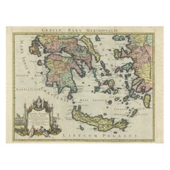
Antique Map of Asia Minor, Route of the Retreat of Ten Thousand Greeks, c.1720
About the Item
Antique map Asia Minor titled 'The Retreat of the Ten Thousand Greeks according to Xenophon'. Historical depiction of the ancient Greek army in Asia Minor. This old map is showing the route.
The Ten Thousand were a force of mercenary units, mainly Greeks, employed by Cyrus the Younger to attempt to wrest the throne of the Persian Empire from his brother, Artaxerxes II. Their march to the Battle of Cunaxa and back to Greece (401–399 BC) was recorded by Xenophon, one of their leaders, in his work Anabasis. Source: Wikipedia
Artists and Engravers: Herman Moll (1654 - 1732), was a London cartographer, engraver and publisher.
Condition: Good, age-related toning and some old handwriting on the verso shining through, slightly visible on the front. Please study image carefully.
Date: c.1720
Overall size: 28 x 22 cm.
Image size: 24 x 20 cm.
- Dimensions:Height: 8.67 in (22 cm)Width: 11.03 in (28 cm)Depth: 0 in (0.01 mm)
- Materials and Techniques:
- Period:
- Date of Manufacture:circa 1720
- Condition:Condition: Good, age-related toning and some old handwriting on the verso shining through, slightly visible on the front. Please study image carefully.
- Seller Location:Langweer, NL
- Reference Number:
About the Seller
5.0
Platinum Seller
These expertly vetted sellers are 1stDibs' most experienced sellers and are rated highest by our customers.
Established in 2009
1stDibs seller since 2017
1,938 sales on 1stDibs
Typical response time: <1 hour
- ShippingRetrieving quote...Ships From: Langweer, Netherlands
- Return PolicyA return for this item may be initiated within 14 days of delivery.
More From This SellerView All
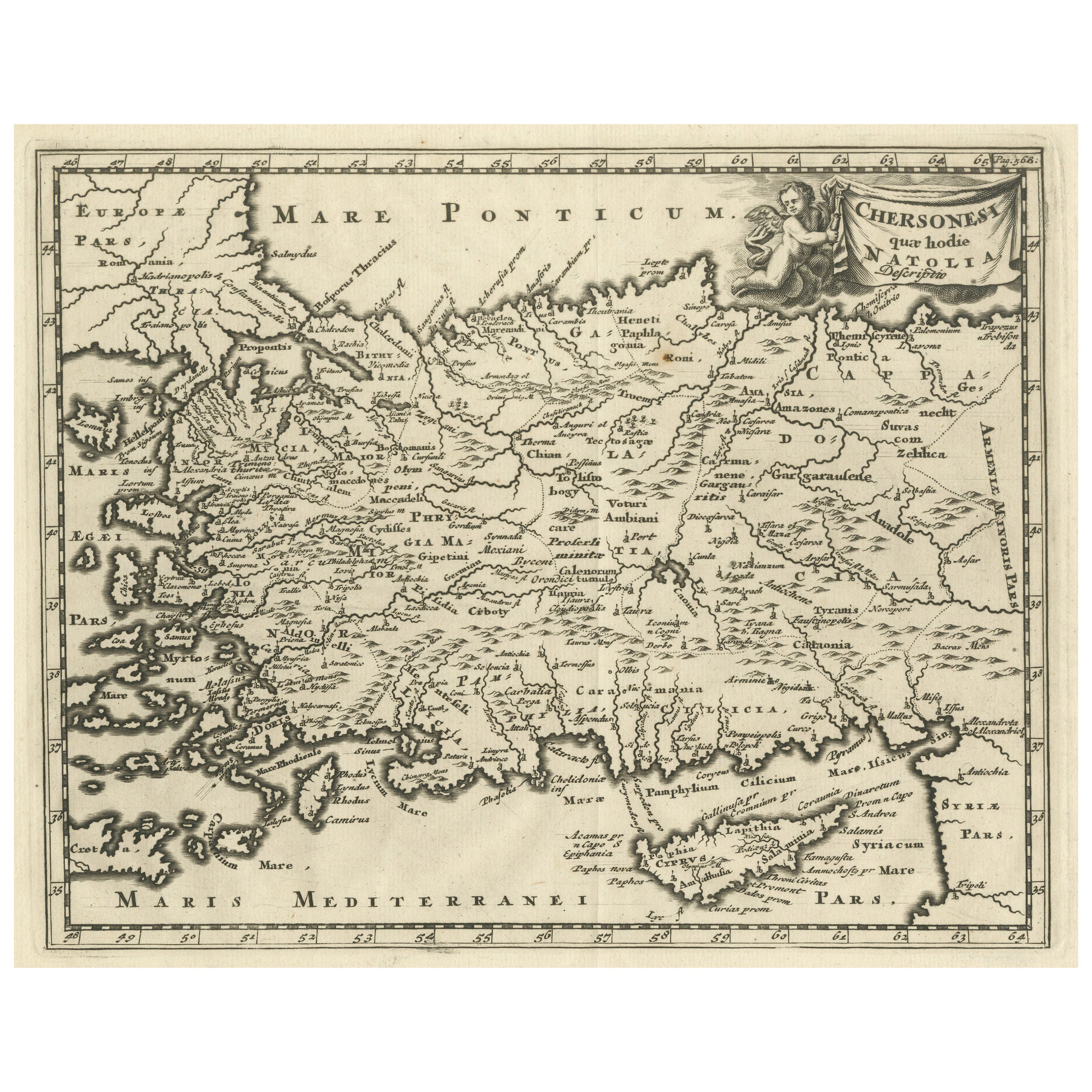
- Antique Map of Asia Minor including part of the Greek Archipelago and CyprusLocated in Langweer, NLAntique map titled 'Chersonesi quae hodie Natolia Descriptio'. Decorative, smaller map of Asia Minor including part of the Greek Archipelago and Cyprus. The drape-style title cartouc...Category
Antique Mid-18th Century Maps
MaterialsPaper
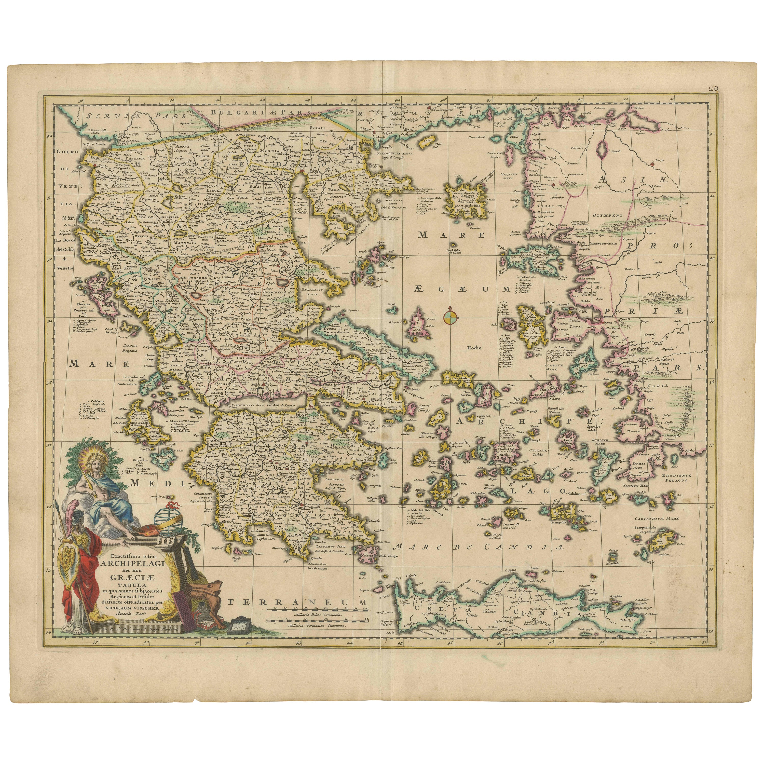
- Scarce Antique Map of Greece, the Aegean, Crete and part of Asia MinorLocated in Langweer, NLOriginal antique map titled 'Exactissima totius Archipelagi nec non Graeciae Tabula'. Visscher's scarce map of the Greek Islands, the Aegean, Crete and part of Asia Minor. Published circa 1680. Among the many great Dutch map publishers active in the seventeenth century were the Visscher family; the firm was begun by Claes Jansz Visscher...Category
Antique Late 17th Century Maps
MaterialsPaper
- Antique Map of Turkey in Asia 'Asia Minor', 1841Located in Langweer, NLAntique map titled 'Turkey in Asia'. Original antique map of Asia Minor (Turkey). Source unknown, to be determined. Artists and Engravers: Published by O...Category
Antique 19th Century Maps
MaterialsPaper
- Antique Map of Asia Minor, Cyprus, and the Eastern MediterraneanLocated in Langweer, NLAntique map titled 'Natoliae quae olim Asia Minor nova descriptio'. Original antique map of Asia Minor, Cyprus, and the eastern Mediterranean. Originally published on one sheet toget...Category
Antique Early 17th Century Maps
MaterialsPaper
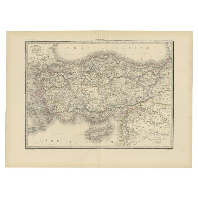
- Antique Map of Asia Minor by Lapie, 1842Located in Langweer, NLAntique map titled 'Carte de l'Asie Mineure Ancienne (..)'. Map of Asia Minor, also called Anatolia or Turkish Anadolu. This map originates from 'Atlas univ...Category
Antique 19th Century Maps
MaterialsPaper
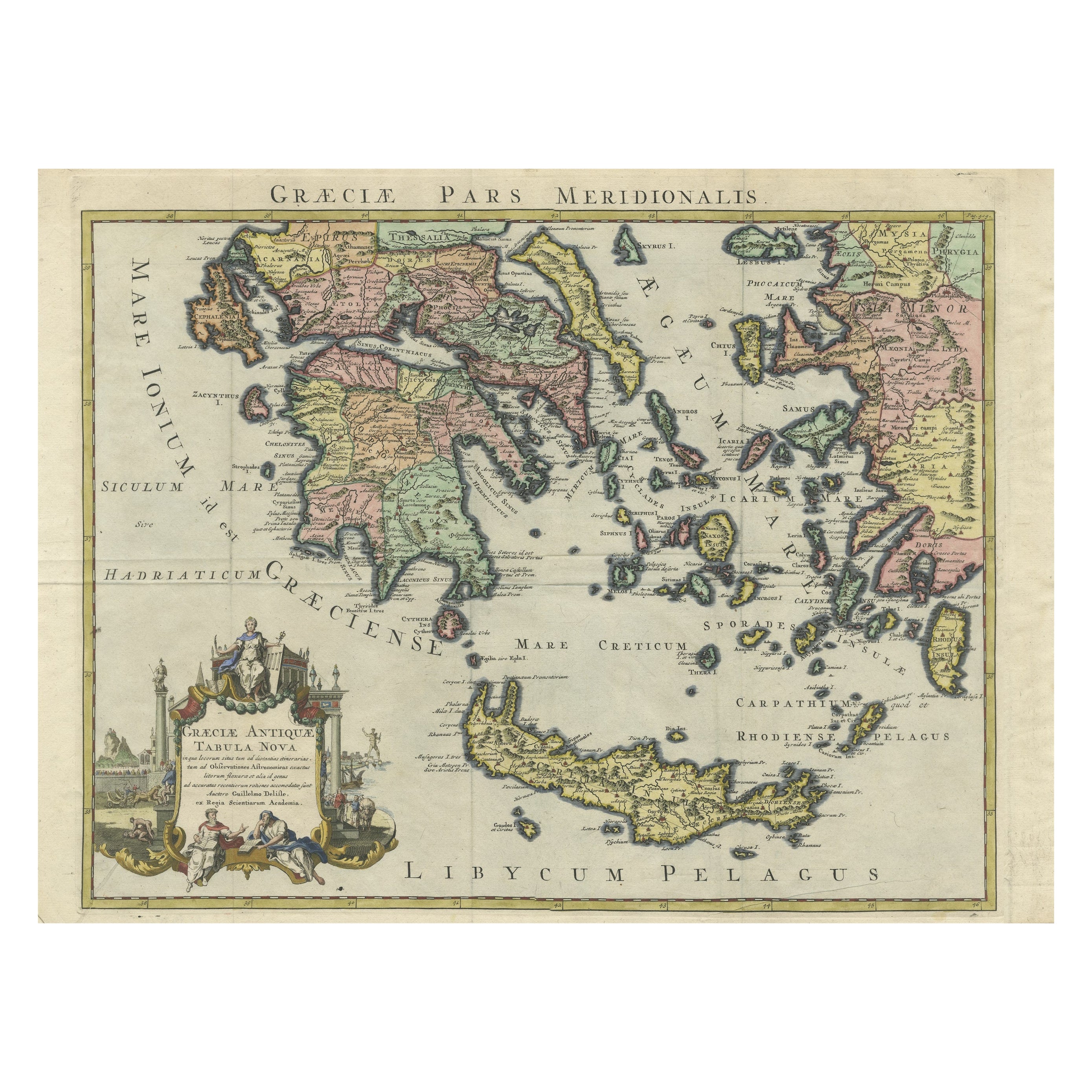
- Antique Map of Greece and Crete, Rhodus and A Part of Asia Minor , ca. 1730Located in Langweer, NLAntique engraved map of Greece. Title: "GRÆCIÆ ANTIQUÆ Tabula Nova". Year: c. 1730. Coloured engraved map by G. Delisle of Greece and Part of the Aegean. Condition is good. Sm...Category
Antique 1720s Maps
MaterialsPaper

You May Also Like
- Hand-Colored 18th Century Homann Map of the Black Sea, Turkey and Asia MinorBy Johann Baptist HomannLocated in Alamo, CAAn attractive original early 18th century hand-colored map of the Black Sea and Turkey entitled "Carte de L'Asie Minevre ou de la Natolie et du Pont Evxin Tiree des Voyages et des Ob...Category
Antique Early 18th Century German Maps
MaterialsPaper
- Original Antique Map of Asia. C.1780Located in St Annes, LancashireGreat map of Asia Copper-plate engraving Published C.1780 Two small worm holes to right side of map Unframed.Category
Antique Early 1800s English Georgian Maps
MaterialsPaper

- Original Antique Map of Ancient Greece, Achaia, Corinth, 1786Located in St Annes, LancashireGreat map of Ancient Greece. Showing the region of Thessaly, including Mount Olympus Drawn by J.D. Barbie Du Bocage Copper plate engraving by P.F Tardieu Original hand color...Category
Antique 1780s French Other Maps
MaterialsPaper
- Original Antique Map of Ancient Greece- Boeotia, Thebes, 1787Located in St Annes, LancashireGreat map of Ancient Greece. Showing the region of Boeotia, including Thebes Drawn by J.D. Barbie Du Bocage Copper plate engraving by P.F T...Category
Antique 1780s French Other Maps
MaterialsPaper
- Original Antique Map of South East Asia, Arrowsmith, 1820Located in St Annes, LancashireGreat map of South East Asia Drawn under the direction of Arrowsmith Copper-plate engraving Published by Longman, Hurst, Rees, Orme and Brown, 1820 Unframed.Category
Antique 1820s English Maps
MaterialsPaper
- Antique Coaching Road Map, Devon, English, Regional Cartography, Georgian, 1720Located in Hele, Devon, GBThis is an antique coaching road map of Devon. An English, framed lithograph engraving of regional interest, dating to the early 18th century and later. Fascinating 18th century hig...Category
Antique Early 18th Century British Georgian Maps
MaterialsWood


