Items Similar to Antique Map Centered on Turkestan, Including the Black and Caspian Seas, 1749


Want more images or videos?
Request additional images or videos from the seller
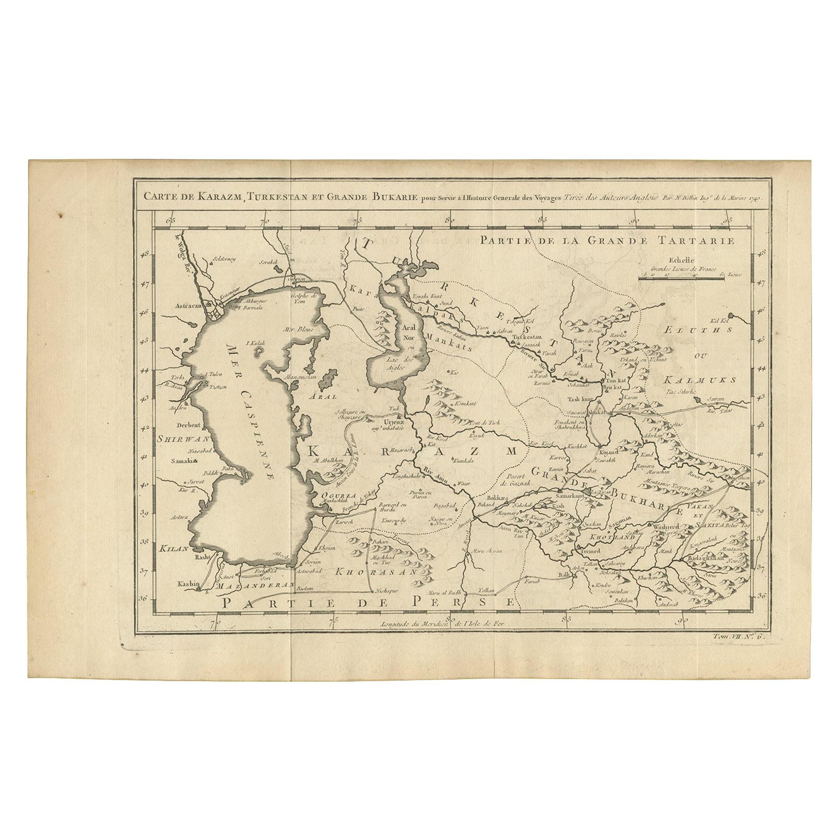
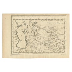
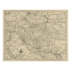
Antique Map Centered on Turkestan, Including the Black and Caspian Seas, 1749
About the Item
Antique map titled 'Carte De Karazm, Turkestan Et Grande Bukarie'.
Original antique map centered on Turkestan. Extends to include the Black and Caspian Seas, Uzbekistan, Tajikistan, Turkmenistan, and the northern reaches of Iran and Afghanistan. This map originates from 'Histoire générale des Voyages'.
Artists and Engravers: Jacques-Nicolas Bellin (1703 - 1772) was one of the most important cartographers of the 18th century. With a career spanning some 50 years, Bellin is best understood as geographe de cabinet and transitional mapmaker spanning the gap between 18th and early 19th century cartographic styles. His long career as Hydrographer and Ingénieur Hydrographe at the French Dépôt des cartes et plans de la Marine resulted in hundreds of high quality nautical charts of practically everywhere in the world. A true child of the Enlightenment Era, Bellin's work focuses on function and accuracy tending in the process to be less decorative than the earlier 17th and 18th century cartographic work. Unlike many of his contemporaries, Bellin was always careful to cite his references and his scholarly corpus consists of over 1400 articles on geography prepared for Diderot's Encyclopedie. Bellin, despite his extraordinary success, may not have enjoyed his work, which is described as ""long, unpleasant, and hard."" In addition to numerous maps and charts published during his lifetime, many of Bellin's maps were updated (or not) and published posthumously. He was succeeded as Ingénieur Hydrographe by his student, also a prolific and influential cartographer, Rigobert Bonne.
Condition: Good, given age. Original folds, as issued. Some age related toning. Please study scan carefully.
Date: 1749
Overall size: 37.3 x 25.3 cm
Image size: 32.8 x 22.8 cm.
- Dimensions:Height: 9.97 in (25.3 cm)Width: 14.69 in (37.3 cm)Depth: 0 in (0.01 mm)
- Materials and Techniques:
- Period:
- Date of Manufacture:1749
- Condition:Condition: Good, given age. Original folds, as issued. Some age related toning. Please study scan carefully.
- Seller Location:Langweer, NL
- Reference Number:
About the Seller
5.0
Platinum Seller
These expertly vetted sellers are 1stDibs' most experienced sellers and are rated highest by our customers.
Established in 2009
1stDibs seller since 2017
1,957 sales on 1stDibs
Typical response time: <1 hour
- ShippingRetrieving quote...Ships From: Langweer, Netherlands
- Return PolicyA return for this item may be initiated within 14 days of delivery.
More From This SellerView All
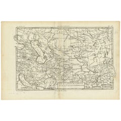
- Antique Map of Khwarezm, Turkestan and Great Bukhara by Bellin, '1749'Located in Langweer, NLAntique map titled 'Carte de Karazm, Turkestan, et Grande Bukarie'. Original antique map of Khwarezm, Turkestan and Great Bukhara. Engraved by J.N. Bellin for 'Histoire Générale des ...Category
Antique Mid-18th Century Maps
MaterialsPaper
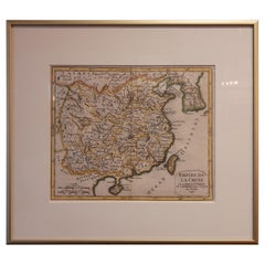
- Antique Map of China Including Korea and Taiwan by Vaugondy, 1749Located in Langweer, NLAntique map titled 'Empire de la Chine'. Beautiful map of China including Korea and Taiwan (Formosa). This map originates from 'Atlas Universel (..)' by Gilles Robert de Vaugondy, 17...Category
Antique Mid-18th Century Maps
MaterialsPaper
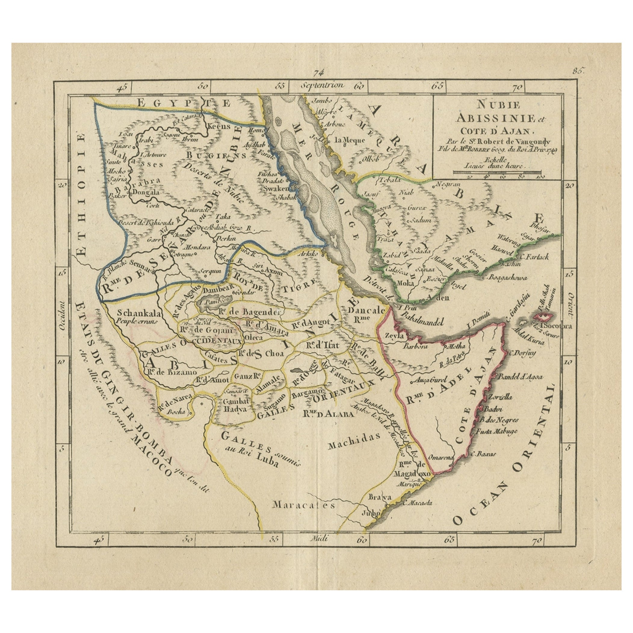
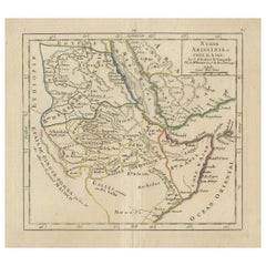
- Original Antique Map of Abyssinia, Sudan and the Red Sea, 1749Located in Langweer, NLAntique map titled 'Nubie, Abissinie et Cote d'Ajan'. Map of Abyssinia, Sudan and the Red Sea by Robert Vaugondy. Covers from Arabia and Egypt south to Mogadishu and includes parts...Category
Antique 1740s Maps
MaterialsPaper
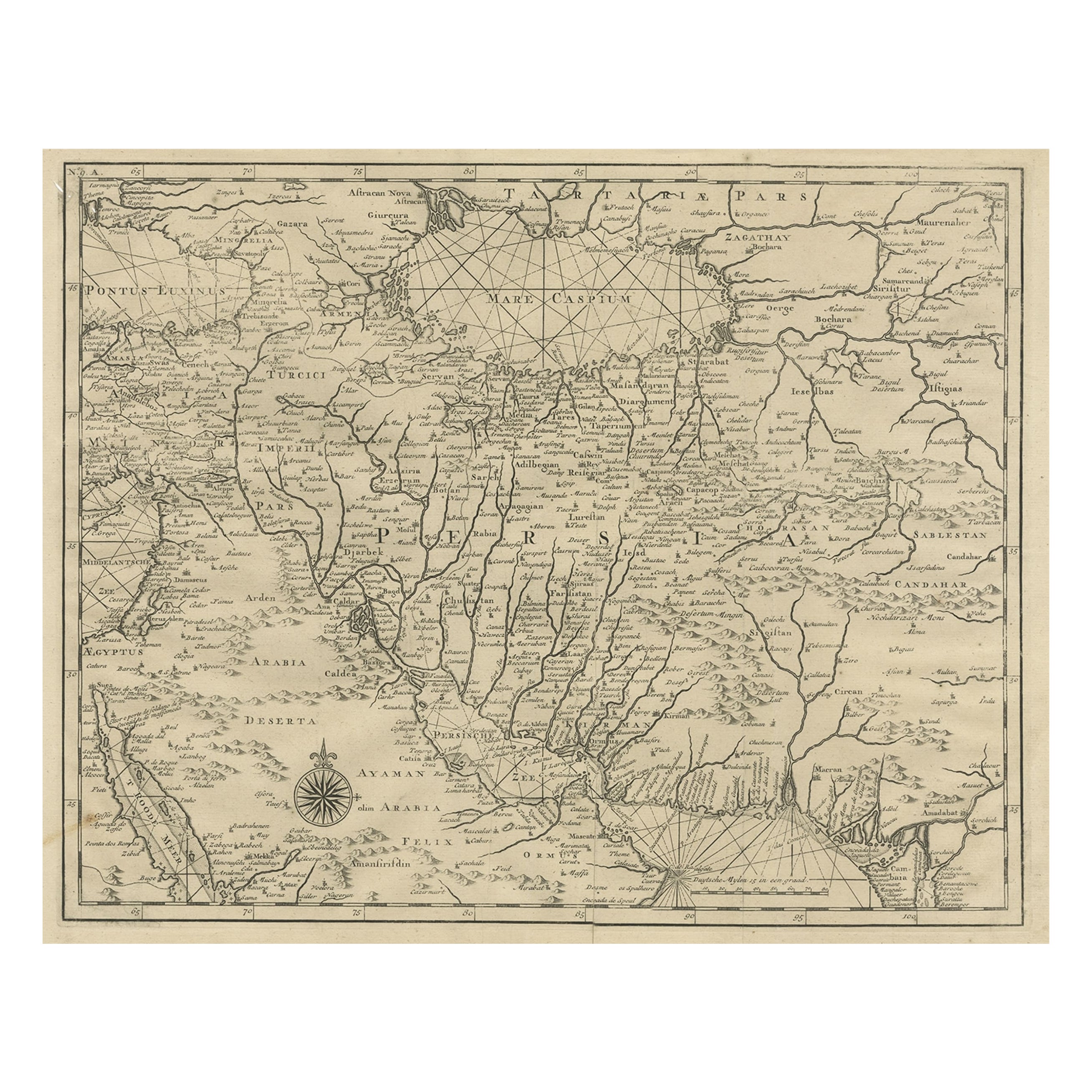
- Antique Map of the Caspian Sea, Uzbekistan, Northern Persia Etc, C.1735Located in Langweer, NLAntique map titled 'Nova Maris Caspii et Regions Usbeck (..).' Detailed map of Central Asia centered on the Caspian Sea, showing Uzbekistan to the east of ...Category
Antique 18th Century Maps
MaterialsPaper
- Rare Antique Map of Persia, Incl the Caspian Sea and the Arabian Peninsula, 1726Located in Langweer, NLRare untitled antique map of Persia. It covers from the Gulf of Suez eastward to Ahmedabad (Amadabad) in modern day western India. This map, centered on Persia, includes the Caspian Sea and part of the Arabian Peninsula...Category
Antique 1720s Maps
MaterialsPaper
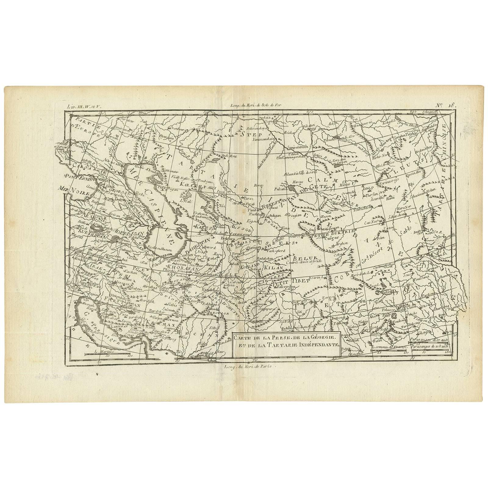
- Antique Map of the Persian Gulf and Caspian Sea Region by R. Bonne, 1780Located in Langweer, NLAntique print titled 'Carte de la Perse, de la Georgie, et de la Tartarie Independante'. Shows the region from the Persian Gulf and Caspian Sea in the wes...Category
Antique Late 18th Century Maps
MaterialsPaper
You May Also Like
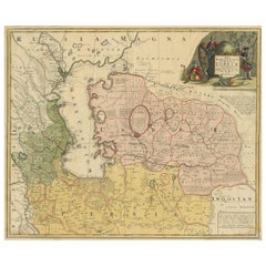
- Hand Colored 18th Century Homann Map of Austria Including Vienna and the DanubeBy Johann Baptist HomannLocated in Alamo, CA"Archiducatus Austriae inferioris" is a hand colored map of Austria created by Johann Baptist Homann (1663-1724) and published in Nuremberg, Germany in 1728 shortly after his death. ...Category
Antique Early 18th Century German Maps
MaterialsPaper
- Hand-Colored 18th Century Homann Map of the Black Sea, Turkey and Asia MinorBy Johann Baptist HomannLocated in Alamo, CAAn attractive original early 18th century hand-colored map of the Black Sea and Turkey entitled "Carte de L'Asie Minevre ou de la Natolie et du Pont Evxin Tiree des Voyages et des Ob...Category
Antique Early 18th Century German Maps
MaterialsPaper
- 18th Century Hand-Colored Homann Map of Germany, Including Frankfurt and BerlinBy Johann Baptist HomannLocated in Alamo, CAAn 18th century hand-colored map entitled "Tabula Marchionatus Brandenburgici et Ducatus Pomeraniae quae sunt Pars Septentrionalis Circuli Saxoniae Superioris" by Johann Baptist Homa...Category
Antique Early 18th Century German Maps
MaterialsPaper
- Vintage "View of the Center of Paris Taken from the Air" Lithograph MapLocated in San Diego, CAA very stylish "View of the Center of Paris Taken from the Air" lithograph map published by the Paris Ministry of Tourism, circa early 1950s. The piece measures 27" x 43" and shows...Category
20th Century French Mid-Century Modern Prints
MaterialsPaper
- Hand-Colored 18th Century Homann Map of Denmark and Islands in the Baltic SeaBy Johann Baptist HomannLocated in Alamo, CAAn 18th century copper plate hand-colored map entitled "Insulae Danicae in Mari Balthico Sitae utpote Zeelandia, Fionia, Langelandia, Lalandia, Falstria, Fembria Mona" created by Joh...Category
Antique Early 18th Century German Maps
MaterialsPaper
- Original Antique Map of The World by Thomas Clerk, 1817Located in St Annes, LancashireGreat map of The Eastern and Western Hemispheres On 2 sheets Copper-plate engraving Drawn and engraved by Thomas Clerk, Edinburgh. Published by Mackenzie And Dent, 1817 ...Category
Antique 1810s English Maps
MaterialsPaper


Recently Viewed
View AllMore Ways To Browse
Sea Antique
Turkestan Antique
Antique Sea Map
Antique Sea Maps
Sea Map
Marine 18th Century
Antique Maps And Charts
Grande Date
Extendable Trolley
Antique Style Map
La Marine Antique
Caspian Sea
19th Century Corpus
Antique Style Trolley
Map Cabinet
18th Century French Child Furniture
Antique Plan Cabinet
Northern France Map