Items Similar to Antique Map of the Coast of Guinea and the Cape Verde Islands


Want more images or videos?
Request additional images or videos from the seller
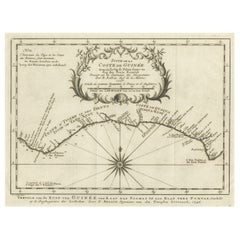
Antique Map of the Coast of Guinea and the Cape Verde Islands
About the Item
Antique map titled 'Carte de la Guinée (..)'. This map was originally part of a 2 sheet larger map of Eastern Africa, showing the Cape Verde Islands and Senegal. This map originates from 'Atlas Moderne ou Collection de Cartes (..)' by R. Bonne. Published circa 1781.
- Dimensions:Height: 19.97 in (50.7 cm)Width: 14.69 in (37.3 cm)Depth: 0.02 in (0.5 mm)
- Materials and Techniques:
- Period:
- Date of Manufacture:circa 1781
- Condition:Wear consistent with age and use. General age-related toning. Original folding line. Later hand coloring. Minor wear and foxing, blank verso. Please study image carefully.
- Seller Location:Langweer, NL
- Reference Number:
About the Seller
5.0
Platinum Seller
These expertly vetted sellers are 1stDibs' most experienced sellers and are rated highest by our customers.
Established in 2009
1stDibs seller since 2017
1,949 sales on 1stDibs
Typical response time: <1 hour
- ShippingRetrieving quote...Ships From: Langweer, Netherlands
- Return PolicyA return for this item may be initiated within 14 days of delivery.
More From This SellerView All
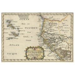
- Antique Map of the West African Coast and the Cape Verde Islands, c.1680Located in Langweer, NLAntique map Africa titled 'Isles du Cap Verd Coste et Pays des Negres'. Antique map of the coast of Africa and the Cape Verde islands. Artists a...Category
Antique 17th Century Maps
MaterialsPaper
- Antique Map of the Coast of Africa and the Cape Verde Islands, ca.1680Located in Langweer, NLAntique map Africa titled 'Isles du Cap Verd Coste et Pays des Negres'. Antique map of the coast of Africa and the Cape Verde islands. Artis...Category
Antique 1680s Maps
MaterialsPaper
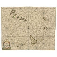
- Original Antique Map of the Cape Verde Islands, 1746Located in Langweer, NLAntique map titled 'Carte Des Isles Du Cap Verd.' Original antique map of the Cape Verde Islands. Decorative cartouche and compass rose. Extends from Isle d...Category
Antique 18th Century Maps
MaterialsPaper
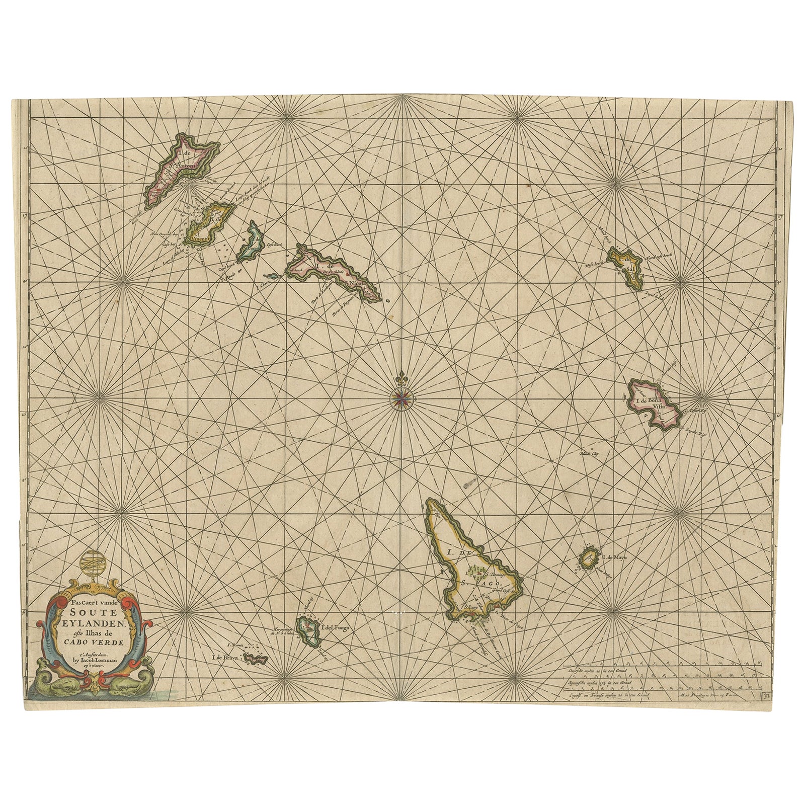
- Antique Map of the Cape Verde Islands, Africa, ca.1670Located in Langweer, NLAntique map titled 'Pascaert van de Soute Eylanden ofte Ilhas de Cabo Verde'. This map depicts the Cape Verde Islands (Africa). Islands titled 'Ile de B...Category
Antique 1670s Maps
MaterialsPaper
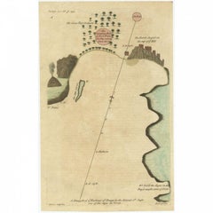
- Antique Map of the Harbour of Praia, Santiago Island, Cape Verde, c.1750Located in Langweer, NLAntique map titled 'A Draught of ye Harbour of Praya in the Island St. Jago (..)'. Uncommon map showing the harbour of Praia on Santiago Island, Cape Verde. Source unknown, to be det...Category
Antique 18th Century Maps
MaterialsPaper
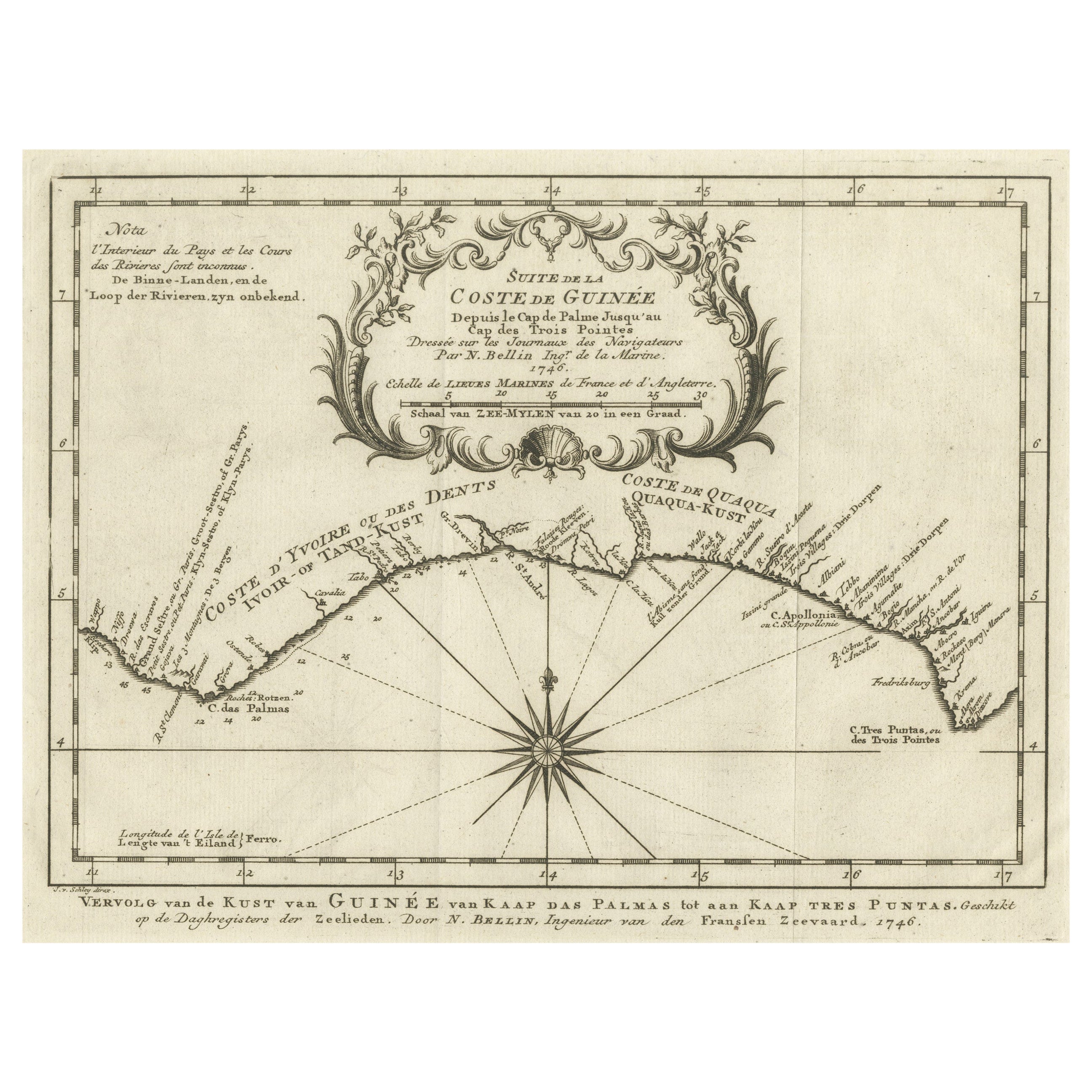
- Antique Map of the Coast of Guinea from, Cape Apollonia to the Volta RiverLocated in Langweer, NLAntique map titled 'Suite de la Coste de Guinée (..) - Vervolg van de Kust van Guinée (..)'. Decorative map of the coast of Guinea from, Cape Apollonia to the Volta River. Engraved b...Category
Antique Mid-18th Century Maps
MaterialsPaper


You May Also Like
- West Coast of Africa, Guinea & Sierra Leone: An 18th Century Map by BellinBy Jacques-Nicolas BellinLocated in Alamo, CAJacques Bellin's copper-plate map entitled "Partie de la Coste de Guinee Dupuis la Riviere de Sierra Leona Jusquau Cap das Palmas", depicting the coast of Guinea and Sierra Leone in ...Category
Antique Mid-18th Century French Maps
MaterialsPaper
- Hand-Colored 18th Century Homann Map of Denmark and Islands in the Baltic SeaBy Johann Baptist HomannLocated in Alamo, CAAn 18th century copper plate hand-colored map entitled "Insulae Danicae in Mari Balthico Sitae utpote Zeelandia, Fionia, Langelandia, Lalandia, Falstria, Fembria Mona" created by Joh...Category
Antique Early 18th Century German Maps
MaterialsPaper
- Map of the Republic of GenoaLocated in New York, NYFramed antique hand-coloured map of the Republic of Genoa including the duchies of Mantua, Modena, and Parma. Europe, late 18th century. Dimension: 25...Category
Antique Late 18th Century European Maps
- Antique Map of Principality of MonacoBy Antonio Vallardi EditoreLocated in Alessandria, PiemonteST/619 - "Old Geographical Atlas of Italy - Topographic map of ex-Principality of Monaco" - ediz Vallardi - Milano - A somewhat special edition ---Category
Antique Late 19th Century Italian Other Prints
MaterialsPaper
- Italy, Sicily, Sardinia, Corsica and Dalmatian Coast: A 17th Century Dutch MapBy Theodorus DanckertsLocated in Alamo, CAThis hand colored 17th century Dutch map entitled "Novissima et Accuratissima totius Italiae Corsicae et Sardiniae Descriptio" by Theodore Danckerts depicts the Italian Peninsula in ...Category
Antique Late 17th Century Dutch Maps
MaterialsPaper
- Original Antique Map of The World by Thomas Clerk, 1817Located in St Annes, LancashireGreat map of The Eastern and Western Hemispheres On 2 sheets Copper-plate engraving Drawn and engraved by Thomas Clerk, Edinburgh. Published by Mackenzie And Dent, 1817 ...Category
Antique 1810s English Maps
MaterialsPaper


Recently Viewed
View AllMore Ways To Browse
Office Cart
Cape Antique Furniture
Antique Africa Maps And Atlases Africa Maps
Island Cart
Bonne Map
Cape Verde
R Cart
Antique Furniture Missouri
Roman Map
Antique Marine Maps
Antique Indian Maps
Antique Africa Maps And Atlases Africa Maps
Antique Map California
Map Of Sweden
Antique Maps California
Antique Map Of California
Antique Maps Of California
Expedition Map