Items Similar to Antique Map of the Duchy of Westphalia, Germany

Want more images or videos?
Request additional images or videos from the seller
1 of 6
Antique Map of the Duchy of Westphalia, Germany
About the Item
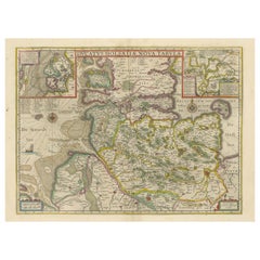
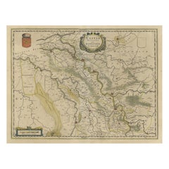
Original antique map titled 'Westphalia Ducatus'. Fine map of the Duchy of Westphalia, Germany. The map is centered on Meschede and includes Arensberg, Beelick, and Brilon. Published by G. Blaeu, circa 1640.
- Dimensions:Height: 19.3 in (49 cm)Width: 22.84 in (58 cm)Depth: 0.02 in (0.5 mm)
- Materials and Techniques:Paper,Engraved
- Period:Mid-17th Century
- Date of Manufacture:circa 1640
- Condition:Wear consistent with age and use. General age-related toning. Original / contemporary hand coloring. Few stains. Latin text on verso. Few pieces of tape on verso. Minor wear, please study image carefully.
- Seller Location:Langweer, NL
- Reference Number:
About the Seller
5.0
Platinum Seller
These expertly vetted sellers are 1stDibs' most experienced sellers and are rated highest by our customers.
Established in 2009
1stDibs seller since 2017
1,957 sales on 1stDibs
Typical response time: <1 hour
- ShippingRetrieving quote...Ships From: Langweer, Netherlands
- Return PolicyA return for this item may be initiated within 14 days of delivery.
More From This SellerView All
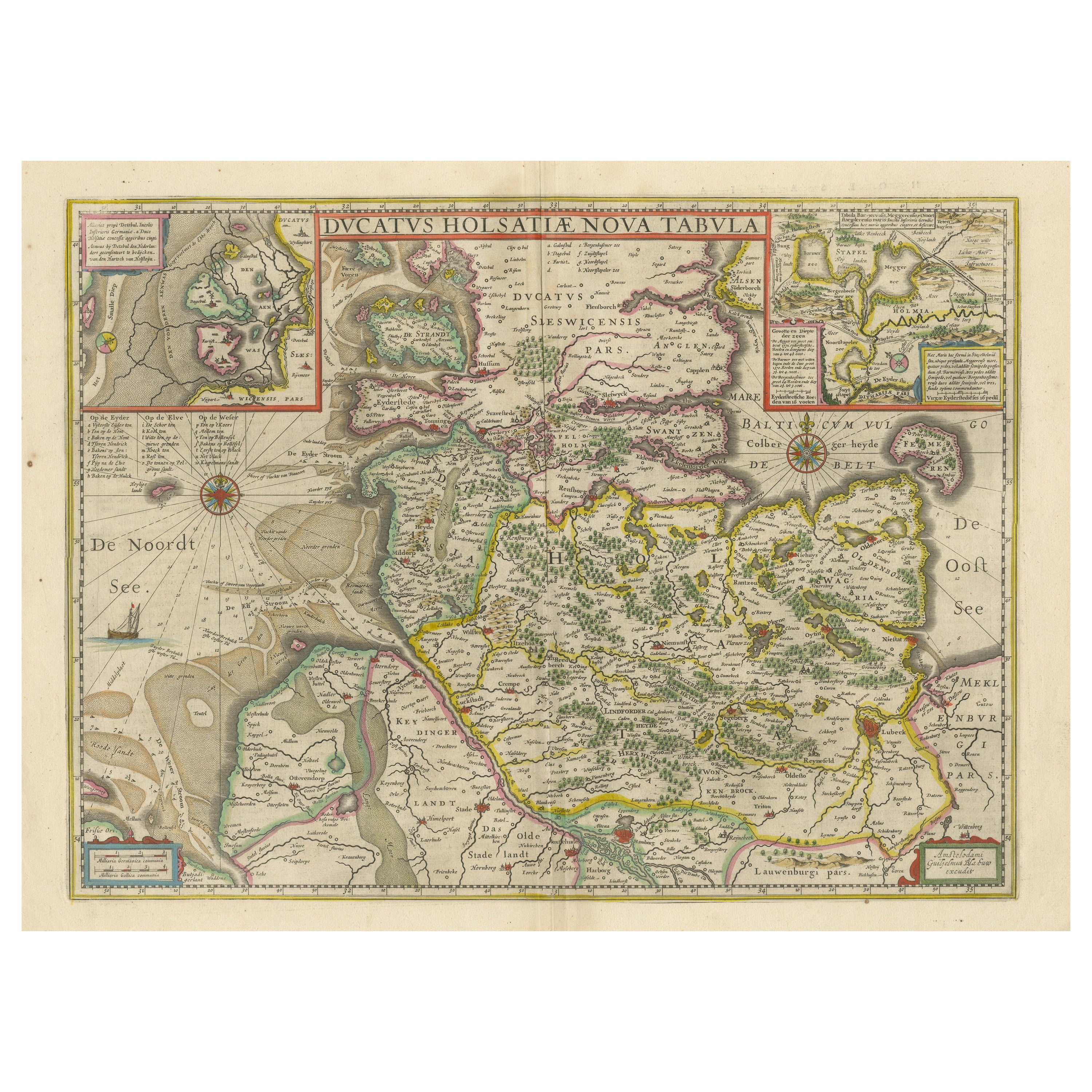
- Original Antique Map of the Duchy of HolsteinBy Willem BlaeuLocated in Langweer, NLAntique map titled 'Ducatus Holsatiae Nova Tabula'. Original old map of the Duchy of Holstein, the northernmost territory of the Holy Roman Empire, from the mid-17th Century. To the ...Category
Antique Mid-17th Century Maps
MaterialsPaper
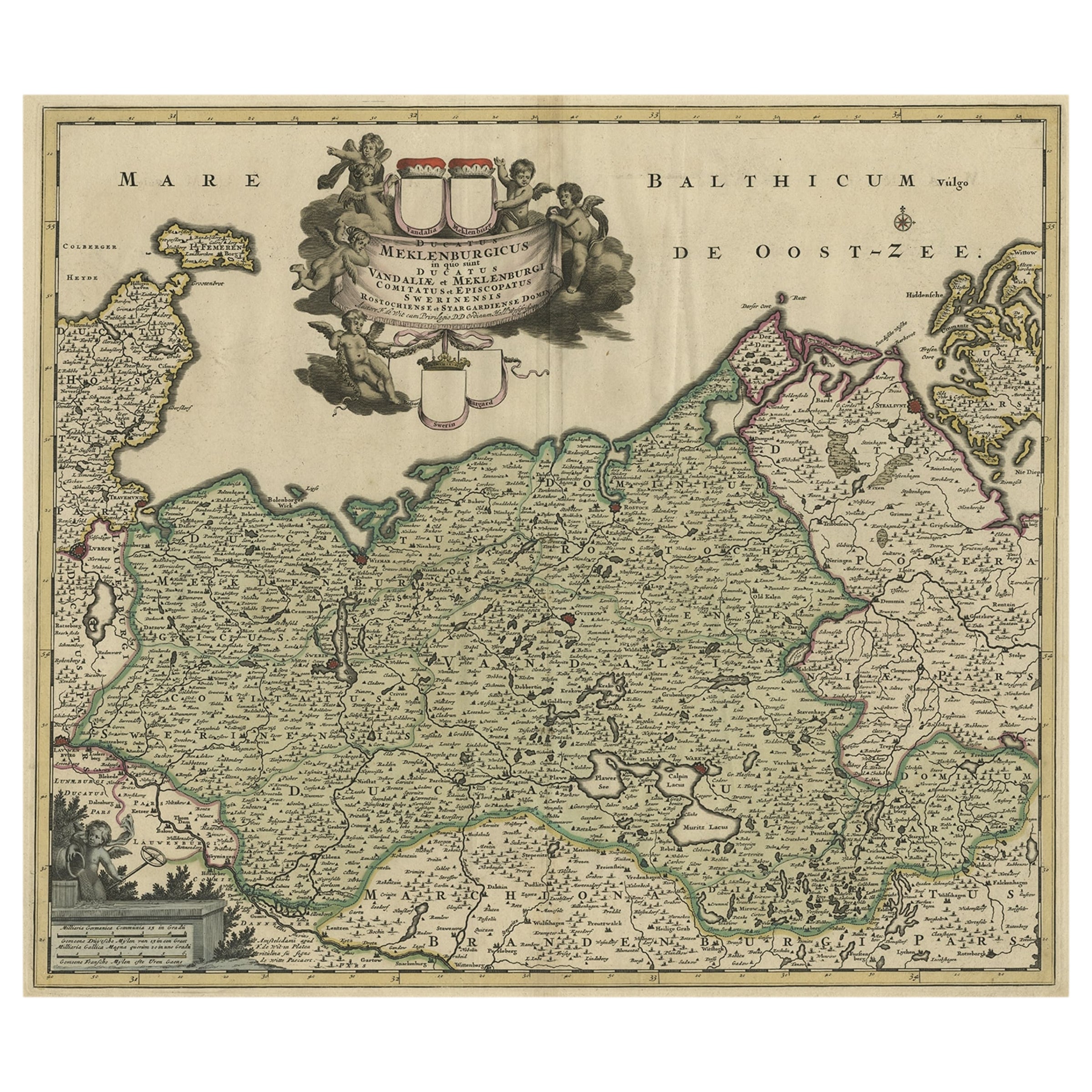
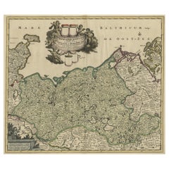
- A Handsome & Detailed Map of the Duchy of Mecklenburg & Pomerania, Germany, 1680Located in Langweer, NLAntique map titled 'Ducatus Meklenburgicus in quo sunt Ducatus Vandaliae et Meklenburgi Ducatus et Comitatus Swerinensis.' A handsome and detailed map of the Duchy of Mecklenburg...Category
Antique 1680s Maps
MaterialsPaper
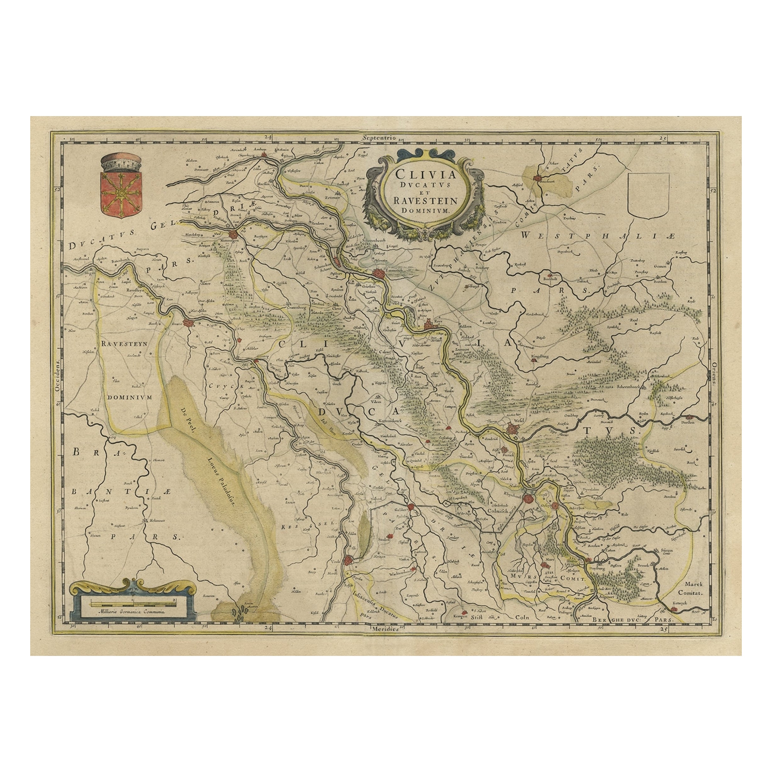
- Map of the Duchy Clivia & Ravestein, Brabant in The Netherlands & Germany, 1635Located in Langweer, NLAntique map titled 'Clivia Ducatus et Ravestein Dominium.' Map of the Duchy Clivia and Ravestein, part of Brabant in The Nethe...Category
Antique 1630s Maps
MaterialsPaper
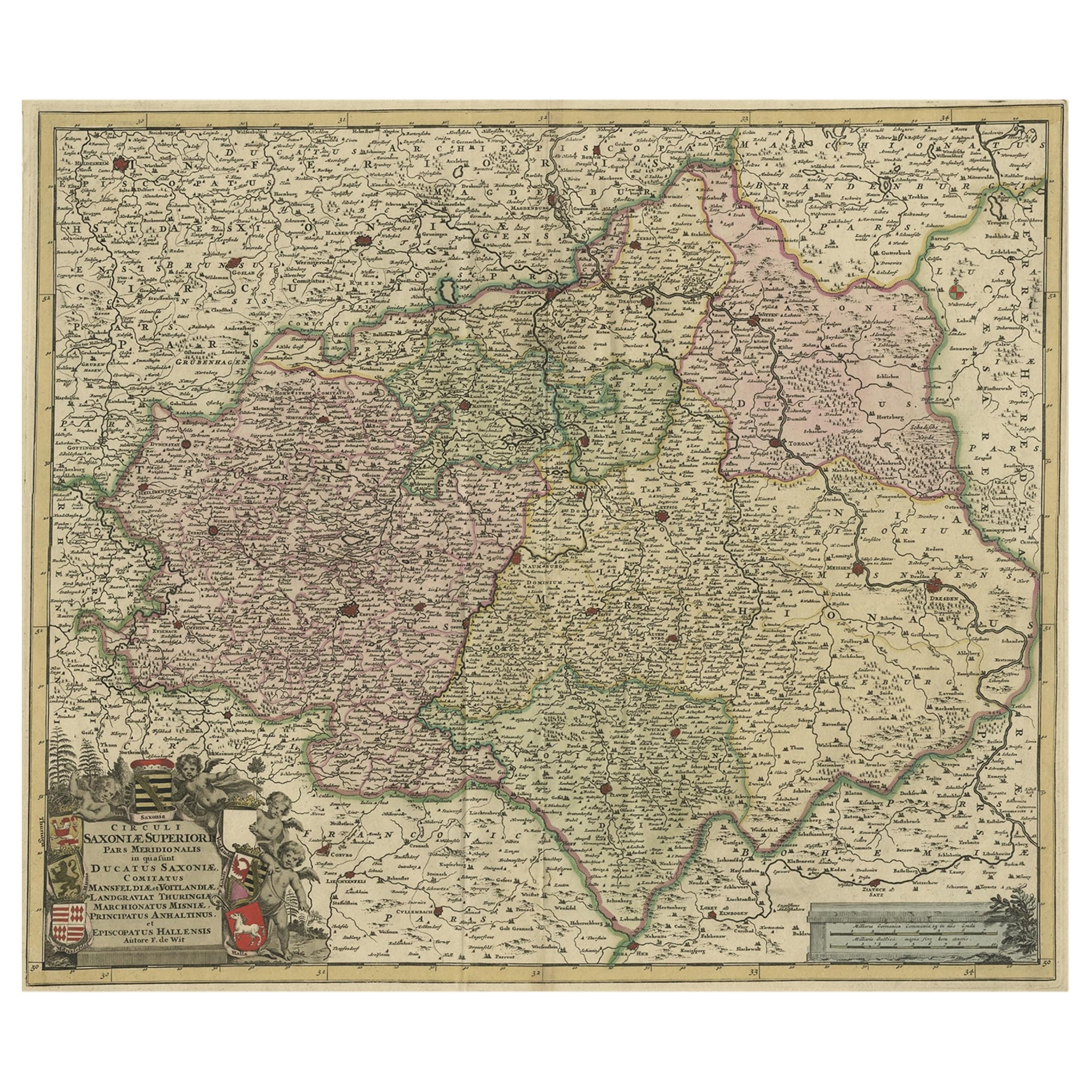
- Old Detailed Map of the Historical Regions of the Duchy of Saxony, Germany, 1680Located in Langweer, NLAntique map titled 'Circuli Saxoniae Superior Pars Meridionalis in qua sunt Ducatus Saxoniae, Comitatus Mansfeldiae, et Voitlandiae, Landgraviat Thuringiae, Marchionatus Misniae Prin...Category
Antique 1680s Maps
MaterialsPaper
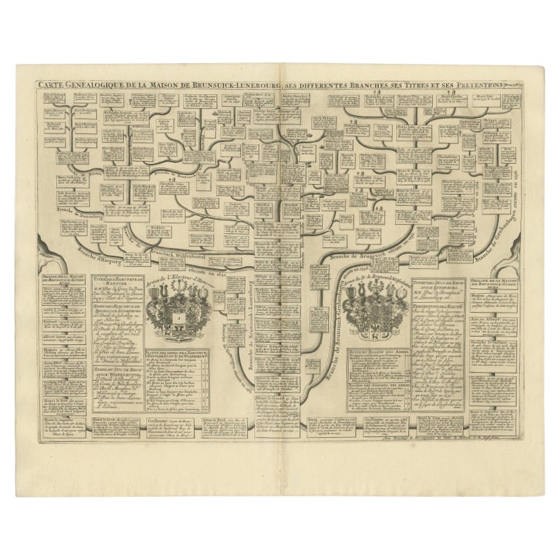
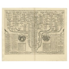
- Antique Genealogy Chart of the Duchy of Brunswick-Luneburg, Germany, 1732Located in Langweer, NLAntique print titled 'Carte Genealogique de la Maison de Brunsuick-Lunebourg'. Genealogy of the Duchy of Brunswick-Luneburg. With coats of arms of the Elector of Hannover and the Duc...Category
Antique 18th Century Prints
MaterialsPaper
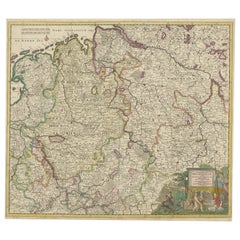
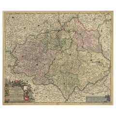
- Antique Map of the Westphalia region of GermanyLocated in Langweer, NLAntique map titled 'Circulus Westphaliae (..)'. Original old map of the Westphalia region, Germany. Published by Justus Danckerts, circa 1696. Justus Danckerts I (11 November 1635 ...Category
Antique Late 17th Century Maps
MaterialsPaper
You May Also Like
- Map of the Republic of GenoaLocated in New York, NYFramed antique hand-coloured map of the Republic of Genoa including the duchies of Mantua, Modena, and Parma. Europe, late 18th century. Dimension: 25...Category
Antique Late 18th Century European Maps
- Antique Map of Principality of MonacoBy Antonio Vallardi EditoreLocated in Alessandria, PiemonteST/619 - "Old Geographical Atlas of Italy - Topographic map of ex-Principality of Monaco" - ediz Vallardi - Milano - A somewhat special edition ---Category
Antique Late 19th Century Italian Other Prints
MaterialsPaper
- Original Antique Map of The World by Thomas Clerk, 1817Located in St Annes, LancashireGreat map of The Eastern and Western Hemispheres On 2 sheets Copper-plate engraving Drawn and engraved by Thomas Clerk, Edinburgh. Published by Mackenzie And Dent, 1817 ...Category
Antique 1810s English Maps
MaterialsPaper
- Antique 18th Century Map of the Province of Pensilvania 'Pennsylvania State'Located in Philadelphia, PAA fine antique of the colony of Pennsylvania. Noted at the top of the sheet as a 'Map of the province of Pensilvania'. This undated and anonymous map is thought to be from the Gentleman's Magazine, London, circa 1775, although the general appearance could date it to the 1760's. The southern boundary reflects the Mason-Dixon survey (1768), the western boundary is placed just west of Pittsburgh, and the northern boundary is not marked. The map has a number of reference points that likely refer to companion text and appear to be connected to boundaries. The western and southern boundaries are marked Q, R, S, for example. A diagonal line runs from the Susquehanna R to the Lake Erie P. A broken line marked by many letters A, B, N, O, etc., appears in the east. There are no latitude or longitude markings, blank verso. Framed in a shaped contemporary gilt wooden frame and matted under a cream colored matte. Bearing an old Graham Arader Gallery...Category
Antique 18th Century British American Colonial Maps
MaterialsPaper
- Map "Estuary- Mouth of the Thames"Located in Alessandria, PiemonteST/426 - Antique French Map of the estuary of the Thames, map dated 1769 - "Mape of the entrance of the Thames. Designed by filing of Navy cards fo...Category
Antique Mid-18th Century French Other Prints
MaterialsPaper
- Germany West of the Rhine: A Hand-colored 18th Century Map by de WitBy Frederick de WitLocated in Alamo, CAThis original 18th century hand-colored map of the county of Moers, Germany entitled "Illustrissimo Celsissmo Principi GUILIELMO HENRICO D.G. Arausionum Principi Domino suo Clementis...Category
Antique Early 18th Century Dutch Maps
MaterialsPaper


Recently Viewed
View AllMore Ways To Browse
German 17th Century Furniture
17th Century German Furniture
Antique Furniture Missouri
Roman Map
Antique Indian Maps
Antique Marine Maps
Antique Africa Maps And Atlases Africa Maps
Antique Map California
Map Of Sweden
Antique Maps California
Antique Map Of California
Antique Maps Of California
Expedition Map
Scottish Coat Of Arms
California Antique Map
Ocean Decor
Antique Maps Of Long Island
Antique Map Of Long Island