Items Similar to Antique Map of the Forts and Town of St. Yago by Prévost, 1764

Want more images or videos?
Request additional images or videos from the seller
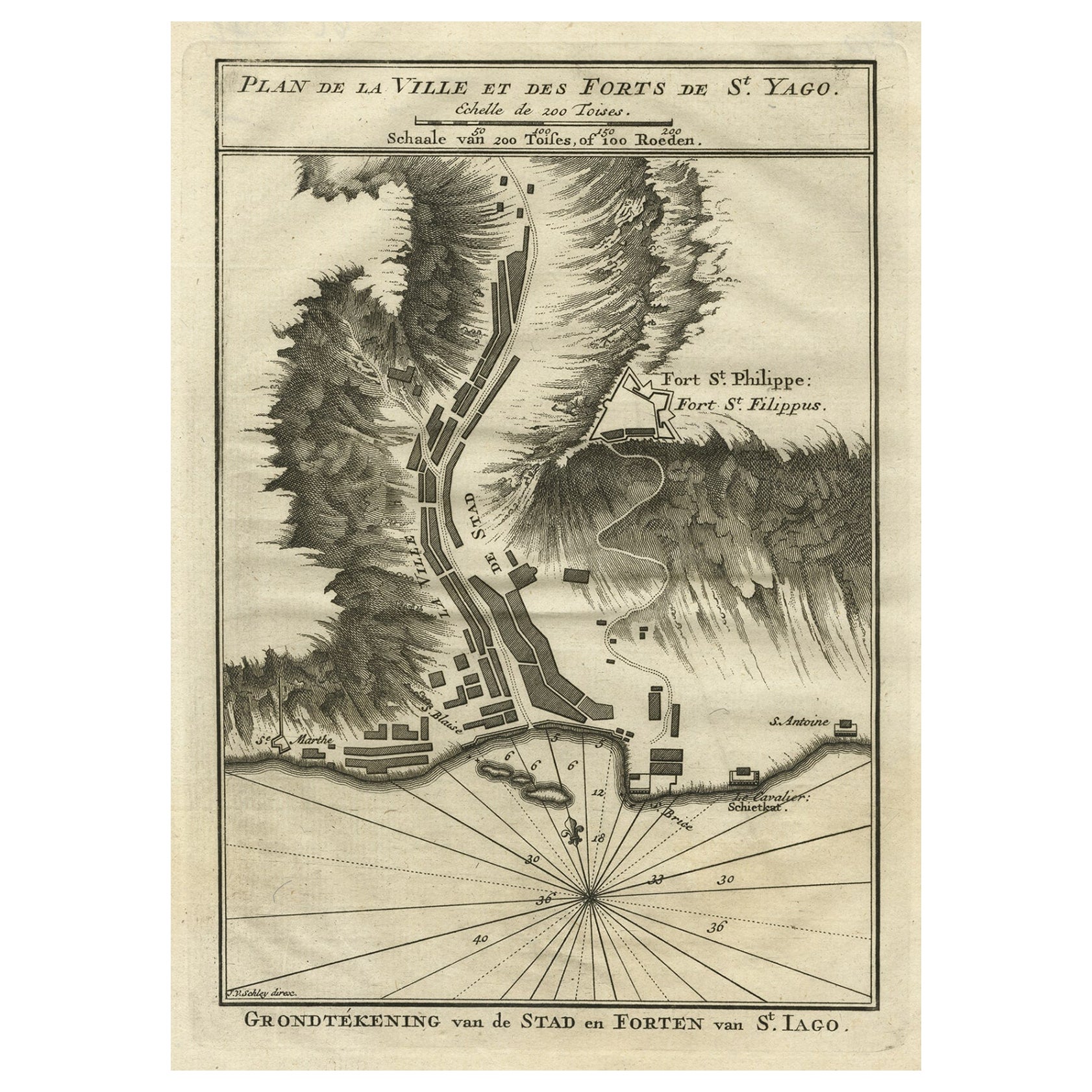
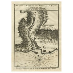
Antique Map of the Forts and Town of St. Yago by Prévost, 1764
About the Item
Antique map titled 'Plan de la Ville et des Forts de St. Yago'. Plan of the Forts and Town of St. Yago in the Cape Verde Islands. This map originates from 'Histoire generale des voyages (..)' by Antoine Francois Prevost d'Exile.
Artists and Engravers: Engraved by Jacques-Nicolas Bellin (1703 - 1772), one of the most important cartographers of the 18th century. With a career spanning some 50 years, Bellin is best understood as geographe de cabinet and transitional mapmaker spanning the gap between 18th and early 19th century cartographic styles. His long career as Hydrographer and Ingénieur Hydrographe at the French Dépôt des cartes et plans de la Marine resulted in hundreds of high quality nautical charts of practically everywhere in the world. A true child of the Enlightenment Era, Bellin's work focuses on function and accuracy tending in the process to be less decorative than the earlier 17th and 18th century cartographic work. Unlike many of his contemporaries, Bellin was always careful to cite his references and his scholarly corpus consists of over 1400 articles on geography prepared for Diderot's Encyclopedie. Bellin, despite his extraordinary success, may not have enjoyed his work, which is described as ""long, unpleasant, and hard."" In addition to numerous maps and charts published during his lifetime, many of Bellin's maps were updated (or not) and published posthumously. He was succeeded as Ingénieur Hydrographe by his student, also a prolific and influential cartographer, Rigobert Bonne.
Condition: Fair, given age. General age-related toning and/or occasional minor defects from handling. Water stain at the bottom of the print. Please study scan carefully.
Date: 1764
Overall size: 20 x 25.3 cm
Image size: 14.6 x 21.5 cm
We sell original antique maps to collectors, historians, educators and interior decorators all over the world. Our collection includes a wide range of authentic antique maps from the 16th to the 20th centuries. Buying and collecting antique maps is a tradition that goes back hundreds of years. Antique maps have proved a richly rewarding investment over the past decade, thanks to a growing appreciation of their unique historical appeal. Today the decorative qualities of antique maps are widely recognized by interior designers who appreciate their beauty and design flexibility. Depending on the individual map, presentation, and context, a rare or antique map can be modern, traditional, abstract, figurative, serious or whimsical. We offer a wide range of authentic antique maps for any budget.
- Creator:Jacques-Nicolas Bellin (Artist)
- Dimensions:Height: 9.97 in (25.3 cm)Width: 7.88 in (20 cm)Depth: 0 in (0.01 mm)
- Materials and Techniques:
- Period:
- Date of Manufacture:1764
- Condition:
- Seller Location:Langweer, NL
- Reference Number:Seller: BL-000681stDibs: LU3054327794172

Jacques-Nicolas Bellin
Jacques Nicolas Bellin (1703 –1772) was a French hydrographer (official cartographer) and a geographer. While still a teenager he became the chief cartographer to the French Navy and later to the king of France. Bellin created a large number of maps for Antoine François Prévost's (L'Abbe Prevost) 'Histoire Generale des Voyages', which was a 25 volume publication focused on 17th and 18th century exploration.It was published in French, Dutch and German. He also contributed maps and articles to the 35-volume Encyclopédie edited by Denis Diderot and Jean le Rond d'Alembert. He was part of the group called Philosophes, which included many of the great intellectuals of the Age of Enlightenment, including Voltaire, Rousseau and Montesquieu. Bellin died at Versailles in 1772.
About the Seller
5.0
Platinum Seller
These expertly vetted sellers are 1stDibs' most experienced sellers and are rated highest by our customers.
Established in 2009
1stDibs seller since 2017
1,956 sales on 1stDibs
Typical response time: <1 hour
- ShippingRetrieving quote...Ships From: Langweer, Netherlands
- Return PolicyA return for this item may be initiated within 14 days of delivery.
More From This SellerView All
- Antique Plan of the Forts and Town of St. Yago in the Cape Verde Islands, 1747By Jakob van der SchleyLocated in Langweer, NLAntique map titled 'Plan de la Ville et des Forts de St. Yago - Grondtekening van de Stad en Forten van St. Iago'. Plan of the Forts and Town of St. Yago in the Cape Verde Islands. T...Category
Antique 18th Century Maps
MaterialsPaper
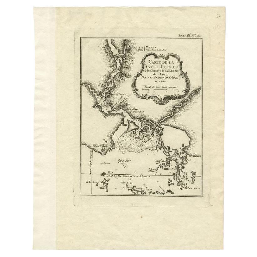
- Antique Map of the Mouth of the Chiang River by Bellin, 1764By Jacques-Nicolas BellinLocated in Langweer, NLAntique map titled ‘Carte de la Baye d'Hocsieu et des Entrees de la Riviere de Chang, Dans la Province de Fokyen en Chine’. This impressive map or sea chart d...Category
Antique 18th Century Maps
MaterialsPaper
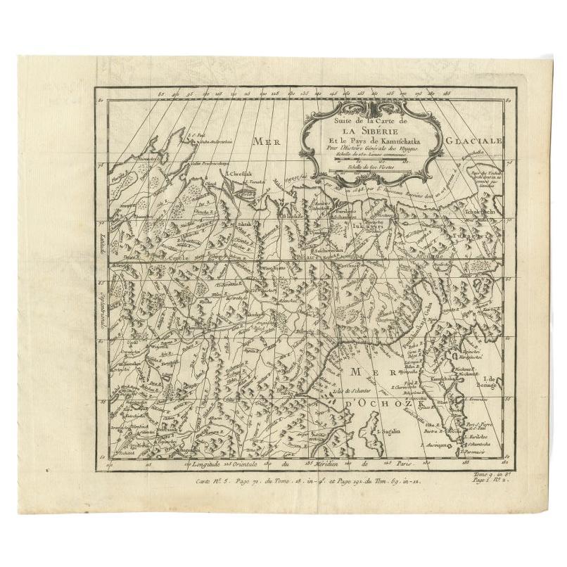
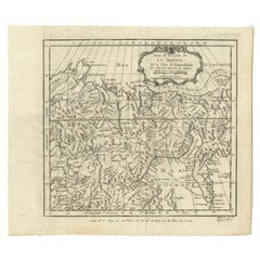
- Antique Map of Eastern Siberia Extending to Kamtchatka, Russia, 1764By Jacques-Nicolas BellinLocated in Langweer, NLAntique map titled 'Suite De La Carte De La Siberie Et le Pays de Kamtchatka'. Detailed map the Eastern portion of Siberia, extending to Kamtchatka. Shows the Russian voyage of 1648 in the NE Passage region. Includes a decorative title cartouche. Originates from Prevost d'Exiles influential travel book, 'L'Histoire Generale des Voyages'. Artists and Engravers: Jacques-Nicolas Bellin (1703-1772) was among the most important mapmakers of the eighteenth century. In 1721, at age 18, he was appointed hydrographer (chief cartographer) to the French Navy. In August 1741, he became the first Ingénieur de la Marine of the Depot des cartes...Category
Antique 18th Century Maps
MaterialsPaper
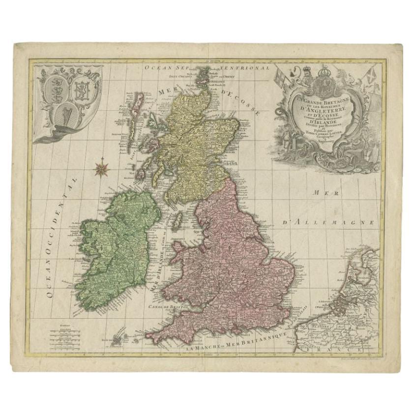
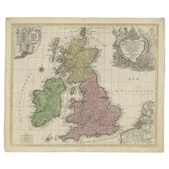
- Antique Map of the British Isles by Lotter, 1764Located in Langweer, NLAntique map titled 'Le Grand Bretagne ou les Royaumes d'Angleterre et d'Ecosse'. Old engraved map of the British Isles (main islands United Kingdom & Ire...Category
Antique 18th Century Maps
MaterialsPaper
- Antique Map of the Caspian Sea and Surroundings by Bellin, 1764Located in Langweer, NLAntique map titled 'Carte de la Mer Caspienne et ses Environs'. Old map depicting the region of the Caspian Sea. This map originates from 'Le Petit Atlas M...Category
Antique 18th Century Maps
MaterialsPaper
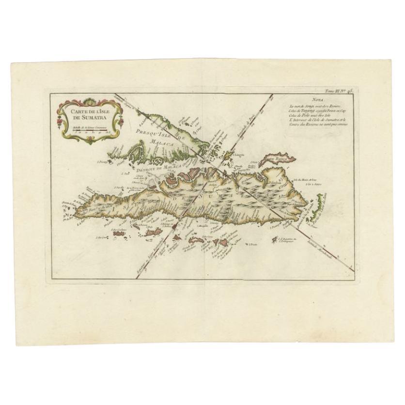
- Antique Map of Sumatra by Bellin, 1764Located in Langweer, NLAntique map Sumatra titled 'Carte de l'Isle de Sumatra'. Old map of Sumatra, Malaysia and the Straits of Malacca, including Singapore. This map originates ...Category
Antique 18th Century Maps
MaterialsPaper


You May Also Like
- Map of Boston and Surrounding TownsLocated in Norwell, MALater copy of a nineteenth century map of Boston and surrounding towns. Showing parts of Quincy, Milton, Hyde Park, Winthrop and Revere. Showing all of B...Category
Antique 19th Century North American Maps
MaterialsPaper
- St. Christophe 'St. Kitts' Island: An 18th Century Hand-colored Map by BellinBy Jacques-Nicolas BellinLocated in Alamo, CAJacques Bellin's copper-plate map of the Caribbean island of Saint Kitts entitled "Carte De De l'Isle St. Christophe Pour servir á l'Histoire Genle. des V...Category
Antique Mid-18th Century French Maps
MaterialsPaper
- 1861 Topographical Map of the District of Columbia, by Boschke, Antique MapLocated in Colorado Springs, COPresented is an original map of Albert Boschke's extremely sought-after "Topographical Map of the District of Columbia Surveyed in the Years 1856 ...Category
Antique 1860s American Historical Memorabilia
MaterialsPaper
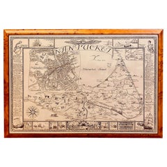
- Vintage Map of Nantucket Town by Ruth Haviland Sutton, 1946Located in Nantucket, MAVintage Map of Nantucket Town by Ruth Haviland Sutton, 1946, a classic vintage tourist map of Nantucket Island showing historic landmarks and geogr...Category
Vintage 1940s American Other Maps
MaterialsPaper
- Captain Cook's Exploration of Tahiti 18th C. Hand-Colored Map by BellinBy Jacques-Nicolas BellinLocated in Alamo, CAThis beautiful 18th century hand-colored copper plate engraved map is entitled "Carte de l'Isle de Taiti, par le Lieutenant J. Cook" was created by Jacques Nicolas Bellin and publish...Category
Antique Mid-18th Century French Maps
MaterialsPaper
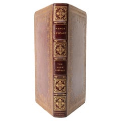
- 1 Volume. The Abbé Prévost, History of Manon Lescaut.Located in New York, NY1 Volume. The Abbé Prévost, History of Manon Lescaut. Bound in full red morocco with the covers and raised band spine displaying ornate floral gilt-tooled detailing. The top edge is ...Category
Antique Late 19th Century French Books
MaterialsLeather


Recently Viewed
View AllMore Ways To Browse
Antique Map Cabinet
Map Cabinet Antique
Antique Nautical Map
Antique Nautical Maps
Antique Nautical Charts
17th Century Corpus
Map Nautical Chart
Scan Style
Chart Cabinet
Cape Verde
French 19th Century Transitional St
Antique Furniture Cape Town
Antique Russian Wood Furniture
Antique Russian Wood
Compass Antique Map
Antique Compass Map
Antique Britain Map
Large Antique Map Of The World