Items Similar to Antique Map of France Showing Post-Napoleonic Departments, 1816
Want more images or videos?
Request additional images or videos from the seller
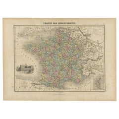
Antique Map of France Showing Post-Napoleonic Departments, 1816
About the Item
Antique map of France titled 'France divided into departments'. Detailed map of France, colored by post-Napoleonic Departments. With an inset map of Corsica.
Artists and Engravers: John Cary (1755-1835) was a British cartographer and publisher best known for his clean engraving and distinct style which influenced the entire map industry.
Condition: Very good, general age-related toning. Original/contemporary hand coloring. Please study image carefully.
Date: 1816
Overall size: 33 x 26.5 cm.
Image size: 28 x 23 cm.
We sell original antique maps to collectors, historians, educators and interior decorators all over the world. Our collection includes a wide range of authentic antique maps from the 16th to the 20th centuries. Buying and collecting antique maps is a tradition that goes back hundreds of years. Antique maps have proved a richly rewarding investment over the past decade, thanks to a growing appreciation of their unique historical appeal. Today the decorative qualities of antique maps are widely recognized by interior designers who appreciate their beauty and design flexibility. Depending on the individual map, presentation, and context, a rare or antique map can be modern, traditional, abstract, figurative, serious or whimsical. We offer a wide range of authentic antique maps for any budget.
- Dimensions:Height: 10.44 in (26.5 cm)Width: 13 in (33 cm)Depth: 0 in (0.01 mm)
- Materials and Techniques:
- Period:
- Date of Manufacture:1816
- Condition:
- Seller Location:Langweer, NL
- Reference Number:
About the Seller
5.0
Platinum Seller
These expertly vetted sellers are 1stDibs' most experienced sellers and are rated highest by our customers.
Established in 2009
1stDibs seller since 2017
1,949 sales on 1stDibs
Typical response time: <1 hour
- ShippingRetrieving quote...Ships From: Langweer, Netherlands
- Return PolicyA return for this item may be initiated within 14 days of delivery.
More From This SellerView All
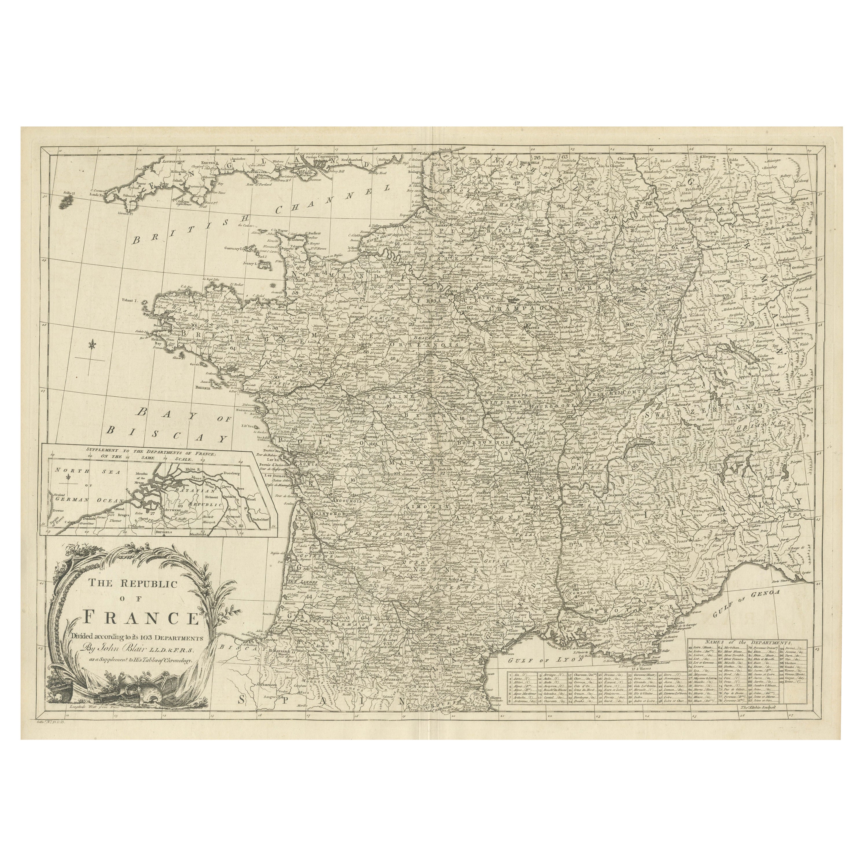
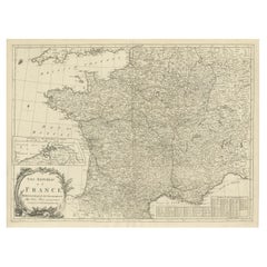
- Antique Map of France with Inset showing the Northern DepartmentsLocated in Langweer, NLAntique map titled 'The Republic of France divided according to its 103 Departments'. Decorative map of France. Includes a large cartouche and an in...Category
Antique Late 18th Century Maps
MaterialsPaper
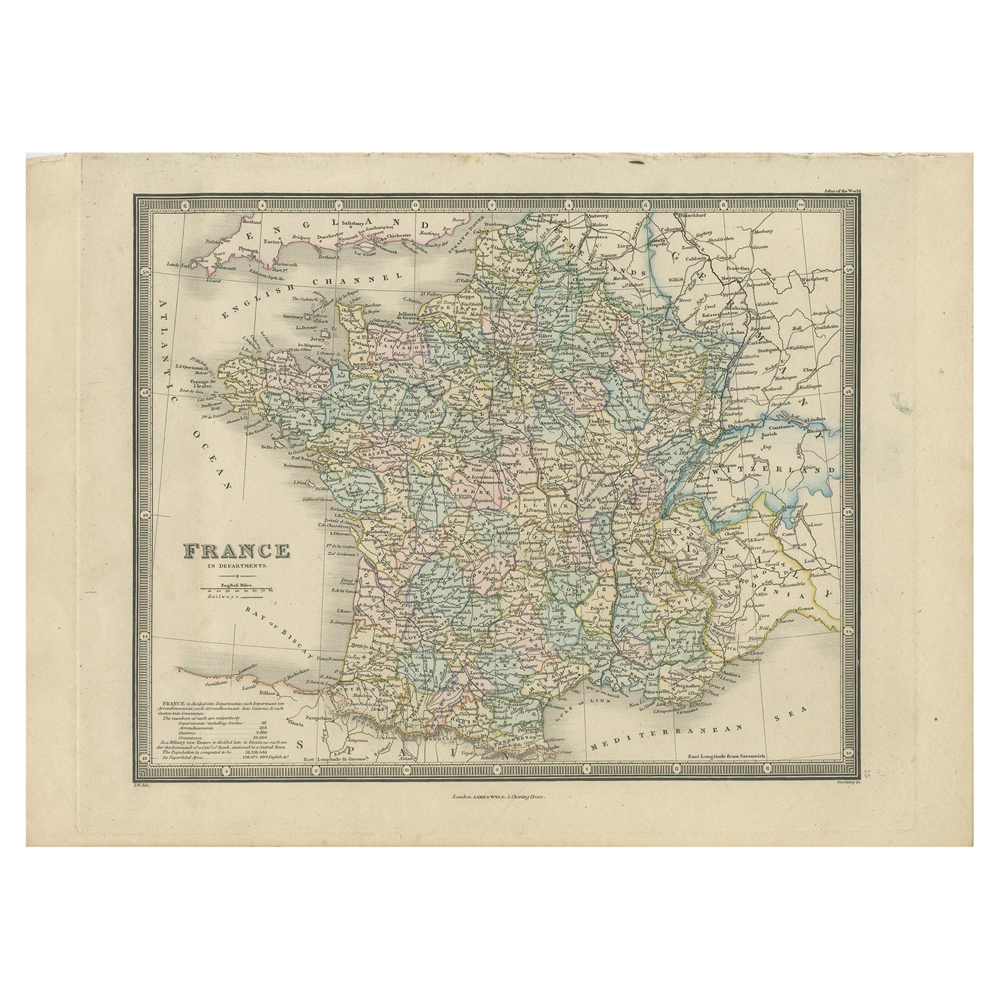
- Antique Map of France in Departments by Wyld '1845'Located in Langweer, NLAntique map titled 'France in Departments'. Original antique map of France. This map originates from 'An Atlas of the World, Comprehending Separate Maps of its...Category
Antique Mid-19th Century Maps
MaterialsPaper
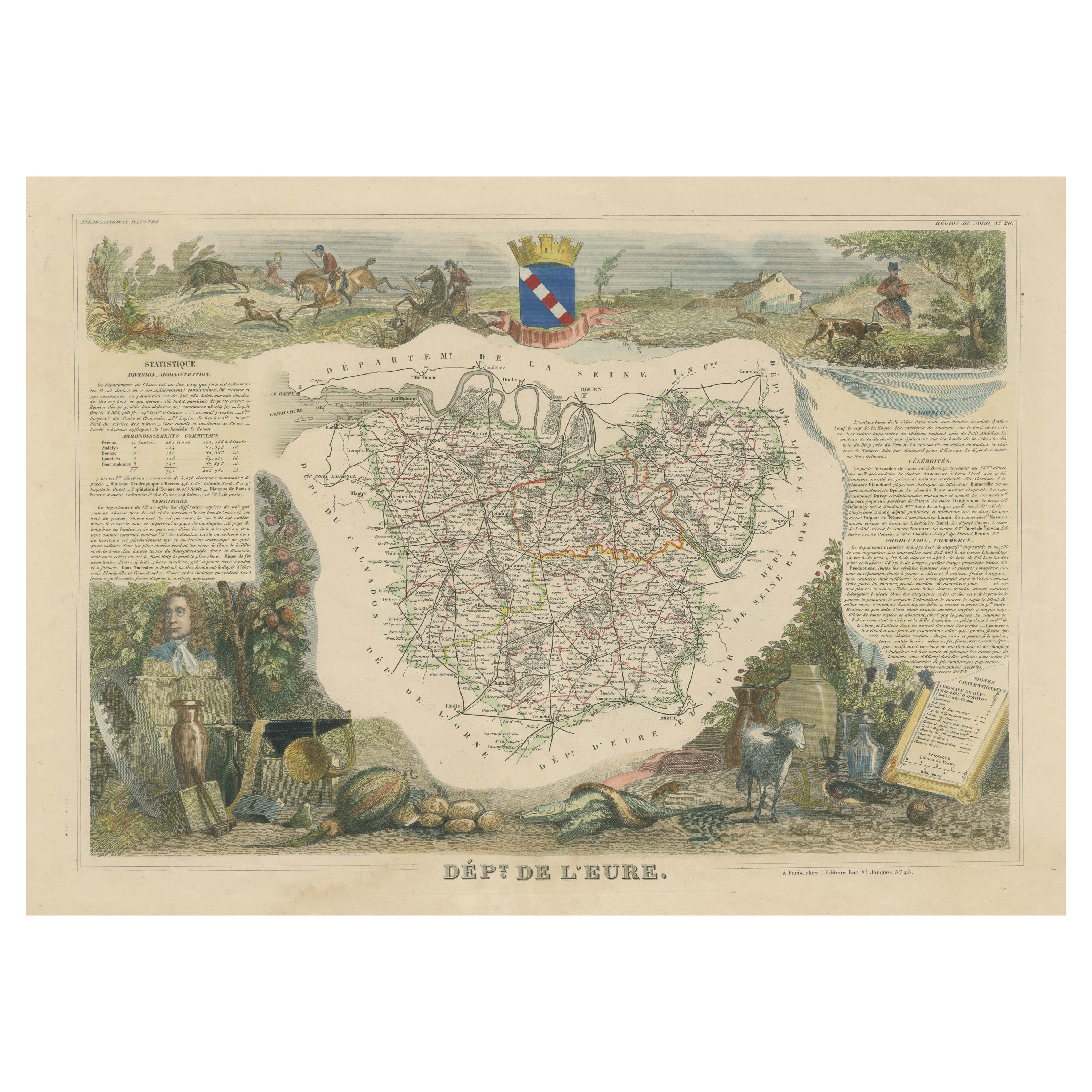
- Hand Colored Antique Map of the Department of Eure, FranceBy Victor LevasseurLocated in Langweer, NLAntique map titled 'Dépt. de l'Eure'. Map of the French department of Eure, France. This region of France is home to Giverny, where impressionist Claude Monet’s home and garden can...Category
Antique Mid-19th Century Maps
MaterialsPaper
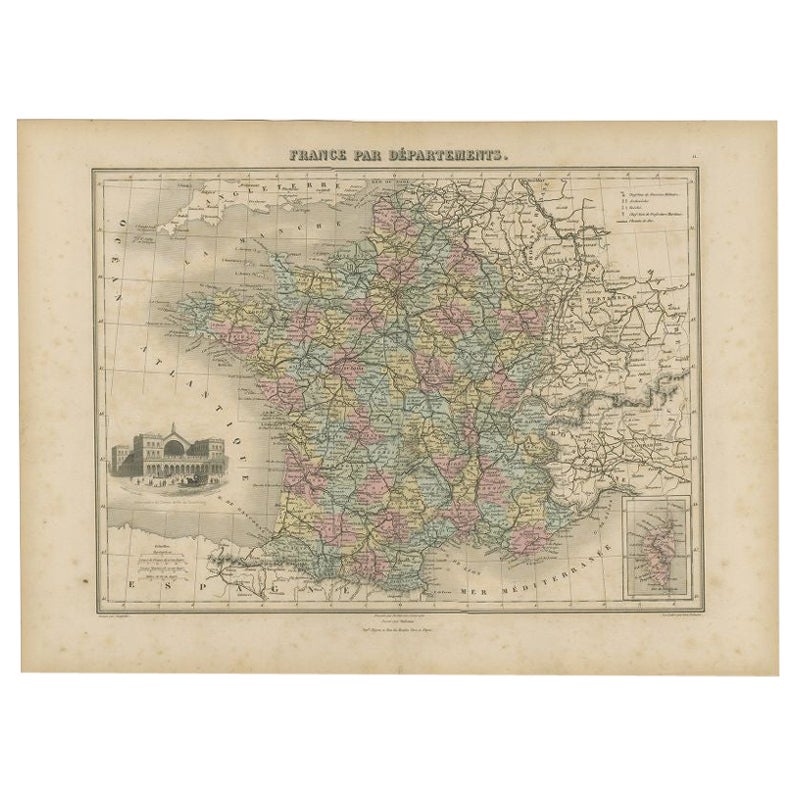
- Antique Map of the Departments of France by Migeon, 1880By J. MigeonLocated in Langweer, NLAntique map titled 'France par Départements'. Old map of France with a decorative vignette of Strasbourg and an inset map of Corsica. This map originate...Category
Antique 19th Century Maps
MaterialsPaper
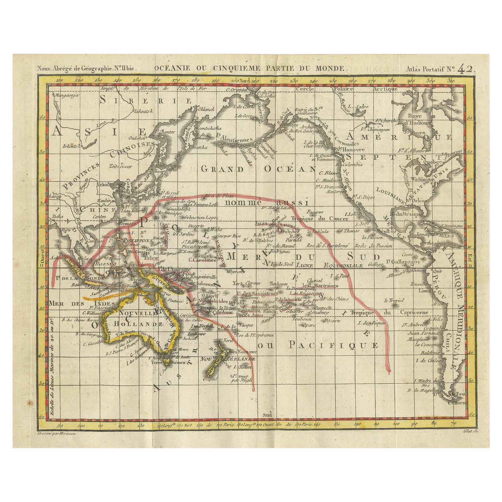
- Antique Map of Oceania by Hérisson, 1816Located in Langweer, NLAntique map titled "Océanie ou cinquième partie du monde". This is an original antique map of Oceania, the 5th continent, by Herisson taken from atlas "Nouv. Abrége de Géographie". A...Category
Antique 19th Century Maps
MaterialsPaper
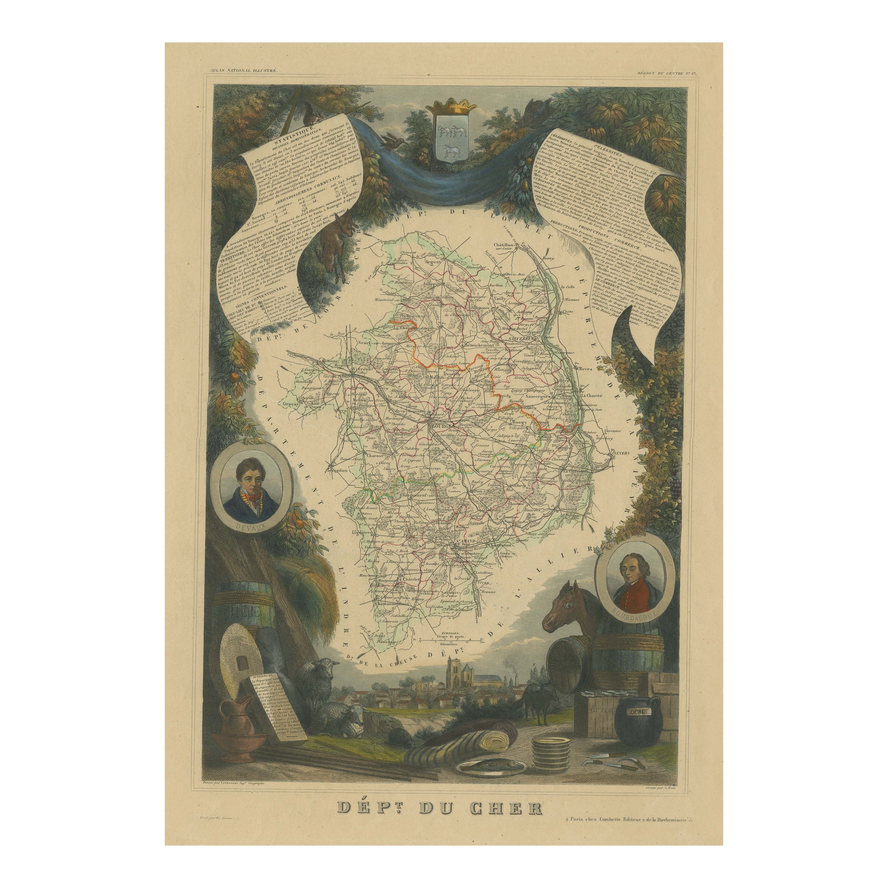
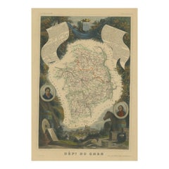
- Hand Colored Antique Map of the Department of Cher, FranceBy Victor LevasseurLocated in Langweer, NLAntique map titled 'Dépt. du Cher'. Map of the French department of Cher, France. This area of France is known for its production of Selles Sur Cher, a goats-milk cheese. The whole i...Category
Antique Mid-19th Century Maps
MaterialsPaper


You May Also Like
- Vintage United States Post Office Department Enamel Advertising SignLocated in Hamilton, OntarioThis vintage metal sign has no maker's marks, but presumed to have originated from the United States and dates to approximately 1976 and done in a traditional American Colonial style...Category
Mid-20th Century American American Colonial Historical Memorabilia
MaterialsBrass, Cut Steel
- Antique Map of Principality of MonacoBy Antonio Vallardi EditoreLocated in Alessandria, PiemonteST/619 - "Old Geographical Atlas of Italy - Topographic map of ex-Principality of Monaco" - ediz Vallardi - Milano - A somewhat special edition ---Category
Antique Late 19th Century Italian Other Prints
MaterialsPaper
- Napoleonic Prisoner-of-War GuillotineLocated in New Orleans, LAAn incredible and extremely rare artifact of world history, this mutton bone model of a guillotine was created during the Napoleonic wars by a French prisoner of war. Many of the inmates at the prisoner of war camps were skilled artisans long before they were soldiers, and because of the long duration of the conflict and cost of care, their captors encouraged detainees to use their skills to create objects to be sold at civilian open markets. Because of the intricacy of these fascinating objets d'art, very few of these models have survived the test of time. This masterpiece is impeccably detailed with soldiers and cannons lining the platforms. Adding to the rarity of this piece is that it has moving parts, as only a scant few model carvings were ever created with such mechanical accuracy. The soldiers have movable arms, while the guillotine features a movable "blade" for added authenticity. By many accounts, Napoleonic prisoners of war...Category
Antique 19th Century French Models and Miniatures
MaterialsBone
- Plan of Paris, France, by A. Vuillemin, Antique Map, 1845Located in Colorado Springs, COThis large and detailed plan of Paris was published by Alexandre Vuillemin in 1845. The map conveys a wonderful amount of information and is decorated throughout with pictorial vigne...Category
Antique 1840s American Maps
MaterialsPaper
- Geographical Antique Map of Principality of MonacoBy Bruno SantiniLocated in Alessandria, PiemonteST/609 - Interesting antique color map of Monaco Principality in French language : "Carte qui contient le Principauté de Piémont, le Monferrat et la comté de...Category
Antique Late 18th Century Italian Other Maps
MaterialsPaper
- 1861 Topographical Map of the District of Columbia, by Boschke, Antique MapLocated in Colorado Springs, COPresented is an original map of Albert Boschke's extremely sought-after "Topographical Map of the District of Columbia Surveyed in the Years 1856 ...Category
Antique 1860s American Historical Memorabilia
MaterialsPaper


Recently Viewed
View AllMore Ways To Browse
Antique Napoleonic
Napoleonic Furniture
French Napoleonic
Antique French Divider
French Interior Engraving
Rare Map France
Antique British Maps
Antique Maps Of Britain
Antique Style Map
World Map British
Antique Map Britain
Antique Britain Map
16th Century Hand Colored Map
Antique Style Map Of The World
World Map Antique Style
World Maps Antique Style
Napoleonic Engraving
Antique Maps Of London