Items Similar to Antique Map of Groningen by Veelwaard, c.1865

Want more images or videos?
Request additional images or videos from the seller
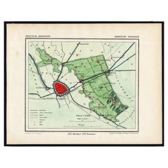
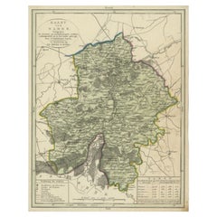
Antique Map of Groningen by Veelwaard, c.1865
About the Item
Antique map titled 'Groningen 1861'. Map of Groningen, the Netherlands. Published by 'Gewest. Vereeniging Noord Holland van het Ned. Onderwijzers-Genootschap'. Artists and Engravers: Engraved by Veelwaard. Published by C.L. Brinkman.
Artist: Engraved by Veelwaard. Published by C.L. Brinkman.
Condition: Good, general age-related toning. Minor wear, blank verso. Please study image carefully.
Date: c.1865
Overall size: 24 x 18.5 cm.
Image size: 18.5 x 14.5 cm.
We sell original antique maps to collectors, historians, educators and interior decorators all over the world. Our collection includes a wide range of authentic antique maps from the 16th to the 20th centuries. Buying and collecting antique maps is a tradition that goes back hundreds of years. Antique maps have proved a richly rewarding investment over the past decade, thanks to a growing appreciation of their unique historical appeal. Today the decorative qualities of antique maps are widely recognized by interior designers who appreciate their beauty and design flexibility. Depending on the individual map, presentation, and context, a rare or antique map can be modern, traditional, abstract, figurative, serious or whimsical. We offer a wide range of authentic antique maps for any budget.
- Dimensions:Height: 7.29 in (18.5 cm)Width: 9.45 in (24 cm)Depth: 0 in (0.01 mm)
- Materials and Techniques:
- Period:
- Date of Manufacture:circa 1865
- Condition:
- Seller Location:Langweer, NL
- Reference Number:
About the Seller
5.0
Platinum Seller
These expertly vetted sellers are 1stDibs' most experienced sellers and are rated highest by our customers.
Established in 2009
1stDibs seller since 2017
1,950 sales on 1stDibs
Typical response time: <1 hour
- ShippingRetrieving quote...Ships From: Langweer, Netherlands
- Return PolicyA return for this item may be initiated within 14 days of delivery.
More From This SellerView All
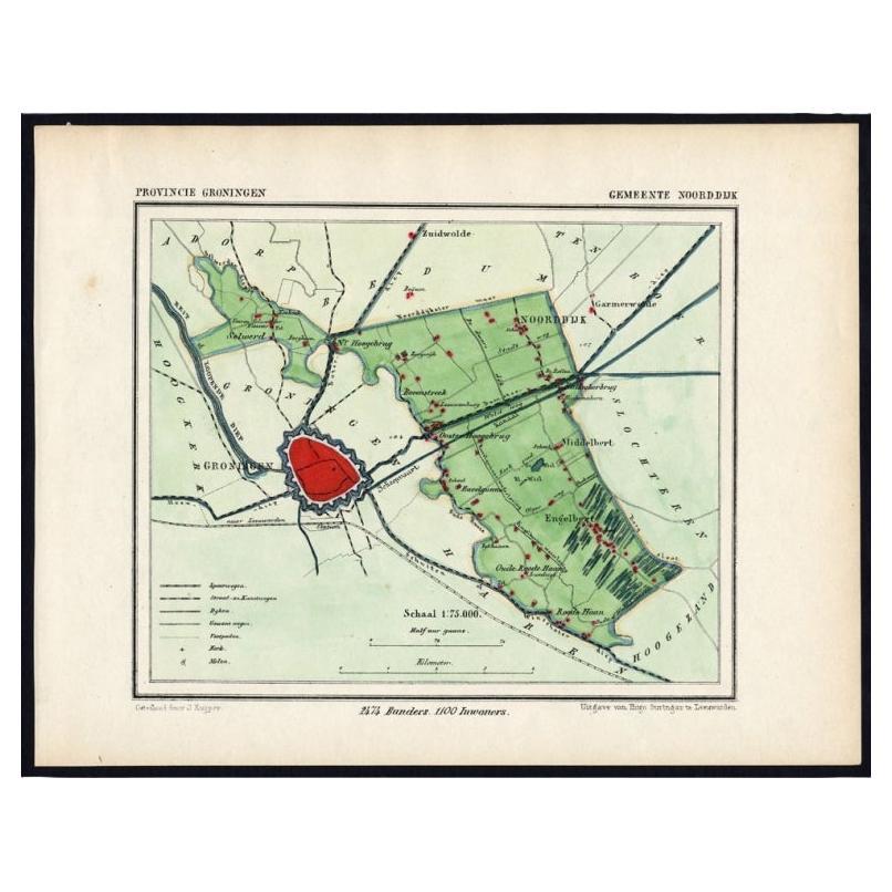
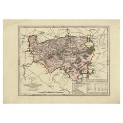
- Rare Map of Dutch Municipality Noorddijk Near Groningen, 1865Located in Langweer, NLGroningen: Gemeente Engelbert, Middelbert, Noorddijk. These scarse detailed maps of Dutch Towns originate from the 'Gemeente-atlas' of Jacob Kuyper. This atlas of all towns in the Ne...Category
Antique 19th Century Maps
MaterialsPaper
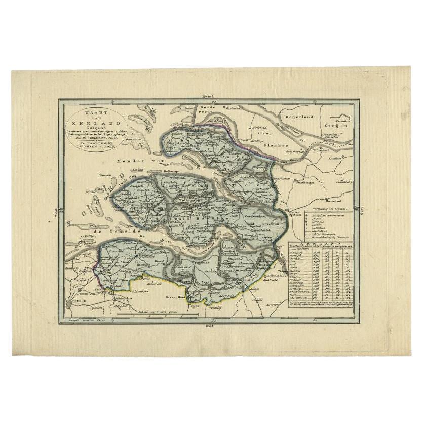
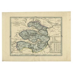
- Antique Map of the Province of Zeeland by Veelwaard, C.1840Located in Langweer, NLAntique map titled 'Kaart van Zeeland (..).' Uncommon map showing the province of Zeeland in the Netherlands. Source unkown, to be determined. Published circa 1840. Artists and E...Category
Antique 19th Century Maps
MaterialsPaper
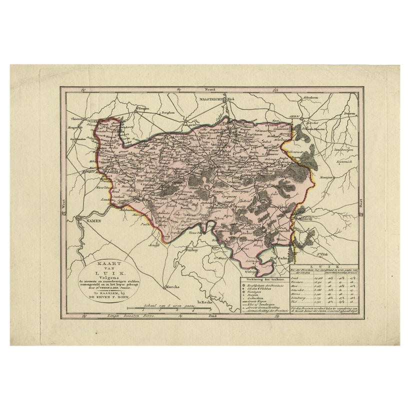
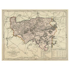
- Antique Map of the Region of Luik by Veelwaard, C.1840Located in Langweer, NLAntique map titled 'Kaart van Luik'. Original antique map of the region of Luik (Liege), Belgium. Source unkown, to be determined. Published circa 1840. Artists and Engravers: E...Category
Antique 19th Century Maps
MaterialsPaper
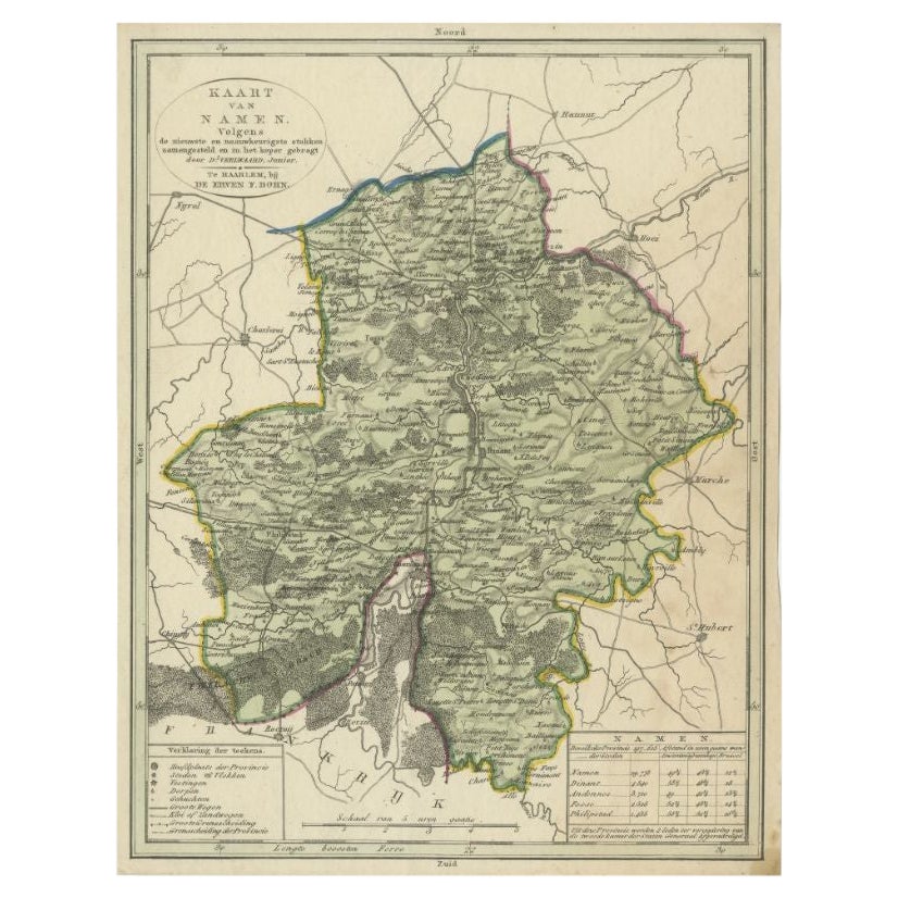
- Antique Map of the Region of Namen by Veelwaard, c.1840Located in Langweer, NLAntique map titled 'Kaart van Namen'. Original antique map of the region of Namen (Namur), Belgium. Source unkown, to be determined. Published circa 1840. Artists and Engravers:...Category
Antique 19th Century Maps
MaterialsPaper
- Antique Map of the Region of Luik by Veelwaard, c.1840Located in Langweer, NLAntique map titled 'Kaart van Luik'. Original antique map of the region of Luik (Liege), Belgium. Source unkown, to be determined. Published circa 1840. Artists and Engravers: E...Category
Antique 19th Century Maps
MaterialsPaper
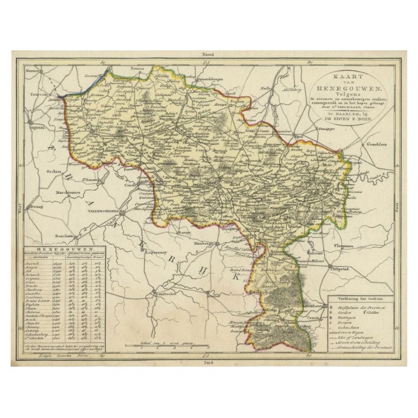
- Antique Map of the Region of Henegouwen by Veelwaard, C.1840Located in Langweer, NLAntique map titled 'Kaart van Henegouwen'. Original antique map of the region of Henegouwen (Hainaut), Belgium. Source unkown, to be determined. Published circa 1840. Artists and...Category
Antique 19th Century Maps
MaterialsPaper

You May Also Like
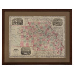
- 1865 "Johnson's Missouri and Kansas" Map by Johnson and WardLocated in Colorado Springs, COPresented is an original 1865 "Johnson's Missouri and Kansas” map. This map was issued as pages 59 and 60 in the 1865 edition of “Johnson's New Illustrated ...Category
Antique Mid-19th Century Maps
MaterialsPaper
- 1861 Topographical Map of the District of Columbia, by Boschke, Antique MapLocated in Colorado Springs, COPresented is an original map of Albert Boschke's extremely sought-after "Topographical Map of the District of Columbia Surveyed in the Years 1856 ...Category
Antique 1860s American Historical Memorabilia
MaterialsPaper
- 1907 Map of Colorado, Antique Topographical Map, by Louis NellLocated in Colorado Springs, COThis highly detailed pocket map is a topographical map of the state of Colorado by Louis Nell from 1907. The map "has been complied from all availabl...Category
Antique Early 1900s American Maps
MaterialsPaper
- Antique Map of Italy by Andriveau-Goujon, 1843By Andriveau-GoujonLocated in New York, NYAntique Map of Italy by Andriveau-Goujon, 1843. Map of Italy in two parts by Andriveau-Goujon for the Library of Prince Carini at Palazzo Carini i...Category
Antique 1840s French Maps
MaterialsLinen, Paper
- Antique Map of Principality of MonacoBy Antonio Vallardi EditoreLocated in Alessandria, PiemonteST/619 - "Old Geographical Atlas of Italy - Topographic map of ex-Principality of Monaco" - ediz Vallardi - Milano - A somewhat special edition ---Category
Antique Late 19th Century Italian Other Prints
MaterialsPaper
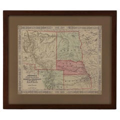
- 1865 "Johnson's Nebraska, Dakota, Colorado, Idaho & Kansas" Map, Johnson & WardLocated in Colorado Springs, COPresented is an original 1865 "Johnson's Nebraska, Dakota, Colorado, Idaho & Kansas” map. This map was issued as page 63 in the 1865 edition of “Johnson's N...Category
Antique Mid-19th Century Maps
MaterialsPaper


Recently Viewed
View AllMore Ways To Browse
Antique Maps Of United States
Antique Collectible Bears
United States Map Vintage
United States Vintage Map
Amsterdam Map
Map Of Amsterdam
Antique Old World Map
Old Antique World Map
Old World Antique Map
Old World Antique Maps
18th Russian Furniture
Antique Old Map Of The World
Furniture Russian 18th Century
Space Map
Antique Maps Of States
Antique South Africa
Antique Map Of Paris
Antique Maps Of Paris