Items Similar to Antique Map of Herefordshire 'England' by R. Morden, 1708


Want more images or videos?
Request additional images or videos from the seller
1 of 5
Antique Map of Herefordshire 'England' by R. Morden, 1708
About the Item
This antique County map of Herefordshire by Robert Morden was first published in 1701 in a work entitled 'The New Description and State of England', however, a subsequent edition by Herman Moll in 1708 added a compass indicator and other detail.
- Dimensions:Height: 7.88 in (20 cm)Width: 10.04 in (25.5 cm)Depth: 0.02 in (0.5 mm)
- Materials and Techniques:
- Period:
- Date of Manufacture:1708
- Condition:Please study image carefully.
- Seller Location:Langweer, NL
- Reference Number:
About the Seller
5.0
Platinum Seller
These expertly vetted sellers are 1stDibs' most experienced sellers and are rated highest by our customers.
Established in 2009
1stDibs seller since 2017
1,948 sales on 1stDibs
Typical response time: <1 hour
- ShippingRetrieving quote...Ships From: Langweer, Netherlands
- Return PolicyA return for this item may be initiated within 14 days of delivery.
More From This SellerView All
- Antique Map of Herefordshire by Morden, c.1700Located in Langweer, NLAntique map titled 'Herefordshire'. Detailed map of the county of Herefordshire embellished with a decorative title cartouche. Three scales. Imprint of Abel Swale, Awnsham Churchill ...Category
Antique 18th Century Maps
MaterialsPaper
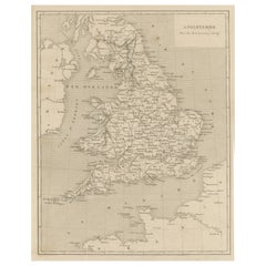
- Antique Map of England & Wales by Wyld '1845'Located in Langweer, NLAntique map titled 'England & Wales'. Original antique map of England & Wales. This map originates from 'An Atlas of the World, Comprehending Se...Category
Antique Mid-19th Century Maps
MaterialsPaper
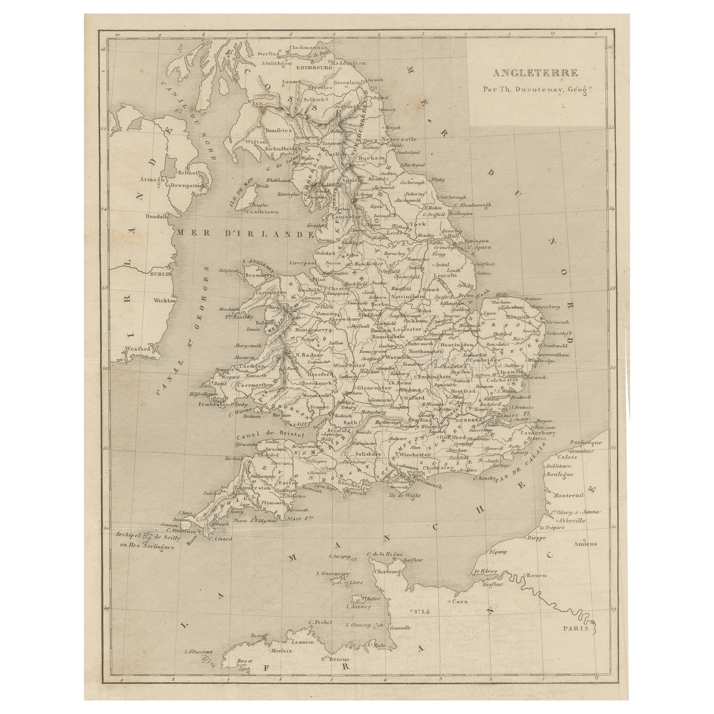
- Steel Engraved Antique Map of EnglandLocated in Langweer, NLAntique map titled 'Angleterre'. Original antique map of England. Engraved by Th. Duvotenay. Originates from 'Complement de L'Encyclopedie Mode...Category
Antique Late 19th Century Maps
MaterialsPaper
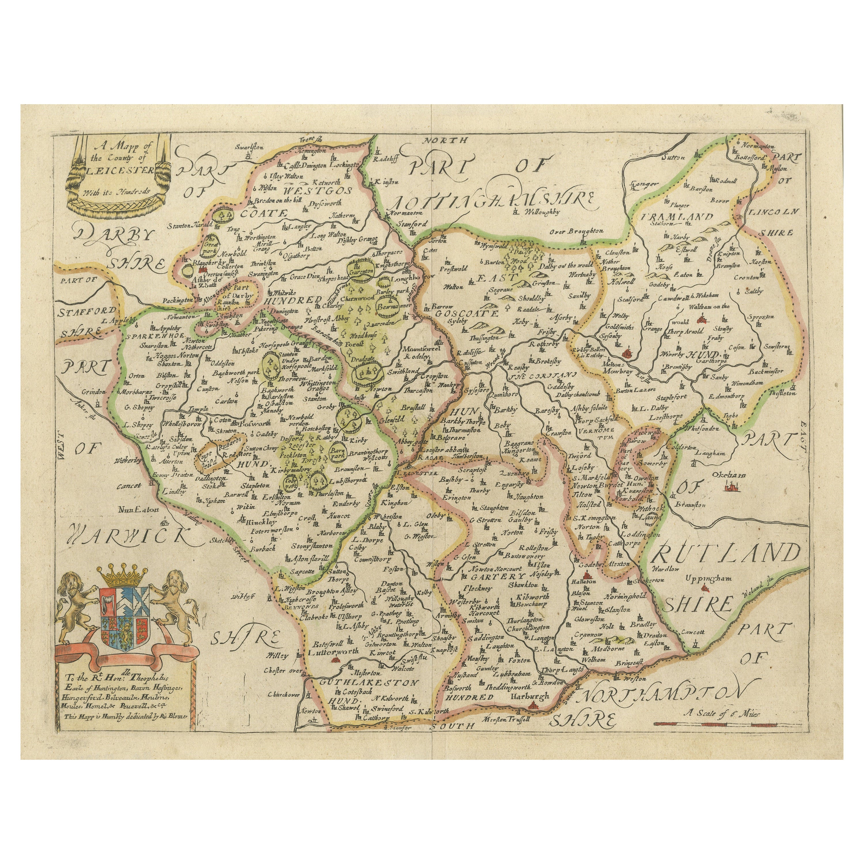
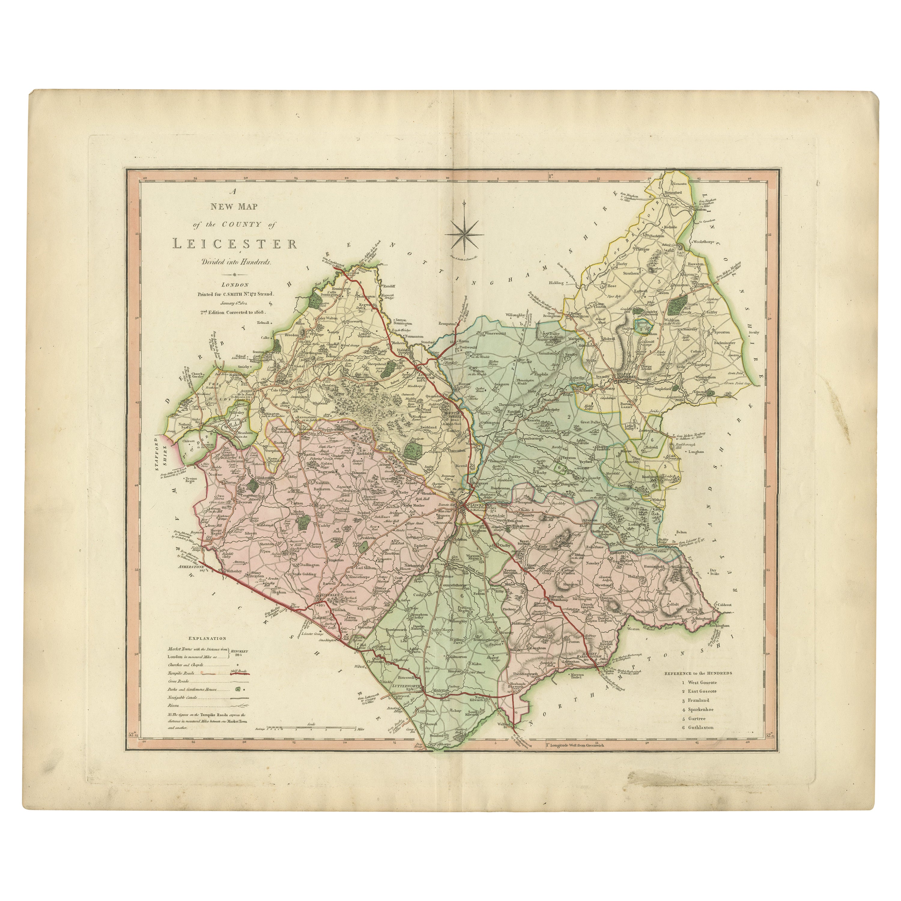
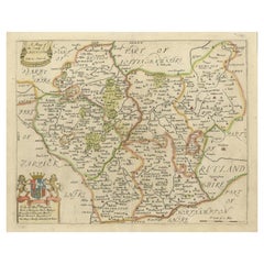
- Original Antique Map of Leicestershire, EnglandLocated in Langweer, NLAntique map titled 'A Mapp of the Country of Leicester'. Original old map of Leicestershire, England. This map originates from 'Britannia: or, a Geographical Description of the Kingd...Category
Antique Late 17th Century Maps
MaterialsPaper
- Antique Map of England and Wales by Johnson '1872'Located in Langweer, NLAntique map titled 'Johnson's England and Wales'. Original map of England and Wales. This map originates from 'Johnson's New Illustrated Family Atlas of the World' by A.J. Johnson. P...Category
Antique Late 19th Century Maps
MaterialsPaper
- Antique Map of Buckinghamshire in England, 1743Located in Langweer, NLAntique map titled 'Buckingham both shyre and shire towne describ'. Map of Buckinghamshire, England. With town plans of Buckingham and Redding. This map originates from Overton's atl...Category
Antique 18th Century Maps
MaterialsPaper


You May Also Like
- Old Horizontal Map of EnglandBy TassoLocated in Alessandria, PiemonteST/520 - Old rare Italian map of England, dated 1826-1827 - by Girolamo Tasso, editor in Venise, for the atlas of M.r Le-Sage.Category
Antique Early 19th Century Italian Other Prints
MaterialsPaper
- England, Scotland & Ireland: A Hand Colored Map of Great Britain by TirionBy Isaak TirionLocated in Alamo, CAThis is a hand-colored double page copperplate map of Great Britain entitled "Nieuwe Kaart van de Eilanden van Groot Brittannien Behelzende de Kon...Category
Antique Mid-18th Century Dutch Maps
MaterialsPaper
- Antique Map of Italy by Andriveau-Goujon, 1843By Andriveau-GoujonLocated in New York, NYAntique Map of Italy by Andriveau-Goujon, 1843. Map of Italy in two parts by Andriveau-Goujon for the Library of Prince Carini at Palazzo Carini i...Category
Antique 1840s French Maps
MaterialsLinen, Paper
- Antique Map of Principality of MonacoBy Antonio Vallardi EditoreLocated in Alessandria, PiemonteST/619 - "Old Geographical Atlas of Italy - Topographic map of ex-Principality of Monaco" - ediz Vallardi - Milano - A somewhat special edition ---Category
Antique Late 19th Century Italian Other Prints
MaterialsPaper
- Original Antique Map of Russia By Arrowsmith. 1820Located in St Annes, LancashireGreat map of Russia Drawn under the direction of Arrowsmith Copper-plate engraving Published by Longman, Hurst, Rees, Orme and Brown, 1820 Unframed.Category
Antique 1820s English Maps
MaterialsPaper
- 17th Century Hand-Colored Map of Southeastern England by Mercator and HondiusBy Gerard MercatorLocated in Alamo, CAA 17th century copperplate hand-colored map entitled "The Sixt Table of England" by Gerard Mercator and Jodocus Hondius, published in Amsterdam in 1635 in 'Cosmographicall Descriptio...Category
Antique Mid-17th Century Dutch Maps
MaterialsPaper


Recently Viewed
View AllMore Ways To Browse
New England Early Furniture
New England Used Office Furniture
A R Antiques
Early 18th Century New England
Antique Furniture Herefordshire
Herefordshire Antique Map
Bag With Map
Bonne Map
Antique Irish Maps
Antique Map Ireland
Antique Map Of Ireland
Antique Maps Of Ireland
George Fleet
Antique Ireland Map
Antique Irish Map
Antique Maps Ireland
South Pole
New Zealand Map