Items Similar to Antique Map of Hungary Incl Surroundings like Croatia, Bosnia, Servia, 1730


Want more images or videos?
Request additional images or videos from the seller
1 of 5
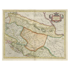
Antique Map of Hungary Incl Surroundings like Croatia, Bosnia, Servia, 1730
About the Item
Antique map titled 'Nieuwe Kaart van t Koninkryk Hongaryen en Zevenbergen na de laatste ontdekkingen'.
This map depicts Hungary including surroundings like Croatia, Bosnia, Servia, Bulgaria and Austria.
Artist: Isaak Tirion, a Dutch publisher in Amsterdam, born 1705. He produced serveral Atlases and Dutch town plans.
We sell original antique maps to collectors, historians, educators and interior decorators all over the world. Our collection includes a wide range of authentic antique maps from the 16th to the 20th centuries. Buying and collecting antique maps is a tradition that goes back hundreds of years. Antique maps have proved a richly rewarding investment over the past decade, thanks to a growing appreciation of their unique historical appeal. Today the decorative qualities of antique maps are widely recognized by interior designers who appreciate their beauty and design flexibility. Depending on the individual map, presentation, and context, a rare or antique map can be modern, traditional, abstract, figurative, serious or whimsical. We offer a wide range of authentic antique maps for any budget.
- Dimensions:Height: 21.66 in (55 cm)Width: 17.13 in (43.5 cm)Depth: 0 in (0.01 mm)
- Materials and Techniques:
- Period:
- Date of Manufacture:1730
- Condition:Condition: Very good, contemporary coloring. Few marginal tears, please study image carefully.
- Seller Location:Langweer, NL
- Reference Number:
About the Seller
5.0
Platinum Seller
These expertly vetted sellers are 1stDibs' most experienced sellers and are rated highest by our customers.
Established in 2009
1stDibs seller since 2017
1,947 sales on 1stDibs
Typical response time: <1 hour
- ShippingRetrieving quote...Ships From: Langweer, Netherlands
- Return PolicyA return for this item may be initiated within 14 days of delivery.
More From This SellerView All
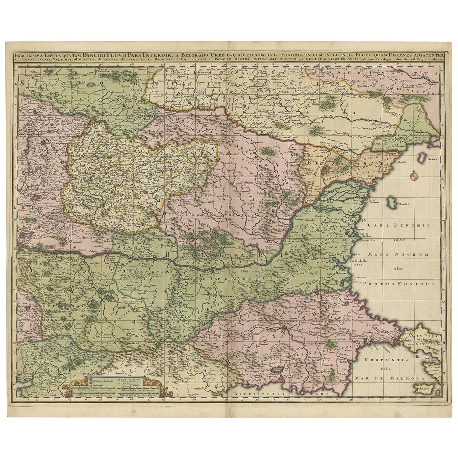
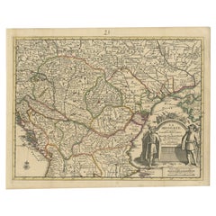
- Antique Map of Ukraine, Bulgaria, Romania, Servia & Surroundings by N. VisscherLocated in Langweer, NLAntique map titled 'Exactissima Tabula qua tam Danubii Fluvii Pars Inferior, a Belgrado Urbe usq ad ejus ostia, et minores in eum influentes, Fluvii quam Regiones adjacentes, ut Tran...Category
Antique Early 18th Century Maps
MaterialsPaper
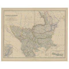
- Old Map of Turkey in Europe, incl Romania, Servia, Montenegro & Bulgaria, 1882Located in Langweer, NLAntique map titled 'Turkey in Europe'. Old map of Turkey in Europe, also depicting part of Romania, Servia, Montenegro and Bulgaria. With inset maps of the Bosphorus, Constantino...Category
Antique 1880s Maps
MaterialsPaper
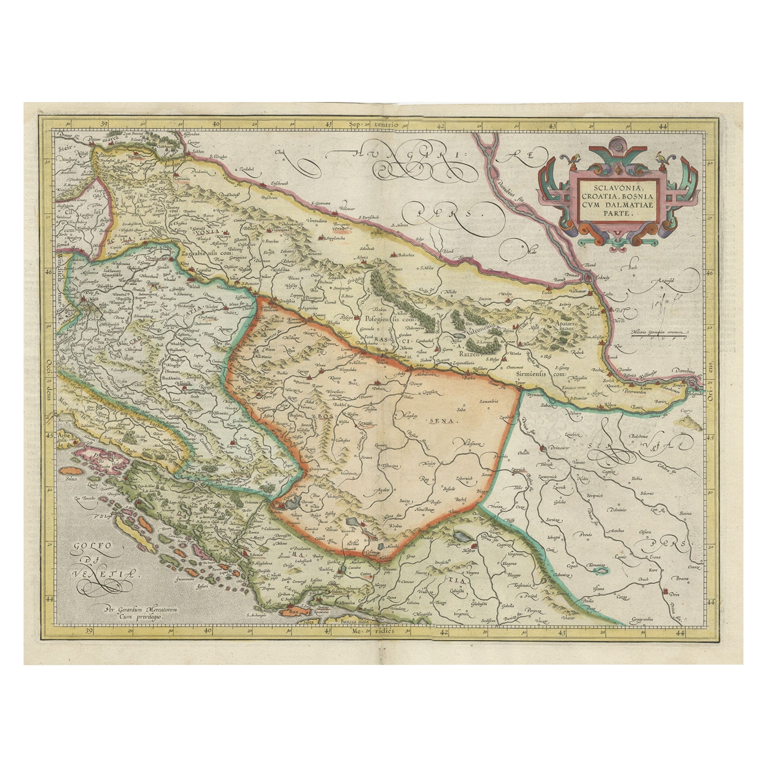
- Old Eastern Balkans Map, with Dalmatia, Croatia, Slavonia, Bosnia, Serbia, 1633Located in Langweer, NLAntique map titled 'Sclavonia, Croatia, Bosnia cum Dalmatiae Parte'. Old map of the Eastern Balkans with the geographical & political divisions of Dalmatia, Croatia, Slavonia, Bosnia, Serbia, etc. The map details the course of the Danube, Sauus, and Drauus Rivers. Originates from the 1633 German edition of the Mercator-Hondius Atlas Major, published by Henricus Hondius and Jan Jansson under the title: 'Atlas: das ist Abbildung der gantzen Welt, mit allen darin begriffenen Laendern und Provintzen: sonderlich von Teutschland, Franckreich, Niderland, Ost und West Indien: mit Beschreibung der selben.' Artists and Engravers: Gerard Mercator (1512 - 1594) originally a student of philosophy was one of the most renowned cosmographers and geographers of the 16th century, as well as an accomplished scientific instrument maker. He is most famous for introducing Mercators Projection, a system which allowed navigators to plot the same constant compass bearing on a flat map...Category
Antique 1630s Maps
MaterialsPaper
- Antique French Map of Hungary with Decorative Title Cartouche, c.1730Located in Langweer, NLAntique map titled 'La Hongrie suivant les Nouvelles Observations (..)'. Antique map of Hungary with decorative title cartouche. Artists and Engravers: ...Category
Antique 18th Century Maps
MaterialsPaper
- Antique Map of Flanders, France Incl the Cities Lille, Tournai, Douai, c.1730Located in Langweer, NLAntique map titled 'Flandriae comitatus pars Australis'. Decorative antique map of the southern portion of Flanders, France. It shows the cities of Lille (Rijsel), Douai, Tournai (Do...Category
Antique 18th Century Maps
MaterialsPaper
- Antique Map of Afghanistan and Surroundings, '1845'Located in Langweer, NLAntique map titled 'Map of Persia and Caubul'. Original antique map of Afghanistan and surroundings. This map originates from 'An Atlas of the World, Comprehending Separate Maps of...Category
Antique Mid-19th Century Maps
MaterialsPaper

You May Also Like
- Original Antique Map of Hungary, Arrowsmith, 1820Located in St Annes, LancashireGreat map of Hungary Drawn under the direction of Arrowsmith. Copper-plate engraving. Published by Longman, Hurst, Rees, Orme and Brown, 1820 Unframed.Category
Antique 1820s English Maps
MaterialsPaper
- Hand-Colored 18th Century Homann Map of the Danube, Italy, Greece, CroatiaBy Johann Baptist HomannLocated in Alamo, CA"Fluviorum in Europa principis Danubii" is a hand colored map of the region about the Danube river created by Johann Baptist Homann (1663-1724) in his 'Atlas Novus Terrarum', publish...Category
Antique Early 18th Century German Maps
MaterialsPaper
- Antique Map of Principality of MonacoBy Antonio Vallardi EditoreLocated in Alessandria, PiemonteST/619 - "Old Geographical Atlas of Italy - Topographic map of ex-Principality of Monaco" - ediz Vallardi - Milano - A somewhat special edition ---Category
Antique Late 19th Century Italian Other Prints
MaterialsPaper
- Original Antique Map of Italy. C.1780Located in St Annes, LancashireGreat map of Italy Copper-plate engraving Published C.1780 Unframed.Category
Antique Early 1800s English Georgian Maps
MaterialsPaper

- Original Antique Map of Asia. C.1780Located in St Annes, LancashireGreat map of Asia Copper-plate engraving Published C.1780 Two small worm holes to right side of map Unframed.Category
Antique Early 1800s English Georgian Maps
MaterialsPaper

- Original Antique Map of India. C.1780Located in St Annes, LancashireGreat map of India Copper-plate engraving Published C.1780 Three small worm holes to right side of map and one bottom left corner Unframed.Category
Antique Early 1800s English Georgian Maps
MaterialsPaper


