Items Similar to Antique Map of the Isthmus of Mount Athos by Choiseul-Gouffier, 1809
Want more images or videos?
Request additional images or videos from the seller
1 of 5
Antique Map of the Isthmus of Mount Athos by Choiseul-Gouffier, 1809
About the Item
Antique map titled 'Plan de l'Isthme du Mont Athos'. Old map of the isthmus of Mount Athos, a mountain and peninsula in northeastern Greece and an important centre of Eastern Orthodox monasticism. This map originates from 'Voyage pittoresque de la Grèce' by M.G.F.A. de Choiseul-Gouffier.
Artists and Engravers: Marie-Gabriel-Florent-Auguste Comte de Choiseul-Gouffier (1752-1817) was a French nobleman, traveller and diploma.
Condition: Fair, large stain in lower part of the map. Minor wear and a repair bottom left below the map. Please study image carefully.
Date: 1809
Overall size: 32.5 x 53.5 cm.
Image size: 22 x 34 cm.
We sell original antique maps to collectors, historians, educators and interior decorators all over the world. Our collection includes a wide range of authentic antique maps from the 16th to the 20th centuries. Buying and collecting antique maps is a tradition that goes back hundreds of years. Antique maps have proved a richly rewarding investment over the past decade, thanks to a growing appreciation of their unique historical appeal. Today the decorative qualities of antique maps are widely recognized by interior designers who appreciate their beauty and design flexibility. Depending on the individual map, presentation, and context, a rare or antique map can be modern, traditional, abstract, figurative, serious or whimsical. We offer a wide range of authentic antique maps for any budget.
- Dimensions:Height: 21.07 in (53.5 cm)Width: 12.8 in (32.5 cm)Depth: 0 in (0.01 mm)
- Materials and Techniques:
- Period:
- Date of Manufacture:1809
- Condition:
- Seller Location:Langweer, NL
- Reference Number:
About the Seller
5.0
Platinum Seller
These expertly vetted sellers are 1stDibs' most experienced sellers and are rated highest by our customers.
Established in 2009
1stDibs seller since 2017
1,940 sales on 1stDibs
Typical response time: <1 hour
- ShippingRetrieving quote...Ships From: Langweer, Netherlands
- Return PolicyA return for this item may be initiated within 14 days of delivery.
More From This SellerView All
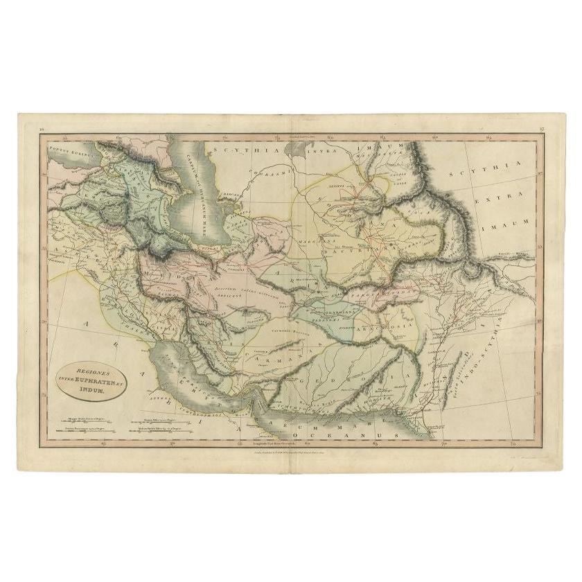
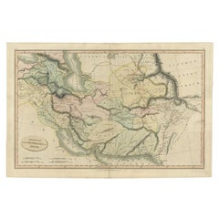
- Antique Map of the Middle East by Smith, 1809Located in Langweer, NLAntique map titled 'Regiones inter Euphraten et Indum'. Old map of the Middle East showing the region between the Euphrates and Indus river. Ori...Category
Antique 19th Century Maps
MaterialsPaper
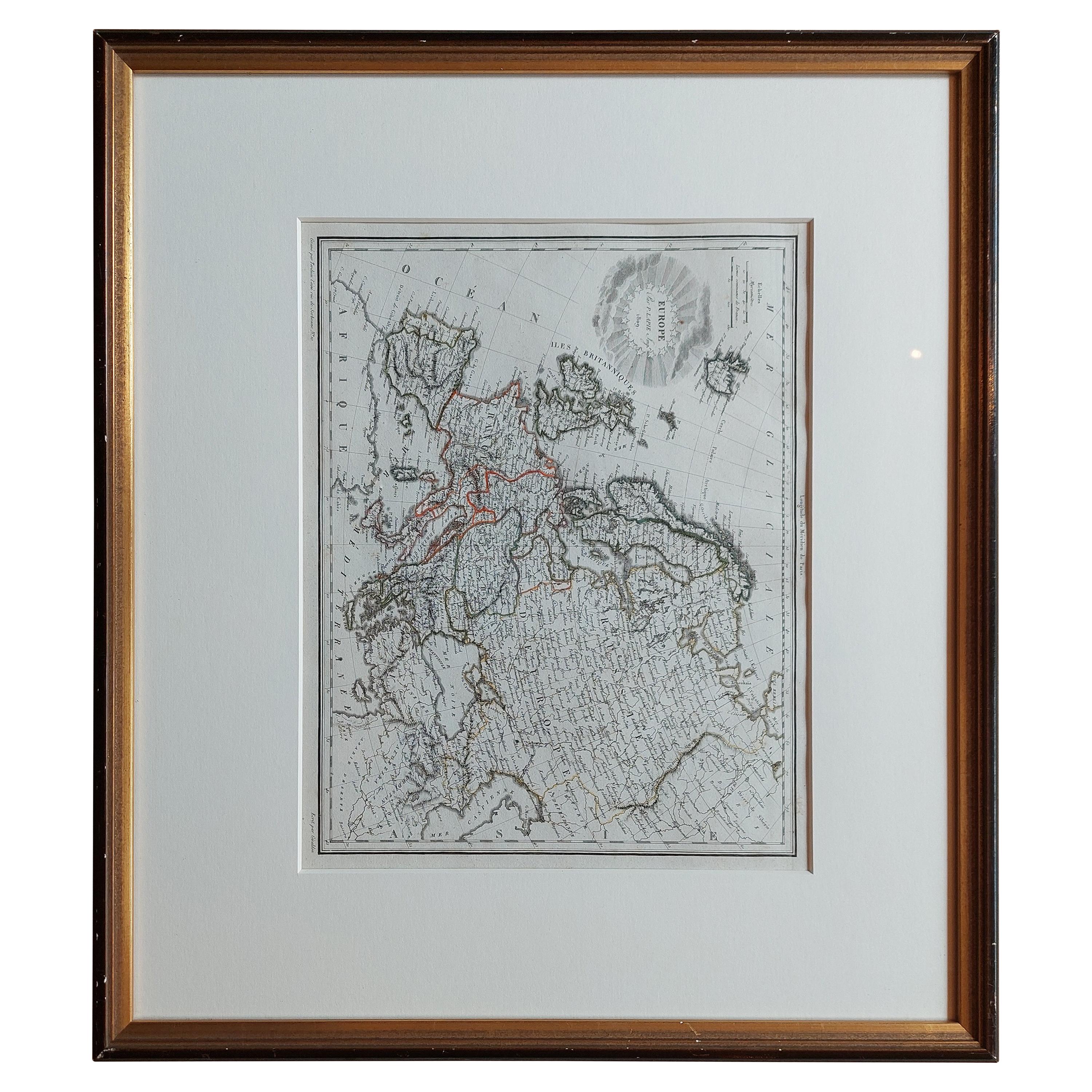
- Antique Map of Europe by Lapie, '1809'Located in Langweer, NLAntique map titled 'Europe'. Original antique map of Europe by P. Lapie, published 1809. Frame included.Category
Antique Early 19th Century Maps
MaterialsPaper
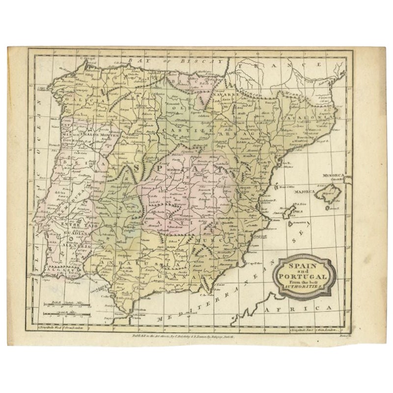
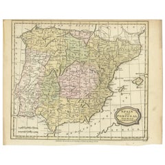
- Antique Map of Spain and Portugal by Barlow, 1809Located in Langweer, NL"Antique map titled 'Spain and Portugal from the best Authorities'. Detailed antique map of Spain and Portugal. This map originates from 'The Gen...Category
Antique 19th Century Maps
MaterialsPaper
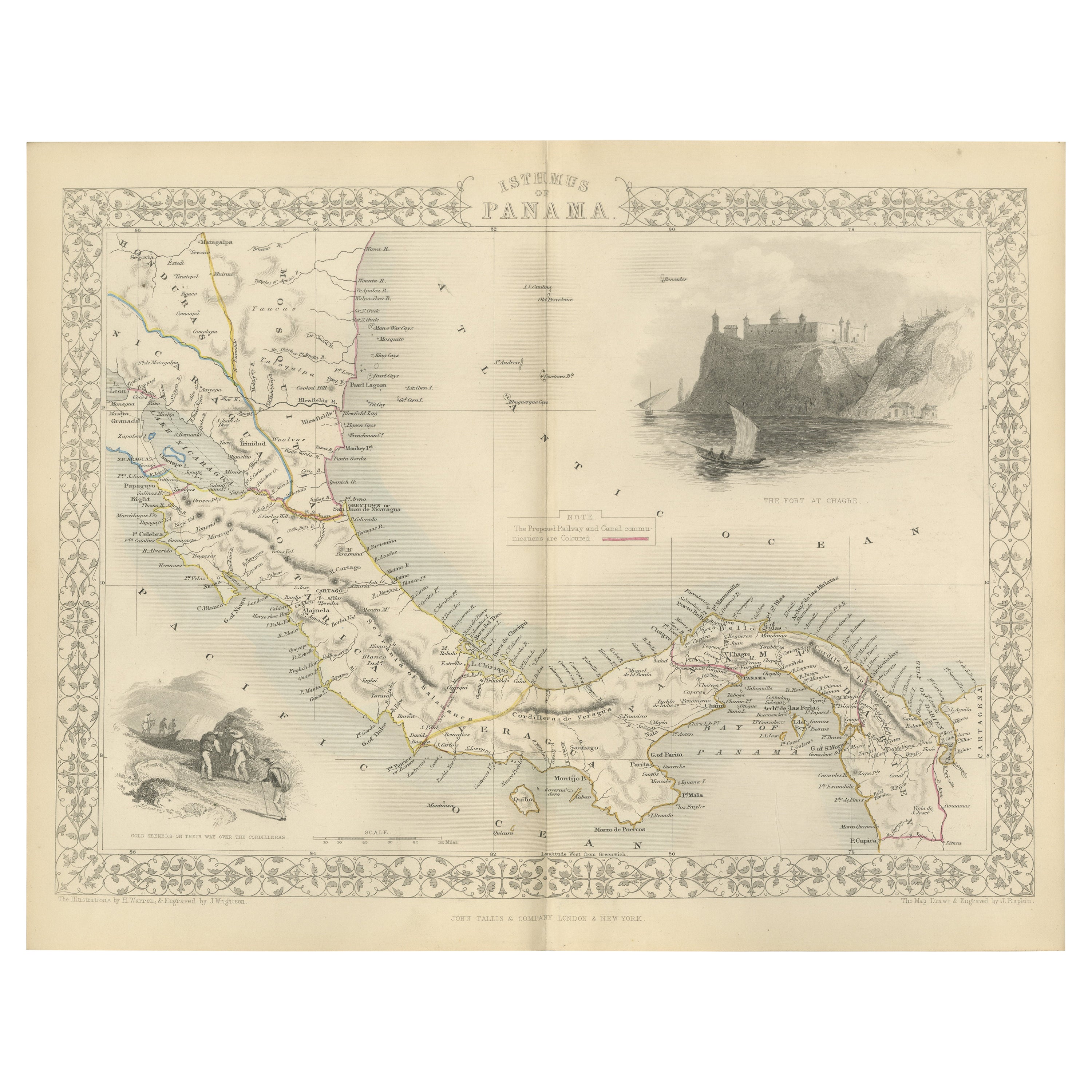
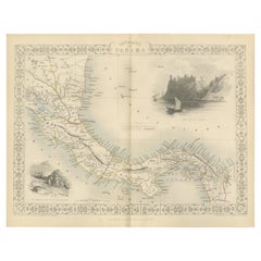
- Crossroads of Empires: A John Tallis Map of the Isthmus of Panama, 1851Located in Langweer, NLThe Tallis map of the Isthmus of Panama is a beautifully detailed work, characteristic of the maps produced by John Tallis & Company, which was one of the last cartographic firms to ...Category
Antique 1850s Maps
MaterialsPaper
- Antique Map of the Islands of the Atlantic by J. TallisLocated in Langweer, NLA highly decorative and detailed mid-19th century map of the Islands of the Atlantic -- including the Azores, Madeira, Bermuda, the Canary Islands and the Cape Verde Islands -- which...Category
Antique Mid-19th Century Maps
MaterialsPaper
- Antique Map of the Philippines by Anson '1749'Located in Langweer, NLAntique map titled 'Carte du Canal des Iles Philippines - Kaart van het Kanaal in de Filippynsche Eilanden'. Large detailed chart of the islands of the Philippines. One of the most detailed charts of the Philippines of the era. Shows Islands, bays, reefs, soundings tracks of the Manila Galleon route, etc. Includes a large compass...Category
Antique Mid-18th Century Maps
MaterialsPaper


You May Also Like
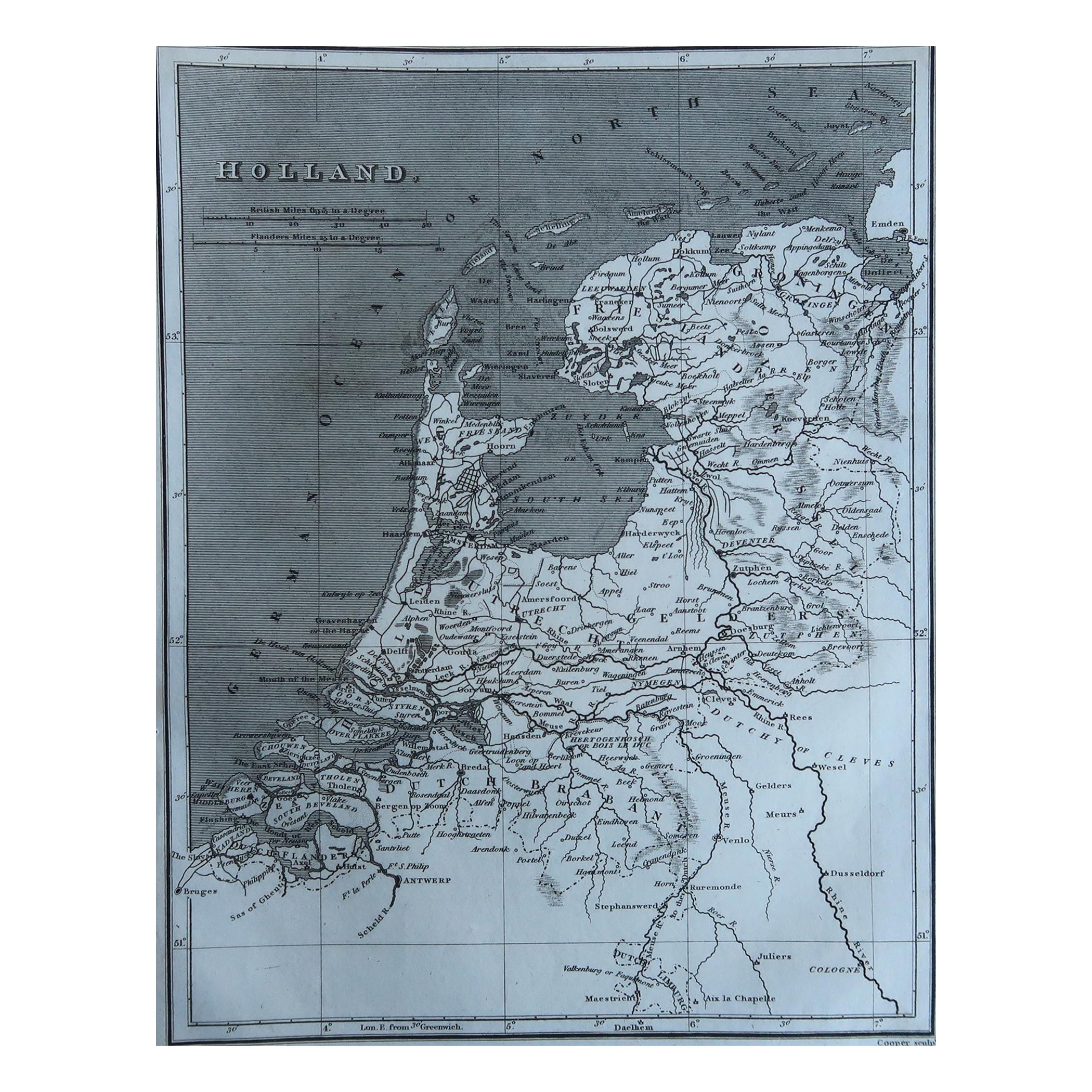
- Original Antique Map of The Netherlands, Sherwood, Neely & Jones, Dated 1809Located in St Annes, LancashireGreat map of The Netherlands Copper-plate engraving by Cooper Published by Sherwood, Neely & Jones. Dated 1809 Unframed.Category
Antique Early 1800s English Maps
MaterialsPaper
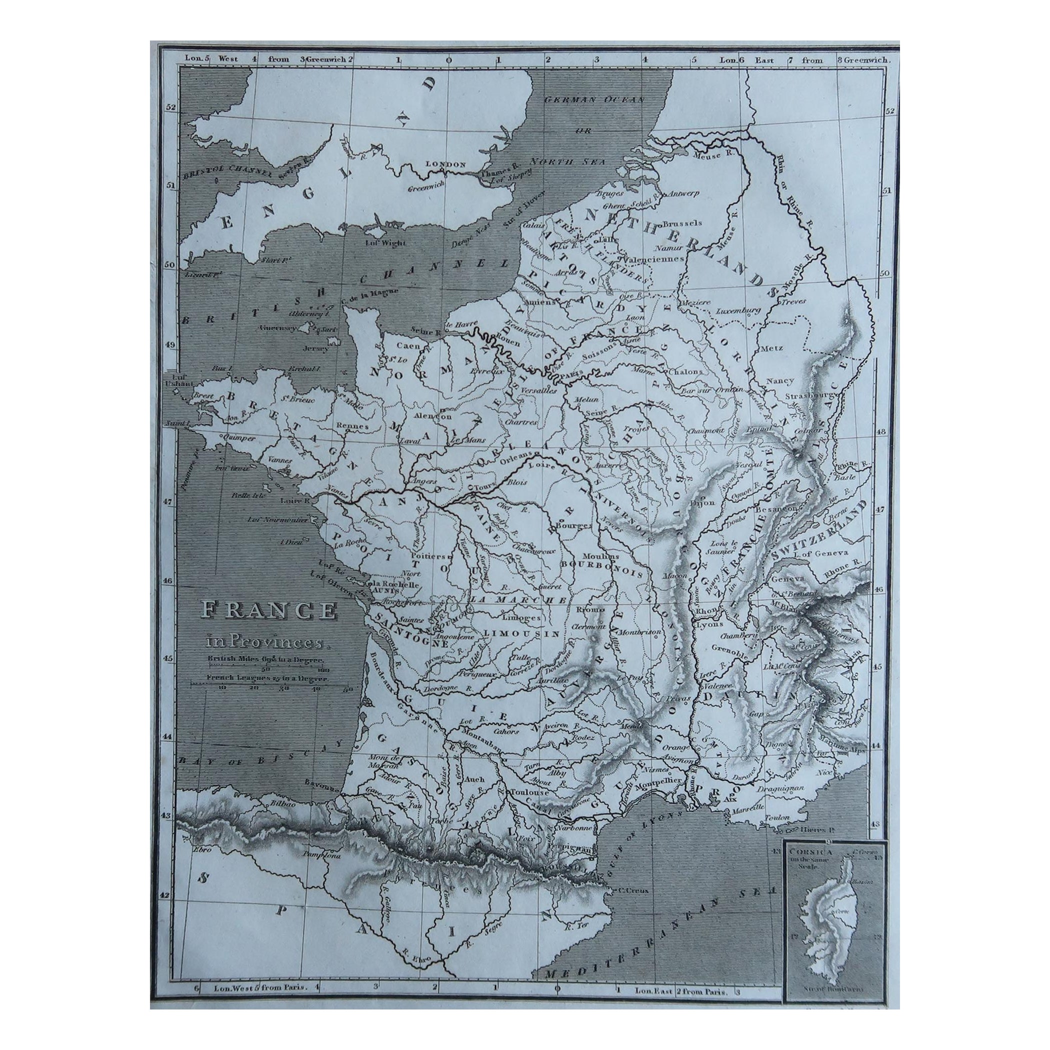
- Original Antique Map of France, Sherwood, Neely & Jones, Dated 1809Located in St Annes, LancashireGreat map of France Copper-plate engraving by Cooper Published by Sherwood, Neely & Jones. Dated 1809 Unframed.Category
Antique Early 1800s English Maps
MaterialsPaper
- 1861 Topographical Map of the District of Columbia, by Boschke, Antique MapLocated in Colorado Springs, COPresented is an original map of Albert Boschke's extremely sought-after "Topographical Map of the District of Columbia Surveyed in the Years 1856 ...Category
Antique 1860s American Historical Memorabilia
MaterialsPaper
- Original Antique Map of The World by Thomas Clerk, 1817Located in St Annes, LancashireGreat map of The Eastern and Western Hemispheres On 2 sheets Copper-plate engraving Drawn and engraved by Thomas Clerk, Edinburgh. Published by Mackenzie And Dent, 1817 ...Category
Antique 1810s English Maps
MaterialsPaper
- 1907 Map of Colorado, Antique Topographical Map, by Louis NellLocated in Colorado Springs, COThis highly detailed pocket map is a topographical map of the state of Colorado by Louis Nell from 1907. The map "has been complied from all availabl...Category
Antique Early 1900s American Maps
MaterialsPaper
- Original Antique Map of The Netherlands, Engraved by Barlow, Dated 1807Located in St Annes, LancashireGreat map of Netherlands Copper-plate engraving by Barlow Published by Brightly & Kinnersly, Bungay, Suffolk. Dated 1807 Unframed.Category
Antique Early 1800s English Maps
MaterialsPaper


Recently Viewed
View AllMore Ways To Browse
Antique White Stain Furniture
Antique Greek Map
Antique Greece Map
Antique Maps Of Greece
Antique Map Of Greece
Antique Maps Greece
Antique Map Greece
Greek Orthodox
G Plan Antique Furniture
G Plan Furniture Antique Furniture
G Plan Antique Furniture Antique Furniture
Antique Orthodox
Eastern Orthodox
Grece Antique
Fair Mont Furniture
Medieval Plate
Antique Depot
Kings Court