Items Similar to Antique Map of the Kansas Pacific Railroad, circa 1900


Want more images or videos?
Request additional images or videos from the seller
1 of 5
Antique Map of the Kansas Pacific Railroad, circa 1900
About the Item
Antique map titled 'Karte der Kansas-Pacific-Eisenbahn'. Lithographed map of the Kansas Pacific railroad. German text on verso which reads 'Kansas Pacific Eisenbahn Gesellschaft erste Hypothek-Anleihe (..)'.
- Dimensions:Height: 9.26 in (23.5 cm)Width: 11.23 in (28.5 cm)Depth: 0.02 in (0.5 mm)
- Materials and Techniques:
- Period:
- Date of Manufacture:circa 1900
- Condition:General age-related toning, minor defects (mainly in margins). German text on verso, please study images carefully.
- Seller Location:Langweer, NL
- Reference Number:Seller: BG-12367-81stDibs: LU3054317689061
About the Seller
5.0
Platinum Seller
These expertly vetted sellers are 1stDibs' most experienced sellers and are rated highest by our customers.
Established in 2009
1stDibs seller since 2017
1,957 sales on 1stDibs
Typical response time: <1 hour
- ShippingRetrieving quote...Ships From: Langweer, Netherlands
- Return PolicyA return for this item may be initiated within 14 days of delivery.
Auctions on 1stDibs
Our timed auctions are an opportunity to bid on extraordinary design. We do not charge a Buyer's Premium and shipping is facilitated by 1stDibs and/or the seller. Plus, all auction purchases are covered by our comprehensive Buyer Protection. Learn More
More From This SellerView All
- Antique Railroad Map of the United States by Rand, McNally & Co, 1900Located in Langweer, NLAntique map titled 'Rand, McNally & Co's New Official Railroad map of the United States with portions of The Dominion of Canada, The Republic of Mexico and the West Indies'. Large railroad map of the United States, sectionalised and laid on linen. Map shows state boundaries for the United States, Mexico, the West Indies, and lower portion of Canada; major cities and towns, military posts, Native American reservations, and railroads; Oklahoma and "Indian Territory." Inset: "Map of Alaska...Category
20th Century Maps
MaterialsLinen, Paper
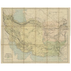
- Antique Map of West Asia, circa 1900Located in Langweer, NLAntique map titled 'Persia, Afghanistan and Beloochistan'. Folding map on linen. Published circa 1900. Stamp below title.Category
Early 20th Century Maps
MaterialsPaper
- Antique Map of the Islands in the Pacific Ocean by Wyld, '1845'Located in Langweer, NLAntique map titled 'Islands in the Pacific Ocean'. Original antique map of the islands in the Pacific Ocean. This map originates from 'An Atlas of the World, Comprehending Separate M...Category
Antique Mid-19th Century Maps
MaterialsPaper
- Antique Map of the Region of Banjarmasin, Indonesia 1900Located in Langweer, NLAntique Map of the Region of Banyuasin, Sumatra. Also depicting Bangka/Banka island. This map originates from 'Atlas van Nederlandsch Oost- en West-Indië' by I. Dornseiffen. Artist...Category
20th Century Maps
MaterialsPaper
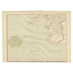
- Antique Map of the Java Sea by Dornseiffen, 1900Located in Langweer, NLAntique map of the Java Sea. Also depicts Bilitung, the Karimata Islands and Sukadana, Borneo. This map originates from 'Atlas van Nederlandsch Oost- en West-Indië' by I. Dornseiffen...Category
20th Century Maps
MaterialsPaper
- Antique Map of the Nias Archipelago, Sumatra, Indonsia, 1900Located in Langweer, NLAntique map of Nias Island and surrounding islands including the Banyak islands, Pini island and Simeulue Island. This map originates from 'Atlas van Nederlandsch Oost- en West-Indië...Category
20th Century Maps
MaterialsPaper


You May Also Like
- Map of the Republic of GenoaLocated in New York, NYFramed antique hand-coloured map of the Republic of Genoa including the duchies of Mantua, Modena, and Parma. Europe, late 18th century. Dimension: 25...Category
Antique Late 18th Century European Maps
- Antique Map of Principality of MonacoBy Antonio Vallardi EditoreLocated in Alessandria, PiemonteST/619 - "Old Geographical Atlas of Italy - Topographic map of ex-Principality of Monaco" - ediz Vallardi - Milano - A somewhat special edition ---Category
Antique Late 19th Century Italian Other Prints
MaterialsPaper
- Antique 18th Century Map of the Province of Pensilvania 'Pennsylvania State'Located in Philadelphia, PAA fine antique of the colony of Pennsylvania. Noted at the top of the sheet as a 'Map of the province of Pensilvania'. This undated and anonymous map is thought to be from the Gentleman's Magazine, London, circa 1775, although the general appearance could date it to the 1760's. The southern boundary reflects the Mason-Dixon survey (1768), the western boundary is placed just west of Pittsburgh, and the northern boundary is not marked. The map has a number of reference points that likely refer to companion text and appear to be connected to boundaries. The western and southern boundaries are marked Q, R, S, for example. A diagonal line runs from the Susquehanna R to the Lake Erie P. A broken line marked by many letters A, B, N, O, etc., appears in the east. There are no latitude or longitude markings, blank verso. Framed in a shaped contemporary gilt wooden frame and matted under a cream colored matte. Bearing an old Graham Arader Gallery...Category
Antique 18th Century British American Colonial Maps
MaterialsPaper
- Map "Estuary- Mouth of the Thames"Located in Alessandria, PiemonteST/426 - Antique French Map of the estuary of the Thames, map dated 1769 - "Mape of the entrance of the Thames. Designed by filing of Navy cards fo...Category
Antique Mid-18th Century French Other Prints
MaterialsPaper
- Large Antique 1859 Map of North AmericaLocated in Sag Harbor, NYThis Map was made by Augustus Mitchell in 1859 It is in amazing condition for being 163 years old. This price is for the rolled up easy to ship version of this piece. I will be Frami...Category
Antique Mid-19th Century American Maps
MaterialsCanvas, Paper

- Antique Map of Italy by Andriveau-Goujon, 1843By Andriveau-GoujonLocated in New York, NYAntique Map of Italy by Andriveau-Goujon, 1843. Map of Italy in two parts by Andriveau-Goujon for the Library of Prince Carini at Palazzo Carini i...Category
Antique 1840s French Maps
MaterialsLinen, Paper


Recently Viewed
View AllMore Ways To Browse
Railroad Furniture
Antique Railroad
Railroad Antique
Railroad Paper
Antique Railroad Furniture
Map Of The Pacific
Kansas Antique
Antique Furniture Kansas
Railroad Collectibles
Pacific Map
Antique Railroad Collectibles Collectibles
Antique Railroad Collectables
Antique Railroad Collectibles
Antique Railroad Maps
Map Railroad
Kansas Map
Map Of The World Antique
Rare Maps