

Want more images or videos?
Request additional images or videos from the seller
1 of 6
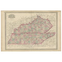
Antique Map of Kentucky
About the Item
Antique map titled 'Kentucky'. Original antique map of Kentucky, United States. This print originates from 'Encyclopaedia Britannica', Ninth Edition. Published 1882.
The Encyclopædia Britannica has been published continuously since 1768, appearing in fifteen official editions. Several editions have been amended with multi-volume "supplements" (3rd, 5th/6th), consisted of previous editions with added supplements (10th, and 12th/13th) or gone drastic re-organizations (15th). In recent years, digital versions of the Britannica have been developed, both online and on optical media. Since the early 1930s, the Britannica has developed several "spin-off" products to leverage its reputation as a reliable reference work and educational tool. The Encyclopedia as known up to 2012 was incurring unsustainable losses and the print editions were ended, but it continues on the Internet.
- Dimensions:Height: 8.27 in (21 cm)Width: 10.63 in (27 cm)Depth: 0.02 in (0.5 mm)
- Materials and Techniques:
- Period:
- Date of Manufacture:1882
- Condition:Wear consistent with age and use. General age-related toning, minor wear. Blank verso. Please study image carefully.
- Seller Location:Langweer, NL
- Reference Number:
About the Seller
5.0
Platinum Seller
These expertly vetted sellers are 1stDibs' most experienced sellers and are rated highest by our customers.
Established in 2009
1stDibs seller since 2017
1,940 sales on 1stDibs
Typical response time: <1 hour
- ShippingRetrieving quote...Ships From: Langweer, Netherlands
- Return PolicyA return for this item may be initiated within 14 days of delivery.
More From This SellerView All
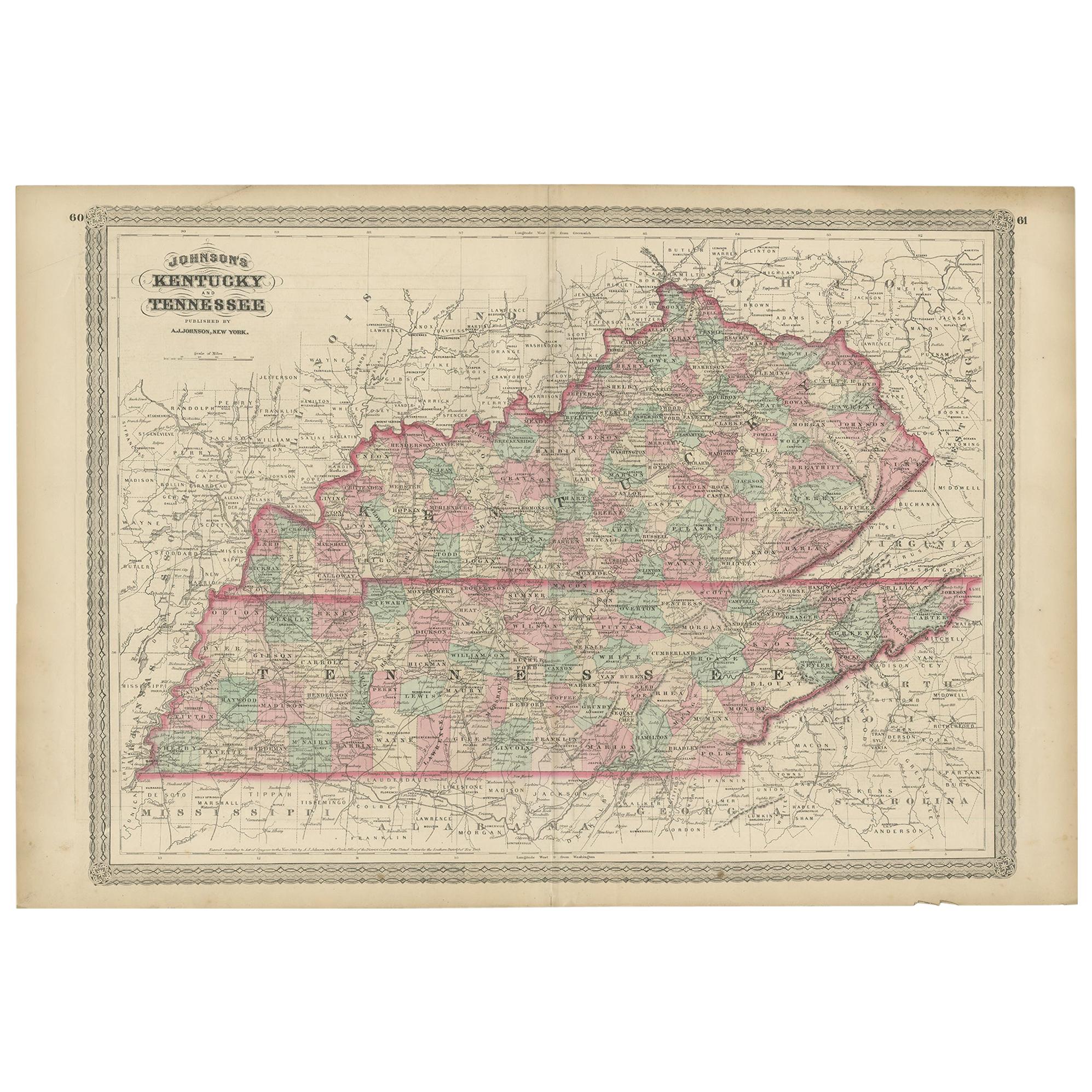
- Antique Map of Kentucky and Tennessee by Johnson, 1872Located in Langweer, NLAntique map titled 'Johnson's Kentucky (..)'. Original map of Kentucky and Tennessee. This map originates from 'Johnson's New Illustrated Family Atlas ...Category
Antique Late 19th Century Maps
MaterialsPaper
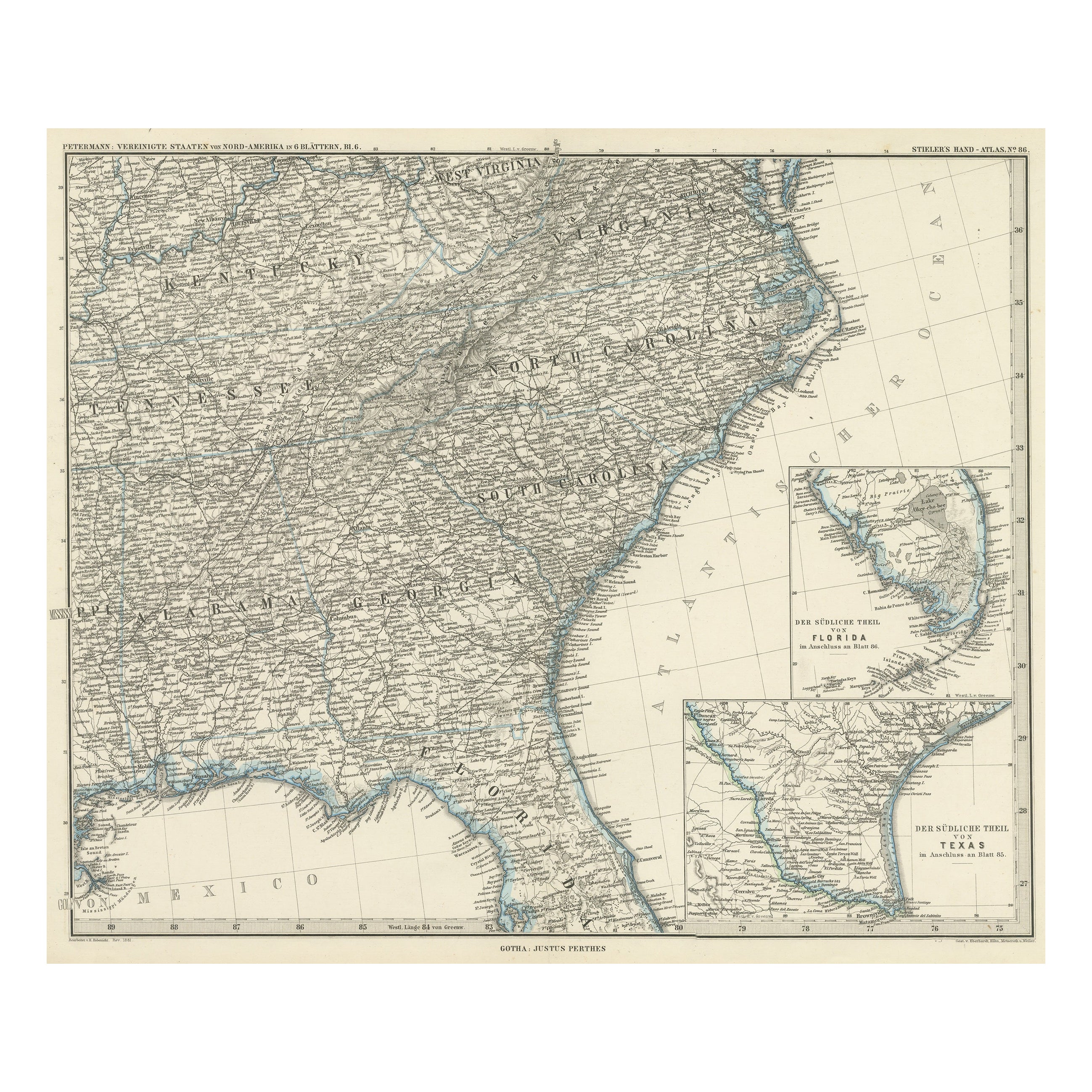
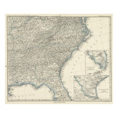
- Antique Map of Tennessee, Kentucky, Virginia, Alabama, Georgia and SurroundingsLocated in Langweer, NLAntique map of part of the United States showing Alabama, Georgia, North Carolina, South Carolina, Tennessee, Kentucky, Virginia and part of Florida. With inset maps of the southern ...Category
Antique Mid-19th Century Maps
MaterialsPaper
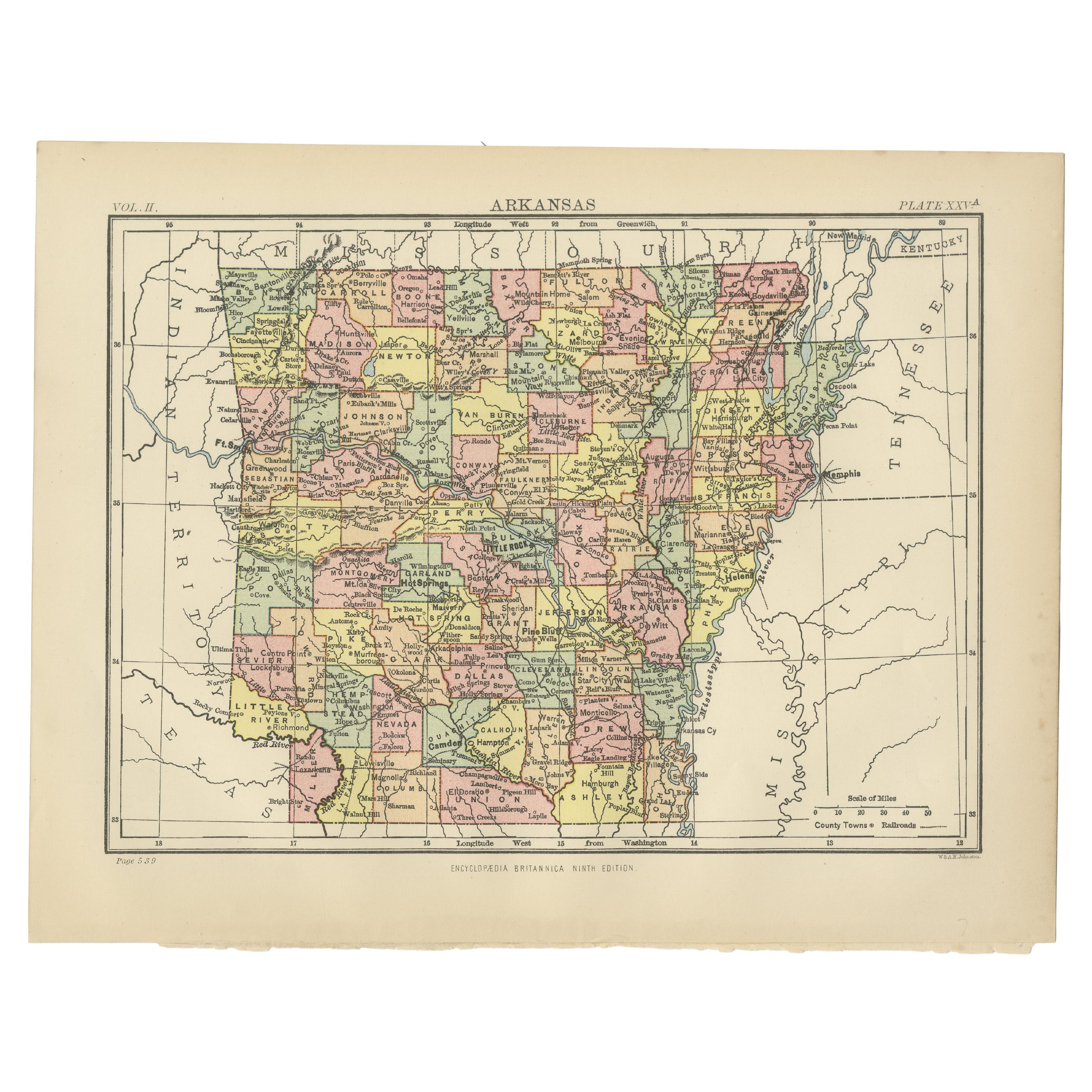
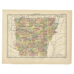
- Antique Map of ArkansasLocated in Langweer, NLAntique map titled 'Arkansas'. Original antique map of Arkansas, United States. This print originates from 'Encyclopaedia Britannica', Ninth Edition. P...Category
Antique Late 19th Century Maps
MaterialsPaper
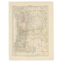
- Antique Map of OregonLocated in Langweer, NLAntique map titled 'Oregon'. Original antique map of Oregon, United States. This print originates from 'Encyclopaedia Britannica', Ninth Edition. Publish...Category
Antique Late 19th Century Maps
MaterialsPaper
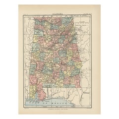
- Antique Map of AlabamaLocated in Langweer, NLAntique map titled 'Alabama'. Original antique map of Alabama, United States. This print originates from 'Encyclopaedia Britannica', Ninth Editi...Category
Antique Late 19th Century Maps
MaterialsPaper
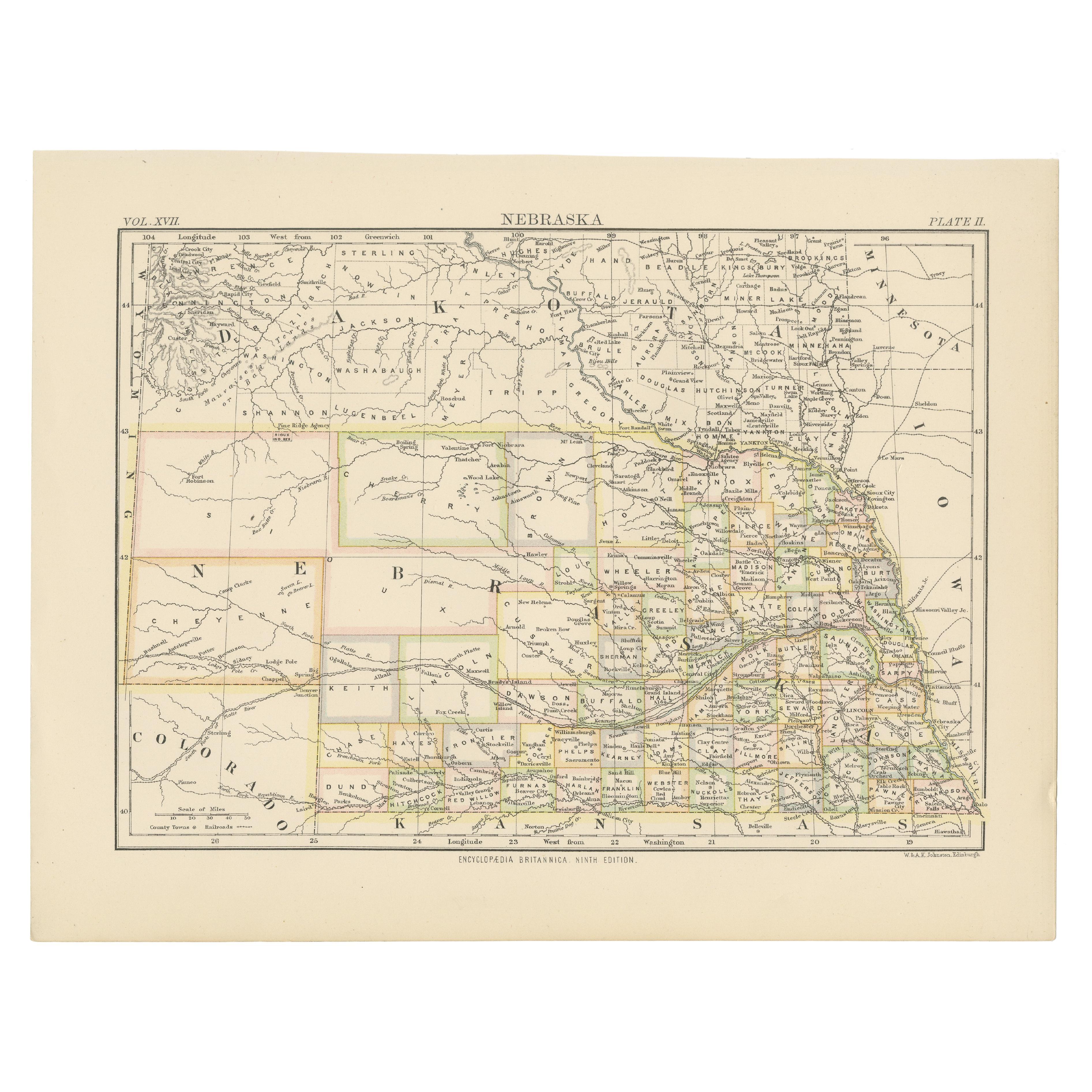
- Antique Map of NebraskaLocated in Langweer, NLAntique map titled 'Nebraska'. Original antique map of Nebraska, United States. This print originates from 'Encyclopaedia Britannica', Ninth Edition. Pu...Category
Antique Late 19th Century Maps
MaterialsPaper

You May Also Like
- Antique Map of Principality of MonacoBy Antonio Vallardi EditoreLocated in Alessandria, PiemonteST/619 - "Old Geographical Atlas of Italy - Topographic map of ex-Principality of Monaco" - ediz Vallardi - Milano - A somewhat special edition ---Category
Antique Late 19th Century Italian Other Prints
MaterialsPaper
- Original Antique Map of Italy. C.1780Located in St Annes, LancashireGreat map of Italy Copper-plate engraving Published C.1780 Unframed.Category
Antique Early 1800s English Georgian Maps
MaterialsPaper

- Original Antique Map of Asia. C.1780Located in St Annes, LancashireGreat map of Asia Copper-plate engraving Published C.1780 Two small worm holes to right side of map Unframed.Category
Antique Early 1800s English Georgian Maps
MaterialsPaper

- Original Antique Map of India. C.1780Located in St Annes, LancashireGreat map of India Copper-plate engraving Published C.1780 Three small worm holes to right side of map and one bottom left corner Unframed.Category
Antique Early 1800s English Georgian Maps
MaterialsPaper

- Original Antique Map of South America. C.1780Located in St Annes, LancashireGreat map of South America Copper-plate engraving Published C.1780 Two small worm holes to left side of map Unframed.Category
Antique Early 1800s English Georgian Maps
MaterialsPaper
- Original Antique Map of Ireland- Kerry. C.1840Located in St Annes, LancashireGreat map of Kerry Steel engraving Drawn under the direction of A.Adlard Published by How and Parsons, C.1840 Unframed.Category
Antique 1840s English Maps
MaterialsPaper


Recently Viewed
View AllMore Ways To Browse
Re Antiques
Office Organization
Antique Work Tools
Antique Spinning
Encyclopedia Antique
Antique Encyclopedias
Kentucky Furniture
Antique Media Furniture
Optical Antiques
Antique Encyclopedia
Kentucky 19th
Multi Tool
15th Century Map
Kentucky Antiques
Encyclopedia Britannica
Antique Maps Of Kentucky
Antique Map Kentucky
Antique Map Of California